Climbing Cotopaxi Volcano (5897m)

The Highest Active Volcano in Ecuador

The crater at the summit of Cotopaxi Volcano

Climbing Cotopaxi volcano in Ecuador is a must for mountaineers, offering an unforgettable experience. Standing at 5,897 meters (19,348 feet), it is Ecuador’s second-highest mountain, located 45 kilometers (28 miles) from Quito in the Cotopaxi National Park.

No previous technical experience is needed, but good physical condition and altitude acclimatization (4,000 to 5,000 meters) are essential. The climb offers stunning views of Cotopaxi’s 800-meter diameter crater and neighboring peaks like Antisana, Ilinizas, Cayambe, and Chimborazo, with Quito illuminated in the background.

Cotopaxi is one of the highest active volcanoes in the world, part of the “Avenida de los Volcanes” named by Alexander von Humboldt. The park’s moorland ecosystem supports diverse flora and fauna. Volcanic remnants from the 1877 eruption are visible along the eastern flanks and Pita River. Cotopaxi is a sacred mountain for native ethnic groups. Its name means “neck of the moon” in Quechua. Its violent historical eruptions have shaped the surrounding landscape and impacted local communities. Exploring Cotopaxi is both a thrilling adventure and a journey into Ecuador’s rich natural and cultural heritage.

Table of Contents

Get access to my curated list of all the best viewpoints, hiking trails, secret waterfalls, diving spots, wildlife tours, accommodations, and more, that will make your trip to Ecuador and The Galapagos unforgettable.

All of this, in an interactive guide featuring a mobile-friendly map, pre-designed itineraries, all my favorite photos, and helpful travel tips to guide your journey in this amazing unexplored country.

If you want personalized advice write me in-app and we can plan it together.

Rexby Guide Review
Cotopaxi Volcano erupting with reflection
Cotopaxi Volcano erupting

Climbing Cotopaxi Volcano: General Details

To climb Cotopaxi Volcano, a high-altitude mountain in the Ecuadorian Andes, you can do it in two ways, with a Mountaineering Agency, or with a local guide:

  • Highlights:
    • Cotopaxi Volcano Summit.
    • Views of the other 3 big famous volcanoes: Antisana, Cayambe, and Chimborazo (on a clear day). Views of the other smaller volcanoes: Sincholagua, Ruminahui, Pasochoa, Los Ilinizas, Corazon, and if you’re lucky El Altar, Sangay, Tungurahua, and Reventador.
    • You might also encounter wild horses, alpacas, and different kinds of birds at the Limpiopungo Lagoon.
  • Duration: 2 days.
  • Authorization: Required but your guide or agency should take care of it. If they don’t, send an email to [email protected] just in case (min. 5 days before your trip).
  • Accommodation: José Rivas Refuge or Tambopaxi Lodge, if the refuge is fully booked.
  • Price: 320-670$ (details in the following section)
  • Outfit: High-altitude mountain gear (details in the following section)
  • Best Months to Climb: September – December
  • Recommended Agencies: Cumbre Tours, Mauna Expeditions, Mountain Tours
  • Recommended Local Guide: Francisco Leon: +593985313320
Cotopaxi Volcano and the José Rivas Refuge

Climbing Cotopaxi Volcano: Technical Details

  • Type: Out-and-Back Trail
  • Distance: 6 km – Starting at the José Rivas Refuge.
  • Duration: 8-9 hours including the summit stop.
  • Difficulty:  Moderate-Hard. The hardest part about the climb was from the Yanasacha wall face up, as it’s more inclined and in my case had a lot of fresh snow so it was harder to advance.
  • Incline: ca. 1013m of ascent and descent.
  • Altitude: Lowest point: 4,864m at the José Rivas Refuge. Highest point: 5,897m at the summit of Cotopaxi Volcano.
Cotopaxi Volcano Summit Map
Cotopaxi Volcano North Face Summit Info Map
Powered by Wikiloc

The climb from the José Rivas Refuge to Cotopaxi Volcano’s Summit

Powered by Wikiloc

The climb from the parking lot to José Rivas Refuge, and then to Cotopaxi Volcano’s Summit

View of the Cotopaxi Volcano from the Tambopaxi Lodge
Book your Cotopaxi Volcano Tours & Tickets

with Viator

How to climb Cotopaxi Volcano?

To climb Cotopaxi Volcano, a high-altitude mountain in the Ecuadorian Andes, you can do it in two ways:

    1. Mountaineering Agency: 
      • Pros: More comfortable and easy to plan. Includes everything.
      • Cons:
        • Shared Trip: Big Groups, Random People
        • Private Trip: More expensive than hiring a guide by yourself.
    2. Hiring a Certified Guide – National Guide – ASEGUIM – UIAGM:
      • Pros: Cheaper (you don’t pay the agency’s fee), private, flexible (your own dates), personally choose your own guide.
      • Cons: You have to arrange the transportation, accommodation, and meals, as well as rent the technical gear. You have to pay for the guide’s expenses too.
The Cotopaxi Volcano

In a Hurry? Save it for Later.

Save it on Pinterest and read it whenever you can.

SAVE TO PINTEREST

Cotopaxi Volcano Summit Climb

What clothing and equipment should i bring to climb Cotopaxi Volcano?

To ensure a safer and more comfortable journey in this High-Altitude Mountain with snow and technical sections, certain specific equipment is indispensable:

Essentials:

* It is advisable to have an additional thermal layer or jacket available for extremely cold conditions (at the climb) and to have an extra change of clothes (that you leave at the refuge).

Climbing Equipment:

  • Helmet: For the entire climb.
  • Crampons: For the snow that exists roughly from the refuge onwards.
  • Piolet: Also for the steep snow part.
  • Harness: For the entire climb.
  • Trekking Poles: For the entire hike until the steep snow climb where it’s advisable to use the ice axe instead.
  • Rope: For the entire climb. (usually, the guide brings)
  • Carabiners:  For the entire climb. (usually, the guide brings)

Useful Extras:

Consumables:

  • Drinks, and Snacks: Bring enough of it especially if you’re a beginner.
  • Thermos

Check out my complete guide on What’s in My Backpack – From photography gear, and clothing for Hiking, Mountaineering, Scuba Diving, Rainforest, and City-Street Photography.

The first group at the summit all geared up, Iliniza Volcanoes in the background

How much does it cost to climb Cotopaxi Volcano?

To provide you with an estimation of the expenses associated with climbing Cotopaxi Volcano, I have provided a detailed breakdown of the costs involved. Firstly, you need to consider whether you will be going with an agency or a local guide. Additionally, there are other supplementary expenses that require careful consideration.

Agency/Private Guide:

  1. Mountaineering Agency:
    • Cotopaxi Volcano Summit:
      1. Shared Trip  (6-14 persons): 320$ (pp)
      2. Private Trip: Solo – 650$ (pp) | 2 persons – 420$ (pp)
    • Complete Acclimatization Program: 4 mid-mountains summits + Cotopaxi summit (6-14 persons): 625$ (pp)
  2. Hiring a guide:
    • Local Guide (1-3 persons): 200-250$ (pp) – including rope and carabiners, the rest you must rent (ask the guide if he has any extra equipment at home he can lend you).

Transport (from Quito):

  • Bus Quito (Terminal Quitumbe) – Machachi: 0,7$ 
  • Taxi Machachi – Refuge Parking: 70$

Equipment for Rental:

(Daily prices without taxes)

  • Helmet: 4$ (used) – 5$ (new)
  • Crampons: 5$
  • Ice Axe: 4$ (used) – 5$ (new)
  • Harness: 4$ (used) – 5$ (new)
  • Waterproof Pants: 5$ (used) – 6$ (new)
  • Waterproof Jacket: 5$ (used) – 6$ (new)
  • Waterproof Gloves: 3$ (used) – 4$ (new)
  • Rubber Boots: 10$
  • Mountaineering Boots: 12.5$ (used) – 20$ (new)
  • Tent: 12$
  • Mattress: 2.5$
  • Sleeping Bag: 5$ (used) – 6$ (new)
  • Backpack 35-65L: 5$
  • Sunglasses (UV 4): 3.5$
  • Headlamp (without batteries): 3$
Equipment for Sale:
 
  • Trekking Poles: 10$
  • Fleece+Pants (1st Layer): 44.80$
  • Gloves (1st Layer): 3.92$
  • Socks (Merino Wool 70-80%): 16.80$
  • Socks (1st Layer): 11.20$
*Prices from Los Alpes Store in Quito, 26.May.2023
 
Alternative Stores for renting equipment: Mauna ExpeditionsTatoo, Cotopaxi Warehouse, Andes AlpinoMountain Tours.
 

Food, Drinks, and Snacks: 10$ (pp)

Estimated Total (per person):

  • Scenario 1:
    • Group of 3,
    • Hired a Local Guide,
    • Already have all the gear,
    • Price Breakdown: 250$ (guide), 1,40$ (bus both ways), 47$ (taxi both ways/ 3), 30$ (accommodation, dinner, and breakfast), 10$ (guide’s accommodation, dinner, and breakfast), 10$ (snacks, and drinks).
    • Total: 350$ USD
  • Scenario 2: 
    • Group of 2
    • Shared Tour with an Agency.
    • Already have all the gear,
    • Price Breakdown: 320$ (guide + logistics + meals + transport)
    • Total: 320$ USD
  • Scenario 3: 
    • Solo
    • Private Tour with an Agency.
    • Need to rent waterproof pants, gloves, and boots,
    • Price Breakdown: 650$ (guide + logistics + meals + transport + technical gear), 20$ (clothing rental)
    • Total: 670$ USD
A panorama of the view from the Summit of Cotopaxi Volcano

How to get to the refuge of Cotopaxi Volcano?

By Car:

From Quito, (Tribuna de la Shyris) to Sangolqui it takes around 35 minutes, or to Machachi (an easier road afterward) it takes around 50 minutes.

From Sangolqui to the Cotopaxi National Park’s northern entrance it takes around 1 hour.

From Machachi to the Cotopaxi National Park’s northern entrance it takes around 47 minutes.

From the Cotopaxi National Park’s northern entrance to the parking lot where the hike to the refuge starts, it takes around 30-40 minutes.

By Bus & Taxi: 

From Quito (Quitumbe Terminal) to Sangolqui or Machachi (by bus), and from there to the parking lot where the hike to the refuge starts (by taxi)

The trail between the parking lot and the refuge

Where to sleep before climbing Cotopaxi Volcano?

It’s easier to stay at the José Rivas Refuge as you don’t need to hike from the parking lot and lose time to get there, but if it is fully booked try some of the Hotels located in the Cotopaxi National Park.  Since the Cotopaxi Volcano is located near Quito, here is a list I created with the best hotels you can find in town to relax before your climb and during your acclimatization program: 20 Best Hotels in Quito, Ecuador.

Wild Horses all around Cotopaxi National Park

Cotopaxi Volcano: Curiosities

Name and Meaning: The name “Cotopaxi” is believed to derive from the Quechua words “coto” (neck) and “paxi” (moon), referring to the crater that resembles a crescent moon. It symbolizes the volcano’s distinctive features and its cultural significance as a sacred mountain, honored by the local Andean people long before the Inca invasion.

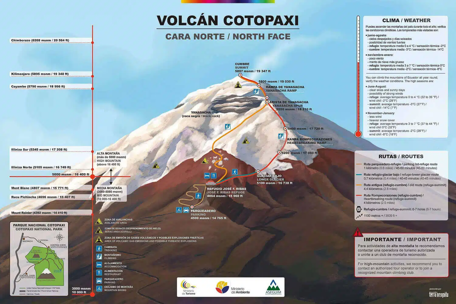
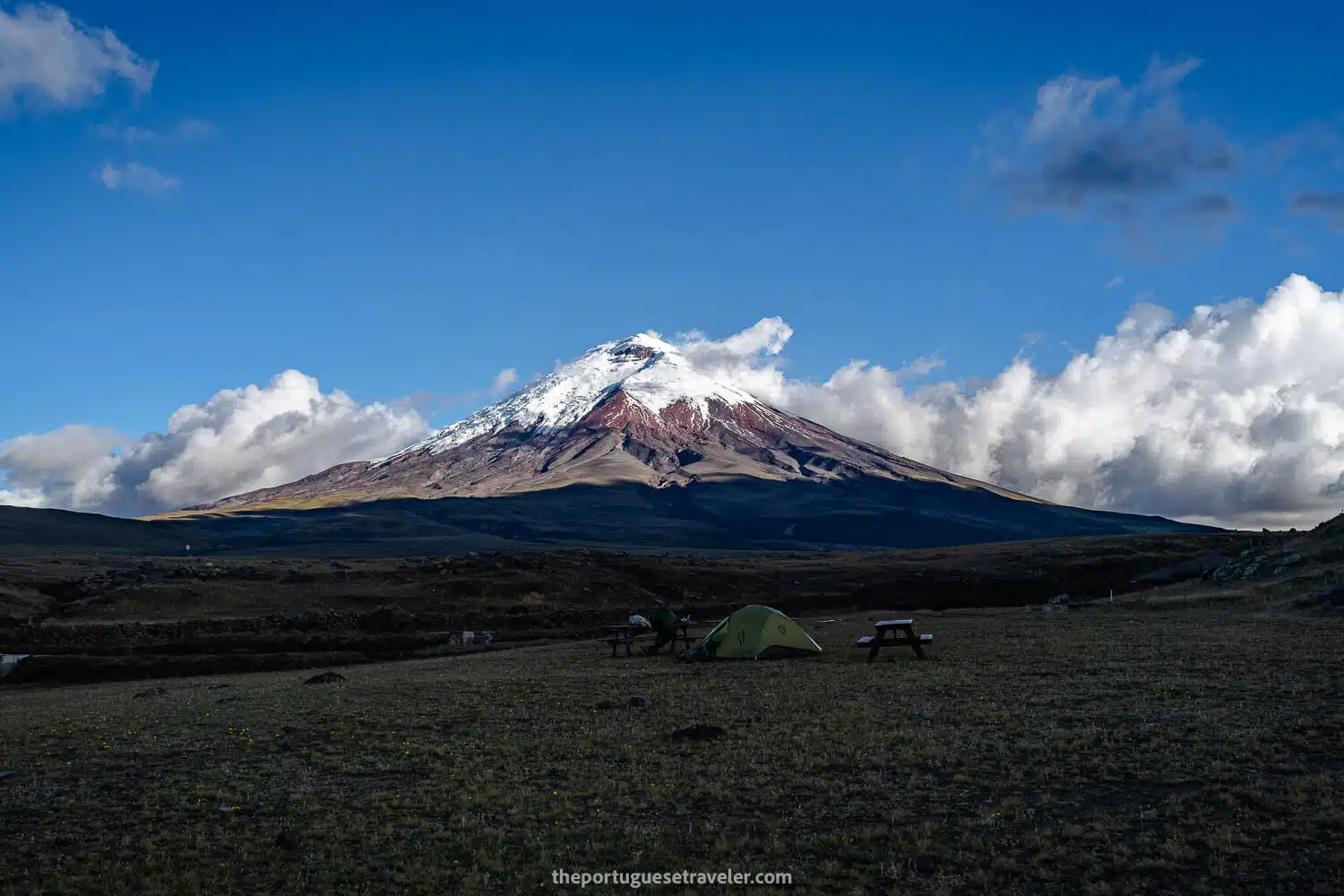
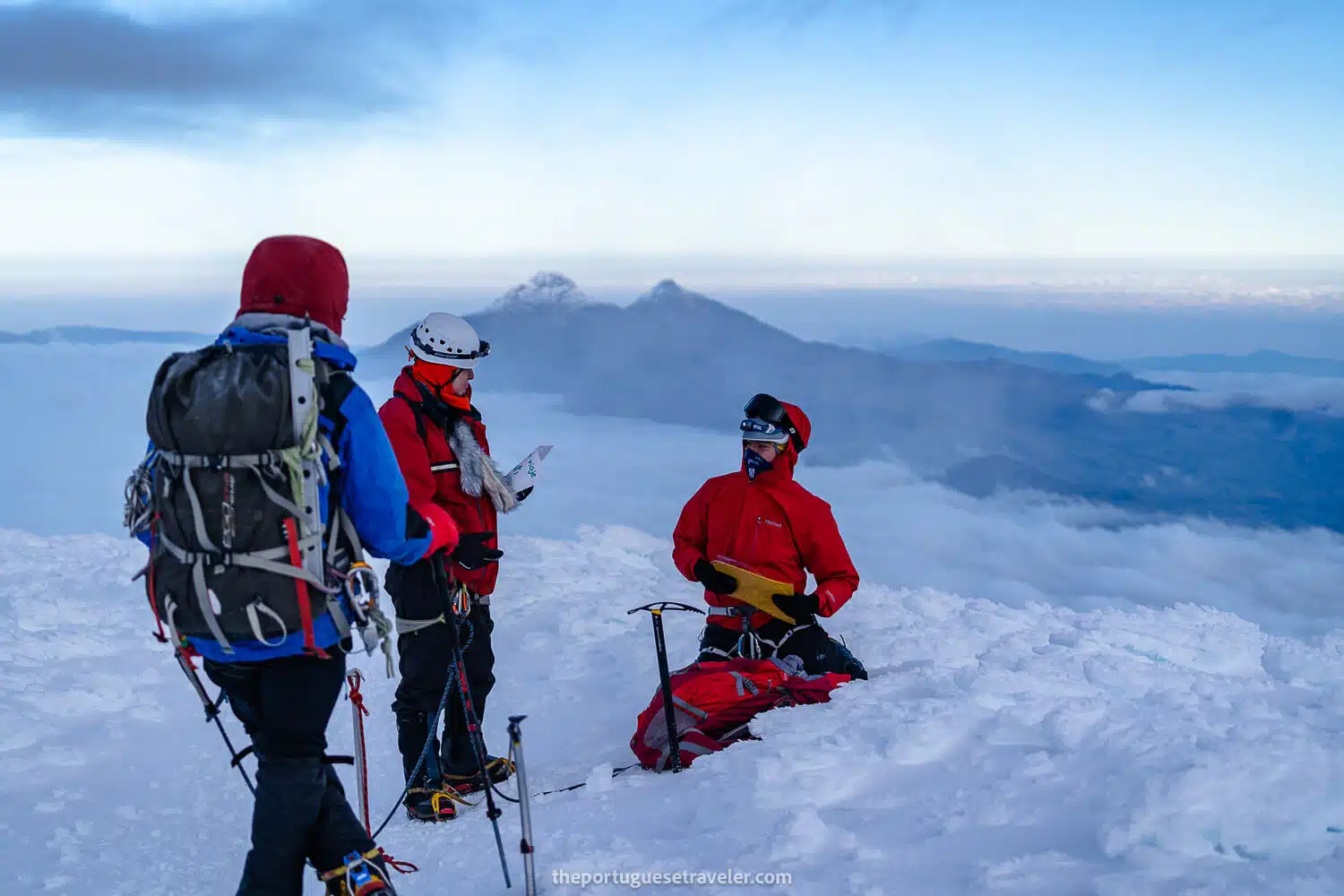
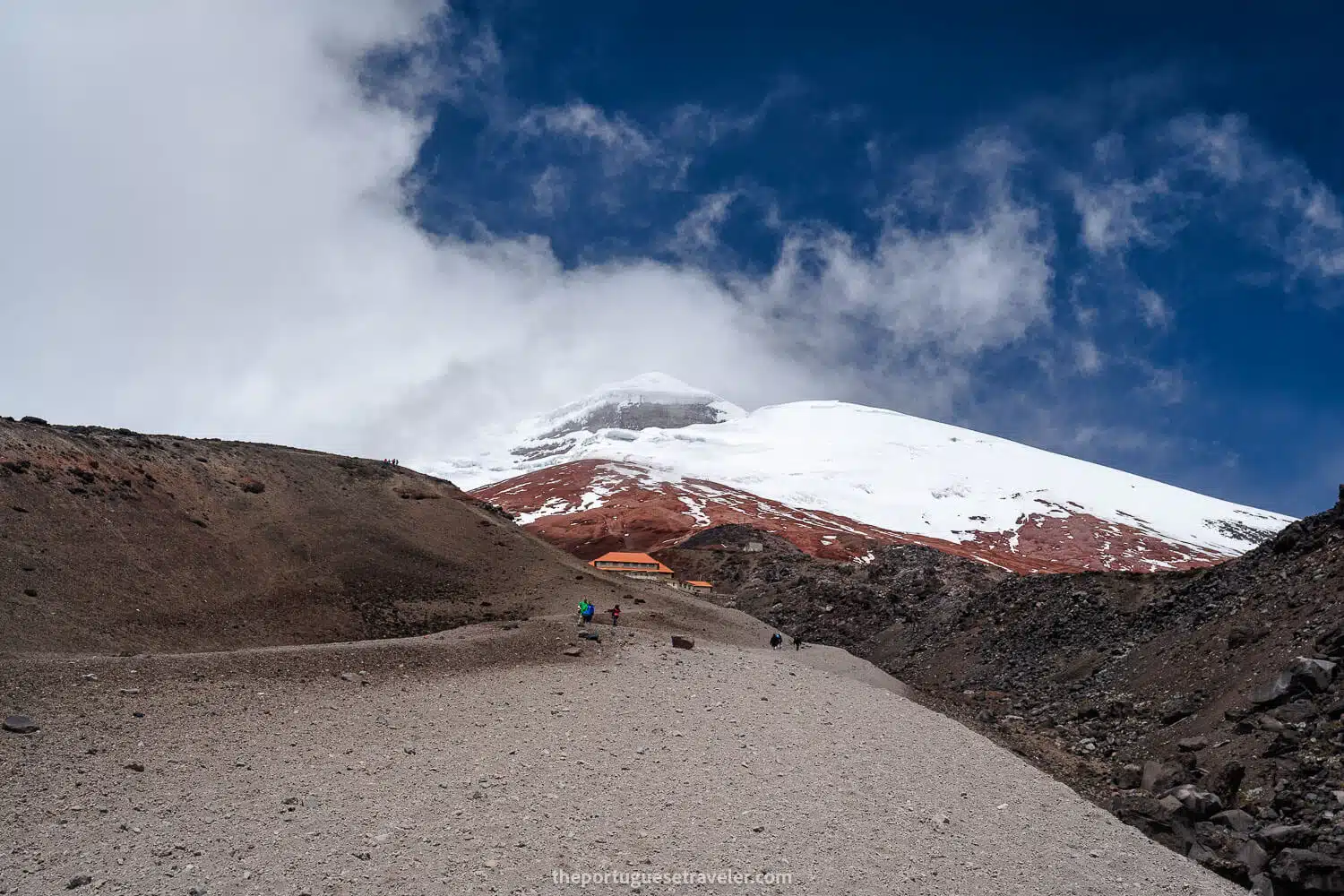
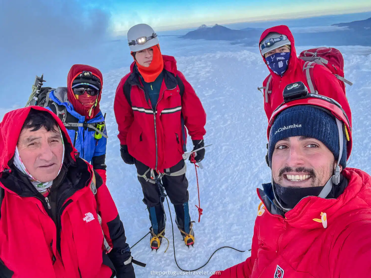
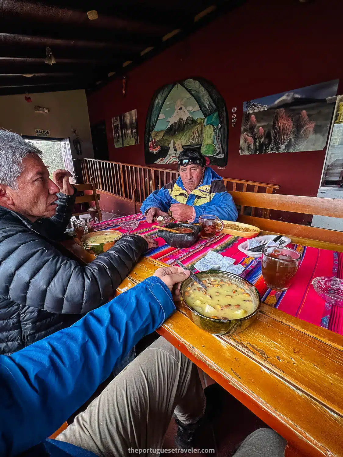
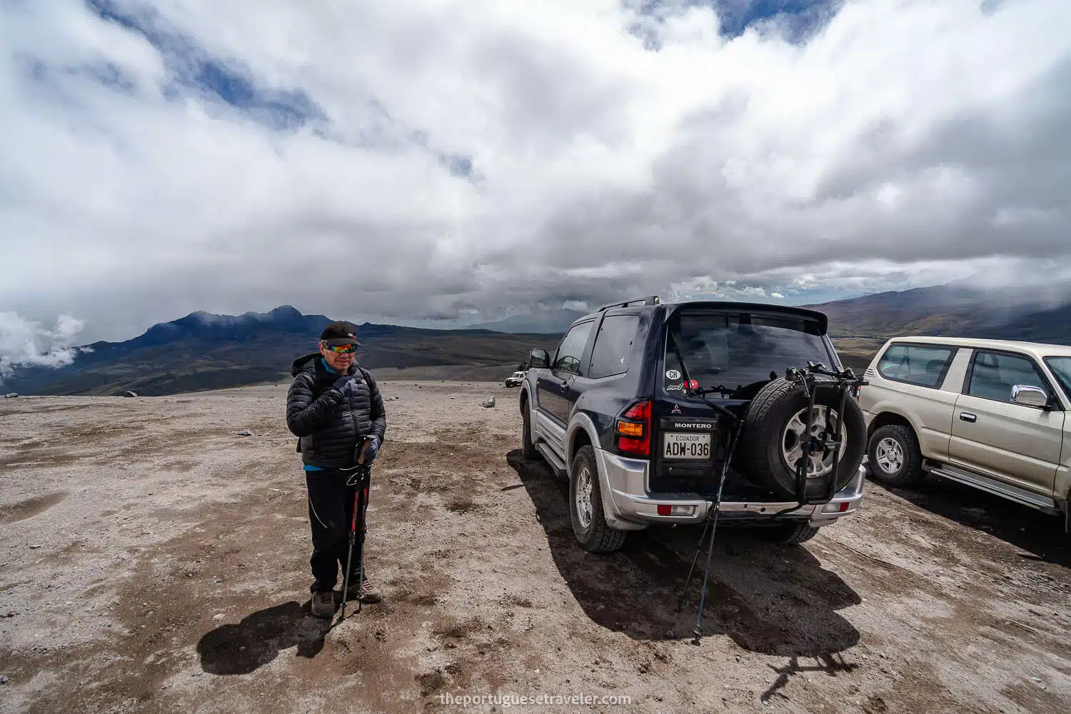
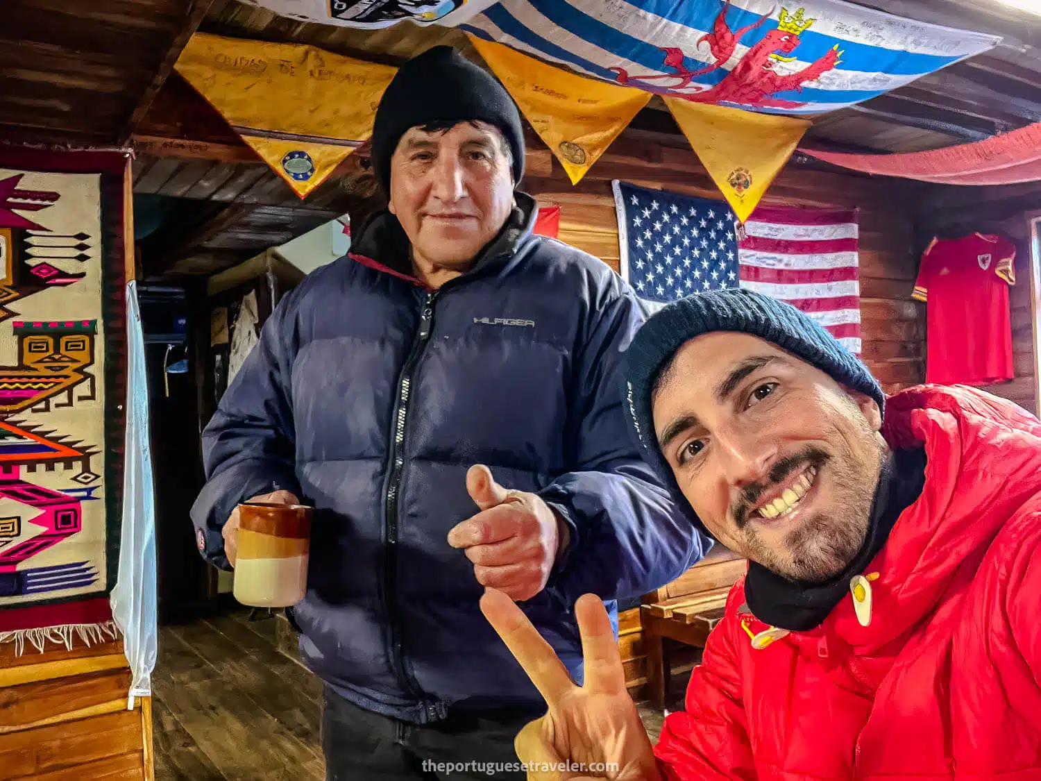
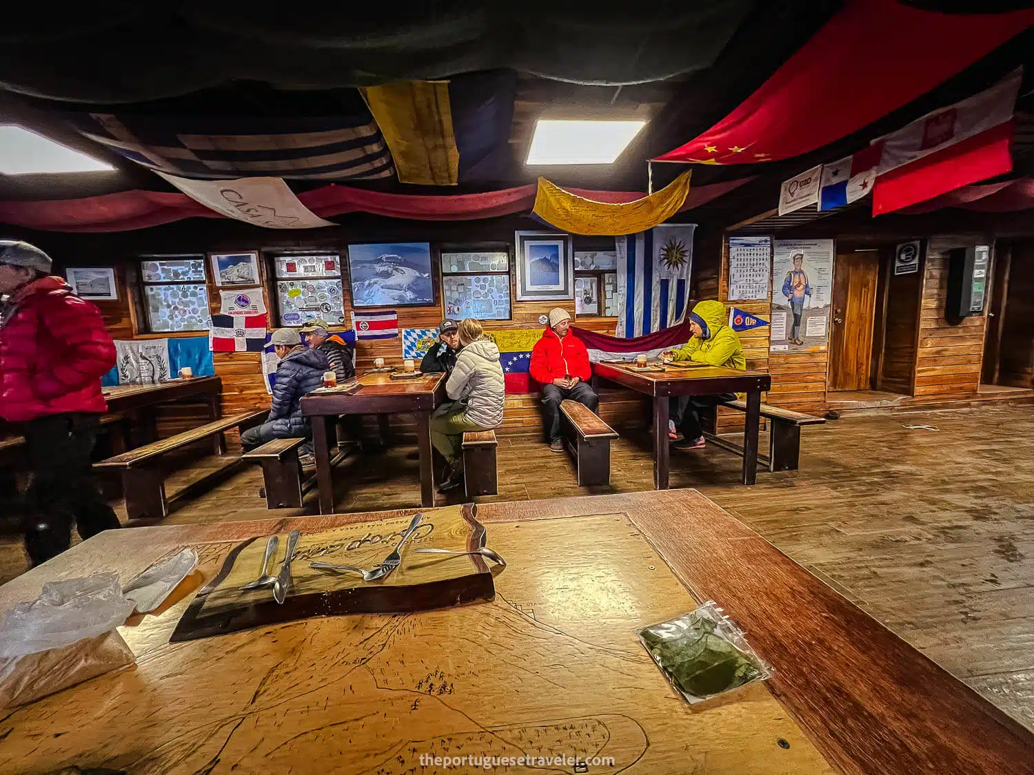
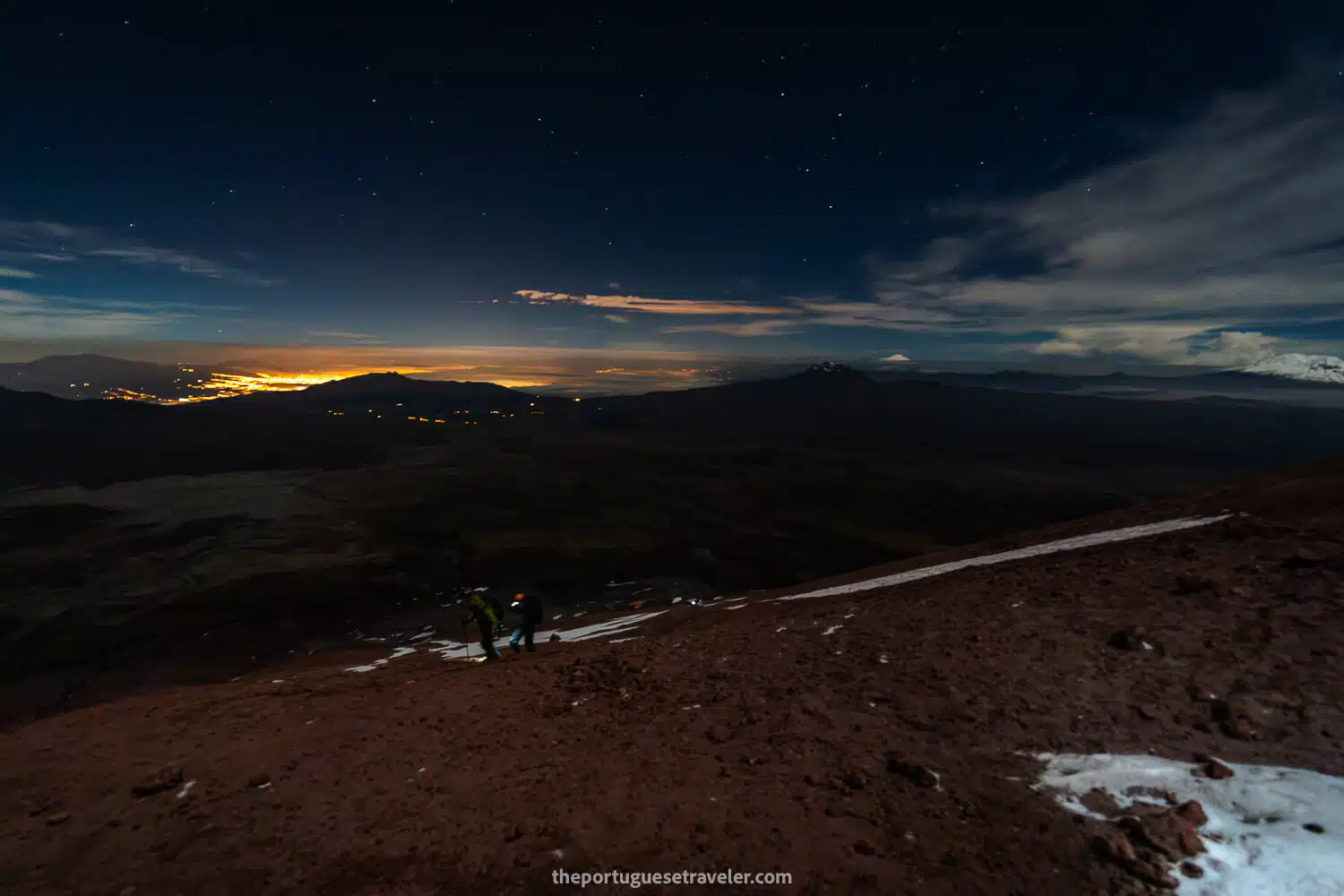
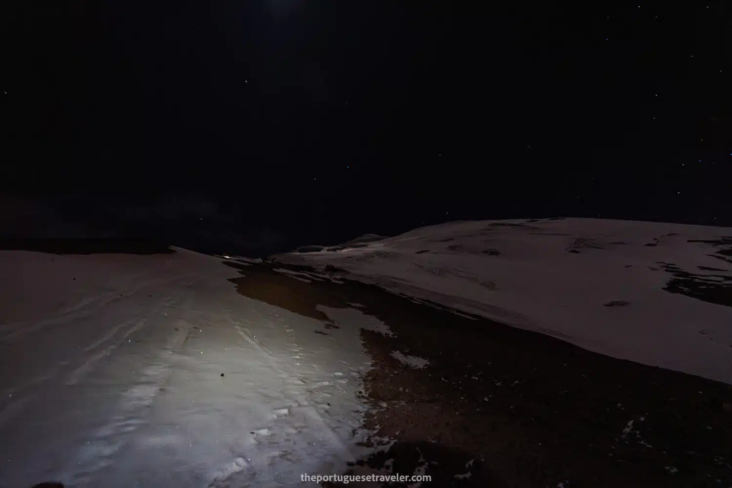
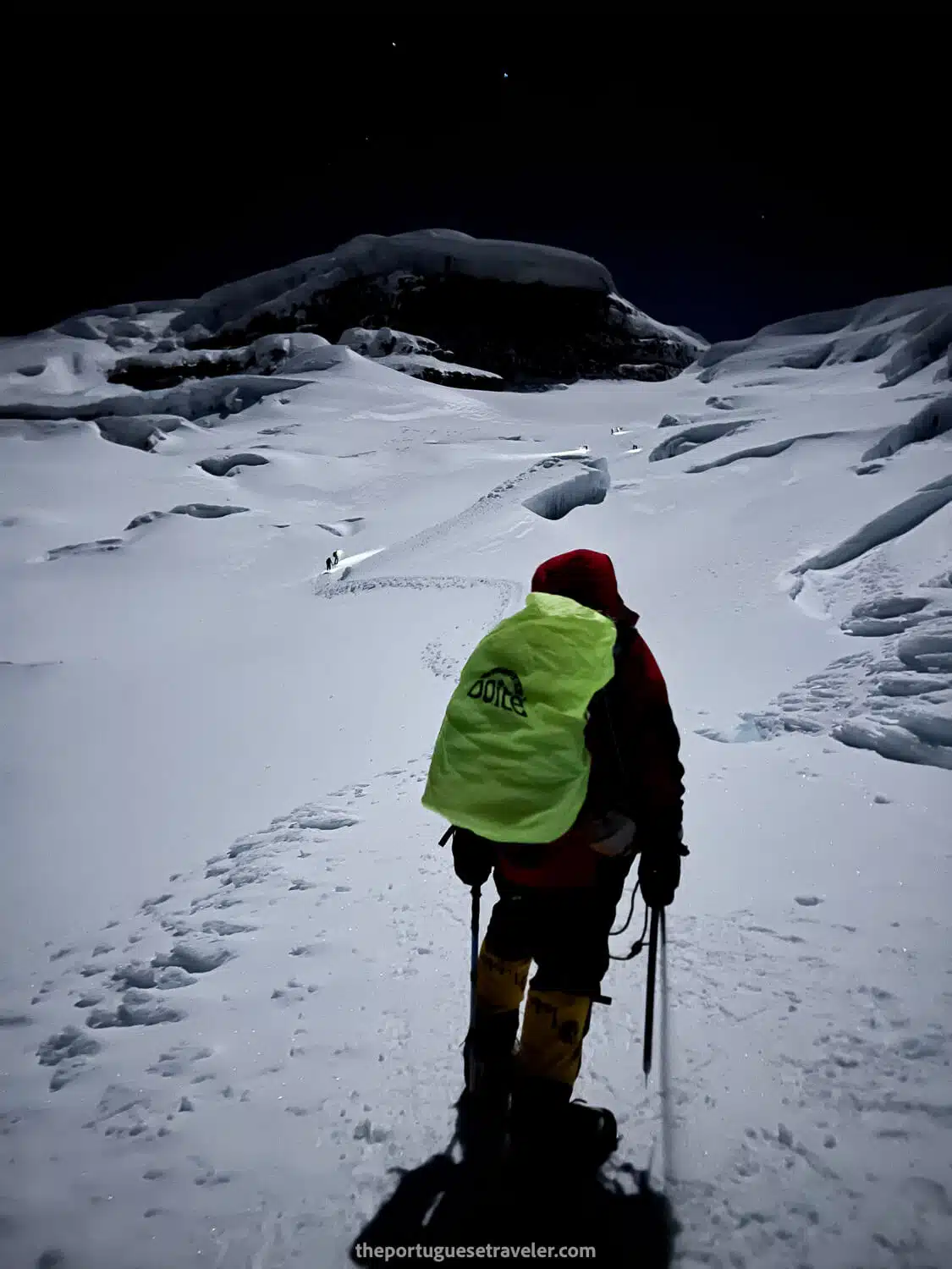
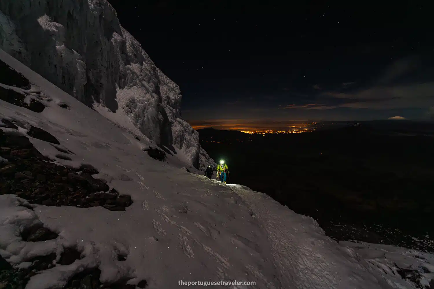
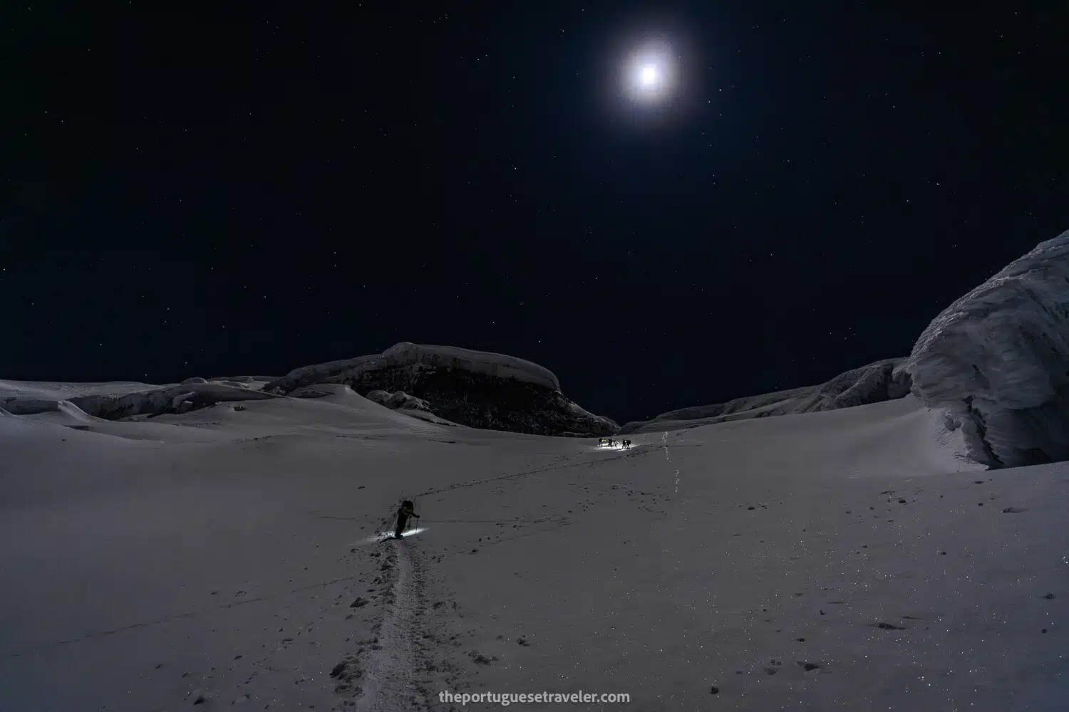
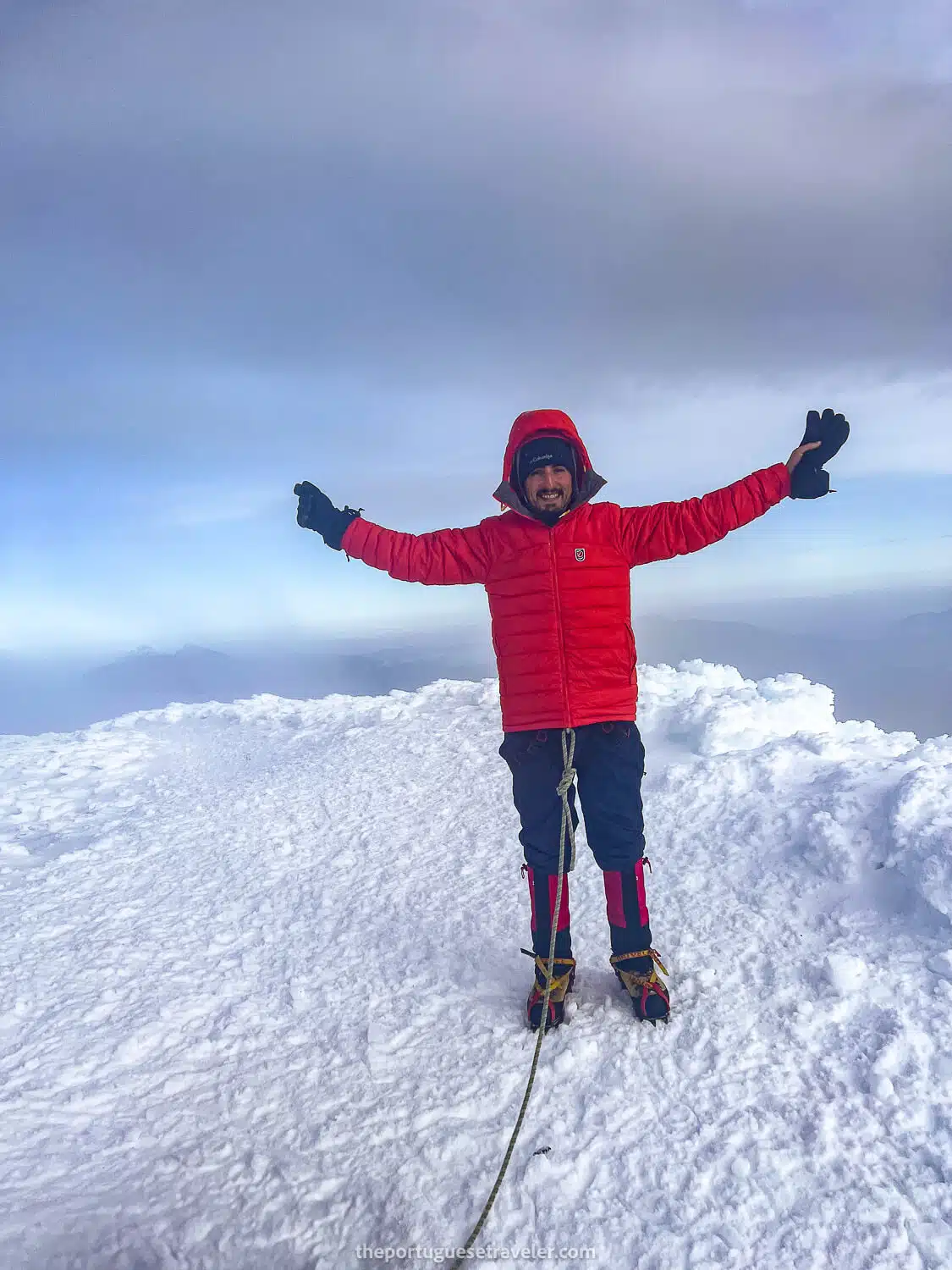
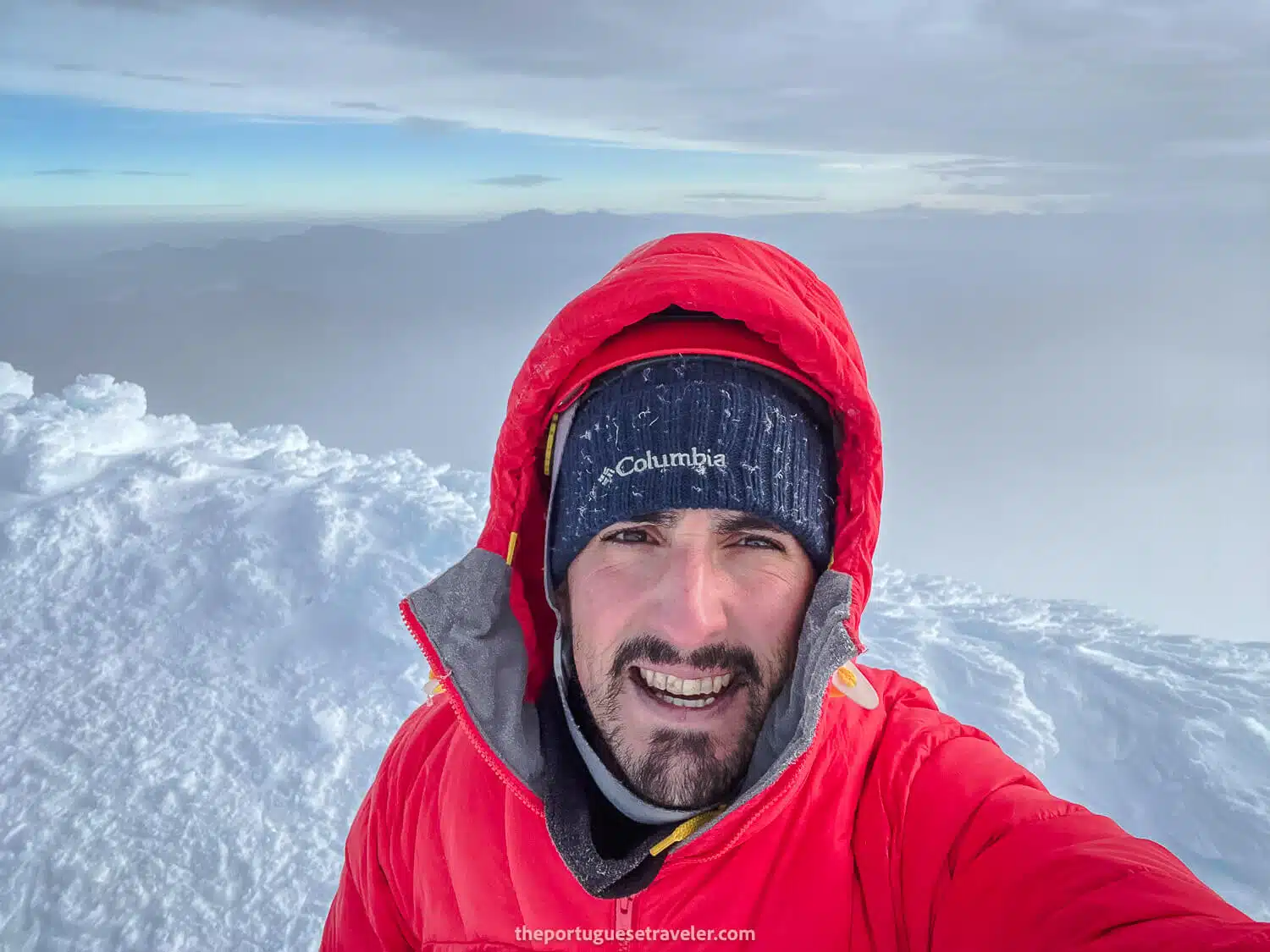
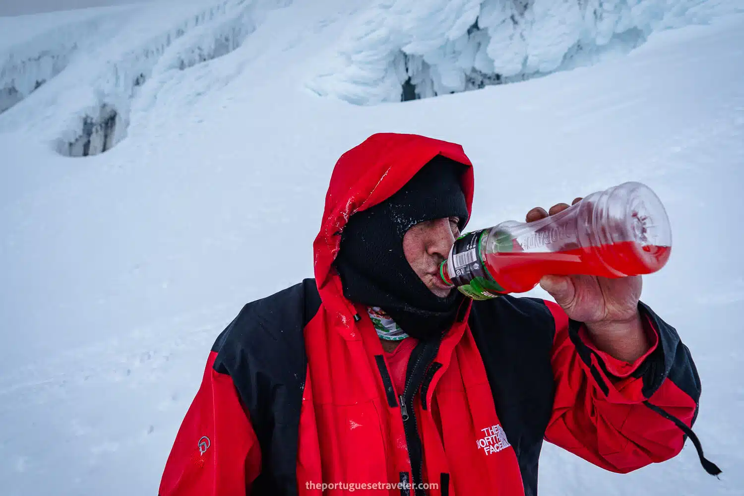
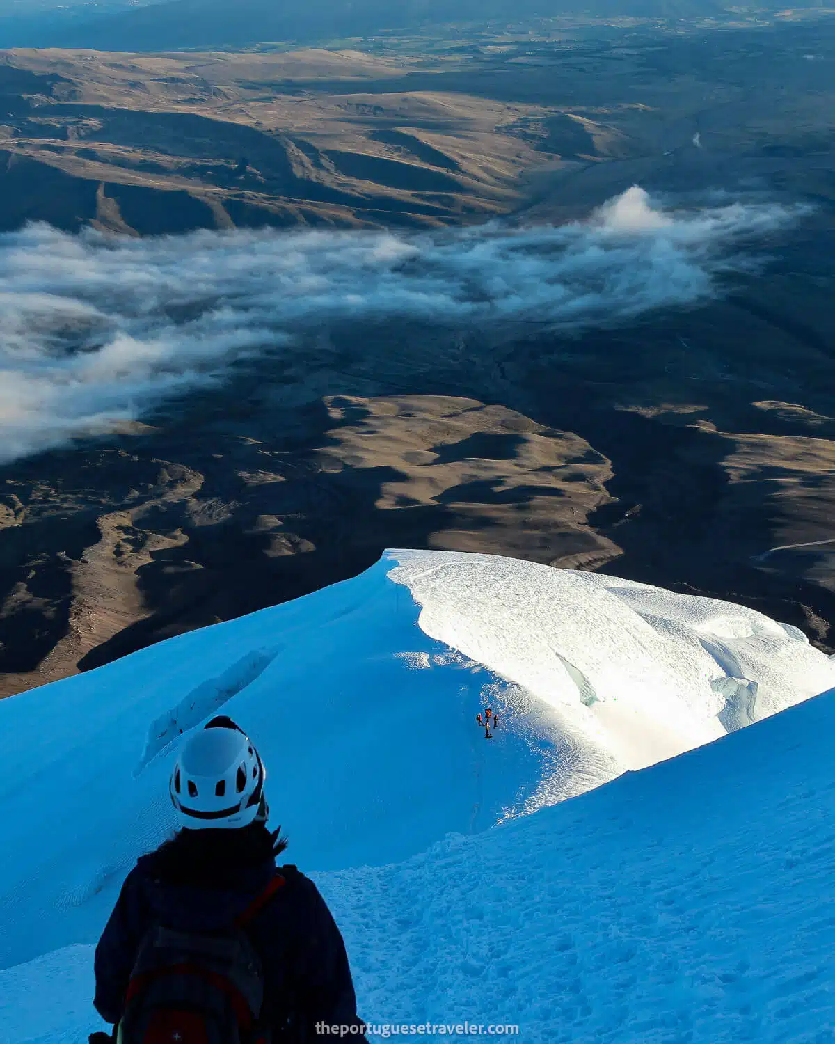
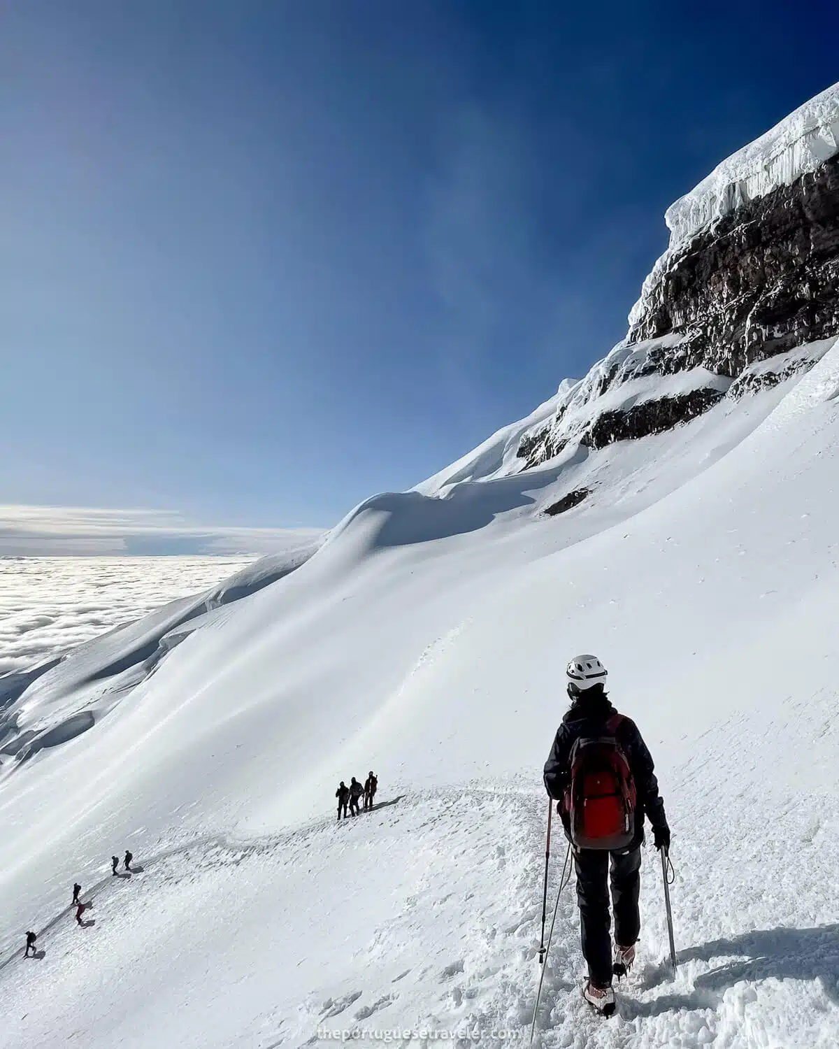
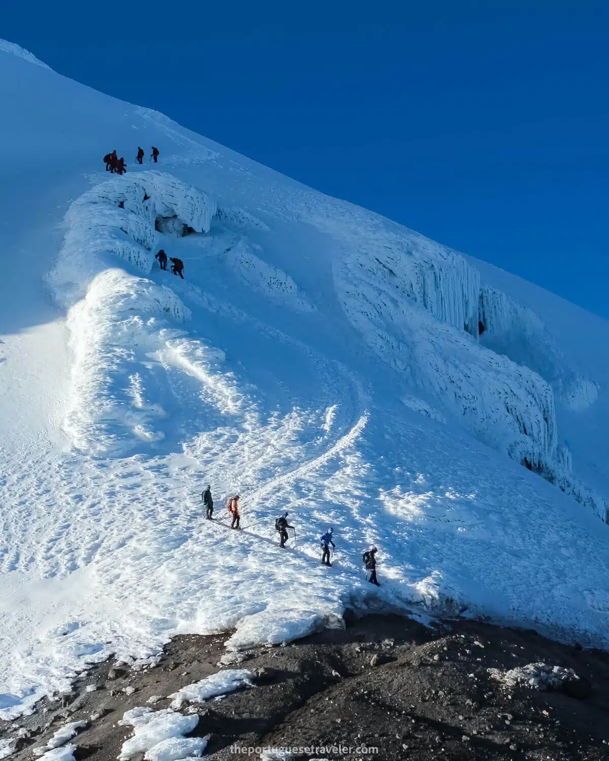
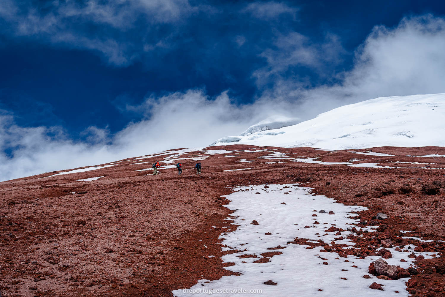
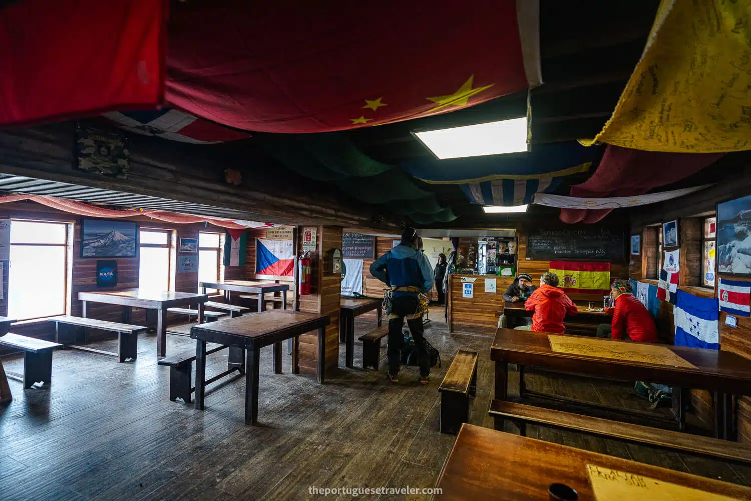
Climbing Conditions: Climbing Cotopaxi is one of the most popular expeditions in Ecuador. The climb does not require prior technical experience, but climbers need to be in good physical condition and acclimatized to high altitudes (above 4,000-5,000 meters). The climb is typically done at night for safety reasons, with each pair of climbers accompanied by a certified mountain guide.

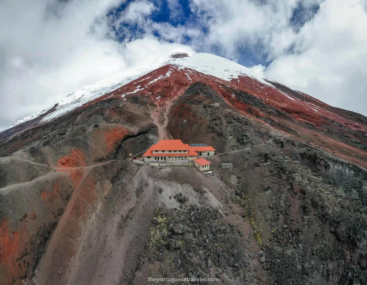
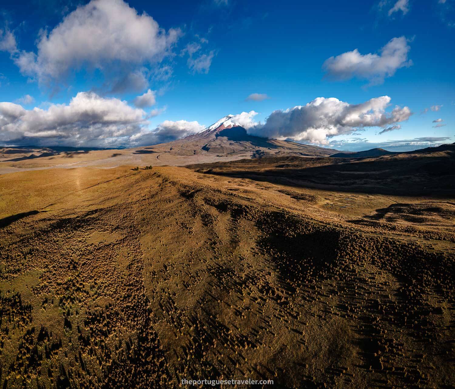
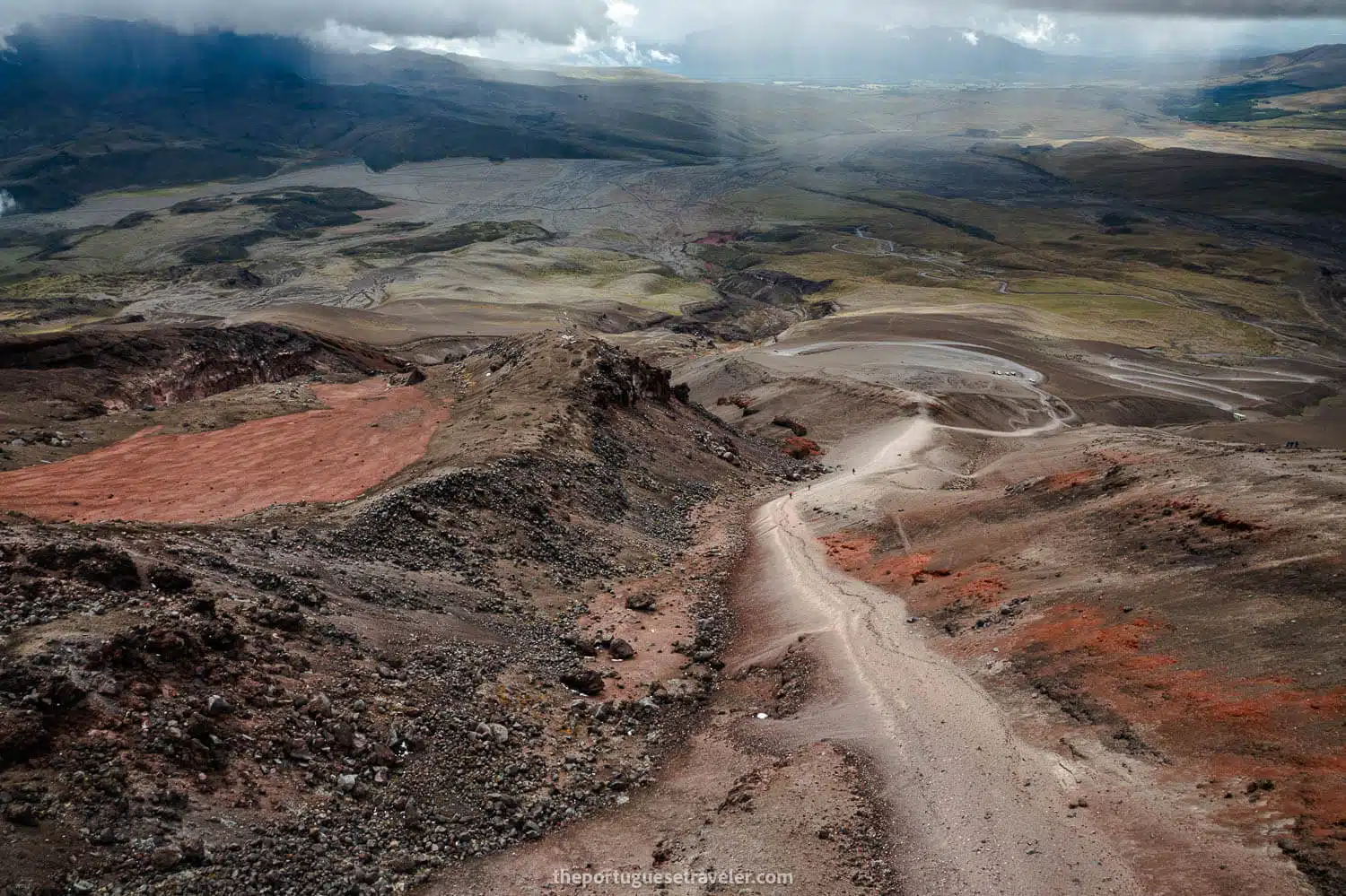
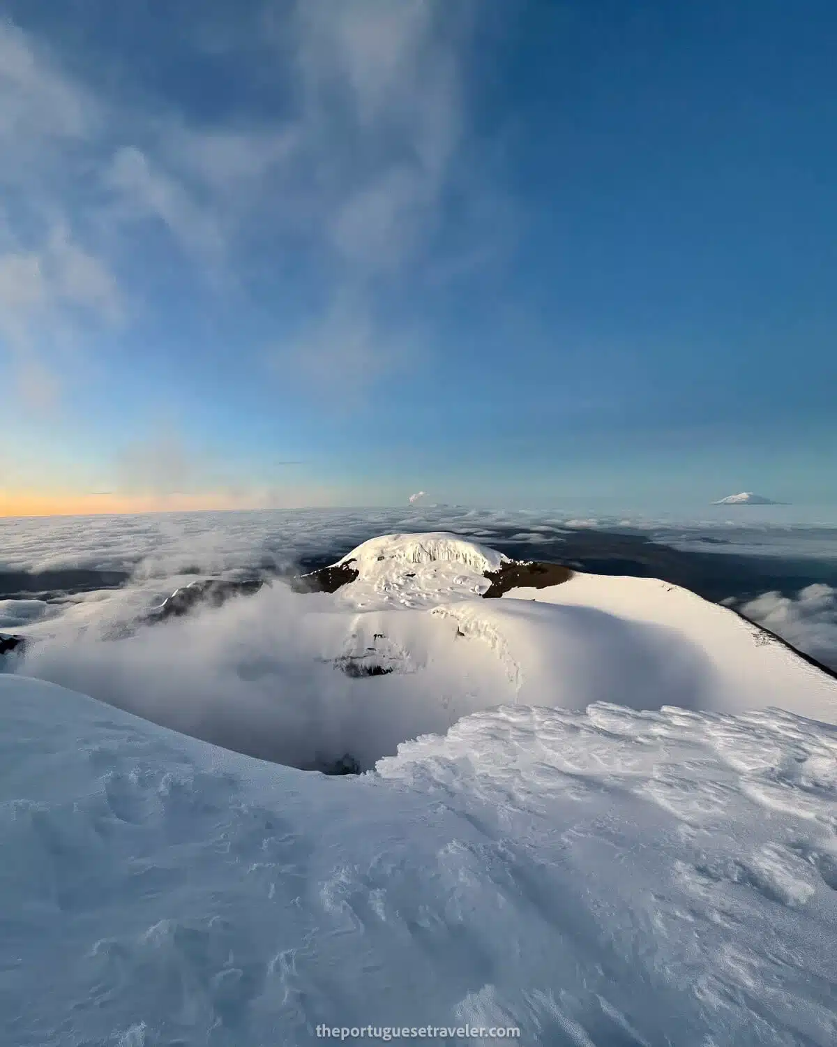
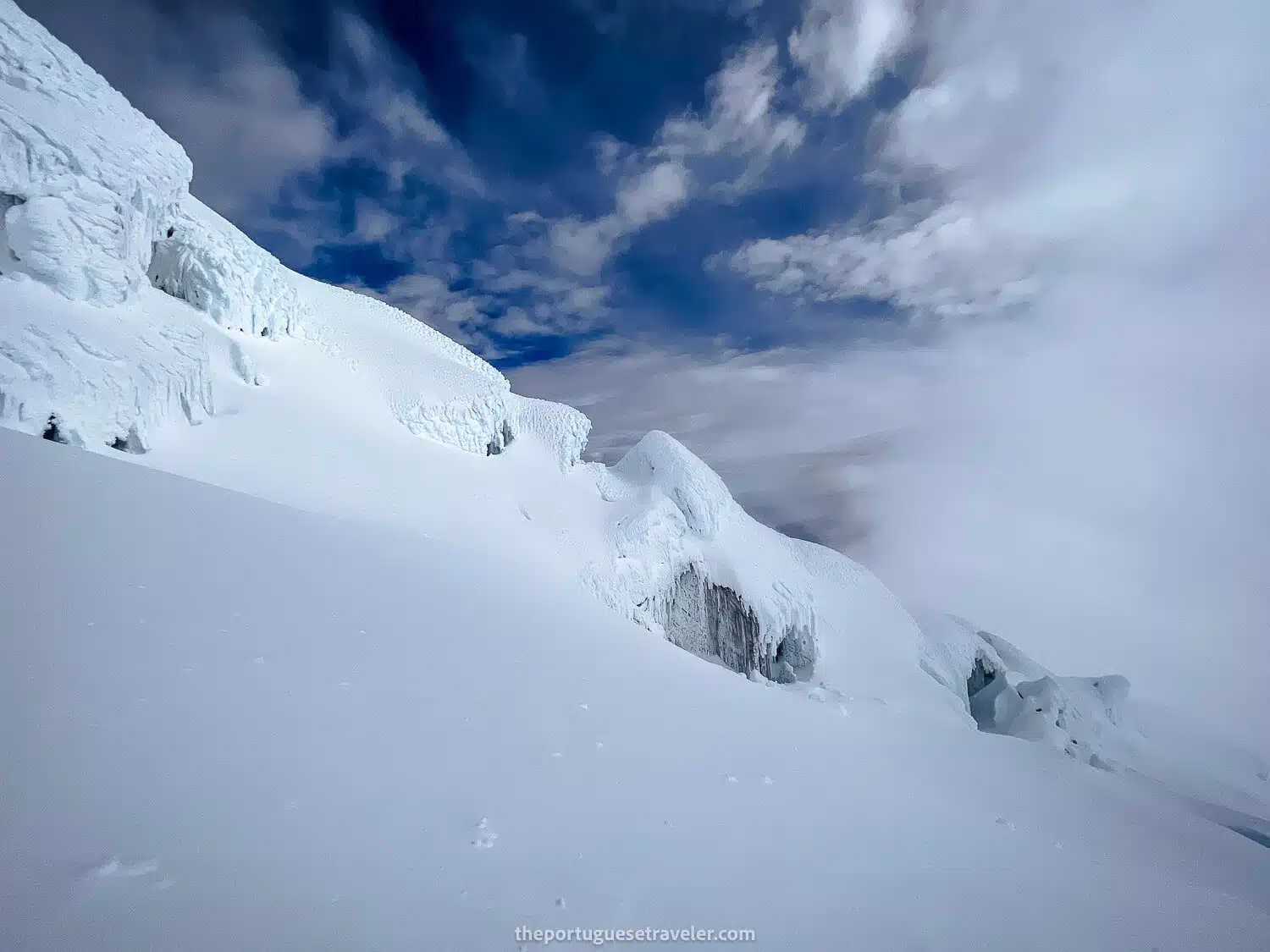
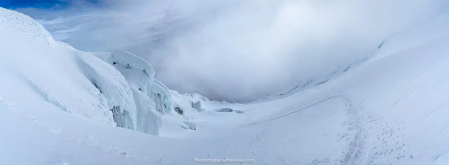
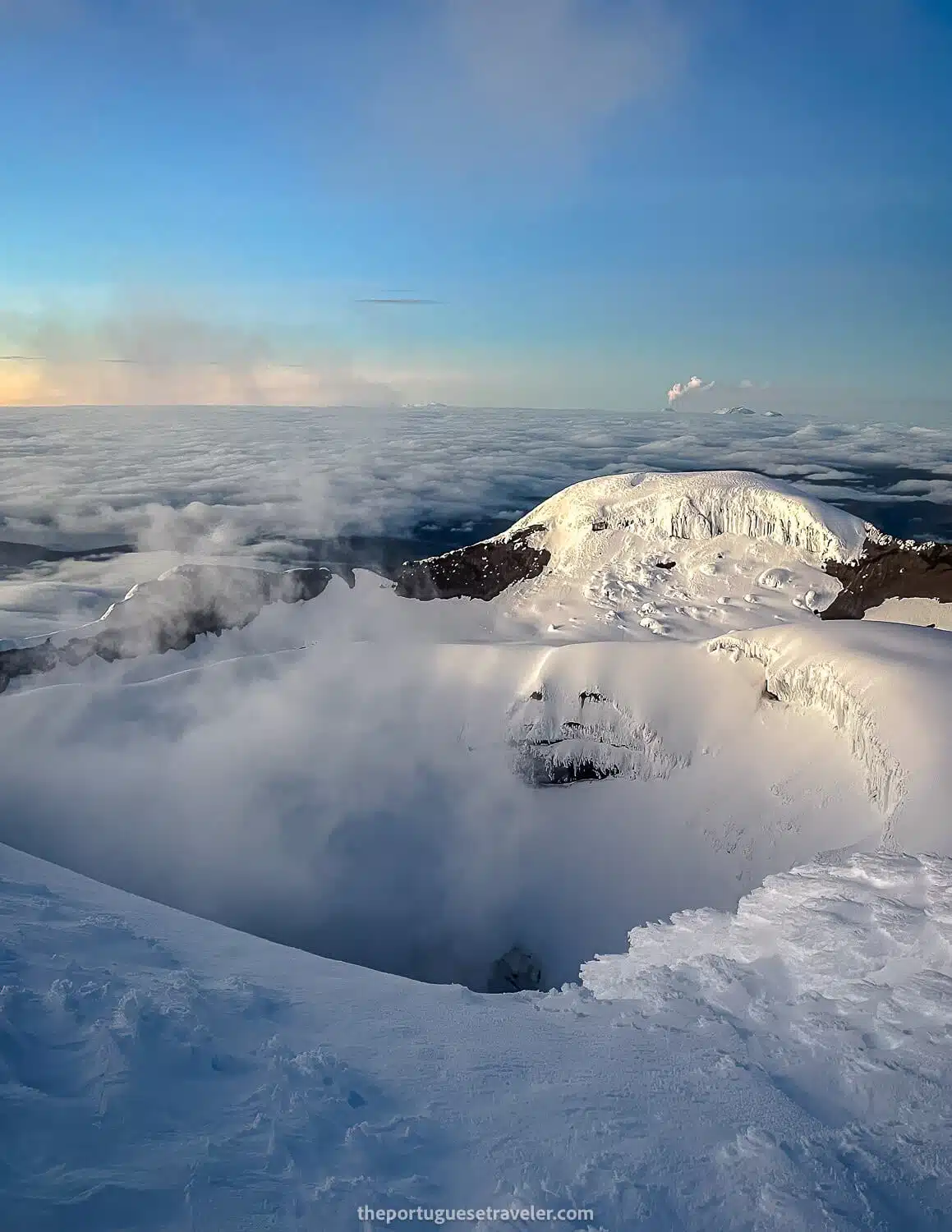
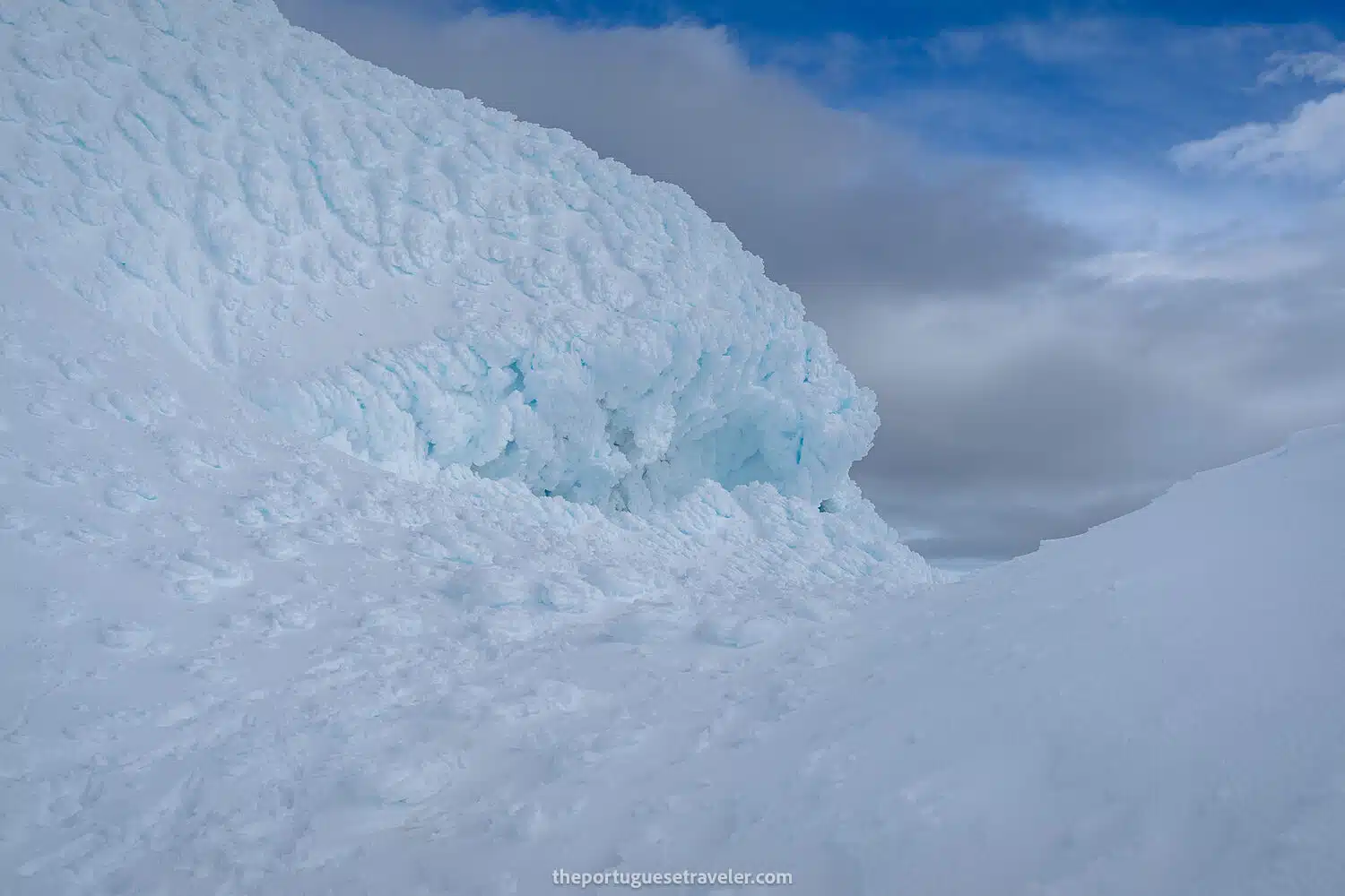
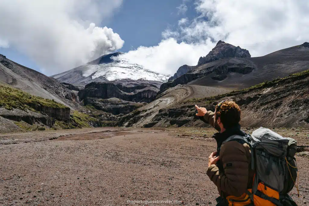
Current Status and Reopening: Cotopaxi was closed to climbers from October 2022 to the beginning of 2024 due to ongoing volcanic activity. It has since reopened, allowing climbers to once again ascend this majestic volcano. However, the summit and its snowy slopes have undergone significant changes. The once predominantly snowy summit is now partly covered in ice and mud, reflecting the dynamic nature of this active volcano.

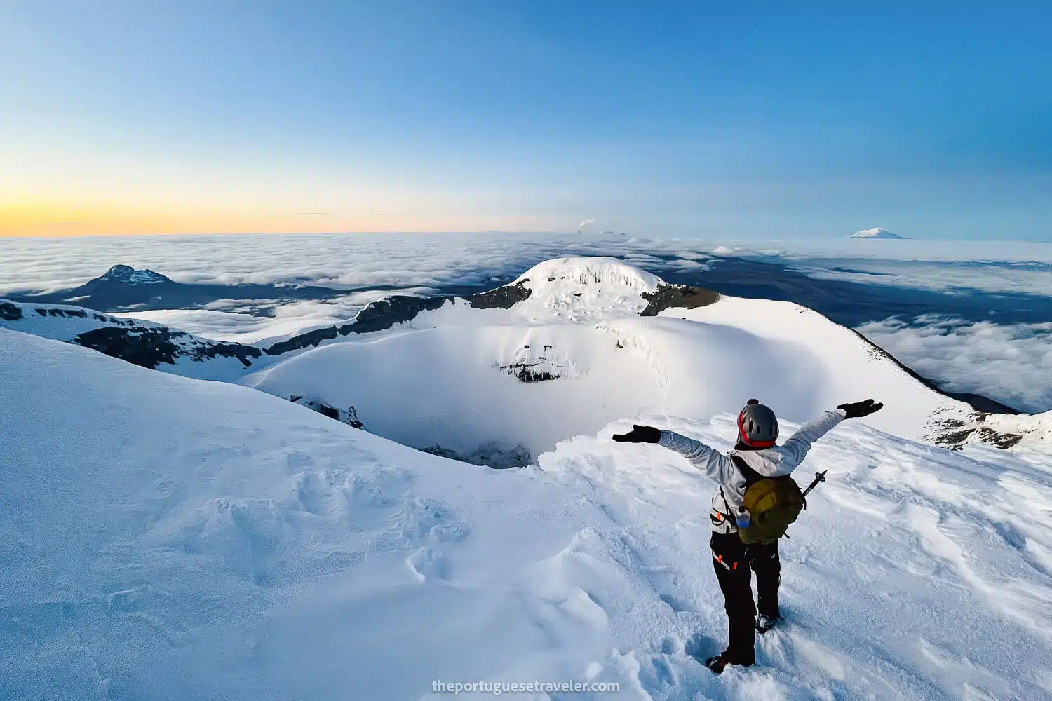
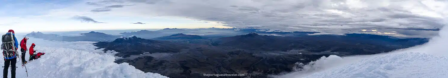
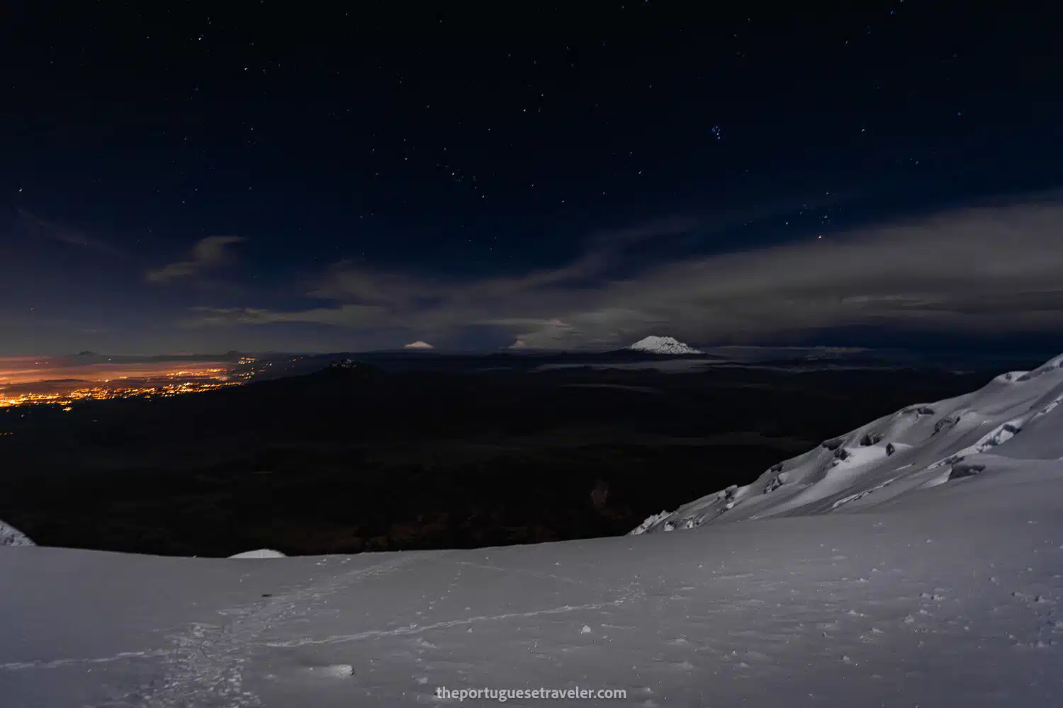
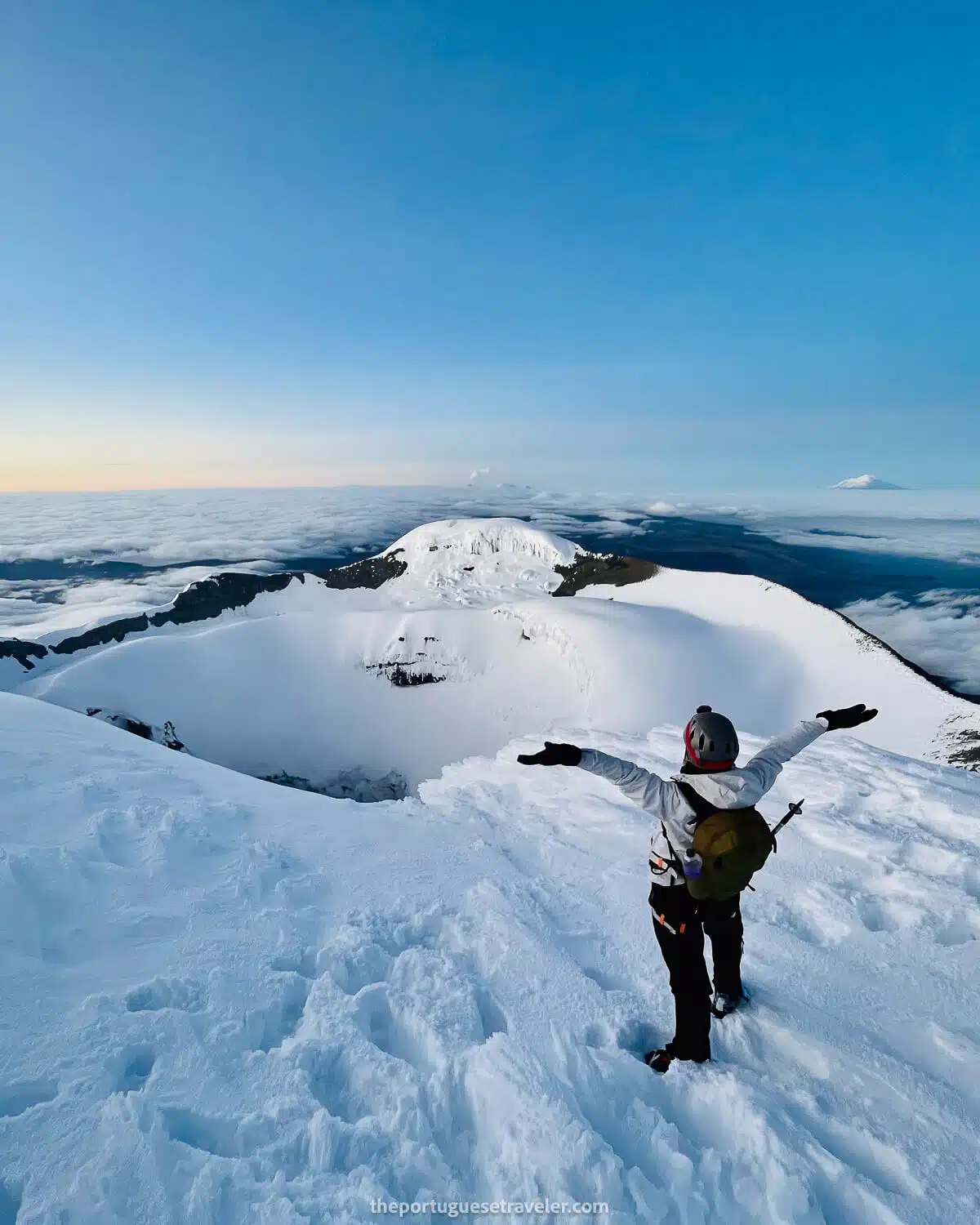
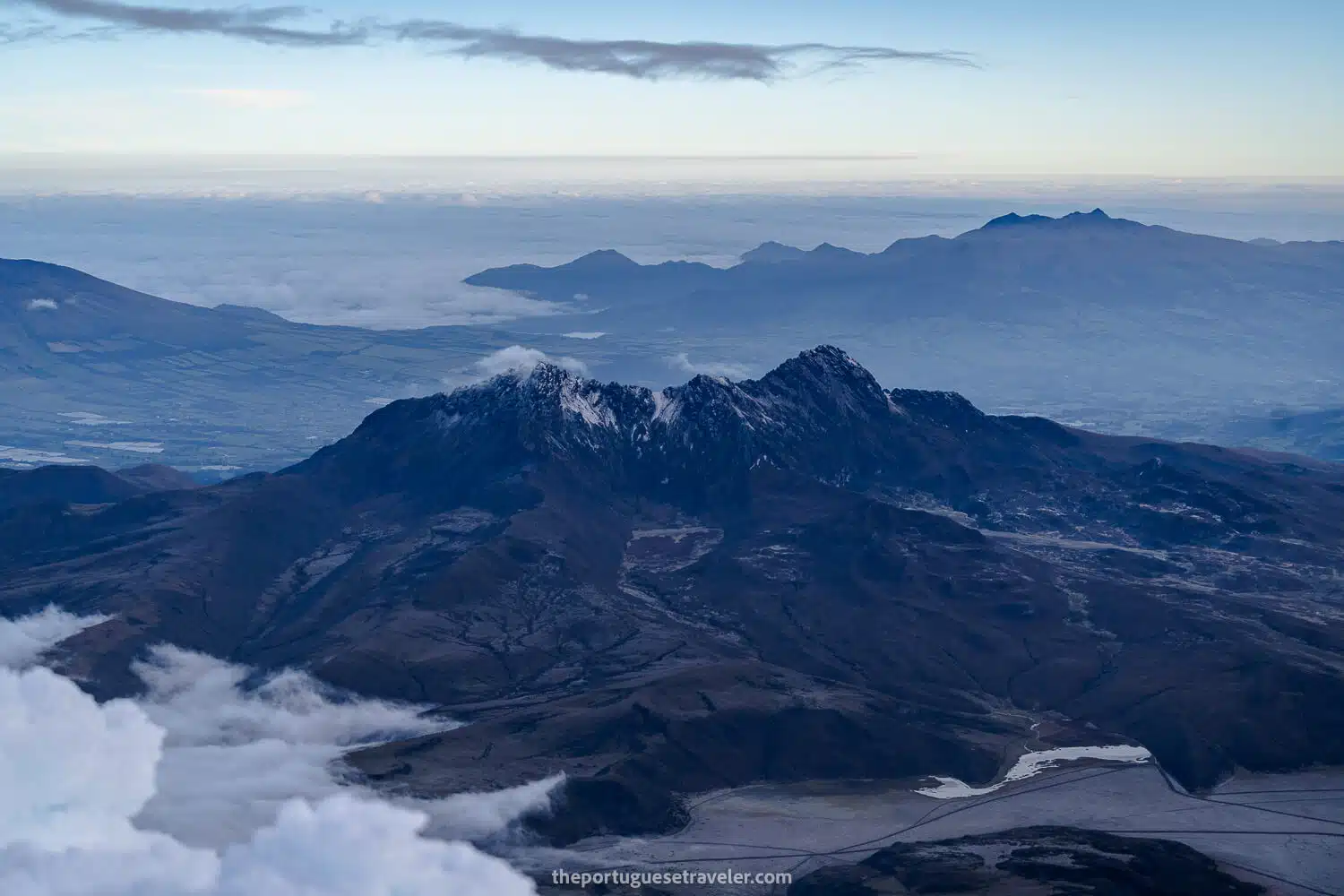
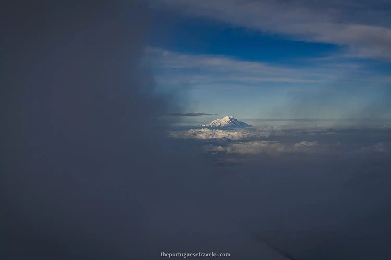
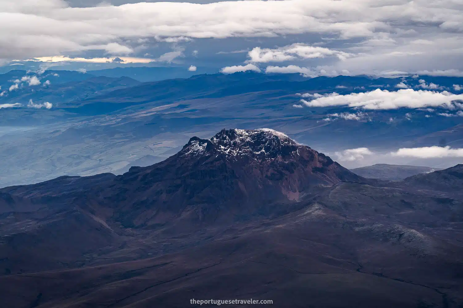
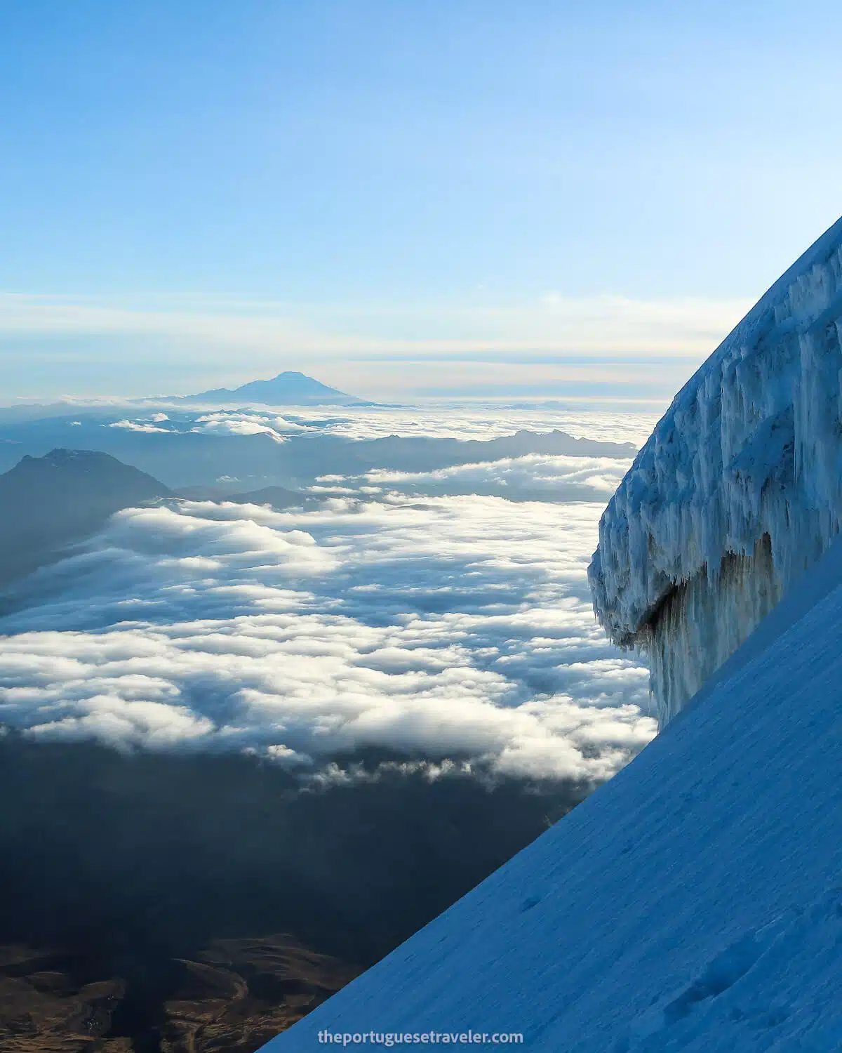
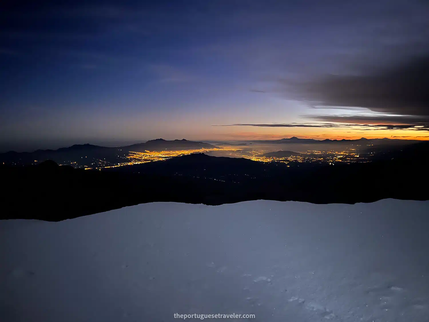
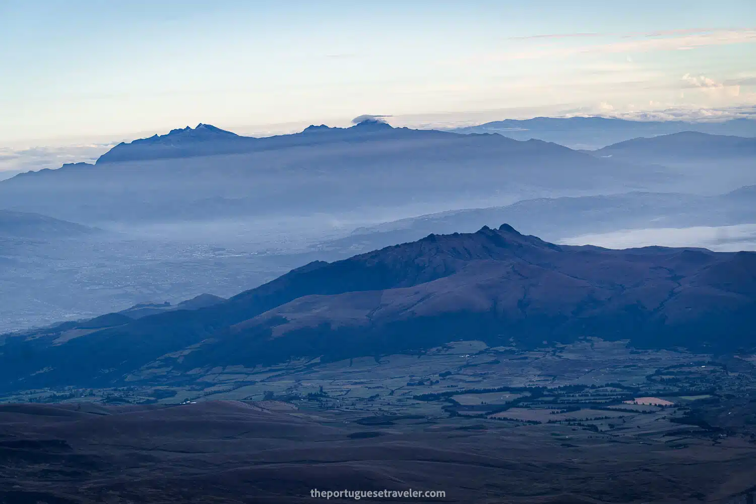
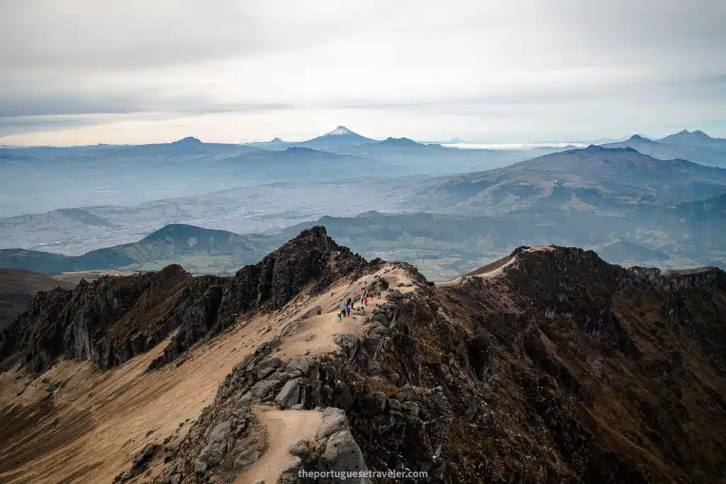
Incredible Views: The ascent offers stunning views of the surrounding landscape. Climbers can see neighboring volcanoes such as Antisana, Ilinizas, Cayambe, and Chimborazo. On clear nights, the illuminated city of Quito can be seen in the background, adding to the mesmerizing experience.

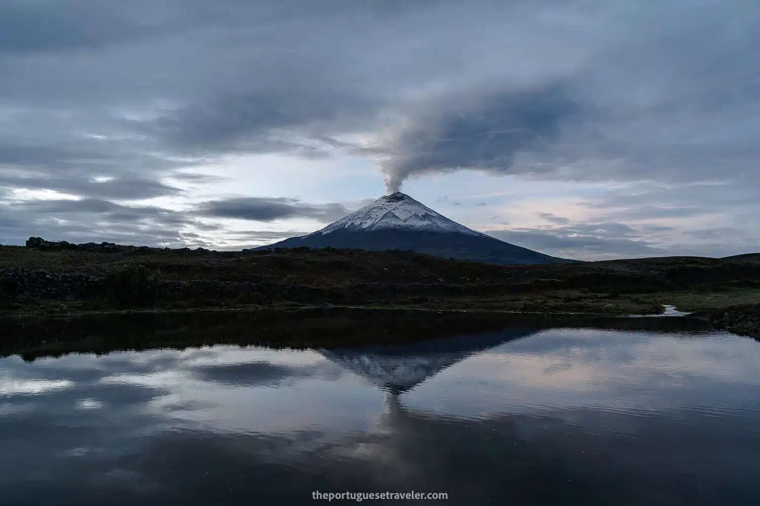
Active Volcano: Cotopaxi is one of the highest active volcanoes in the world. It has erupted 87 times, with the most recent activity beginning on October 21, 2022. The Geophysical Institute of Ecuador reported around 8,000 earthquakes between October 2022 and February 2023, highlighting the volcano’s ongoing activity.

Historic Eruptions: Cotopaxi’s most violent eruptions occurred in 1742, 1744, 1768, and 1877. The 1877 eruption caused lahars (mudflows) that traveled over 100 kilometers, destroying the town of Latacunga. These historic eruptions have shaped the surrounding landscape, creating numerous valleys formed by lahars.

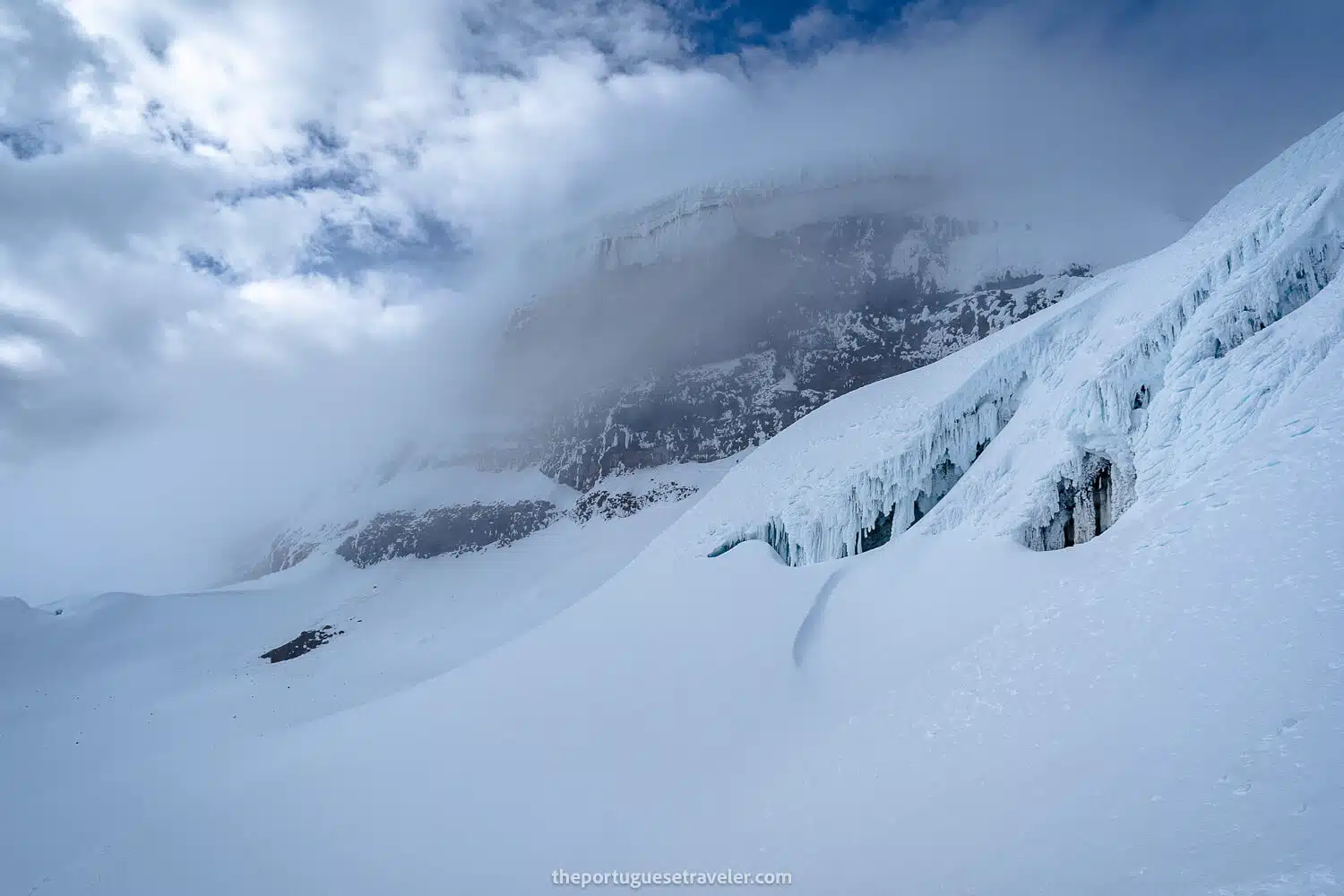
Preparation for Climbers: Cotopaxi serves as a preparation ground for climbers aiming to ascend higher peaks like Chimborazo. The climb to Cotopaxi’s summit is graded as mildly difficult, requiring basic snow and ice techniques. Climbers must use crampons and ice axes to navigate the icy slopes.

Sacred Mountain: The indigenous people revered Cotopaxi as a rain sender and a place where gods lived. Its summit was considered sacred, and it played a significant role in local mythology and cultural practices.

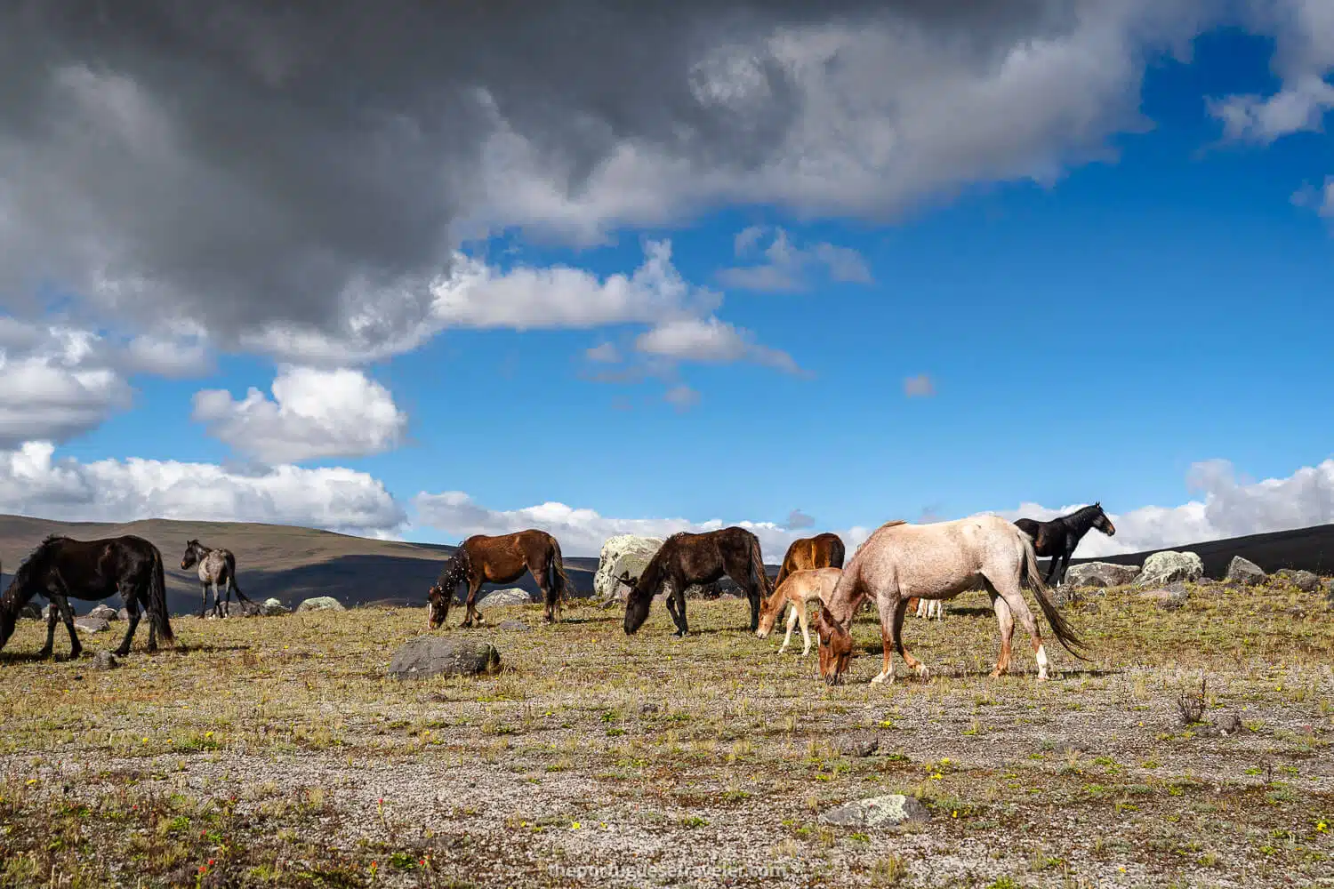
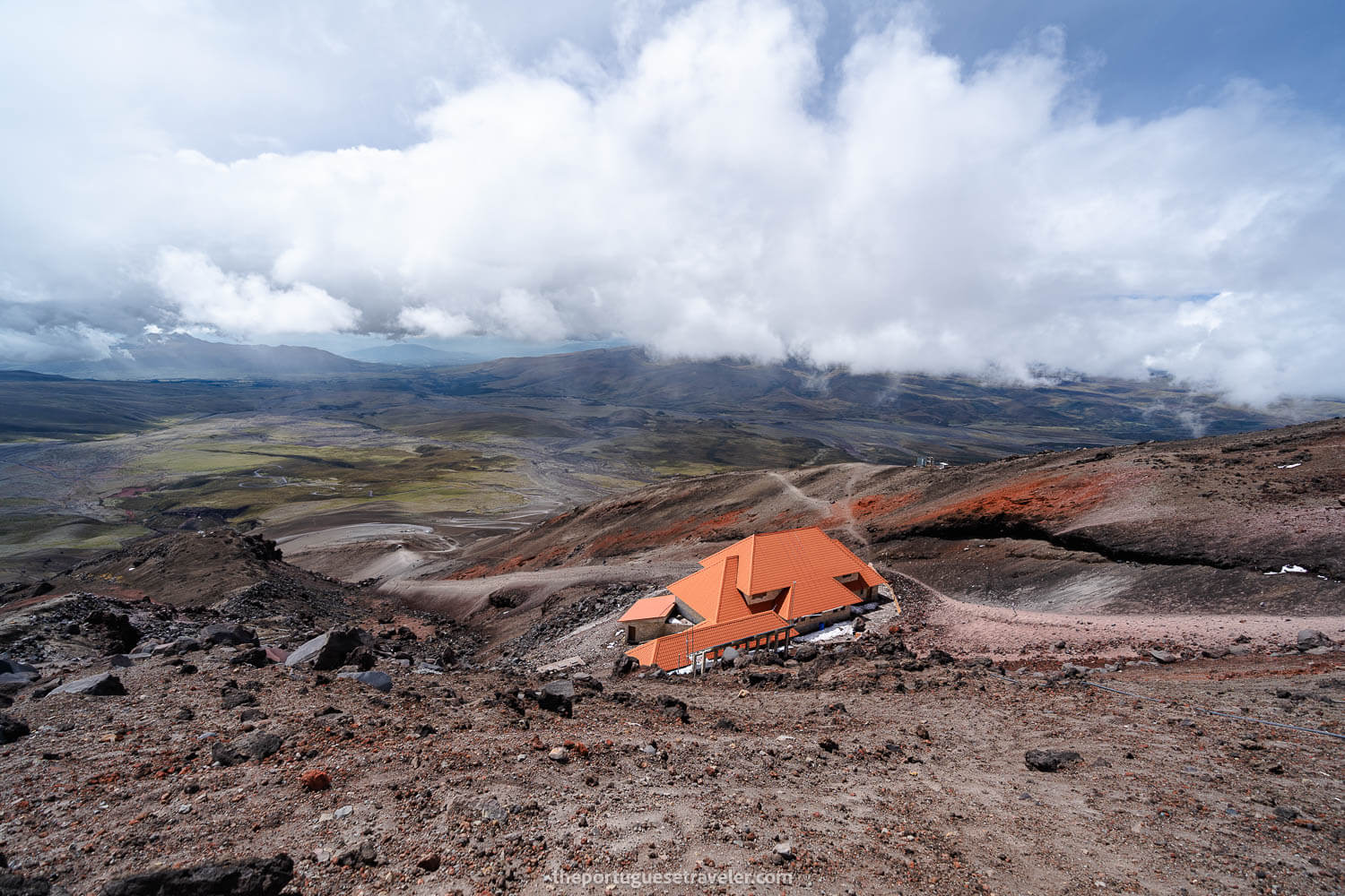
Protected Ecosystem: Cotopaxi is located within the Cotopaxi National Park, a protected area that preserves the unique ecosystem and habitat of native Andean animals. The park’s highland plain starts at about 3,800 meters, with the glacier beginning at 5,000 meters.

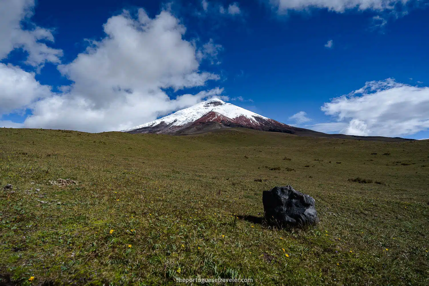
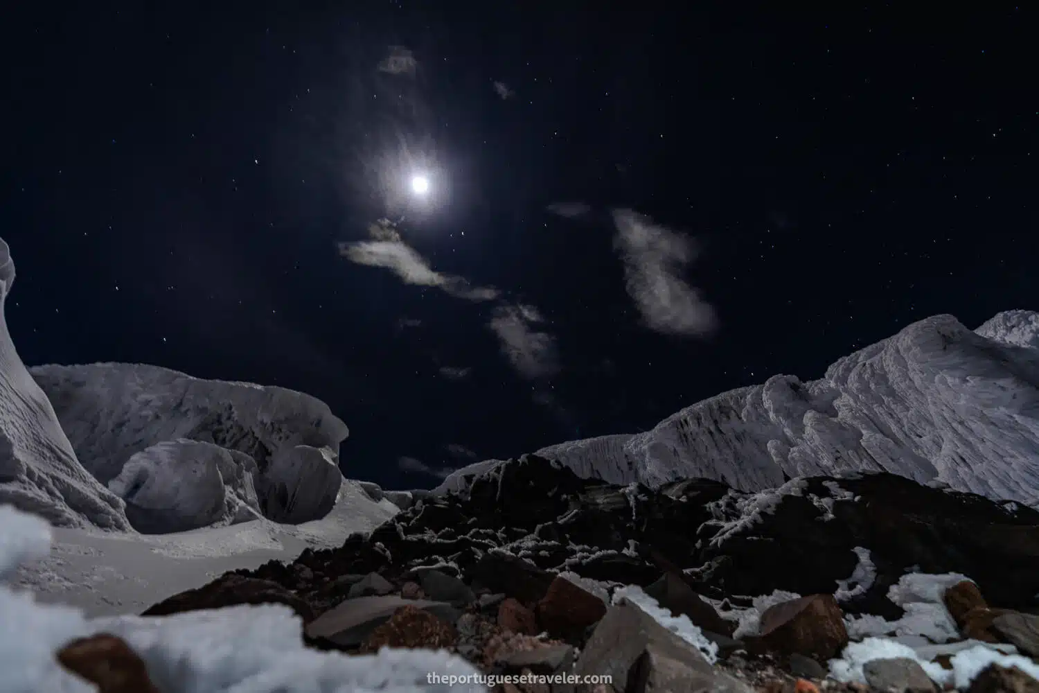
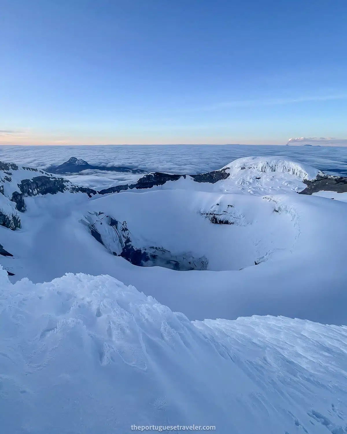
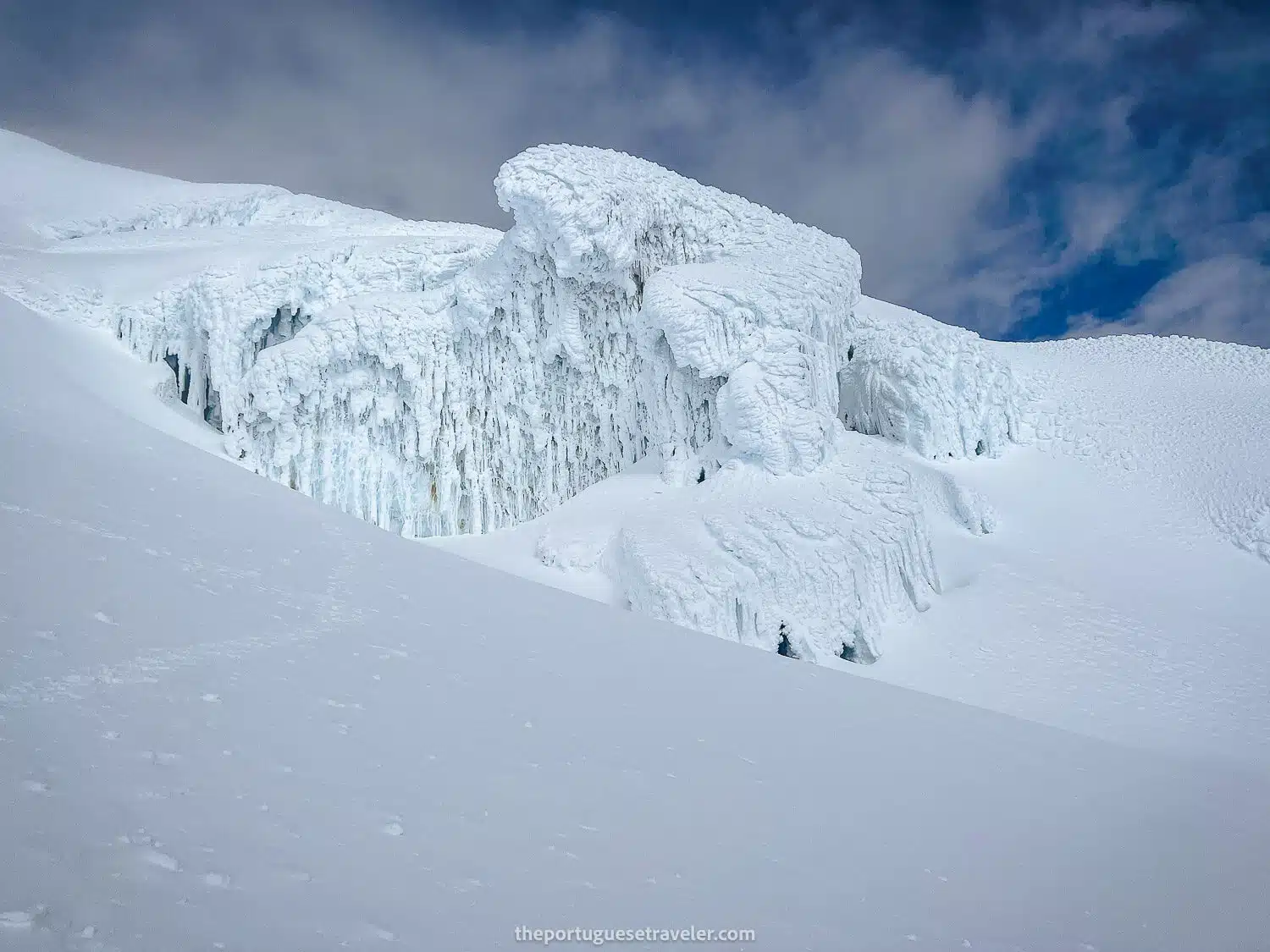
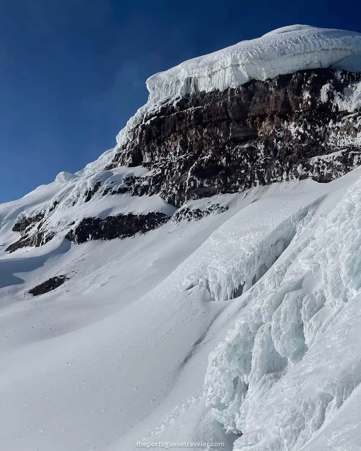
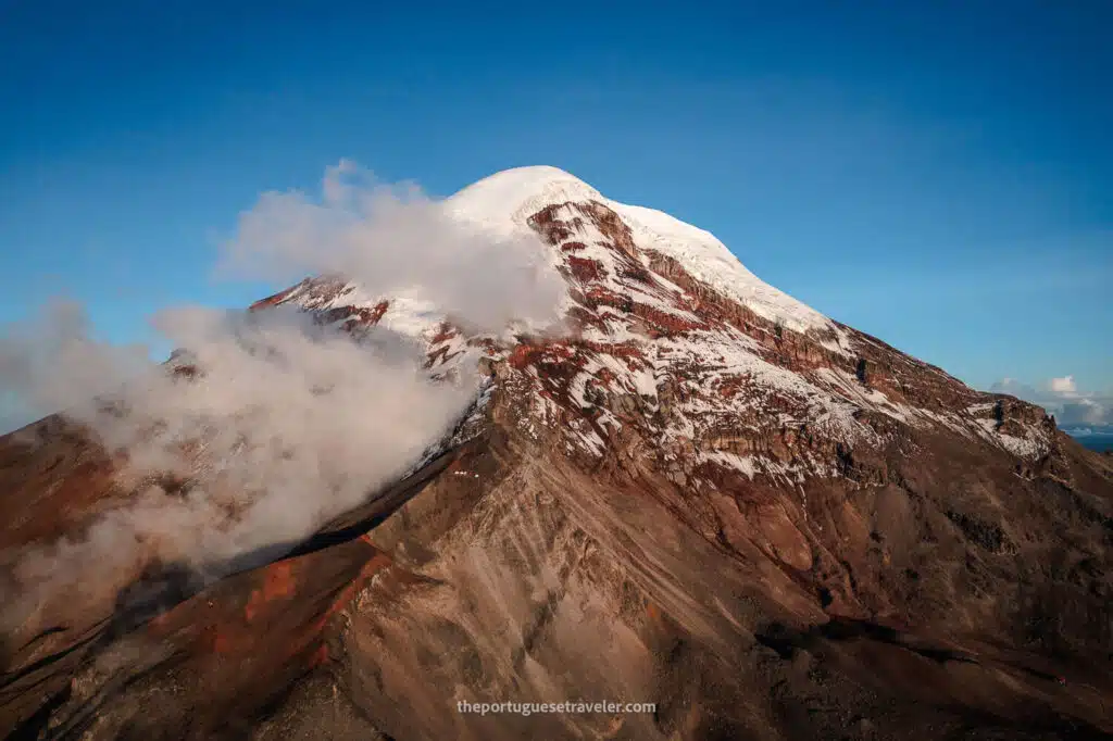
Mountain Features: Cotopaxi has an almost symmetrical cone that rises from its base, with a width of about 23 kilometers. Its crater is 800 meters by 550 meters wide and 250 meters deep, consisting of two concentric rims. The outer rim is partly snow-free and irregular in shape, while the inner crater is covered with ice cornices.

Climbing History: The first non-Spanish European attempt to climb Cotopaxi was by Alexander von Humboldt in 1802, though he only reached 4,500 meters. The first successful ascent was made by Wilhelm Reiss and Angel Escobar in 1872. Since then, Cotopaxi has become a major draw for climbers worldwide.

Recent Activity: In addition to the ongoing eruption since October 2022, Cotopaxi showed significant activity in 2015, with phreatic eruptions and increased sulfur dioxide emissions. This recent activity serves as a reminder of the volcano’s dynamic nature and the potential risks it poses to nearby populations.

Cotopaxi Volcano seen from Ruminahui Volcano

My Experience climbing Cotopaxi Volcano

This is my story of climbing Cotopaxi. In 2022, while exploring Ecuador, I had just finished traveling through the majority of Ecuador’s Pacific coast and the Galapagos when I reached the Andes, my third of the four regions of Ecuador. My main goal was to climb Cotopaxi Volcano before my birthday on July 18th. I started acclimatizing however I could, beginning with my mountaineering friends Eddie, Bryan, Ale, and Feli. We climbed the Fuya Fuya peak together, then I summited Imbabura with a guide from Cotacachi. Afterward, I tackled Iliniza Norte with Eddie and finally felt ready to attempt the Cotopaxi summit.

Bear in mind, I’m originally from the coast and had only experienced hiking in Switzerland at around 2,000-3,000 meters in height, with no prior technical ice gear experience.

At the Summit of Cotopaxi Volcano

The First Day - Refuge Climb

I planned the climb with Pancho (Francisco), a guide recommended to me who had completed more than 1,000 Cotopaxi climbs in his life. I was confident that if anyone could get me to the summit, it would be him. Pancho informed me that other guides had recently made the summit, indicating a clear window for our climb.

Our mutual friend Marco picked me up in Quito and drove us to a highway crossing near Pancho’s house, where we picked him up and proceeded to the entrance of the National Park. We entered through the Chasqui entrance, a bit further than Machachi, and had lunch at a small, nice restaurant. After lunch, we continued to the refuge’s parking lot, said goodbye to Marco, and climbed to the José Rivas Refuge.

Once at the refuge, at 4,864 meters, we had dinner and went to sleep right after sunset. The night attack would start at midnight. We needed to reach the summit before 7 a.m. and be back at the refuge by 10-11 a.m. to minimize avalanche risk or cloud coverage visibility problems.

The lunch with Marco and Pancho
We parked the 4x4 at the parking lot
The high spirit before the big day
The gravel/sand trail between the parking lot and the refuge
Inside the José Rivas Refuge
Inside the José Rivas Refuge, before dinner (coca leaves on the side)
First Dish: Vegetables Soup
Second: Chicken with Rice
Desert: Strawberry Jelly
Quick snack before starting the climb
Quick snack before starting the climb (everybody ready in the background)
The first snow on the climb, Quito illuminated in the back
The first snow on the climb, Quito illuminated in the back, and on the right Antisana and Cayambe Volcanoes
The visibility at night with our headlamps
Pancho ahead of me and the other group already near Yanasacha Wall

The Night Summit Attack

We woke up at midnight and started climbing, initially without crampons, using just our headlamps. There was one other group aiming for the summit that day, and we were behind them. We climbed slowly and steadily in the pitch-black night until around 5,000 meters, where we put on our crampons for the snow. It was a full moon, a good sign for clear weather in the Andes.

We continued climbing, sometimes passing the other group and sometimes being passed by them. It felt like an eternity to climb such a repetitive, conic path that was mostly straight upwards for hours. When we reached the famous Yanasacha wall, I started taking photos of the surrounding volcanoes and illuminated Quito. The view was stunning! There were some clouds scattered around, making me wonder if we would reach the top with a clear view. To be at the summit for the sunrise at 6 a.m. was our goal.

Taking photos without a tripod at altitude while climbing was challenging. Sometimes I used my backpack or the guide’s shoulder for support, but it was often easier to just use my phone. As we continued, the climb got steeper and higher. We were almost at the summit, about an hour away, but I was exhausted and short of breath.

After Yanasacha, the snow became deeper, causing me to slide back with each step. I had to switch to using an ice axe instead of a walking stick due to the increased incline. Despite my fatigue, Pancho literally pulled me the last few meters up. It was humbling to see a 60-year-old man pulling a 31-year-old like me to the summit. 

Trying to photograph on the go with my camera
Trying to photograph on the go with my camera (Cayambe and Quito in the back)
The approach to Yanasacha Wall
Illuminated Quito and the volcanoes Cayambe and Antisana
The glaciers and Crevasses of Cotopaxi

The Cotopaxi Summit

We finally reached the summit on July 16, 2022, two days before my birthday, and I burst into tears. It was my biggest mountain ever climbed, and having been previously hospitalized in Bolivia’s salt flats with altitude sickness, being at 5,897 meters was a personal record and a moment of overcoming fear.

The sheer fact that I made it there brought me to tears even before stepping on the summit. Once on top, I hugged Pancho, congratulated the other group, and realized that a cloud had covered the crater, allowing me to see Quito and the other volcanoes but not the crater itself. I guess I’ll have to try this summit again. Despite the new eruptions making it darker and icier, it will still be an amazing feat to attempt a second time.

I caught a glimpse of Chimborazo Volcano through a small opening in the crater cloud, along with other volcanoes like Antisana, Cayambe, Ruminahui, Sincholagua, Paschoa, Illinizas, and El Corazon—an entire Avenue of Volcanoes. It was an unbelievable view, one to remember forever.


Me at Cotopaxi's Summit (and the cloud that came along)
Jhose at the Summit a couple of days later (envy)
Me at the summit all frozen and dirty
Me emotional at the summit all frozen and dirty
The Crater of the Cotopaxi Volcano
The Crater of the Cotopaxi Volcano (Sangay Volcano erupting in the background)
Ruminahui Volcano and Limpiopungo Lagoon at the bottom
The Mighty Chimborazo Volcano
Cotopaxi's Crater and Chimborazo
Sincholagua Volcano seen from the Summit of Cotopaxi
The crevasses of Cotopaxi Volcano
The icy formations of Cotopaxi Volcano
Panchito drinking his energy drink to finish the run
Some more ice structures
The return home on a taxi van

The Way Down

Finally, after 15 minutes at the top, we had to go down. There’s a saying that the summit is just half of the adventure; to complete it, you have to descend successfully. When you’re tired and out of energy, this can be quite a challenge.
 
My legs were shaking, and I was descending almost without control. Once again, Pancho helped me out and suggested we pause to drink something before continuing.
 
During that stop next to Yanasacha, I took some more photos in the daylight and could see the stunning white fields of Cotopaxi, the crevasses, and the small dots in the distance that were the other group ahead of us.
 
We moved on and finally reached the refuge. To my surprise, I found Jhose, my future wife, participating in a glacier school to attempt the summit of Cotopaxi a few days later. The featured photo and some other photos in this article are hers. Amazing right!?
 
A panorama of the snow and crevasses of Cotopaxi
The ice walls of Cotopaxi
The way down
The way down from Cotopaxi's Summit
The Yanasacha wall on the right
The end of the snowy section

Finally, after a well-deserved breakfast, we went to the parking lot, where we took off by taxi to Quito.

Have you had the opportunity to climb Cotopaxi Volcano? I would love to hear about your experience if you’ve done it. Please share your thoughts and opinions in the comments below.

Thanks for reading through, and I hope you have fun on this adventure. I will share more of my favorite shots below, enjoy!

Photo Gallery

The First Day - Refuge Climb

Some hikers trying to reach the snow section
The Jose Ribas refuge seen from the top
The José Rivas / Jose Ribas Refuge

The Night Summit Attack

The view of Quito on a stop on the way up

The Cotopaxi Summit

The crater of Cotopaxi
Pasochoa Volcano

The Way Down

Yanasacha
The Yanasacha semi-covered in clouds
Cotopaxi's Ice Formations

All the Articles About the Ecuador

Galapagos Islands – Experience the wonders of nature and unique wildlife in this pristine archipelago.

Amazon Rainforest – Immerse yourself in the lush greenery and rich biodiversity of the world’s largest tropical rainforest.

The Andes – Embark on an adventure in the Ecuadorian Andes, a majestic mountain range with diverse landscapes, ancient sites, and captivating wildlife.

Pacific Coast – Discover Ecuador’s Pacific Coast, nestled between the majestic Andes Mountains and the vast Pacific Ocean. 

Cloud Forest – Explore a Biodiverse Paradise of Flora and Fauna.

Leave a Comment

Your email address will not be published. Required fields are marked *

26 Shares
Share
Pin
WhatsApp
Email