Morurco 360 Hike - Cerro Morurco

Cotopaxi National Park

Morurco 360 Hike in the Cotopaxi National Park

The Morurco 360 Hike, is an unforgettable adventure within the captivating landscapes of Cotopaxi National Park. Nestled on the southeastern slopes of the iconic Cotopaxi volcano, Morurco Mountain, aka. Cerro Morurco, stands tall at an impressive altitude of 4,844 meters, beckoning both seasoned climbers and beginners alike.

Renowned for its accessibility and suitability for acclimatization, this mountain offers a remarkable opportunity to test your skills on rocky terrains while reveling in the natural splendor that surrounds you.

Table of Contents

The Morurco Mountain on the background

Morurco 360 Hike: General Details

To do the Morurco 360 Hike, a mid-mountain hike in the Ecuadorian Andes, you can do it in three ways, with a Mountaineering Agency, with a private guide, or on your own without a guide (the trail has some signs and there are usually people doing the same trek):

  • Highlights: Cotopaxi Volcano South Face, the Morurco Mountain, views of other volcanoes such as the famous Chimborazo, and Los Ilinizas (on a clear day).
  • Duration:  1 day.
  • Accommodation: No need but there is a refuge and a camping area.
  • Authorization: Not required for the Morurco 360 hike. For the Morurco summit, send an email to [email protected] just in case (min. 5 days before your trip).
  • Price: 17-45$ (details in the following section)
  • Outfit: Mid-mountain gear, and if camping – appropriate equipment (details in the following section)
  • Best Months to hike: June – September
  • Recommended Agencies: Cumbre Tours, Mountain ToursMauna Expeditions
Powered by Wikiloc
Me showing off my Portuguese flag at the Lahar of Cotopaxi Volcano

Morurco 360 Hike: Technical Details

  • Type: Loop.
  • Distance: 14 km – Starting at the parking area, the last place a 4×2 car can reach as there is a gate.
  • Duration: 7-8 hours in total (4h of moving time), 9-10 hours counting the lunch and small breaks.
  • Difficulty: Moderate-Hard. The most challenging aspect of the hike is the sandy incline following the canyon/lahar, requiring you to ascend approximately 400m within a distance of 1km.
  • Incline: ca. 850m of ascent and descent.
  • Altitude: 3900m (lowest point) at the parking and 4727m (highest point) at the middle of the hike – The refuge stands at 4000m
Powered by Wikiloc
Cotopaxi Volcano erupting seen from the South Face

How to do the Morurco 360 Hike?

To do the Morurco 360 hike, a mid-mountain in the Ecuadorian Andes, you can do it in three ways:

  1. Mountaineering Agency: 
    • Pros: More comfortable and easy to plan. Includes everything.
    • Cons:
      • Shared Trip: Big Groups, Random People
      • Private Trip: More expensive than hiring a guide by yourself.
  2. Hiring a Certified Guide – National Guide – ASEGUIM – UIAGM:
    • Pros: Cheaper (you don’t pay the agency’s fee), private, flexible (your own dates), personally choose your own guide.
    • Cons: You have to arrange the transportation, accommodation, meals, and rent the technical gear. You have to pay for the guide’s expenses too.
  3. By yourself: 
    • Pros: It’s Free
    • Cons: You might get lost if you don’t follow a Wikiloc Map or If there aren’t people nearby that you can follow. Yes, there are signs but not many. And in foggy conditions, you might not see the path.

In a Hurry? Save it for Later.

Save it on Pinterest and read it whenever you can.

SAVE TO PINTEREST

Cerro Morurco 360 Hike
The Cerro Morurco seen from the sky

What clothing and equipment should i bring for the Morurco 360 Hike?

To ensure a safer and more comfortable journey in this Mid-Mountain, certain specific equipment is indispensable (if you’re going for the Morurco summit then the technical gear is also required):

Essentials:

  • Three Layers of Clothing: The base layer (thermal clothing for the body and pants, typically made of synthetic material), the second layer (warm jacket and pants, preferably water repellent from goose down, fleece, or polar fabric), the third layer (waterproof jacket and pants).
  • Mountaineering Boots: Mountain boots or hiking shoes.
  • Backpack: 25-35 liters.
  • Gloves: One Layer.
  • Sunglasses: Category 4 UV protection.
  • Hat: Beanie or buff and a cap if it’s not cold.
  • Socks: One Layer.
  • Sunscreen: Ensure you have a minimum of SPF 50 as the Equator’s sun is more prone to causing burns compared to other regions.
  • Food, Drinks, and Snacks: Bring enough of it for lunch and snacks during the hike.
  • Camping and Cooking Equipment: If you are staying overnight and not at the refuge.

* It is advisable to have an extra change of clothes (that you leave in the car for if it rains).

Climbing Equipment (especially if you’re going for the summit):

  • Helmet: For the loose rocks on the last steep pre-summit section.
  • Harness: If there is snow and loose rocks at the summit.
  • Trekking Poles: For the entire hike.
  • Rope: For the summit push (usually the guide brings)
  • Carabiners: For the summit push (usually the guide brings)
The sandy slope after the canyon

How much does it cost to do the Morurco 360 Hike?

To provide you with an estimation of the expenses associated with the Morurco 360 hike, I have provided a detailed breakdown of the costs involved. Firstly, you need to consider whether you will be going with an agency, a private guide, or by yourself. Additionally, there are other supplementary expenses that require careful consideration.

Agency/Private Guide:

  1. Mountaineering Agency (shared trip): 45$ (pp) – The pricing decreases as the number of participants increases (12-30 persons).
  2. Hiring a National guide: Around 40$ (2-3 persons).

Transport (from Quito – Terminal Quitumbe):

  • Bus (Quito – Lasso): 4$ (both ways)
  • Taxi (Lasso – Ticatilín): 10-12$ (both ways)
  • Taxi (Ticatilín – Refuge): 8-12$ (both ways)
  • Gas: 20$ (both ways)

Accommodation:

  • Camping: Free just to sleep (there might be a 1-2$ fee to camp), or 10$ if you want dinner and breakfast.
  • Refuge: 30$ (pp), it also includes dinner and breakfast.
Check the official website of the Refuge (Refugio de Montaña Cotopaxi Cara Sur) for more up-to-date prices and info.
 

Equipment for Rental:

(Daily prices without taxes)

  • Helmet: 4$ (used) – 5$ (new)
  • Crampons: 5$
  • Ice Axe: 4$ (used) – 5$ (new)
  • Harness: 4$ (used) – 5$ (new)
  • Waterproof Pants: 5$ (used) – 6$ (new)
  • Waterproof Jacket: 5$ (used) – 6$ (new)
  • Waterproof Gloves: 3$ (used) – 4$ (new)
  • Rubber Boots: 10$
  • Mountaineering Boots: 12.5$ (used) – 20$ (new)
  • Tent: 12$
  • Mattress: 2.5$
  • Sleeping Bag: 5$ (used) – 6$ (new)
  • Backpack 35-65L: 5$
  • Sunglasses (UV 4): 3.5$
  • Headlamp (without batteries): 3$
Equipment for Sale:
 
  • Trekking Poles: 10$
  • Fleece+Pants (1st Layer): 44.80$
  • Gloves (1st Layer): 3.92$
  • Socks (Merino Wool 70-80%): 16.80$
  • Socks (1st Layer): 11.20$
*Prices from Los Alpes Store in Quito, 26.May.2023
 
Alternative Stores for renting equipment: Tatoo, Cotopaxi Warehouse, Andes AlpinoMountain Tours.
 

Food, Drinks, and Snacks: 10$ (pp)

Estimated Total (per person):

  • Scenario 1:
    • Group of 3,
    • Full Equipment,
    • Private Car,
    • Didn’t hire a guide:
    • Price Breakdown: 6,6$ (gas), 10$ (meals).
    • Total: 16,6$ USD
  • Scenario 2: 
    • Group of 2
    • No Equipment,
    • Hired a Privet Tour with an Agency.
    • Price Breakdown: 45$ (ASEGUIM guide + logistics)
    • Total: 45$ USD.
The glaciers of Cotopaxi Volcano's South Face

How to get to the Morurco Mountain?

By Car:

*I strongly advise a 4×4 car since the terrain from Ticatilín to the parking has lots of holes.

From Quito to the parking of the refuge/basecamp it takes around 1:30h – Direction Quito – Machachi – Ticatilín – Parking of the Refuge (72,5km)

From Guayaquil to the parking of the refuge/basecamp it takes around 5:30h – Direction Guayaquil – Riobamba – Ambato – Ticatilín – Parking of the Refuge (366,5km).

From Riobamba to the parking of the refuge/basecamp it takes around 2:20h – Direction Riobamba – Ambato – Ticatilín – Parking of the Refuge (146km).

By Bus & Taxi:

From Quito (Quitumbe Terminal) to Lasso (by bus), and then from Lasso to the Parking of the Refuge (by taxi).

From Guayaquil to Latacunga (by bus), and then to Ticatilín and the Parking of the Refuge (by taxi).

From Riobamba to Latacunga (by bus), and then to Ticatilín and the Parking of the Refuge (by taxi).


Powered by Wikiloc
Chimborazo Volcano seen from the beginning of the Morurco 360 hike

Morurco Mountain: Curiosities

  • Name and Meaning: The Morurco peak, also known as “Cabeza del Inca” (The Inca Face) in the past, was referred to as “Morurco” by Humboldt, although the origin and meaning of this name remain uncertain. This name has been widely adopted and is commonly used to refer to the rocky peak situated at the southern face of the Cotopaxi volcano.
  • Rocky components: The peak is composed of ampholic-pyroxene andesite rocks, remnants of an ancient volcanic cone that preceded the current one.
  • Views: The Morurco offers breathtaking views of the Cotopaxi volcano. On clear days, the south face glaciers of Cotopaxi can be seen towering just 200 meters north of the Morurco peak.
  • Location: The Morurco is situated within the Cotopaxi National Park, which encompasses a beautiful area showcasing the visible effects of intense volcanic activity. This includes volcanic sand slopes, ancient glacial valleys, and the striking black Morurco rocks, sometimes covered with snow and ice.
  • Historical ascent: In 1872, Wilhelm Reiss became the first to conquer the Cotopaxi volcano by ascending its south face, passing near the Morurco peak. He was accompanied by his butler Angel Escobar and his dog, traversing sand and rock drifts caused by a recent eruption.
Cotopaxi Volcano with Morurco Mountain - Painting by Frederic Edwin Church, 1855

(Source: https://americanart.si.edu/artwork/cotopaxi-4807)

Cotopaxi Volcano and Morurco Mountain painting by Alexander Von Humboldt, 1816

(Source: https://www.ambiente.gob.ec/wp-content/uploads/downloads/2017/03/ecociencia_vol_2.pdf)

The Most Complete Guide & Map of Ecuador

+300 Unique Places: Galapagos - Amazon - Andes - Coast

Unlock exclusive access to hidden gems and local insights with my guide! Your purchase fuels my dedication to providing free travel content and supports my passion for sharing the best of Ecuador. Plus, enjoy lifetime updates and personalized assistance. Let’s explore together! 

My Experience on the Morurco 360 Hike

The Morurco 360 Hike proved to be both physically demanding and filled with unexpected challenges. The hike itself was exceptionally long, making it advisable to tackle it only after gaining experience with mid-mountains. Moreover, reaching the hike’s starting point proved to be quite difficult, and I strongly discourage driving your own car unless you’re willing to risk its condition.

Even the jeeps that followed us incurred scratches along the way. Regrettably, my car suffered scratches on both sides and sustained some damage underneath. The path was riddled with deep potholes, necessitating the use of branches to navigate through them.  It took us six attempts before successfully maneuvering through. Therefore, unless your car is already scratched and equipped with 4×4 capabilities, it’s best not to bring it here.

Setting aside the challenges, we eventually arrived at the parking lot and began our ascent to the refuge.

The first view of Cotopaxi Volcano on the Moururco 360 Hike
The start of the hike right after leaving the parking area
The Refuge of Cotopaxi Cara Sur

From the Parking lot to the Canyon

Since it was a Sunday, the refuge appeared to be closed. Undeterred, we continued our hike until we caught a breathtaking view of Cotopaxi without any clouds, a sight worth beholding, especially considering the cloudy sky en route to Ticatilín.

From there, we proceeded straight along the only available path until we reached a point where people were diverging left or right.

Opting for the right path was a strategic decision, as it meant avoiding a highly inclined sandy slope during the return journey to the refuge. Going left would have been a grueling experience, particularly if fatigued. Hence, we decided to go right and descended the slope into the lahar/landslide canyon.

At that checkpoint, before descending, we enjoyed a magnificent view of Cerro Morurco and Cotopaxi, capturing some remarkable photographs.

We swiftly descended the sandy section, given its nature, until we reached the lahar, a canyon formed long ago by the sliding lava from Cotopaxi Volcano. We took some thrilling shots there, with me proudly displaying my Portuguese flag and the others operating the drone to capture stunning panoramas and showcase my patriotic spirit.

The arrival at Ticatilín town
A ceremony around a mini Cotopaxi in Ticatilín
The registration office
The first glimpse of Cotopaxi Volcano erupting
Miguel, Eddie, Edwin and Samy at the start of the hike
Cotopaxi Volcano in eruption and Morurco at its right
Miguel having a blast seeing snow in Cotopaxi
Edwin and Samy posing with Cotopaxi
The Cotopaxi Volcano in eruption (South Face)
The Piedra Santa Barbara and Cotopaxi
Cotopaxi Volcano in eruption
A drone shot of the path
The sandy slope down to the lahar of Cotopaxi
The view to the canyon/lahar of Cotopaxi, on our first stop of the hike
Cerro Morurco aka Morurco Mountain
A BW shot of Cotopaxi on the Morurco 360 hike
Edwin with Cotopaxi at the background
Edwin with Cotopaxi Volcano behind now with colours
The way down to the lahar/canyon
Eddie and Miguel enjoying a little rest
The path we just hiked down
Eddie taking some shots of the lahar
The landslide/lava canyon/lahar of Cotopaxi
Miguel at the lahar
Miguel at the lahar
The Portuguese Traveler at the Morurco 360 Hike
Miguel refreshing himself before the big climb
Climbing up the sandy slope
Finally reaching the top and meeting another group resting
The path before reaching Cerro Morurco Mountain
Morurco's window and right before reaching the viewpoint to Cotopaxi glaciers
The first glimpse at Cotopaxi's Glaciers

From the Canyon up until the Glaciers viewpoint

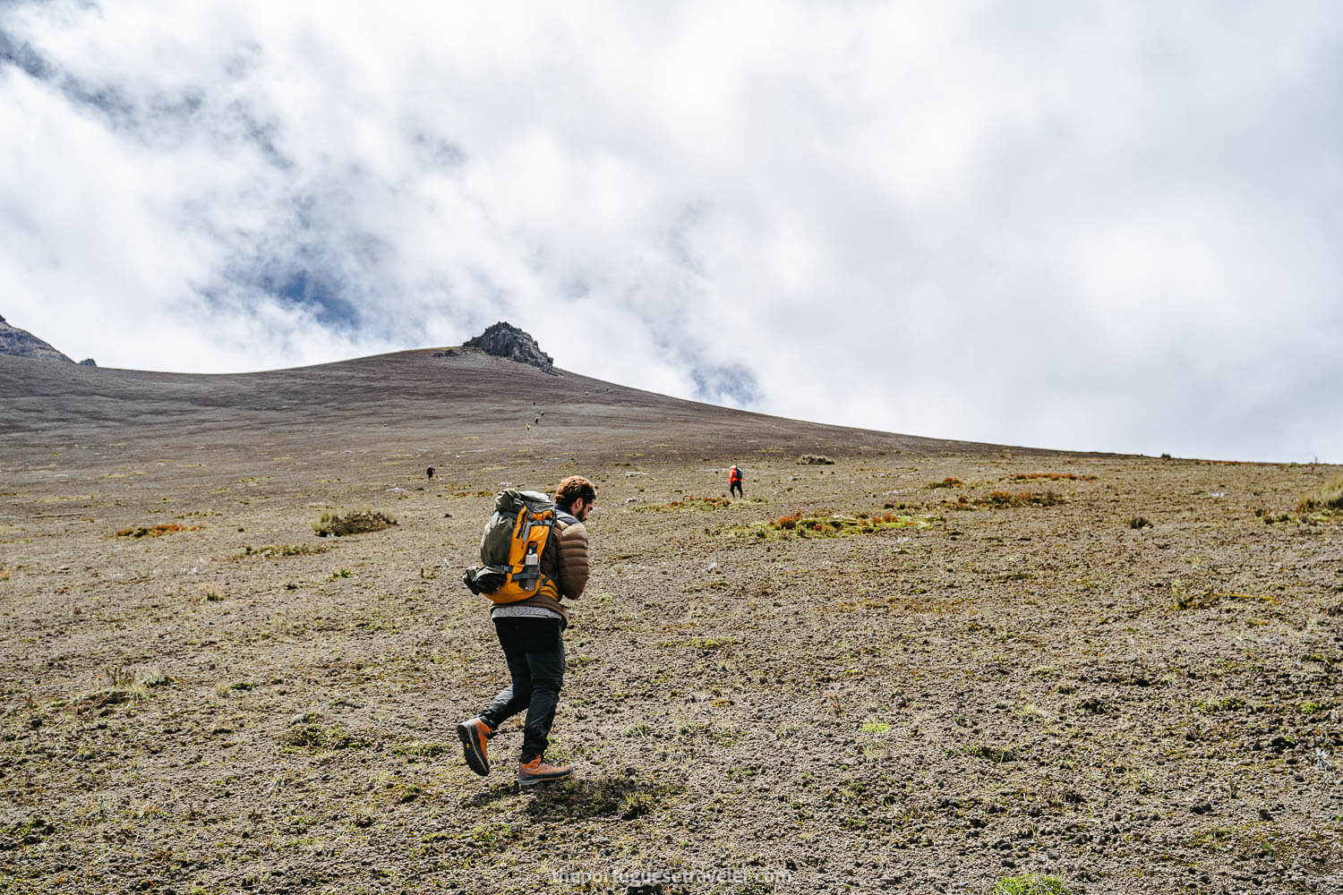
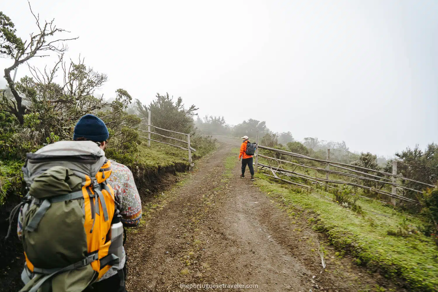
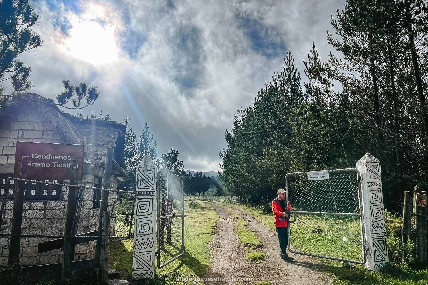
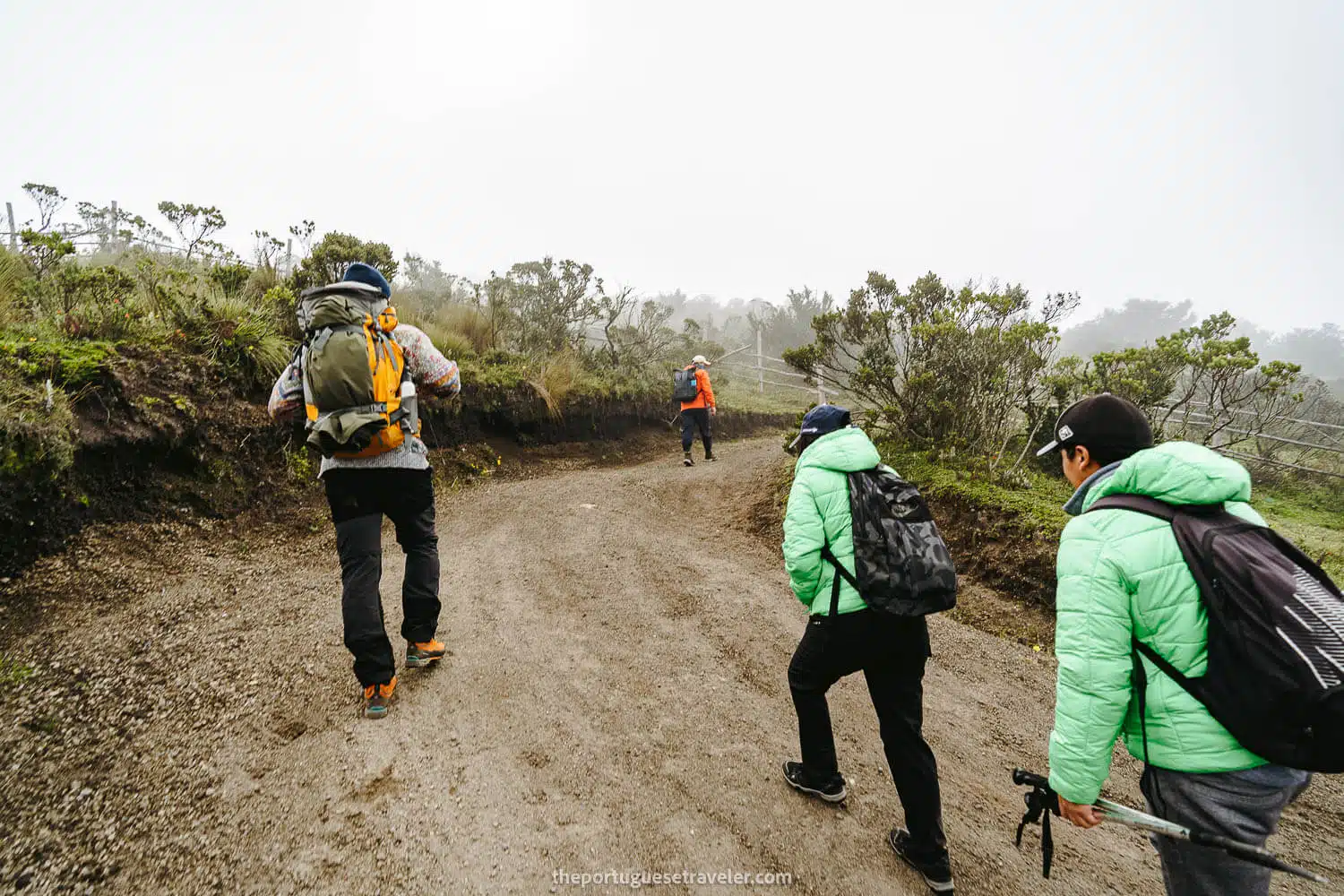
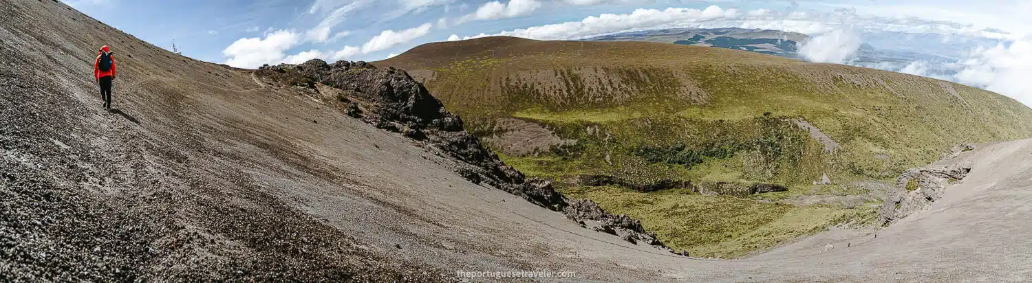
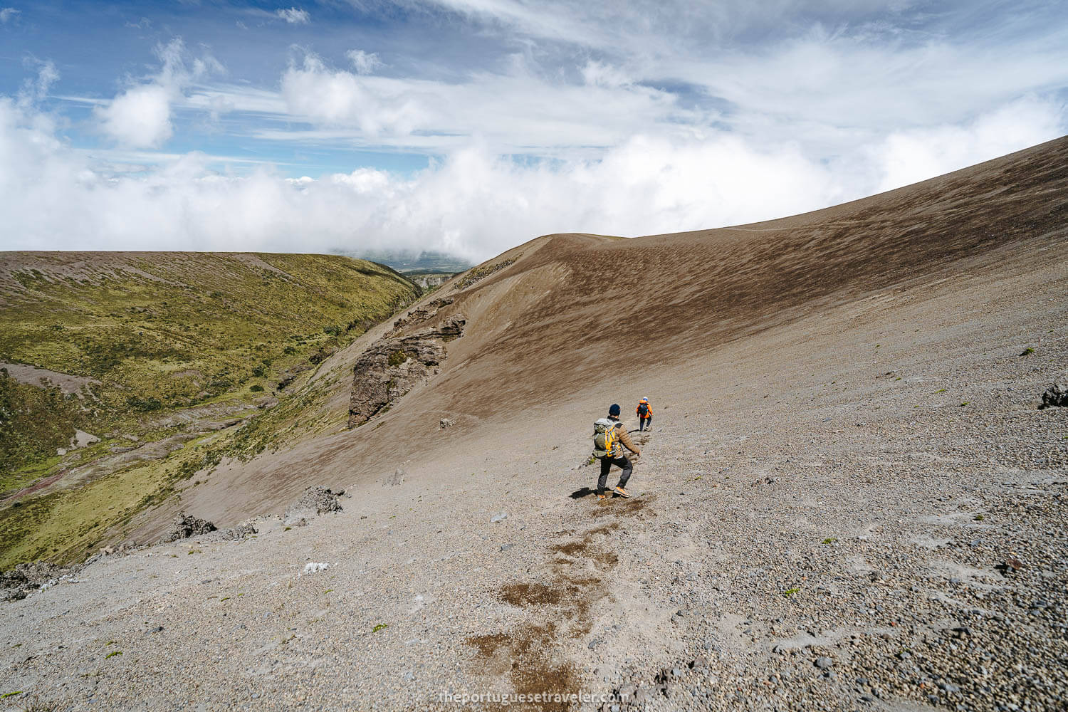
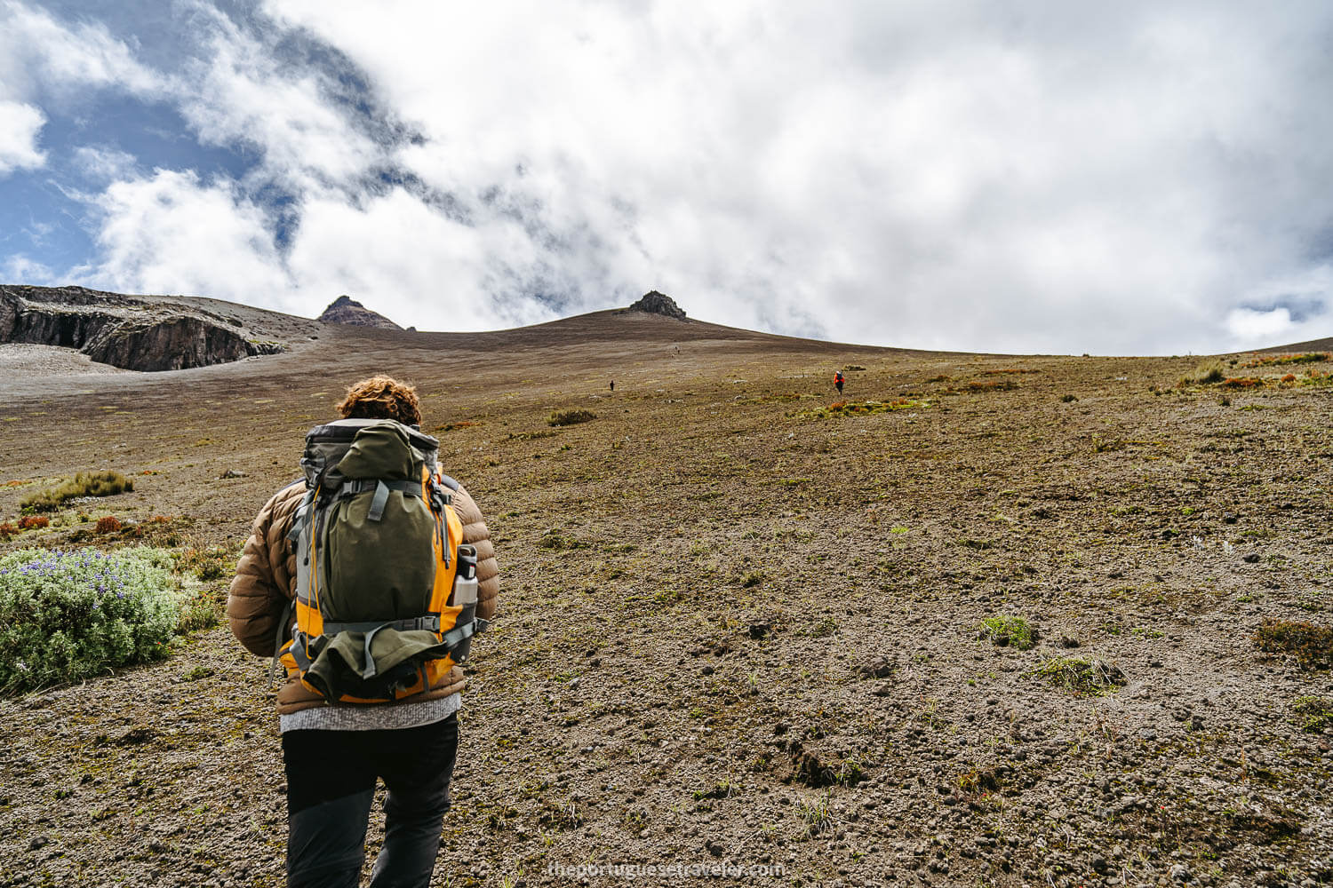
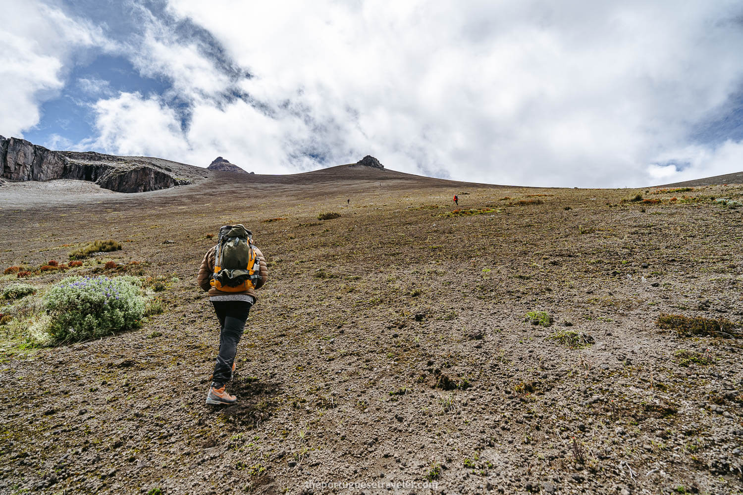
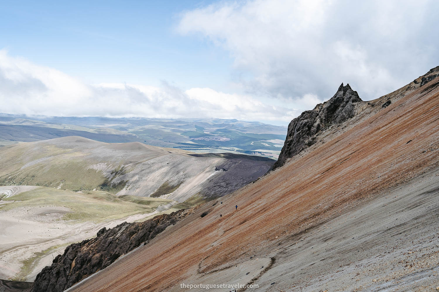
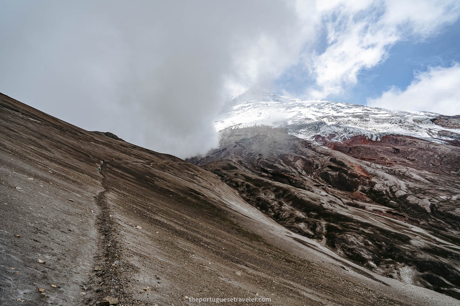
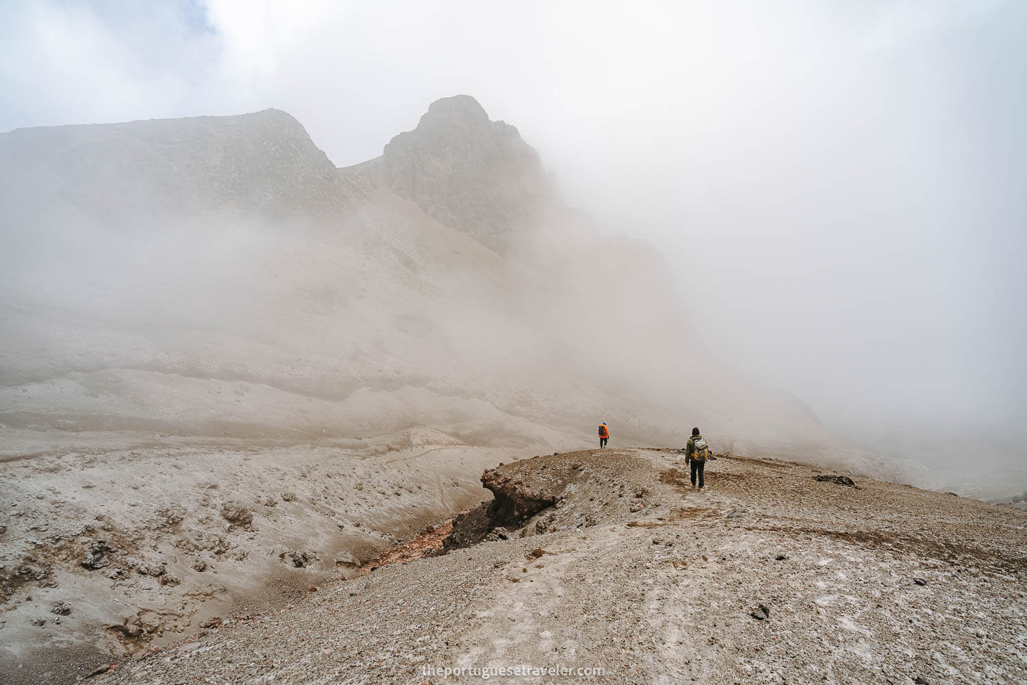
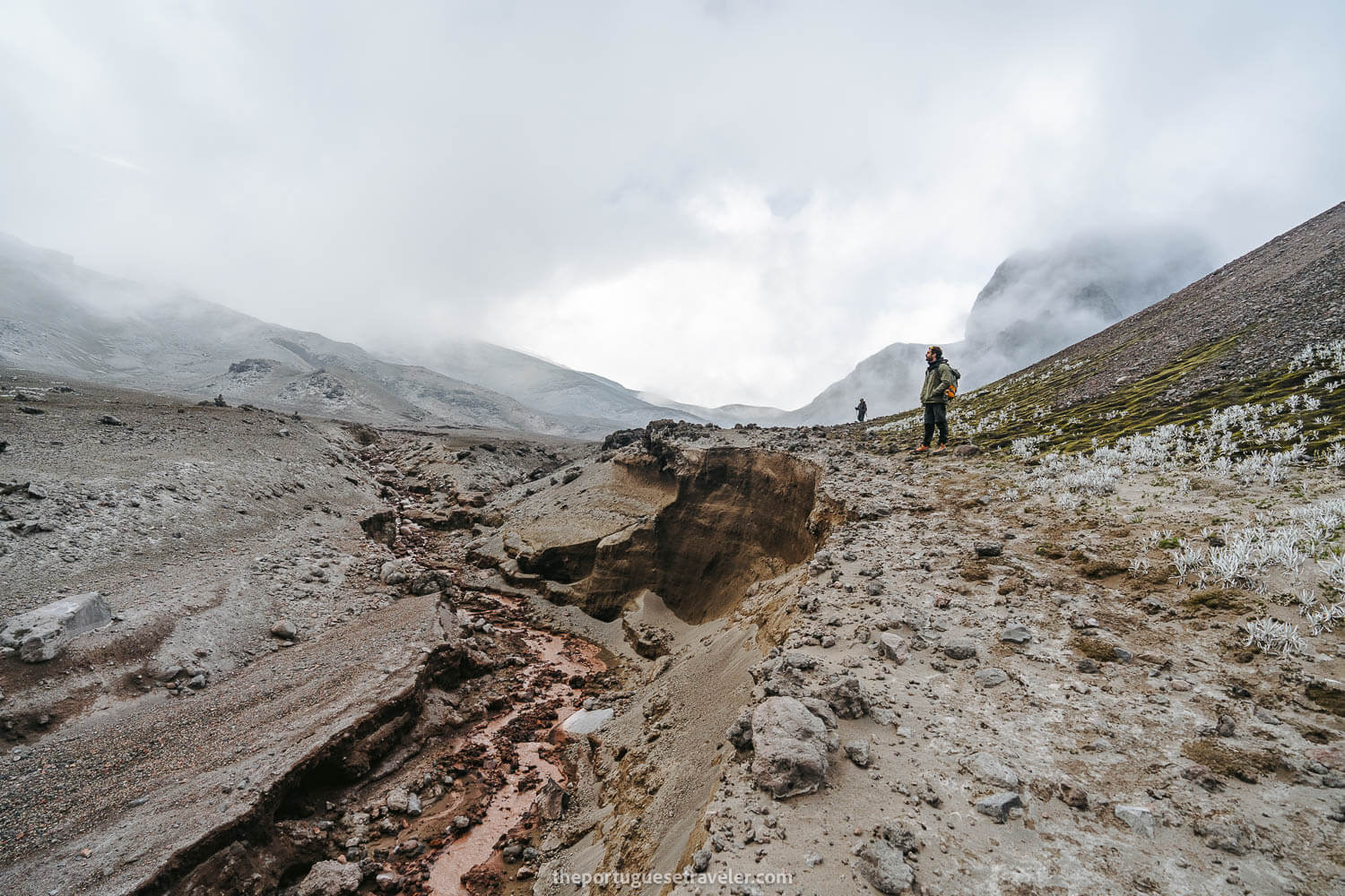
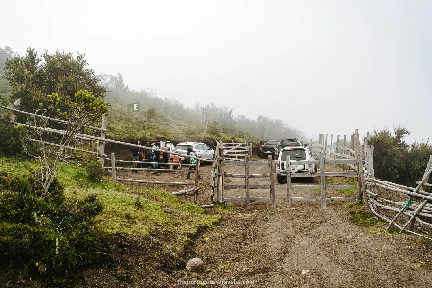
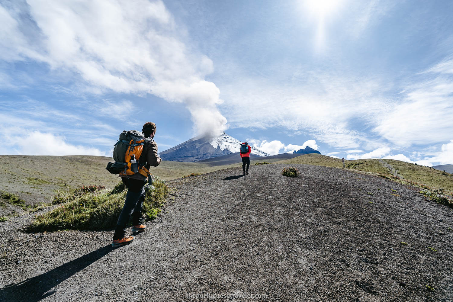
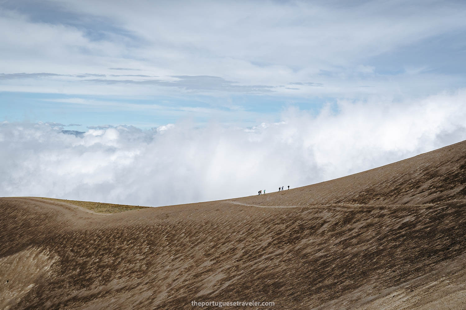
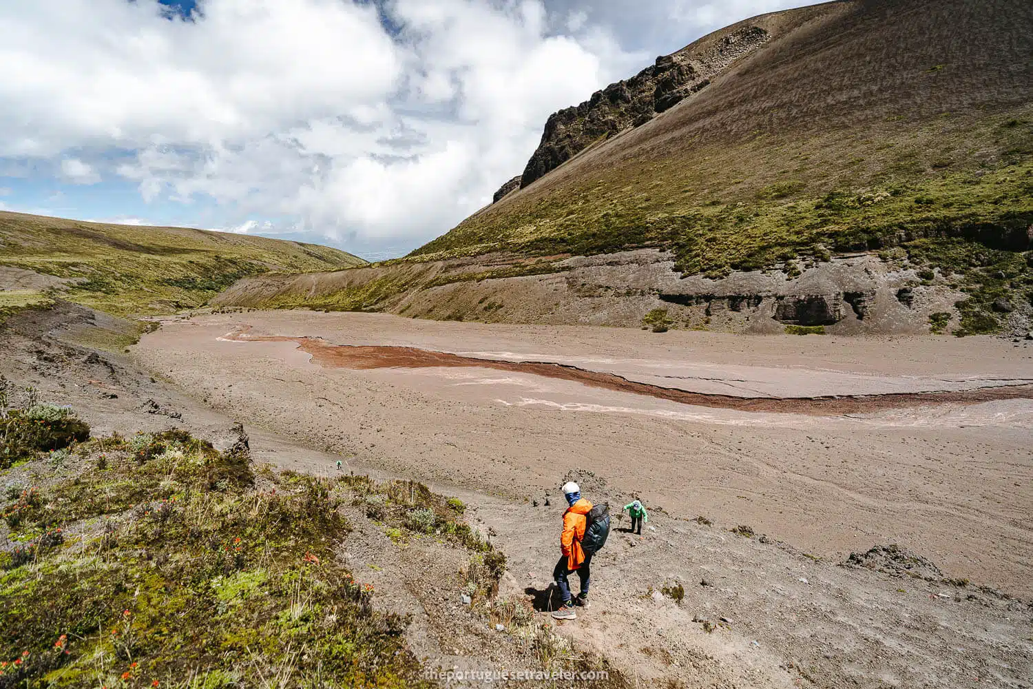
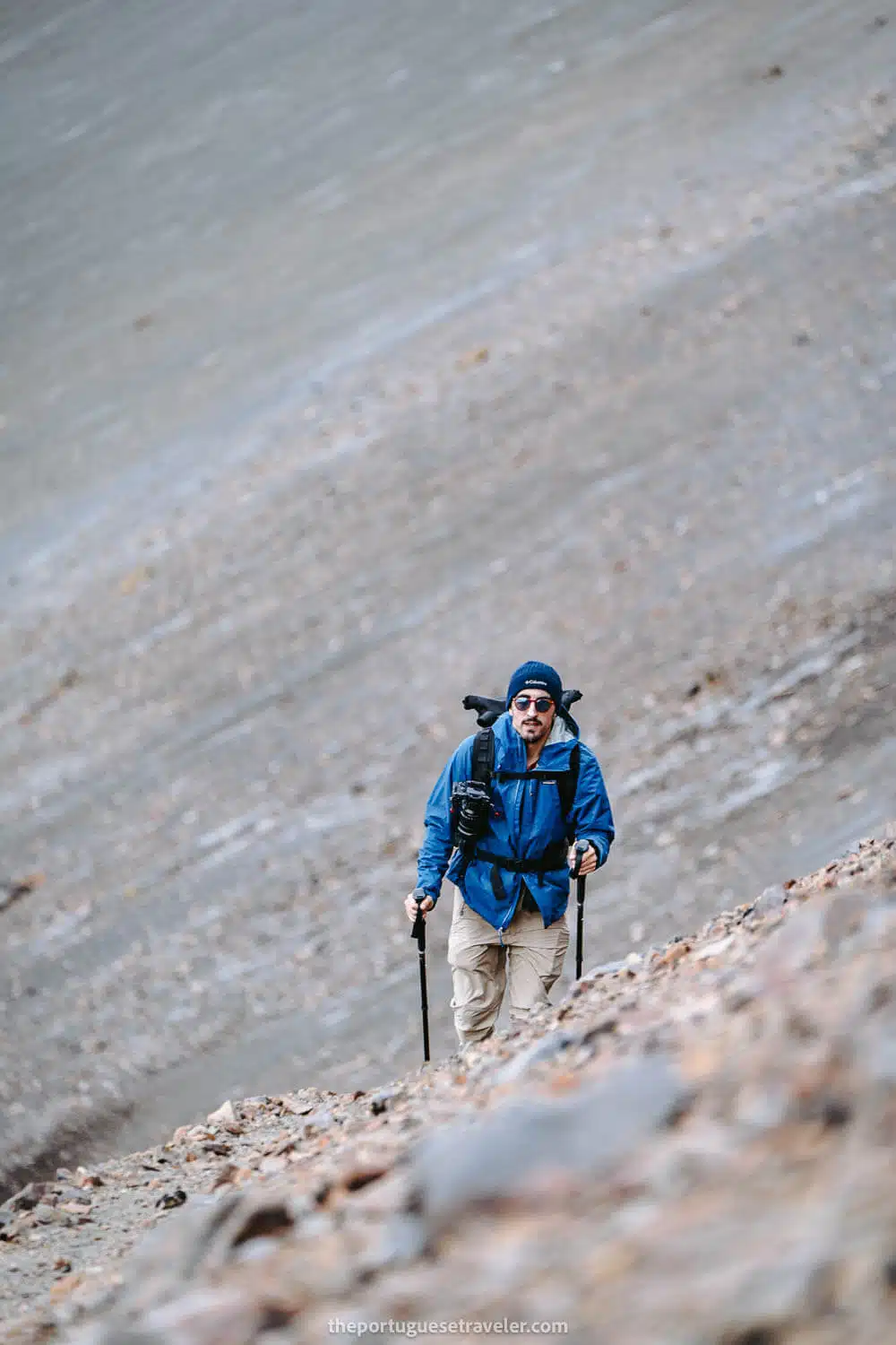
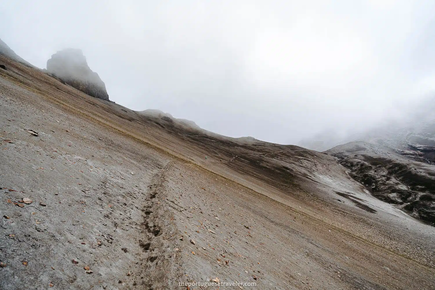
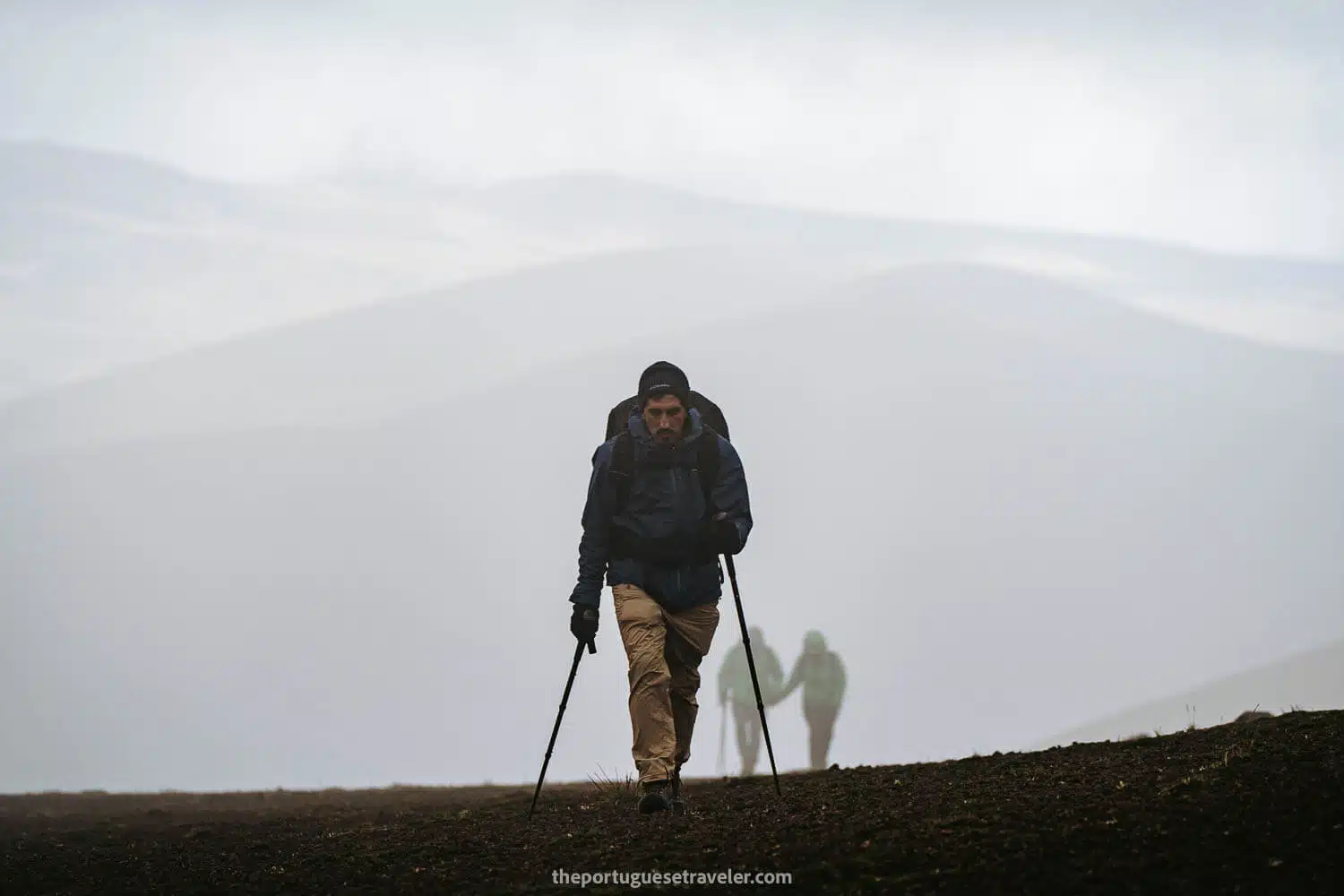
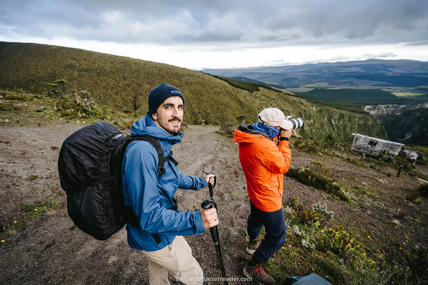
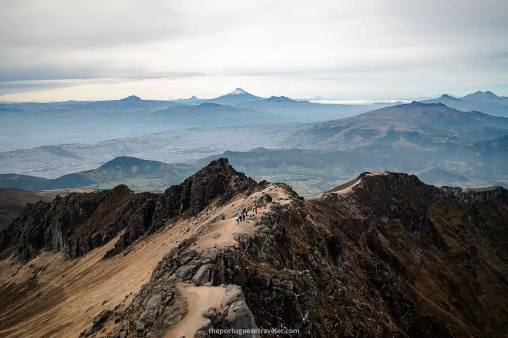
Climbing the other side of the lahar valley proved to be excruciating, as every two steps forward resulted in one step back due to the loose sand. It took us about an hour to conquer the ascent, draining our energy.

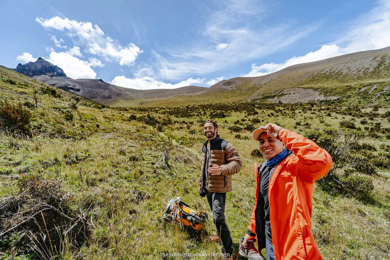
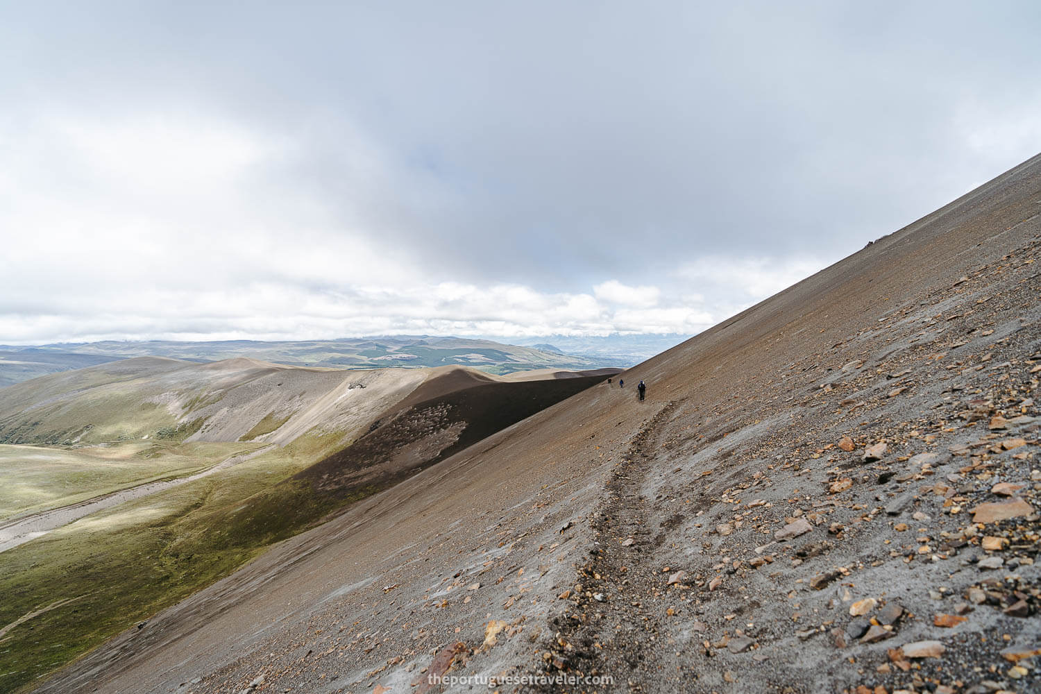
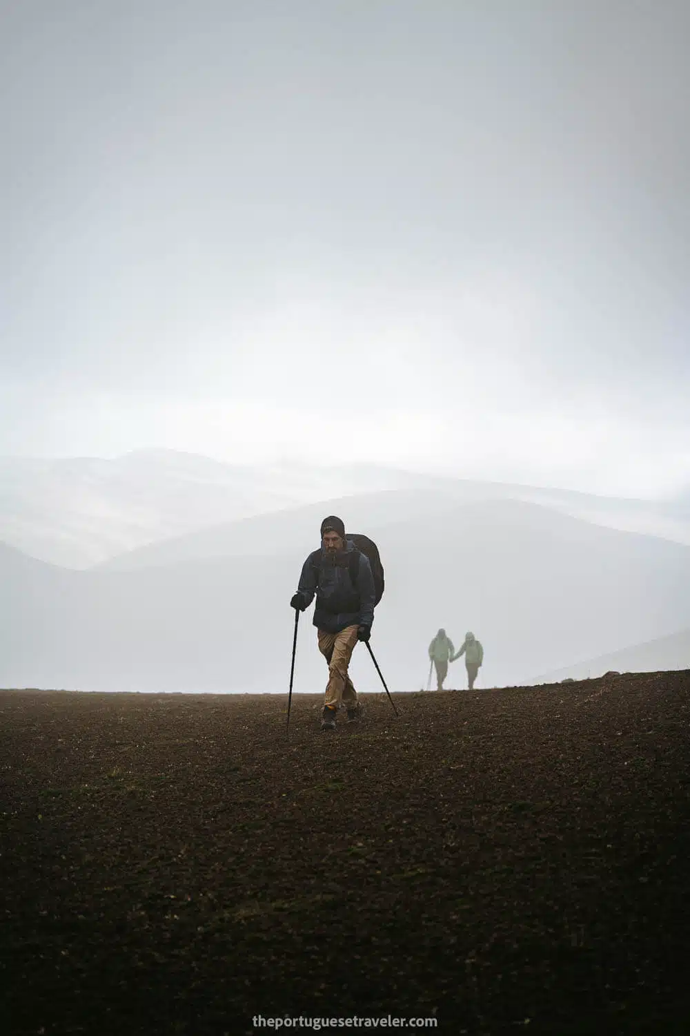
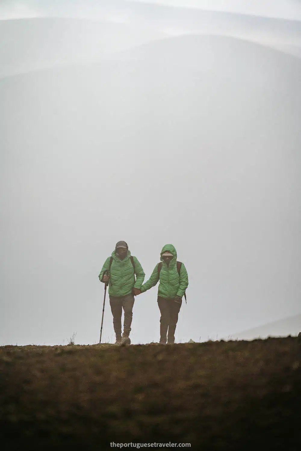
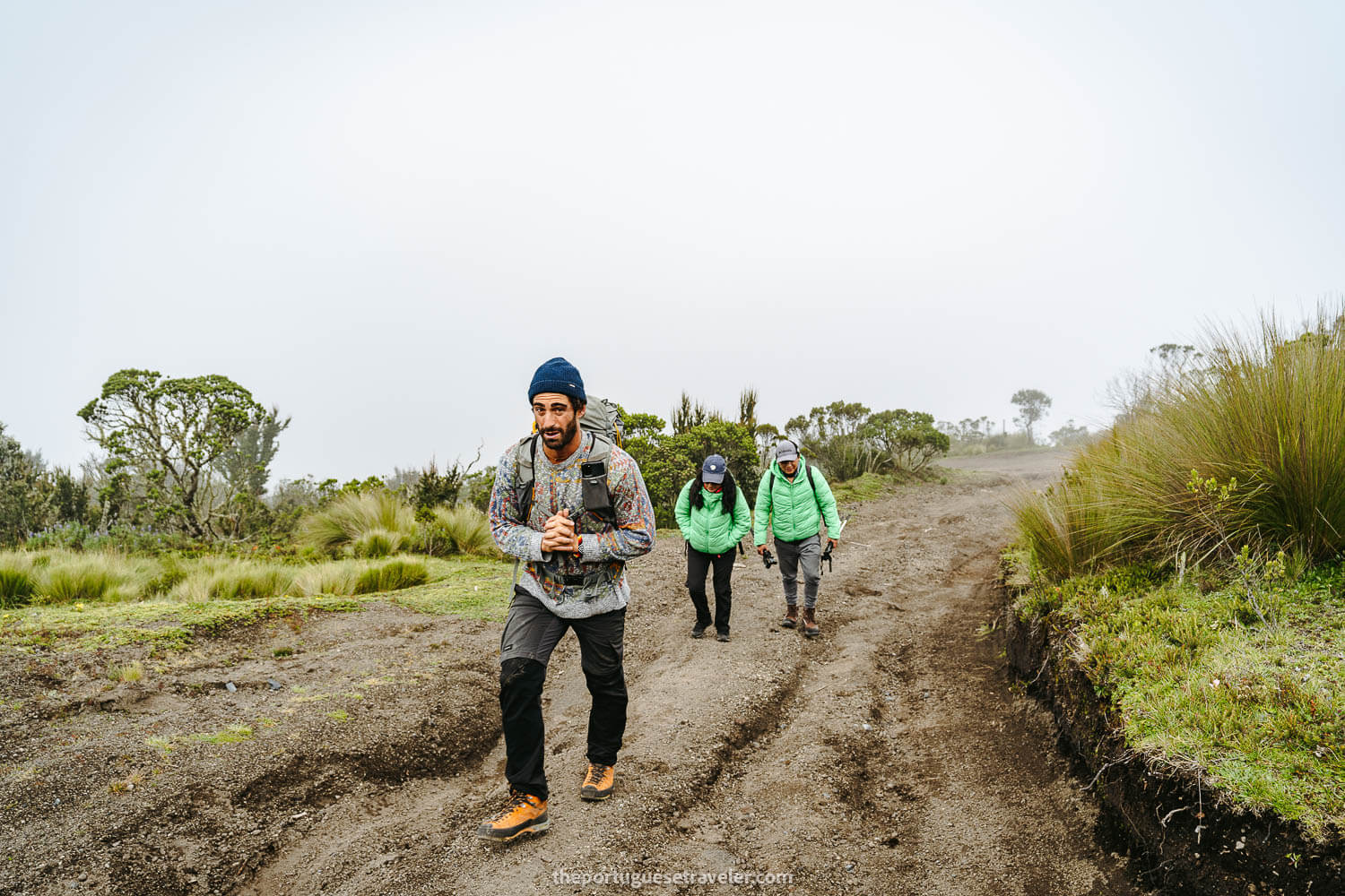
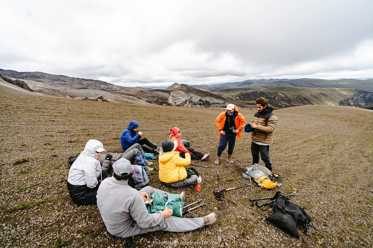
Finally, we triumphed over the dune-like slope, rejoicing in its absence. There, Miguel and I caught up with another group that had been resting and happened to be the group we had previously seen ahead of us.

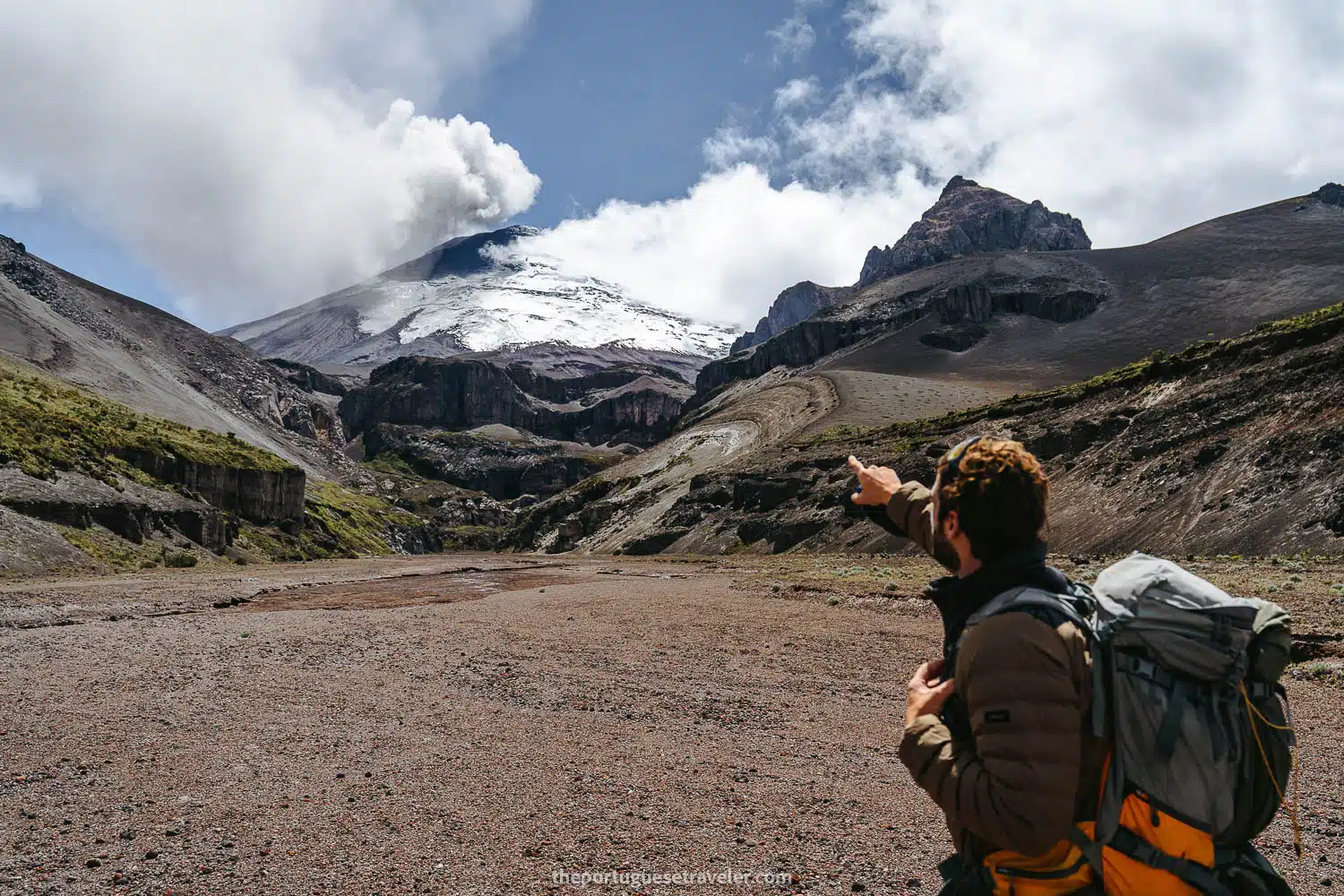
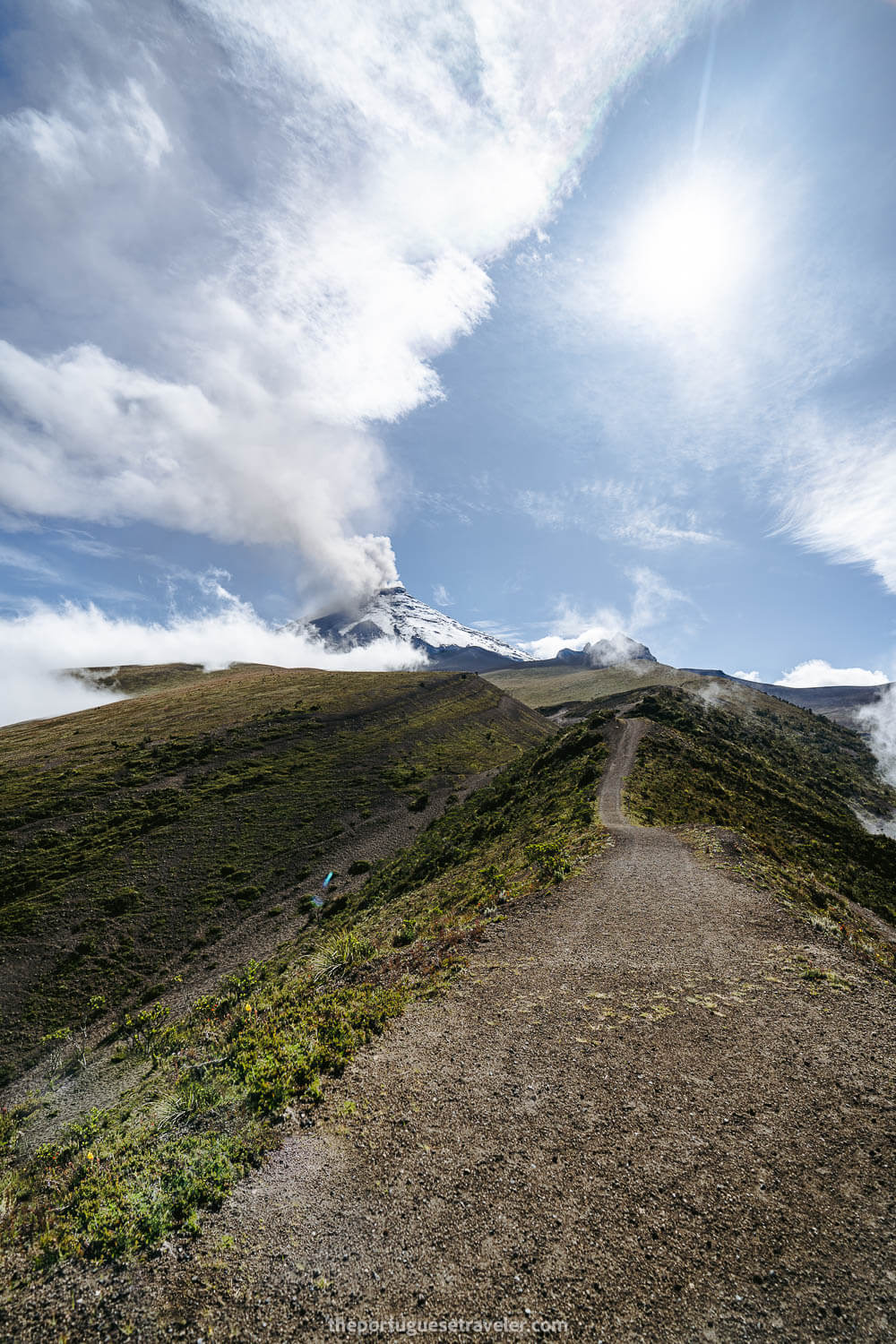
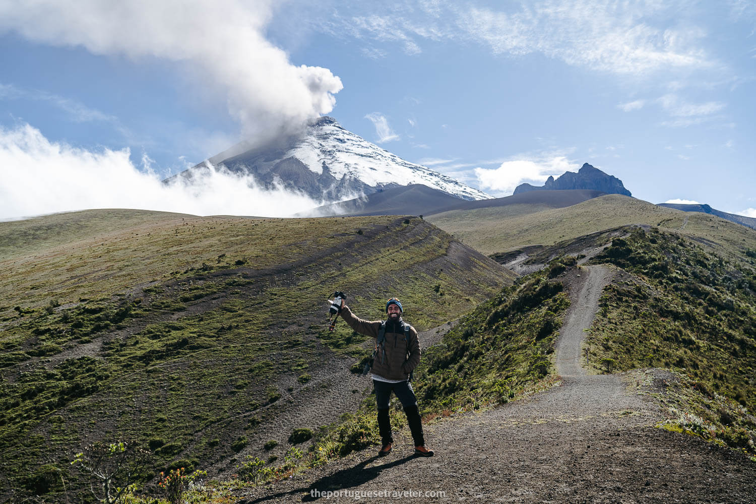
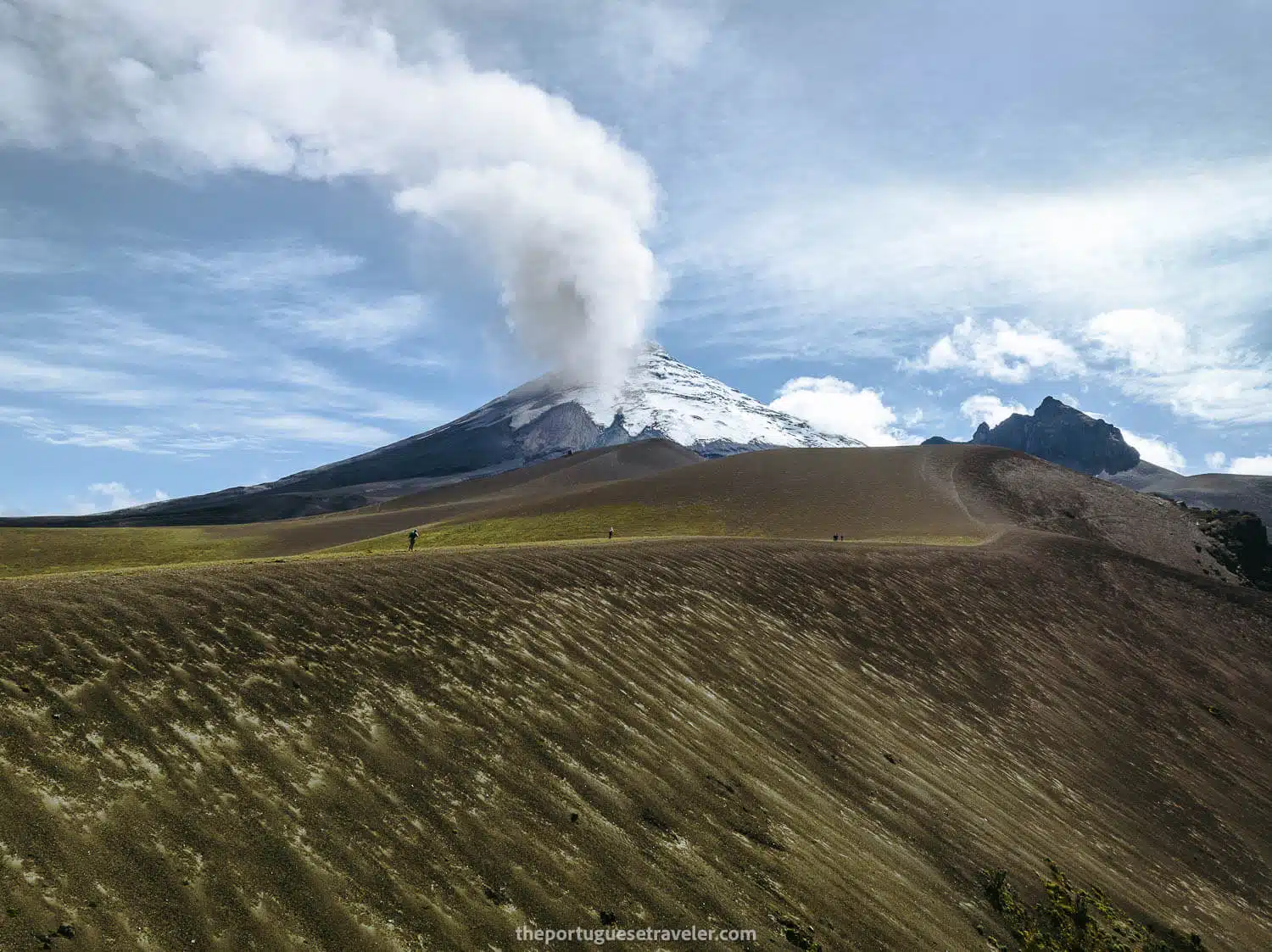
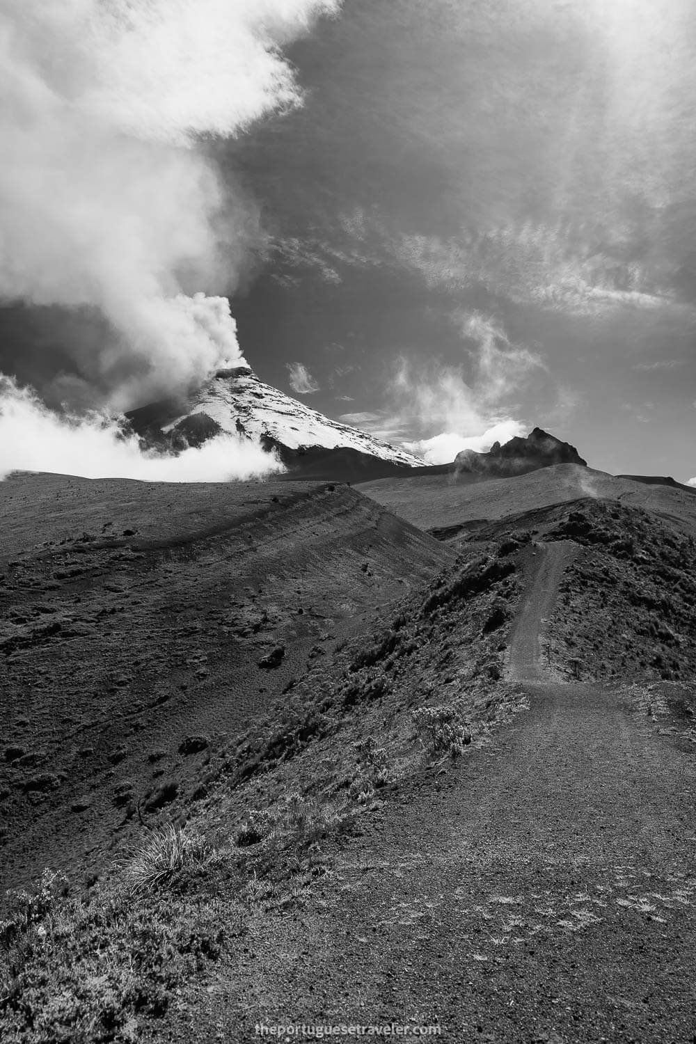
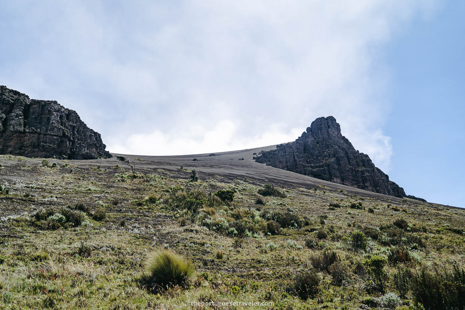
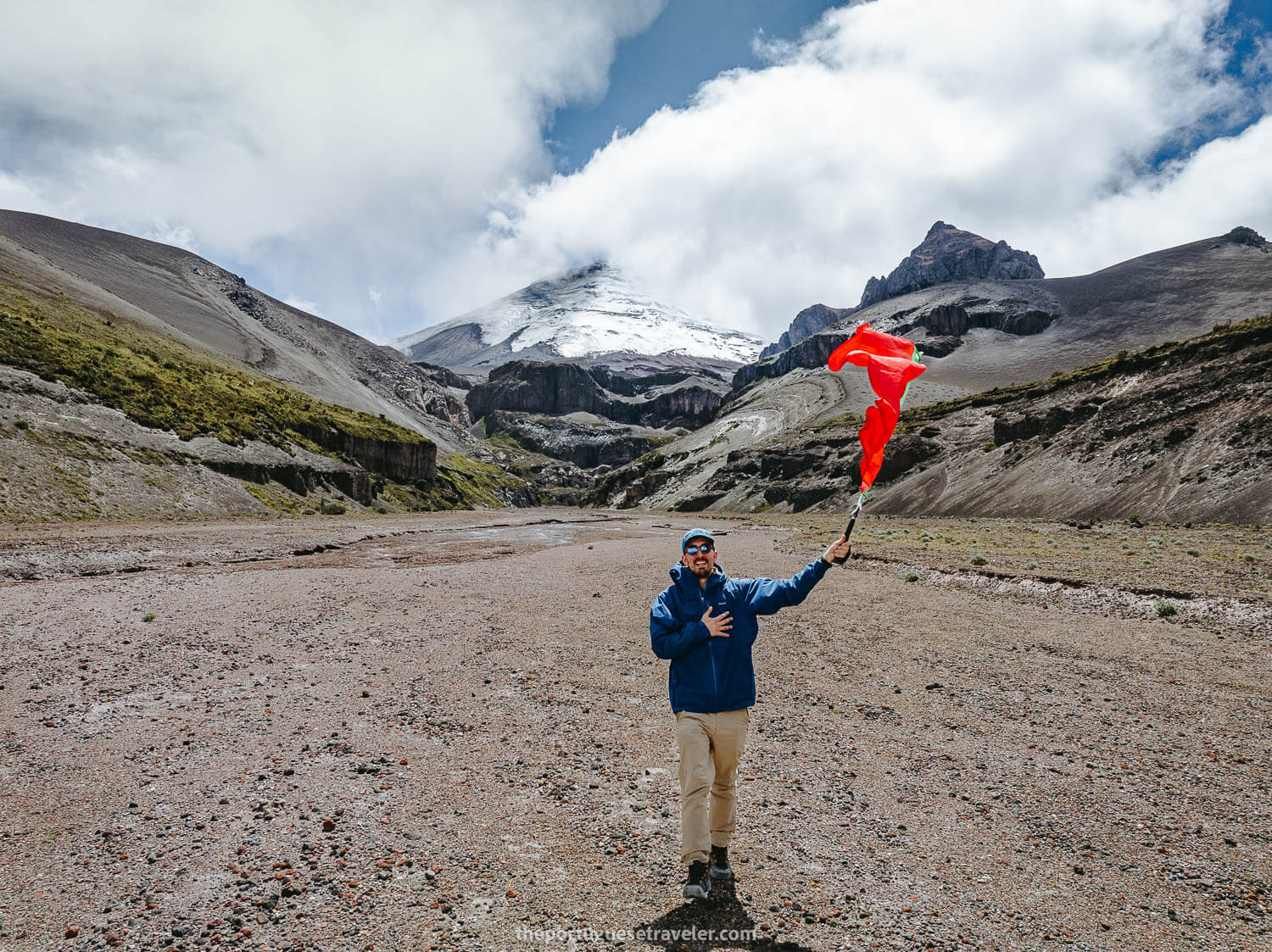
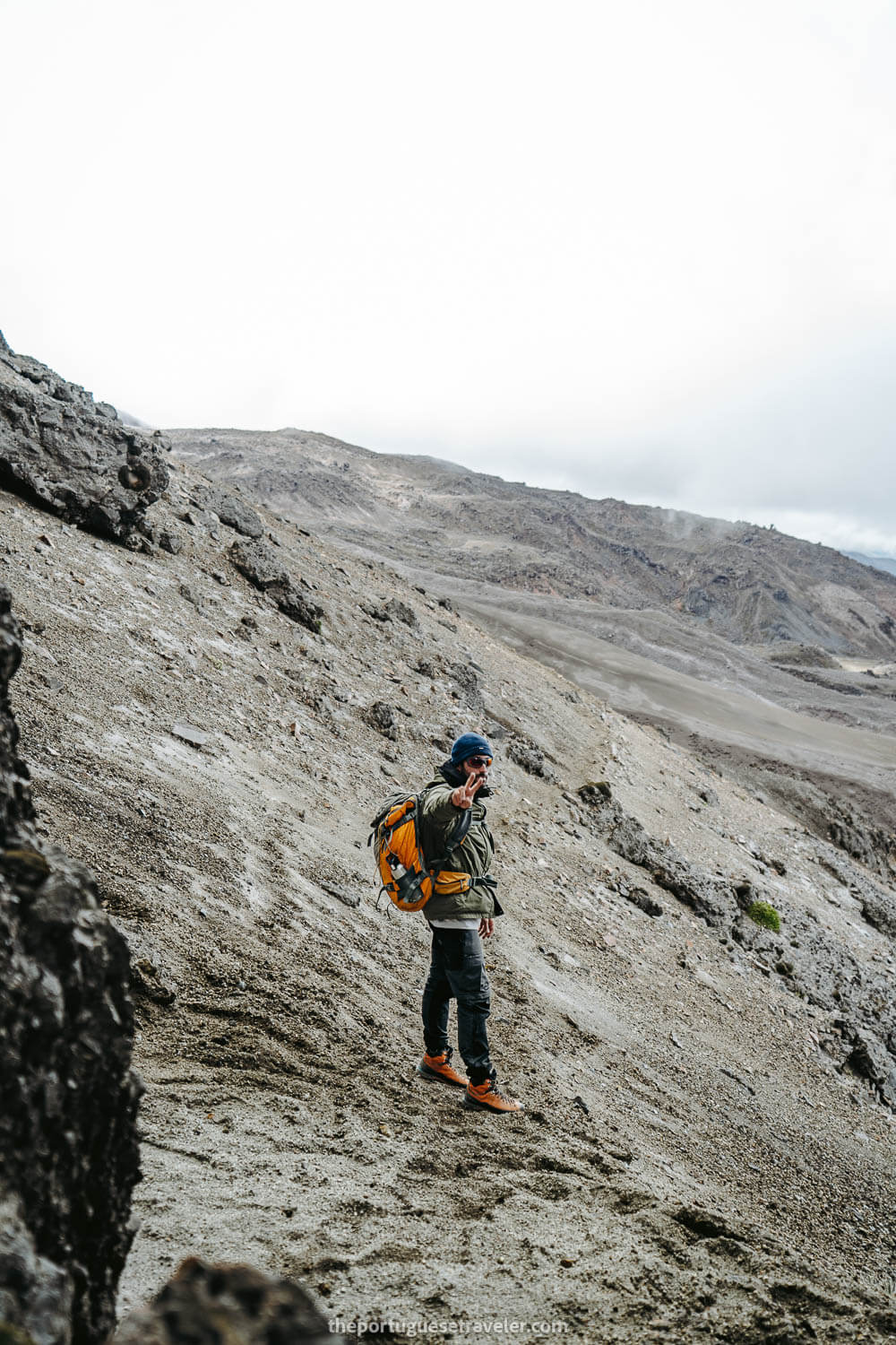
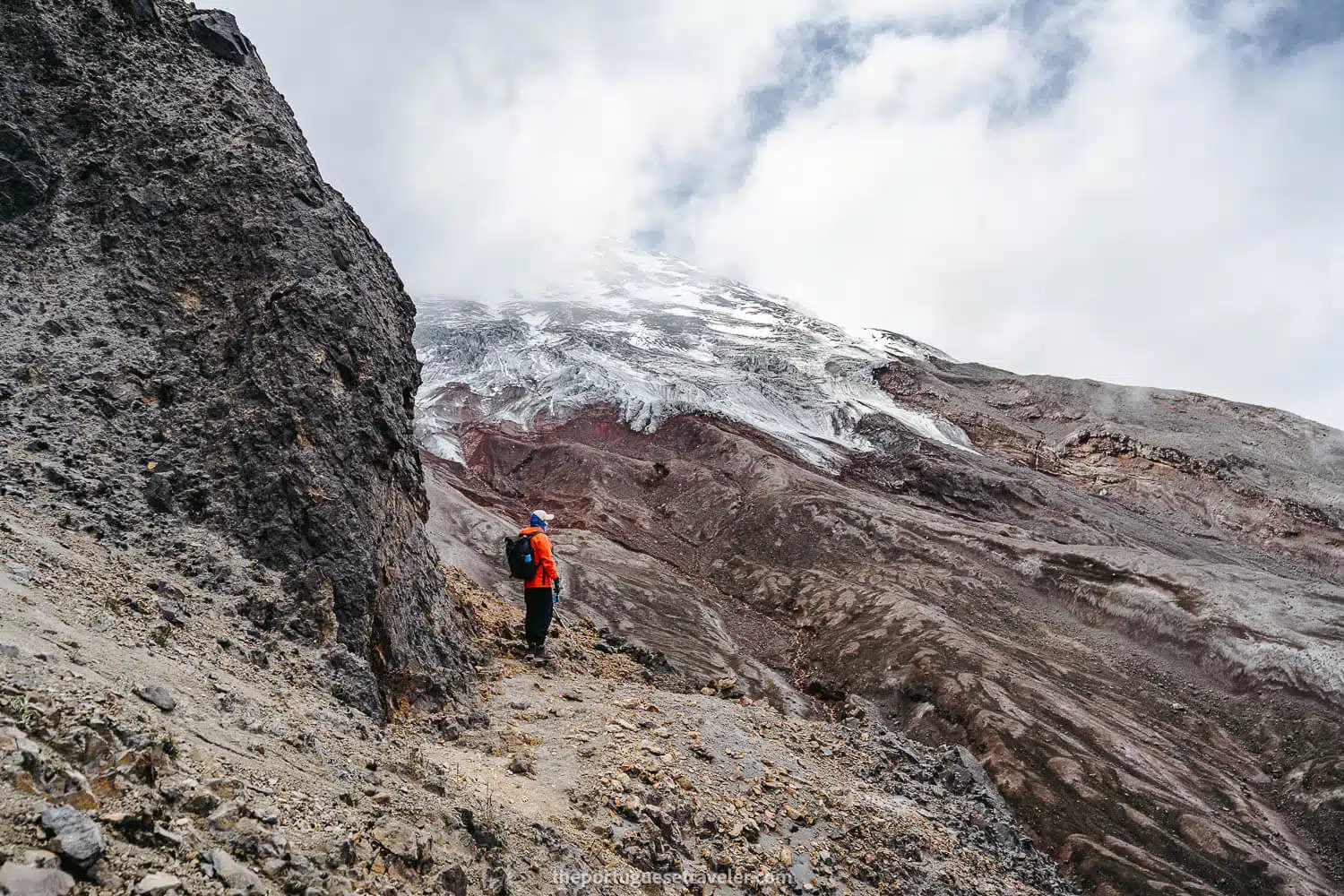
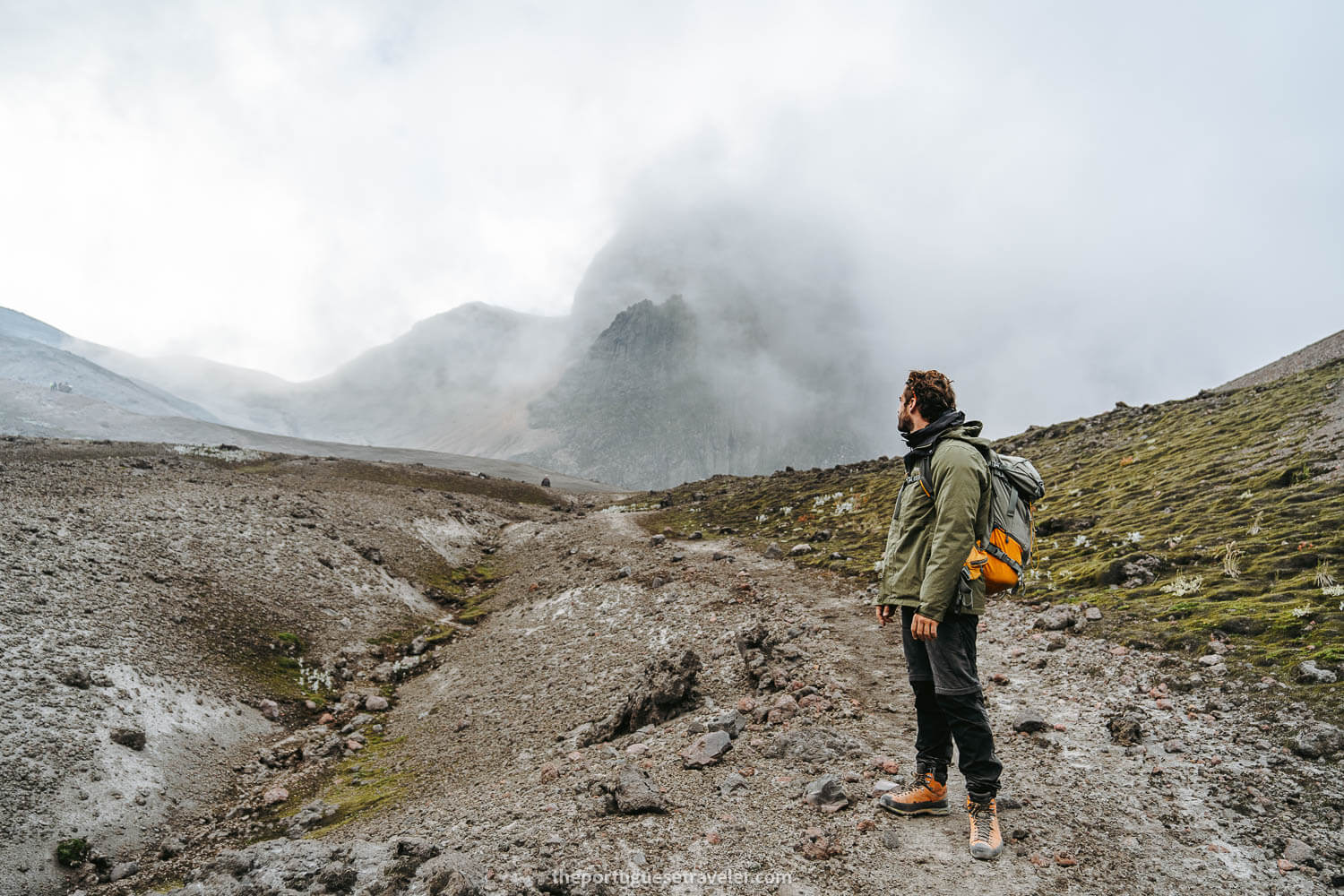
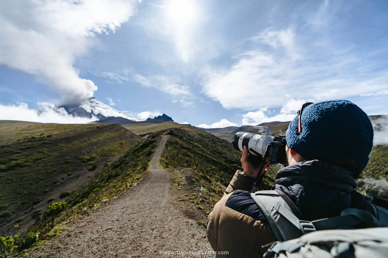
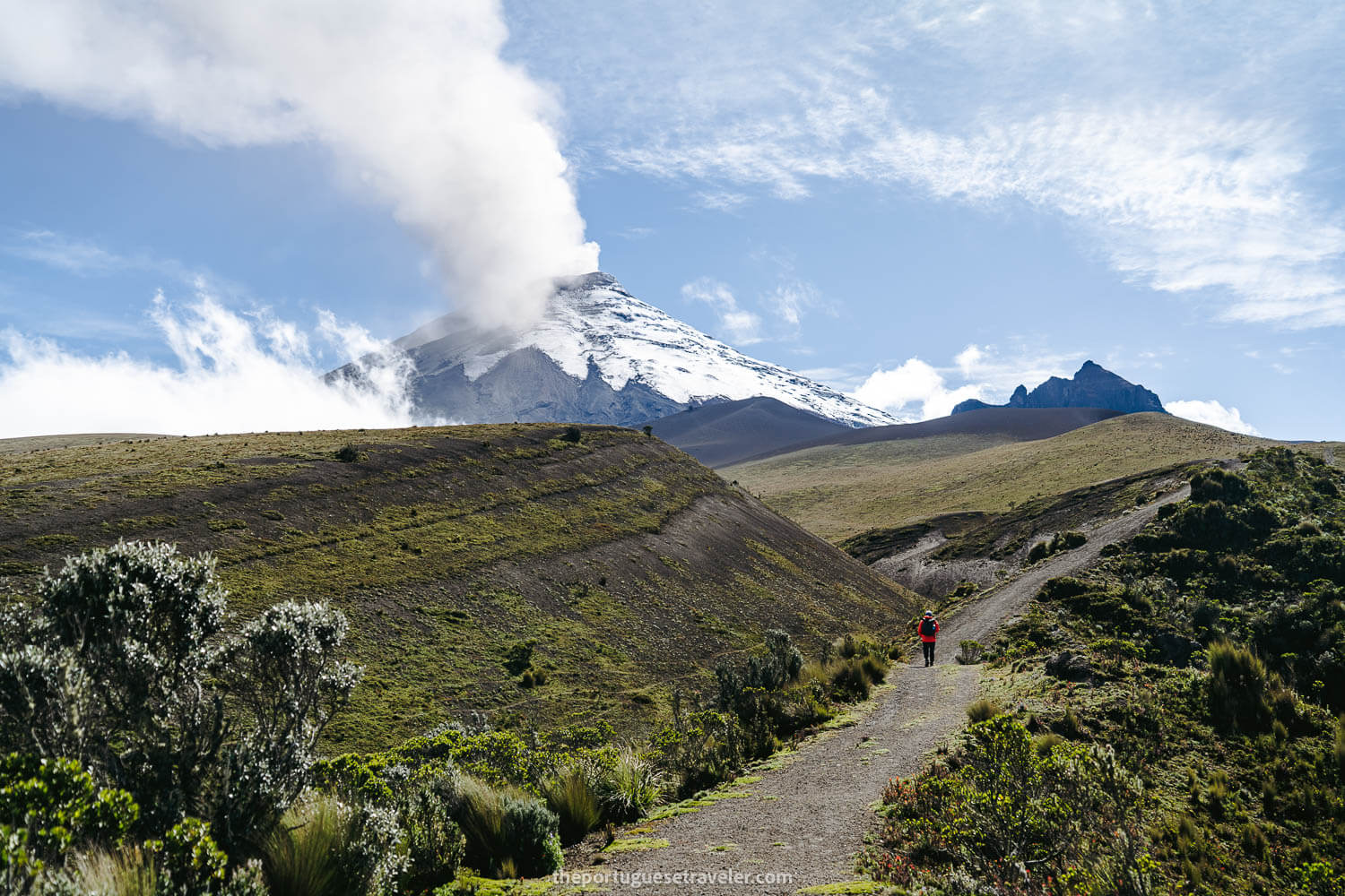
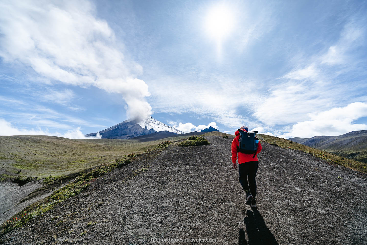
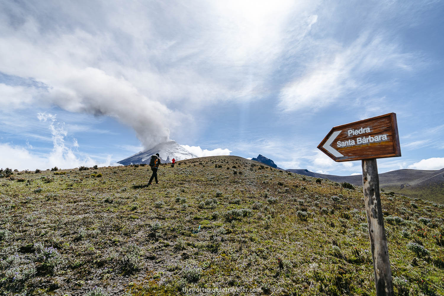
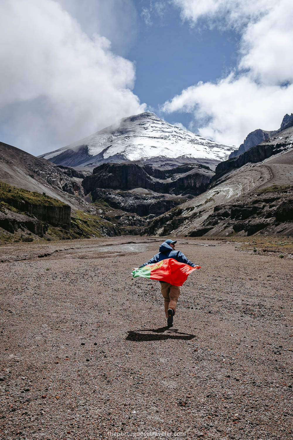
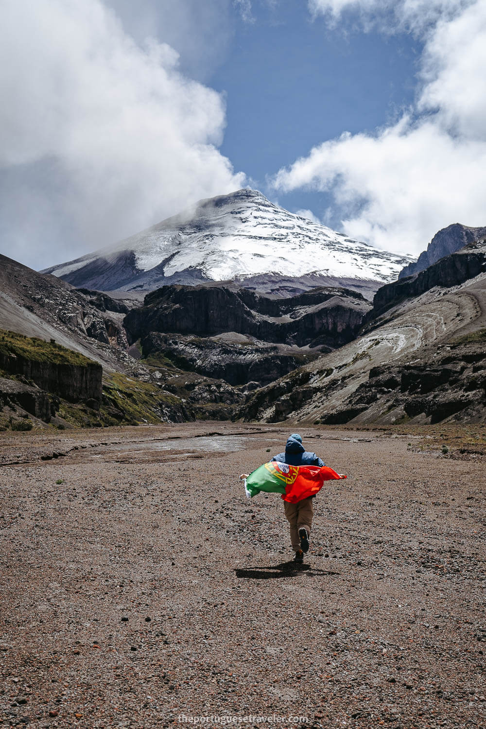
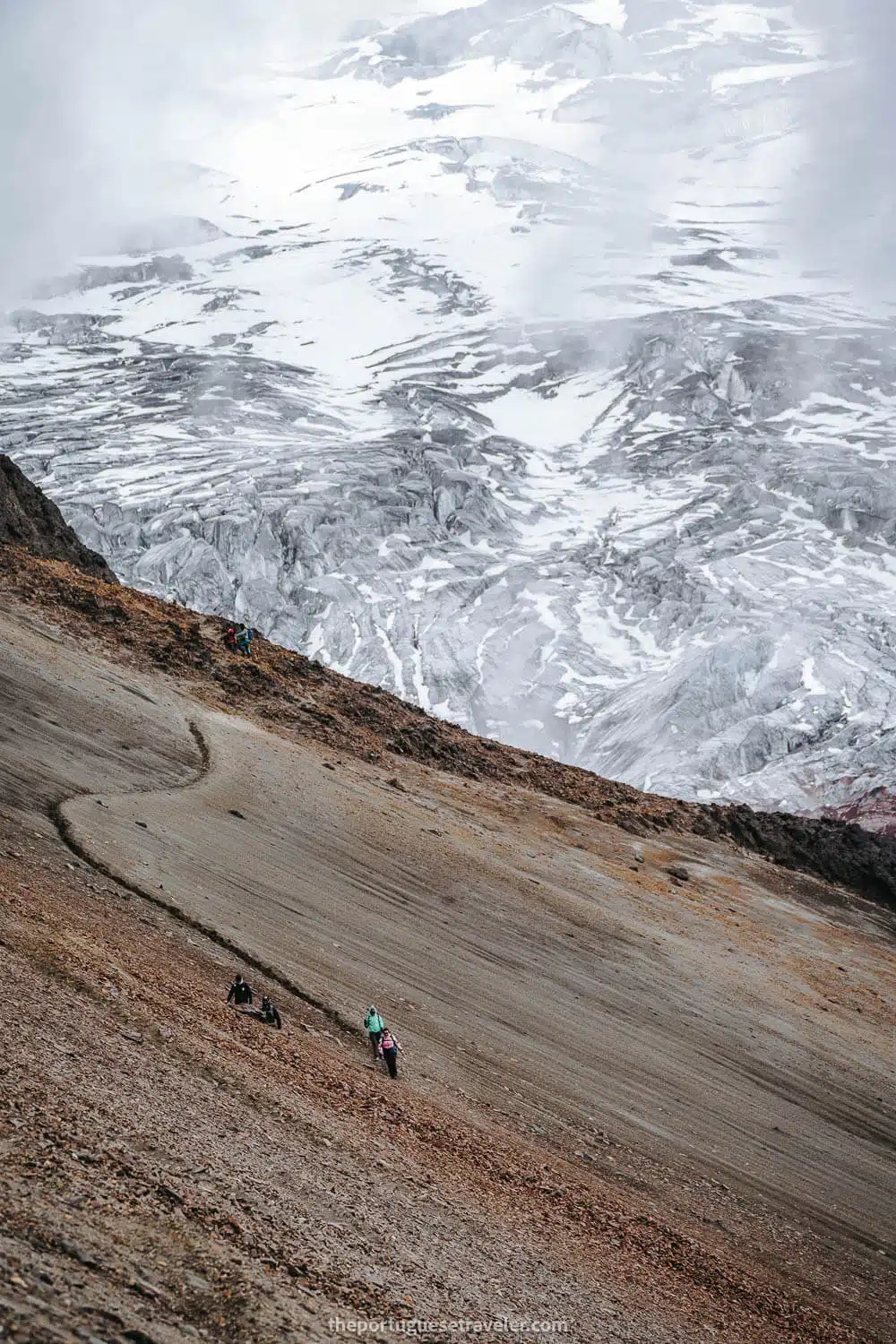
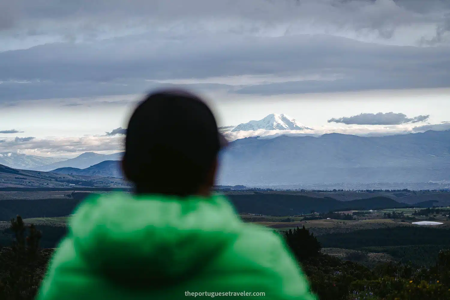
After quenching our thirst, we resumed our hike towards the window, eagerly anticipating the moment to cross Morurco’s 180-degree point and witness Cotopaxi’s glaciers once again.

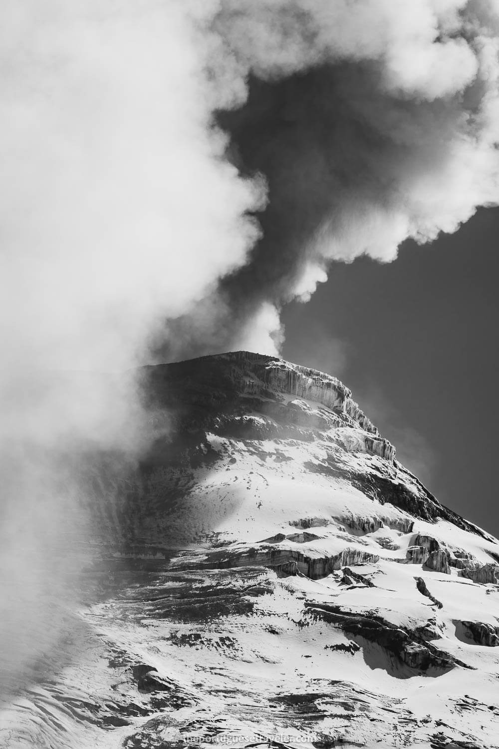
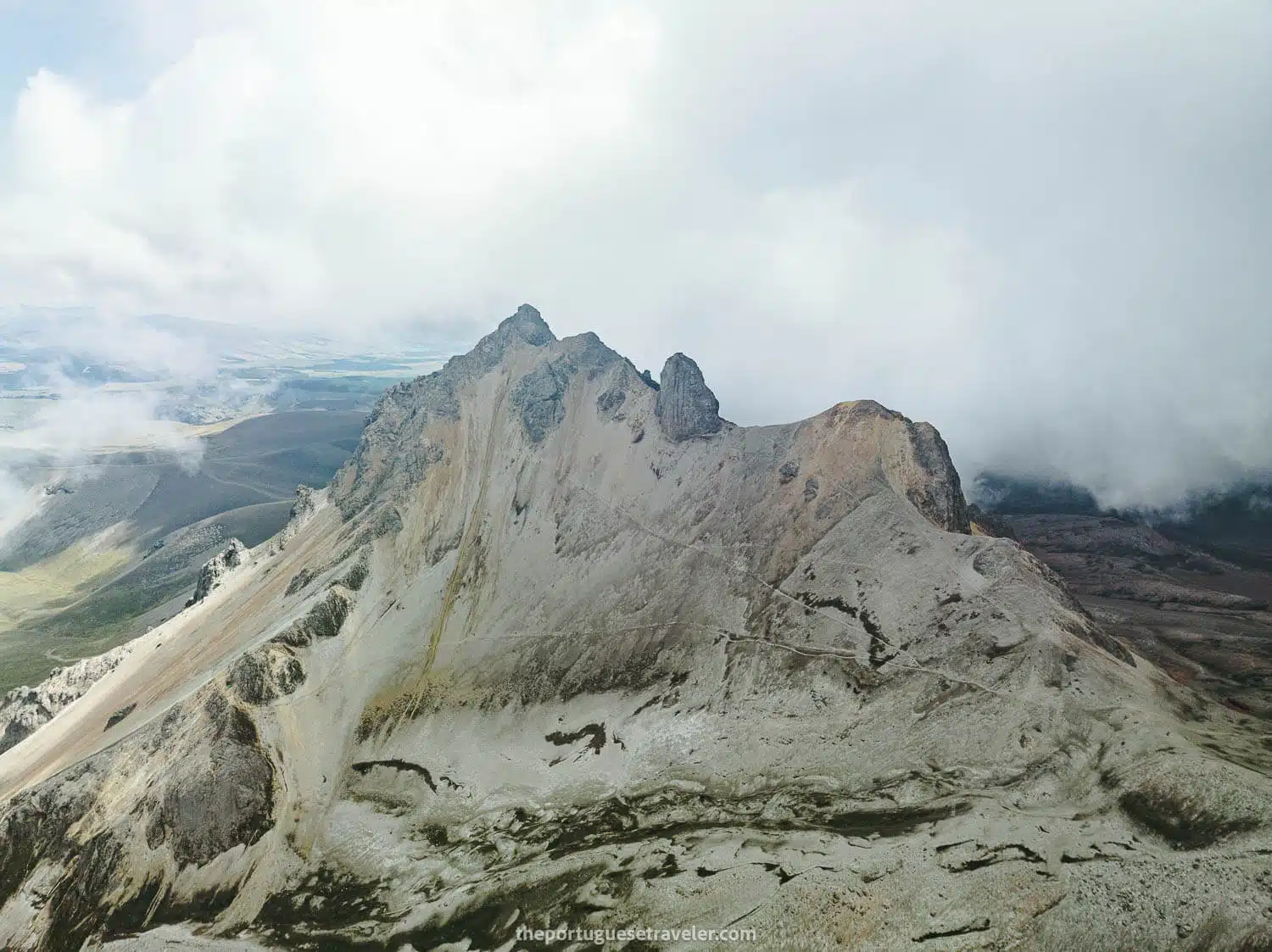
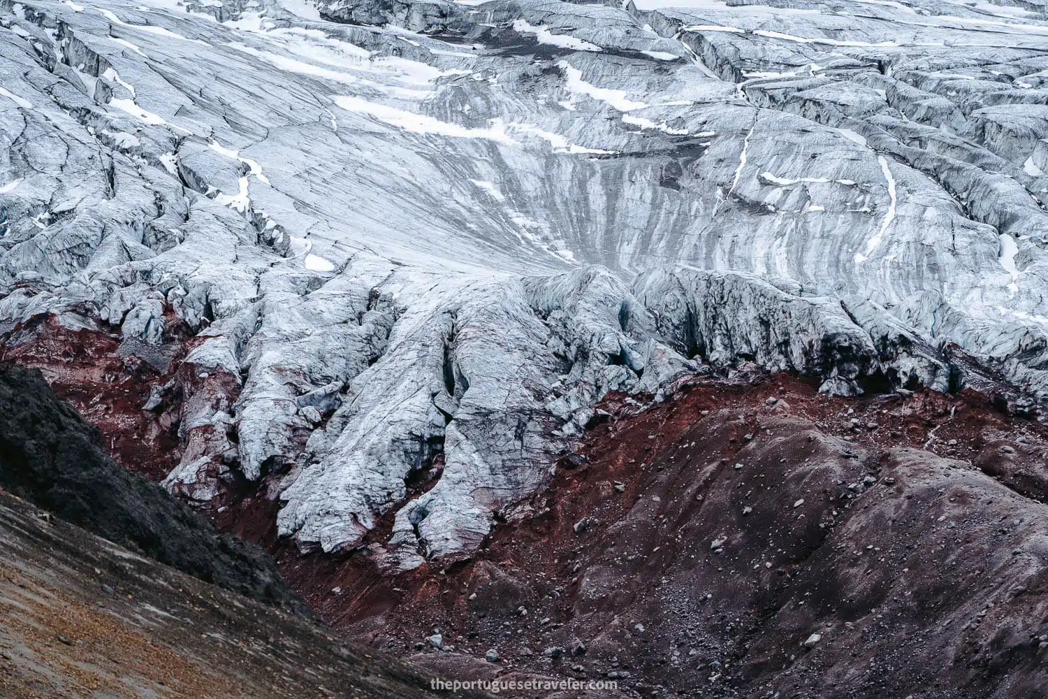
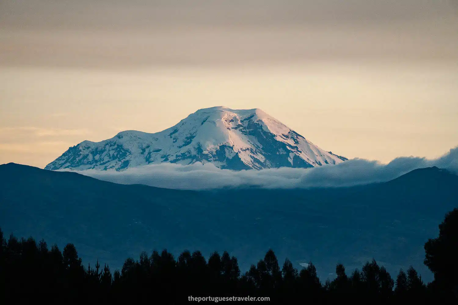
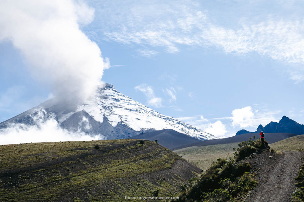
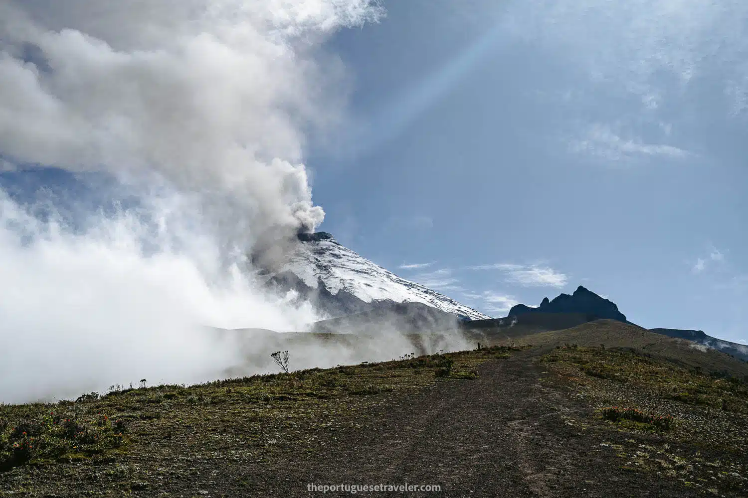
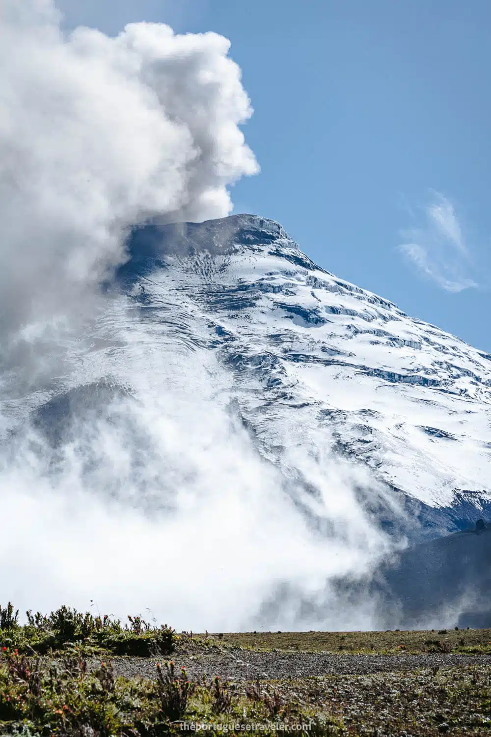
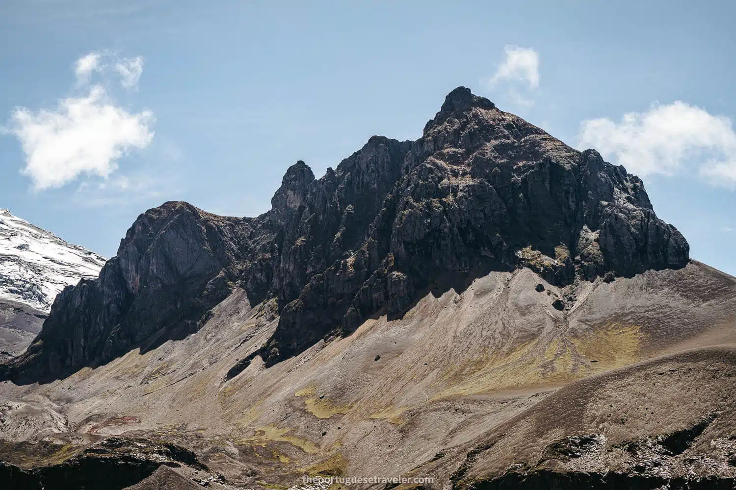
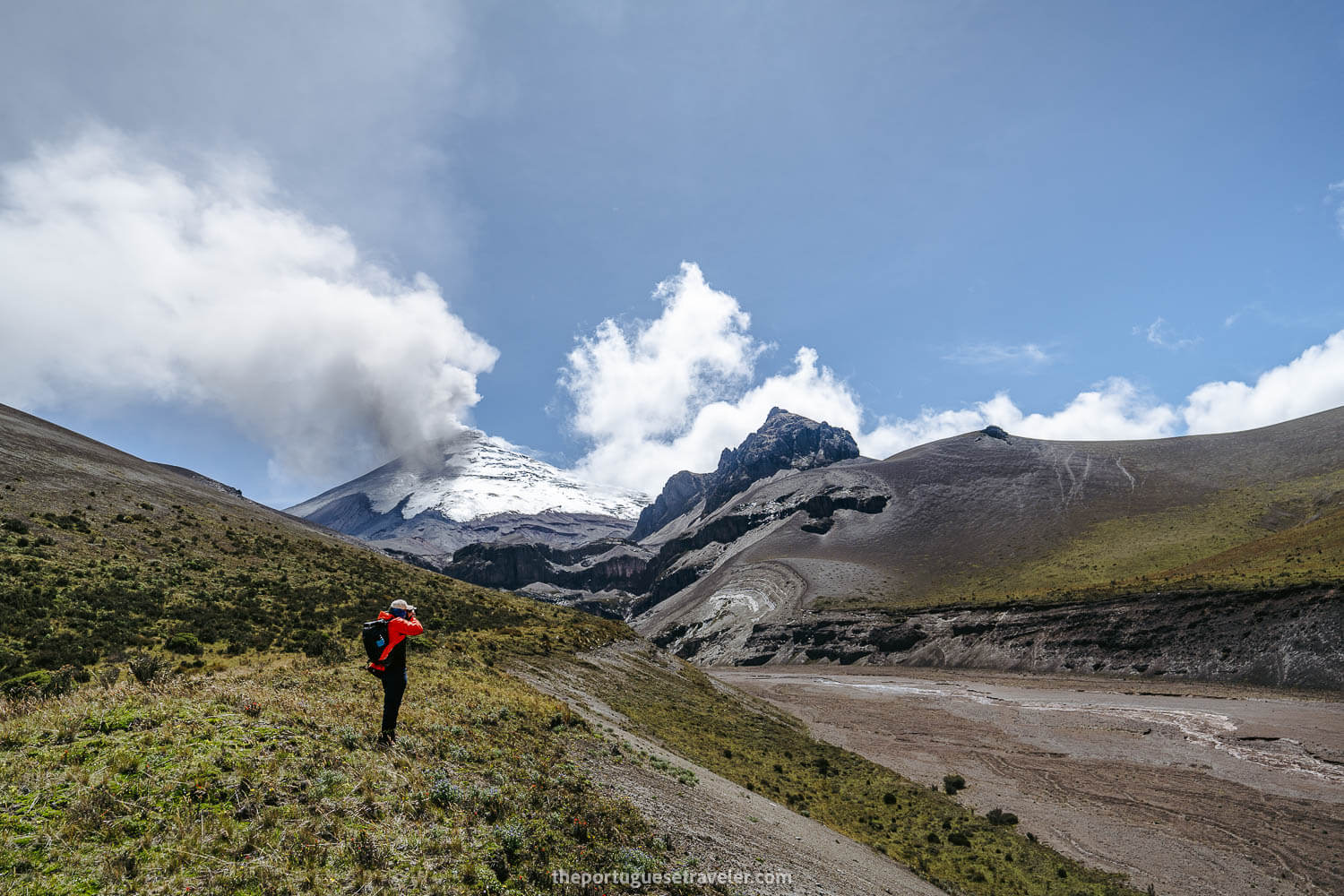
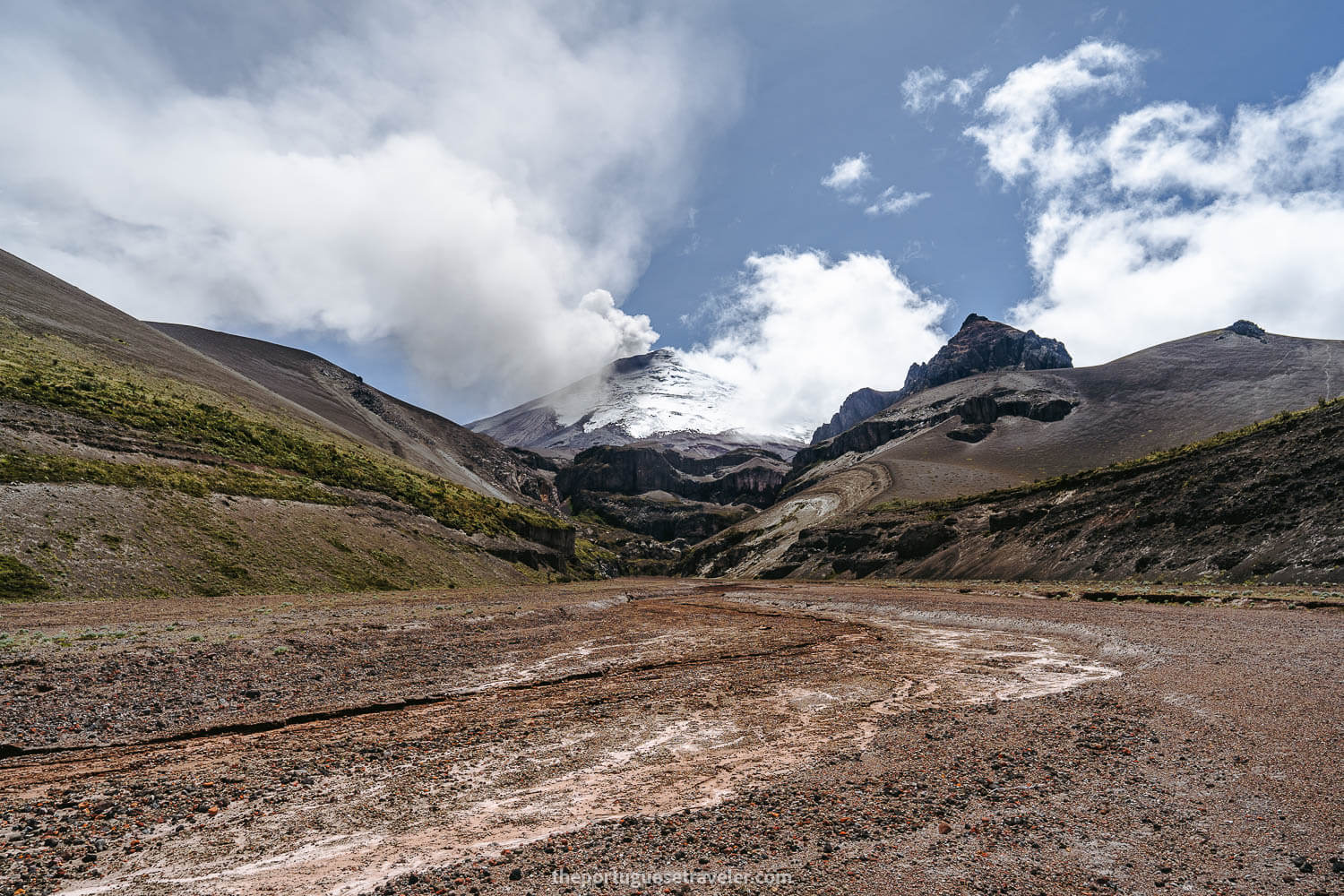
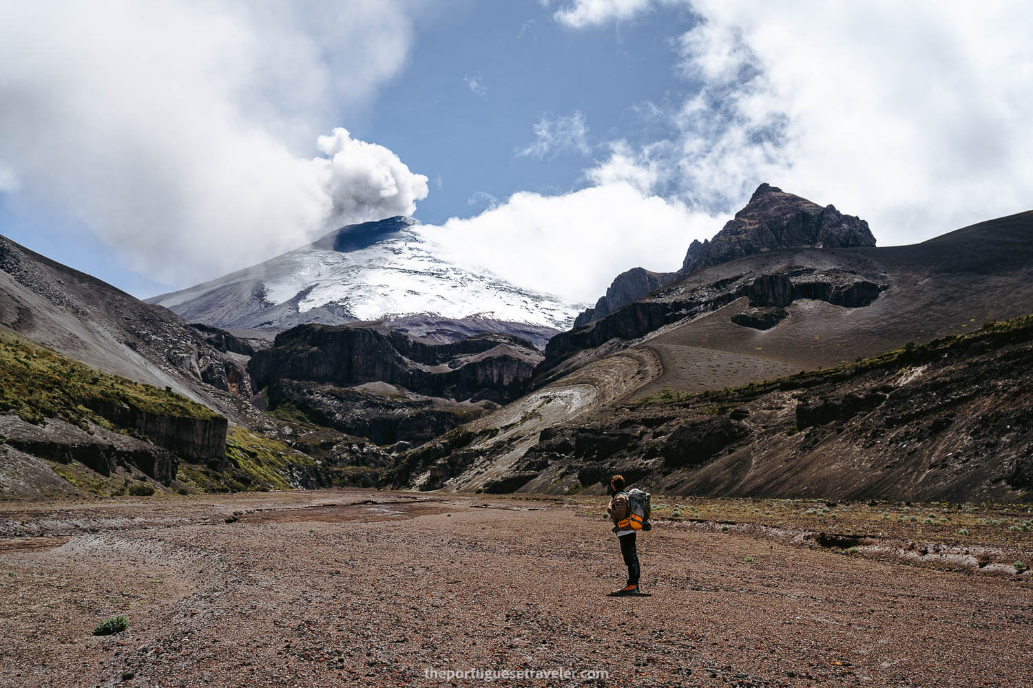
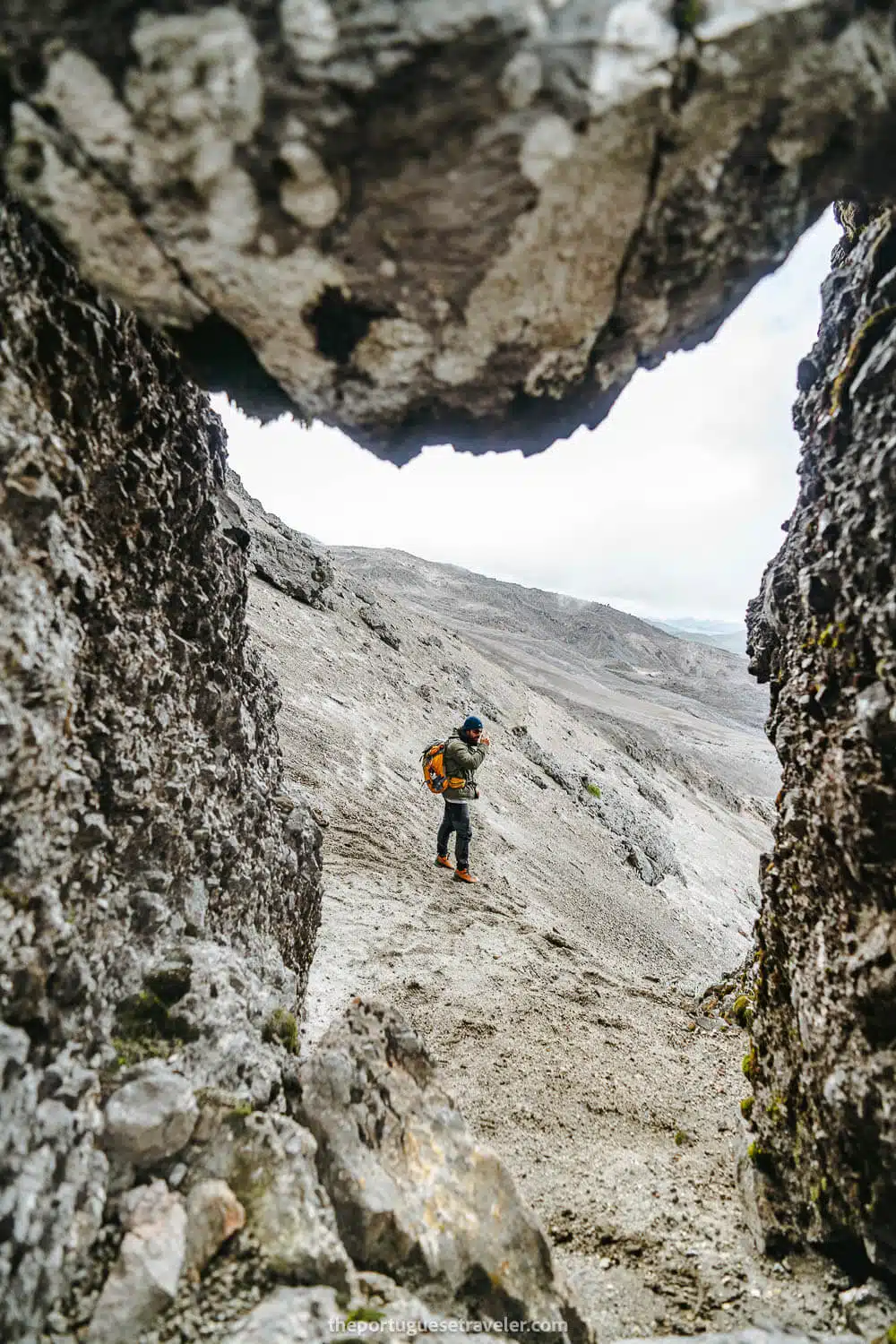
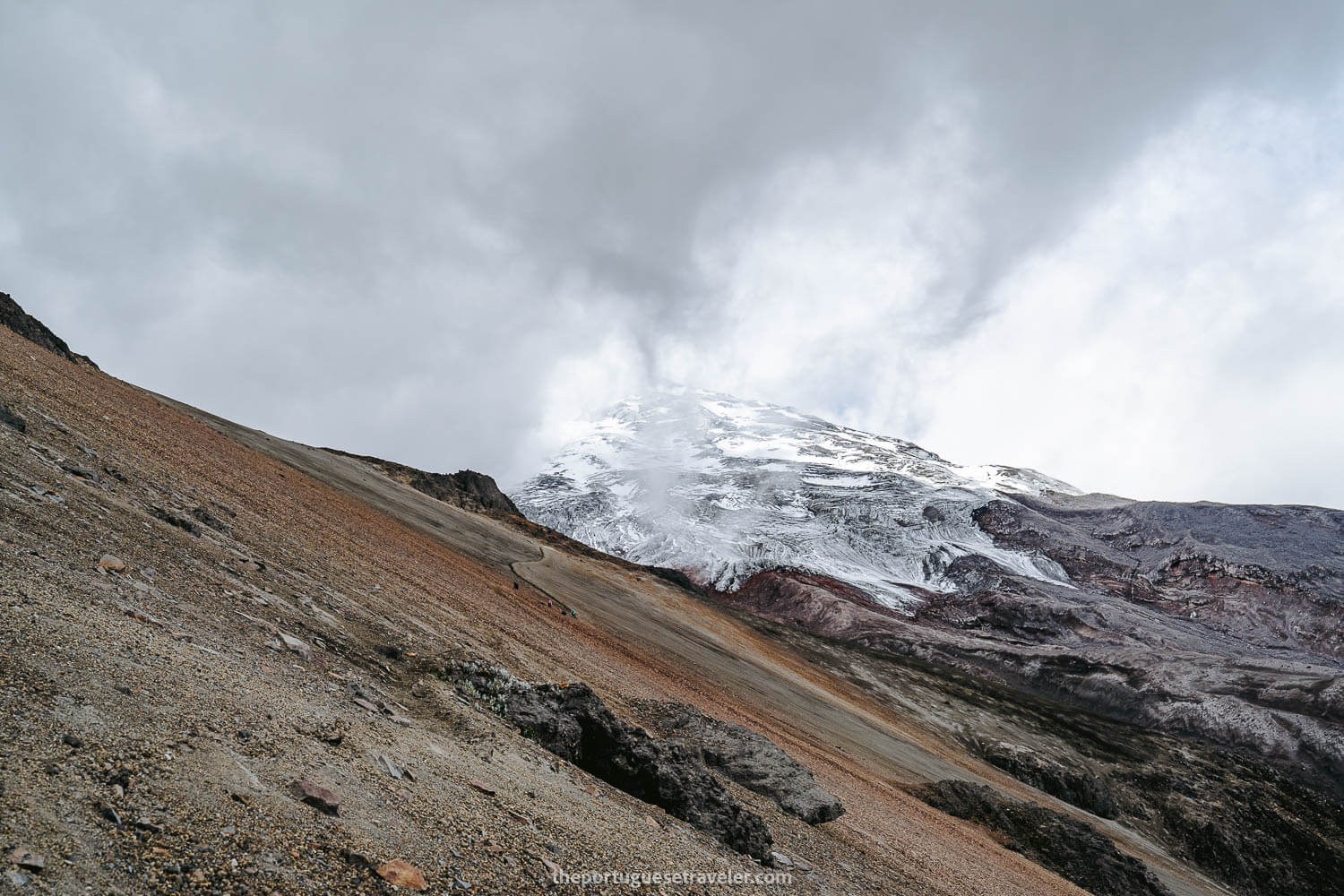
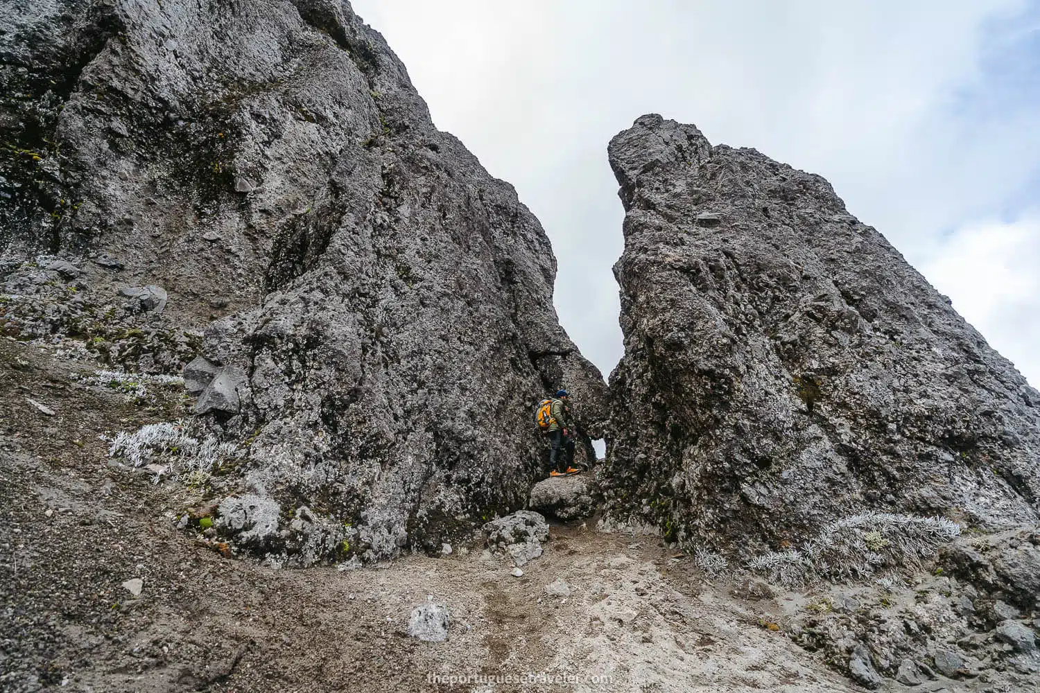
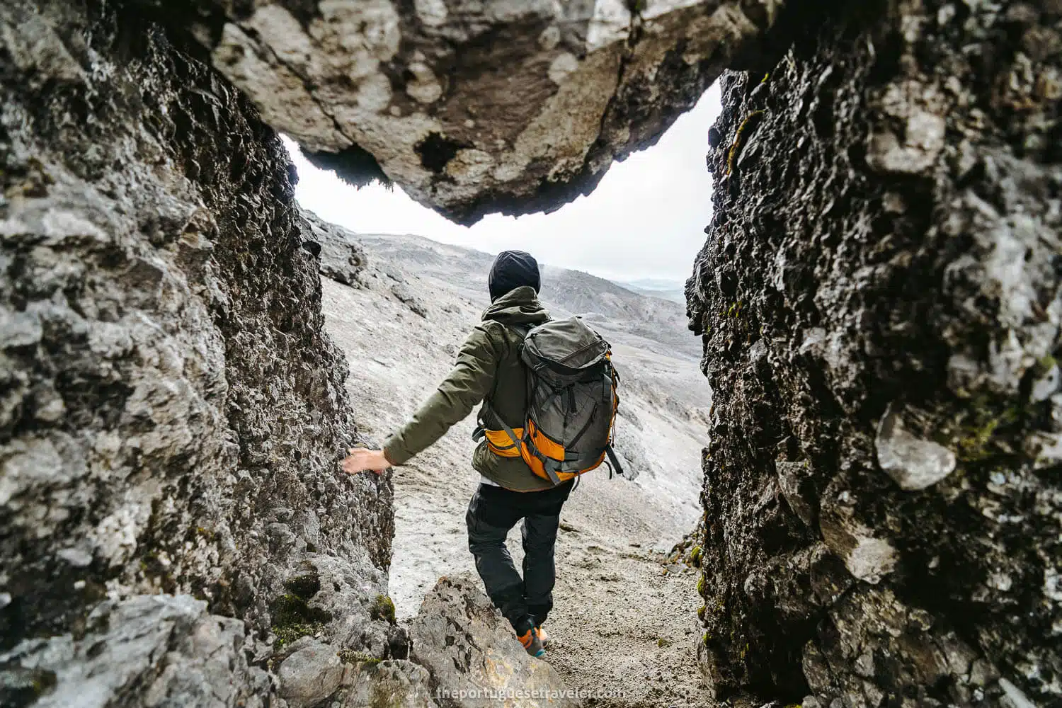
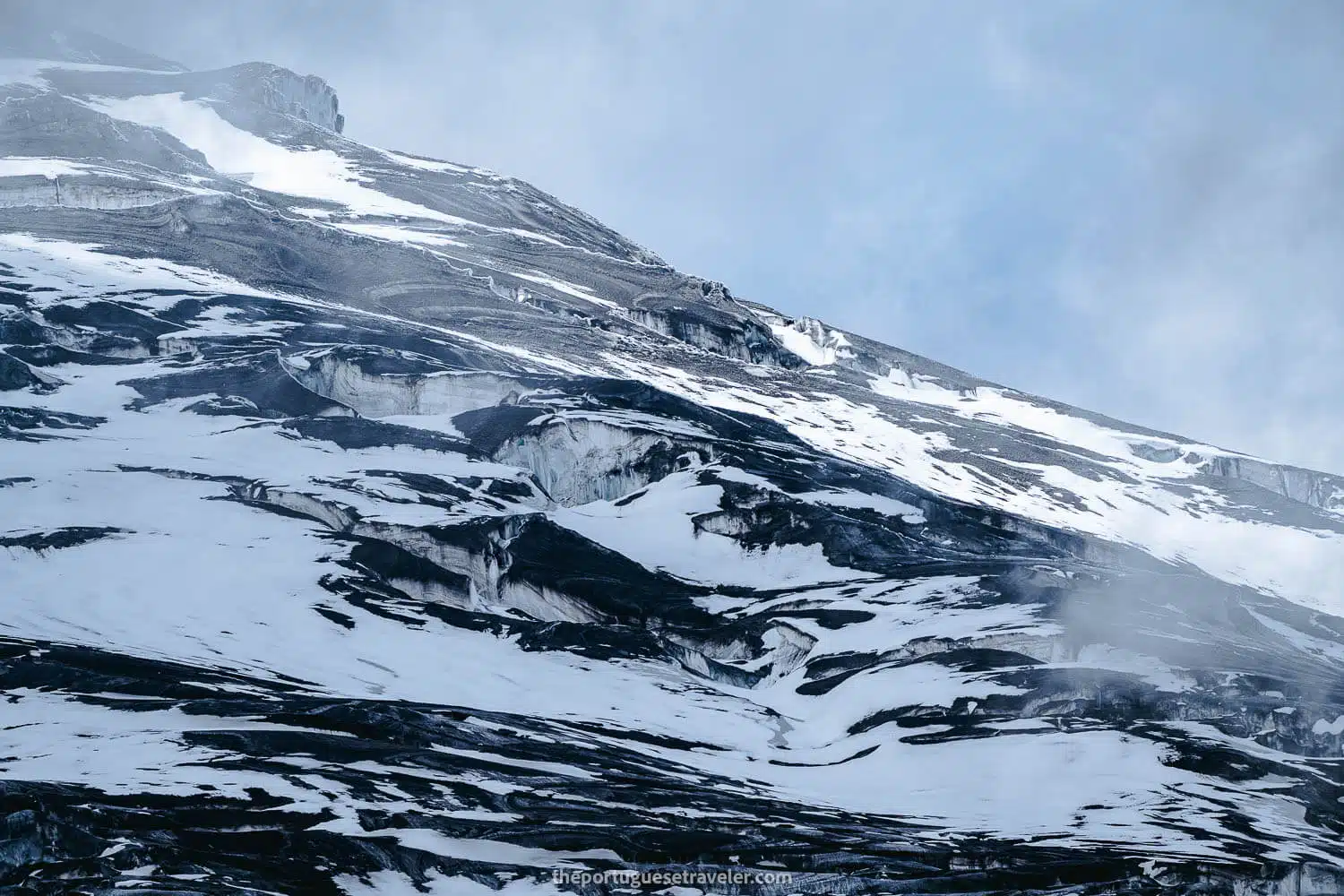
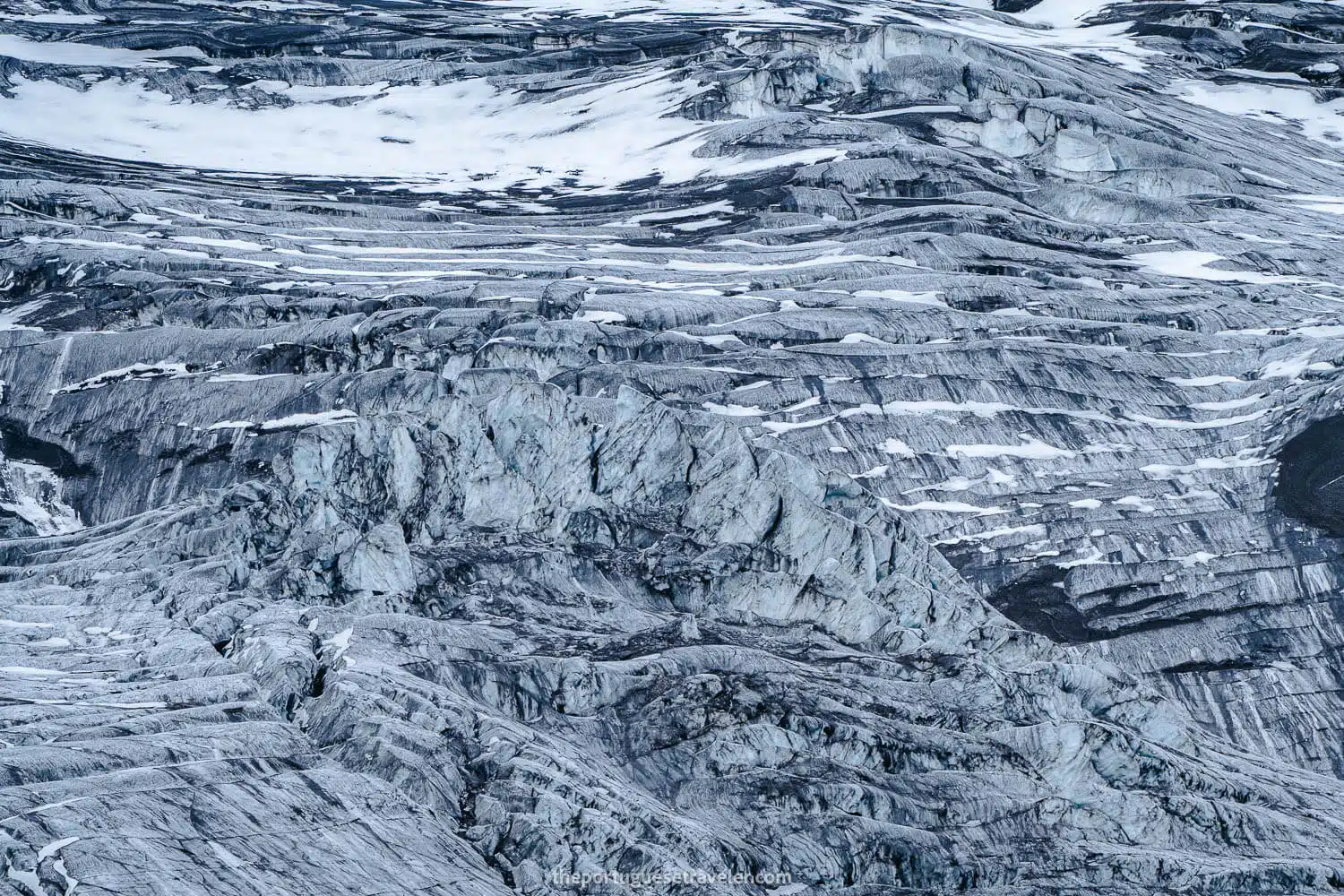
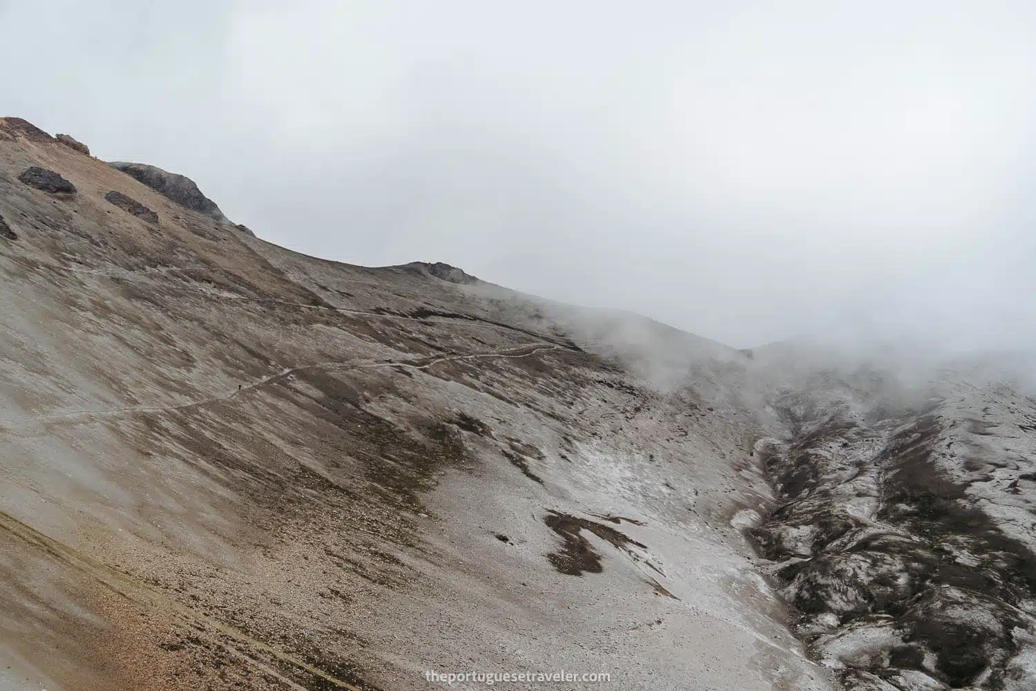
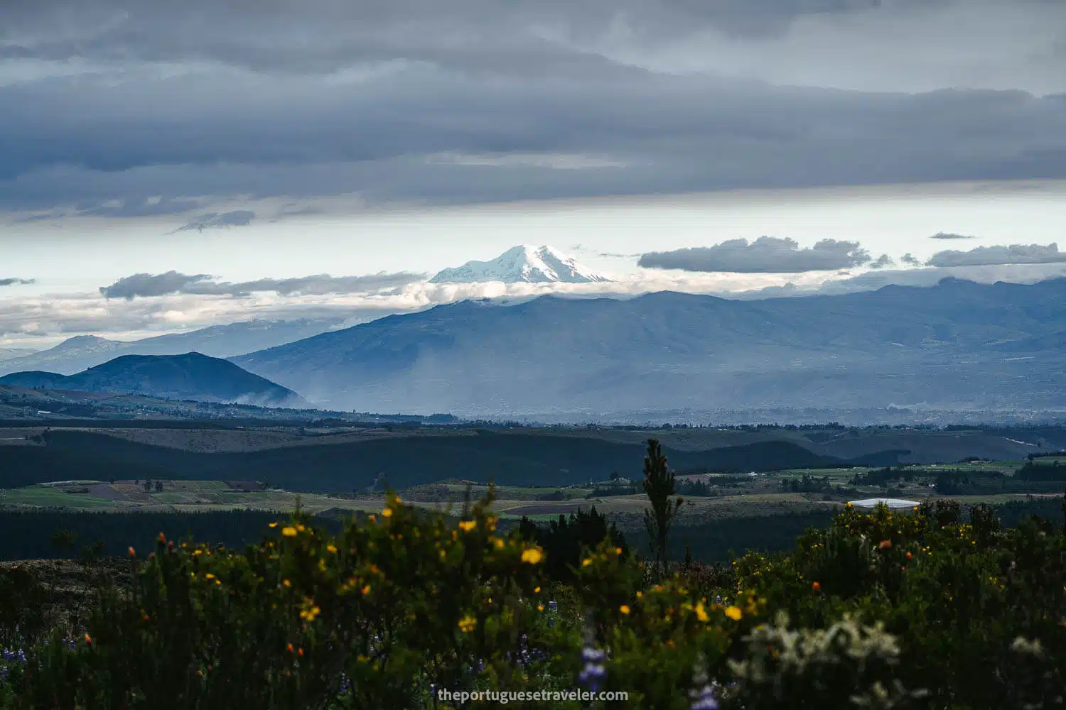
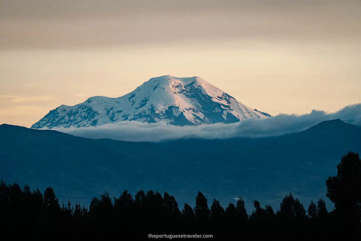
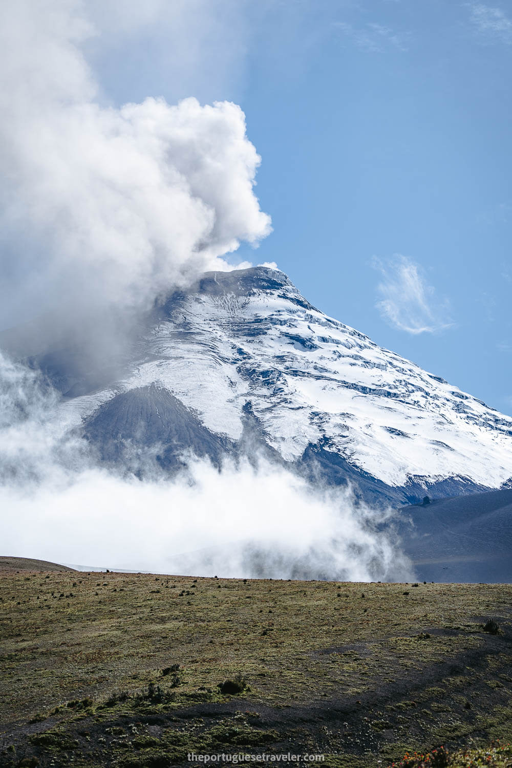
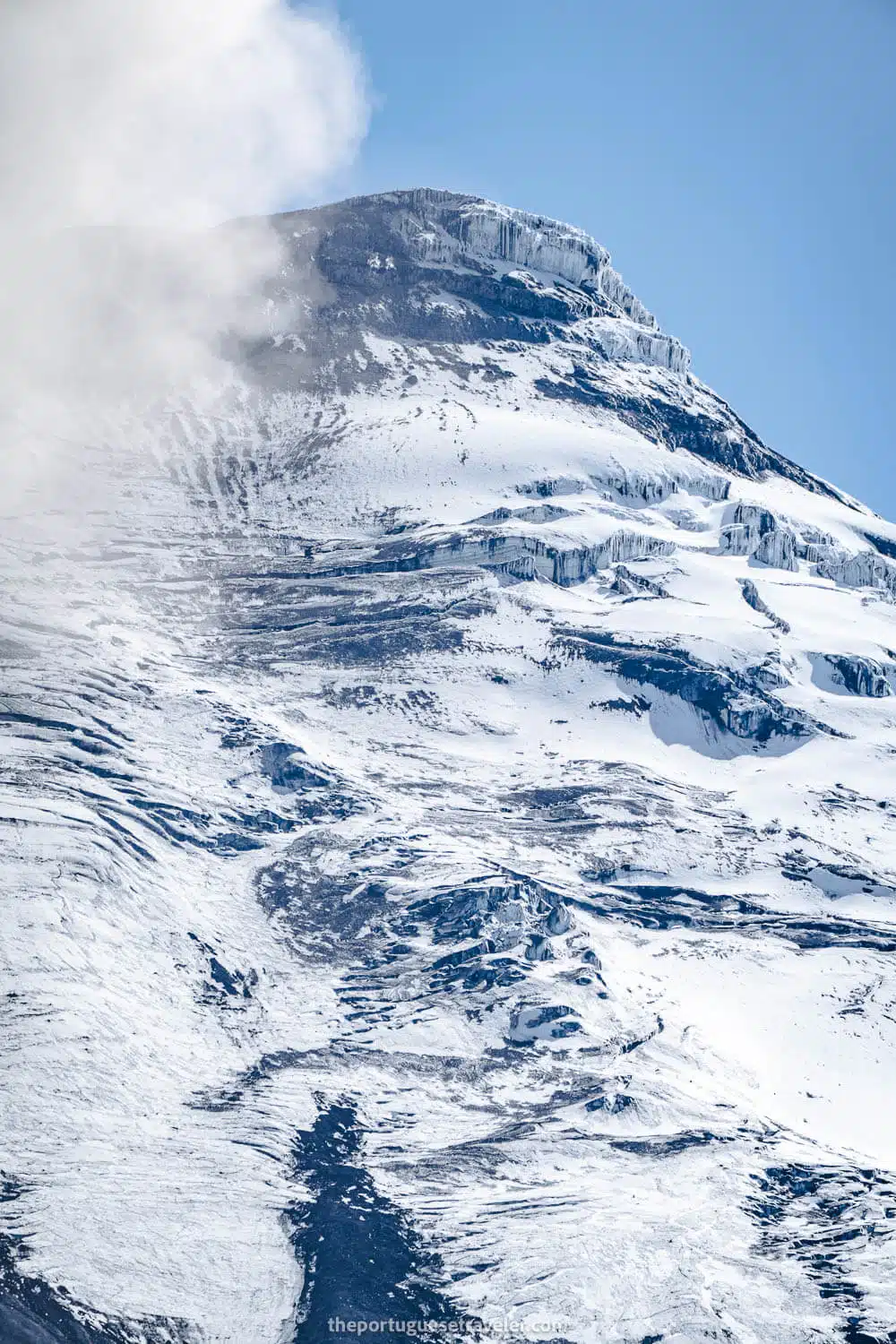
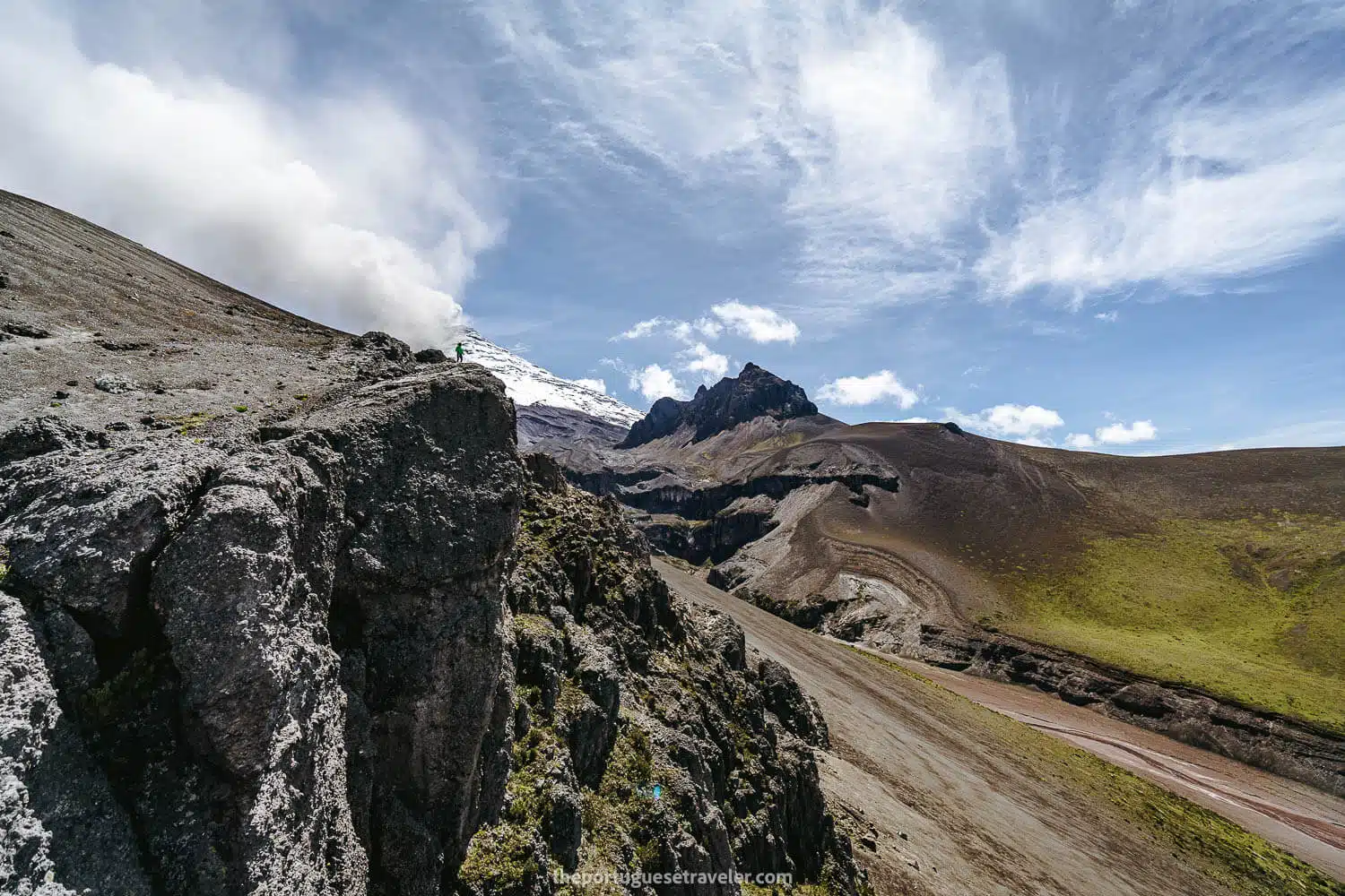
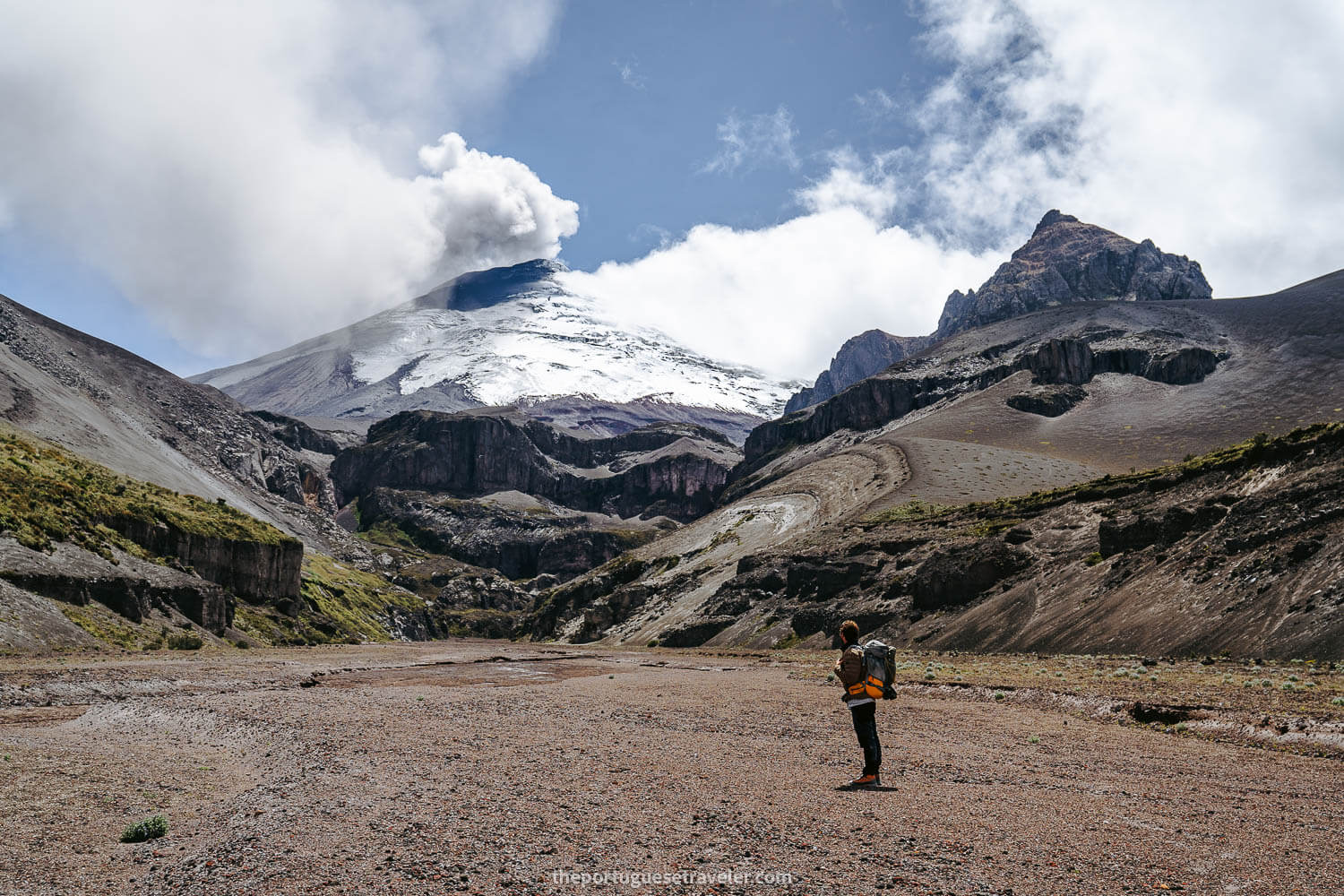
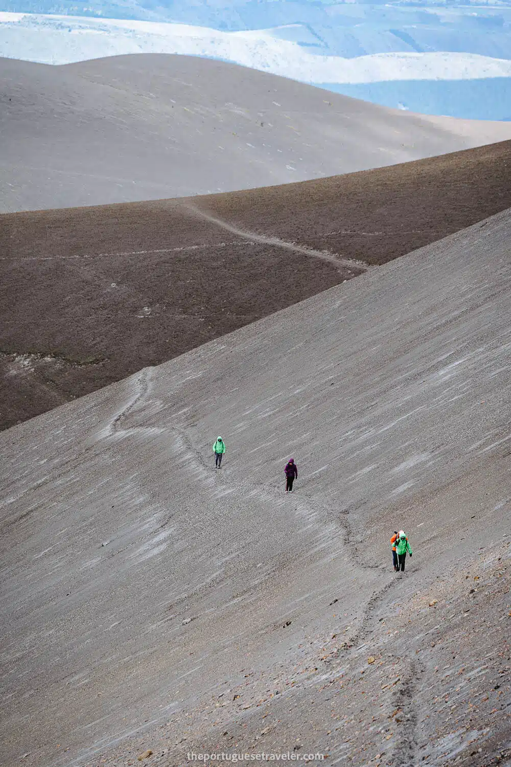
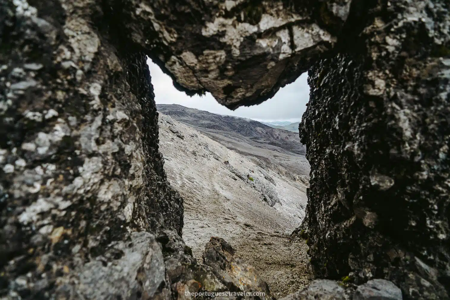
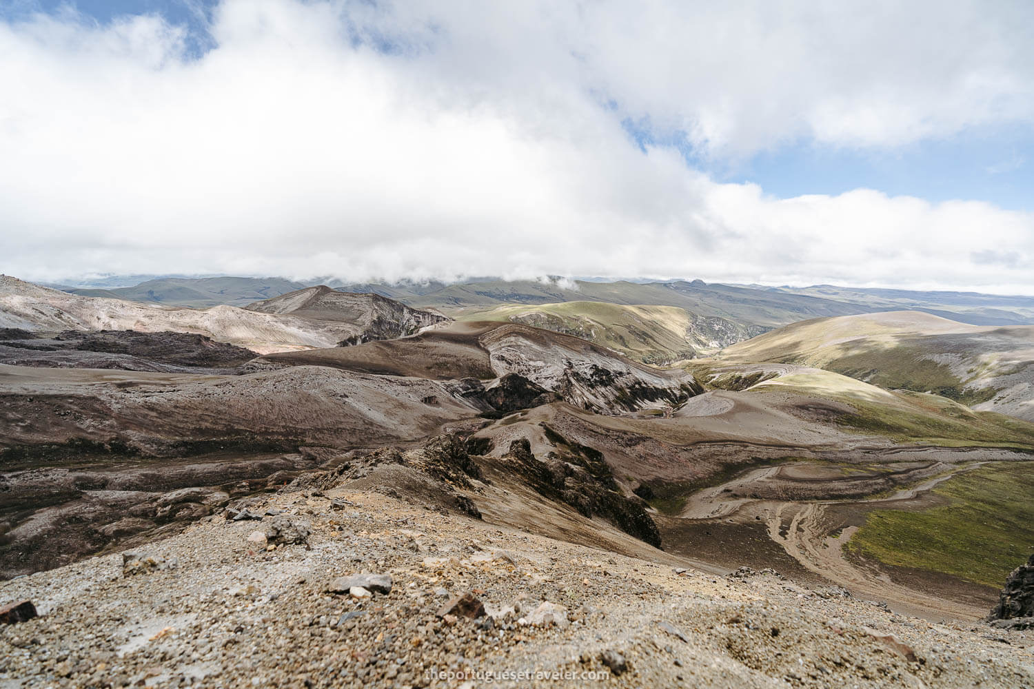
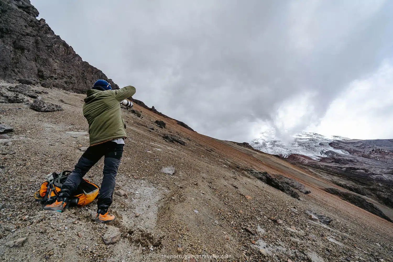
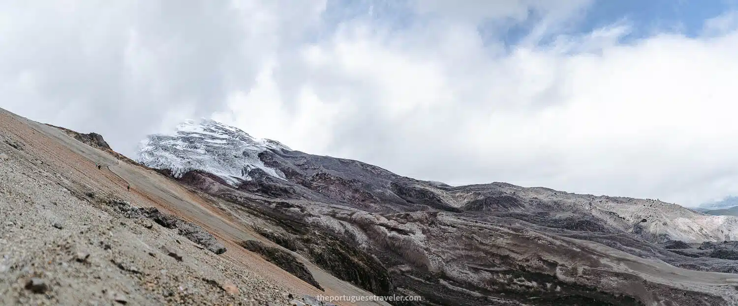
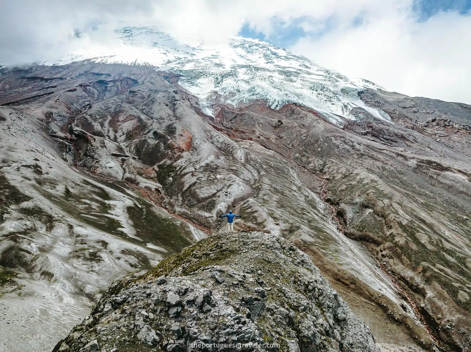
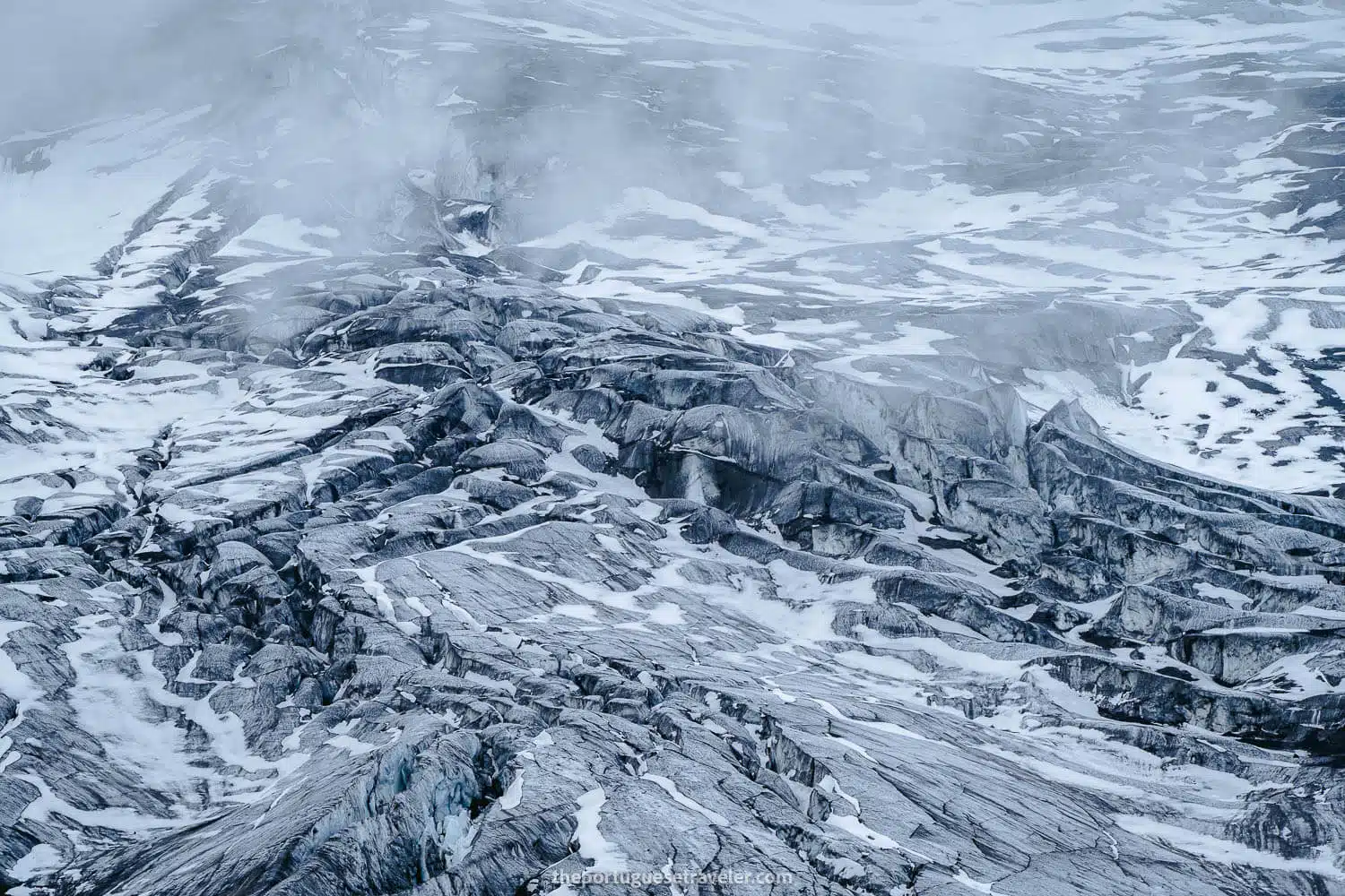
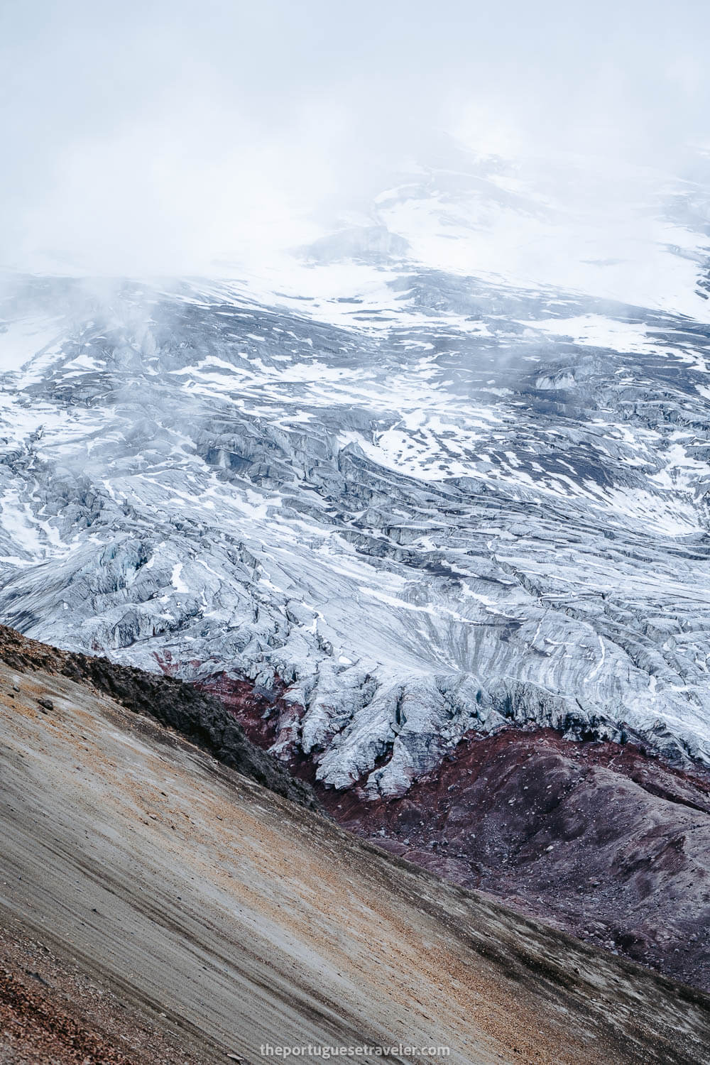
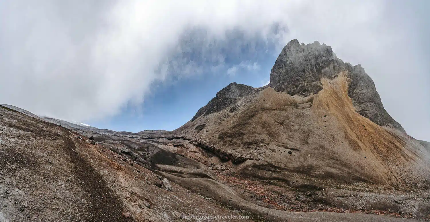
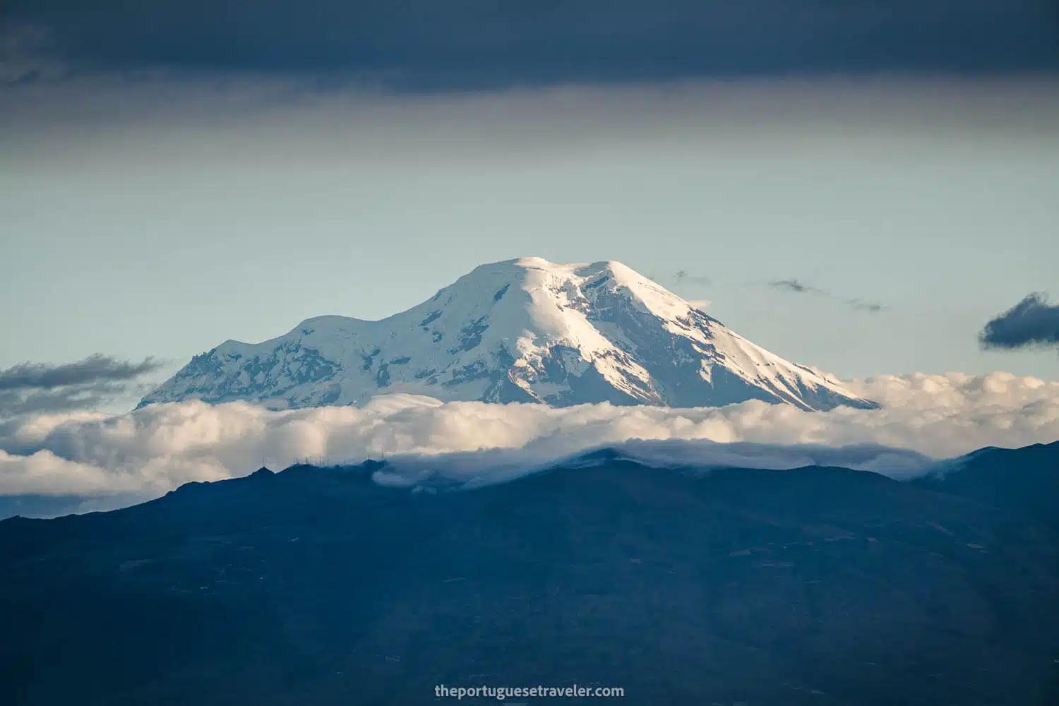
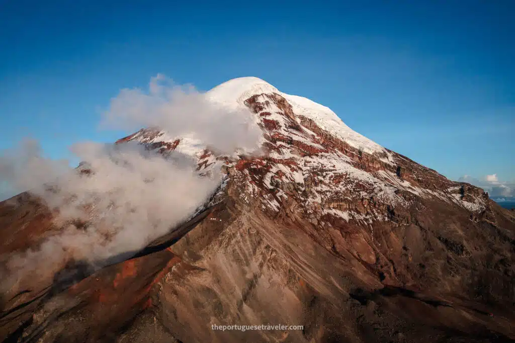
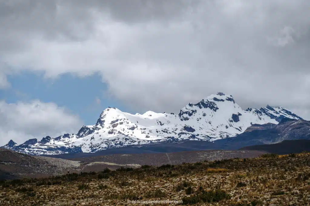
Passing through the Morurco’s window, we encountered a desolate landscape on the other side, which fascinated me since I had never seen any photos or reports depicting the south face of Cotopaxi Volcano. It featured numerous valleys and an immense glacier descending from its summit.

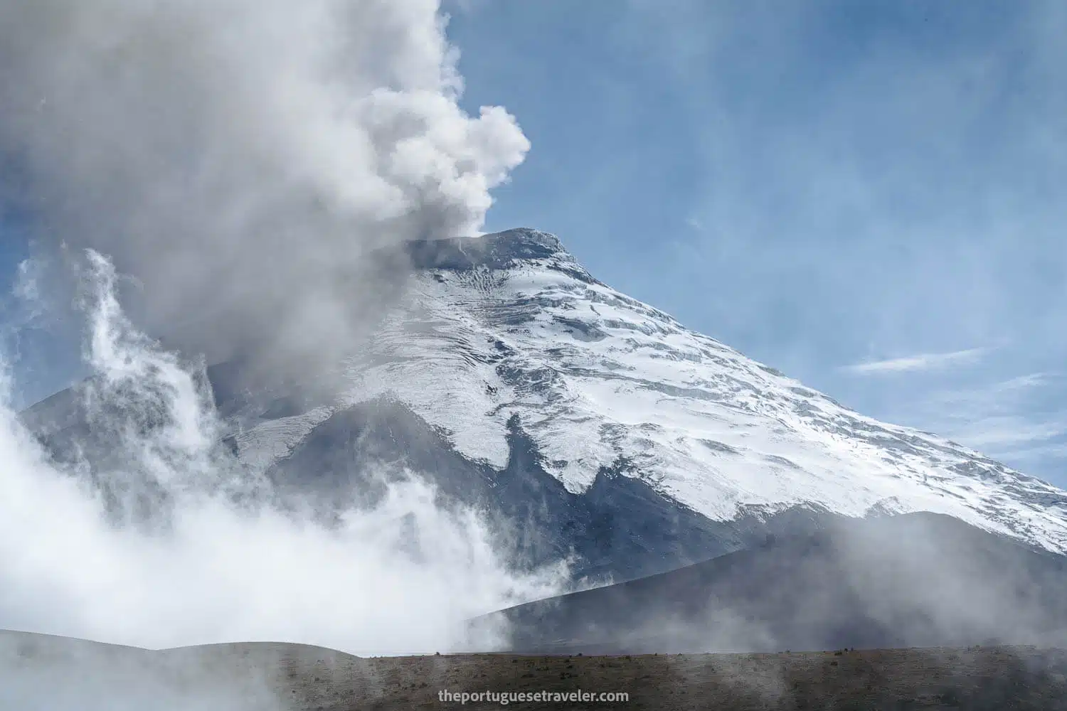
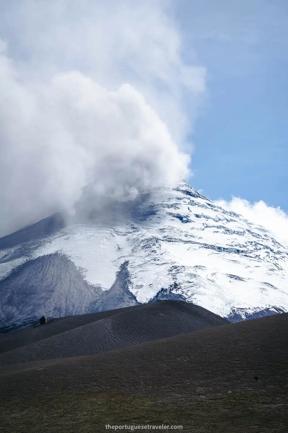
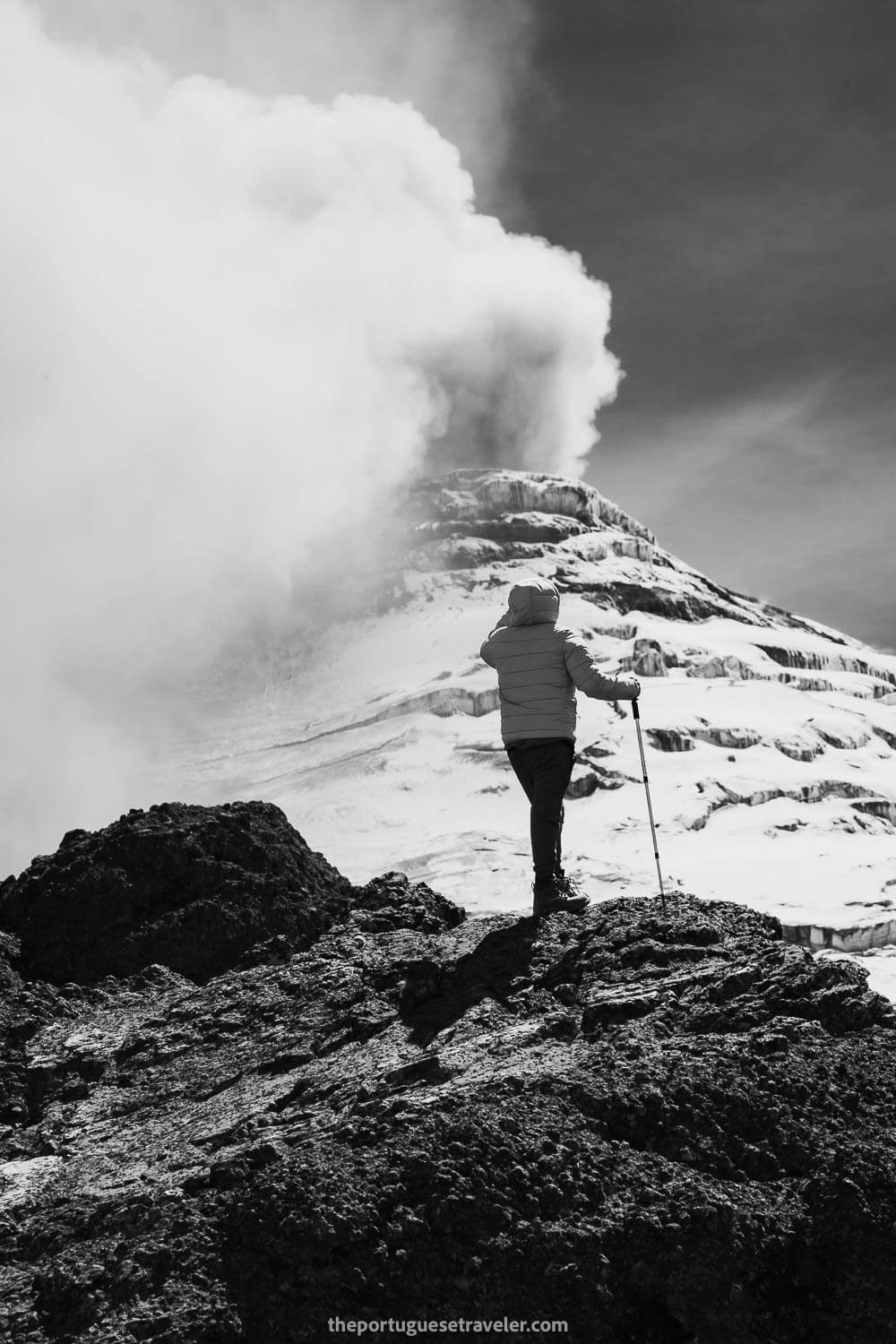
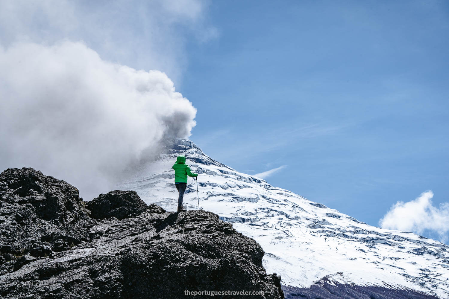
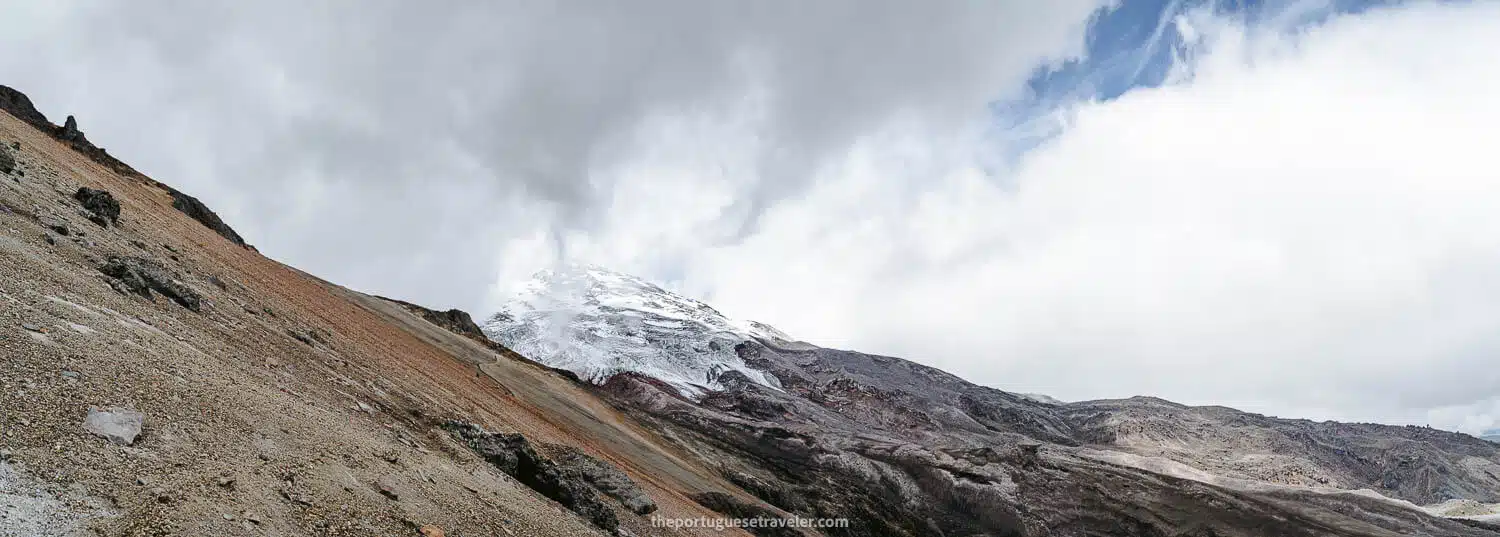
It was intriguing to observe that the glacier appeared white until a certain point, where it turned grey. This discoloration resulted from the ashes expelled by the erupting volcano being carried by the wind to one specific side of Cotopaxi, rather than covering the entire summit.

Later that day, upon reaching Quito, we learned that the eruption had released an unusually large amount of ashes, explaining the awe-inspiring nature of the photos we had taken. It was far from a regular occurrence.

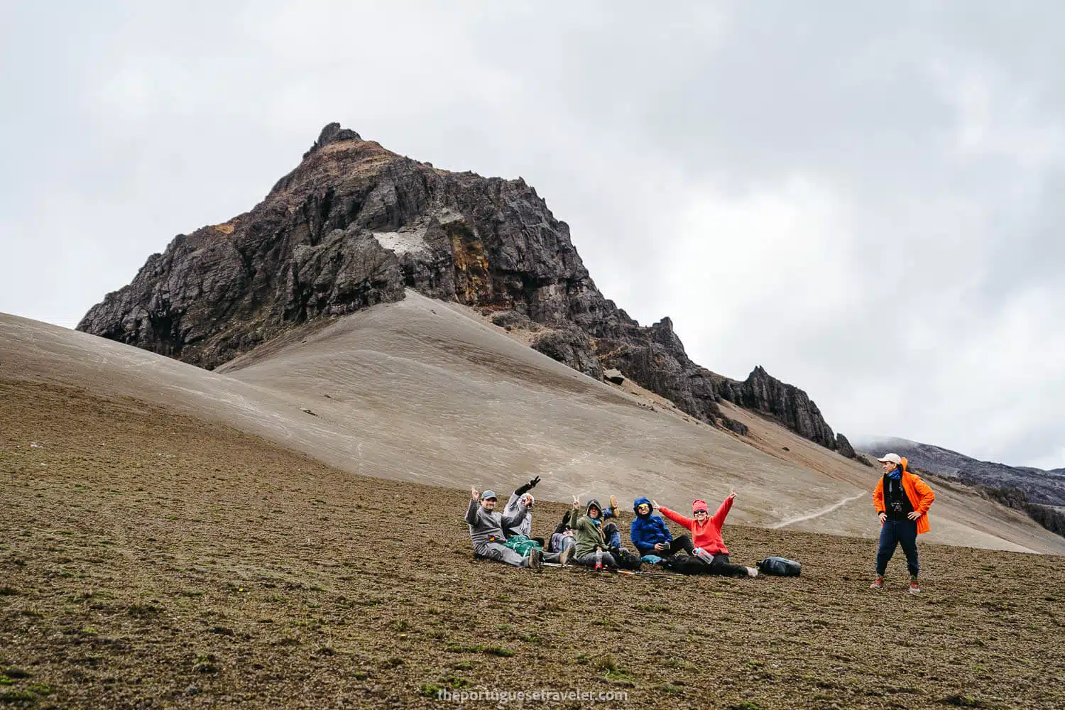
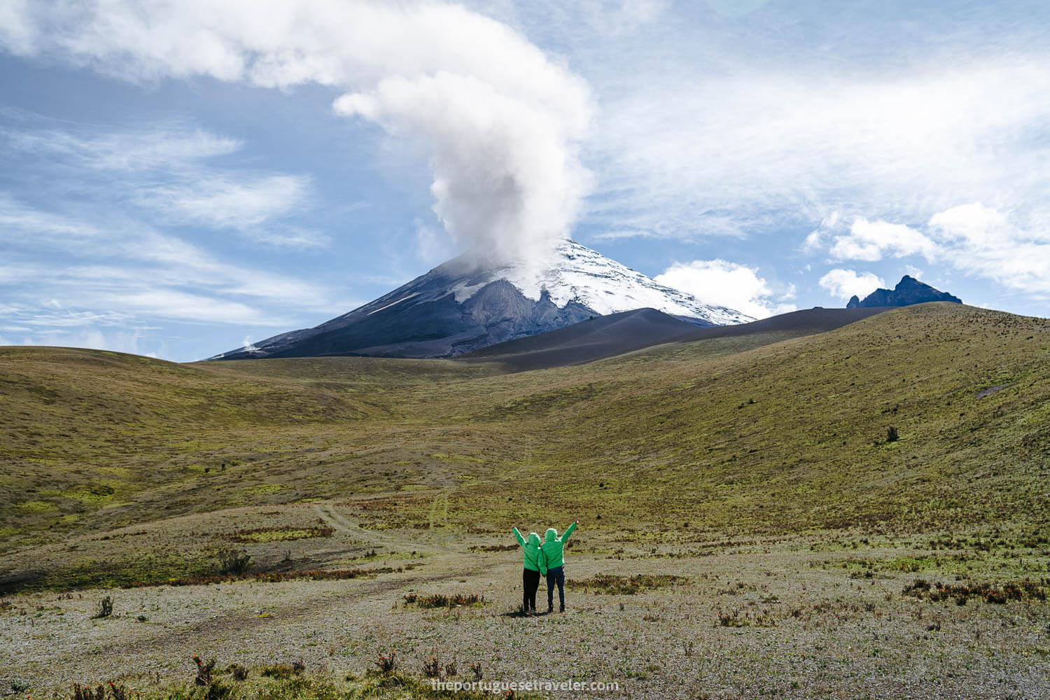
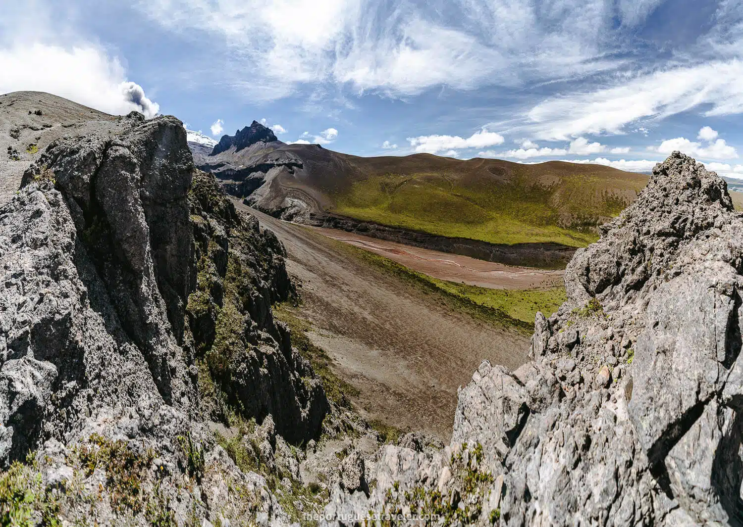
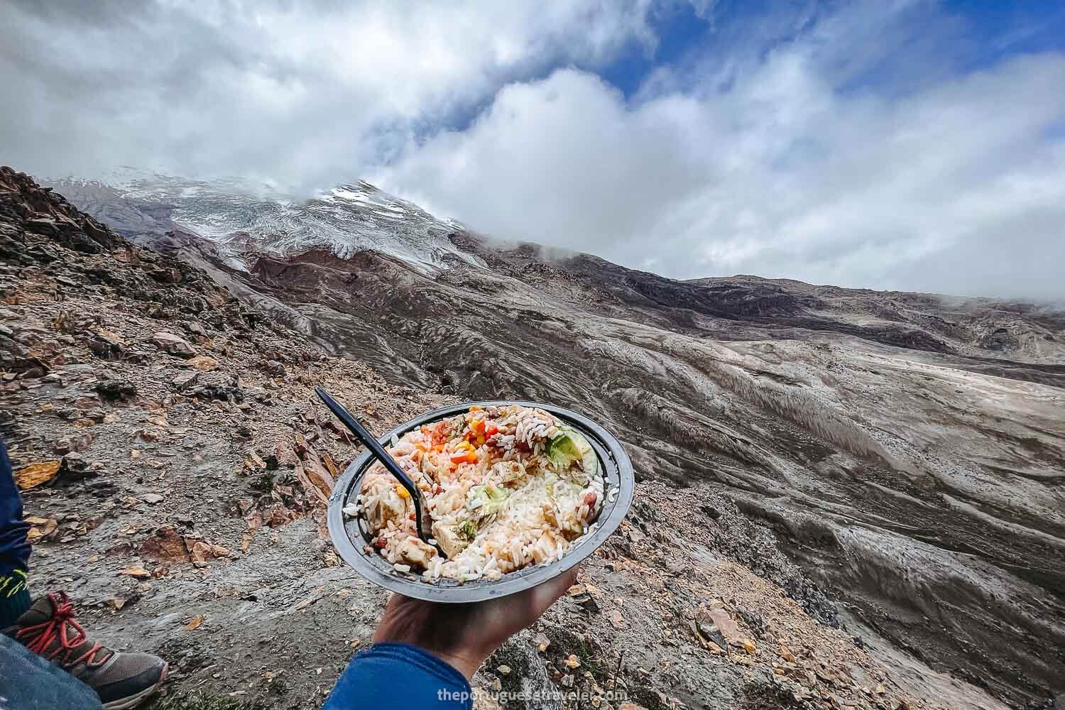
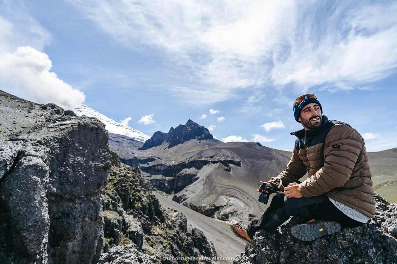
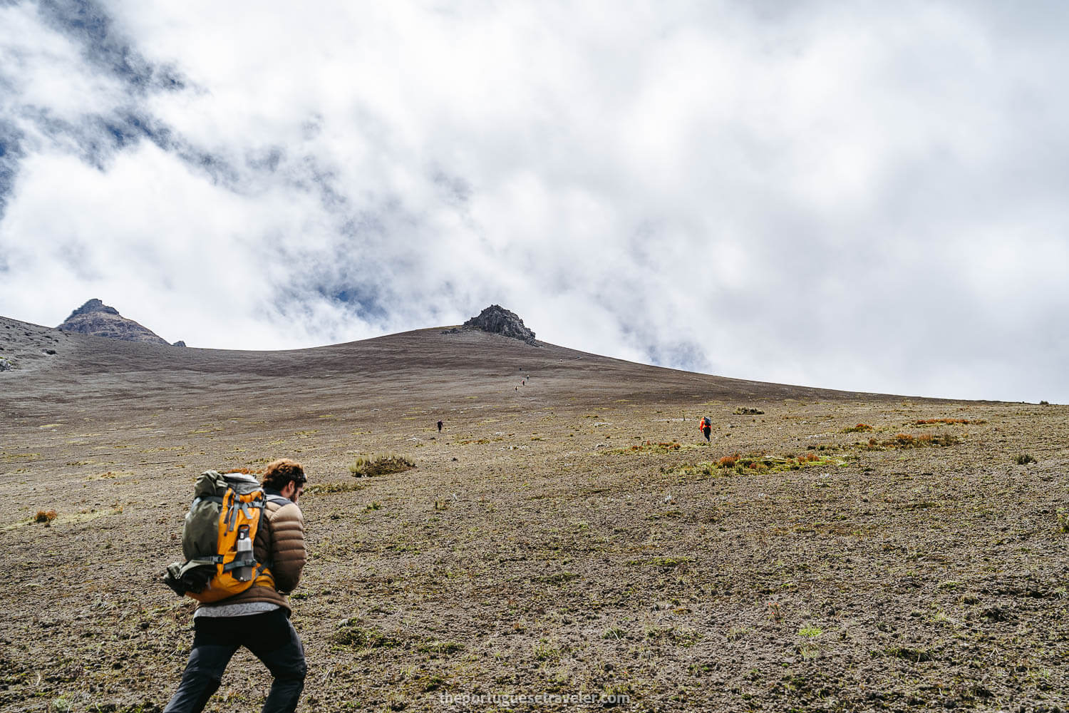
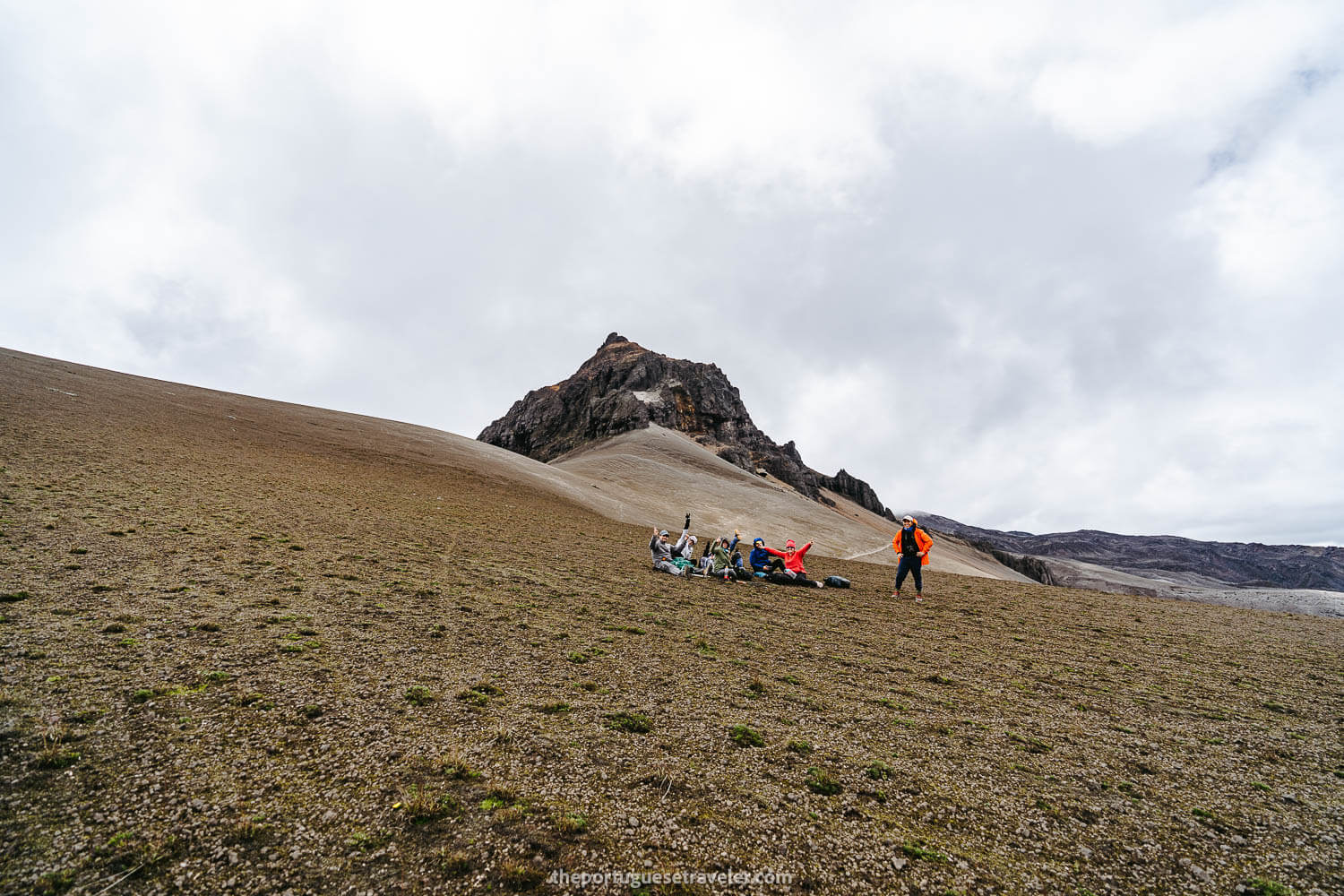
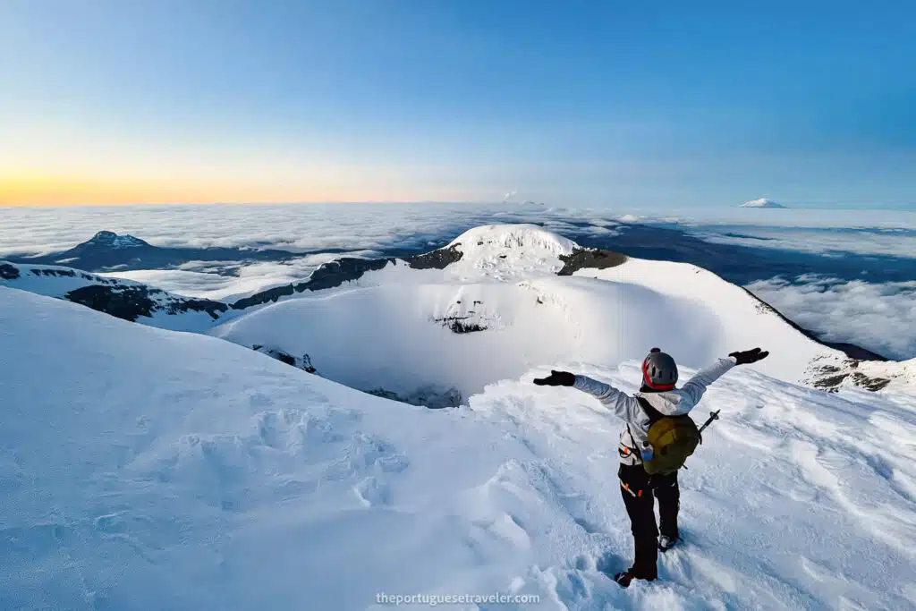
After reaching the midpoint of the 360-degree hike, we enjoyed our lunch break, flew the drone once again to capture remarkable shots of Morurco and Cotopaxi’s glaciers, and commenced our journey back to the refuge.

The way up the sandy slope to reach Morurco
Miguel being cool at the Morurco
Me also being cool on the Morurco 360 hike
The window you need to pass to reach the north side of Morurco and see Cotopaxi's glaciers
Miguel crossing the window
The view back of the window section
A Panorama of Cotopaxi's glaciers
Having lunch with a glacier view
Eddie posing with the glaciers as backdrop
More details of the South Face of Cotopaxi
The glaciers of Cotopaxi South Face

From the Glaciers viewpoint back to the Refuge

As we embarked on the initial section after lunch, a massive cloud engulfed Cotopaxi, obscuring it from our view for the remainder of the day. Undeterred, we continued our hike, only to find ourselves enveloped by clouds, rendering the path invisible.

Fortunately, Eddie had the hike’s map on Wikiloc, which enabled us to discern the correct direction. Additionally, the guide from the previous group joined us, confirming the route’s authenticity.

Although we eventually spotted wooden signs pointing the way once the cloud dissipated, I must say that without Eddie’s guidance and the assistance of the other guide, we would have likely become lost, especially considering that sunset was approaching. It was a somewhat perilous situation for those lacking proper knowledge of the area, compounded by our extreme exhaustion.

Following that episode, the sky cleared before us, allowing us to leisurely trek back to the refuge, retrieve our car, and return to Quito.

Along the way to the refuge, we encountered wild horses and enjoyed splendid views of the Chimborazo Volcano.

The way back to the refuge still with Cotopaxi at the background
The fog coming in and Morurco hidden in the clouds
Miguel looking at a hidden Morurco
The signs you can find in the Morurco 360 hike
The trail back from the lunch stop seen from a drone's perspective
A river and the Morurco
Me, Edwin and Samy walking in the fog
The Lechuginis hidden in the fog
Chimborazo Volcano at the distance
Chimborazo Volcano at sunset

Have you had the opportunity to do the Morurco 360 Hike? If yes, I would love to hear about your experience. Please share your thoughts and opinions in the comments below.

Thanks for reading through and I hope you have fun on this adventure. I will drop more of my favorite shots underneath, enjoy!

Photo Gallery

From the Parking lot to the Canyon

The Parking where the hike starts
Miguel and the lechuguinis on the way to the refuge
Miguel shooting Cotopaxi
Cotopaxi Volcano South Face - Cara Sur
Cotopaxi's Summit
The views to Cotopaxi volcano and Morurco
Eddie hiking the Morurco 360
Miguel and Eddie on the 360 hike
Piedra Santa Barbara sign
Edwin showing the scale of this landscape
Miguel and the Cerro Morurco
The other way of the hike
Going down the first sandy slope of Morurco 360 hike
Miguel at the Lahar of Cotopaxi
Representing Portugal at the Cotopaxi National Park
Me again with the Portuguese Flag

From the Canyon up until the Glaciers viewpoint

The way up the lahar
Miguel going up the sandy slope
The Cerro Morurco and a group of hikers
Resting after the sandy slope
The group coming to the Morurco's window
Me reaching the window
Morurco's Window
The view after the window of Morurco
Miguel shooting the glaciers
A panorama of the Cotopaxi Volcano South Face glaciers
Me and Cotopaxi
Me and Cotopaxi
The glaciers of Cotopaxi South Face

From the Glaciers viewpoint back to the Refuge

The way back to the refuge
Cotopaxi at the background
Cotopaxi's Glaciers
The Cerro Morurco Mountain
Me on the way back in the fog
The canyon at the end of the hike
Wild horses on the Cotopaxi National Park
The group at the end of the hike
Edwin and the Chimborazo
El Chimbo

All the articles about Ecuador

Galapagos Islands – Experience the wonders of nature and unique wildlife in this pristine archipelago.

Amazon Rainforest – Immerse yourself in the lush greenery and rich biodiversity of the world’s largest tropical rainforest.

The Andes – Embark on an adventure in the Ecuadorian Andes, a majestic mountain range with diverse landscapes, ancient sites, and captivating wildlife.

Leave a Comment

Your email address will not be published. Required fields are marked *

20 Shares
Share
WhatsApp
Pin20
Email
More