Climbing Pichincha Volcano (4784m)

Integral de los Pichinchas - From Guagua to Rucu

Guagua Pichincha's Summit and Cotopaxi in the background

Climbing Pichincha Volcano in Ecuador is a popular choice for acclimatisation and adventure. This volcanic range, featuring Guagua Pichincha, Padre Encantado, Cerro Ladrillos, and Rucu Pichincha, rises to a peak of 4,784 meters and lies just west of Quito, making it a tourist hotspot. The route, which can be tackled in a day, is perfect for budding mountaineers and trekkers, while also serving as valuable acclimatisation for those aiming higher, such as Cotopaxi or Chimborazo. The landscape is a captivating mix of active craters, fumaroles, and diverse species. The most common route starts in Lloa, with a truck ride followed by an ascent from nearly 4,700 meters.

Table of Contents

Panorama of the "Avenida de los Volcanes" from the refuge of Guagua Pichincha Volcano

Climbing Pichincha Volcano: General Details

To climb Pichincha Volcano, a mid-altitude mountain in the Ecuadorian Andes, you can do it in three ways, with a Mountaineering Agency, with a local guide or on your own without a guide:

  • Highlights: Guagua Pichincha Volcano, Padre Encantado Hill, Cerro Ladrillos Hill, and Rucu Pichincha Volcano. Views of the 4 big famous volcanoes: Cotopaxi, Antisana, Cayambe, and Chimborazo. Views of the other volcanoes on the “Avenida de los Volcanes”: Imbabura, Cotacachi, Los Ilinizas, El Altar, Tungurahua, Ruminhahui, Pasochoa, etc (on a clear day).
  • Duration: 1 day.
  • Accommodation: No need (there is a refuge in Guagua Pichincha Volcano if you want to spend the night though).
  • Price: 20-55$ (details in the following section)
  • Outfit: Mid-altitude mountain gear, and some technical equipment (details in the following section)
  • Best Months to Climb: September – December
  • Recommended Agency: Mauna Expeditions
  • Recommended Local Guide: Eddie Lint: +593995577260
Other possible mountaineering agencies: Cumbre ToursMountain Tours
Cotopaxi Volcano seen from the Guagua Pichincha's Refuge

Climbing Pichincha Volcano: Technical Details

  • Type: Point-to-Point Trail
  • 4 Summits Climb:
    • Distance: 14 km – Starting at the Refuge of Guagua Pichincha Volcano, passing through Guagua Pichincha Summit, Padre Encantado, Cerro Ladrillos, Rucu Pichincha Summit, Cueva del Oso, and finishing at the Teleférico (cable car).
    • Duration: 4 hours and 30 minutes of moving time. 8 hours and 40 minutes, including lunch and small breaks.
    • Incline: 838m ascent and 1310m descent.
  • 3 Summits Climb:
    • Distance: 11 km – Starting at the Refuge of Guagua Pichincha Volcano, including Guagua Pichincha Summit, Cerro Ladrillos, Rucu Pichincha Summit, Cueva del Oso, and finishing at the Teleférico.
    • Duration: 3 hours and 15 minutes of moving time. 8 hours, including lunch and small breaks.
    • Incline: 719m ascent and 1310m descent.
  • Difficulty: Moderate. The most challenging aspect of this hike is the high starting altitude of 4,560m at the Refuge of Guagua Pichincha Volcano. If you arrive by car and aren’t acclimated to the altitude, you may experience dizziness. Apart from that, it’s more of a hike with gentle inclines. The climb to Rucu Pichincha Summit is somewhat technical with some rock climbing, but no special equipment is required. However, in rainy conditions, it could be potentially dangerous and strenuous.
  • Altitude: Lowest point: 3,964m at the Teleférico/Café Cruz Loma. Highest point: 4,784m at the summit of Guagua Pichincha Volcano.
Powered by Wikiloc
Powered by Wikiloc
Guagua Pichincha Volcano's Summit
Guagua Pichincha Volcano's Chapel and Cross

The Most Complete Guide & Map of Ecuador

+300 Unique Places: Galapagos - Amazon - Andes - Coast

Unlock exclusive access to hidden gems and local insights with my guide! Your purchase fuels my dedication to providing free travel content and supports my passion for sharing the best of Ecuador. Plus, enjoy lifetime updates and personalized assistance. Let’s explore together! 

How to climb Pichincha Volcano?

To climb Pichincha Volcano, a mid-altitude mountain in the Ecuadorian Andes, you can do it in two ways:

  1. Mountaineering Agency: 
    • Pros: More comfortable and easy to plan. Includes everything.
    • Cons:
      • Shared Trip: Big Groups, Random People
      • Private Trip: More expensive than hiring a guide by yourself.
  2. Hiring a Certified Guide – National Guide – ASEGUIM – UIAGM:
    • Pros: Cheaper (you don’t pay the agency’s fee), private, flexible (your own dates), personally choose your own guide.
    • Cons: You have to arrange the transportation, meals, and rent the technical gear.
  3. By Yourself:
    • Pros: The Cheapest Option (no need to pay for a guide or agency).
    • Cons: You must arrange transportation, meals, and rent technical gear. In case of fog, there is a risk of getting lost, despite the presence of blue signage marking the path.

In a Hurry? Save it for Later.

Save it on Pinterest and read it whenever you can.

SAVE TO PINTEREST

Pichincha Volcano Pinterest - Integral de Los Pichincha
Tobi at Cerro Ladrillos

What clothing and equipment should i bring to climb Pichincha Volcano?

To ensure a safer and more comfortable journey in this Mid-Altitude Mountain with some rocky sections, certain specific equipment is indispensable:

Essentials:

  • Three Layers of Clothing: The base layer (thermal clothing for the body and pants, typically made of synthetic material), the second layer (warm jacket and pants, preferably water repellent from goose down, fleece, or polar fabric), the third layer (waterproof jacket and pants).
  • Mountaineering Boots: Mountain boots or hiking shoes.
  • Backpack: 25-35 liters
  • Gloves: One Layer (preferable waterproof)
  • Sunglasses: Category 4 UV protection.
  • Hat: Beanie or buff and a cap if it’s not cold.
  • Socks: One Layer (preferable thick socks).
  • Sunscreen: Ensure you have a minimum of SPF 50 as the Equator’s sun is more prone to causing burns compared to other regions.
  • Food, Drinks, and Snacks: Bring enough of it for dinner, breakfast at the camp, and for the climb.

* It is advisable to have an additional thermal layer or jacket available for extremely cold conditions (at the summits or if it’s rainy or hailing).

Climbing Equipment (for the rocky sections next to the summits):

  • Helmet: For the rocky sections next to every summit.
  • Trekking Poles: For the entire hike until the summit of Rucu Pichincha which requires both hands to climb.
Antisana Volcano also seen from the Refuge

How much does it cost to climb Pichincha Volcano?

To provide you with an estimation of the expenses associated with climbing Pichincha Volcano, I have provided a detailed breakdown of the costs involved. Firstly, you need to consider whether you will be going with an agency or a local guide, or by yourself. Additionally, there are other supplementary expenses that require careful consideration.

Agency/Private Guide:

  1. Mountaineering Agency:
    • Shared Trip (1-24 persons): ca. 50$ (pp) – The pricing decreases as the number of participants increases.
    • Private Trip: Private Guide + Agency’s Logistics 40$ (pp)
  2. Hiring a guide:
    • Local Guide (5-15 persons): 30$ (pp) – Fixed Price.

Transport (from Quito):

  • Uber (Quito – LLoa): 8-10$ (per Uber)
  • 4×4 Van – Camioneta (Lloa – Guagua Pichincha Refuge): 30-35$ (per van)
    • Rafael (Local Lloa Driver): +593992640119,  +593992933029
  • Teleférico – Quito (cable car): 5$ 
  • Uber (Teleférico – Quito): 3-5$

Equipment for Rental:

(Daily prices without taxes)

  • Helmet: 4$ (used) – 5$ (new)
  • Crampons: 5$
  • Ice Axe: 4$ (used) – 5$ (new)
  • Harness: 4$ (used) – 5$ (new)
  • Waterproof Pants: 5$ (used) – 6$ (new)
  • Waterproof Jacket: 5$ (used) – 6$ (new)
  • Waterproof Gloves: 3$ (used) – 4$ (new)
  • Rubber Boots: 10$
  • Mountaineering Boots: 12.5$ (used) – 20$ (new)
  • Tent: 12$
  • Mattress: 2.5$
  • Sleeping Bag: 5$ (used) – 6$ (new)
  • Backpack 35-65L: 5$
  • Sunglasses (UV 4): 3.5$
  • Headlamp (without batteries): 3$
Equipment for Sale:
 
  • Trekking Poles: 10$
  • Fleece+Pants (1st Layer): 44.80$
  • Gloves (1st Layer): 3.92$
  • Socks (Merino Wool 70-80%): 16.80$
  • Socks (1st Layer): 11.20$
*Prices from Los Alpes Store in Quito, 26.May.2023
 
Alternative Stores for renting equipment: Mauna ExpeditionsTatoo, Cotopaxi Warehouse, Andes AlpinoMountain Tours.
 

Food, Drinks, and Snacks: 10$ (pp)

Estimated Total (per person):

  • Scenario 1:
    • Group of 5,
    • Hired a Local Guide,
    • Already have helmet and all the gear,
    • Price Breakdown: 30$ (guide w/ transport), 10$ (meals)
    • Total: 40$ USD
  • Scenario 2: 
    • Group of 2
    • Shared Tour with an Agency.
    • Already have helmet and all the gear,
    • Price Breakdown: 50$ (guide + logistics + meals + transport)
    • Total: 50$ USD (max 55$ USD)
  • Scenario 3: 
    • Group of 2
    • Private Tour with an Agency.
    • Need to rent a jacket and helmet,
    • Price Breakdown: 125-130$ (guide + logistics + meals + transport + gear)
    • Total: 125$ USD (max 130$ USD)
  • Scenario 4:
    • Group of 4
    • No guide
    • Have all the Equipment and Gear
    • Price Breakdown:  Uber (Quito – Lloa): 2$, 4×4 van (Lloa – Refuge): 8,75$, Teleférico – Quito (cable car): 5$, Uber (Teleférico – Quito): 3$, Meals: 10$
    • Total: 28,75$USD
Dani, from Mauna Expeditions in Cerro Ladrillos with Guagua Pichincha behind

How to get to the refuge of Guagua Pichincha Volcano?

By Uber & 4×4 Van:

From Quito, (Tribuna de la Shyris) to Lloa it takes around 40-50min.

From Lloa to the Refuge it takes around 30min.

Rucu Pichincha Volcano panorama
Rucu Pichincha Volcano panorama with Antisana, Cayambe, Imbabura and Cotacachi Volcanoes in the background

Where to sleep before climbing Pichincha Volcano?

Since the volcano is located in Quito, here is a list i created with the best hotels you can find in town to relax before your climb and during your acclimatisation program: 20 BEST HOTELS IN QUITO, ECUADOR

Pichincha Volcano: Curiosities

General Information:

  • Pichincha is a stratovolcano in Ecuador, and the capital city, Quito, wraps around its eastern slopes.
  • The two highest peaks of the mountain are Guagua Pichincha (Wawa Pichincha) at 4,784 meters (15,696 feet) and Rucu Pichincha at 4,698 meters (15,413 feet).
  • The active caldera is located in Guagua Pichincha on the western side of the mountain.

Description:

  • Both peaks, Guagua Pichincha and Rucu Pichincha, are visible from the city of Quito and are popular for acclimatization climbs.
  • Guagua Pichincha is typically accessed from the village of Lloa outside of Quito, while Rucu Pichincha is often accessed from the Teleférico on the western side of the city.

Historical Eruptions:

  • In October 1999, the volcano erupted, covering the city of Quito with several inches of ash.
  • Before that, the last major eruptions were in 1553 and in 1660 when about 30 cm (12 inches) of ash fell on the city.

Geography and Geology:

  • Pichincha is known for its unique plant life, including the Dracula vampira plant found between 1,900m and 2,200m above sea level.

Names and Meanings:

  • “Pichincha”, in Xinca means “dos volcanes” (two volcanoes), “pi” for “dos”(two) and from “chincha” meaning “volcán” (volcano).
  • “Guagua” in Kichwa means “child, source of life.”
  • “Rucu,” in Kichwa, means “old.” This name is due to the fact that it was the first crater of the Pichinchas massif, and therefore, it is the oldest summit.
  • “Padre Encantado” means “Enchanted Father.”
  • “Cerro Ladrillos” means “Bricks Hill,” due to the small piles of stones that hikers set up on top of that hill.

Significance in History:

  • The volcano was considered sacred by various indigenous cultures in the region for thousands of years before the arrival of Europeans.
  • The first recorded ascent of Guagua Pichincha was in 1582 by a group of locals led by José Ortiguera.
  • In 1737, members of the French Geodesic Mission, including Charles-Marie de La Condamine and Pierre Bouguer, spent 23 days on the summit of Rucu Pichincha for triangulation work to calculate the length of a degree of latitude.
  • In June 1742, during the same mission, La Condamine and Bouguer ascended Guagua Pichincha and peered into its crater, which had last erupted in 1660.
  • Alexander von Humboldt climbed and measured the altitude of Pichincha in 1802, inspiring artist Frederic Edwin Church to visit and paint Pichincha and other Andean peaks.
  • On May 24, 1822, the Battle of Pichincha marked the climax of General Sucre’s campaign in the Spanish–American War of independence, securing the independence of present-day Ecuador from Spanish colonial rule.
The Eruption of Guagua Pichincha Volcano in 1999
The Eruption of Guagua Pichincha Volcano in 1999. Credit: Instituto Geofísico de Ecuador
Guagua Pichincha Volcano's Crater, and a cloud inversion behind

My Experience climbing Pichincha Volcano

It was my second time doing the Ruta Integral de los Pichinchas. Last year, I did it as part of an acclimatization program to climb Cotopaxi Volcano, and I literally saw nothing more than clouds and hail for the entire hike.

This year, I did it with Mauna Expeditions mountaineering company as part of the acclimatization program to climb Cayambe and Chimborazo Volcano.

The day before the hike – let’s call it a hike as it’s pretty long and mostly flat, apart from the summit’s rock climbing parts – the sky was completely covered in clouds. Luckily, as is common in the Andes, the sky cleared up before 5 am. This time the meeting point wasn’t the Tribuna de los Shyris but the Teleférico parking lot, as we would end the hike there and be able to comfortably drive back home.

Panorama of the Volcano Avenue seen from the top of Guagua Pichincha's Summit
Guagua Pichincha Volcano's Crater

The Views from Guagua Pichincha Volcano

As we parked, the entire group arrived, and we departed in multiple taxi-vans to Lloa and subsequently to the Guagua Pichincha refuge.

Once we arrived at the refuge, we couldn’t believe our eyes. Literally, all the volcanoes were visible from there. Only Sumaco and Reventador were hidden by Amazonian clouds, and Sangay Volcano was behind El Altar, but we could see its gas emissions over El Altar. Even Chimborazo Volcano was visible!

What a difference from the previous trip last year.

Before we started the hike, we asked for permission from the spirits of the mountain for safe passage, put on our helmets, and then began our hike. We headed towards the highest summit of Guagua Pichincha, not the hill with the cross and chapel, but the summit on the right.


The group before the start of the hike outside of the refuge
Marie from Bomkanari and Fuya posing in front of the refuge of Guagua Pichincha
The group and Dani with his drone at the Refuge
Antisana Volcano seen from the Refuge
The Chimborazo and the Ilinizas Volcanoes
The Chimborazo and the Ilinizas Volcanoes seen from the refuge
The beginning of the Ruta Integral de los Pichinchas
Guagua Pichincha's chapel hill and Tobi
A Panorama of the Guagua Pichincha summit plateau
Guagua Pichincha Volcano's Crater
The Cayambe Volcano seen from the summit of Guagua Pichincha
The summit of Guagua and the view of the Volcano Avenue
The view of Rucu Pichincha, and Cayambe Volcanoes
The group on its way to the summit of Guagua Pichincha's volcano
The way down from Guagua's summit
The way down to Padre Encantado
The group resting after reaching the base of Guagua
Arriving at Padre Encantado
The information signs along the way
Almost arriving at Cerro Ladrillos with Padre Encantado in the background
The jump section right after Cerro Ladrillos

Guagua, Padre Encantado and Cerro Ladrillos

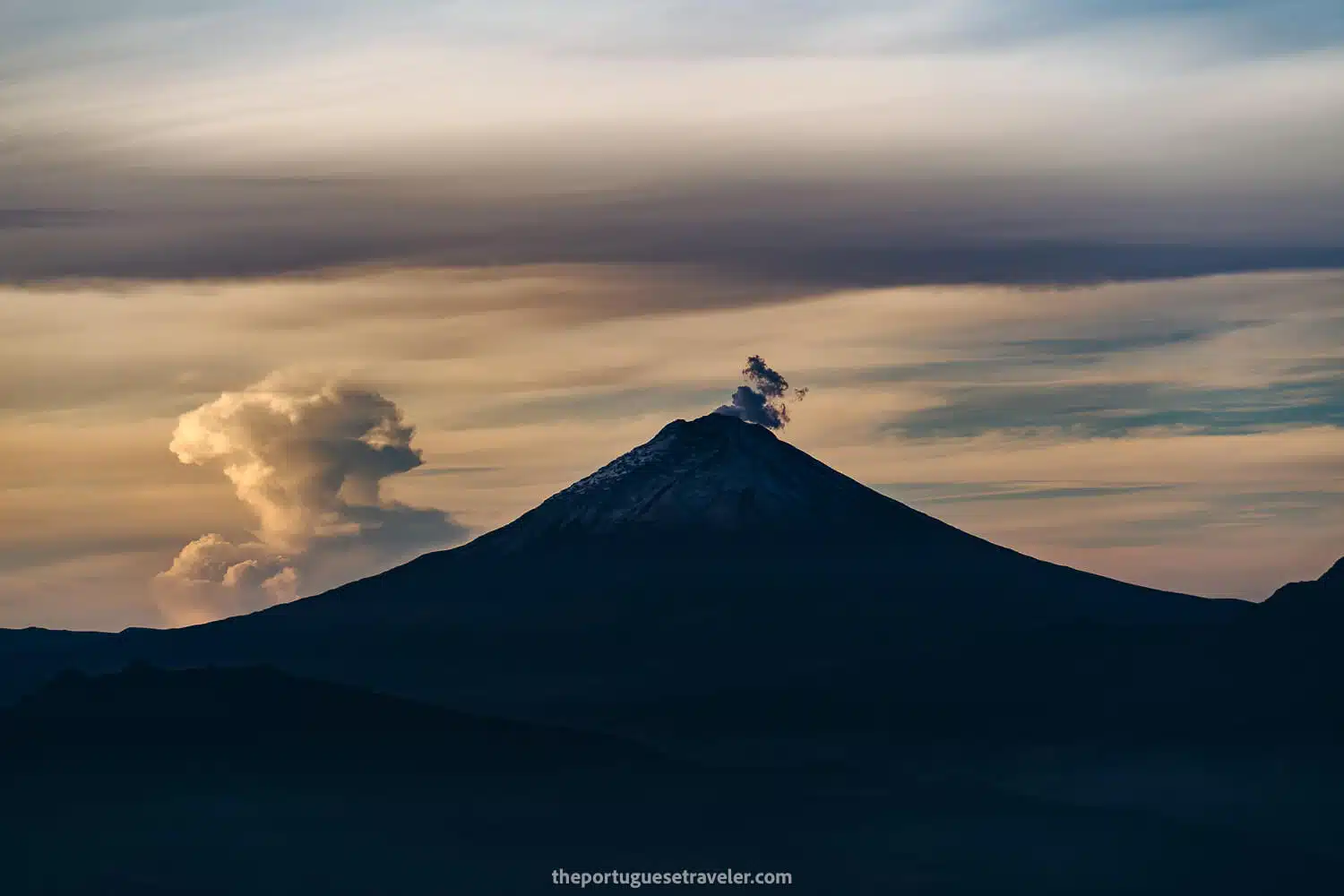
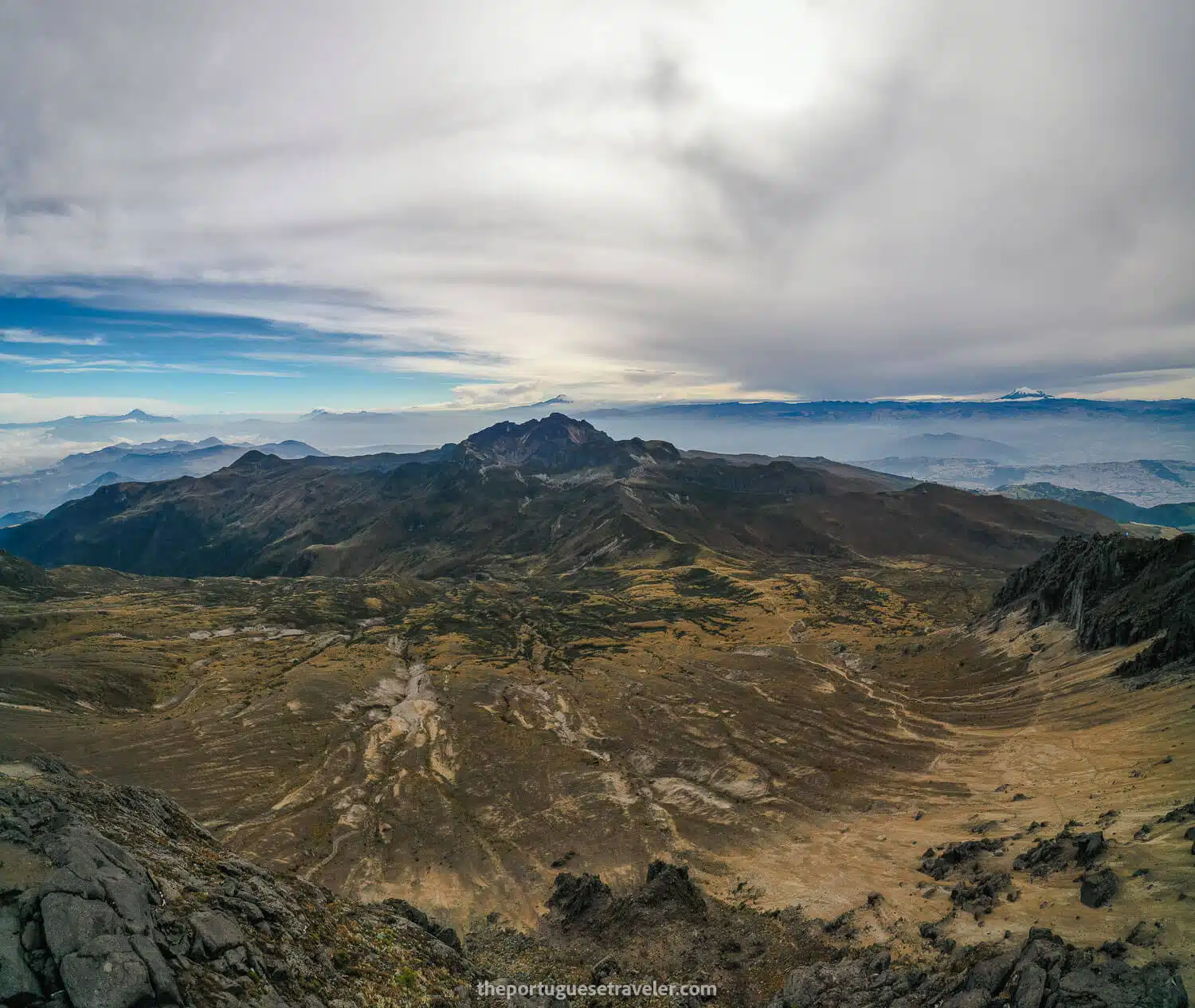
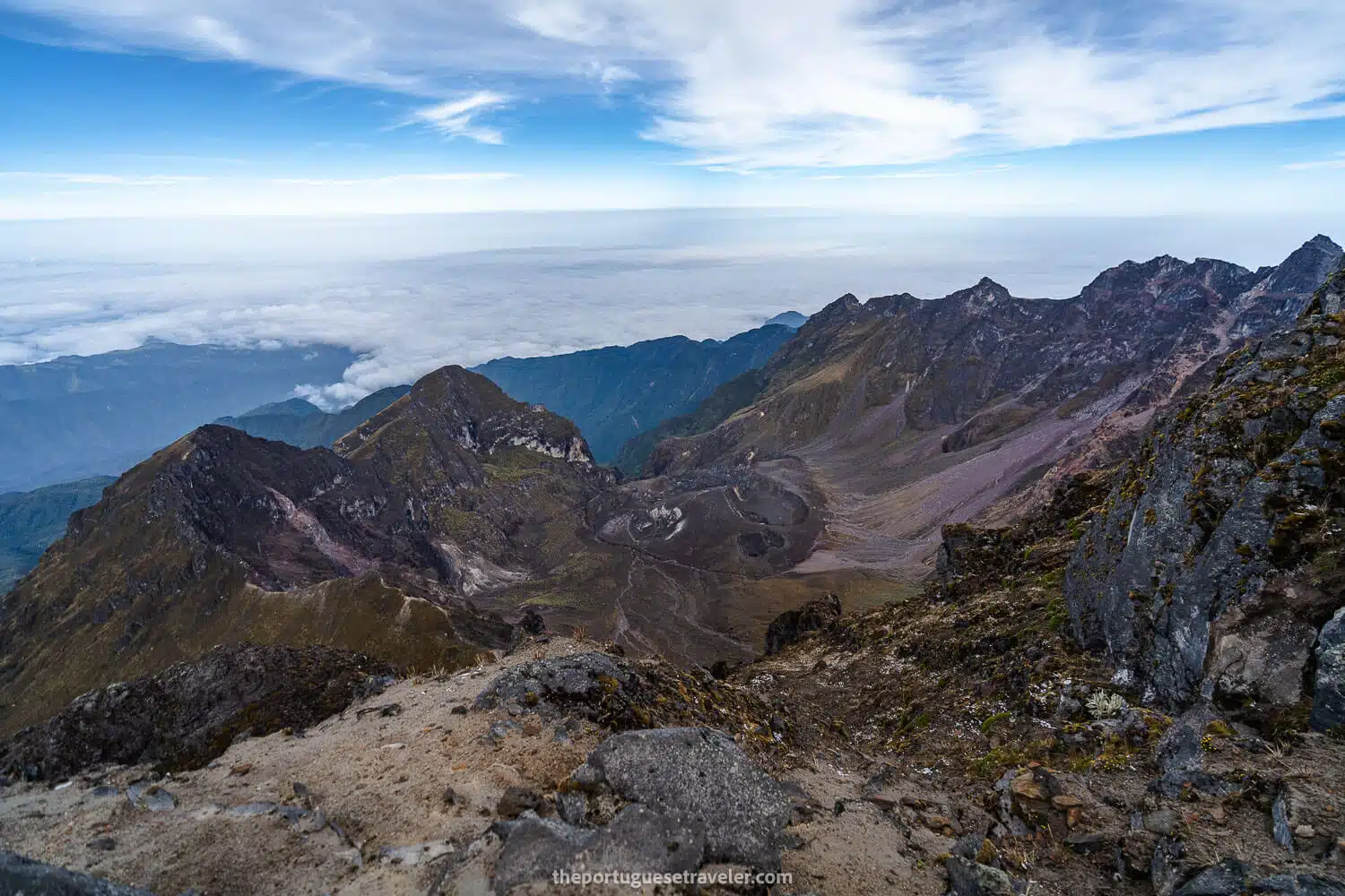
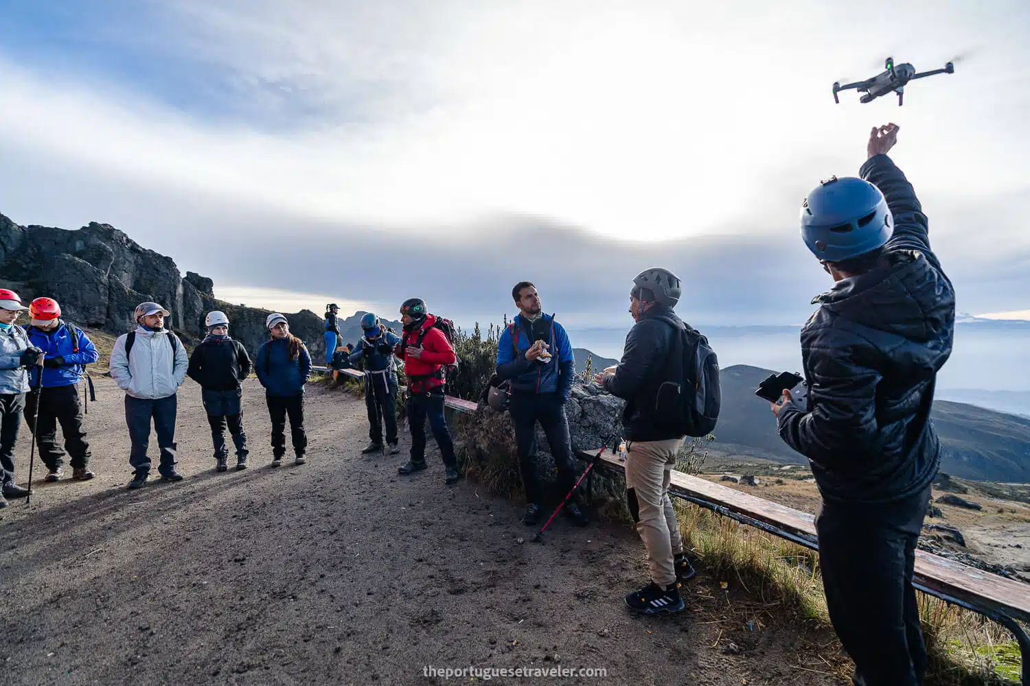
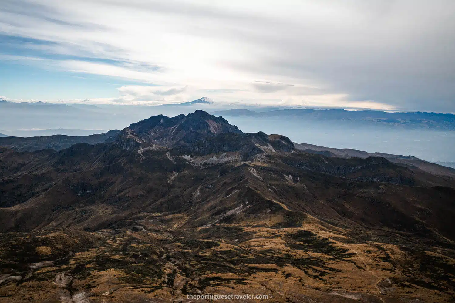
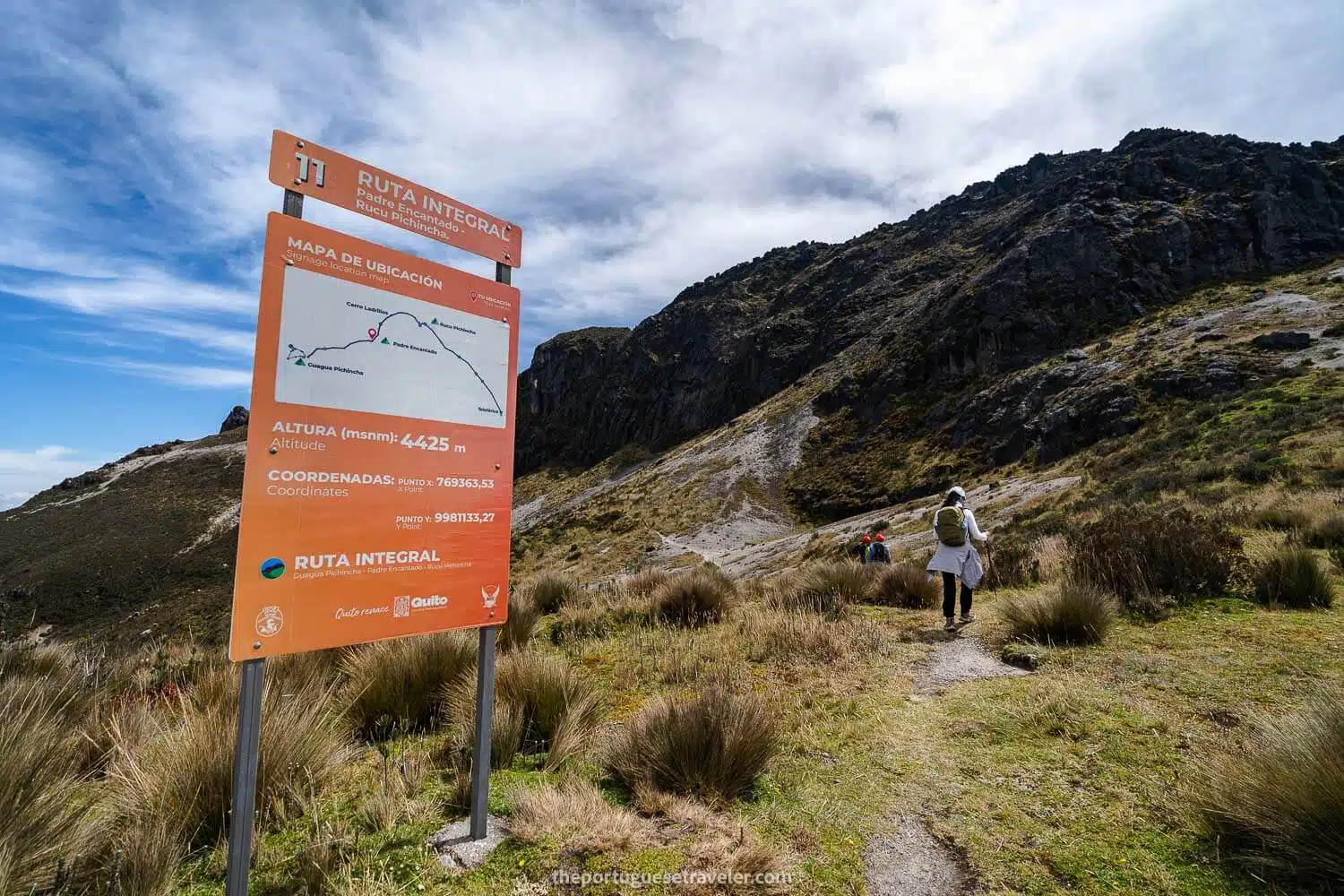
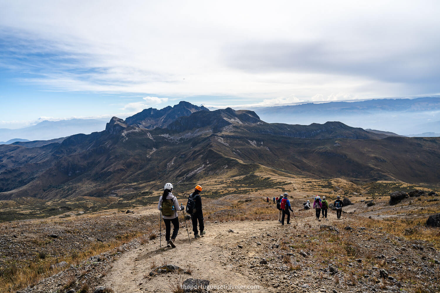
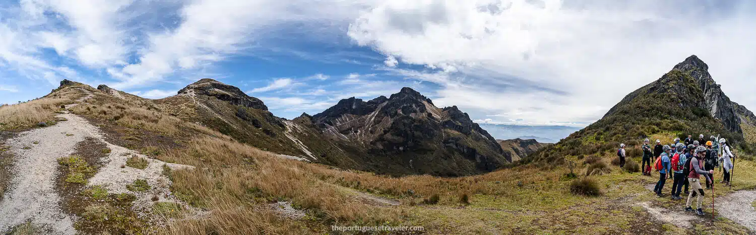
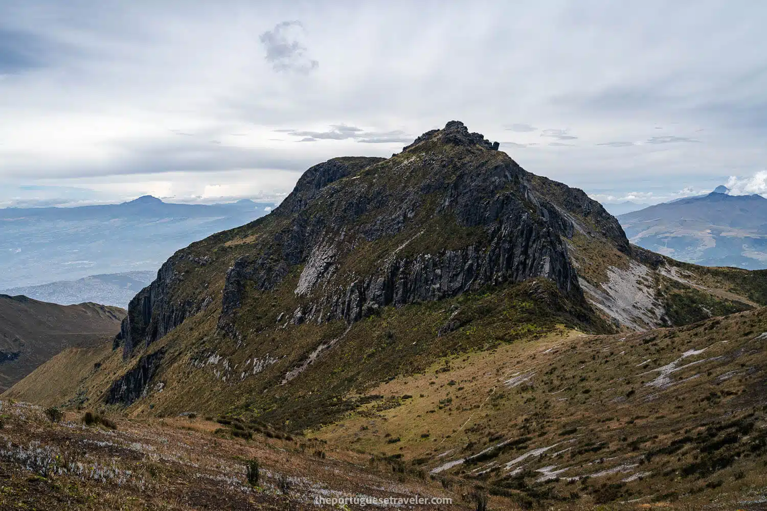
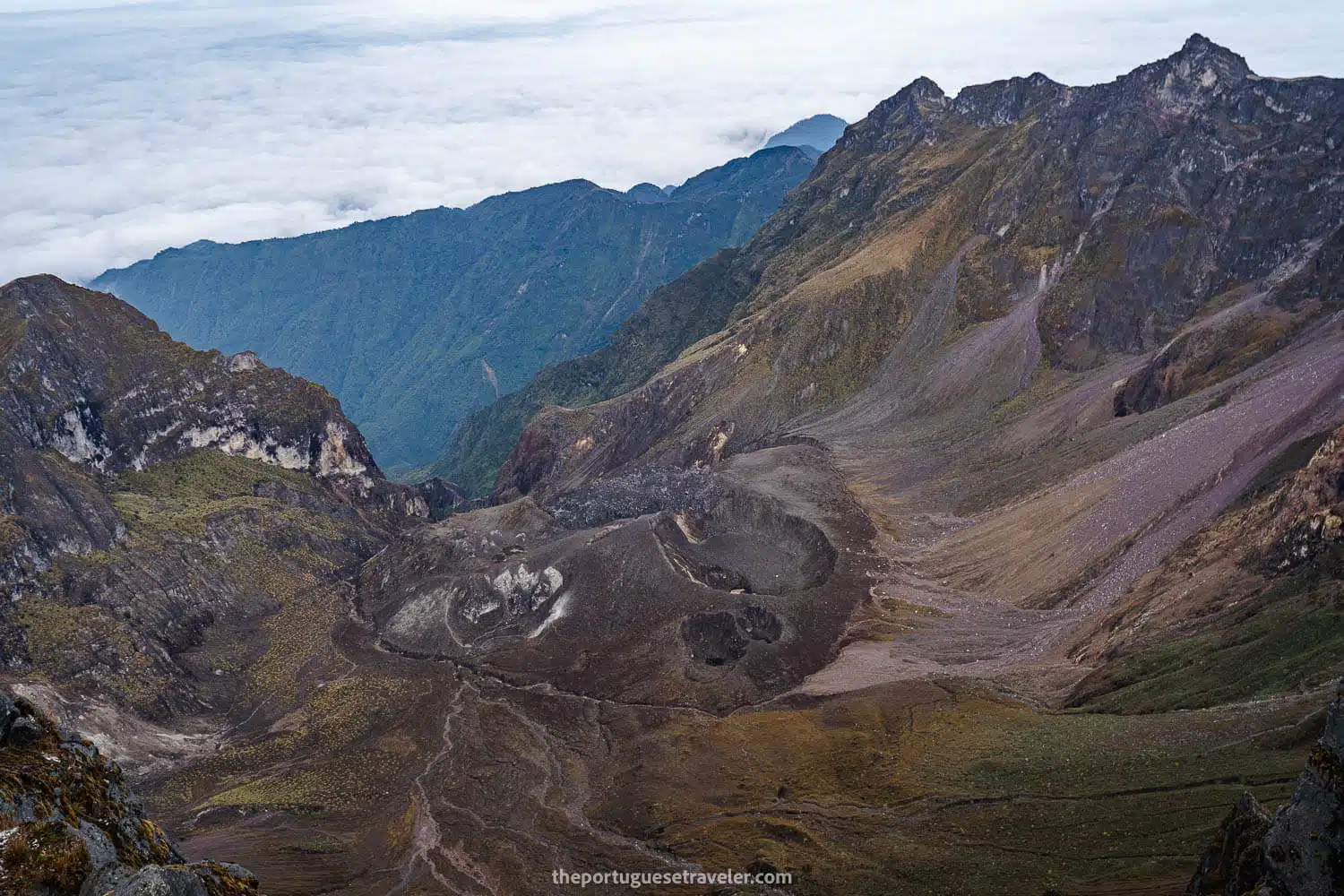
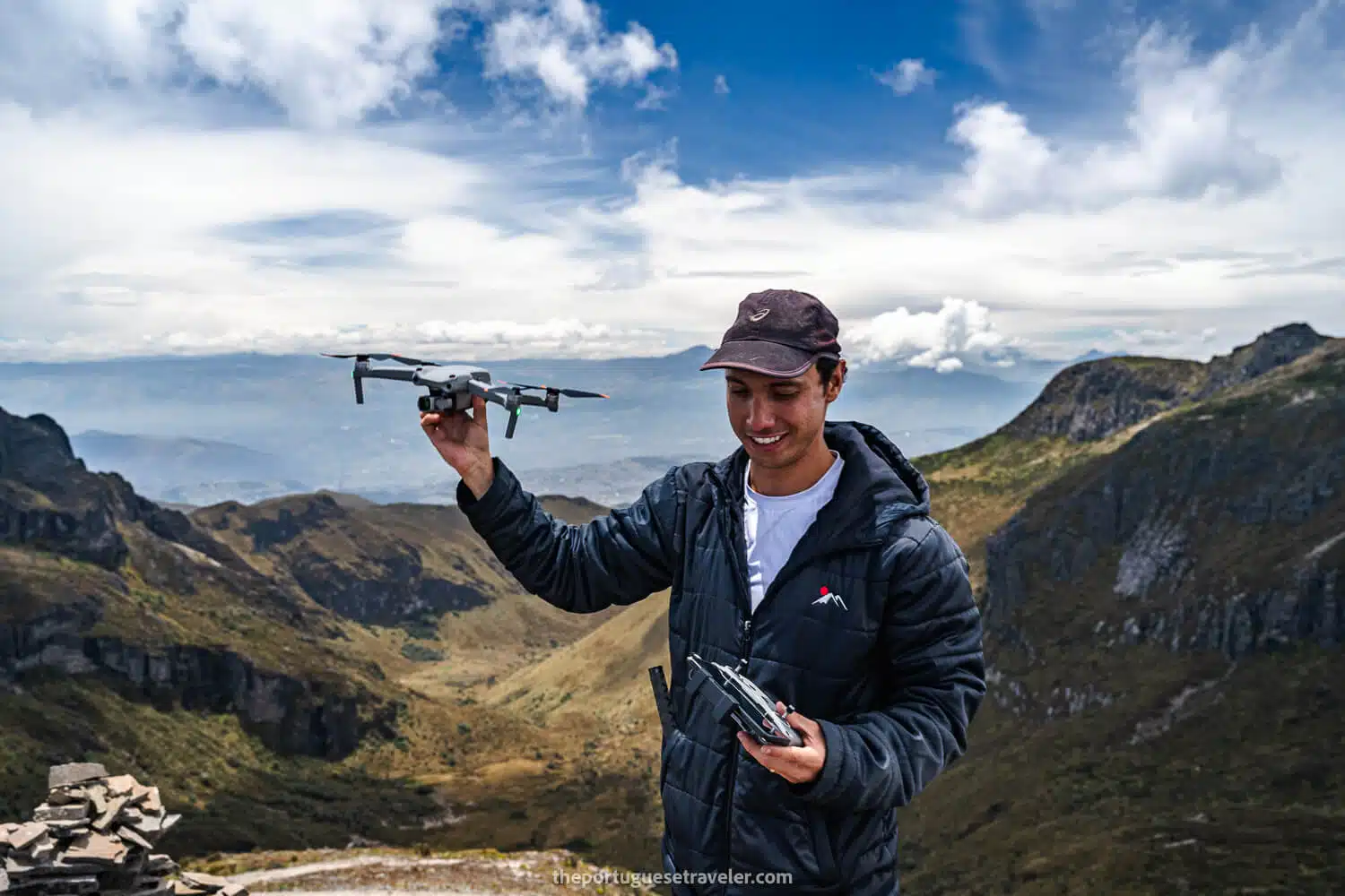
Once we got there, Dani, the co-founder of Mauna, and I flew our drones and got amazing shots of the group and the Guagua Pichincha crater with smoky fumaroles. After that, we retraced our steps a bit and made our way down in the direction of Rucu Pichincha Volcano. First, we stumbled upon Padre Encantado Hill, which we didn’t summit as it would add more than an hour to the hike, and we moved directly to Cerro Ladrillos Hill.

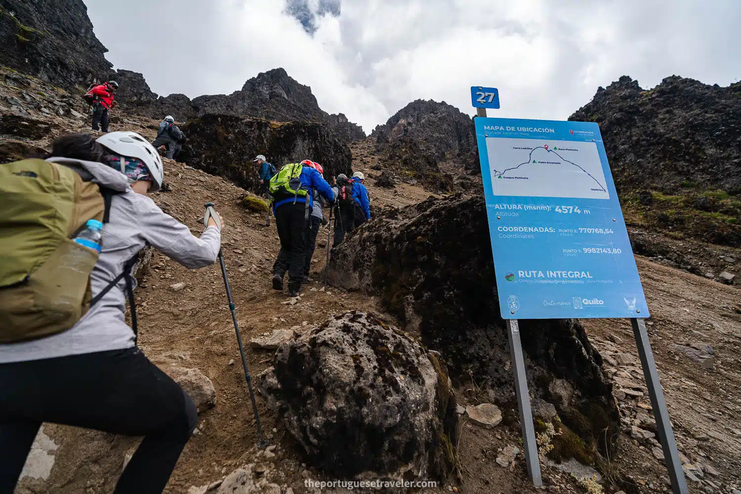
Last year, my group of friends climbed Padre Encantado, and I didn’t due to hail, cold, and the goal to summit both Pichinchas, not the middle hills.

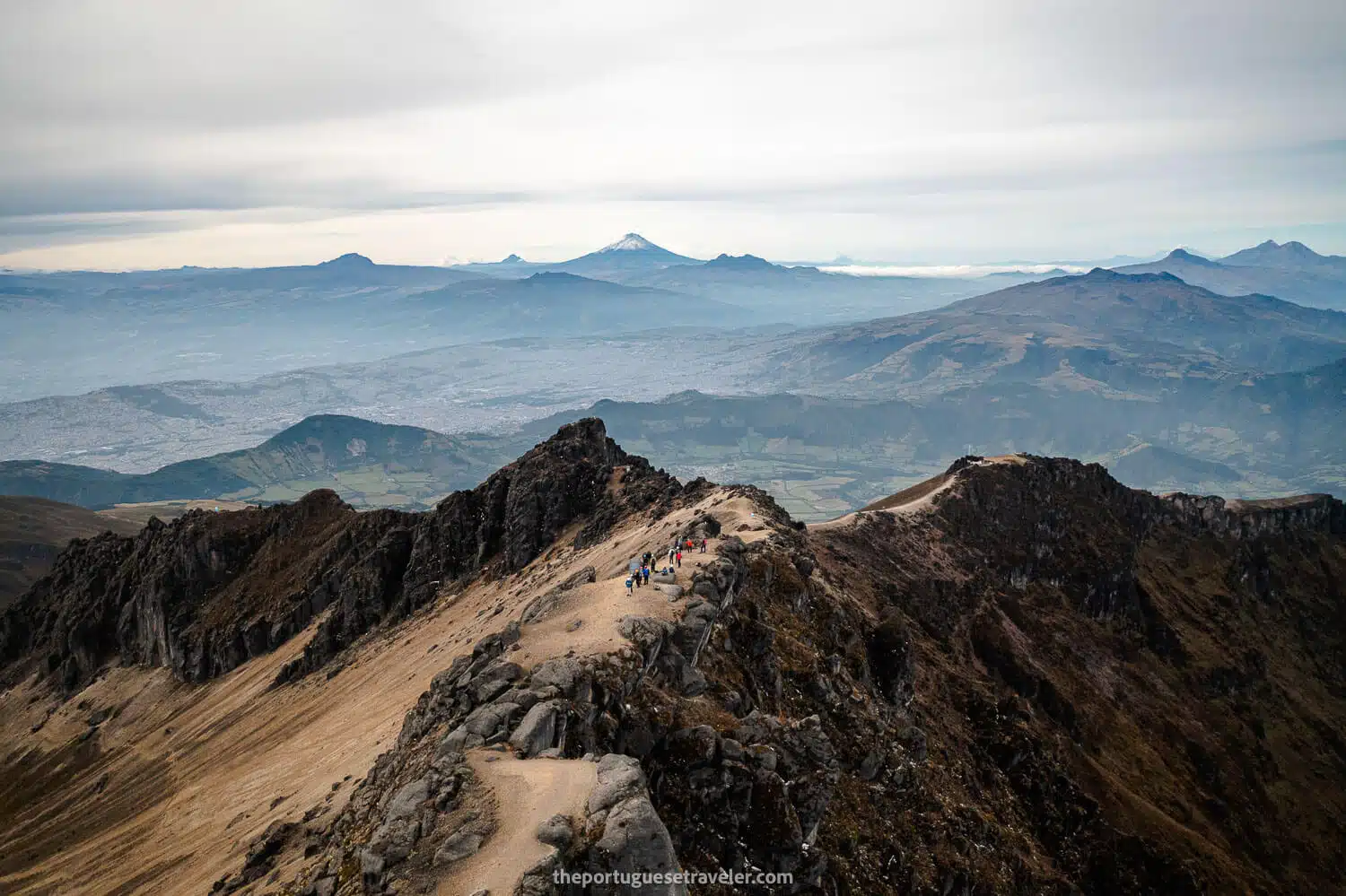
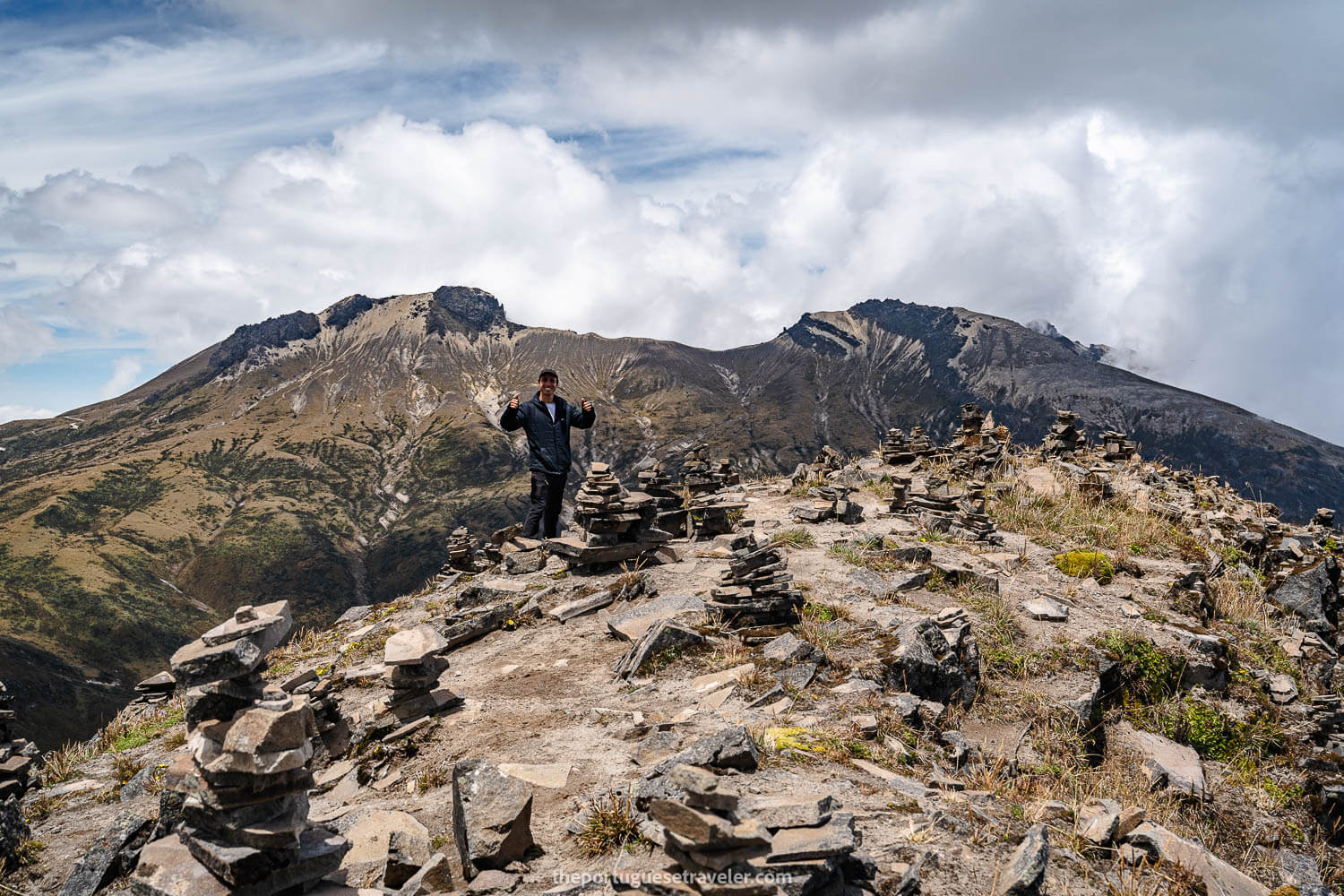
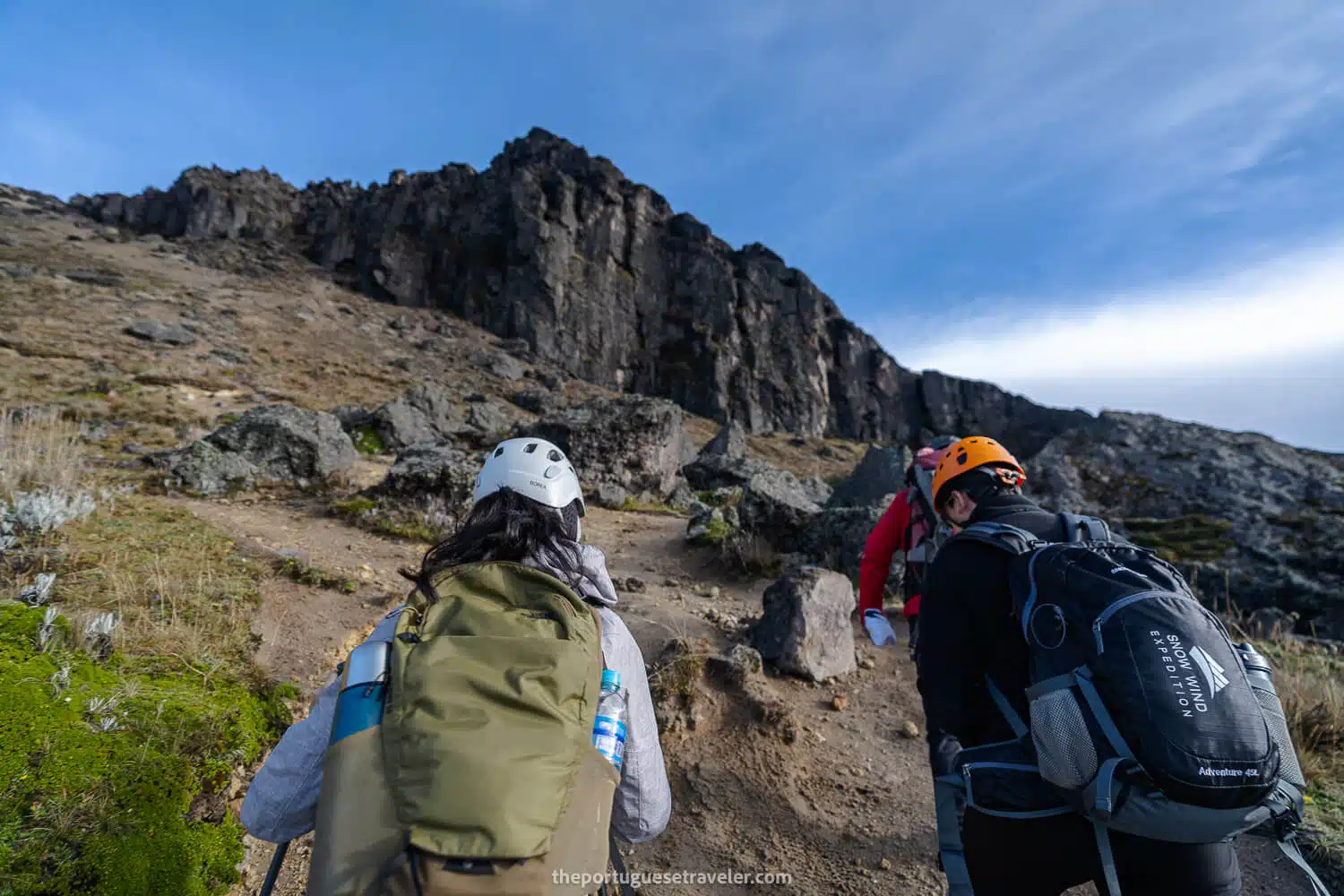
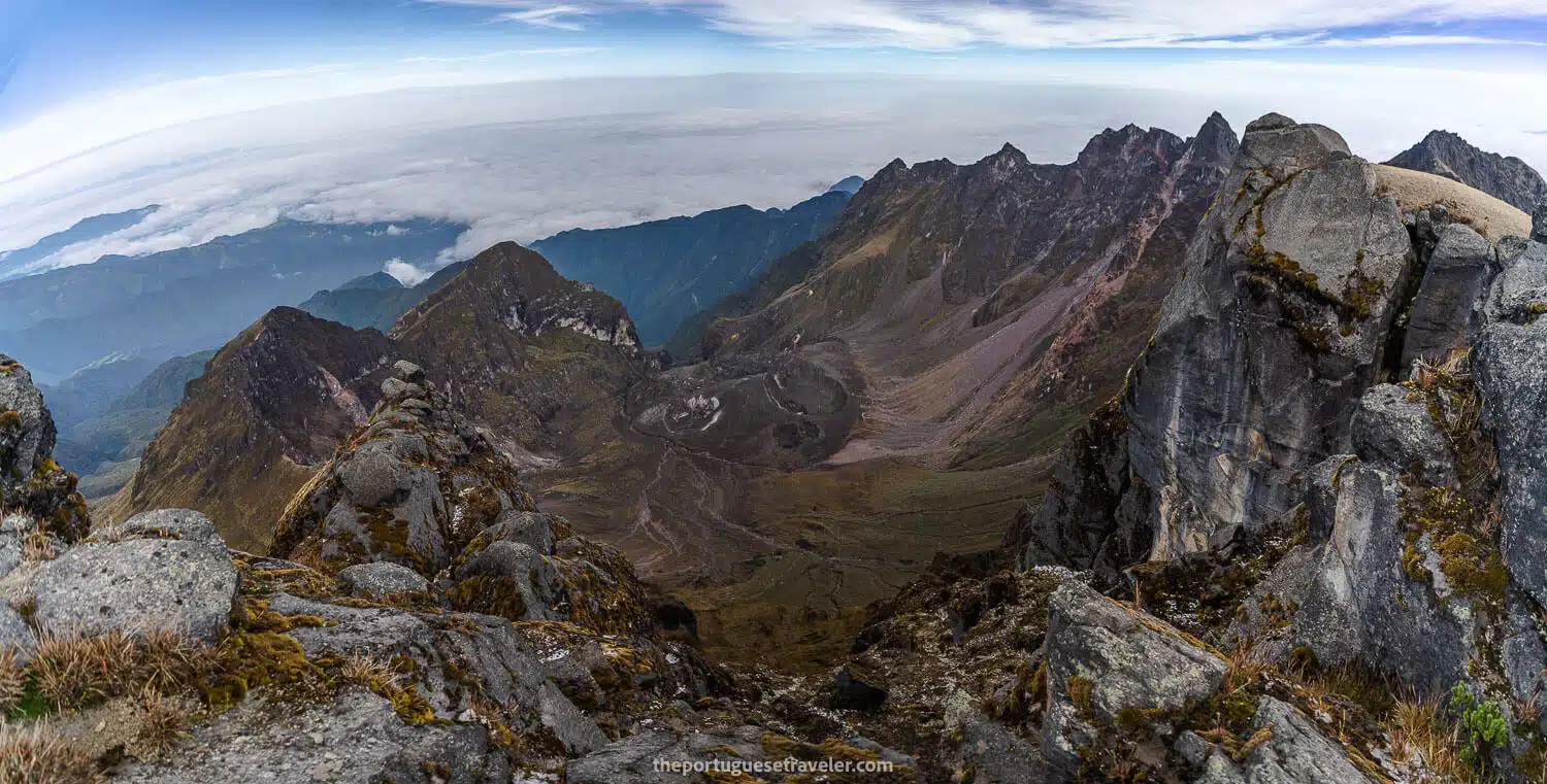
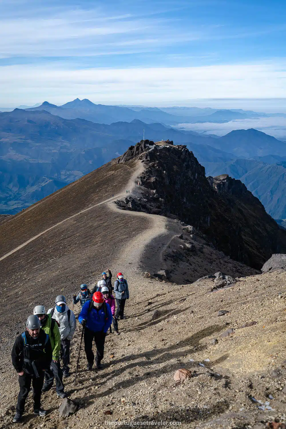
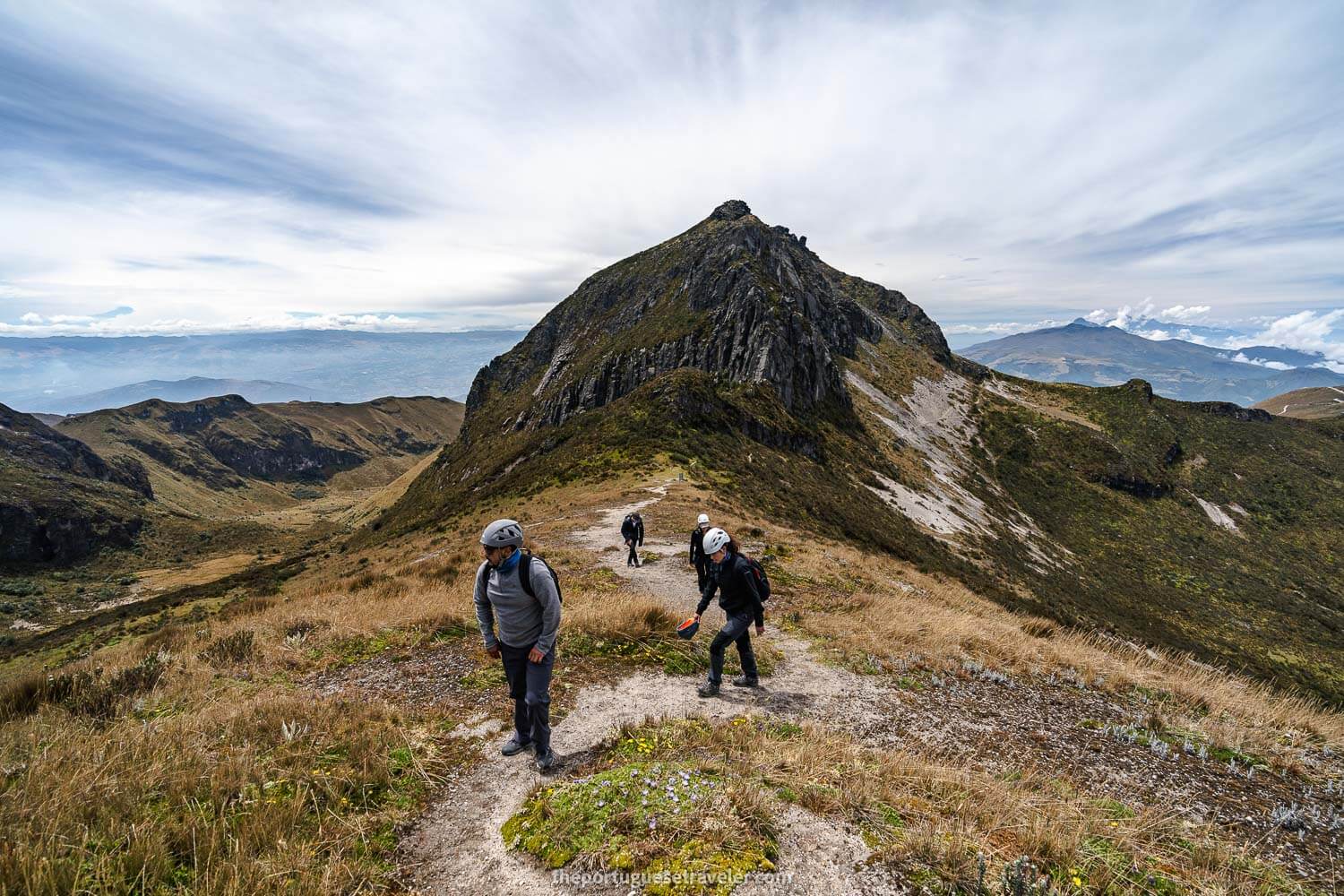
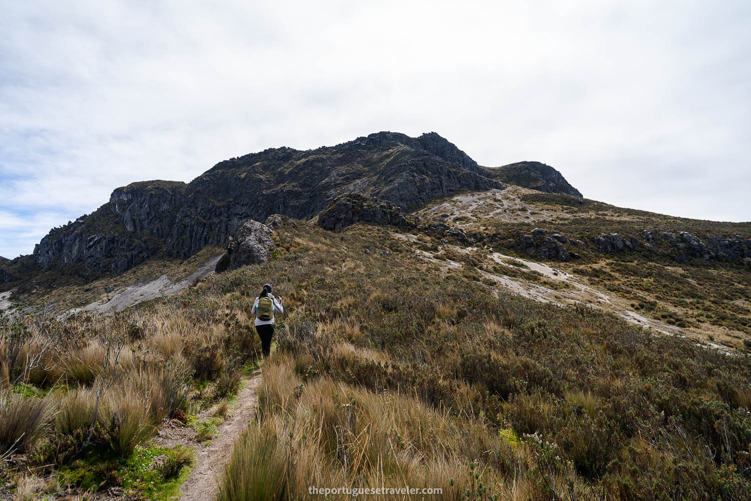
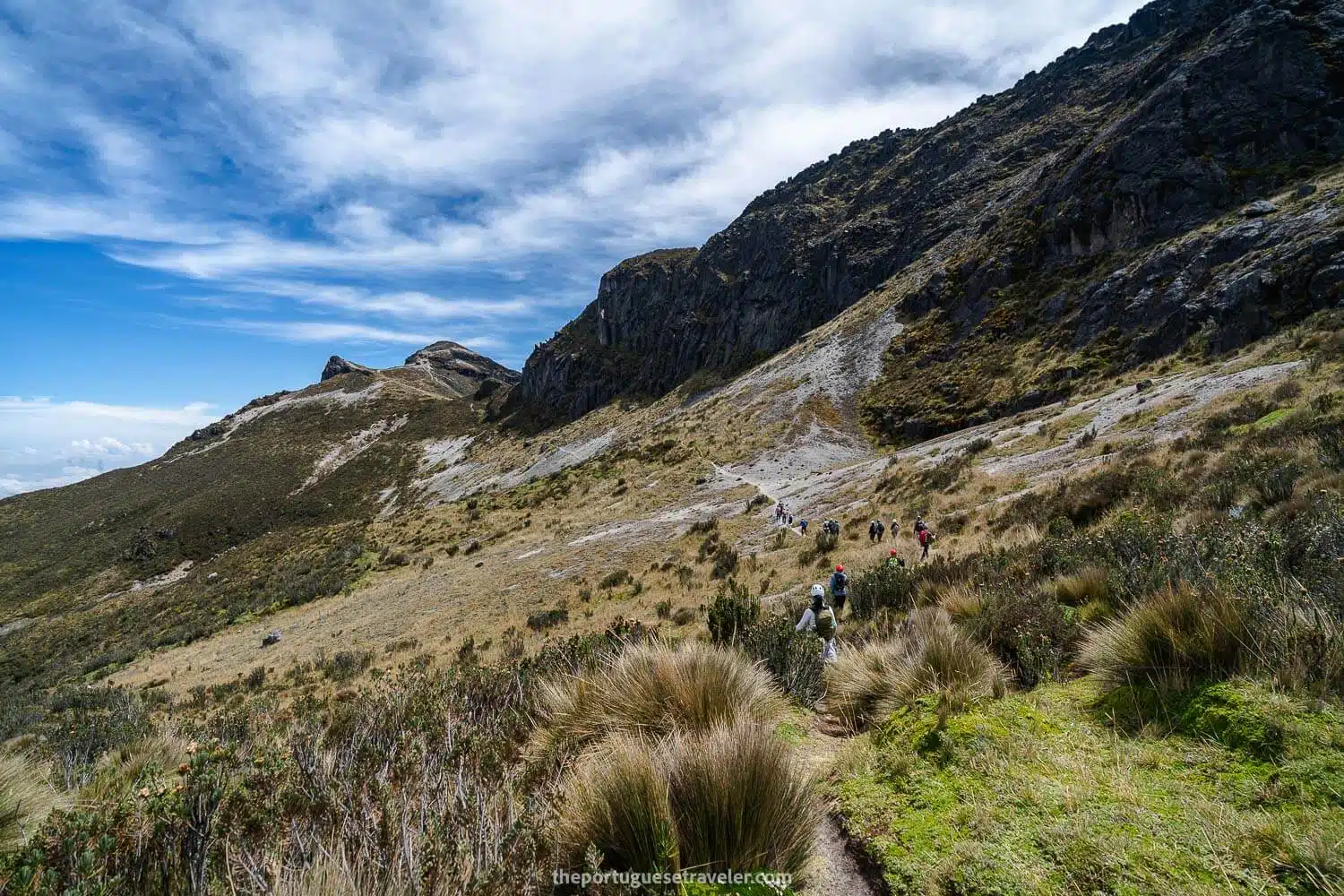
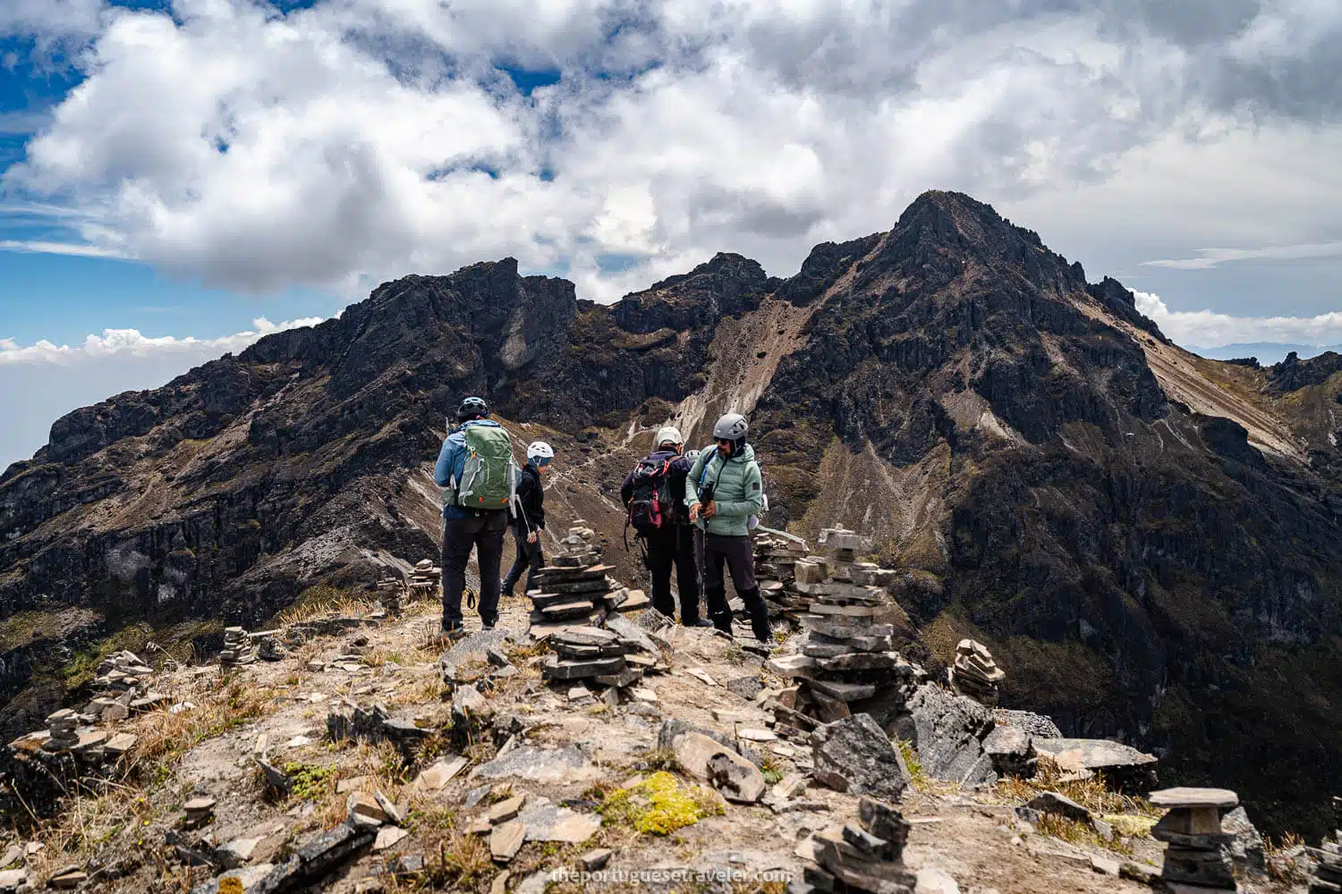
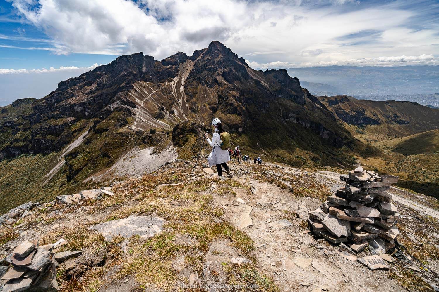
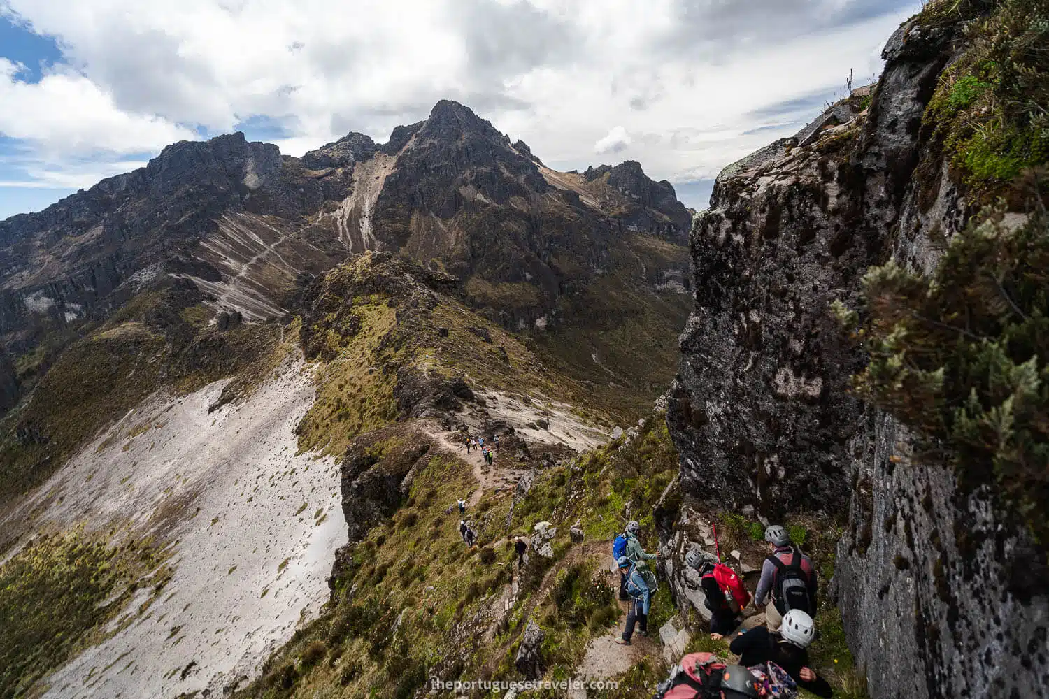
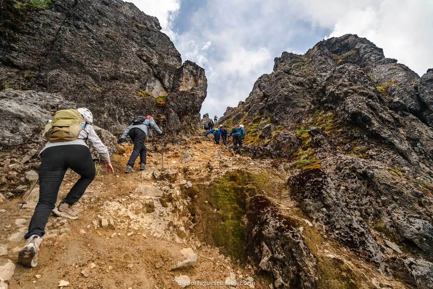
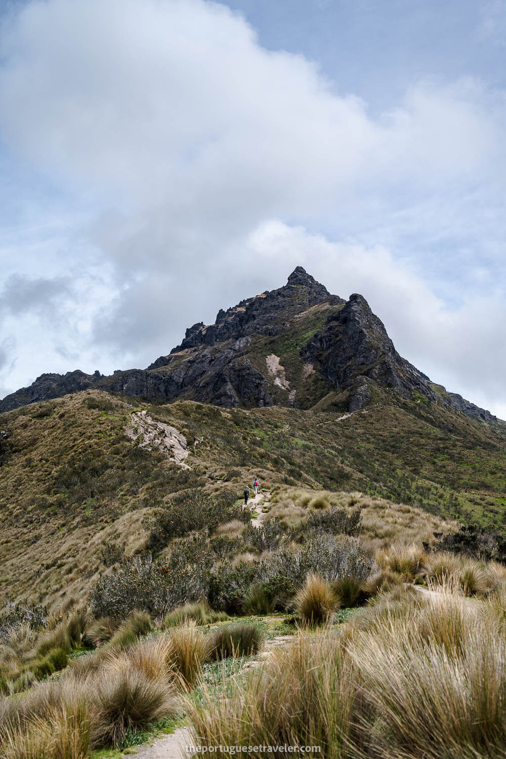
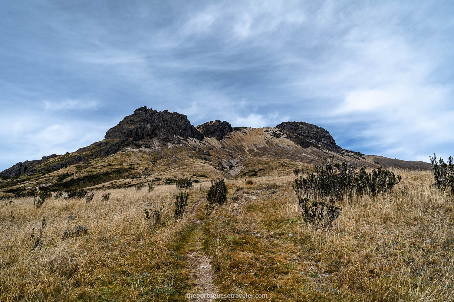
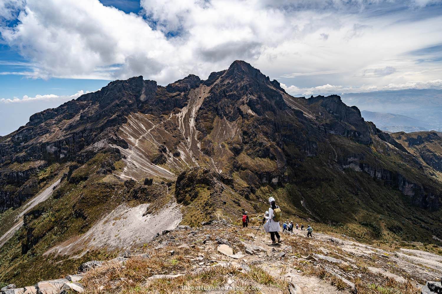
This time we did climb Cerro Ladrillos, and we could understand why it’s named that way. There were dozens of cairns there, hiker-made little rock pyramids.

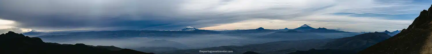
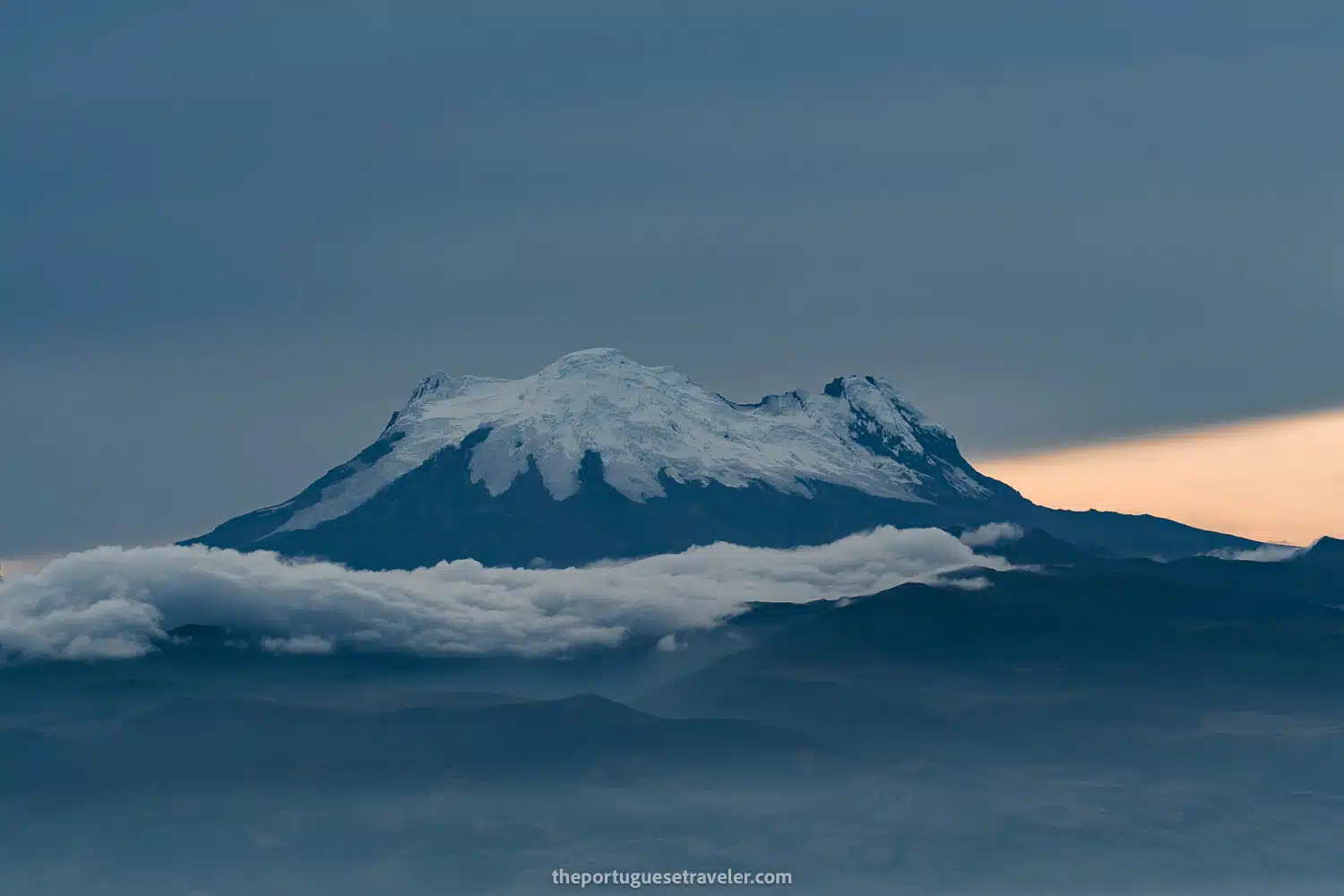
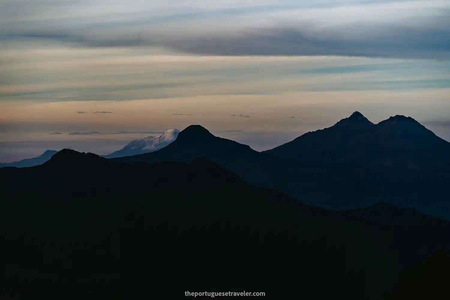
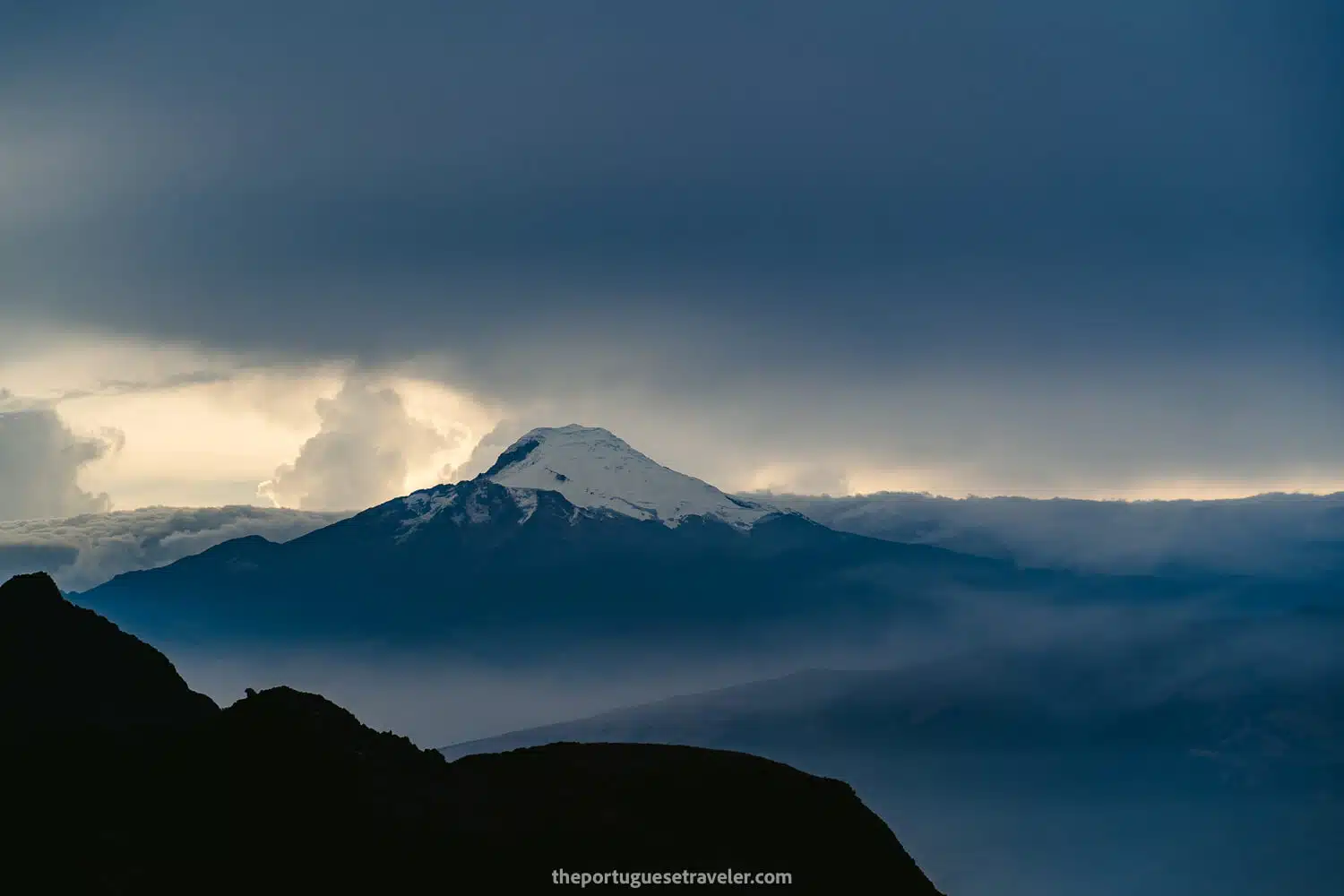
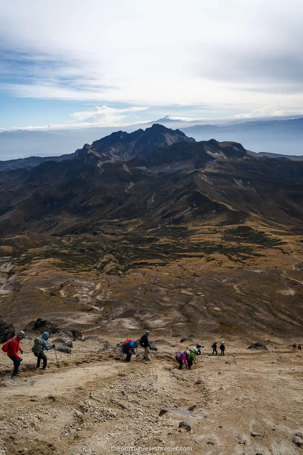
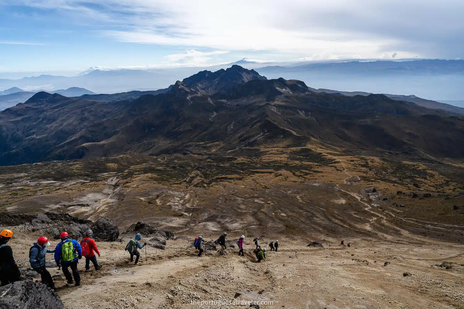
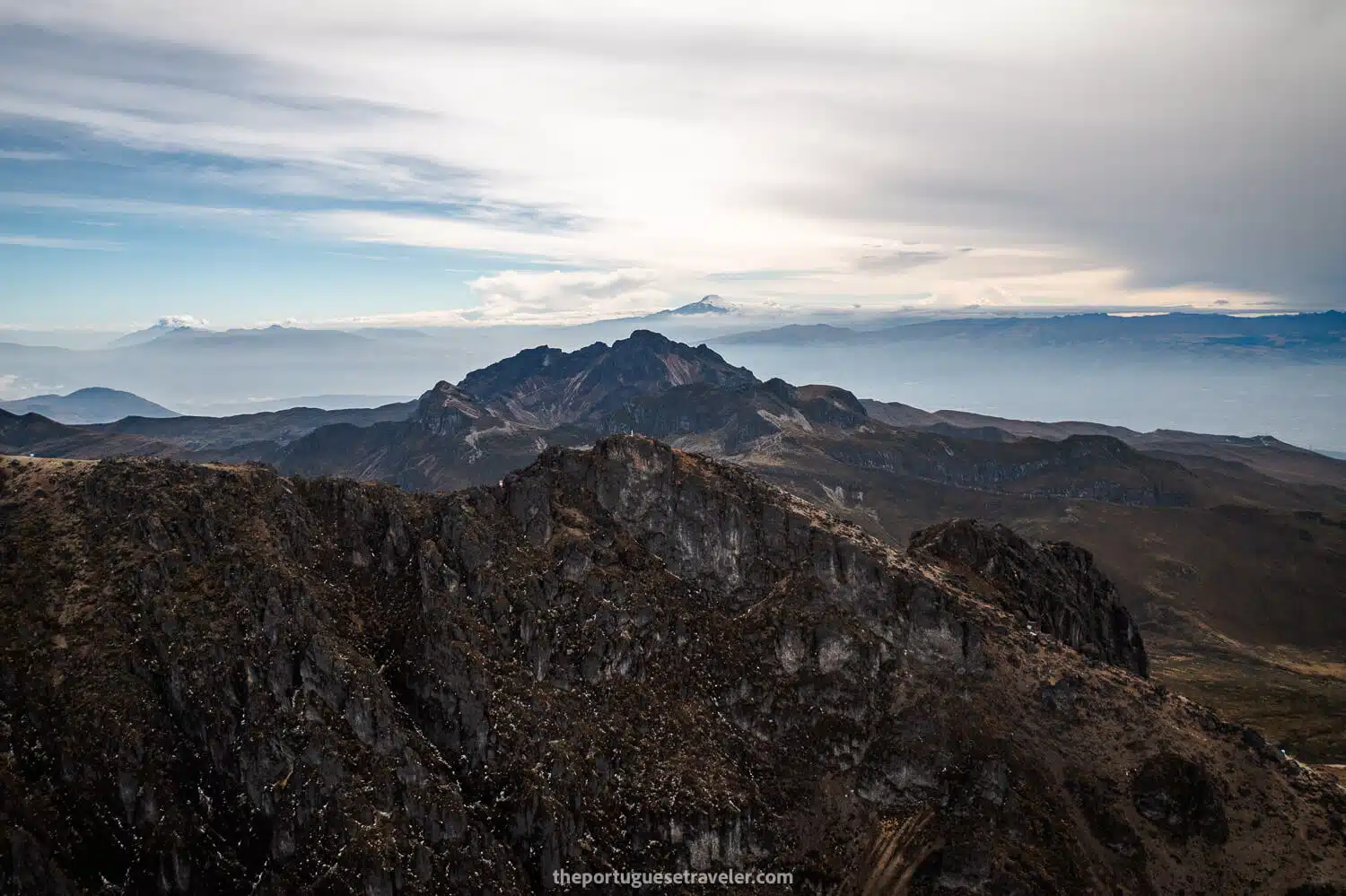
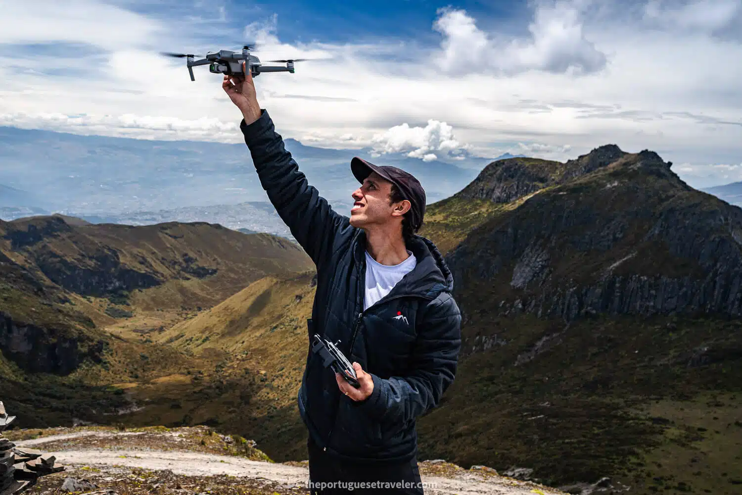
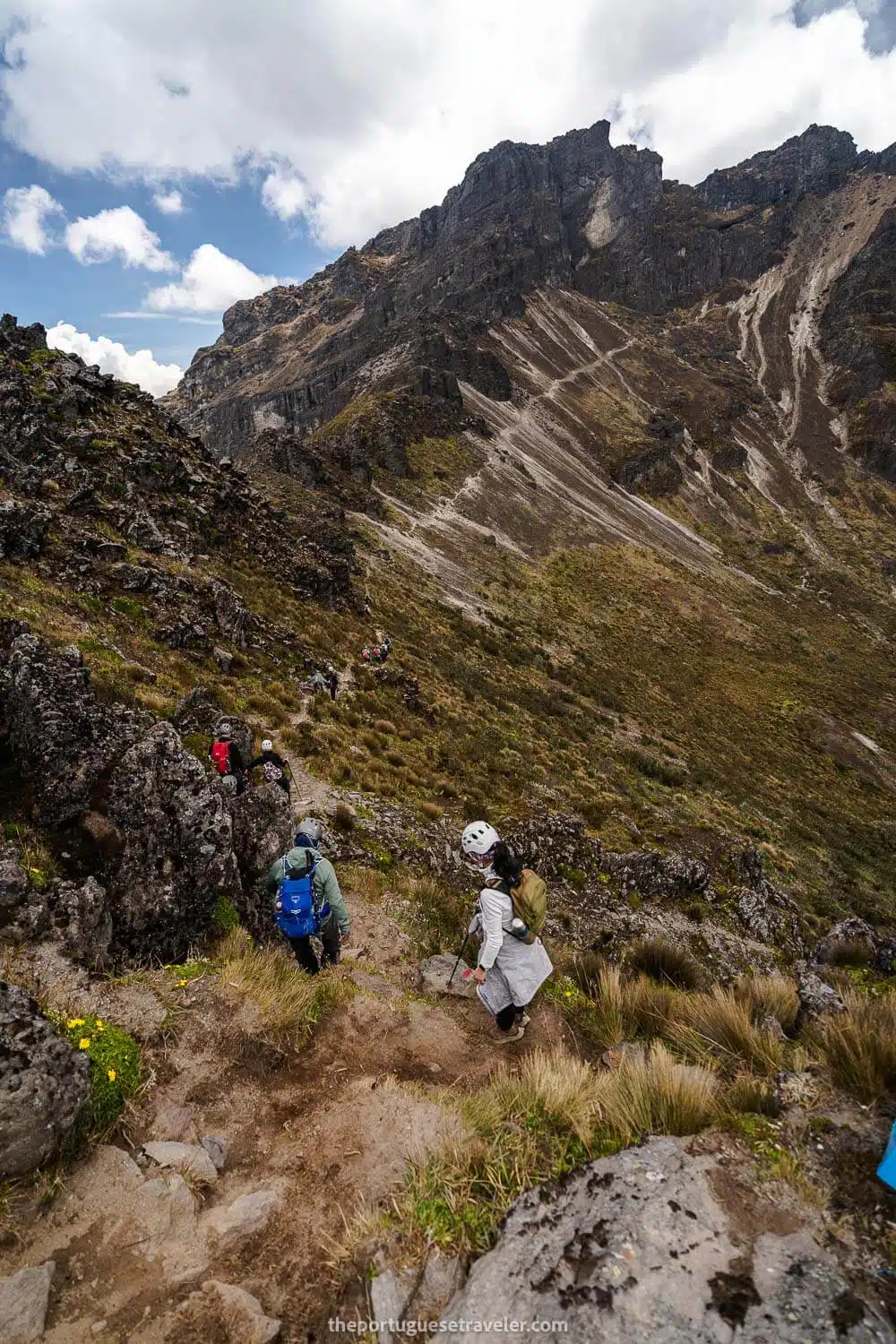
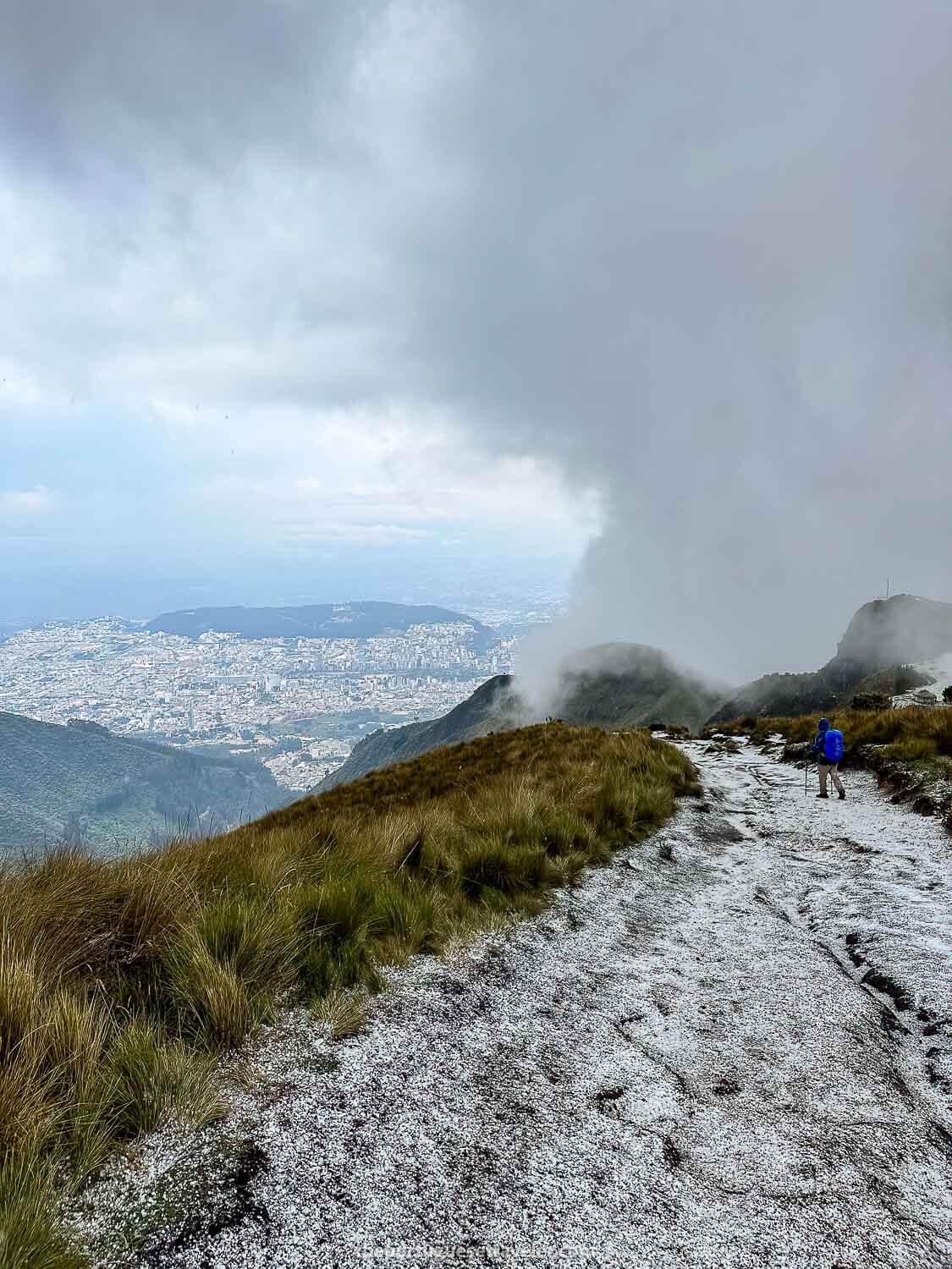
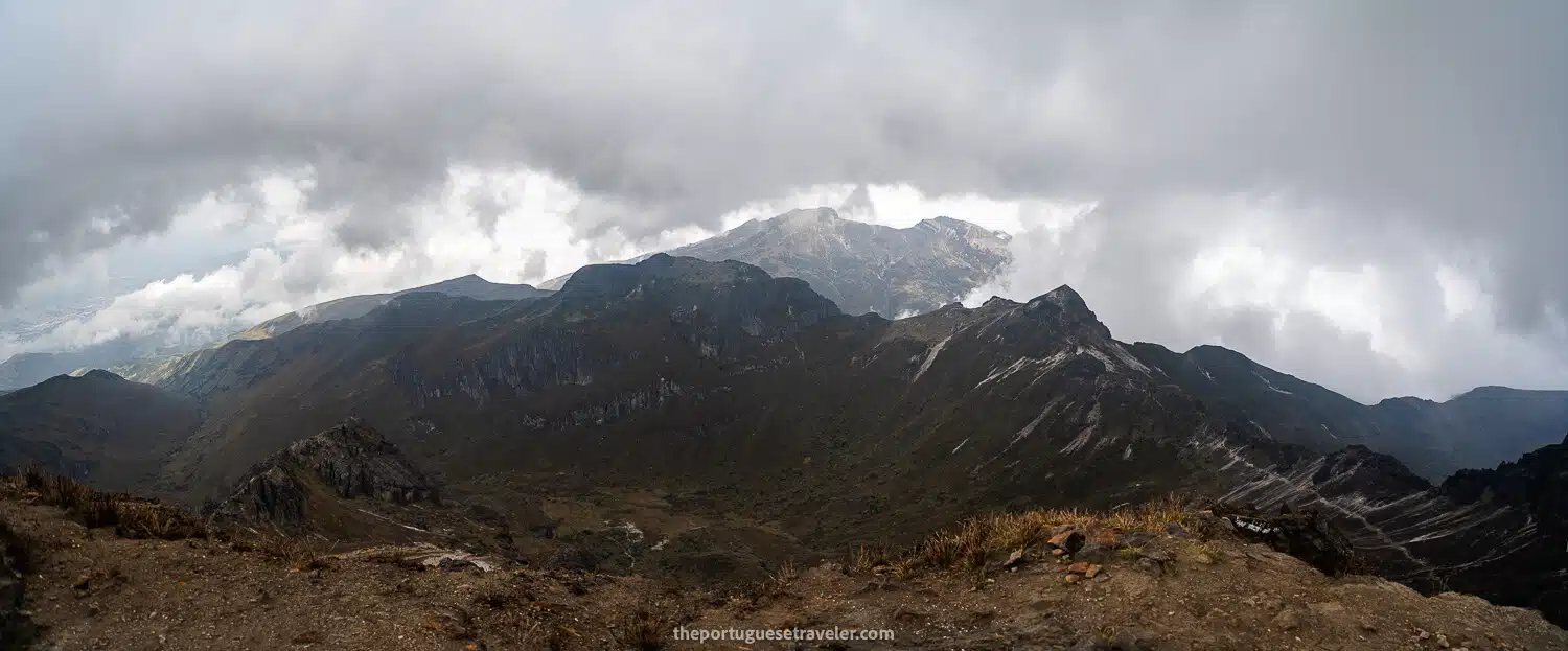
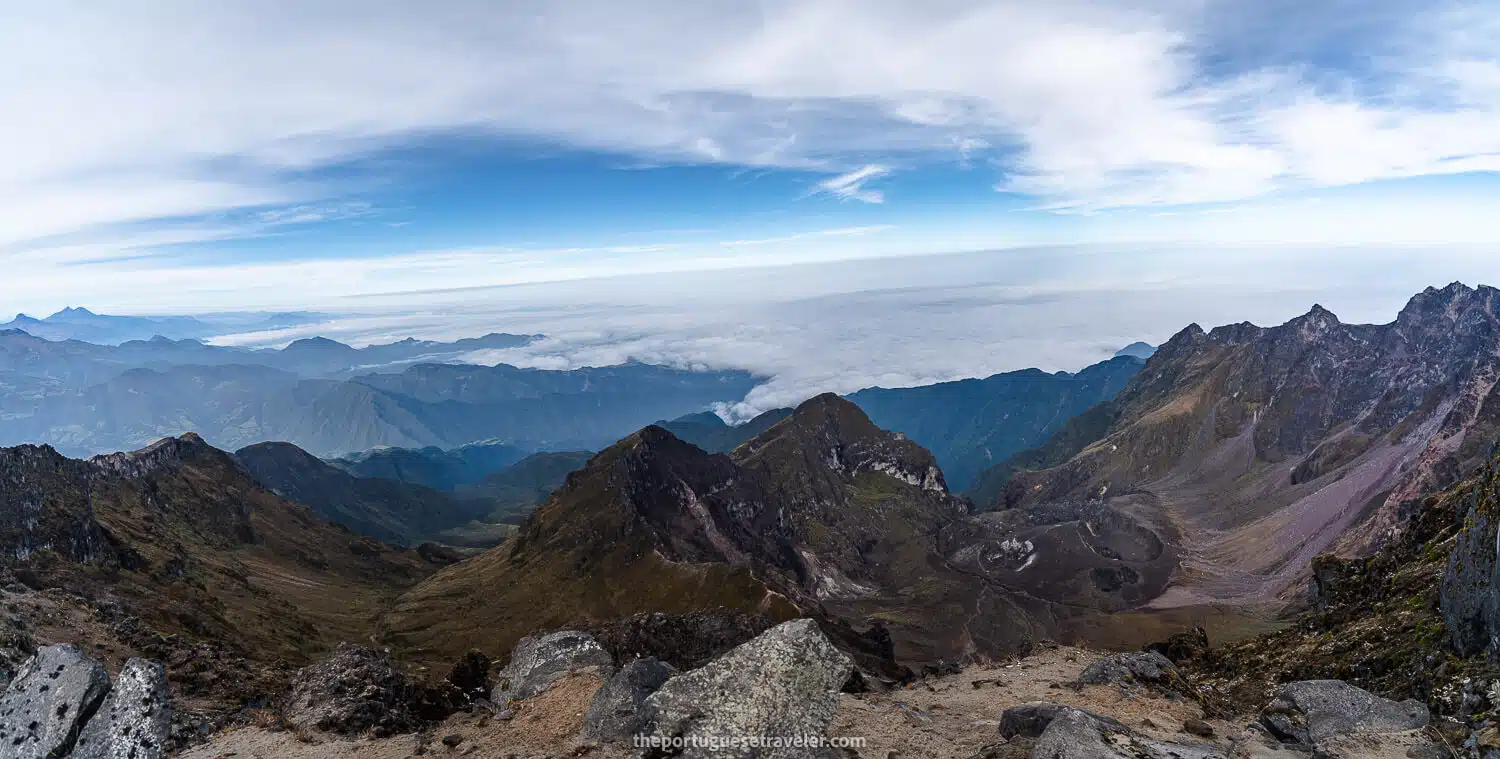
Once we were on top, we had lunch, Dani flew his drone again, and we could see that already half the volcanoes were starting to be hidden by clouds.

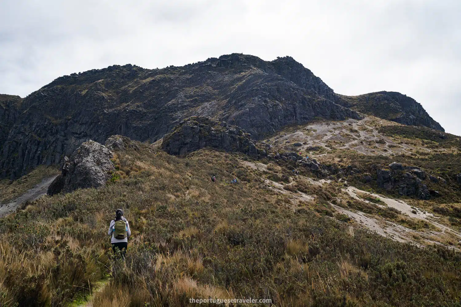
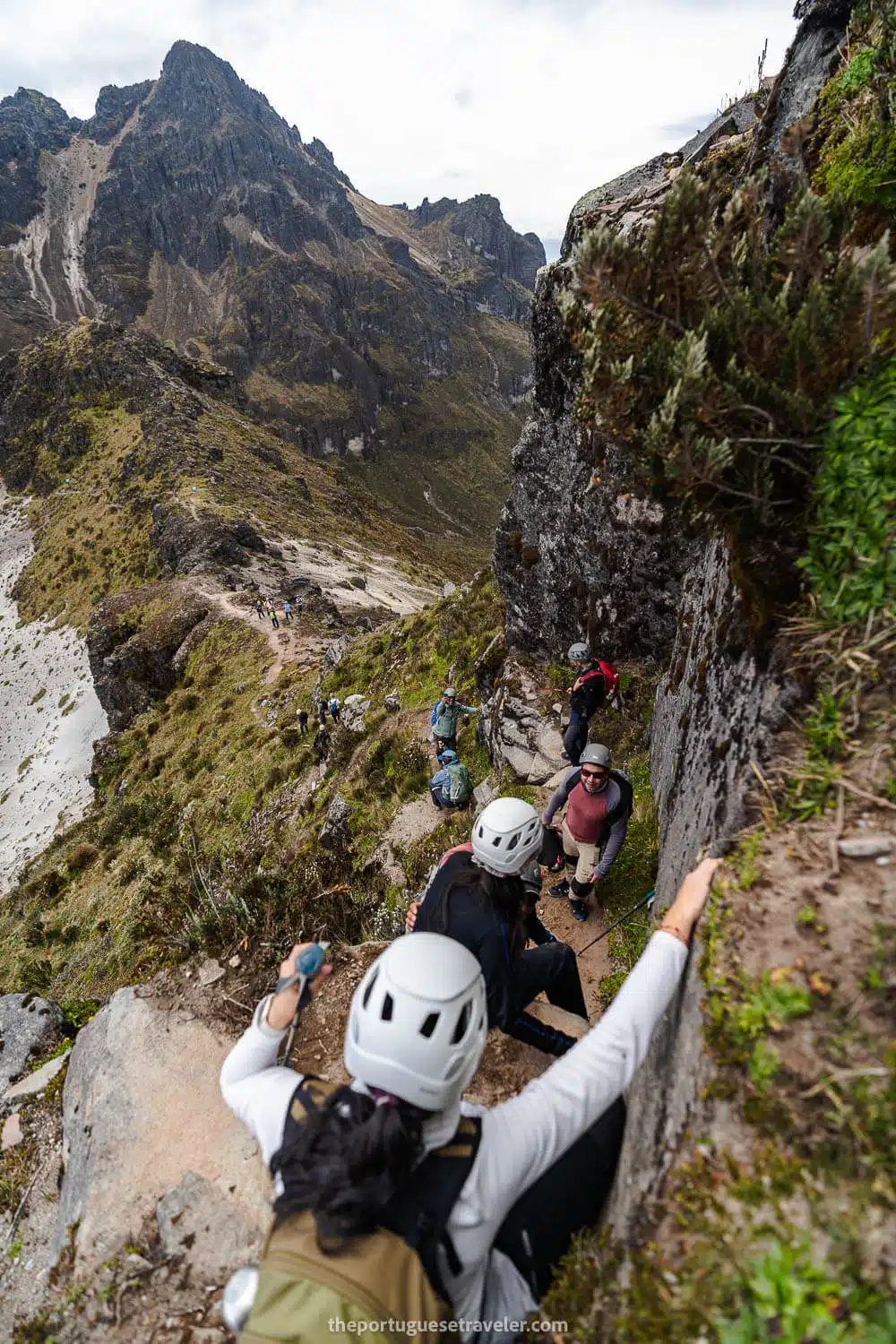
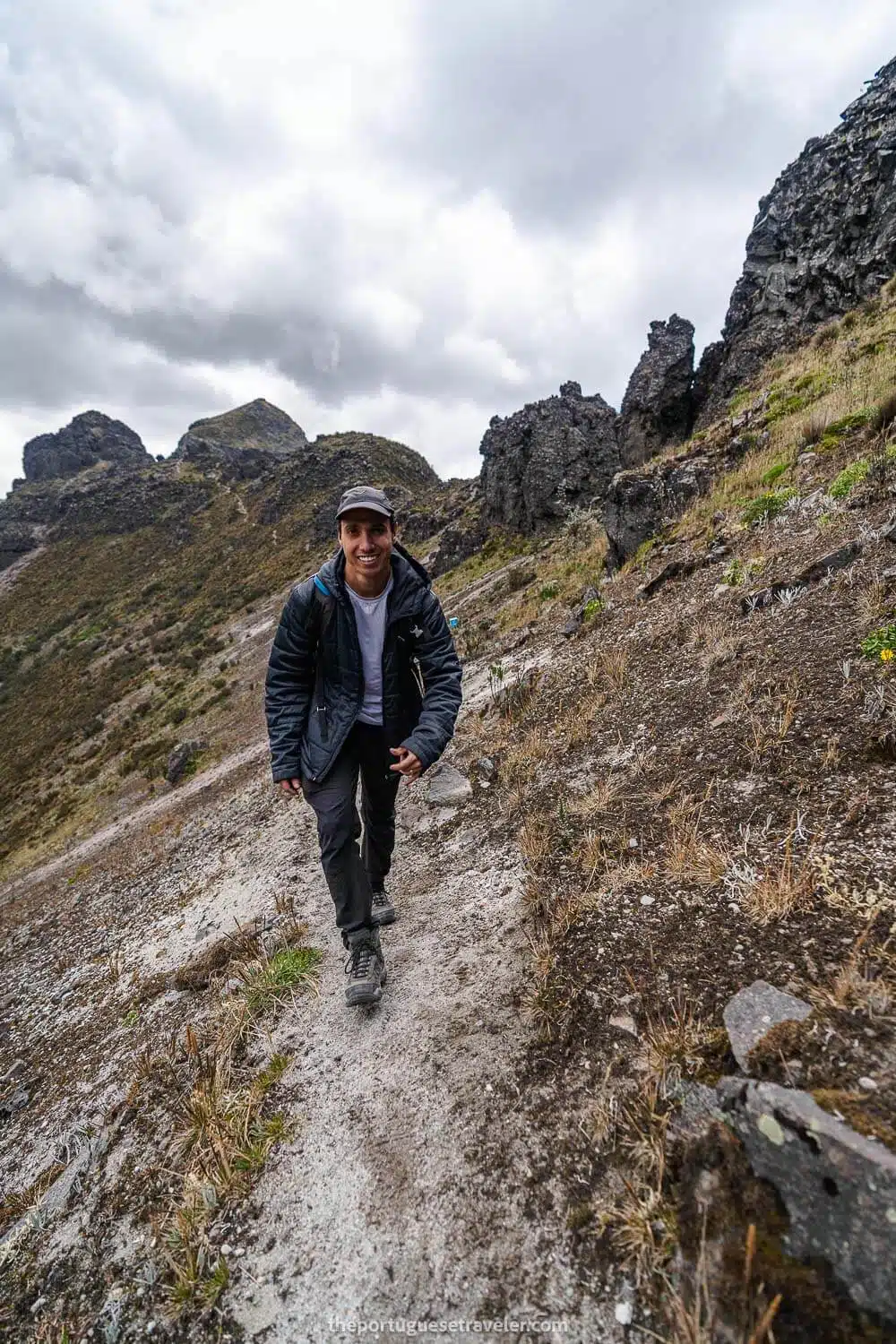
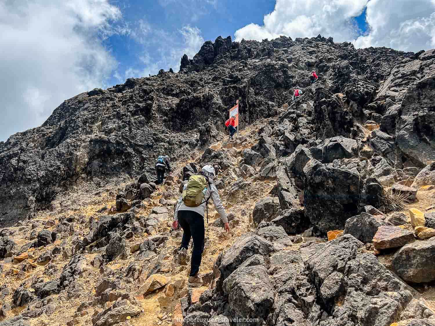
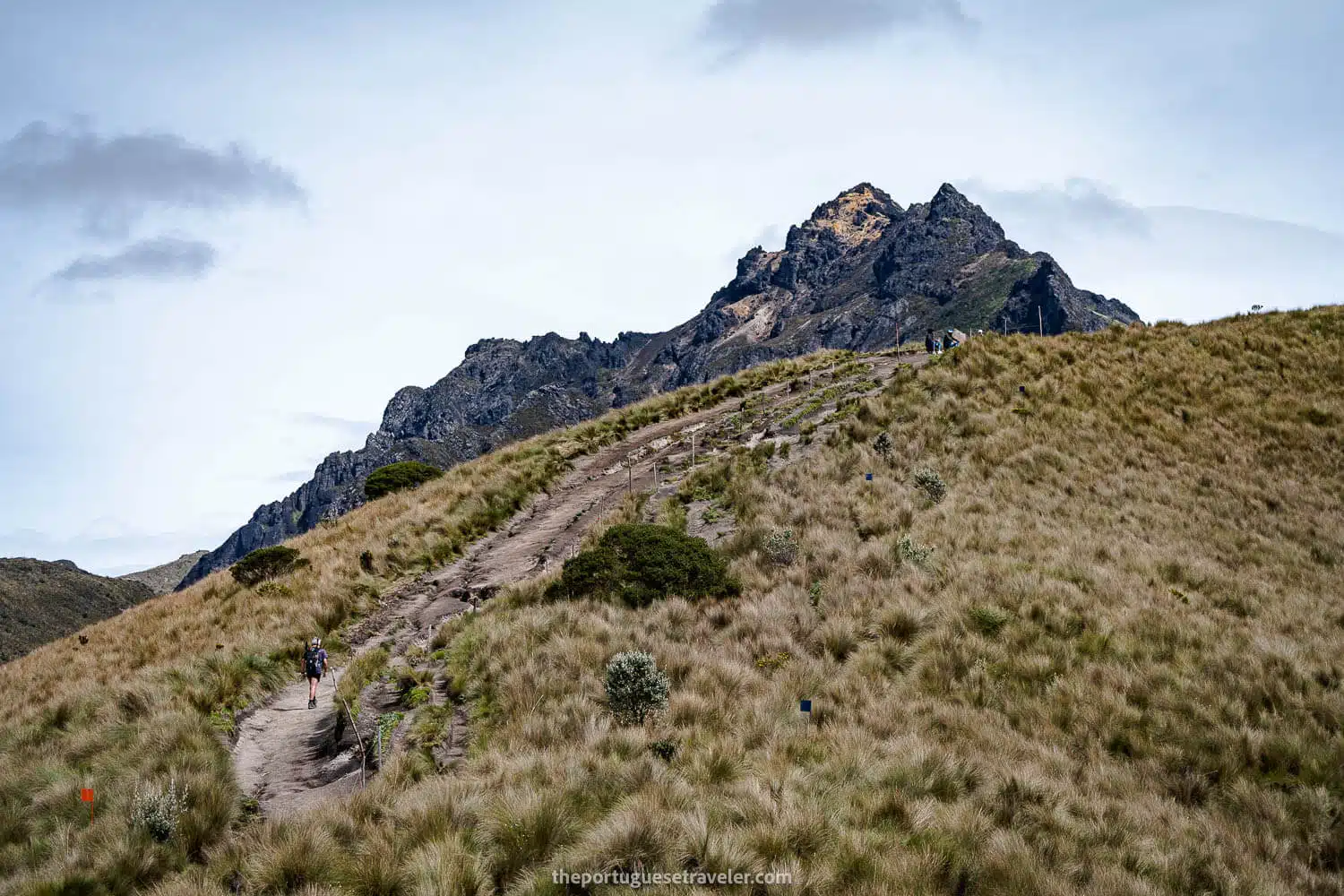
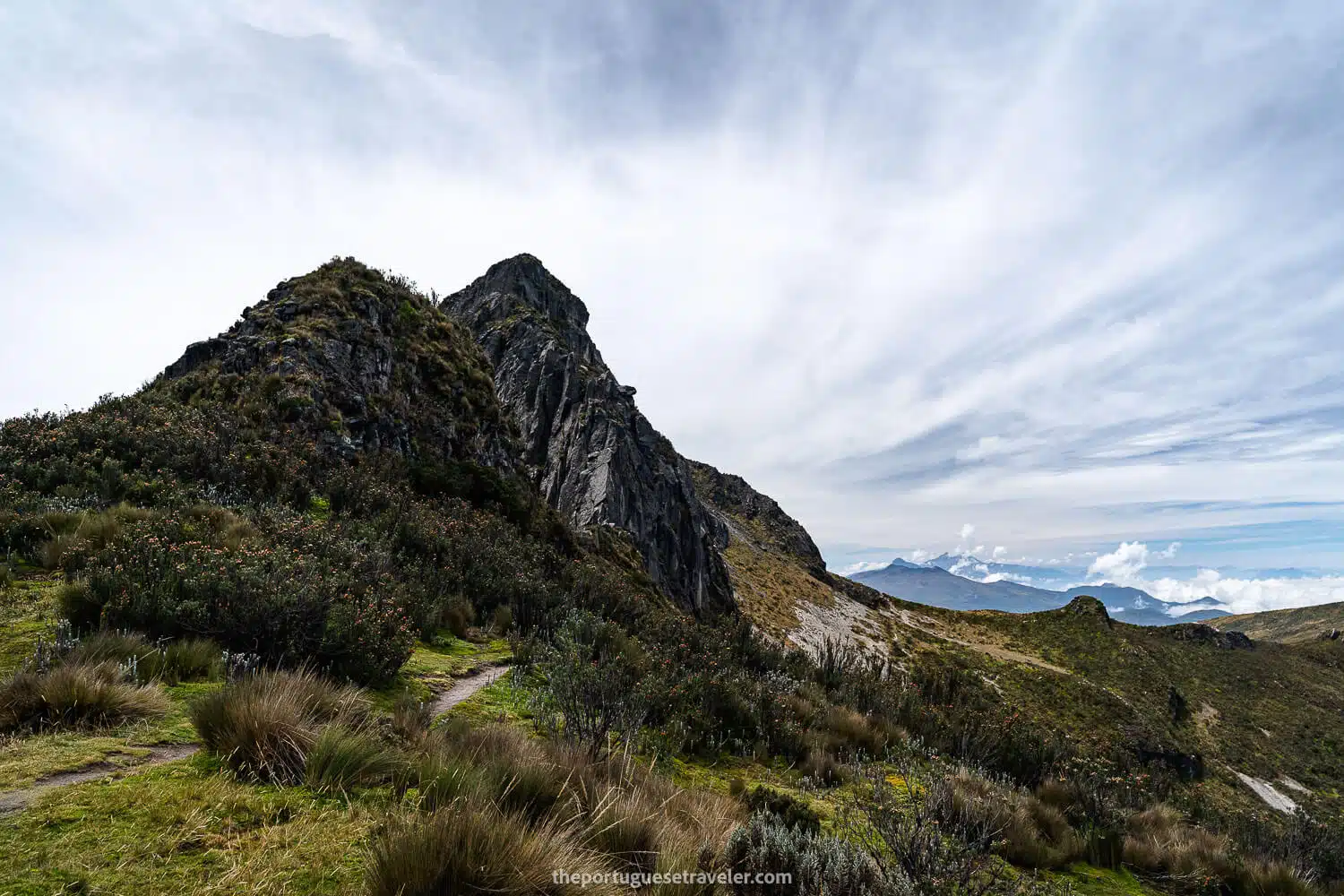
After lunch, we continued our descent. There was a steep section where we had to jump about a meter. On my previous trip here, we didn’t pass through here and went directly from Padre Encantado to Rucu Pichincha, so we didn’t encounter this challenging section.

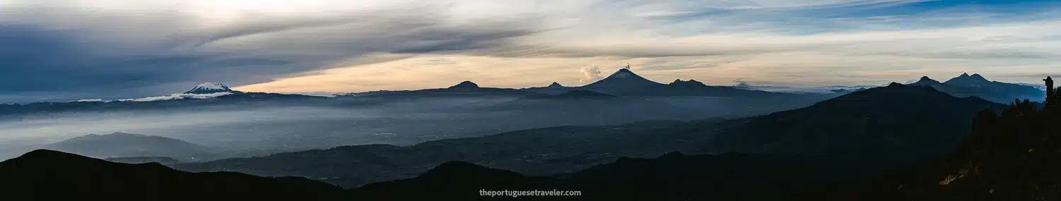
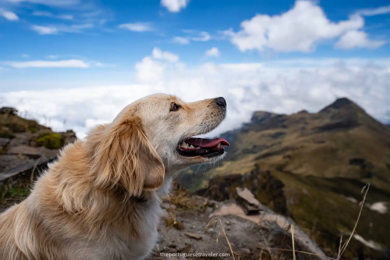
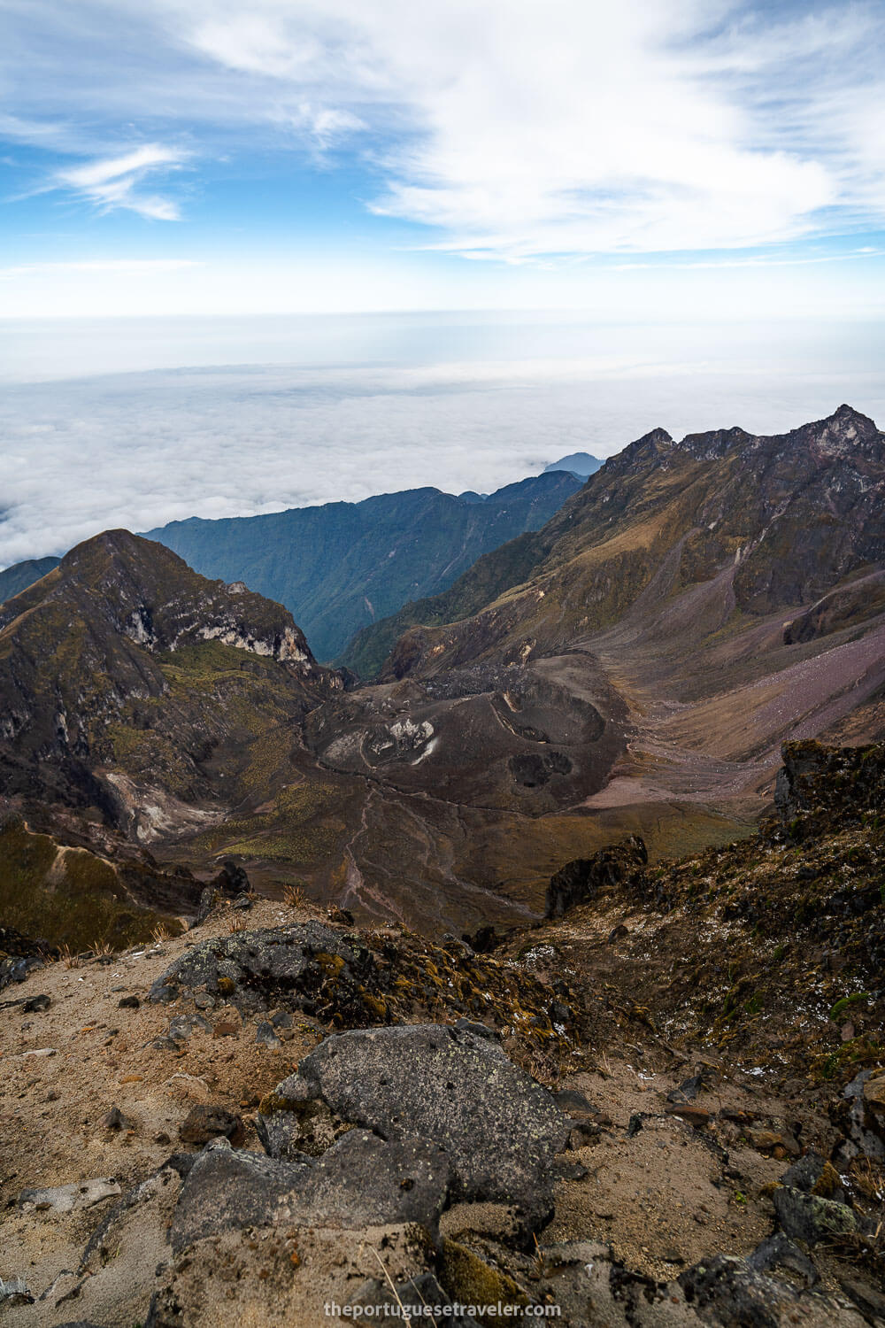
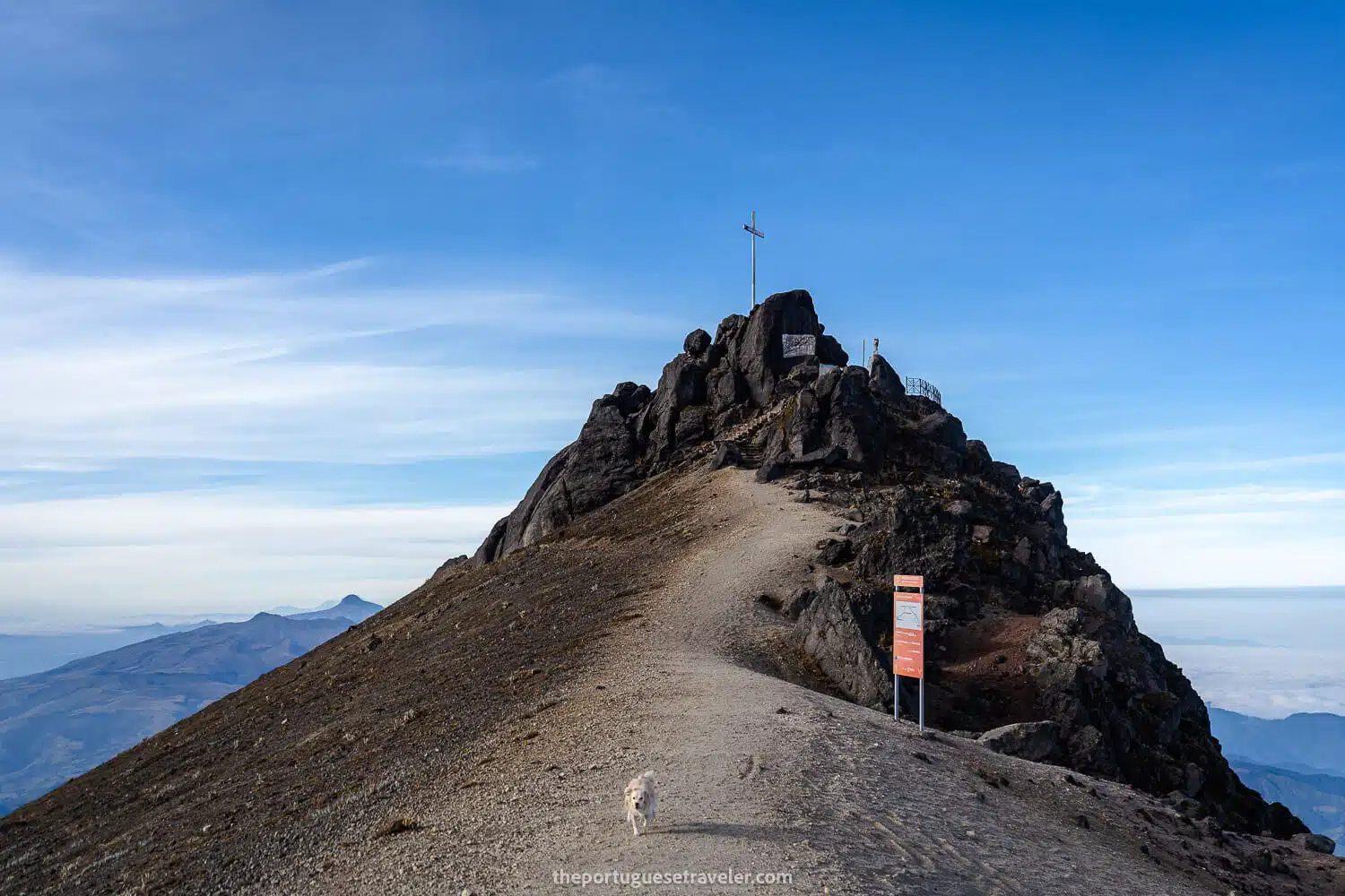
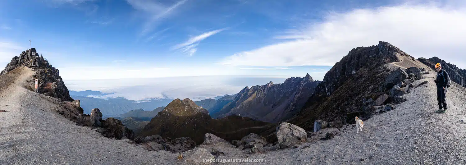
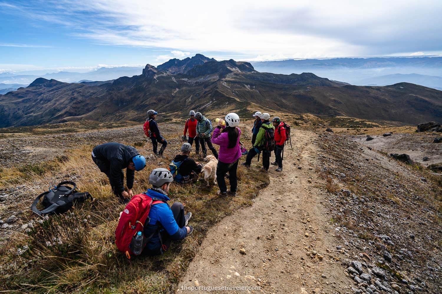
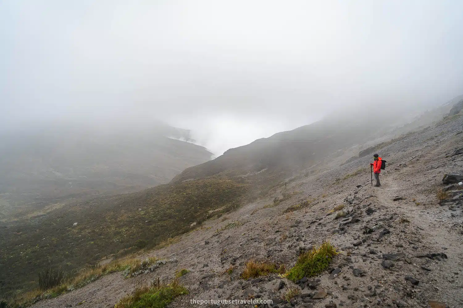
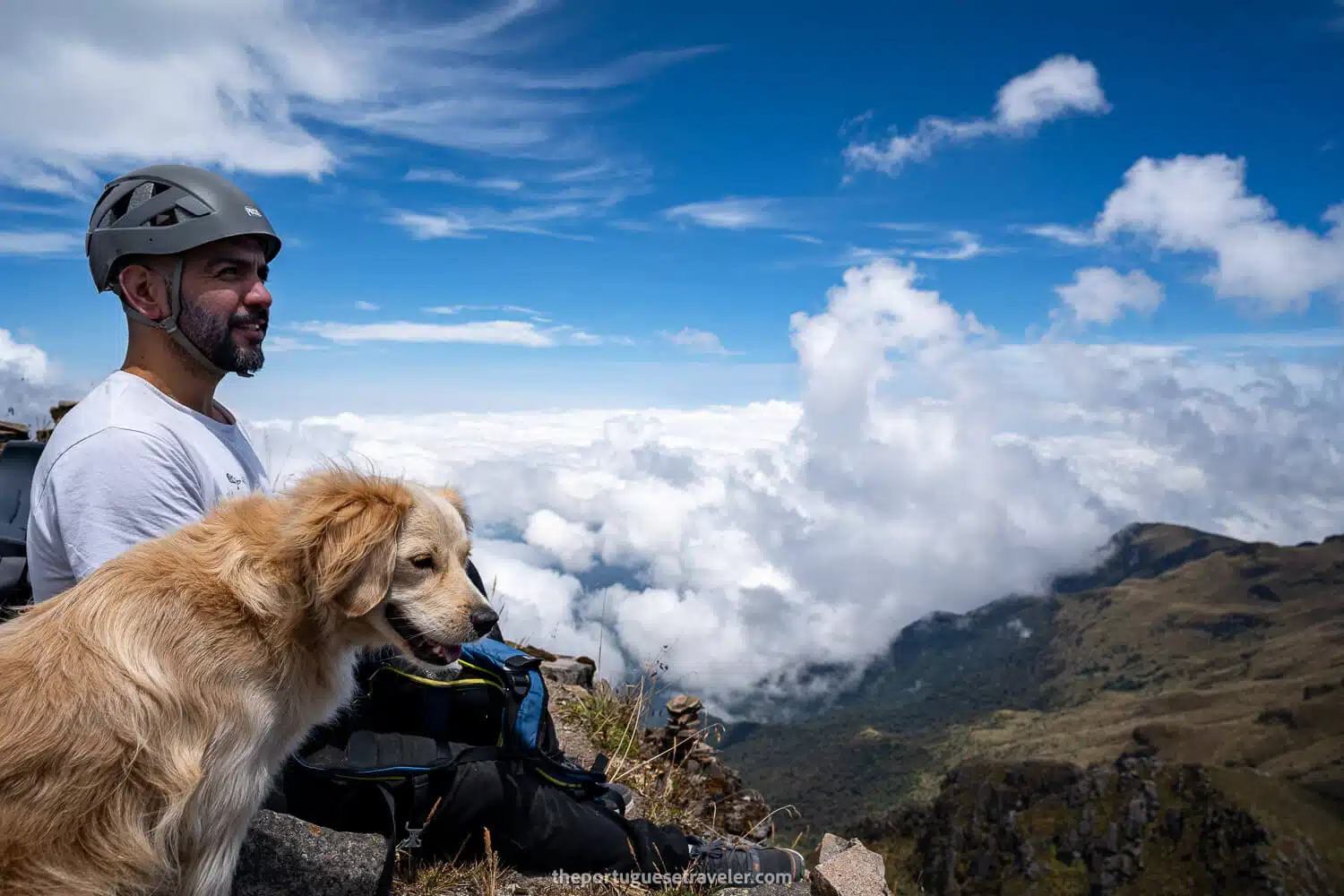
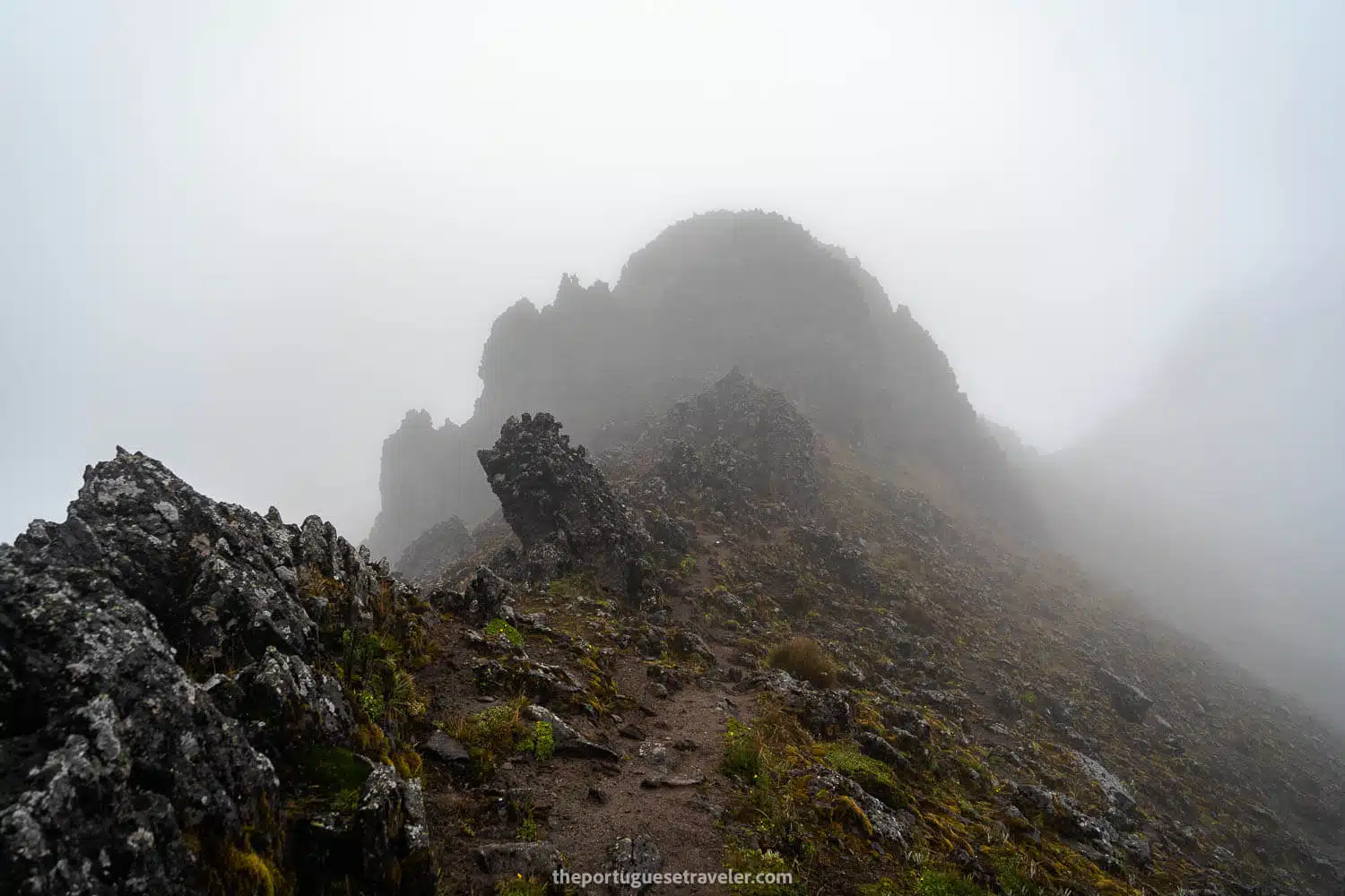
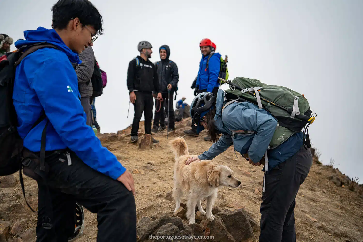
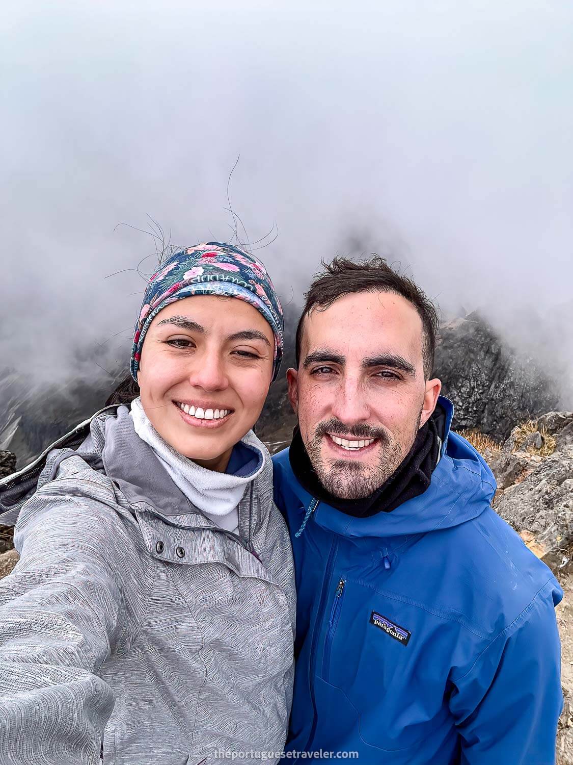
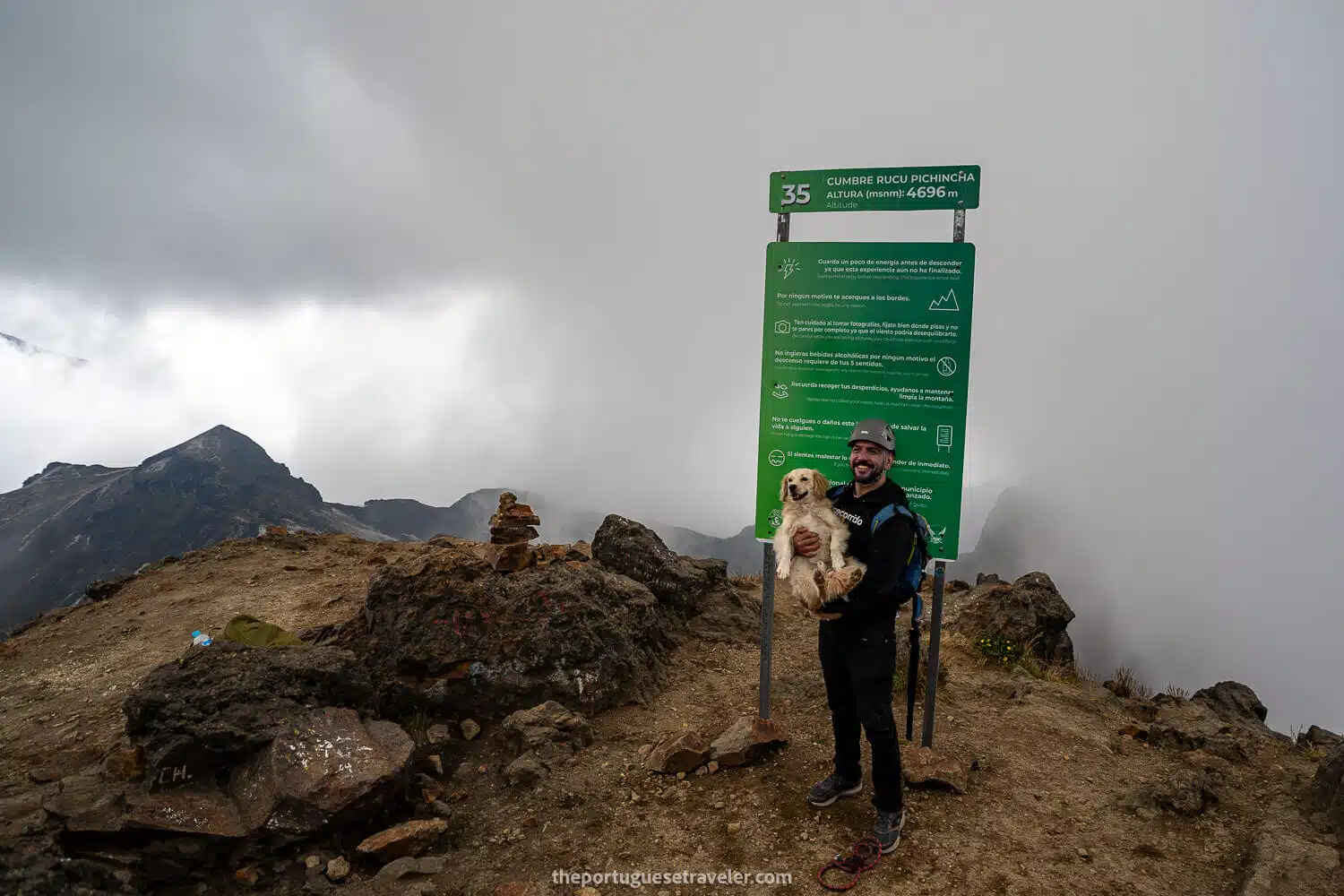
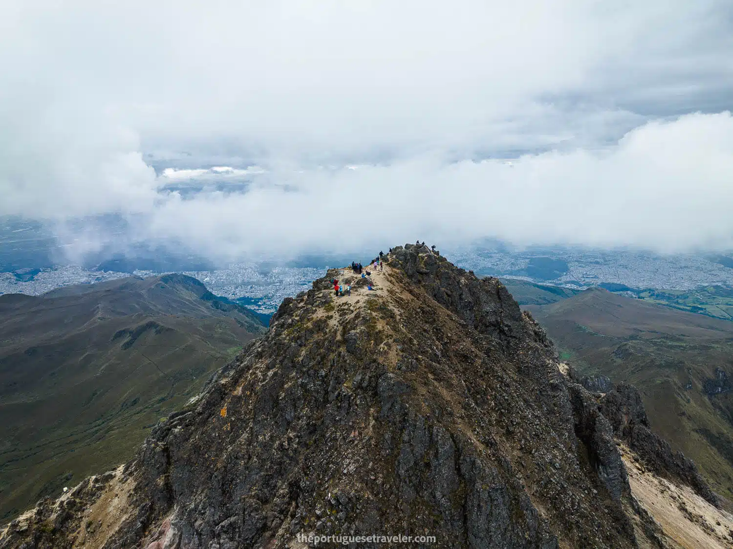
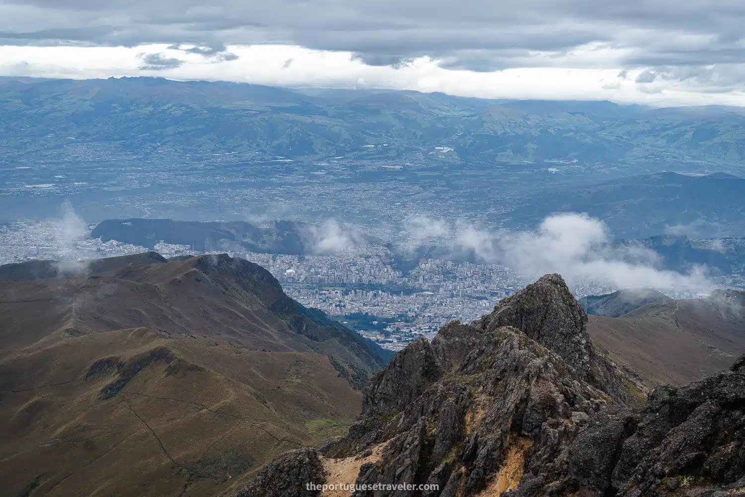
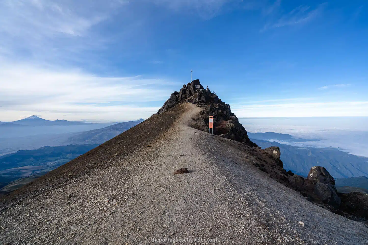
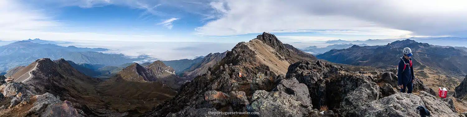
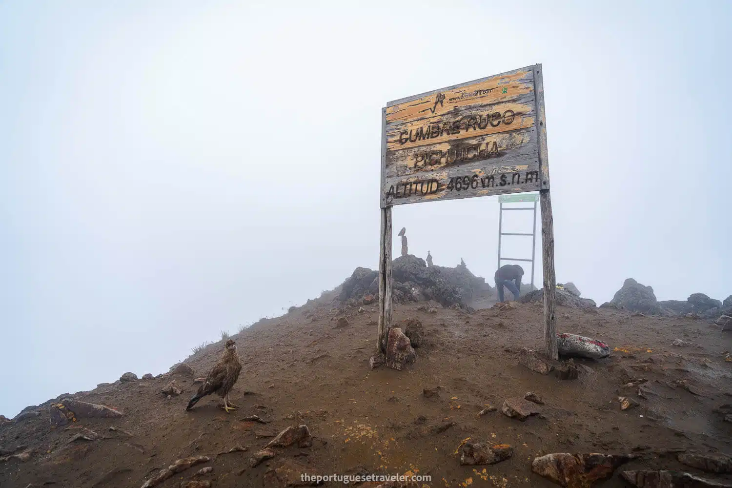
Almost arriving at Rucu, the clouds were completely over us, and we could only see in the direction of Guagua Pichincha. There was a dog with us, Tobi, who was super tired, and we had to help him navigate the rocky section of Rucu Pichincha for the summit. We finally reached the summit, and there was almost no view apart from a couple of brief moments when we could see something.

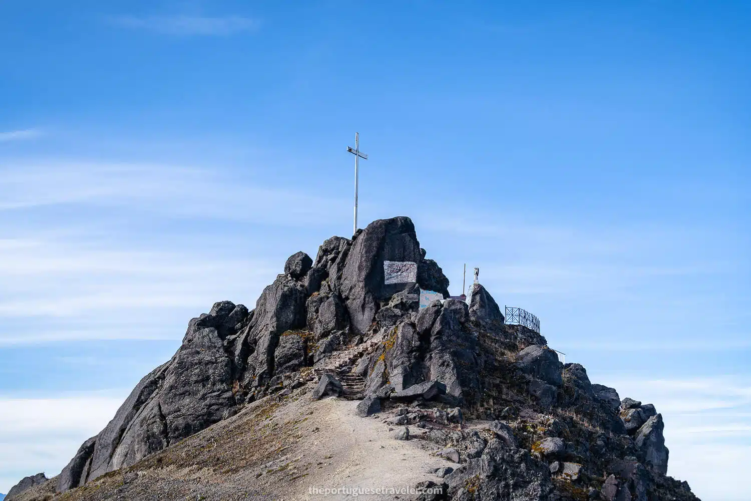
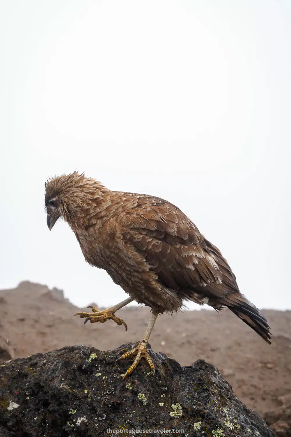
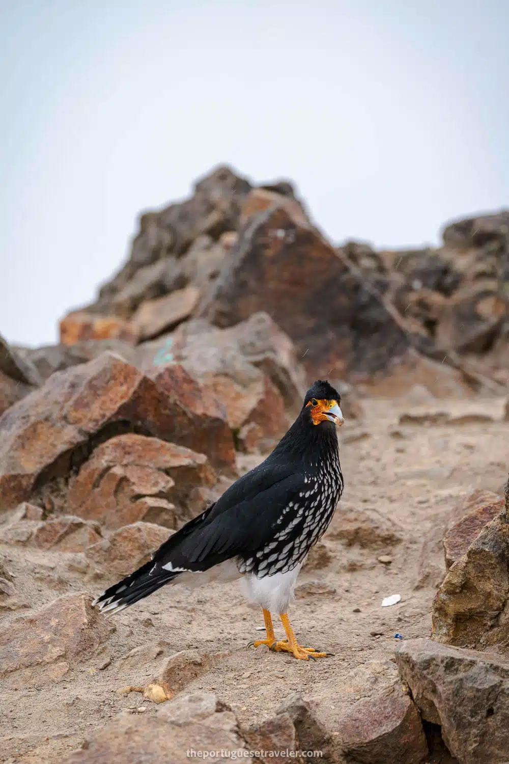
There was a new tourism metal sign, and the original wooden one was not up its pole. There were some Curiquingue birds flying around, and we celebrated our achievement – three summits in one hike, which doesn’t happen all the time.


The summit of Guagua and Rucu Pichincha
The way to Padre Encantado
Arriving at Padre Encantado
The way around Padre Encantado
The same view around Padre Encantado but in foggy weather (2022)
The path between Cerro Ladrillos and Padre Encantado hills
Dani and his dear drone at Cerro Ladrillos
Esteban and his dog Toby at Cerro Ladrillos
Padre Encantado Hill
The group resting at Cerro Ladrillos, full with cairns
The way down to Rucu Pichinch
The jumpy section one needs to pass to advance to Rucu Pichincha
Almost arriving at Rucu Pichincha
Dani also arriving at Rucu
The sharp rocks between Cerro Ladrillos and Rucu Pichincha
Arriving at the rocky section of Rucu Pichincha

Rucu Pichincha's Summit, Hale and Lightnings on the way to the Teleférico.

After this, we began our descent, passing the volcanic sandy section, a particularly steep part where we had to jump (last year it had water flowing, making it a bit harder), and then we passed Cueva del Osso, a small entrance in the rock. Afterwards, it was just an open plain field until the Teleférico.

Bad news for us: this open field with no problematic parts was covered with clouds. The closer we got to the Teleférico, the darker the clouds became, and then we started seeing lightning all around. The lightning grew stronger as we got closer, and then it started hailing really hard, and we had nowhere to hide. So, we got completely soaked, and really would have appreciated using helmets during the hailstorm.

Once we finally arrived close to the Cerro Loma Café and the Teleférico, the hail stopped, and we made it inside.

Then we received the worst news: the son of a guy in our group had been struck by lightning a few minutes earlier and needed to be transported to the hospital in Quito.

Also, the cable cars were shut down because of the storm, and when they restarted, there was a massive queue. We had to wait for literally four hours to board and go down, ending this adventure. 

So, I advise you, if you want to do this hike for acclimatization purposes, do it, but be aware that you might encounter a thunderstorm at the end, and as you hike for 8 hours, you can’t leave through another route. 

This hill with the Teleférico is filled with antennas, and that’s why it attracts so many lightning strikes and, there’s a chance you might get struck by one. I would advise either hiking to Rucu on a sunny day or just going to Guagua for the views and returning.

The start of the rocky section of Rucu Pichincha
The rocky section of Rucu Pichincha
The summit of Rucu Pichincha with Tobi
Me and Jhos at the summit of Rucu Pichincha
The hale storm on the way to Teleférico
The view of the caldera of Rucu Pichincha
A happy doggo on the summit of Rucu Pichincha
A Caracara (Curiquingue) at Rucu Pichincha Volcano's Summit
A second type of Caracara (Curiquingue) at Rucu Pichincha Volcano's Summit
The summit of Rucu Pichincha Volcano. Credit: Miguel Almeida
Quito seen from the summit of Rucu Pichincha
Quito seen from the summit of Rucu Pichincha. Credit: Miguel Almeida
The way to Rucu Pichincha from the Teleférico
The way to Rucu Pichincha from the Teleférico. Credit: Miguel Almeida
The way down from Rucu Pichincha's summit after the sand part
The section after the sand part on the way down. Credit: Miguel Almeida
Rucu Pichincha's Hike
Rucu Pichincha's Hike. Credit: Miguel Almeida

Finally, we arrived at the parking lot, where we took off for our home.

Have you had the opportunity to climb Pichincha Volcano – Ruta de los Integrales? If you’ve done it, I would love to hear about your experience. Please share your thoughts and opinions in the comments below.

Thanks for reading through, and I hope you have fun on this adventure. I will share more of my favorite shots below, enjoy!

Photo Gallery

The Views from Guagua Pichincha Volcano

The Guagua Pichincha's Chappel
The caldera and crater of Guagua Pichincha Volcano
The crater of Guagua Pichincha and a cloud inversion behind

Guagua, Cerro Ladrillos and Rucu Pichincha Summits

Guagua Pichincha seen from next to Padre Encantado
Padre Encantado Hill
Dani droning in Cerro Ladrillos
The view from Cerro Ladrillos
A panorama from the top of Guagua Pichincha

Rucu Pichincha's Summit, Hale and Lightnings on the way to the Teleférico.

Rucu Pichincha seen almost from the Teleférico
Rucu Pichincha's Summit with a Curiquingue

All the Articles About the Ecuador

Galapagos Islands – Experience the wonders of nature and unique wildlife in this pristine archipelago.

Amazon Rainforest – Immerse yourself in the lush greenery and rich biodiversity of the world’s largest tropical rainforest.

The Andes – Embark on an adventure in the Ecuadorian Andes, a majestic mountain range with diverse landscapes, ancient sites, and captivating wildlife.

Pacific Coast – Discover Ecuador’s Pacific Coast, nestled between the majestic Andes Mountains and the vast Pacific Ocean. 

Cloud Forest – Explore a Biodiverse Paradise of Flora and Fauna.

Leave a Comment

Your email address will not be published. Required fields are marked *

23 Shares
Share
WhatsApp
Pin23
Email
More