Climbing Chimborazo Volcano (6263m)

The Highest Volcano in Ecuador | Highest Point on Earth

Climbing Chimborazo Volcano in Ecuador

Climbing Chimborazo Volcano in Ecuador is one of the most rewarding experiences for mountaineers and a popular expedition worldwide. At 6,263 meters (20,548 feet), it is not only the highest mountain in Ecuador but also the closest point to the sun on Earth due to the planet’s equatorial bulge. Located 180 kilometers (112 miles) south of Quito, Chimborazo is surrounded by the Reserva de Producción y Fauna Chimborazo, making it a stunning destination for adventurers. The volcano has also drawn notable figures like Alexander von Humboldt, who famously explored its heights in the early 19th century.

While no previous technical experience is needed, climbers should be in good physical condition and acclimatized to altitudes above 5,000 meters. The ascent offers breathtaking views of giant cracks and glaciers, along with spectacular sunrises illuminating Riobamba in the background. From the summit, climbers can also see neighboring peaks like Cotopaxi, Carihuairazo, and Altar, which enhance the majesty of the experience. To prepare for this challenge, it’s advisable to train on smaller mountains or engage in multi-day climbing programs to improve acclimatization.

For safety, climbs are typically done at night, with each pair of climbers accompanied by a certified mountain guide. If you’re traveling solo, the ascent will be led by a guide. Climbing Ecuador’s highest peak provides a unique opportunity to immerse yourself in the breathtaking natural beauty and cultural significance of Chimborazo, a site that has captivated adventurers for centuries.

Chimborazo and the Milky Way seen from the refuge of Carihuairazo Volcano

Table of Contents

Get access to my curated list of all the best viewpoints, hiking trails, secret waterfalls, diving spots, wildlife tours, accommodations, and more, that will make your trip to Ecuador and The Galapagos unforgettable.

All of this, in an interactive guide featuring a mobile-friendly map, pre-designed itineraries, all my favorite photos, and helpful travel tips to guide your journey in this amazing unexplored country.

If you want personalized advice write me in-app and we can plan it together.

Rexby Guide Review
A llama and Chimborazo behind

Climbing Chimborazo Volcano: General Details

To climb Chimborazo Volcano, the highest high-altitude mountain in the Ecuadorian Andes, you can do it in two ways, with a Mountaineering Agency, or with a local guide:

Highlights:

  • Chimborazo Volcano Summit.
  • Views of the other 3 big famous volcanoes: Antisana, Cayambe, and Cotopaxi (on a clear day). Views of the other smaller volcanoes: Ruminahui, Pasochoa, Los Ilinizas, Corazon, El Altar, Sangay, Tungurahua.
  • You might also encounter wild horses, alpacas, llamas, and vicuñas.

Duration: 2 days.

Authorization: Required but your guide or agency should take care of it. If they don’t, send an email to [email protected] just in case (min. 3-5 days before your trip).

Accommodation: Refugio Carrel or Refugio Edward Wymper. If both refuges are full, and you’re not staying at high camp, then you might want to check some of the hotels nearby like Chimborazo Lodge, Chimborazo Basecamp Lodge, Chakana Templo de Montaña, or Hostería La Andaluza.

Price: 360-800$ (details in the following section)

Outfit: High-altitude mountain gear (details in the following section)

Best Months to Climb: September – December

Recommended Agencies: Mauna Expeditions, Cumbre Tours, Mountain Tours

Recommended Local Guide: Julian Ilalo: +593 (0) 992999371

Chimborazo on our way to the refuge
Chimborazo on our way to the refuge of Carihuairazo

Climbing Chimborazo Volcano: Technical Details

Type: Out-and-Back Trail

Distance: 15 km – Starting at the Refugio Carrel.

Duration: 10-12 hours including the summit stop.

Difficulty: Hard. The toughest part of the climb was the relentless, steep ascent leading up to the Veintimilla Summit.

Incline: ca. 1400m of ascent and descent.

Altitude: Lowest point: 4,850m at the Refugio Carrel. Highest point: 6,263m at the Whymper Summit of Chimborazo Volcano.

Climbing Chimborazo Volcano Map
Chimborazo Volcano Climbing Map - Southwest Face
Powered by Wikiloc

The climb and return from the Carrel Refuge to the Whymper Summit of Chimborazo Volcano.

Powered by Wikiloc

The climb from the Refuge Carrel to the High Camp (5300m)

Powered by Wikiloc

The climb from the High Camp to the Whymper Summit of Chimborazo Volcano.

Chimborazo Volcano seen from the Carihuairazo Basecamp
Book your Chimborazo Volcano Tour

with Viator

Chimborazo Volcano seen from the Carihuairazo's Refuge

How to climb Chimborazo Volcano?

To climb Chimborazo Volcano, the highest high-altitude mountain in the Ecuadorian Andes, you can do it in two ways:

Mountaineering Agency: 

  • Pros: More comfortable and easy to plan. Includes everything.
  • Cons:
    • Shared Trip: Big Groups, Random People
    • Private Trip: More expensive than hiring a guide by yourself.

Hiring a Certified Guide – National Guide – ASEGUIM – UIAGM:

  • Pros: Cheaper (you don’t pay the agency’s fee), private, flexible (your own dates), personally choose your own guide.
  • Cons: You have to arrange the transportation, accommodation, and meals, as well as rent the technical gear. You have to pay for the guide’s expenses too.
El Chimbo
El Chimbo

In a Hurry? Save it for Later.

Save it on Pinterest and read it whenever you can.

SAVE TO PINTEREST

Climbing Chimborazo Volcano in Ecuador
A llama on the reserve
Book your Chimborazo Volcano Tour

with GetYourGuide

Powered by GetYourGuide
A vicuna looking at us

What clothing and equipment should i bring to climb Chimborazo Volcano?

To ensure a safer and more comfortable journey in this High-Altitude Mountain with snow and technical sections, certain specific equipment is indispensable:

Essentials:

* It is advisable to have an additional thermal layer or jacket available for extremely cold conditions (at the climb) and to have an extra change of clothes (that you leave at the refuge).

Climbing Equipment:

  • Helmet: For the entire climb.
  • Crampons: For the snow that exists roughly from the refuge onwards.
  • Piolet: Also for the steep snow part.
  • Harness: For the entire climb.
  • Trekking Poles: For the entire hike until the steep snow climb where it’s advisable to use the ice axe instead.
  • Rope: For the entire climb. (usually, the guide brings)
  • Carabiners:  For the entire climb. (usually, the guide brings)

Useful Extras:

Consumables:

  • Drinks, and Snacks: Bring enough of it especially if you’re a beginner.
  • Thermos

Check out my complete guide on What’s in My Backpack – From photography gear, and clothing for Hiking, Mountaineering, Scuba Diving, Rainforest, and City-Street Photography.

The Mighty Chimborazo Volcano
The Mighty Chimborazo Volcano seen from the Cotopaxi Volcano summit

How much does it cost to climb Chimborazo Volcano?

To provide you with an estimation of the expenses associated with climbing Chimborazo Volcano, I have provided a detailed breakdown of the costs involved. Firstly, you need to consider whether you will be going with an agency or a local guide. Additionally, there are other supplementary expenses that require careful consideration.

Agency/Private Guide:

Mountaineering Agency:

  • Chimborazo Volcano Summit:
    • Shared Trip  (6-10 persons): 380$ (pp)
    • Private Trip: Solo – 720$ | 2 persons – 550$ (pp)
  • Complete Acclimatization Program: 4 mid-mountains summits  w/ Cotopaxi + Chimborazo summit (6-10 persons): 625$+380$ (pp)

Hiring a guide:

  • Local Guide (1-2 persons): 300$ (pp or per couple ) – including rope and carabiners, the rest you must rent (ask the guide if he has any extra equipment at home he can lend you) – It’s cheaper if you come with a second person – The price is for the guiding not per person.

Transport (from Quito):

  • Private Van (Quito – Refuge Carrel): 240$ (Both ways)

Accommodation (High Camp): 80$ – Includes dinner and breakfast. If you’re vegetarian, be sure to let them know in advance so they can prepare accordingly.

Equipment for Rental:

(Daily prices without taxes)

  • Helmet: 4$ (used) – 5$ (new)
  • Crampons: 5$
  • Ice Axe: 4$ (used) – 5$ (new)
  • Harness: 4$ (used) – 5$ (new)
  • Waterproof Pants: 5$ (used) – 6$ (new)
  • Waterproof Jacket: 5$ (used) – 6$ (new)
  • Waterproof Gloves: 3$ (used) – 4$ (new)
  • Rubber Boots: 10$
  • Mountaineering Boots: 12.5$ (used) – 20$ (new)
  • Tent: 12$
  • Mattress: 2.5$
  • Sleeping Bag: 5$ (used) – 6$ (new)
  • Backpack 35-65L: 5$
  • Sunglasses (UV 4): 3.5$
  • Headlamp (without batteries): 3$
Equipment for Sale:
 
  • Trekking Poles: 10$
  • Fleece+Pants (1st Layer): 44.80$
  • Gloves (1st Layer): 3.92$
  • Socks (Merino Wool 70-80%): 16.80$
  • Socks (1st Layer): 11.20$
*Prices from Los Alpes Store in Quito, 26.May.2023
 
Alternative Stores for renting equipment: Mauna ExpeditionsTatoo, Cotopaxi Warehouse, Andes AlpinoMountain Tours.
 

Food, Drinks, and Snacks: 10$ (pp)

Estimated Total (per person):

  • Scenario 1:
    • Group of 2
    • Hired a Local Guide
    • Already have all the gear
    • Price Breakdown: 300$/2 (guide), 240$/2 (private van both ways), 80$ (accommodation, dinner, and breakfast), 80$/2 (guide’s accommodation, dinner, and breakfast), 10$ (snacks, and drinks)
    • Total: 400$ USD
  • Scenario 2: 
    • Solo
    • Shared Tour with an Agency
    • Only have standard hiking gear
    • Price Breakdown: 320$ (guide + logistics + meals + transport), 40-80$ (equipment/clothing rental)
    • Total: 360-400$ USD
  • Scenario 3: 
    • Solo
    • Private Tour with an Agency
    • Only have standard hiking gear
    • Price Breakdown: 720$ (guide + logistics + meals + transport + technical gear), 40-80$ (equipment/clothing rental)
    • Total: 760-800$ USD
Me and Miguel my Portuguese friend at the basecamp of Carihuairazo looking at Chimborazo

How to get to the refuge of Chimborazo Volcano?

By Private Van:

For this climb, it’s more practical and comfortable to arrange a private van from Quito directly to the refuge. Due to the amount of gear needed and the distance, it’s best to travel with a guide. The van ride from Quito to the refuge takes around 4 hours, offering a hassle-free way to start your ascent.

Alternatively, if you prefer to come by bus, taxi, or car, check out my article on Climbing Carihuairazo Volcano, which is nearby. You can use the travel times and details provided there as an estimated guide for this trip.

Many alpacas, llamas and vicuñas at El Arenal reserve

Where to sleep before climbing Chimborazo Volcano?

You can stay at Refugio Carrel or Refugio Edward Wymper. If both are full and you’re not staying at high camp, nearby options include Chimborazo Lodge, Chimborazo Basecamp Lodge, Chakana Templo de Montaña, or Hostería La Andaluza. Alternatively, you can also stay in Riobamba for more accommodation choices. Since you’re probably departing from Quito, here is a list I created with the best hotels you can find in town to relax before your climb and during your acclimatization program: 20 Best Hotels in Quito, Ecuador.

Some details of Chimborazo
Some details of Chimborazo's glaciers

Chimborazo Volcano: Curiosities

Name and Meaning: The name “Chimborazo” has uncertain origins, with some suggesting it may come from the Cayapa word “shimbu,” meaning “Great Lady of the Snow.” Others believe it could derive from the Quechua words “chinú” (hot) and “rase” (snowy), potentially referring to the mountain’s icy summit and volcanic nature.

Indigenous Mythology: Traditionally, Chimborazo was regarded as a female mountain deity, celebrated for its majestic presence. In more recent times, it has been reimagined as a male figure, often referred to as Taita Chimborazo (Father Chimborazo). According to legend, Chimborazo triumphed over the mountains Carihuairazo and Altar in a romantic rivalry for the affection of Mama Tungurahua. This epic quarrel destroyed the craters of Carihuairazo and Altar volcanoes, shaping their current forms and leaving a lasting mark on the landscape.

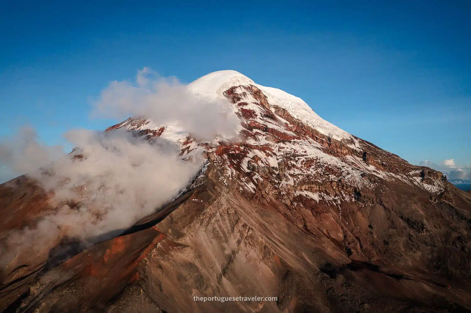
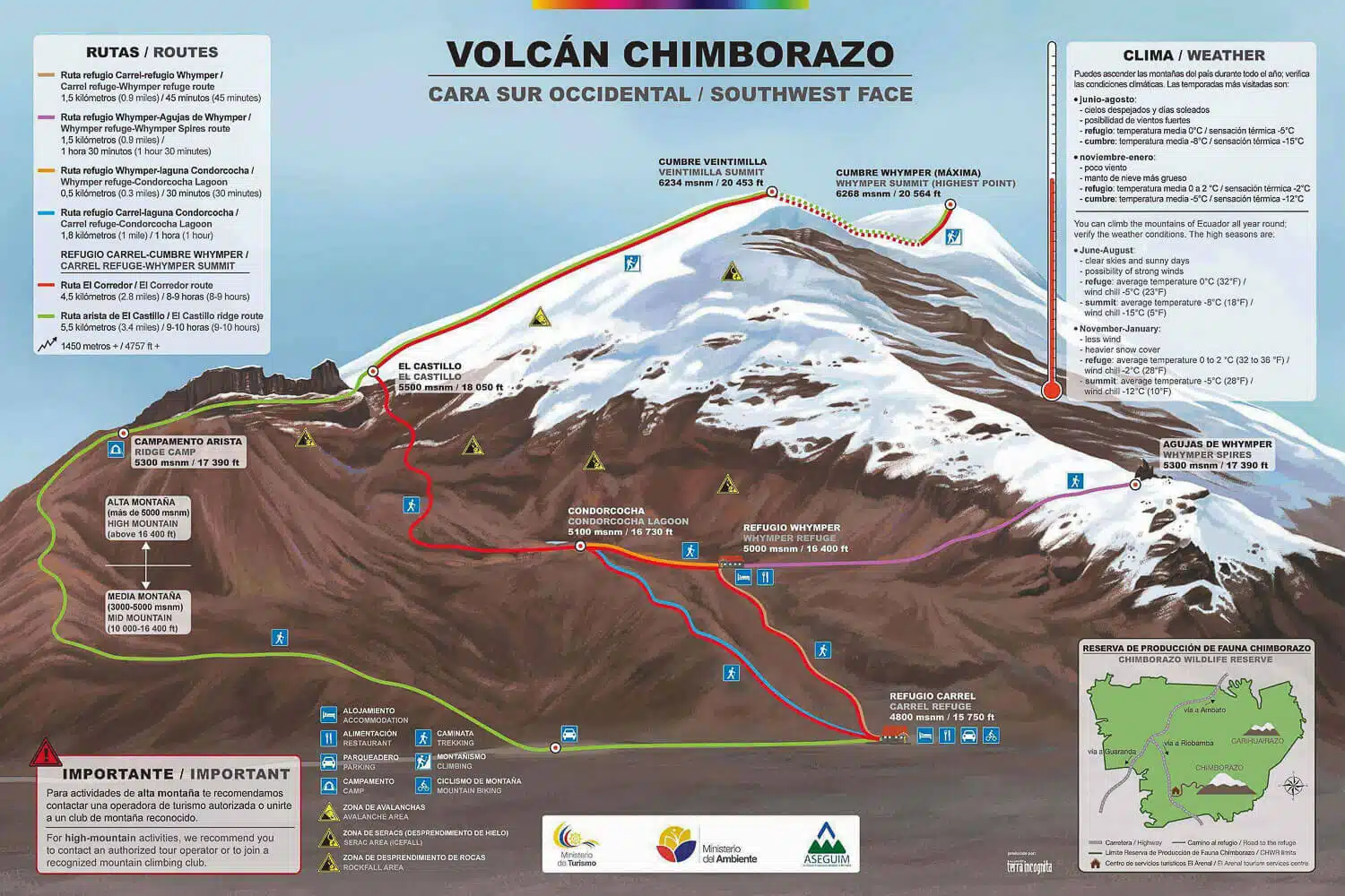
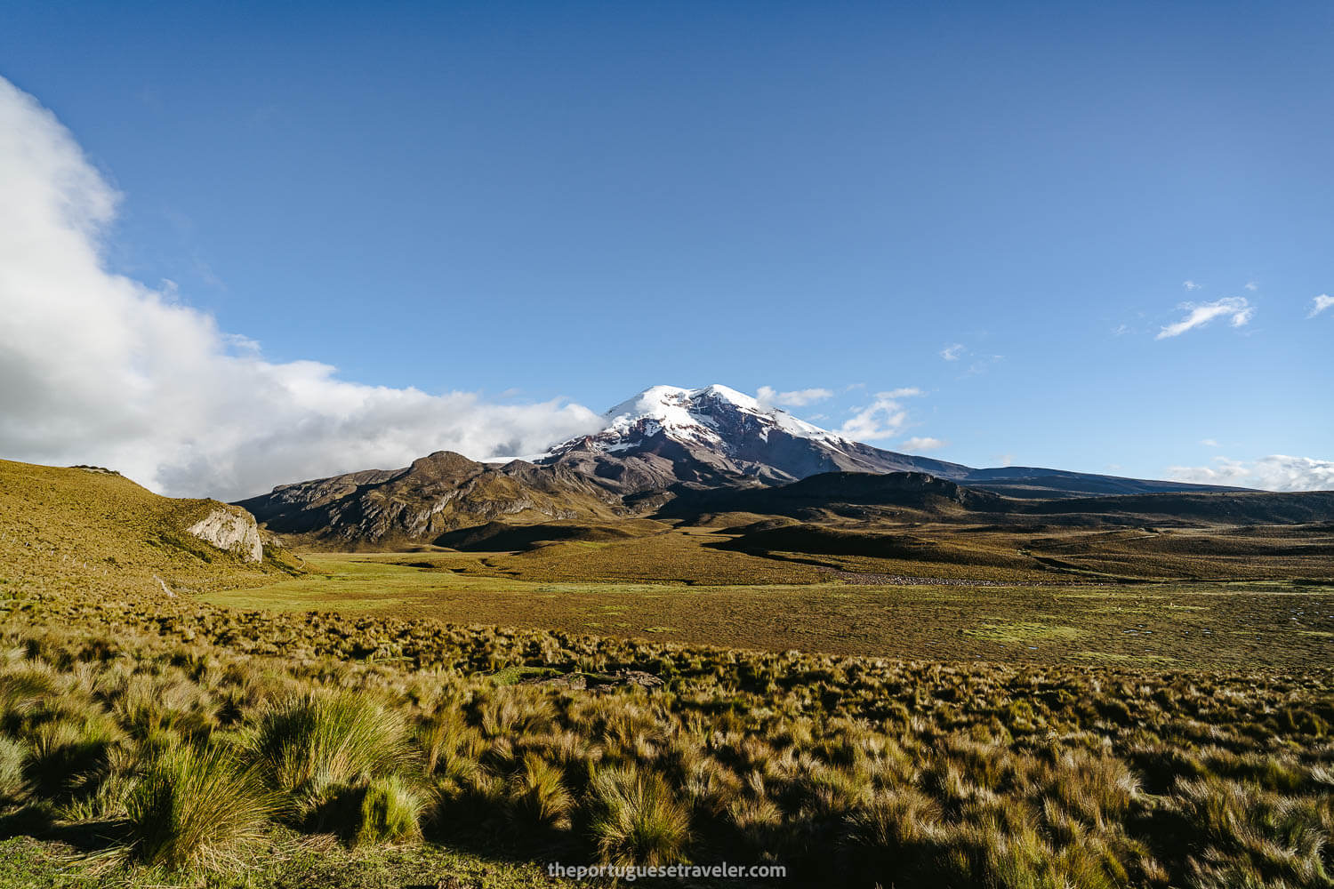
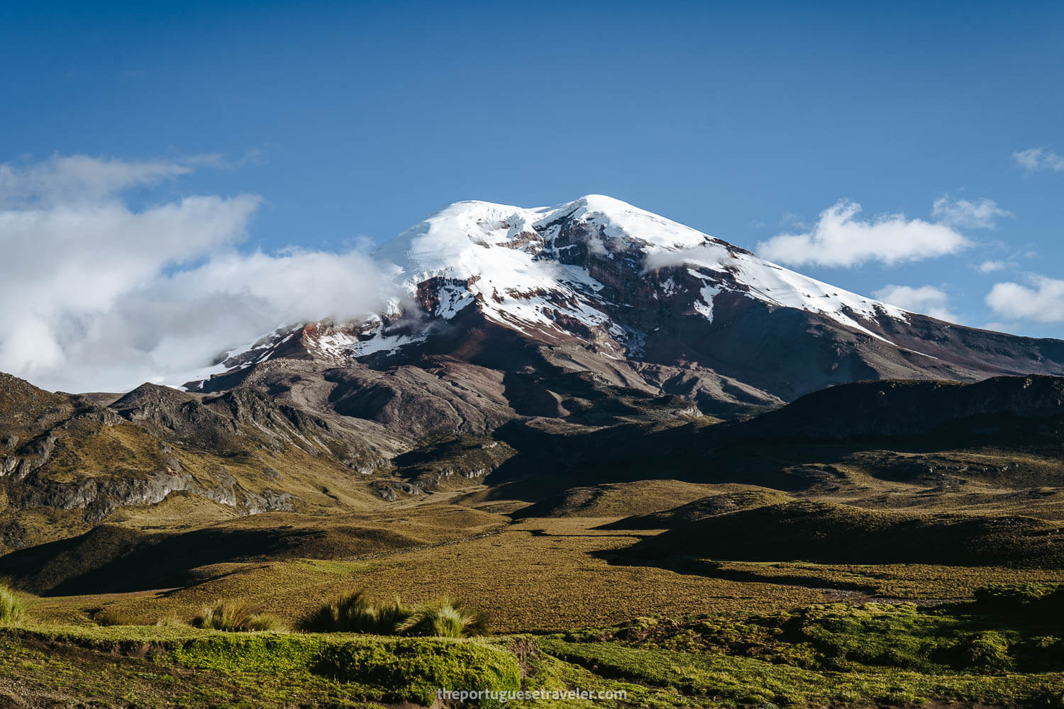
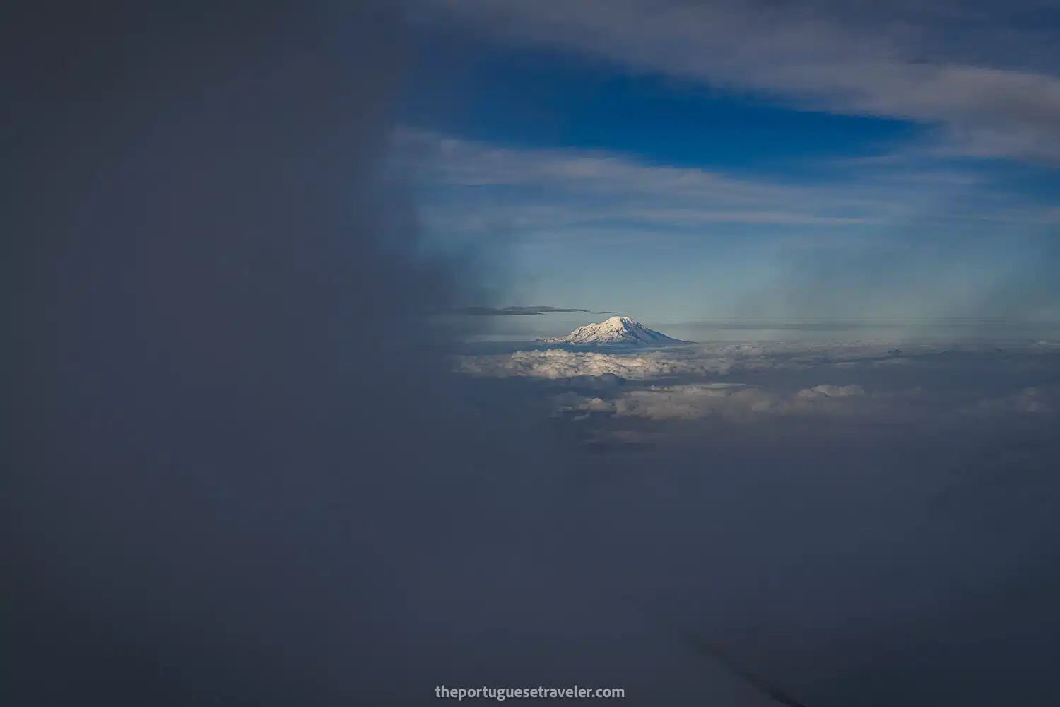
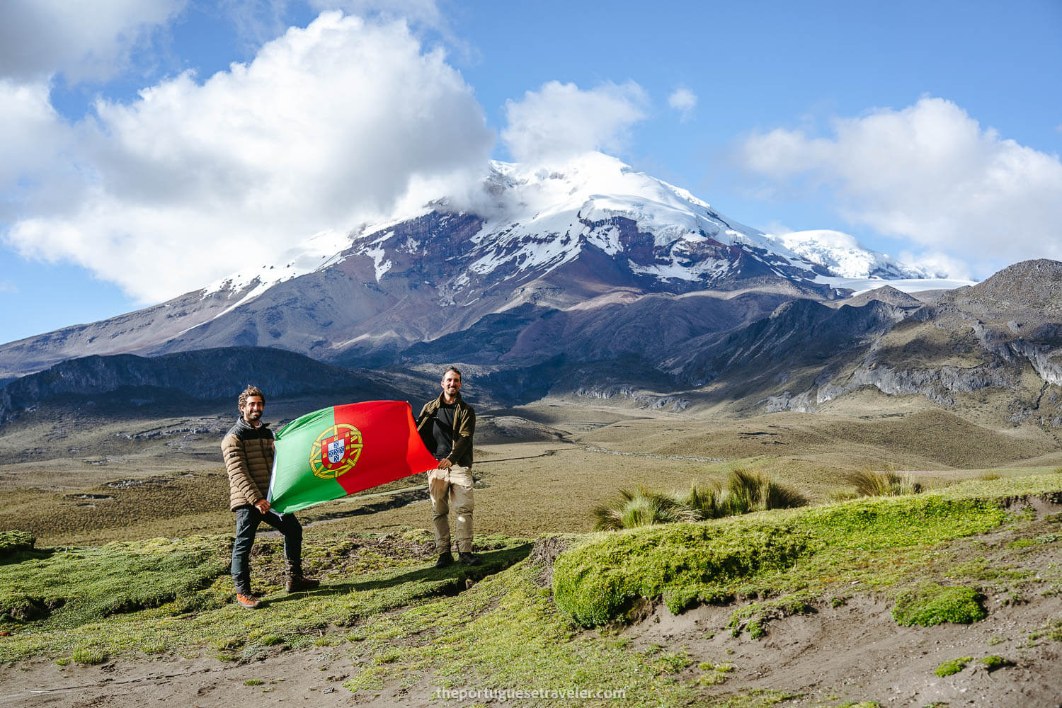
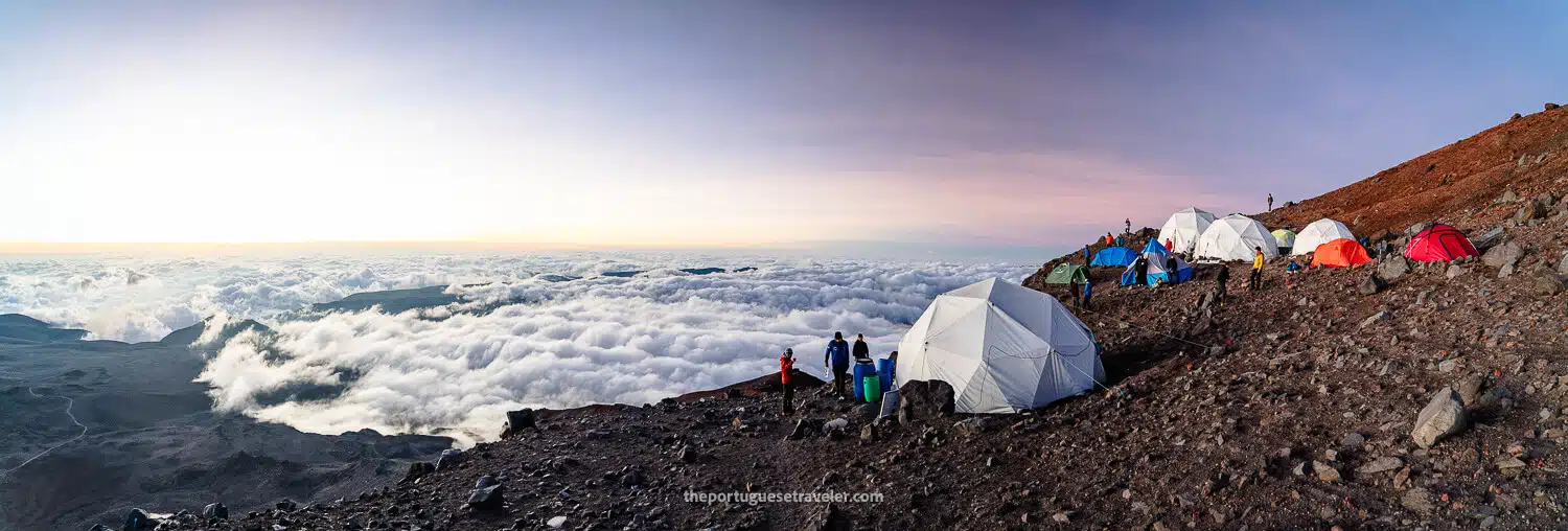
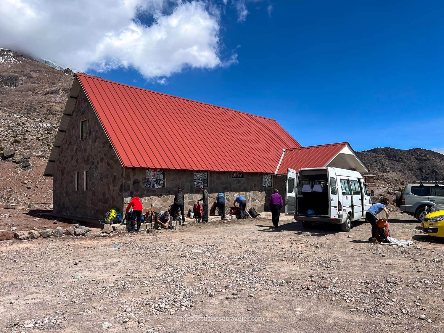
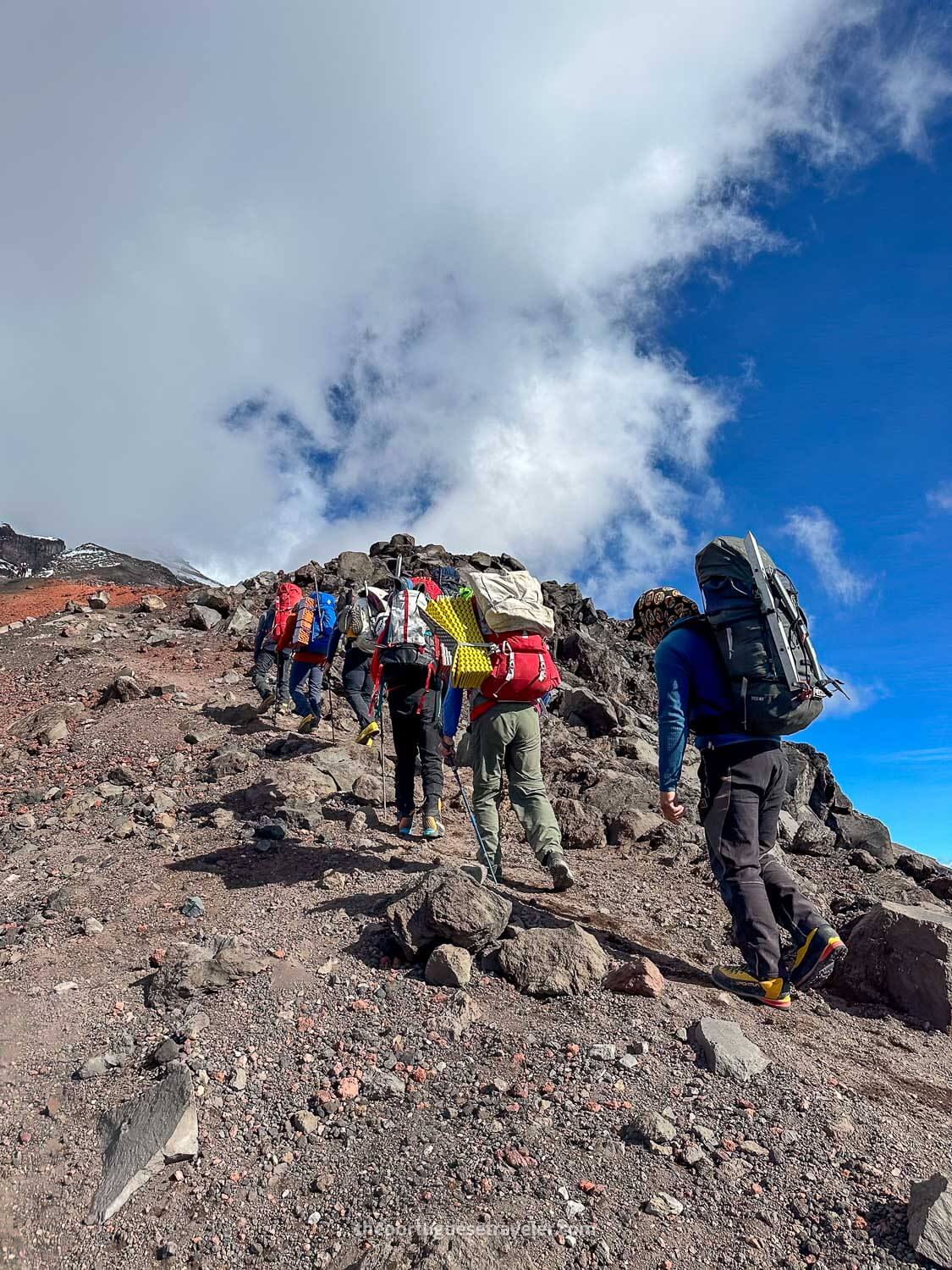
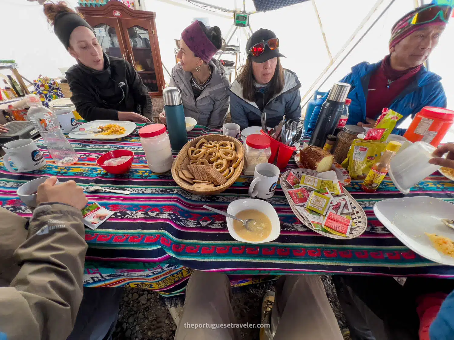
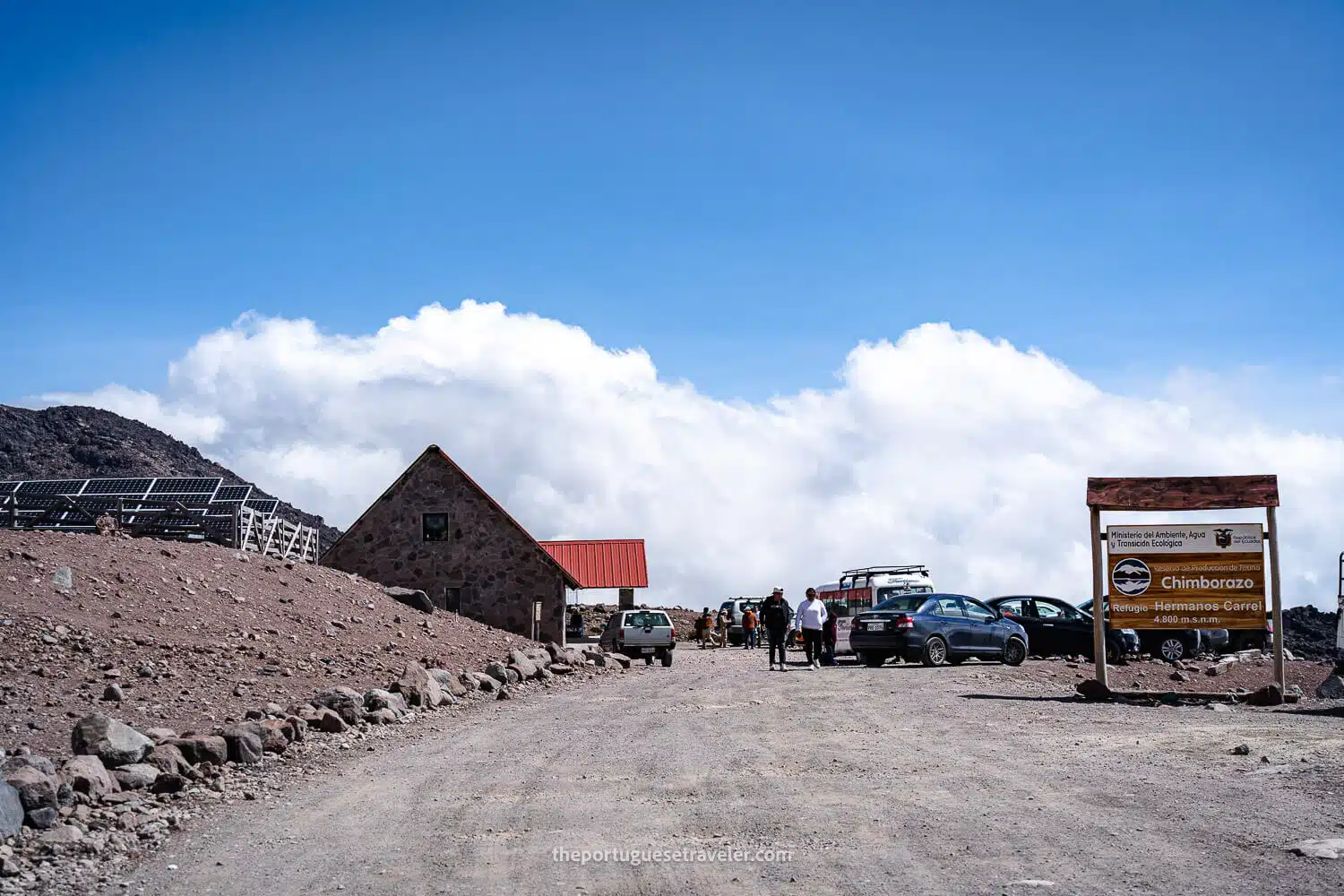
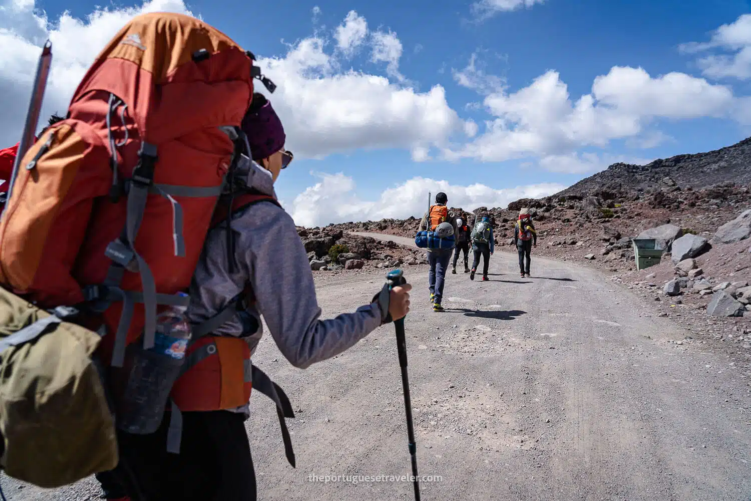
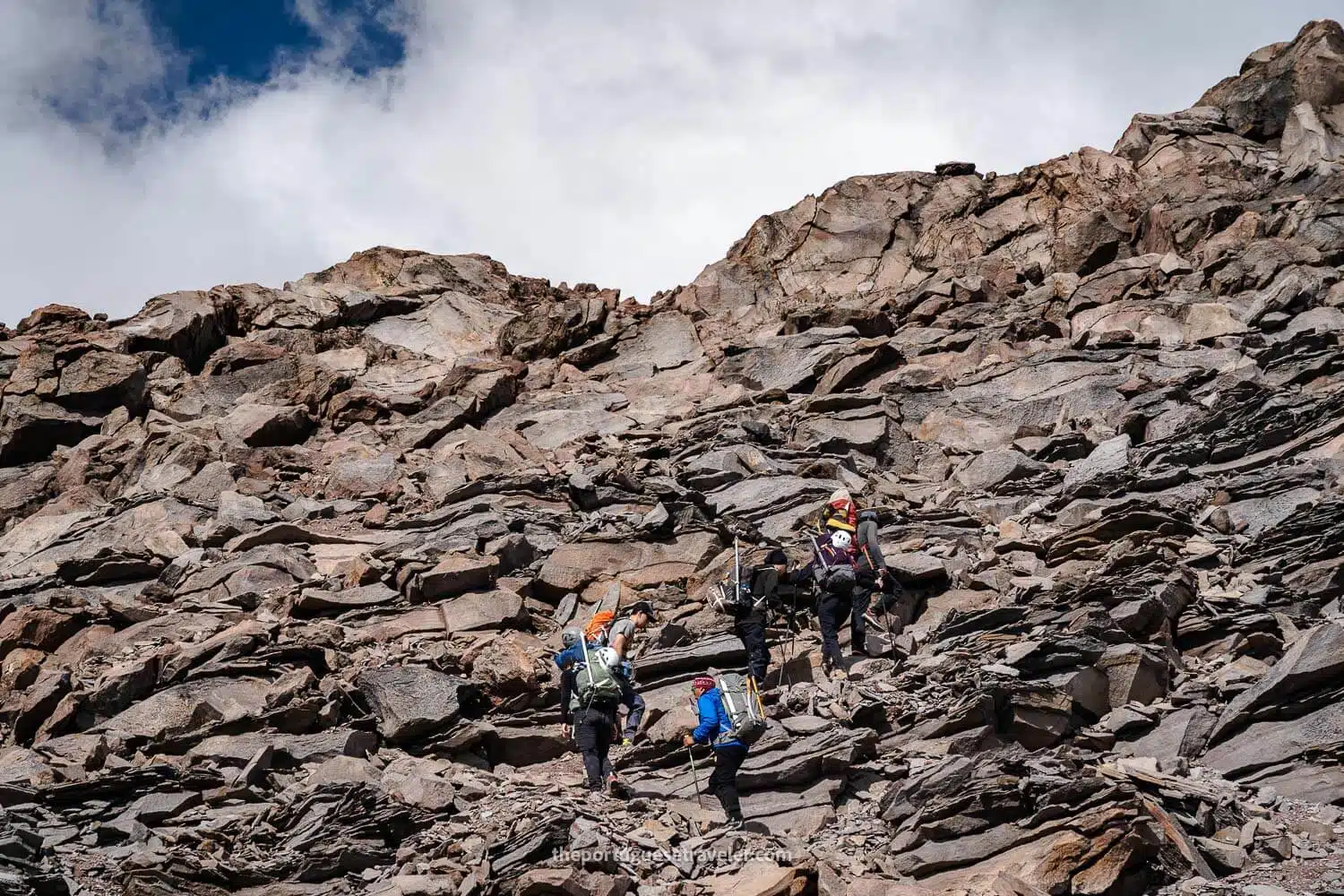
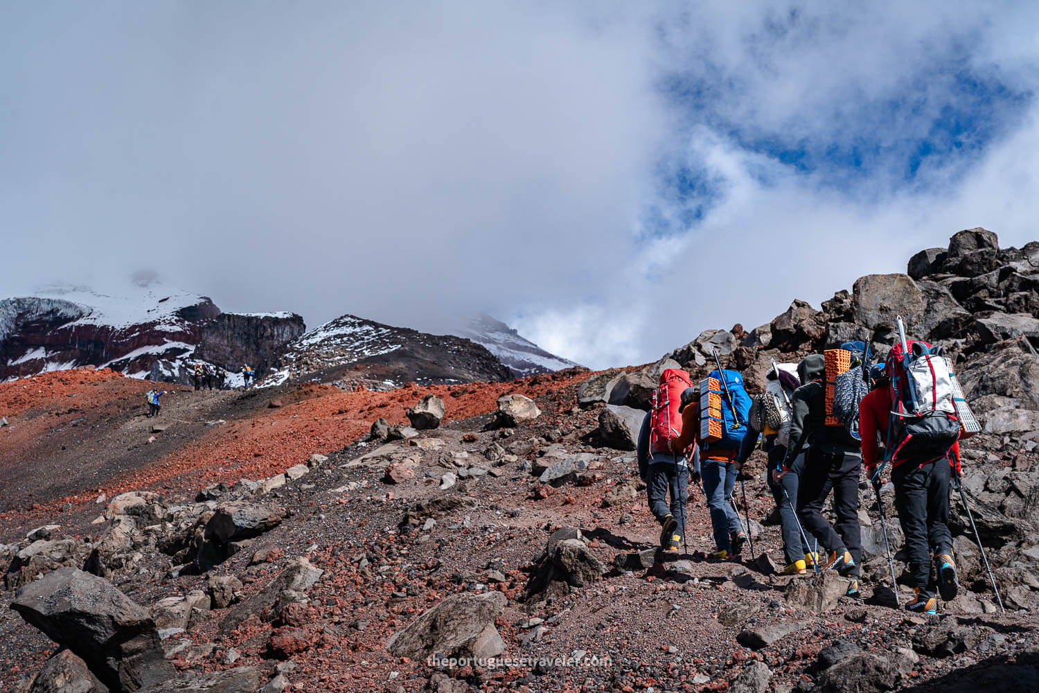
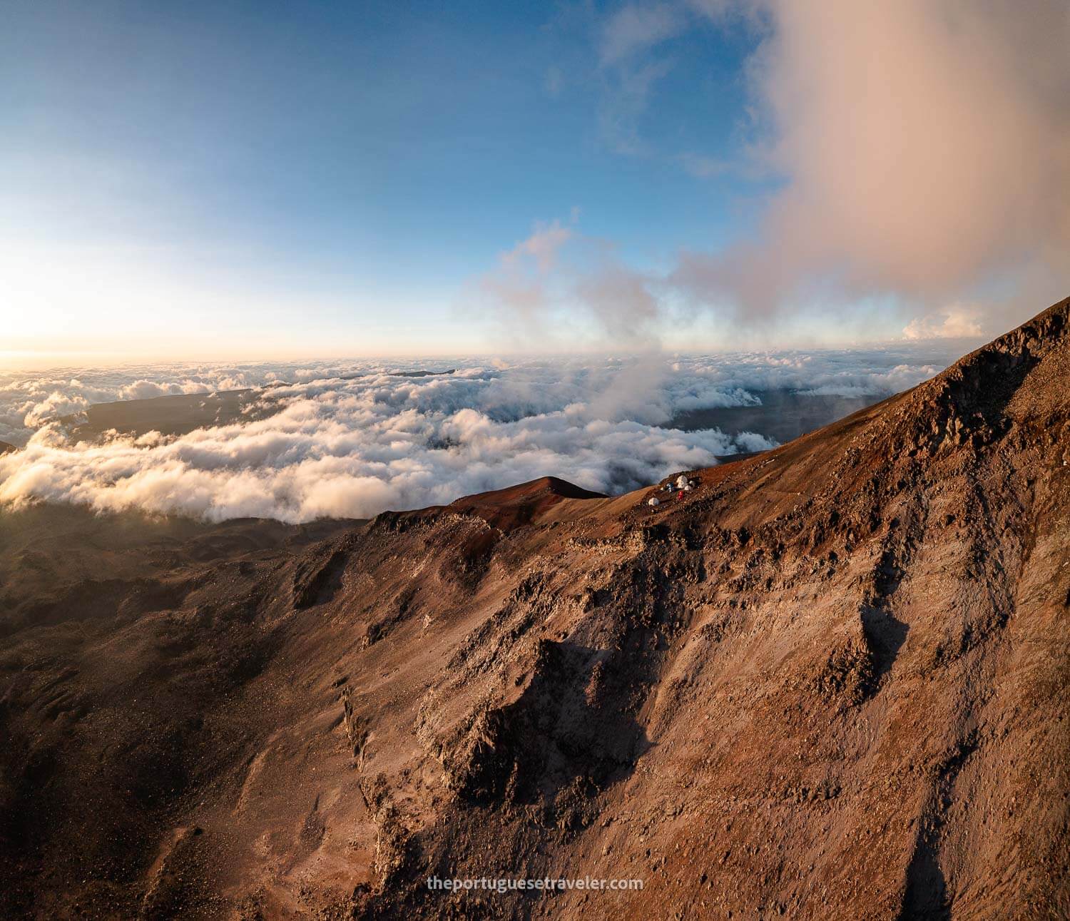
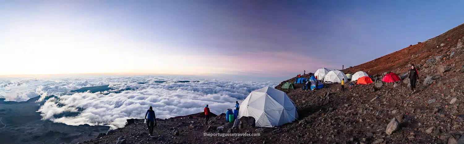
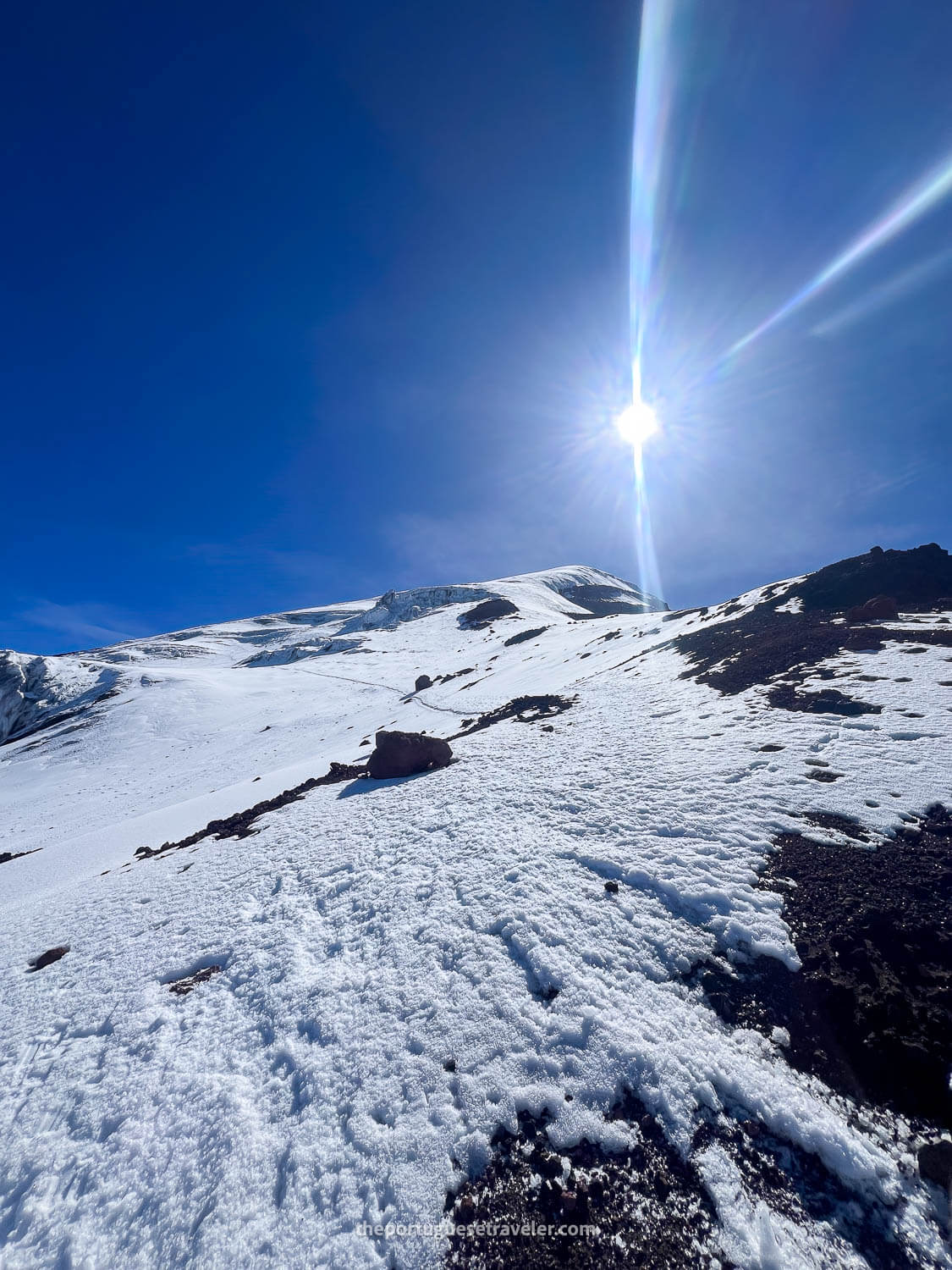
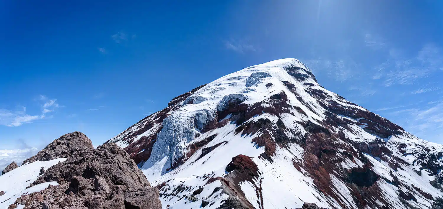
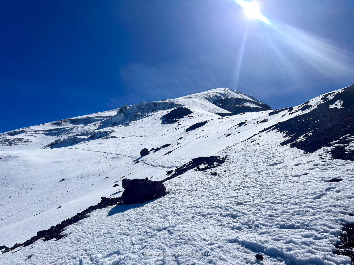
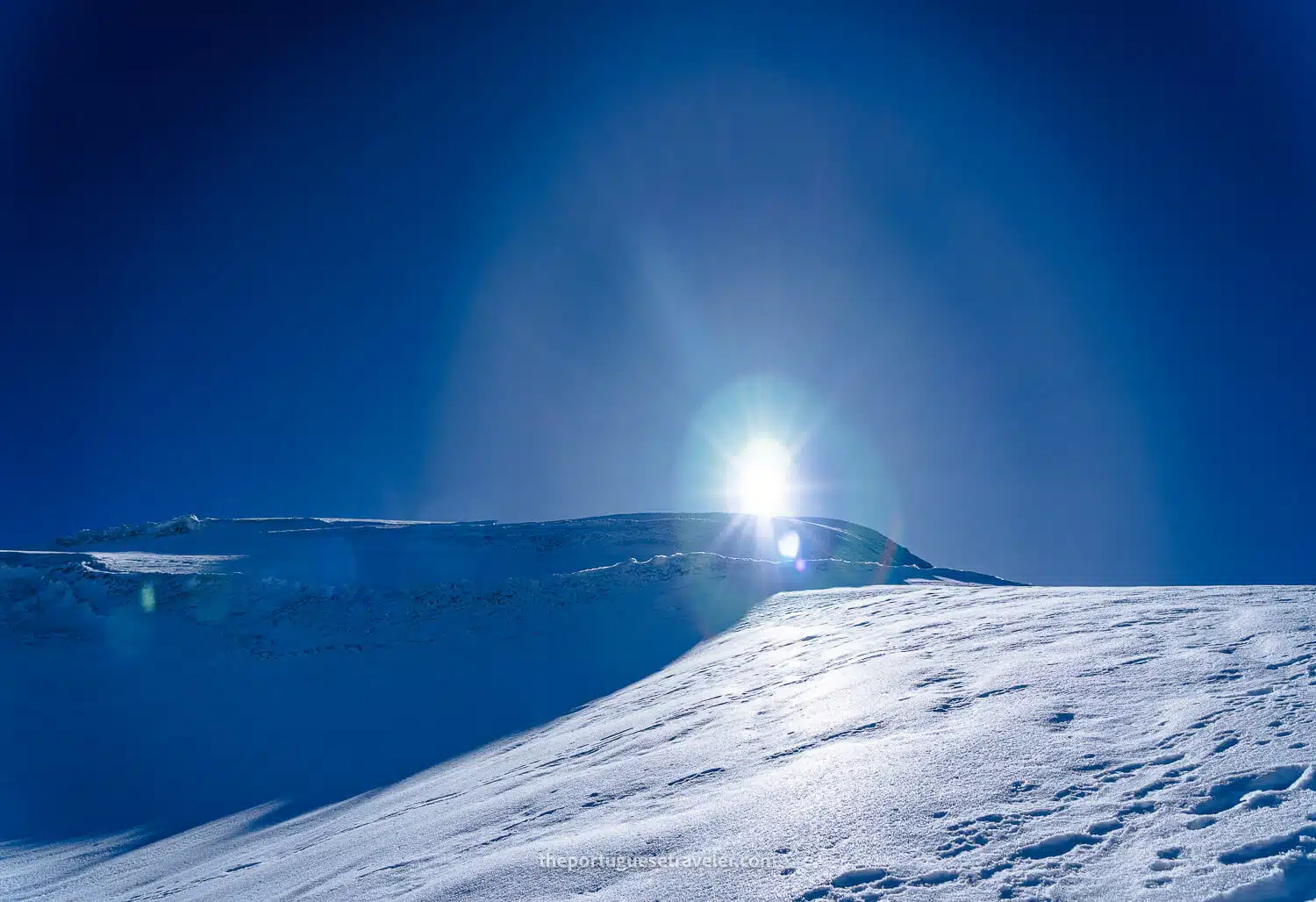
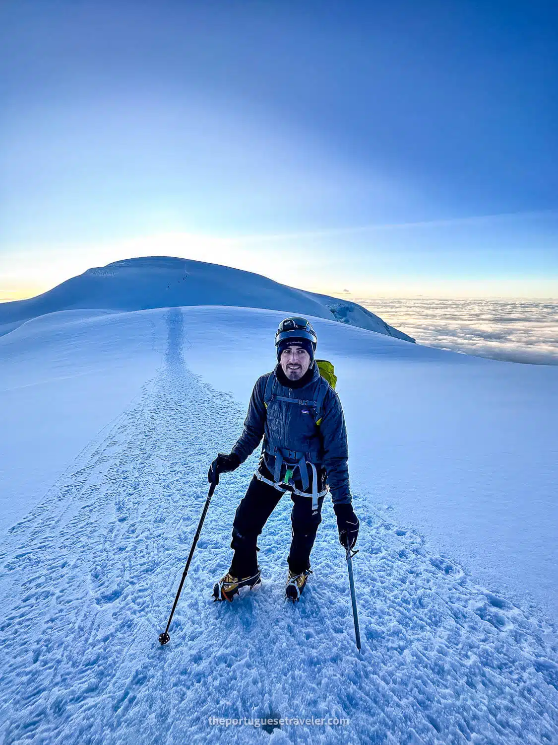
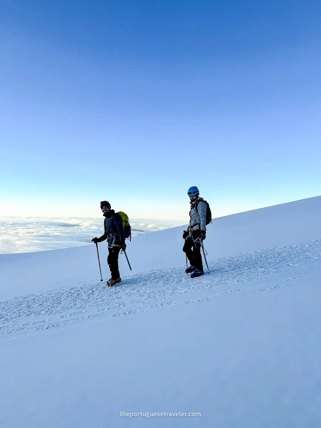
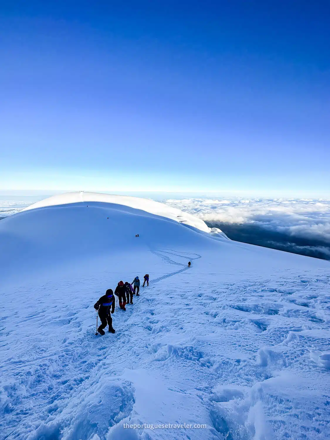
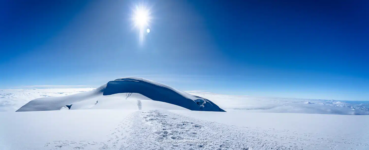
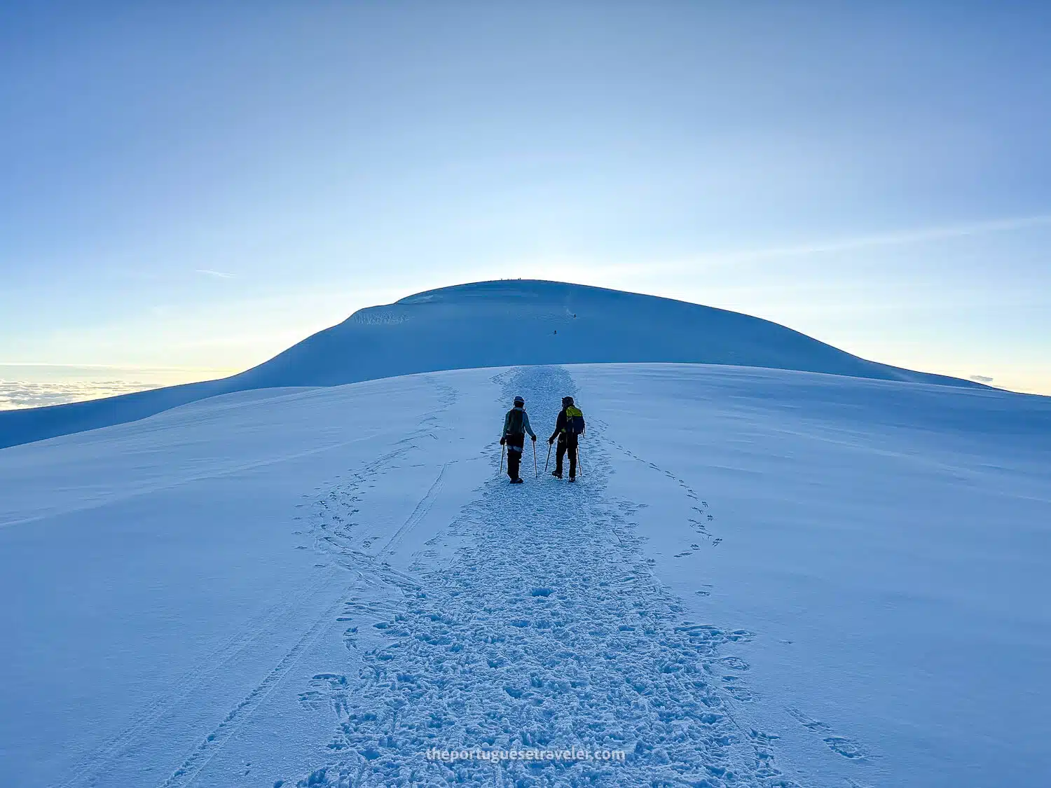
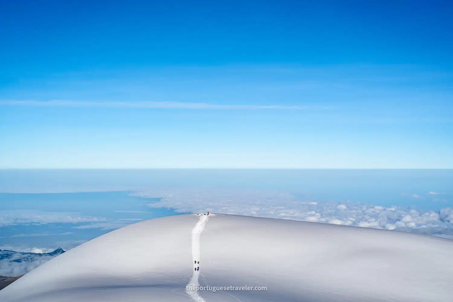
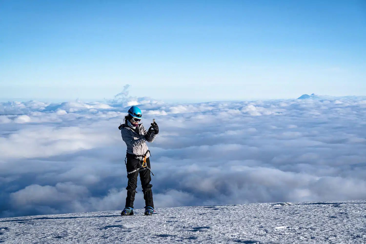
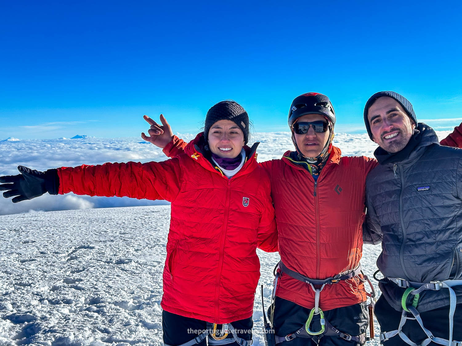
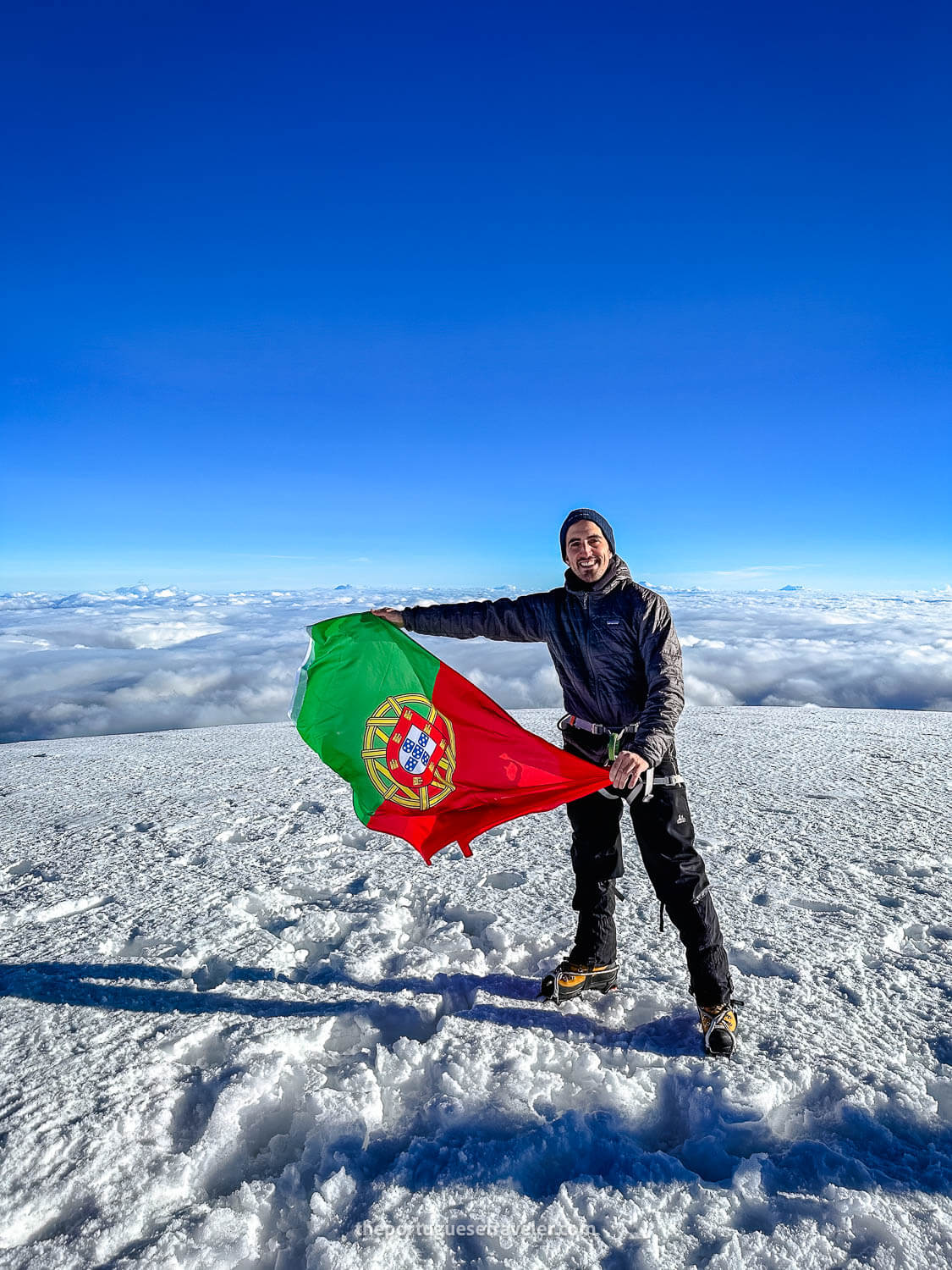
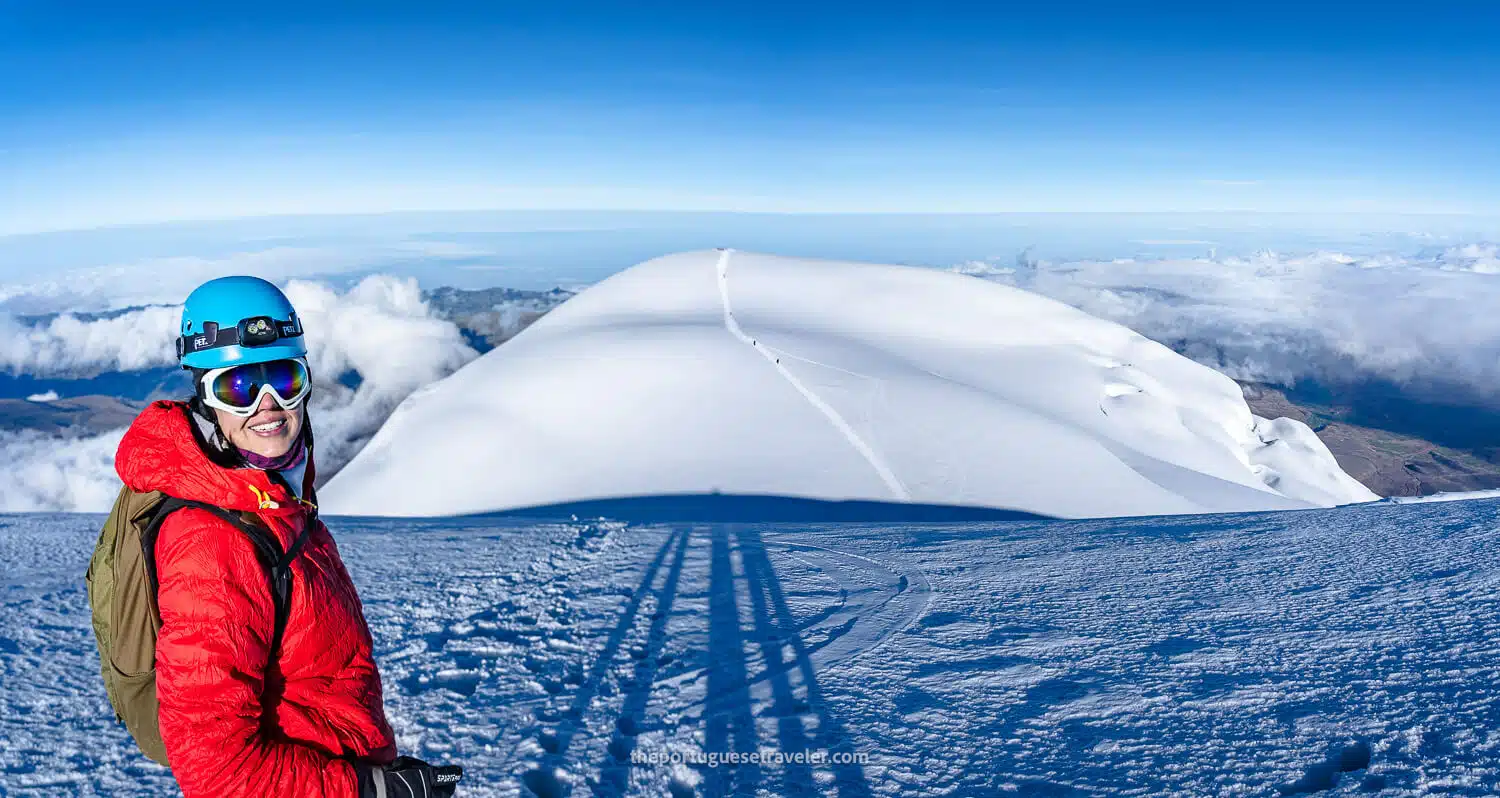
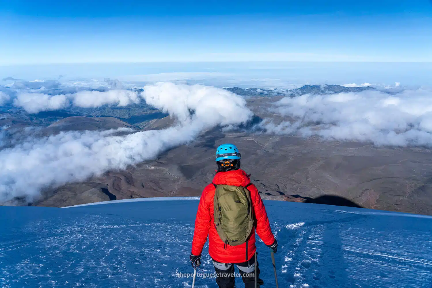
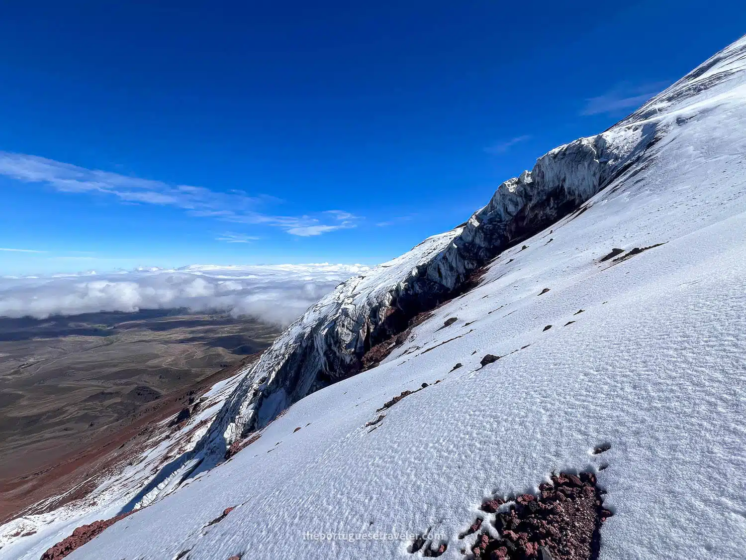
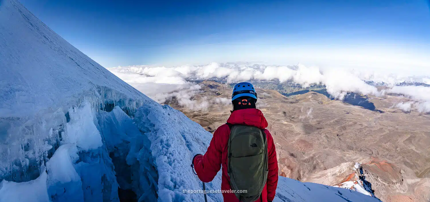
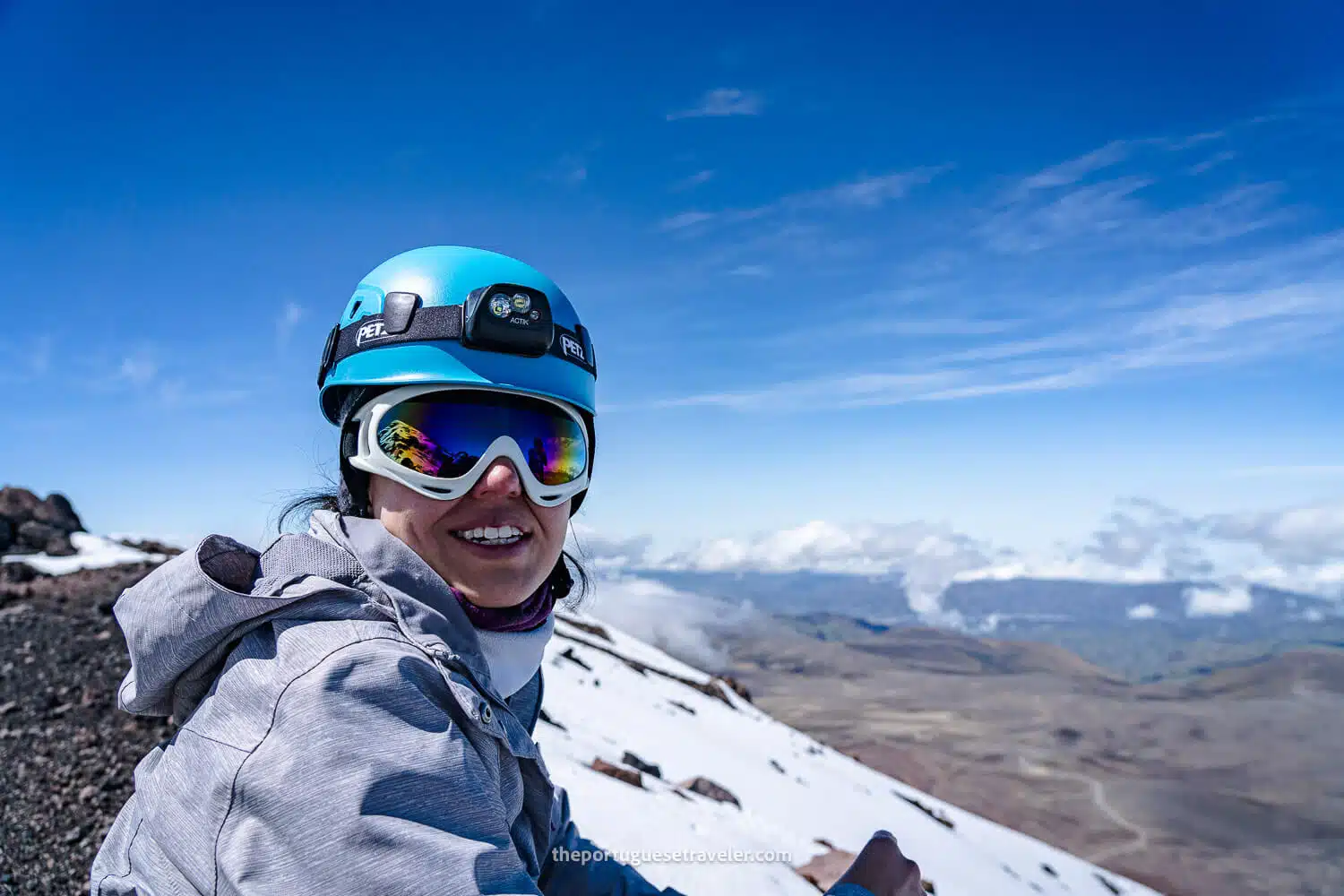
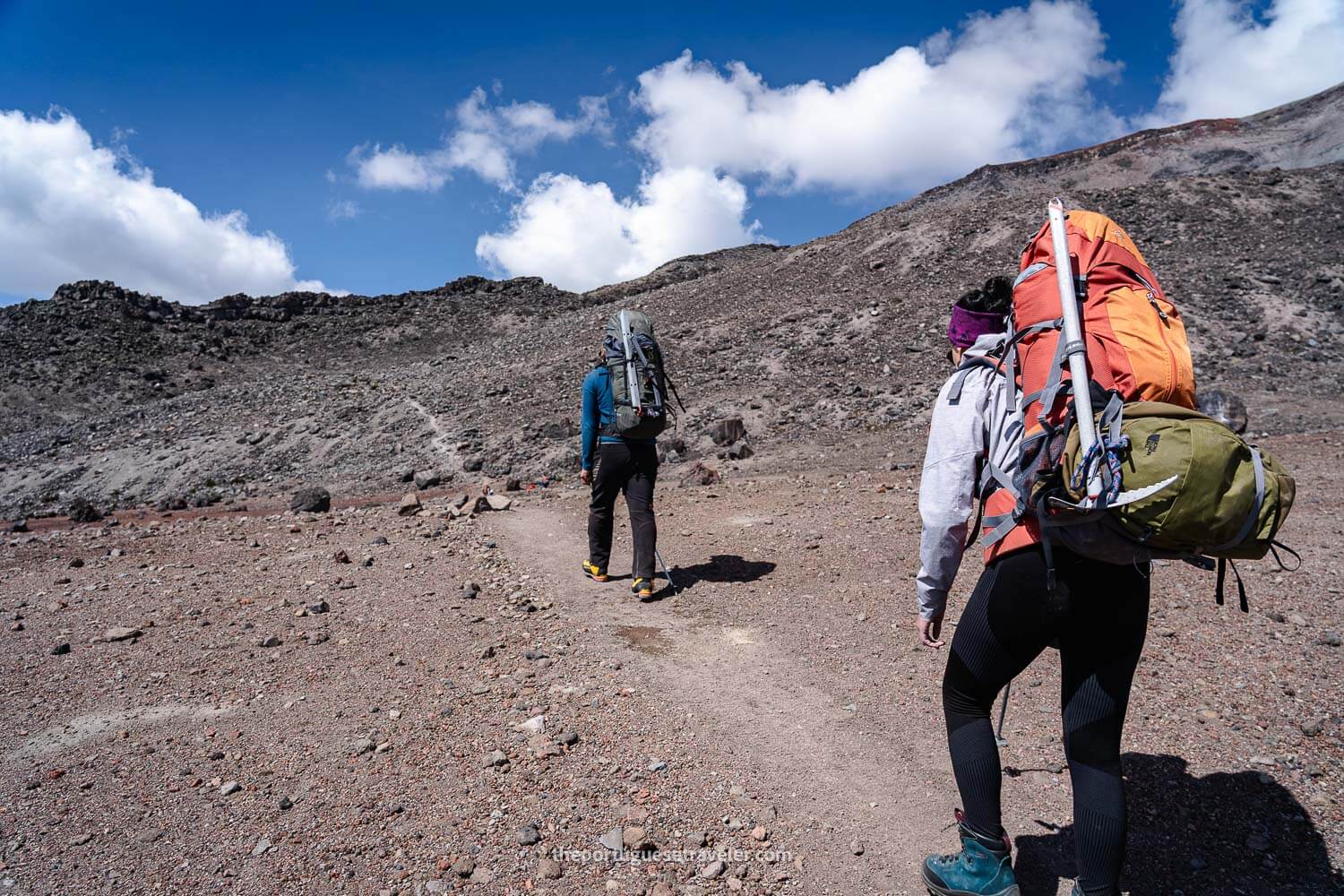
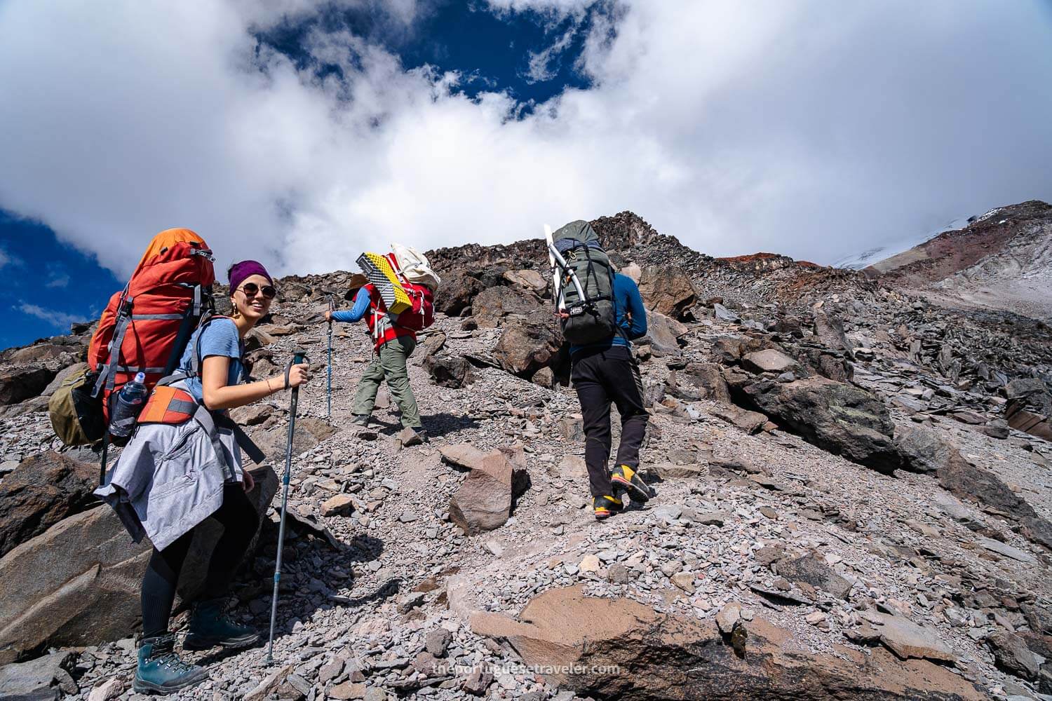
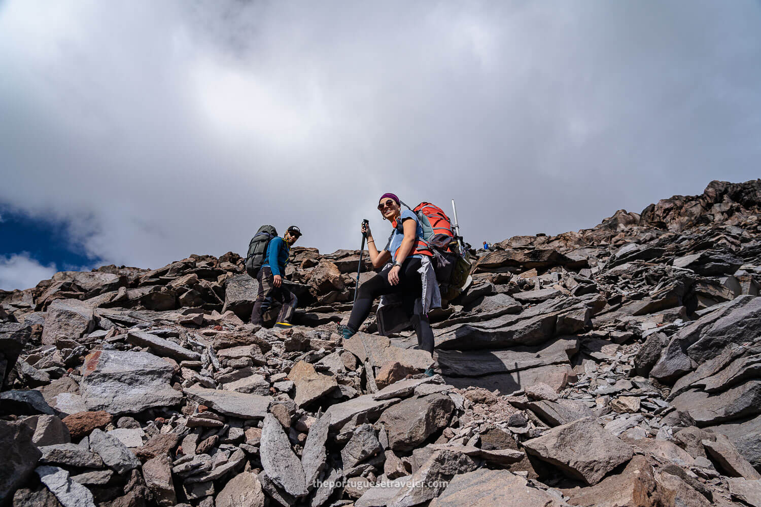
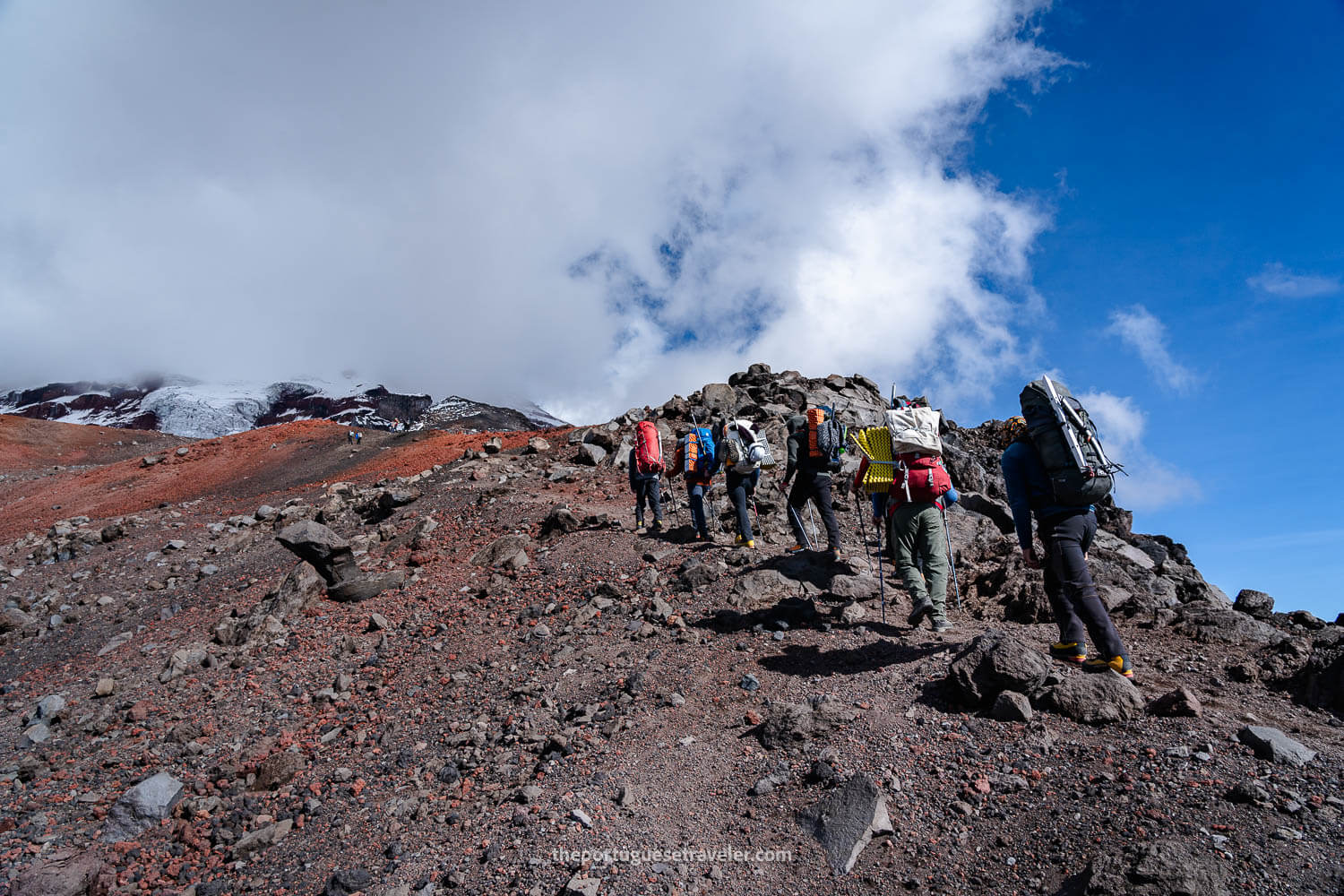
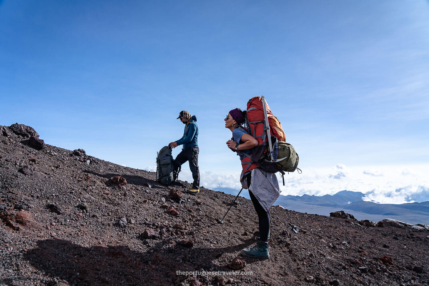
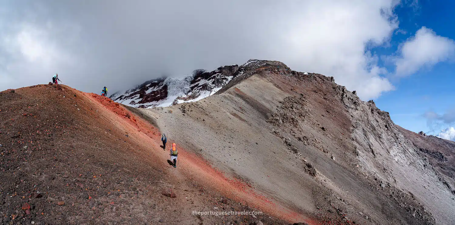
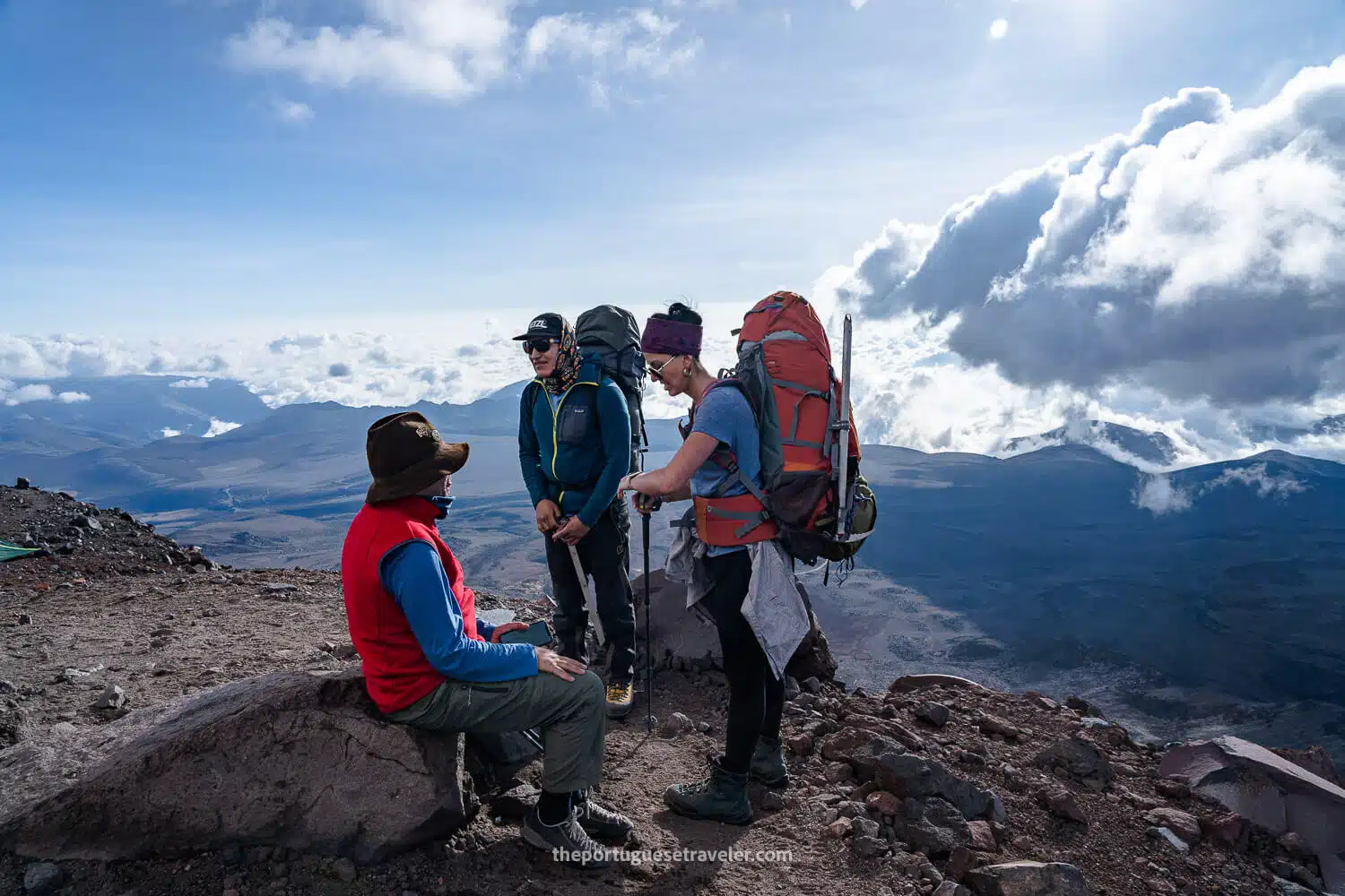
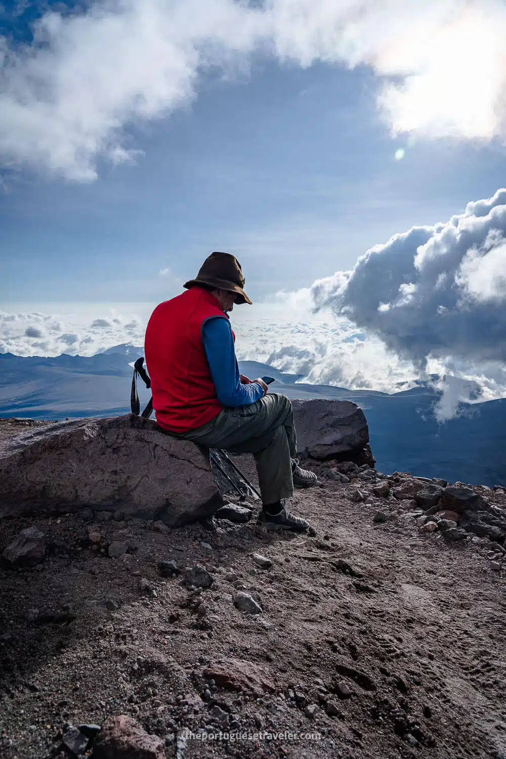
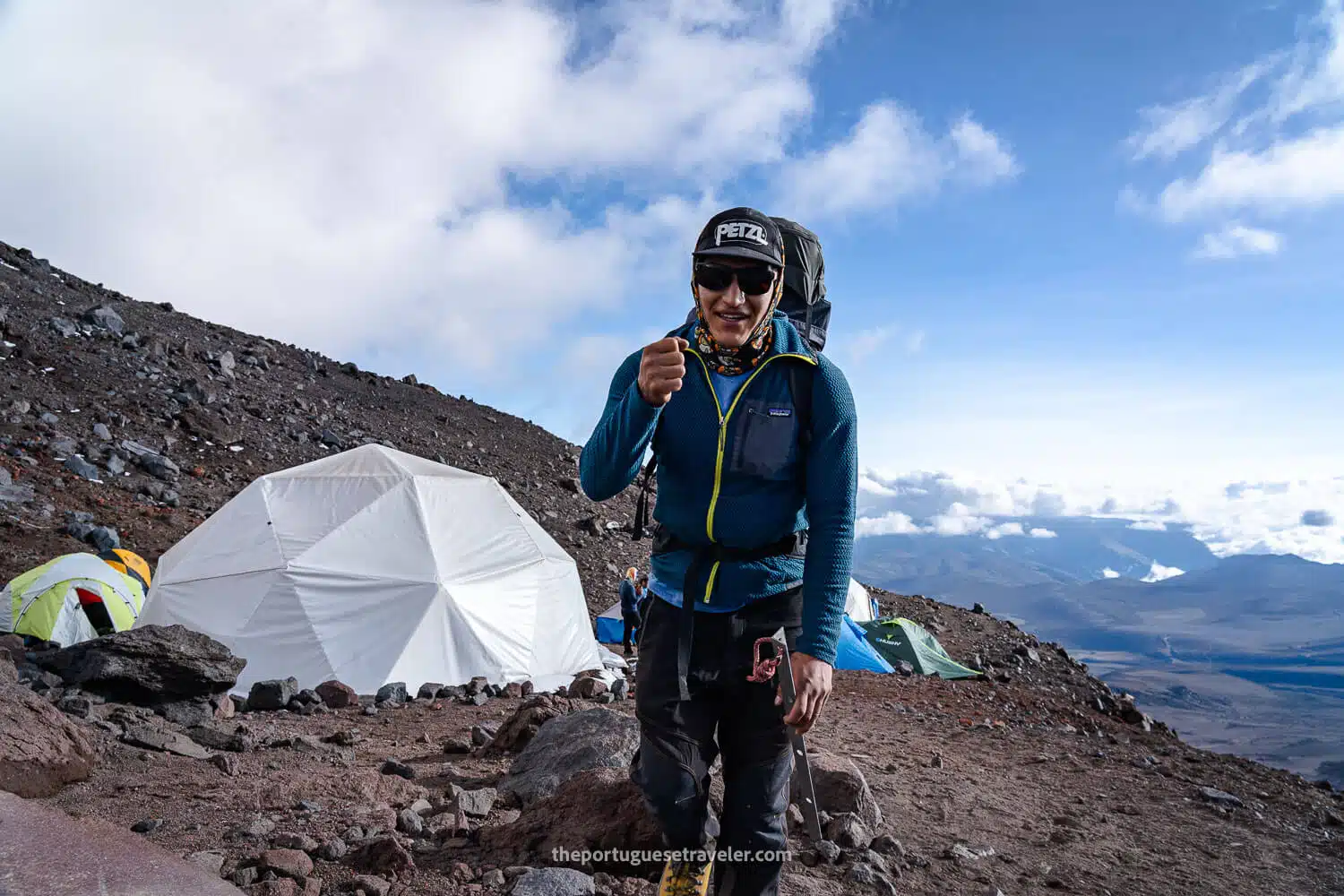
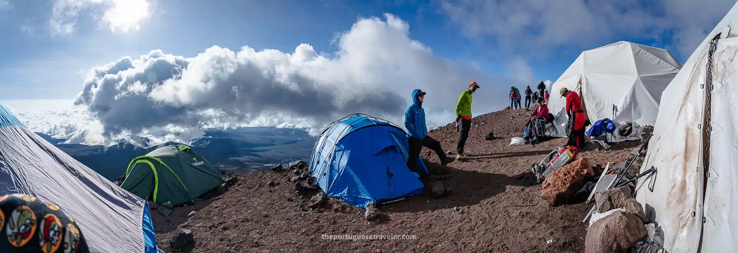
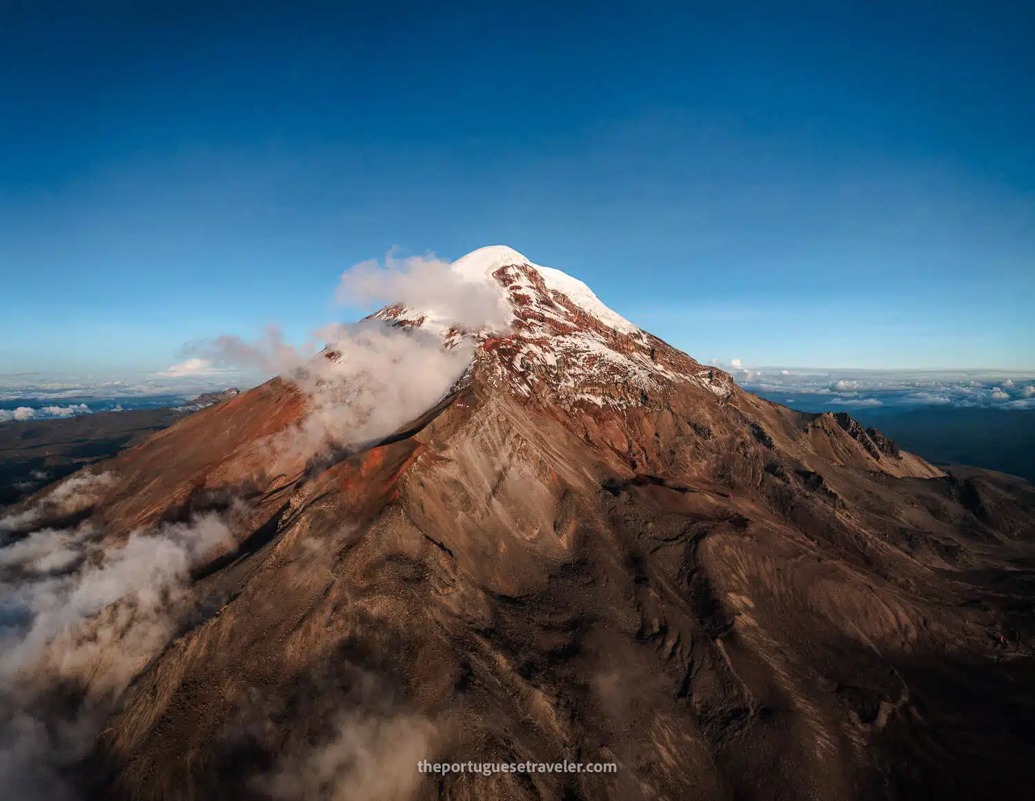
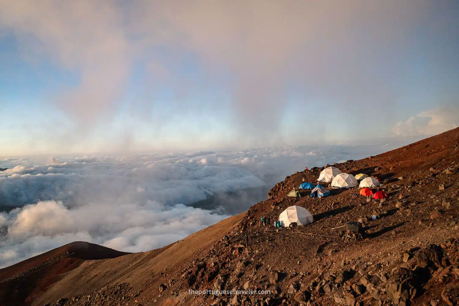
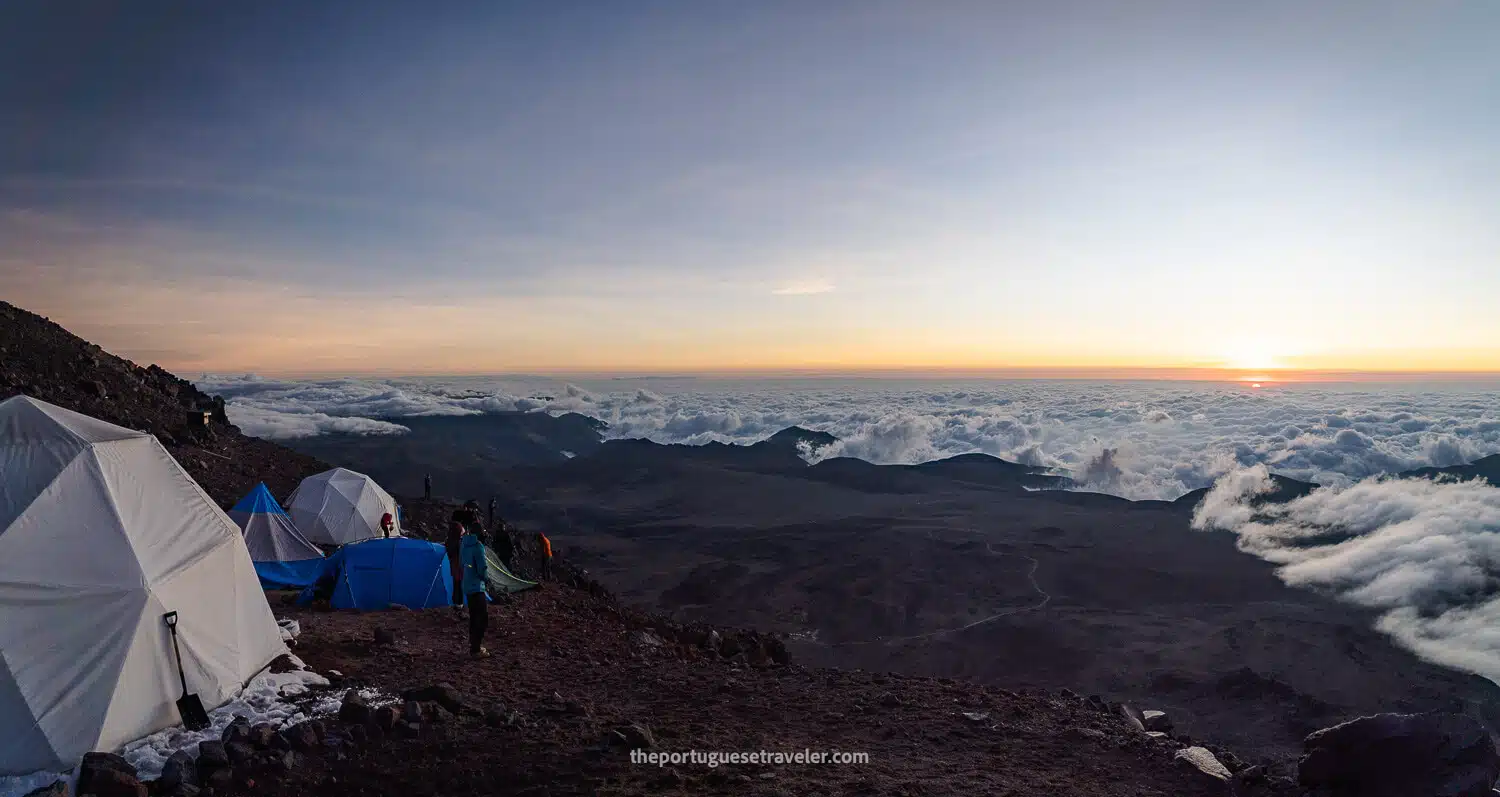
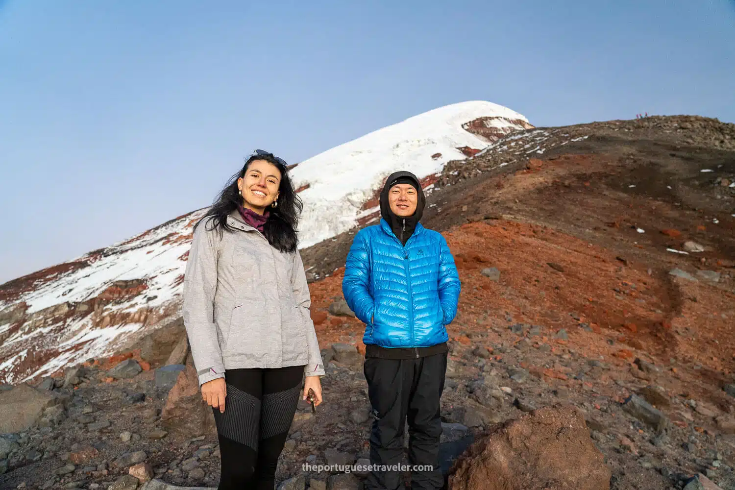
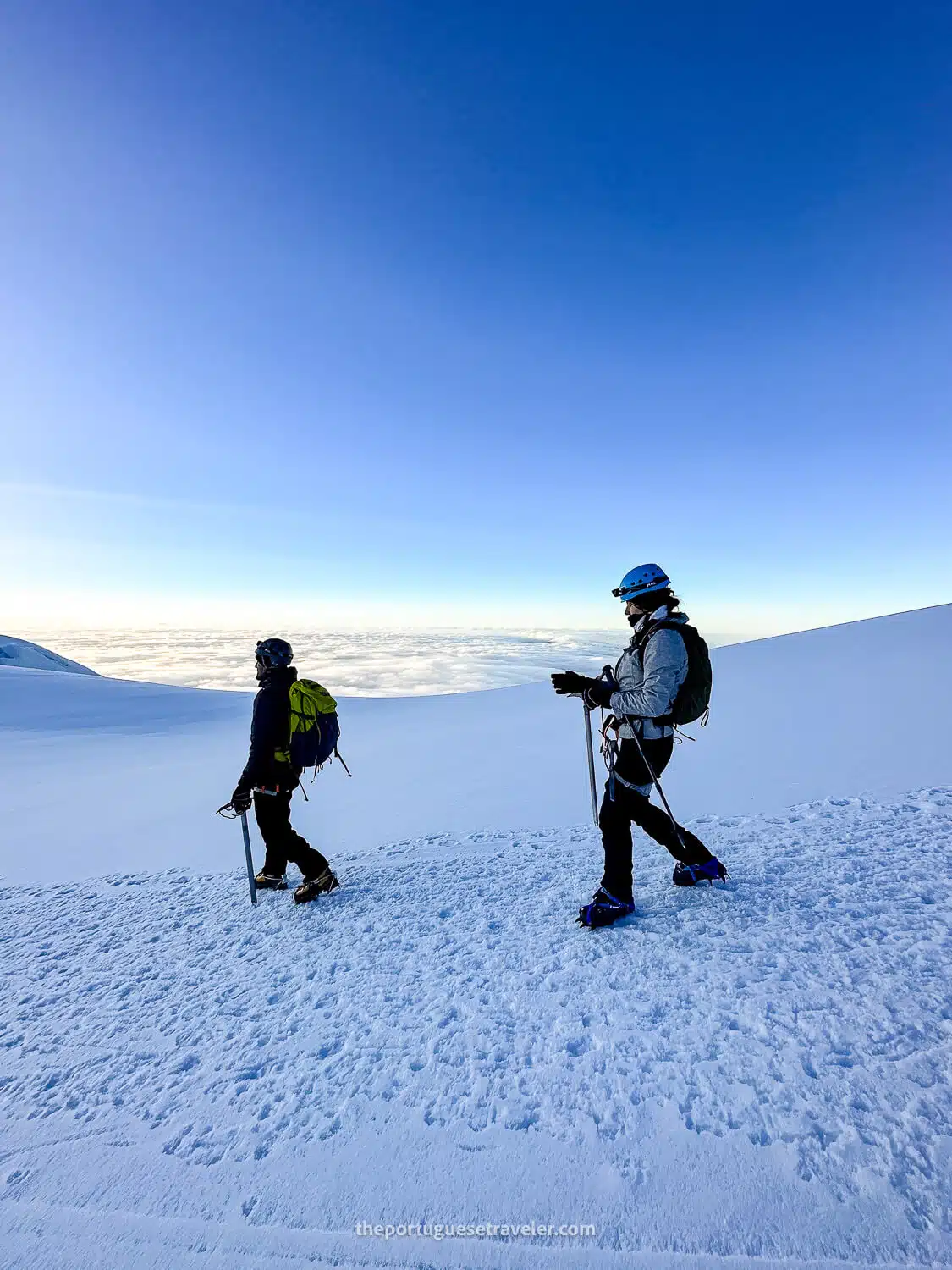
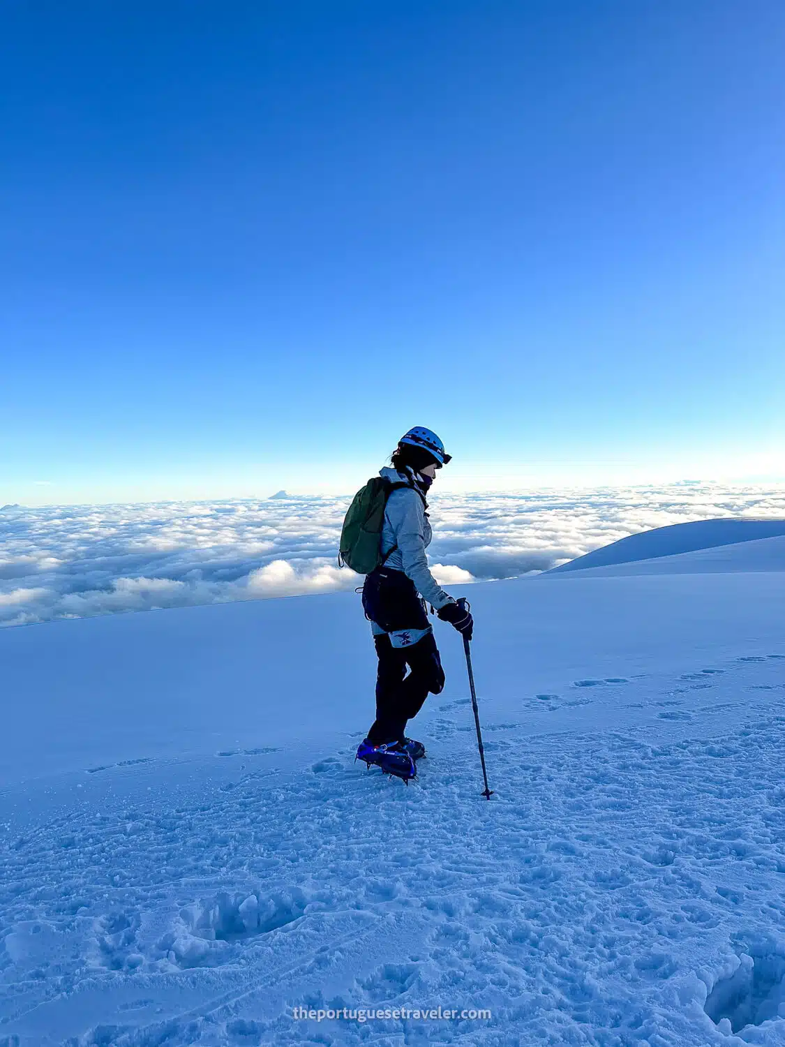
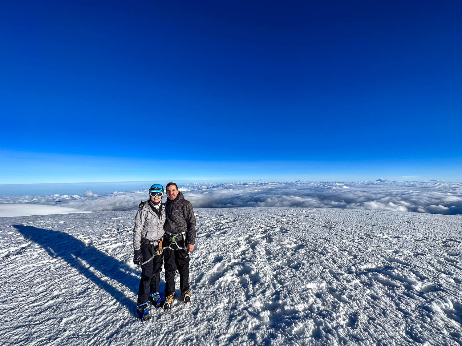
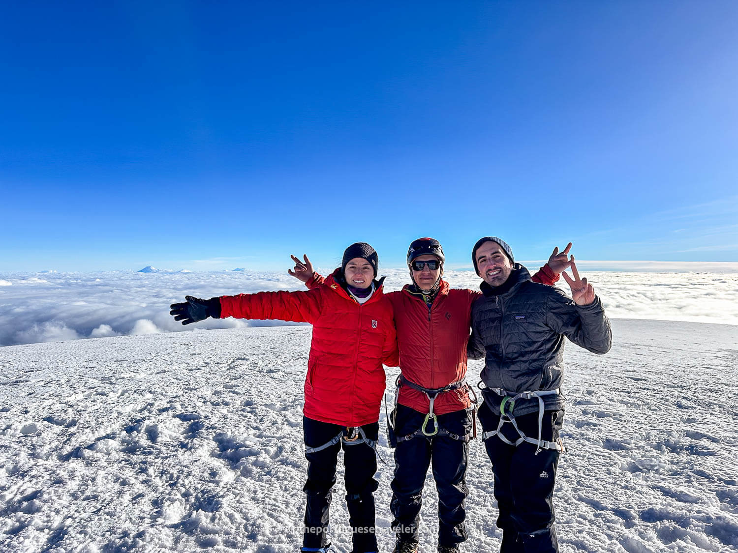
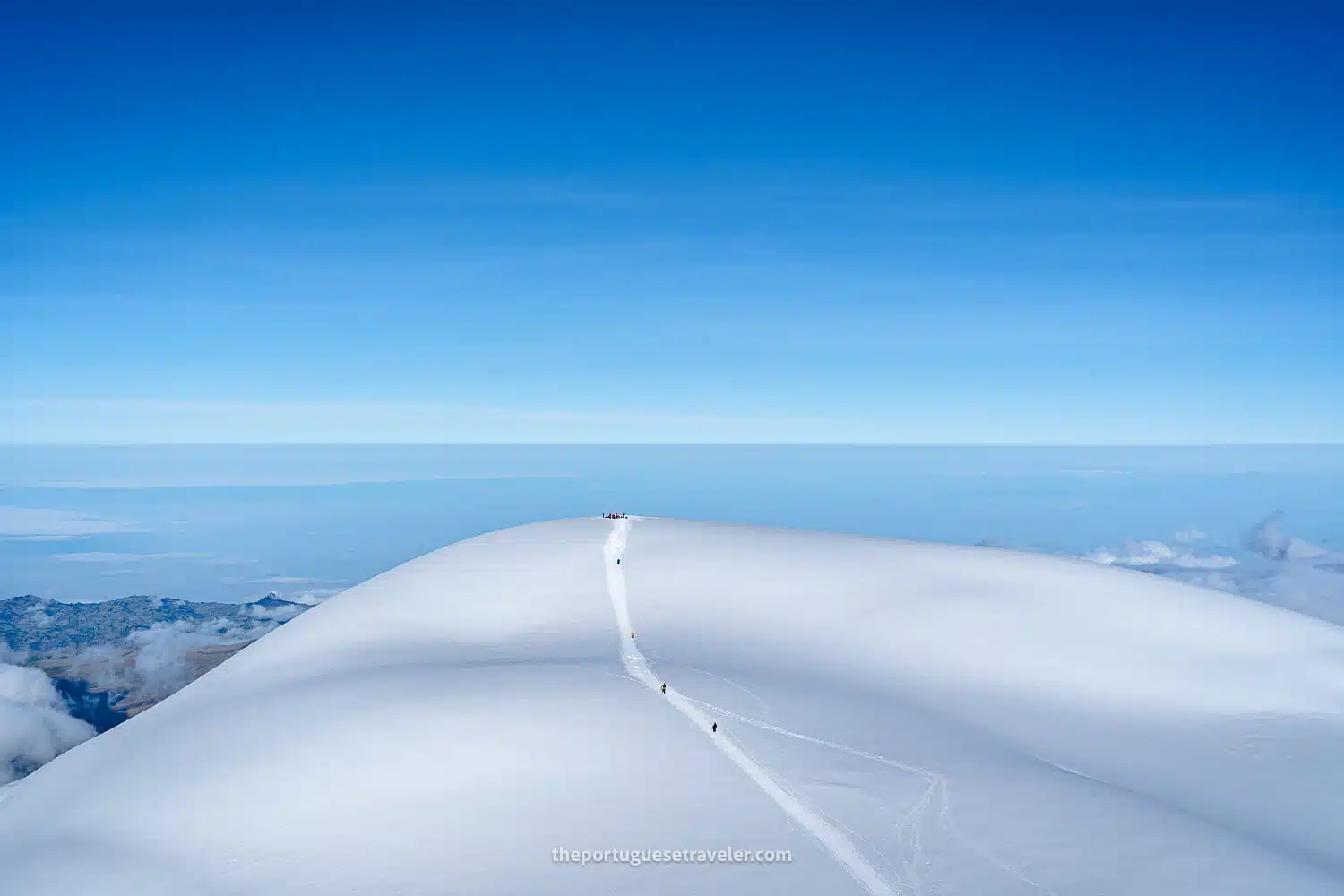
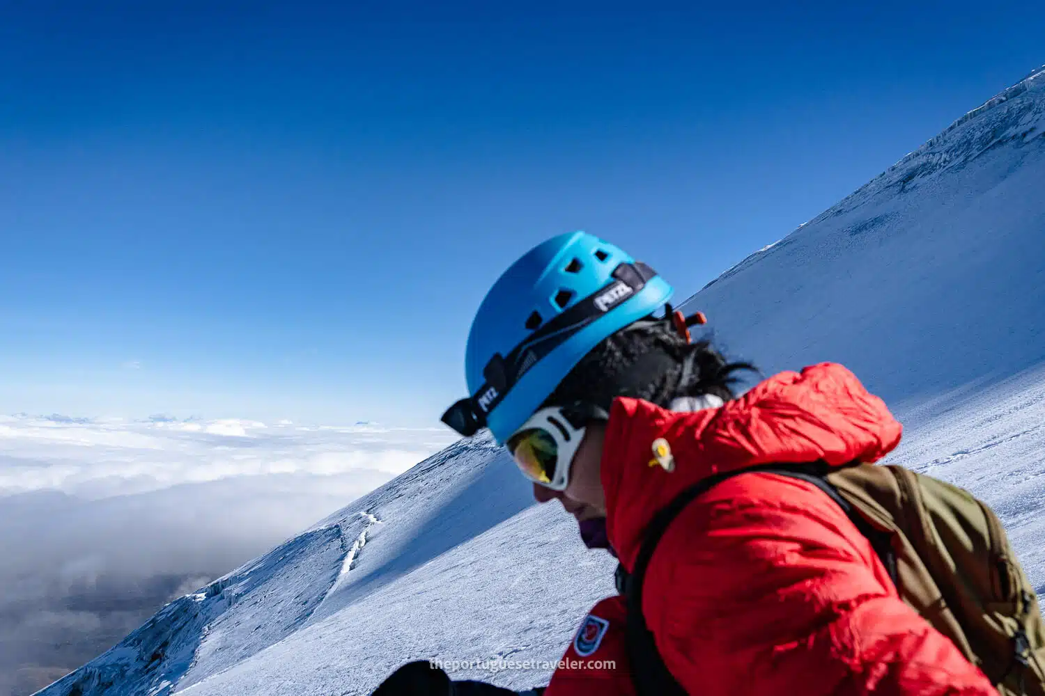
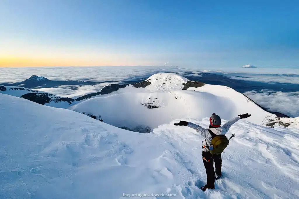
Climbing Conditions: Standing at 6,263 meters (20,549 feet) above sea level, Chimborazo is the highest mountain in Ecuador and the Northern Andes. While technically less demanding than other high-altitude climbs, reaching its summit requires excellent physical conditioning and experience with glacier climbing, as the upper slopes are covered in snow and ice. Climbers must use proper equipment like crampons and ice axes, and due to the high altitude, proper acclimatization is essential.

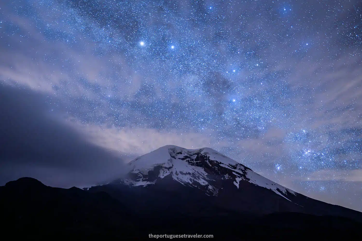
Unique Geographic Feature: Chimborazo holds the distinction of being the point on Earth farthest from its center, surpassing Mount Everest by over 2,000 meters. This is due to the Earth’s equatorial bulge, making Chimborazo’s summit the closest point to outer space.

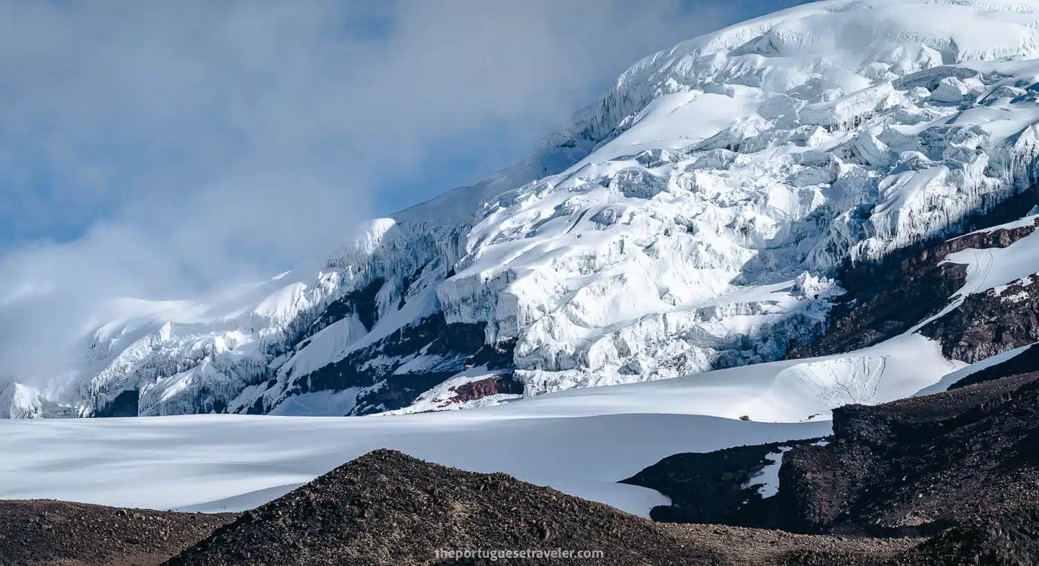
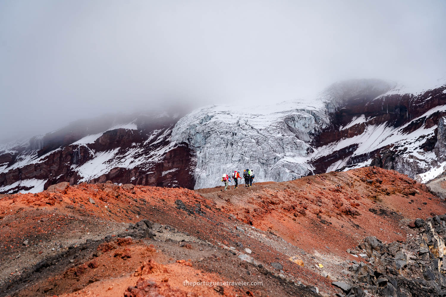
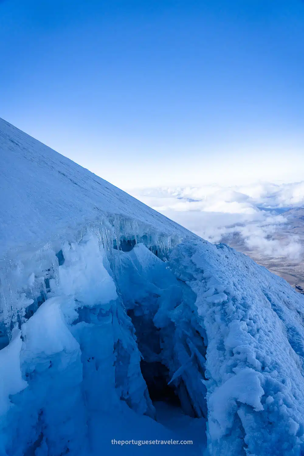
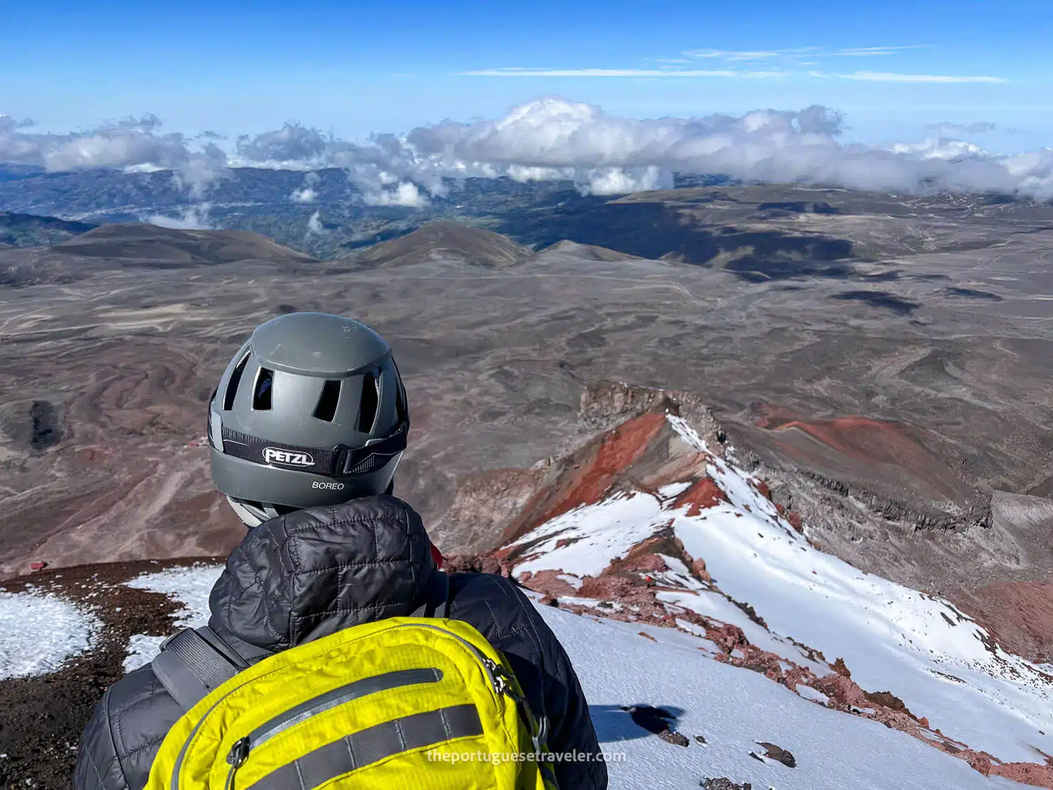
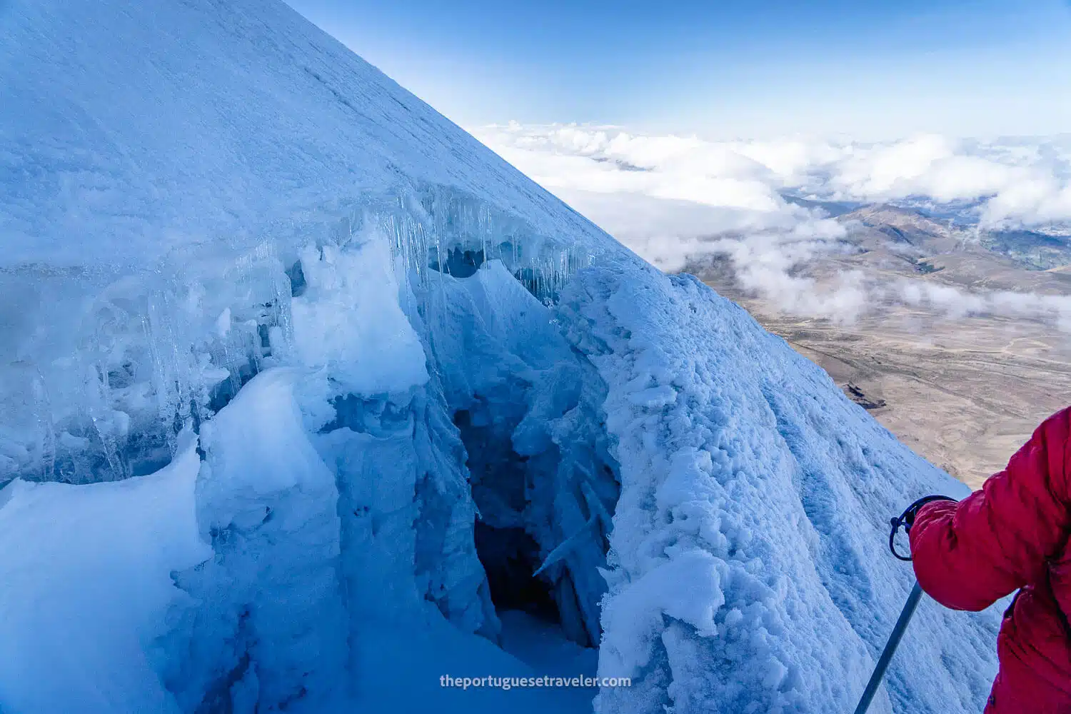
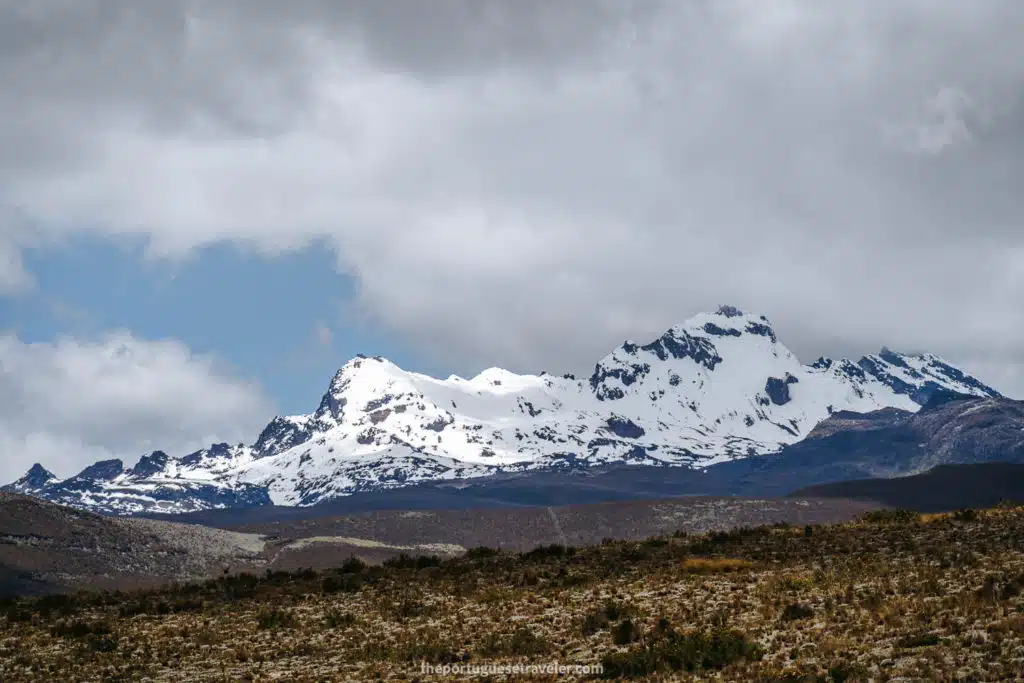
Glaciers and Water Source: The glaciers of Chimborazo extend down to 4,600 meters and provide a crucial water source for surrounding provinces like Bolívar and Chimborazo. However, these glaciers have significantly receded due to climate change and ash from nearby volcanic activity, particularly from Tungurahua.

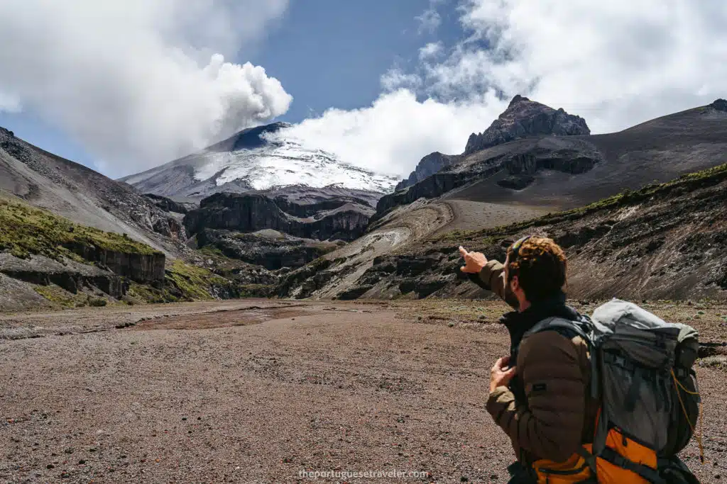
Volcanic Activity: Chimborazo is classified as a potentially active stratovolcano. Its last known eruption occurred around 550 AD. Though it has been dormant for centuries, the volcano is closely monitored by the Ecuadorian Geophysical Institute, as its glacier-covered slopes pose a risk of lahars in the event of future eruptions.

Sacred Mountain: In ancient times, Chimborazo was a sacred site for the indigenous people, particularly the Puruháes, who believed the mountain was home to powerful gods. It played a key role in local rituals, including offerings of llamas and young women to ensure water and appease the mountain’s spirits.

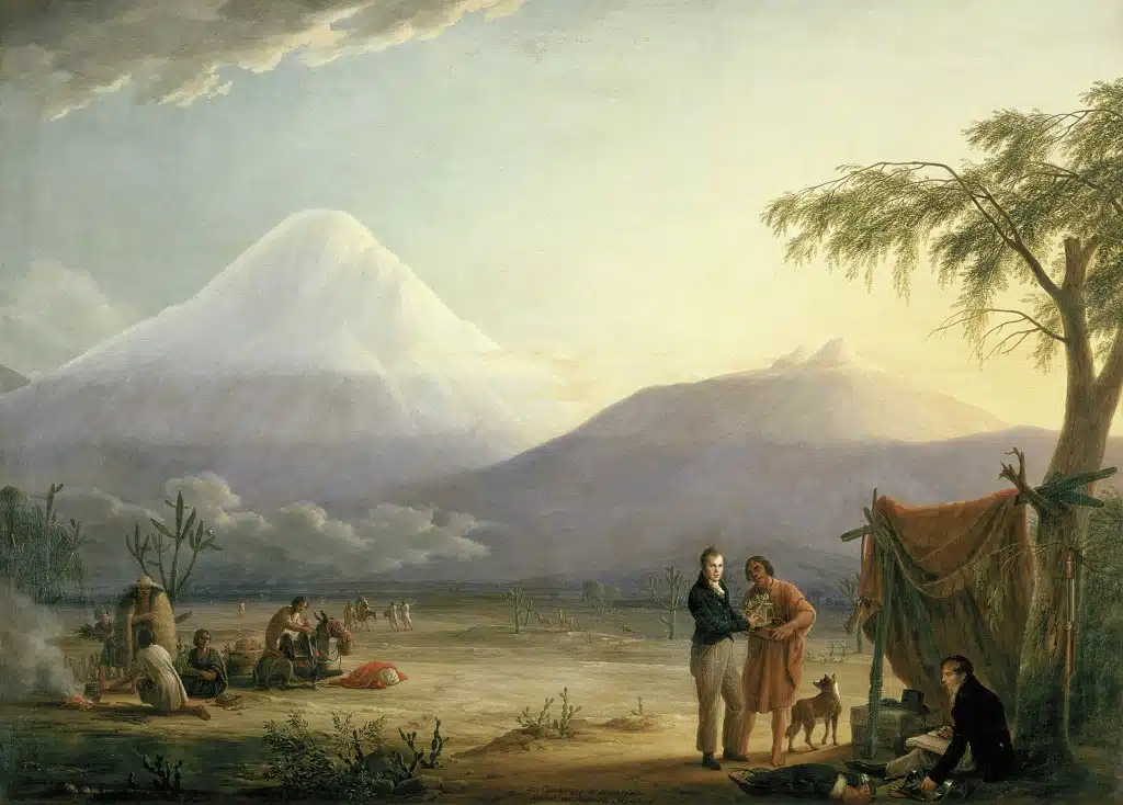
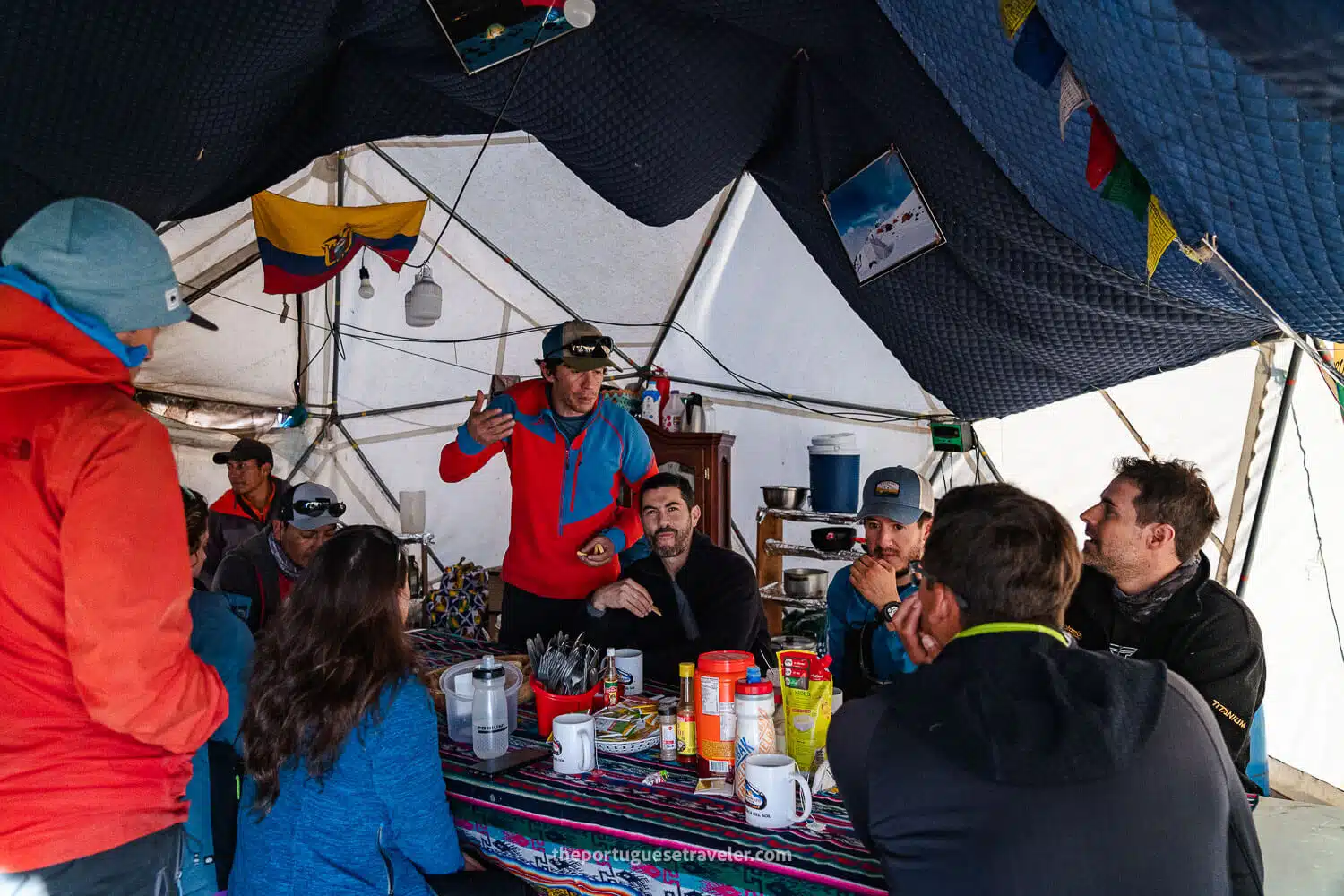
Historic Expeditions: Chimborazo was once considered the highest peak in the world, attracting early explorers and mountaineers. In 1802, Alexander von Humboldt attempted to climb it, reaching 5,875 meters, the highest recorded altitude at the time. The first successful ascent to the summit was achieved by Edward Whymper in 1880, along with guides Jean-Antoine and Louis Carrel. Today, Chimborazo remains a popular destination for mountaineers worldwide.

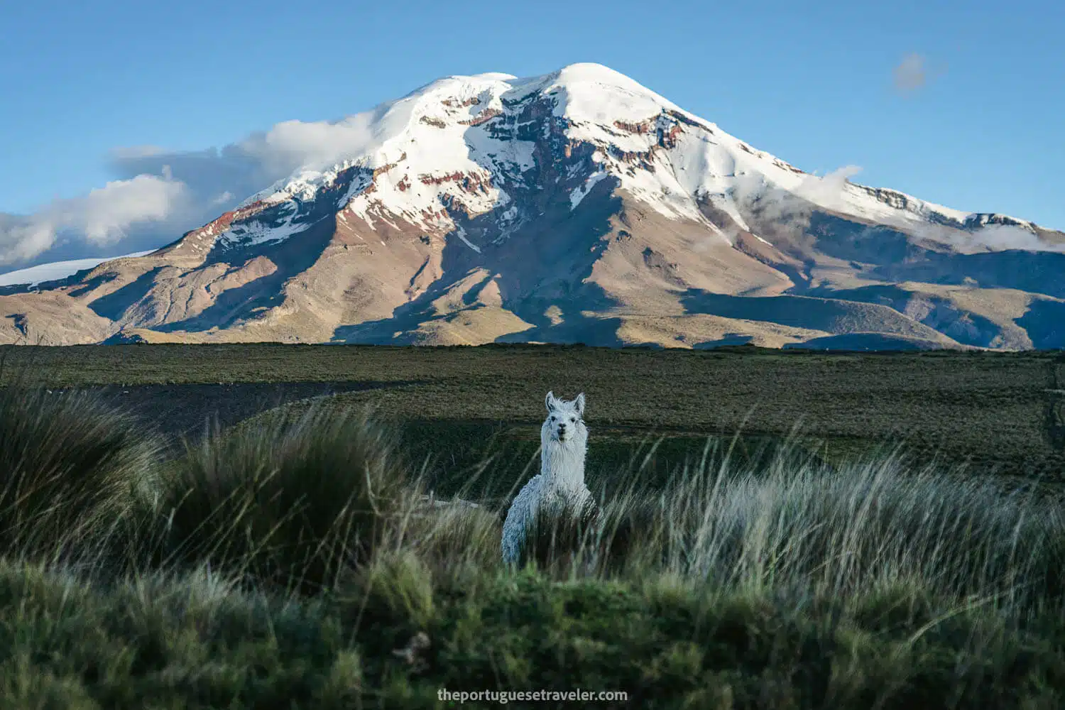
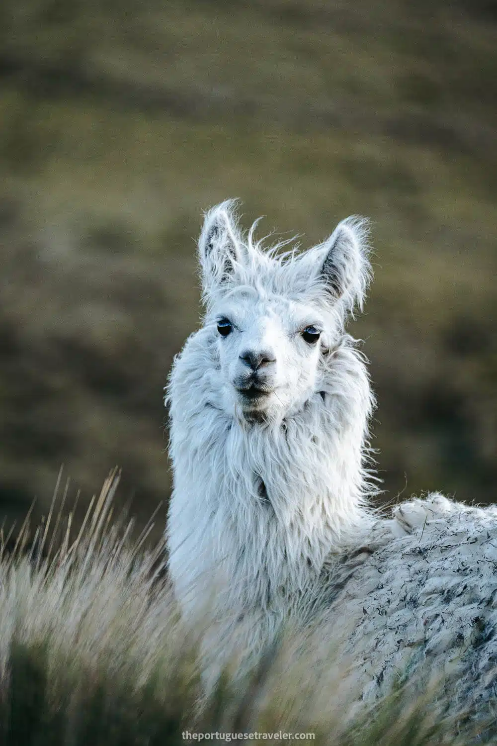
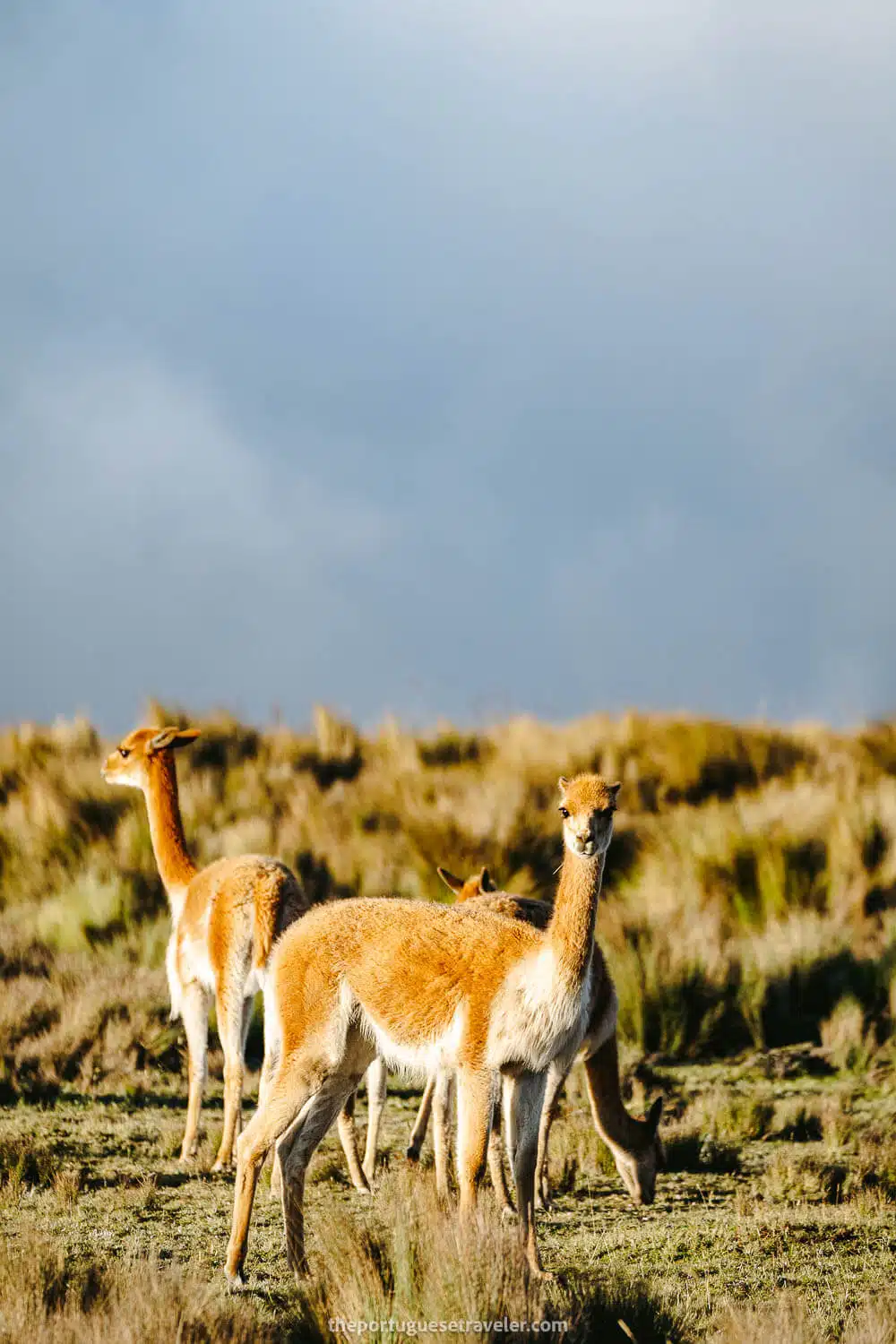
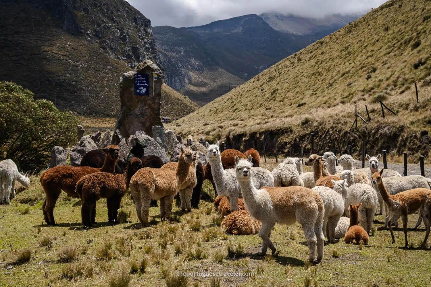
Protected Ecosystem: The volcano is located within the Chimborazo Fauna Reserve, a protected area that preserves the habitat of native Andean animals such as vicuñas, llamas, and alpacas. The surrounding ecosystem is vital to the region’s biodiversity, offering climbers and visitors a unique glimpse into the Andean highlands.

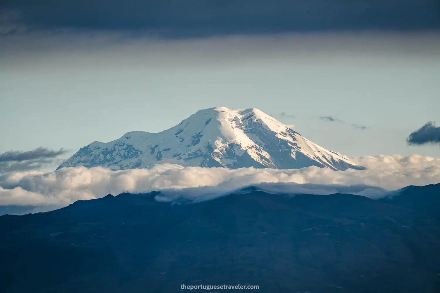
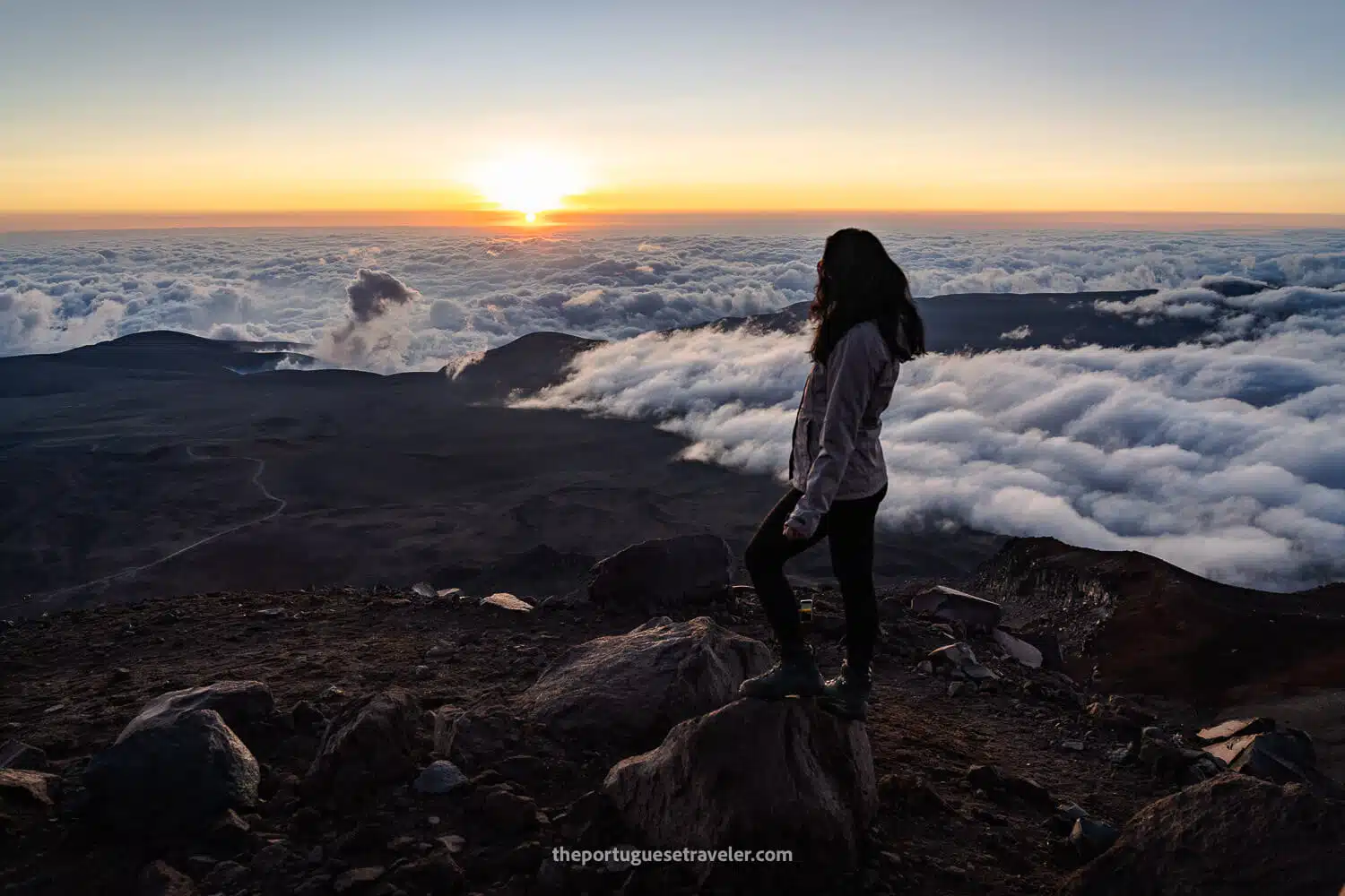
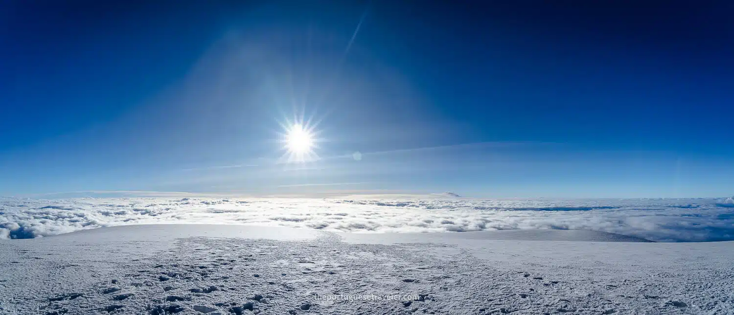
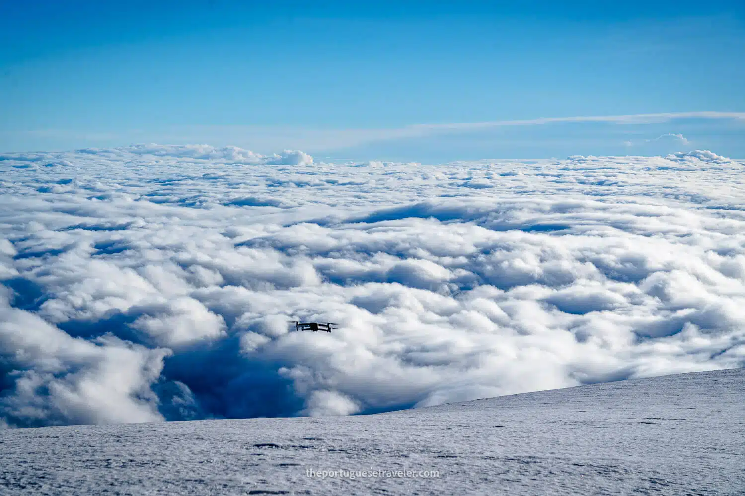
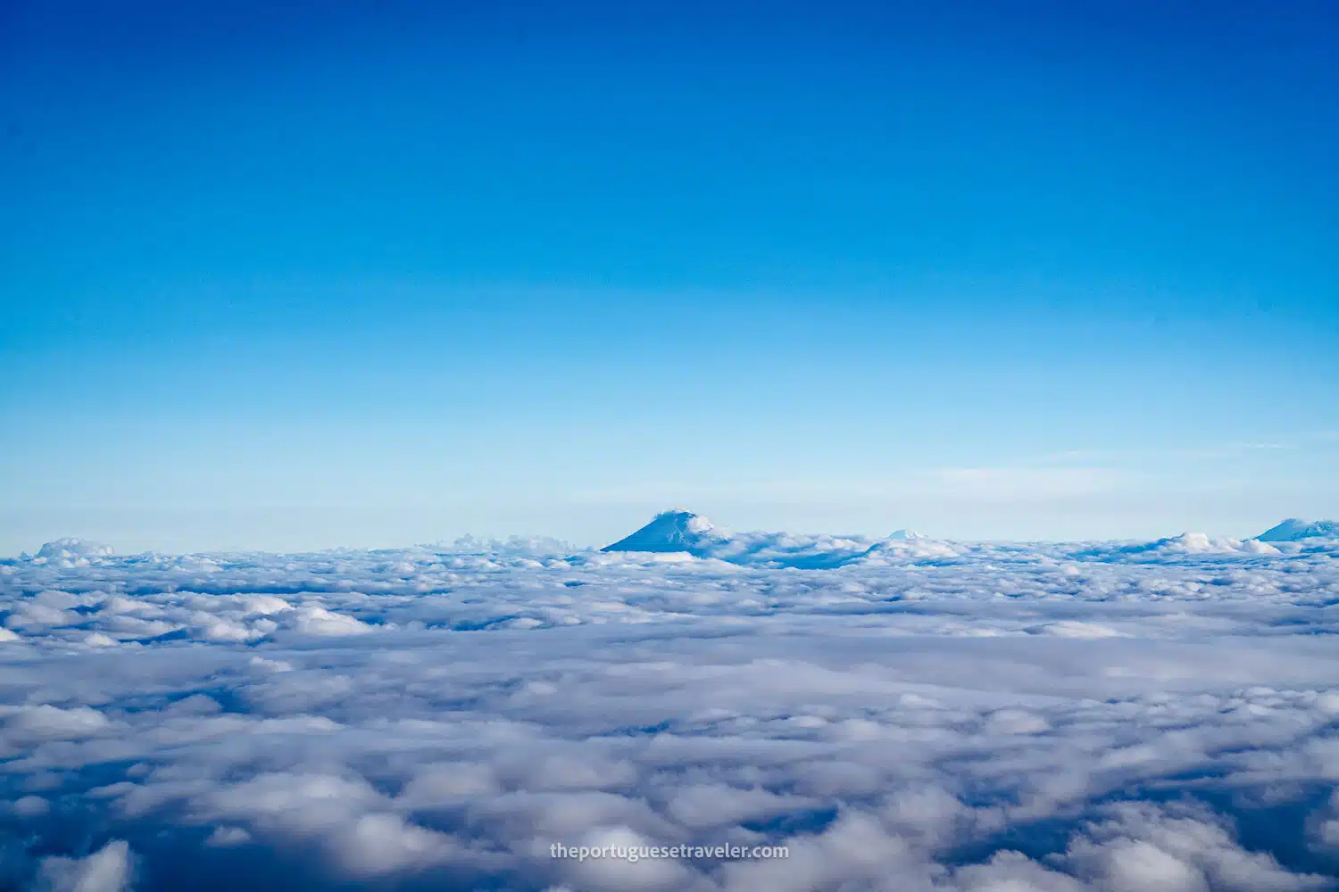
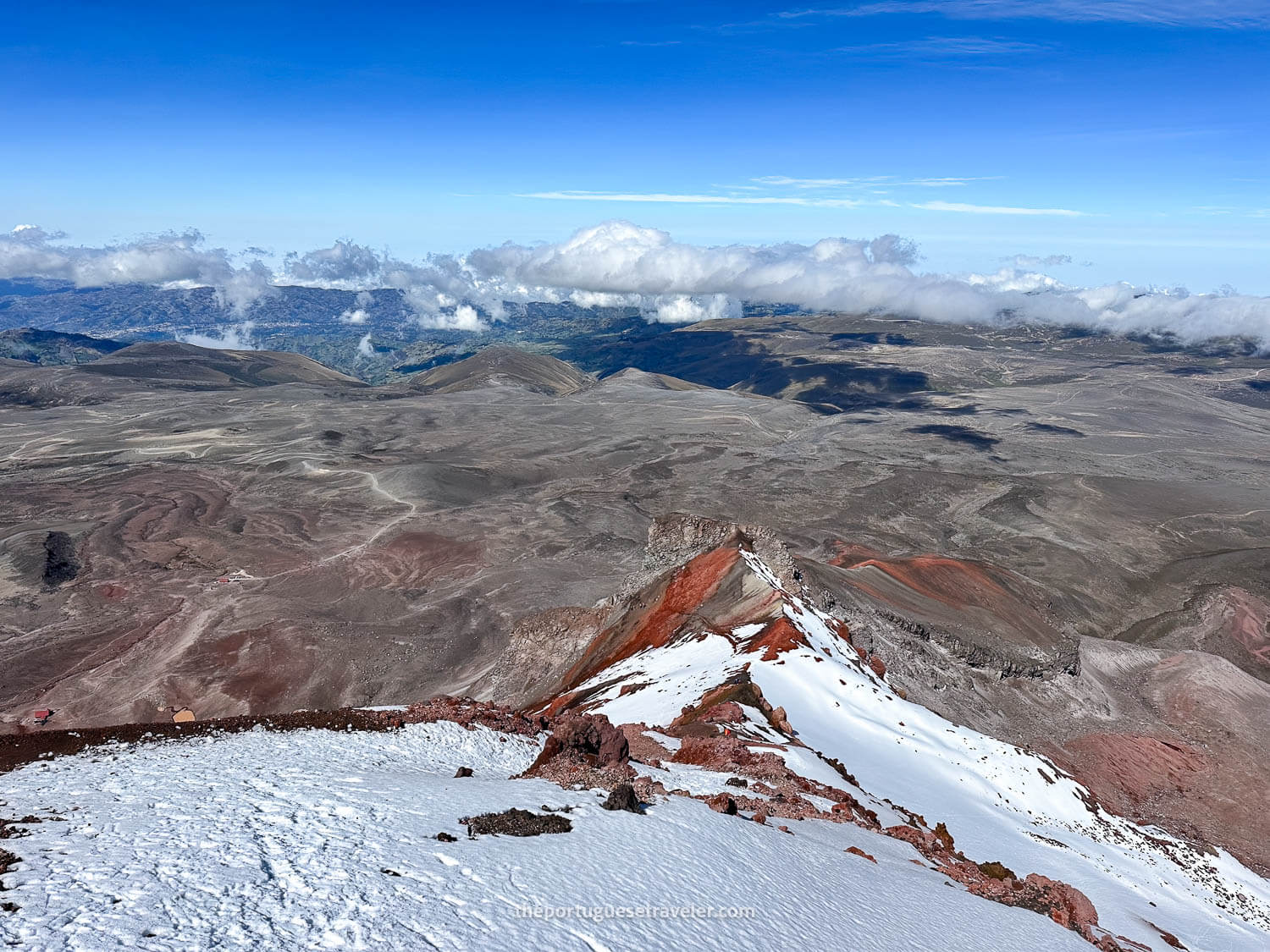
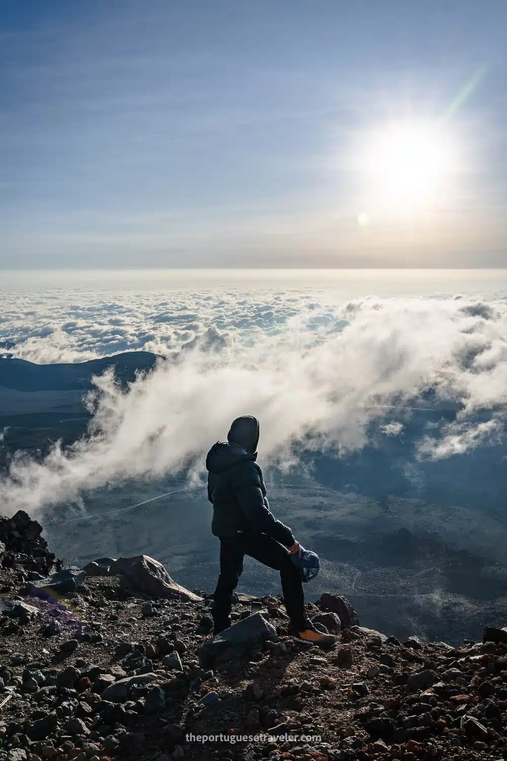
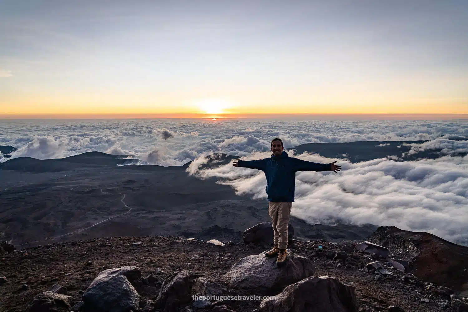
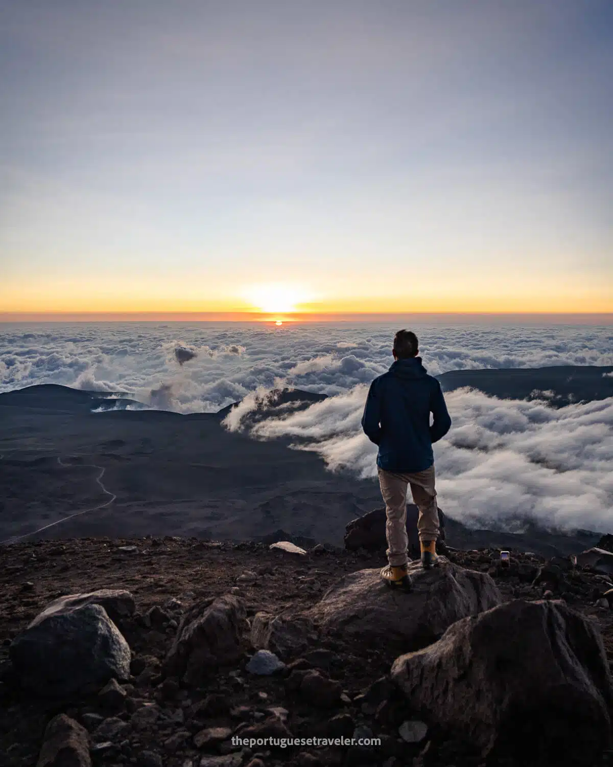
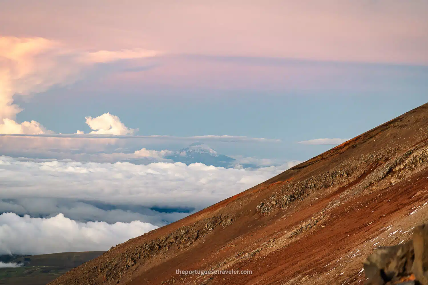
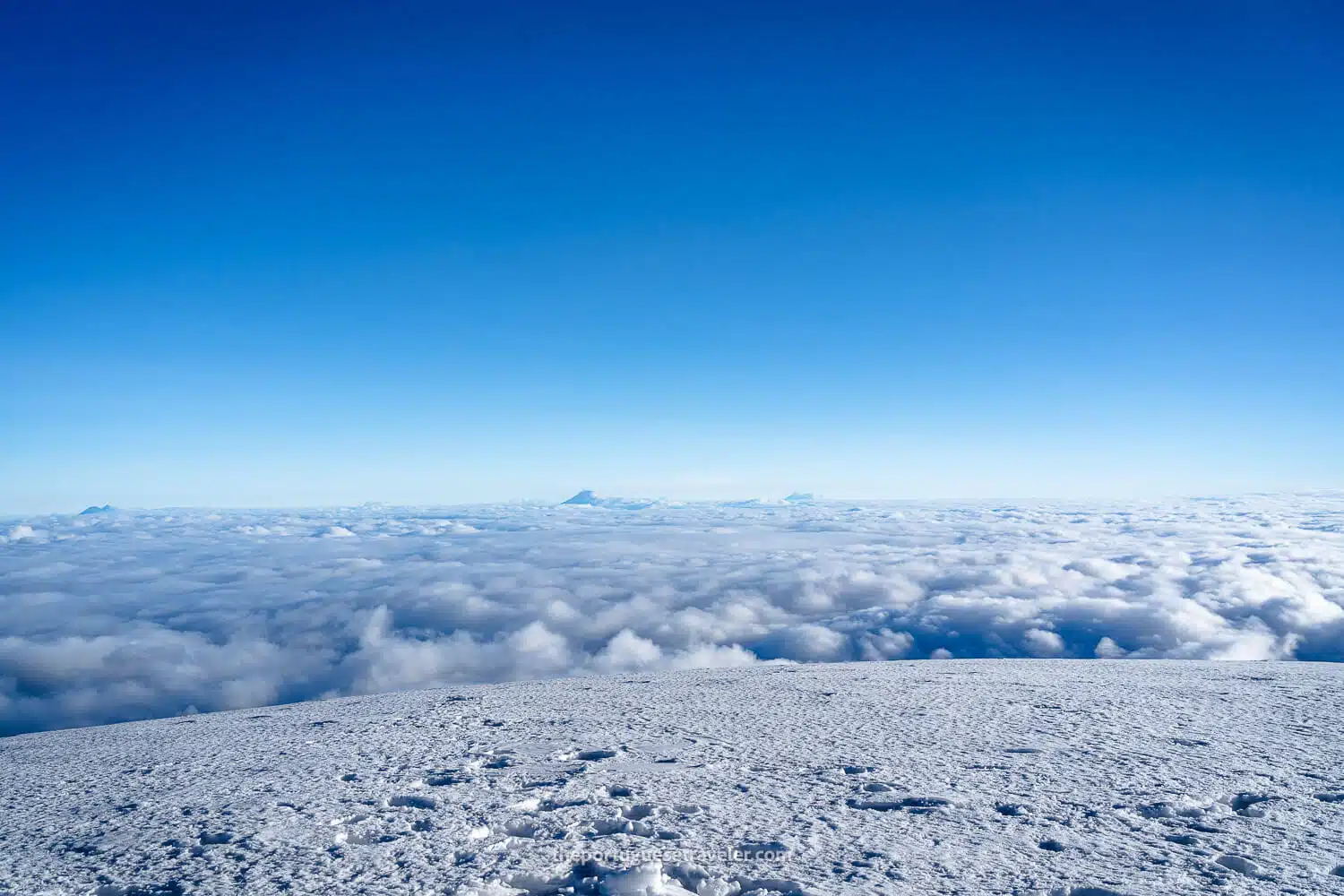
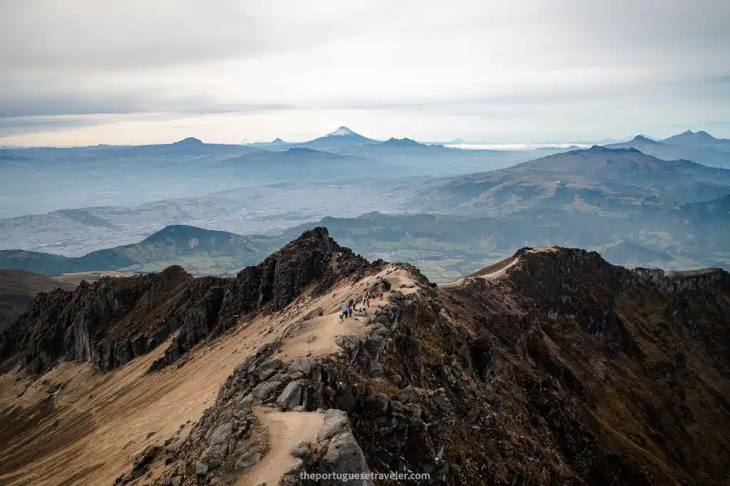
Incredible Views: On a clear day, the views from Chimborazo are spectacular, with glimpses of neighboring peaks and even the distant city of Guayaquil, 142 kilometers away. The mountain’s isolation and height make it a breathtaking sight from nearly any direction.

Recent Activity: Baltazar Ushca, known as the last ice harvester of Chimborazo, recently passed away. For decades, he carried on the ancient tradition of extracting ice from the mountain’s glaciers, an almost vanished craft. His death marks the end of an era that tied local communities to the glaciers of Chimborazo in a deeply meaningful way.

Humboldt and the Chimborazo and Carihuairazo Volcanoes, painting by Friedrich Georg Weitsch, 1806
Humboldt and the Chimborazo and Carihuairazo Volcanoes, painting by Friedrich Georg Weitsch, 1806 (Source: https://picturingtheamericas.org/painting/alexander-von-humboldt-and-aime-bonpland-near-the-chimborazo-volcano/?lang=es)

My Experience climbing Chimborazo Volcano


This is the story of how I climbed to the highest point on Earth and Ecuador’s tallest volcano, Chimborazo, and proposed to my Ecuadorian girlfriend.

It all began as a simple idea after summiting Cotopaxi Volcano in 2022. Returning to Ecuador in 2023, I decided to aim higher, both literally and figuratively. That’s when the plan to climb Chimborazo took shape. Jhose, now my wife, recommended Mauna Expeditions, the same company that had helped her climb Cotopaxi the previous year. We contacted them, exploring the possibility of partnering with them in a mutually beneficial way. I eventually agreed to follow a thorough acclimatization process—four mid-altitude mountains and one high-altitude peak—before attempting Chimborazo.

For acclimatization, we climbed Los Pichinchas, Imbabura, Sincholagua (though we had to turn back due to weather), and did glacier training on Antisana. Finally, we summited Cayambe Volcano, one of Ecuador’s four massive snow-capped peaks. The stage was set for Chimborazo the following weekend.

A panorama of the blue hour at high camp

The First Day - High Camp Climb

We met the rest of the group at Tribuna de Los Shyris and boarded a small van bound for Chimborazo. After about four hours, we arrived at the reserve and registered at the entrance. From there, we headed to Refugio Carrel, where we parked the van. As soon as we stepped out, we were greeted by the towering presence of Chimborazo, its colossal mass looming behind the hut. We changed gear, leaving our hiking gear in the car, and put on our summit boots and helmets for the approach to High Camp.

The walk to High Camp (Campamento Arista – Ridge Camp – 5,300m) was tougher than expected. The new boots I had brought to avoid the pain from my previous pair on Cayambe weren’t very comfortable, making the climb on loose rocks and gravel even more challenging. The path was a straightforward, zigzagging route, and we could see other groups ahead and behind us. From the refuge, the sight of tents at the high camp reassured us that we wouldn’t be walking for much longer.

When we arrived at High Camp, we were amazed by how well-equipped and beautiful it was. The camp consisted of glacier-white domes with mattresses inside, one of them serving as a kitchen and dining area where we would soon have lunch. After unpacking, we prepared for lunch and the approaching sunset. As I grabbed my drone and camera, the scenery that unfolded was breathtaking. A cloud inversion revealed a clear sky, and as the sun began to set, the sky turned shades of red and purple—an otherworldly experience no doubt.

After the sunset, we headed to our tent, hoping to get some rest. We tried to sleep from 7 p.m., knowing that we would need to wake up at midnight to begin our summit push.

On the van on the way to the Refuge Carrel
The registration office at the entrance of the reserve
The Refuge Carrel or Refugio Carrel where we parked to start ascending to the High Camp
The scramble uphill
The scramble uphill
Lunch at High Camp
Lunch at High Camp
Refugio Hermanos Carrel
The start of the climb up to High Camp
The climb from the refuge to high camp
The group ahead of us almost reaching the camp
The glaciers of Chimborazo behind the climbers group
Arriving at Chimborazo High Camp
The Chimborazo High Camp
The Kitchen Tent
The Kitchen Tent
An amazing drone shot of high camp with a cloud inversion
Jhose at Sunset
Jhose at Sunset
Sunset at High Camp over a cloud inversion
The blue hour at High Camp
My beautiful boots before starting the climb
The way up (during the day since at night i didn't take any photos)
The few crevasses on the way to the summit

The Night Summit Attack

We woke up at midnight (if you can call it waking up, since sleeping at 5,300m with altitude headaches and layers of clothes on is nearly impossible) and began our climb. We started fully equipped with crampons, helmets, and headlamps. The night was pitch black, and various groups were also heading for the summit. The first section we needed to cross was El Castillo, a big rocky wall on our left, notorious for loose rocks falling from its top. We heard several rocks tumbling down, but luckily none came too close.

As we climbed, we alternated between passing other groups and being passed ourselves. The climb seemed endless, with the path being mostly a straightforward ascent, unlike Cayambe, which had zigzags and icy slopes with crevasses. Once we got past the rocky section, it was snow all the way. Though we encountered a few crevasses, recent snowfall made the ascent manageable. The summit area, prone to avalanches, didn’t pose any issues that day, though we heard that groups attempting it in the days after weren’t as fortunate.

We used the “Paso Ochomilero” technique, maintaining a slow, steady pace without too many pauses, as our Cayambe guide had taught us. This helped manage the strain on my tendons and ankles. The climb was monotonous, with little variation in the path and few views of the other volcanoes, as most of them were on the opposite side of the mountain. Eventually, as the sky began to lighten, we could see the summit ahead of us, dotted with the lights of other climbers already making their way. Reaching the first summit, I couldn’t help but tear up.

The path uphill (The El Castillo Wall is underneath us in this photo)
The path through ice and snow
The endless snow climb to the summit

The Chimborazo Summit

As we neared the first summit, I could hardly believe that in just a few minutes, I would be proposing to my girlfriend with a ring I had been carrying for over a month. I could have proposed at the summit of Cayambe, but my heart was set on Chimborazo, and we were lucky to have the gods and the weather on our side.

When we reached Veintimilla Summit (6,234m), tears welled up in my eyes. Our guide Julian, whom I had secretly informed to film and photograph the moment without Jhose knowing, asked if we wanted to stop there or continue to the highest point. Of course, we wanted to go all the way. The summits of Chimborazo are unique; instead of one conical peak, it has two distinct summits. After a brief descent and then another climb, we arrived at Whymper Summit (6,263m), the highest point. Julian started recording, we took some photos, and then I reached for the ring in my jacket. I dropped to one knee in the snow and asked the question: “Will you marry me?”. It was the most important moment of my life. Both of us burst into tears—not only were we standing on the summit of Ecuador’s highest volcano, the closest point to space on Earth, but I had just asked her to marry me. And she said “YES!”. I can officially say I took her breath away, both from the altitude and the proposal.

After the emotional high, I took my camera to capture the view and attempted to launch my drone, just like I had on Cayambe. Unfortunately, the cold temperatures caused it to crash twice in the snow (lesson learned—next time, I’ll warm it up before takeoff). But for a brief moment, we were literally on top of the world. We lingered at the summit, soaking it all in—the proposal, the drone attempts, the photographs with the Portuguese flag, and just the sheer disbelief of being in such an extraordinary place. It was something I never imagined I’d achieve, especially after saying the year before, “Cotopaxi is my goal, I don’t want to risk going higher—I’m not a mountain man.” Yet, there I was, standing on top of this 6,263-meter colossus.

What an adventure!

The arrival at the Veintimilla Summit, the Whymper Summit at the horizon
Me and Jhos before getting engaged on the way to the Cumbre Máximo
The last climb to the last summit
The newly engaged couple on the top of the world
A panorama of the Whymper summit seen from the Veintimilla summit
The plateau in between the two summits
The Highest Summit of the Chimborazo Volcano, and the view with a cloud inversion
A drone working properly, unlike mine
The Cotopaxi Volcano seen from the summit of Chimborazo Volcano
The Cotopaxi Volcano seen from the summit of Chimborazo Volcano (Cayambe and Antisana on the right)
The Veintimilla Summit seen from the Whymper Summit
Jhos taking a selfie on top of the world
Jhos, Julian and Me at the Whymper Summit of Chimborazo Volcano
Me with the Portuguese Flag on the top of the world
Jhos with the Veintimilla Summit behind
The way down back to high camp
Me with my Atlas Pack on the way down to the Via Ferrata
The glaciers of Chimborazo
Back home, celebrating both the highest summit we've ever conquered and our new engagement.
Back home, celebrating both the highest summit we've ever conquered and our new engagement

The Way Down

After what felt like an hour at the summit, it was time to descend. There’s a saying that the summit is just half of the adventure; to complete it, you must make it back down successfully. When you’re tired and low on energy, this descent can be quite challenging.

Unlike my previous summits, I felt energized and strong. It hardly felt like we had just climbed a 6,200-meter mountain. We were well acclimatized and used proper techniques for both walking and resting. We made sure to snack and stay hydrated, which completely transformed this climb. The difference was remarkable compared to our earlier experiences; it truly was a game changer.

On the way down, instead of taking the normal path beneath El Castillo like we did on the way up, Julian guided us through a Via Ferrata behind the wall section. We navigated a thrilling section with a metal ladder and arrived back at the high camp. Once there, we quickly packed our gear and enjoyed breakfast before heading down to Refuge Carrel. Although we arrived later than expected, everything turned out well as we met up with some members of our larger group on the way back to the refuge and eventually made it back to Quito.

On the way down passing the crevasses of Chimborazo
Jhos after summiting the highest mountain in Ecuador
The ridge to the Via Ferrata above El Castillo
The ridge to the Via Ferrata above El Castillo (on the left the Whymper Refuge and the Lagoon, and on the back the Carrel Refuge)

What a day—one I will never forget. How about you? Have you had the chance to climb Chimborazo Volcano? I’d love to hear about your experience if you’ve tackled this giant. Feel free to share your thoughts and stories in the comments below.

Thanks for following along, and I hope you find inspiration in this adventure. I’m excited to share more of my favorite shots below. Enjoy!

Photo Gallery

The First Day - High Camp Climb

The group climbing to the high camp of Chimborazo
Jhos, Julian the guide climbing to High Camp
The Carrel Refuge down the road
Jhos smiling on the way to high camp
The group arriving at high camp
Jhos finally at high camp
Arriving at high camp
A local andean mountaineer with a traditional costume
The mountaineer with his traditional hat
Julian at High Camp
The tent where we slept
The High Camp of Chimborazo
Chimborazo Volcano seen by drone
Posing for the cloud inversion at Chimborazo High Camp
The kitchen tent
A panorama of the high camp of Chimborazo
A drone shot of Chimborazo high camp
Me at sunset at the Chimborazo High Camp
Chimborazo High Camp at Sunset
The team before the sunset
Cotopaxi at Sunset seen from the Chimborazo High Camp
High Camp at Sunset

The Chimborazo Summit

Me and Jhos at the plateau between summits
Jhos and Cotopaxi at the distance
Cotopaxi Antisana and Cayambe with a cloud inversion on the summit of Chimborazo Volcano
Jhos taking a selfie after reaching the summit
Me after reaching the Whymper Summit clearly emotional
Me and Jhos after reaching the summit
The group at the summit
A drone shot of the first summit

The Way Down

Chimborazo's Grietas
Julian our guide going down
Jhos and the glaciers

All the Articles About the Ecuador

Galapagos Islands – Experience the wonders of nature and unique wildlife in this pristine archipelago.

Amazon Rainforest – Immerse yourself in the lush greenery and rich biodiversity of the world’s largest tropical rainforest.

The Andes – Embark on an adventure in the Ecuadorian Andes, a majestic mountain range with diverse landscapes, ancient sites, and captivating wildlife.

Pacific Coast – Discover Ecuador’s Pacific Coast, nestled between the majestic Andes Mountains and the vast Pacific Ocean. 

Cloud Forest – Explore a Biodiverse Paradise of Flora and Fauna.

Leave a Comment

Your email address will not be published. Required fields are marked *

45 Shares
Share
Pin
WhatsApp
Email