Oeschinensee Hike - Panorama Trail, in Kandersteg

Oeschinen Lake - Loop Circuit

Oeschinensee Hike - Oeschinen Lake Panorama Trail in Kandersteg, Switzerland

The Oeschinensee Hike – Panorama Trail is one of Switzerland’s most famous hikes, just as Oeschinensee is one of the country’s most renowned lakes.

I did this hike on the same weekend as the Aletsch Glacier Trail, so it’s possible to do both if you’re on a hiking spree.

As for Oeschinensee Lake, its turquoise water is so vivid that it’s almost unbelievable. This color is typical of glacier lakes and is exceptionally beautiful, especially on a sunny day.

If hiking isn’t your thing, you can rent a boat and have a romantic time on the lake or simply enjoy its waters at the various beaches around.

Table of Contents

One of the coolest hiking photos i took on the Oeschinensee lake

Oeschinensee Hike: General Details

The Oeschinensee Lake can be reached in various ways, either on foot or by cable car from Kandersteg, as well as by trekking from other surrounding mountains. The easiest and most accessible option is the cable car, which I will describe in this article.

  • Highlights: Oeschinensee Lake, Ride the Mountain Coaster, Rent a boat for a romantic ride in the middle of the lake.
  • Duration: Half Day – 1 day.
  • Accommodation: If you’re staying overnight, Kandersteg is the place to be. 
  • Price: CHF 47 – 150 (details in the following section)
  • Outfit: Hiking gear (details in the following section)
  • Best Months to Hike: June – October
  • Cable Car Operation Hours: Every day from 08:30 – 18.00 (The cable car is under maintenance between: 11.11.24-21.11.24 and 17.04.25-17.05.25)

For up-to-date information check all the info on the official Kandersteg-Oeschinensee cable car Website.

A boat on the Oeschinensee

Oeschinensee Hike: Technical Details

  • Type: Loop Trail.
  • Pre-Hike (if you’re hiking up from Kandersteg):
    • Distance: 2 km – Starting at the Kandersteg cable car station and finishing at the Oeschinensee cable car station, the hiking trail goes underneath the cable car lines. This is a good option when you want to be at the lake for sunrise or sunset or just want to skip the cable car. Alternatively, you can also hike down through the river instead of taking the same way you came up and do a full loop, which will add an extra 2 km to the hike.
    • Duration: 1h20min of moving time.
    • Elevation Gain: 430m
    • Altitude: Lowest point: 1200m at the Kandersteg cable car station. Highest point: 1630m at the Oeschinensee cable car station.
  • Oeschinensee Loop Hike:
    • Distance: 9 km – Starting and ending at the Oeschinensee cable car station
    • Duration: 2h15min of moving time. 3h total.
    • Elevation Gain: 1,637m | +808m | -829m
    • Altitude: Lowest point: 1,582m at the Oeschinensee Lake.  Highest point: 1,989m in the middle of the hike, overlooking the lake.
  • Difficulty: Easy. It’s generally easy, and you will find many people with kids doing it. If you’re not used to hike bring trekking poles.
Powered by Wikiloc

The Oeschinensee Panorama Trail starting and ending at the Oeschinensee cable car station.

Powered by Wikiloc

The Kandersteg-Oeschinensee Loop Circuit starting and ending at the Kandersteg cable car station and hiking all the way through without taking the cable car station.

The view down at the lake with the fog settling in.

How to do the Oeschinensee Hike?

Planning this hike is relatively straightforward, but it requires a few considerations. First, ensure the cable car is in operation, or you will have to make your way on foot. If you plan to stay overnight in the area, make a reservation in the hotel & restaurant Arva – Berghaus am Oeschinensee or in a hotel in Kandersteg beforehand.
 

Start your journey in Kandersteg. Usually, you will have to switch trains in Bern. Find the Kandersteg Cable Car station, take the ride up the hill, and follow the signs on the trail. The trail will take you up the hill overlooking Oeschinensee Lake, which will be on your right side. You will then reach a charming restaurant called Berghaus Unterbärgli, where you will turn down and start your hike near the shores of the lake. The trail is not literally a loop around the lake but stays on the same mountain face. Continue the trail until you reach the hotel & restaurant Arva – Berghaus am Oeschinensee and then head back up to the cable car station.

In a Hurry? Save it for Later.

Save it on Pinterest and read it whenever you can.

SAVE TO PINTEREST

Oeschinensee Lake Hike
A close-up of the glacier on the surrounding mountains

What clothing and equipment should i bring to do the Oeschinensee Hike?

To ensure a safer and more comfortable journey in this mid-altitude mountain hike with some rocky sections, certain specific equipment is indispensable, especially if you’re staying overnight or doing it on a cold day:

Essentials:

Camping and Extras:

Other Things:

The amazing viewpoints, and photo spots on the Oeschinensee Panorama Trail
Book Your Tour with GetYourGuide
Powered by GetYourGuide

How much does it cost to do the Oeschinensee Hike?

To provide you with an estimation of the expenses associated with doing the Oeschinensee hike, I have provided a detailed breakdown of the costs involved. Firstly, you need to consider whether you will be going in your car or by public transport. Additionally, other supplementary expenses require careful consideration.

Transport (from Zurich):

  • Train (Zurich HB – Kandersteg – Saver Day Pass  with 50% discount w/ Half-Fare Travel Card): CHF 49
  • Car (Diesel – 312kms both ways):  CHF 36
  • Cable Car (both ways w/ Half-Fare Travel Card): CHF 16

Drinks, and Snacks: CHF 15-20 (pp)

Estimated Total (per person):

  • Scenario 1:
    • Solo,
    • Public Transport,
    • 1-day hike without overnight,
    • Price Breakdown: CHF 49 (Train), CHF 16 (Cable Car), CHF 20 (Food, Drinks and Snacks).
    • Total: CHF 85
  • Scenario 2: 
    • Solo,
    • Public Transport,
    • 1-day hike with overnight in Kandersteg,
    • Price Breakdown: CHF 49 (Train), CHF 16 (Cable Car), CHF 40 (Food, Drinks and Snacks for 2 days), CHF 45 (Dorm in Kandersteg).
    • Total: CHF 150
  • Scenario 3: 
    • Group of 4
    • Private Car,
    • 1-day hike without overnight,
    • Price Breakdown: CHF 9 (Gas/4), CHF 2 (Parking/4), CHF 16 (Cable Car), CHF 20 (Food, Drinks and Snacks).
    • Total: CHF 47
The way down from the Berghaus to the lake
The view on the trail down to the lake

How to get to the Kandersteg cable car station on the Oeschinensee Hike?

By Train & Hike:

From Zurich HB to the Kandersteg train station: 2h7min.

From Kandersteg train station to the Kandersteg cable car station on foot: 15min.

By Car:

From Zurich to the Kandersteg cable car station:  2h.

The path to the cable car station in Kandersteg

Where to sleep on the Oeschinensee Hike?

You can stay at the Arva – Berghaus am Oeschinensee or in Kandersteg. Wild camping and bivouacking is not allowed at the lake since large parts of it are a UNESCO World Heritage Site and are protected – you can however camp or bivouack at the Rendez-Vous Campsite in Kandersteg

If you’re staying overnight in Kandersteg here are the best hotels and the best hostels in town.

The cliffs surrounding the Oeschinensee lake

Oeschinensee Lake: Curiosities

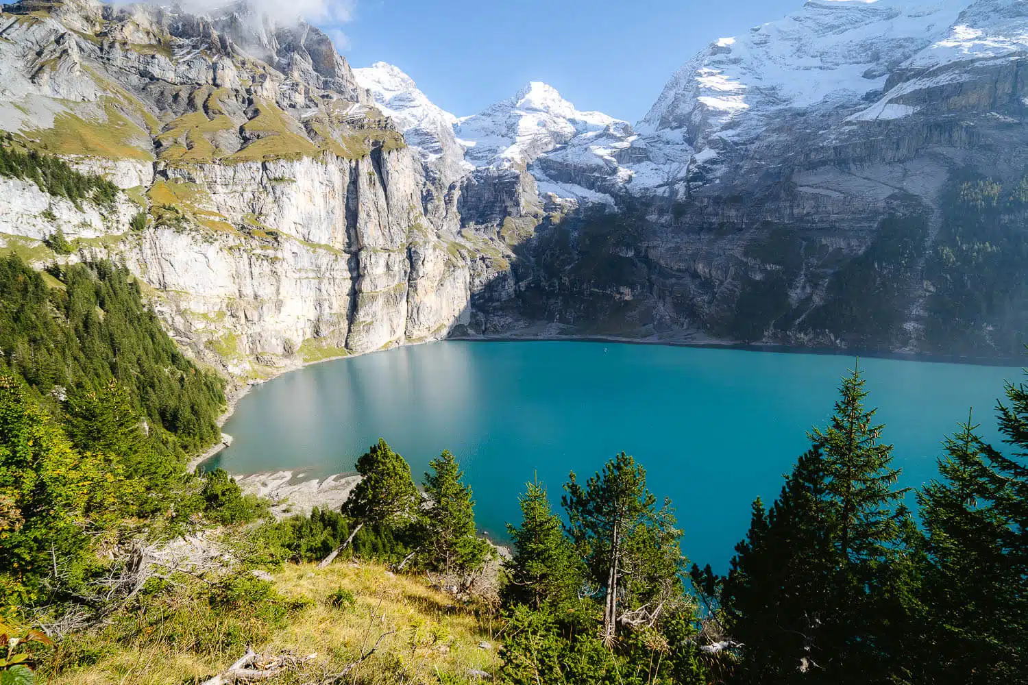
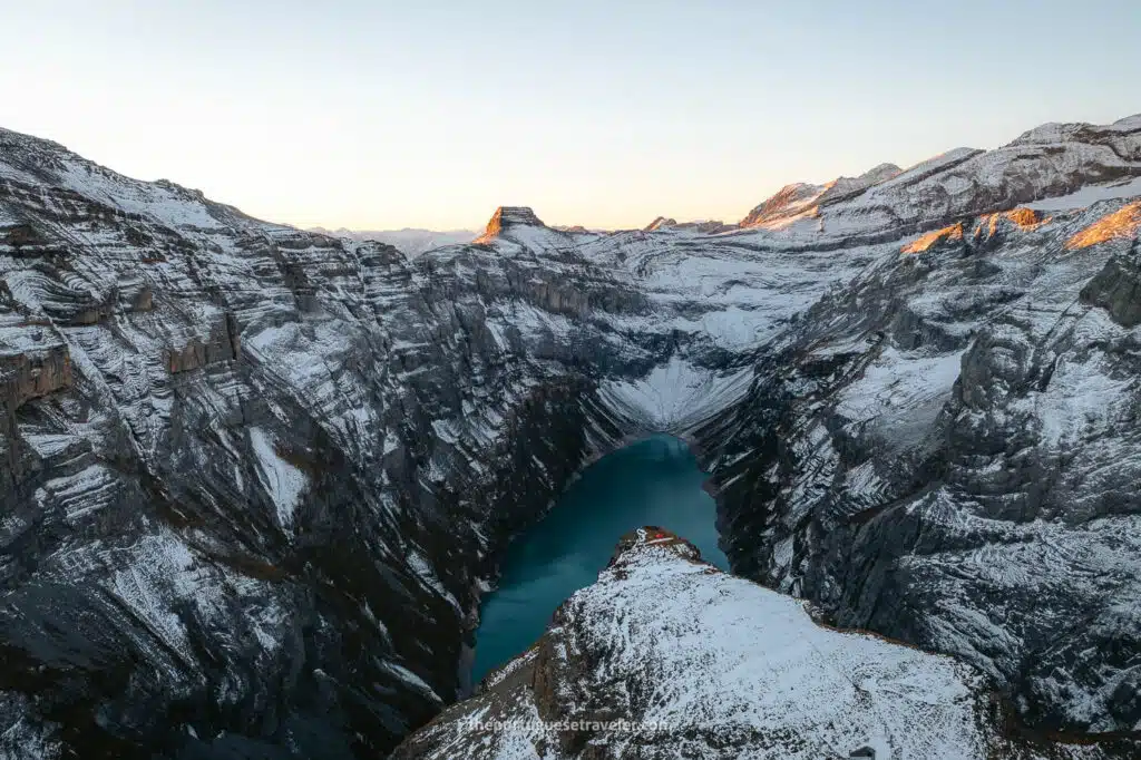
Name Origin: The name “Oeschinensee” is derived from the nearby Oeschinen Valley and the local German word “See,” meaning lake.

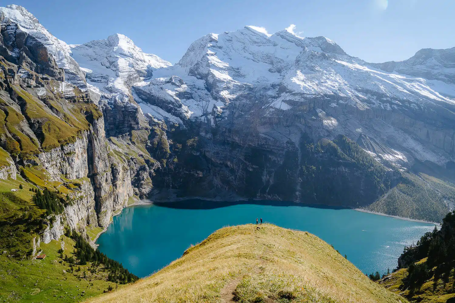
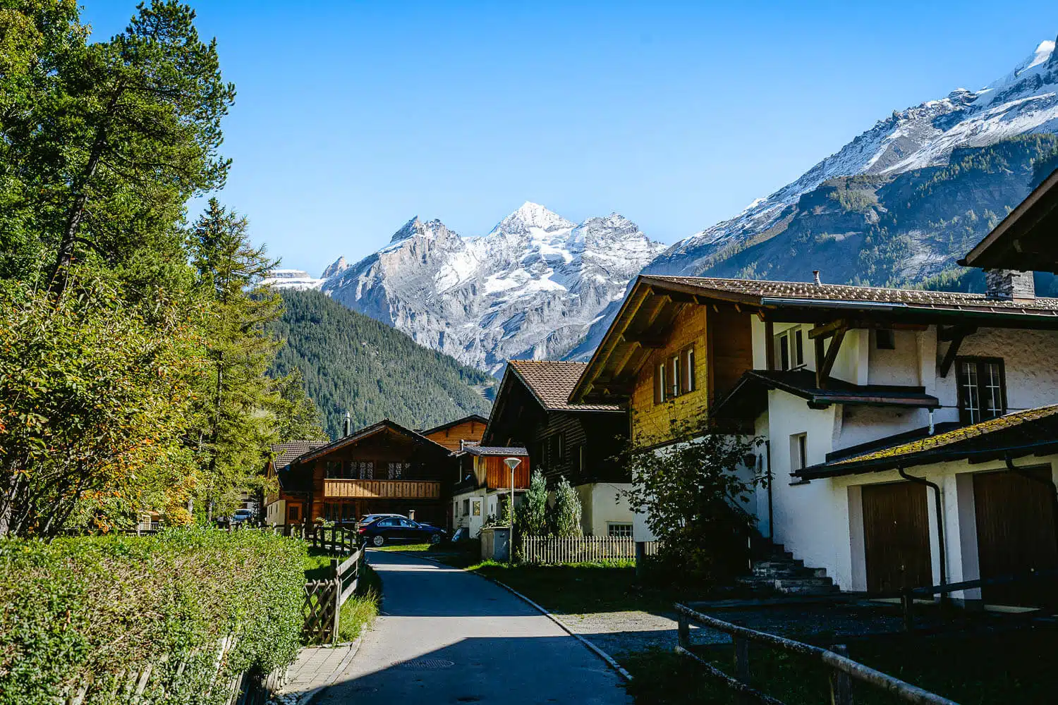
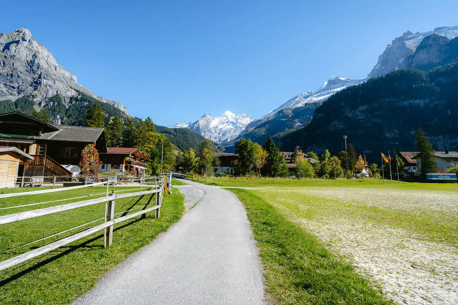
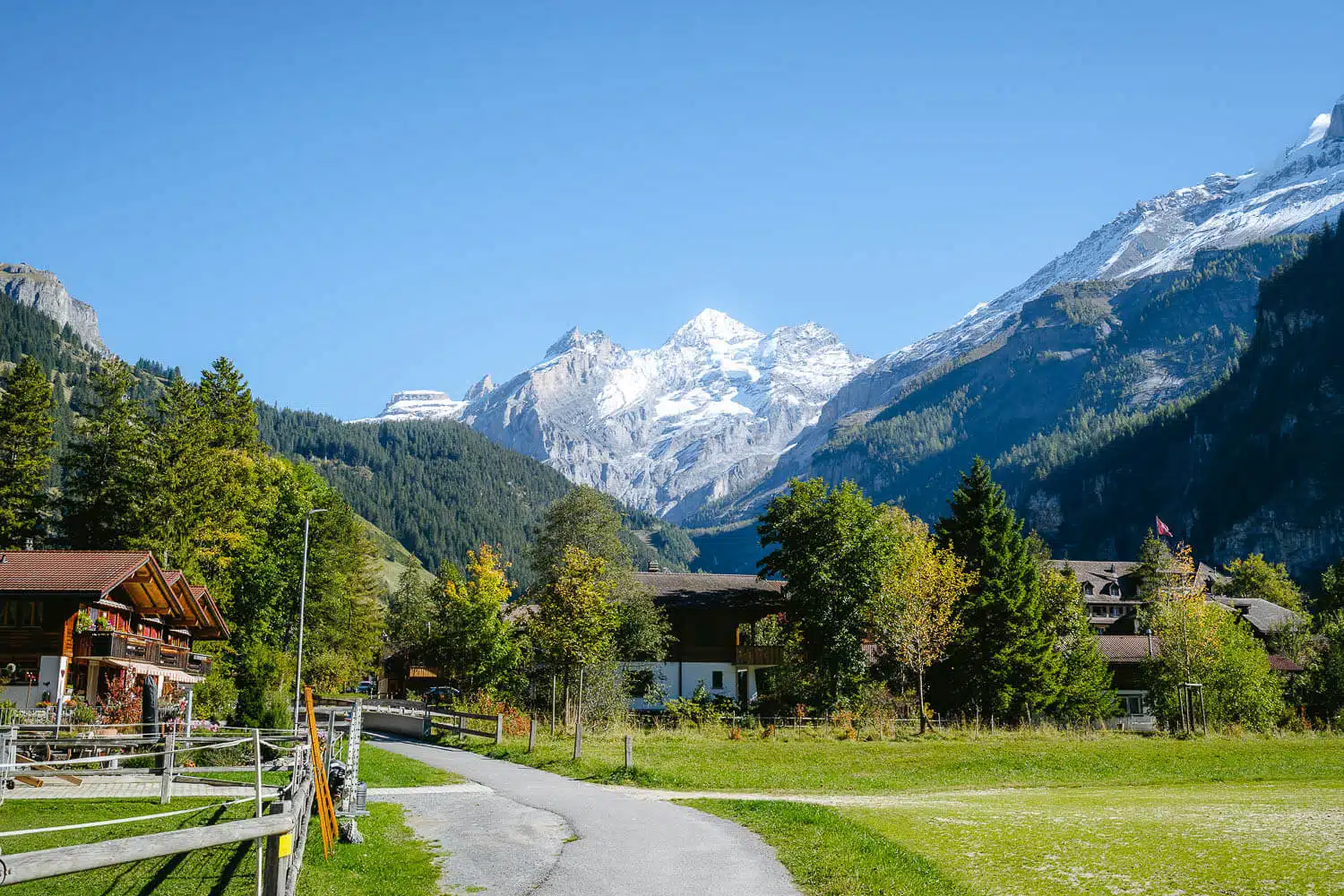
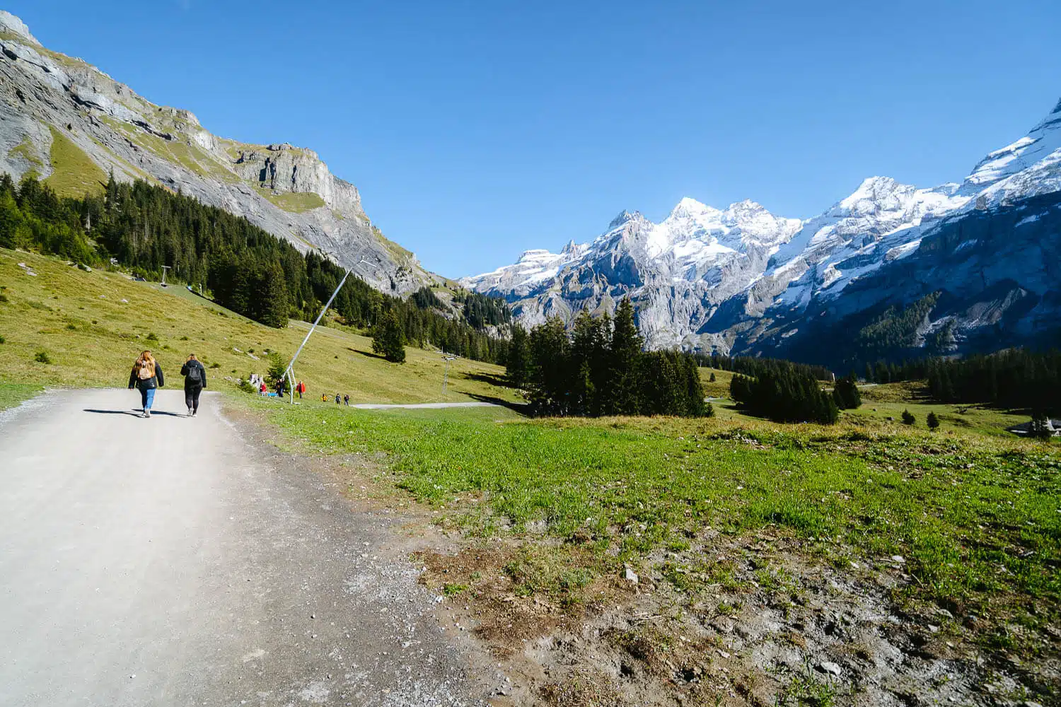
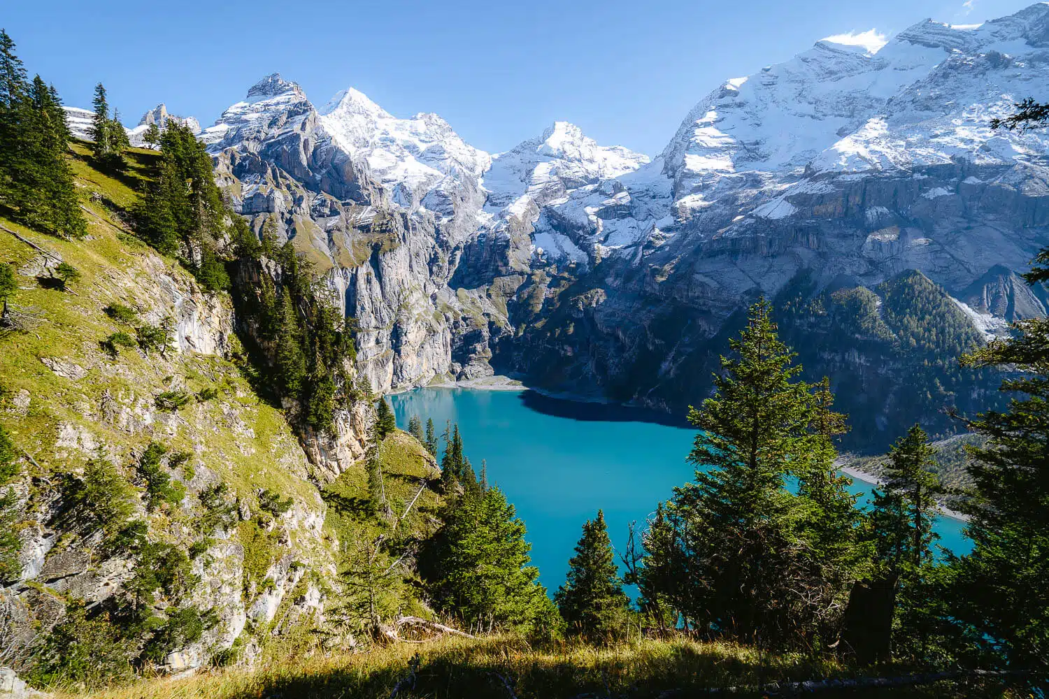
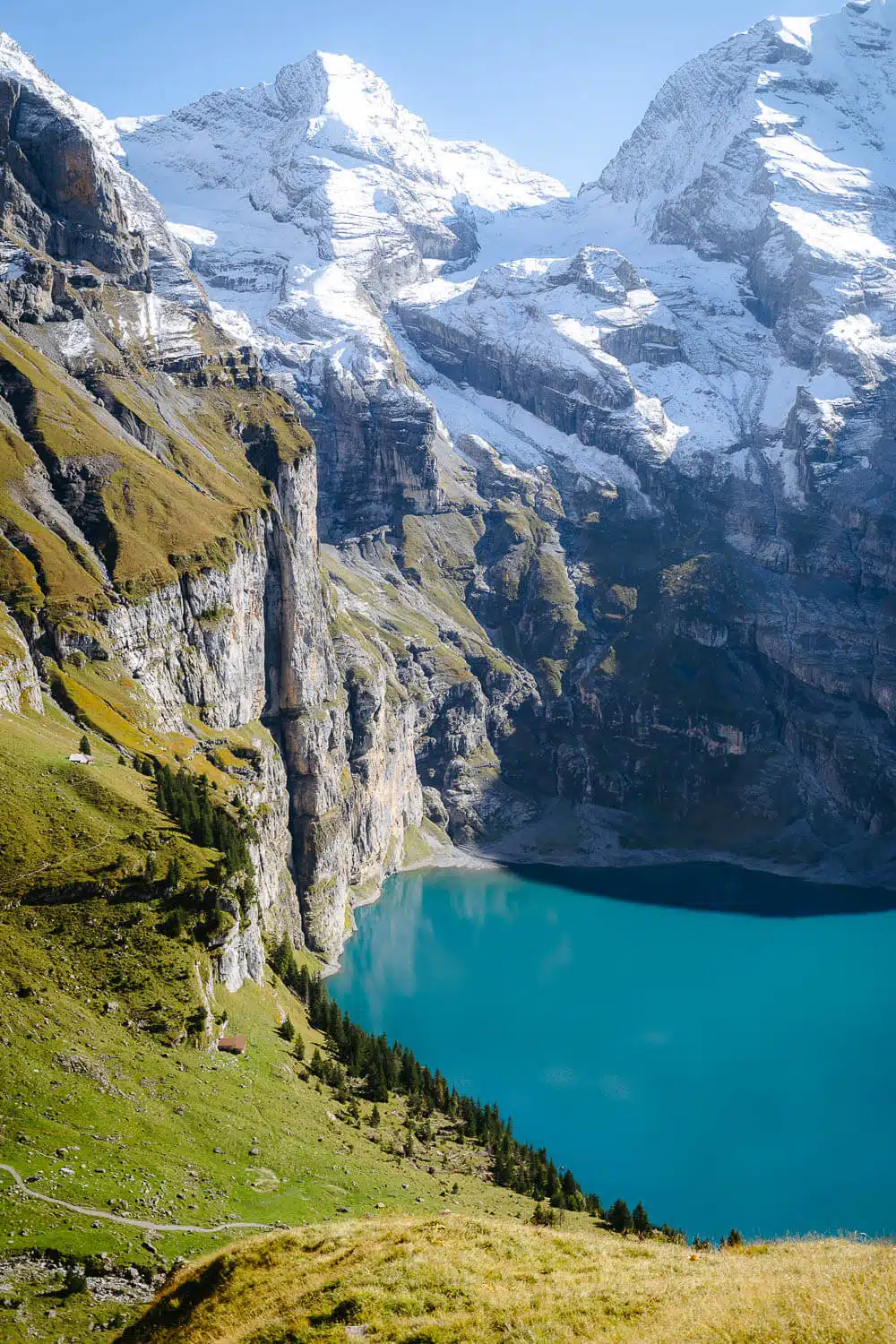
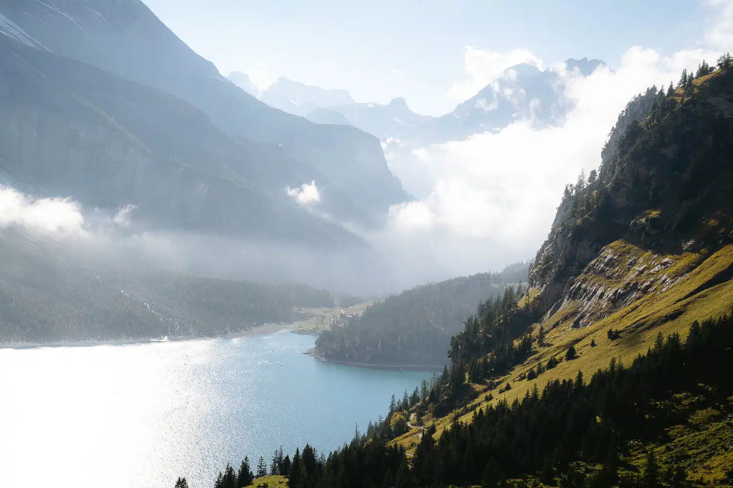
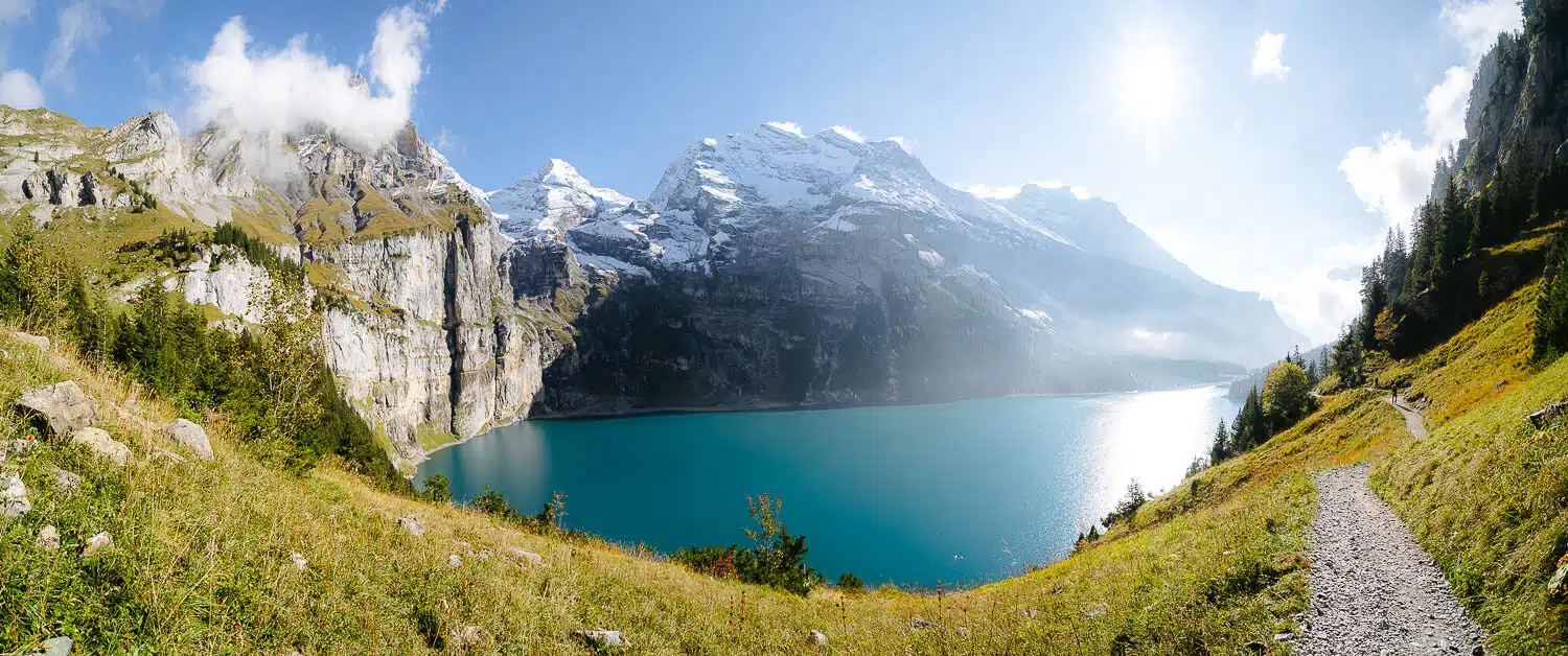
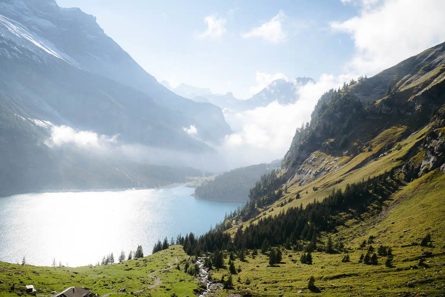
Location: Oeschinensee is situated in the Bernese Oberland region of Switzerland, above the village of Kandersteg.

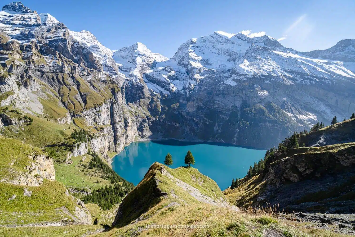
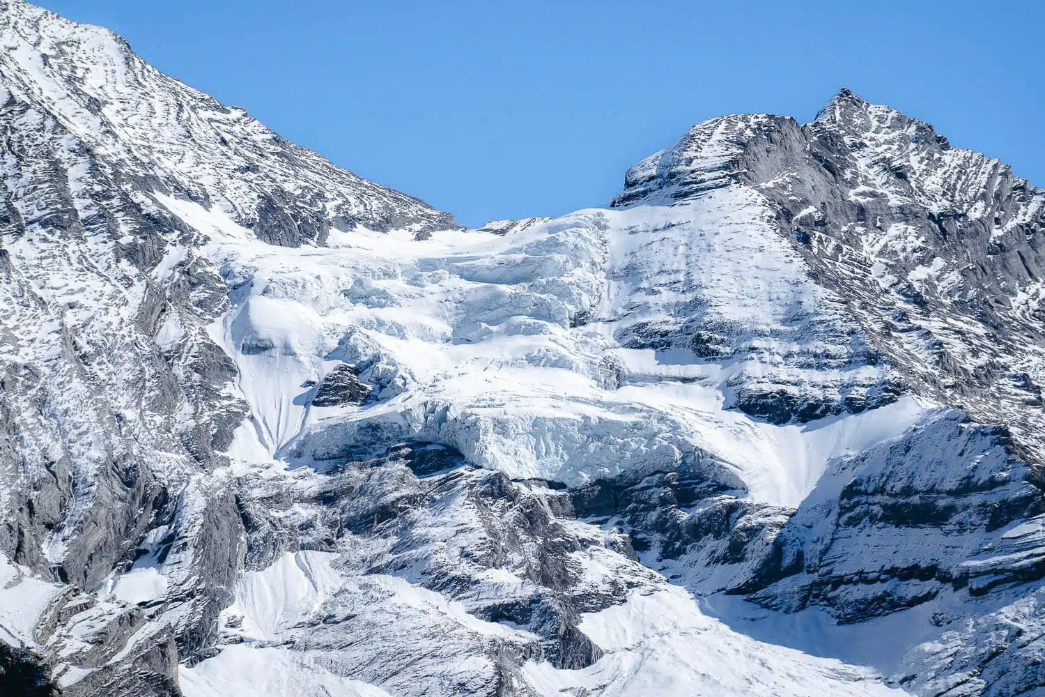
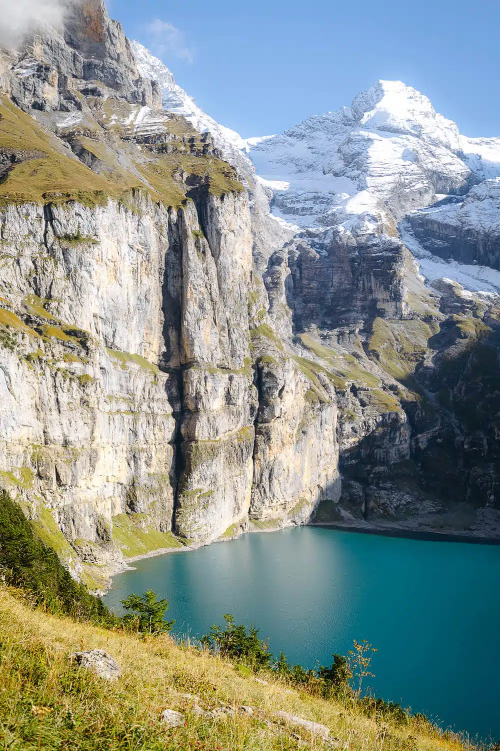
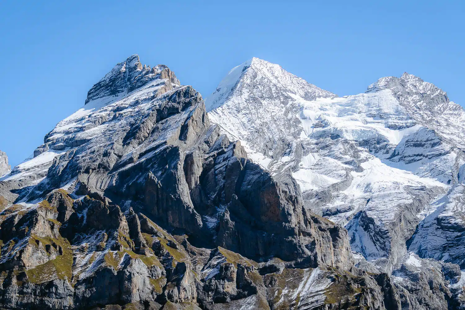
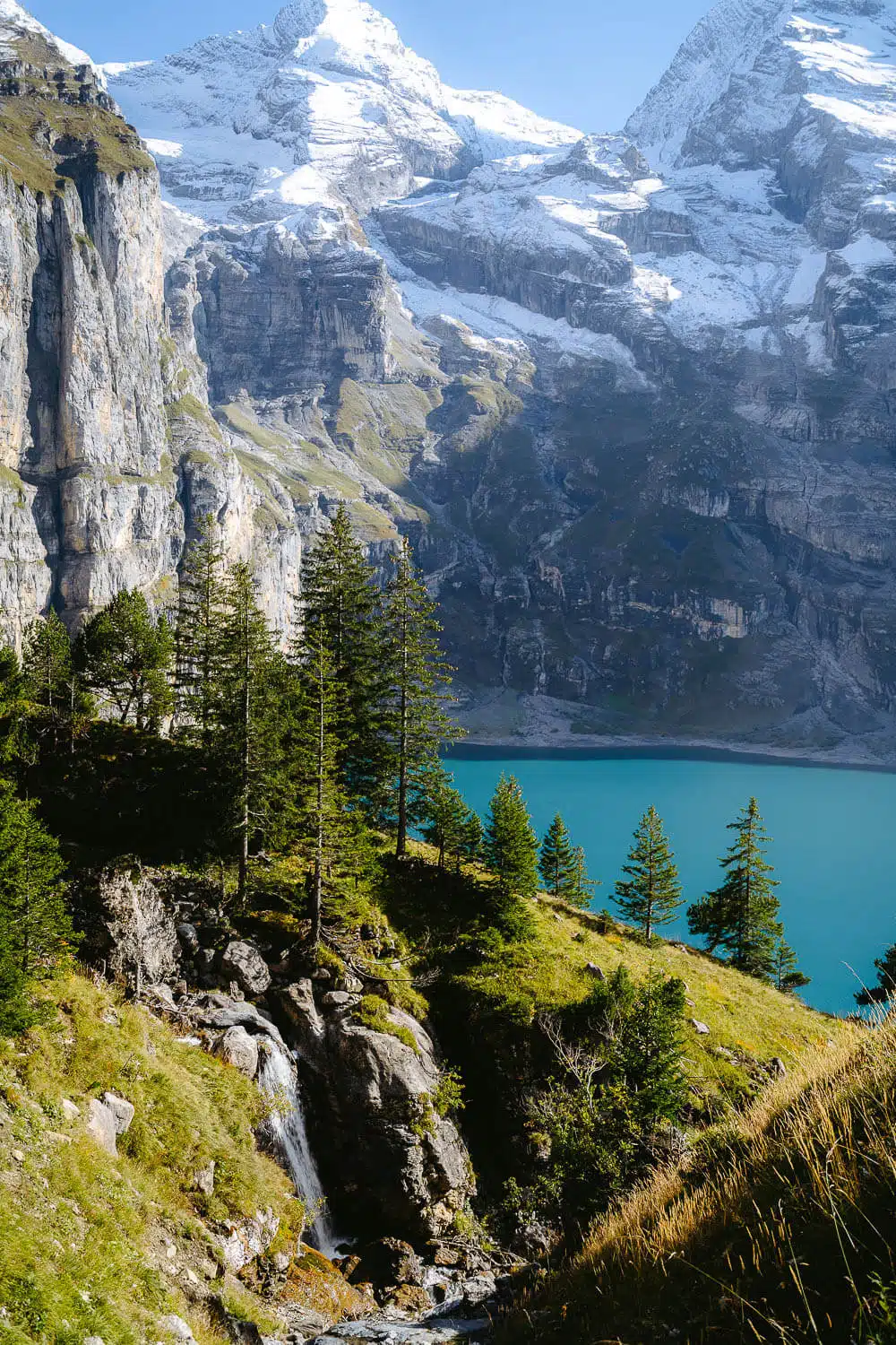
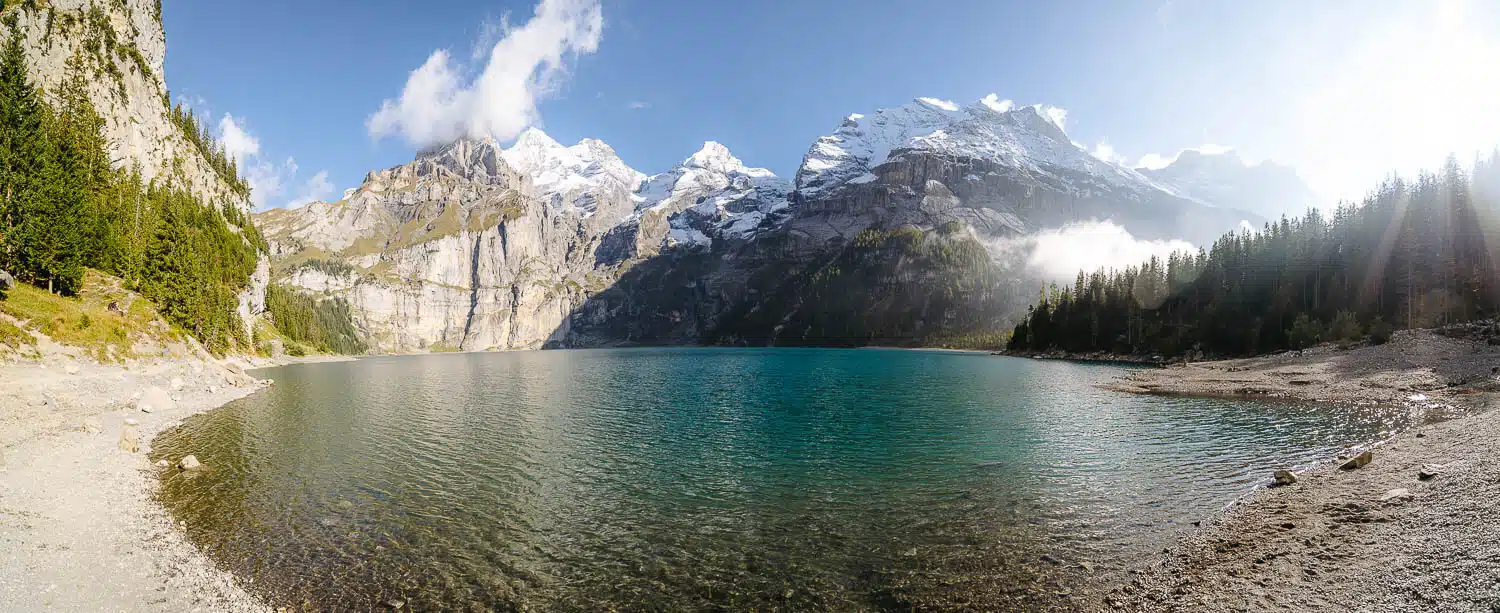
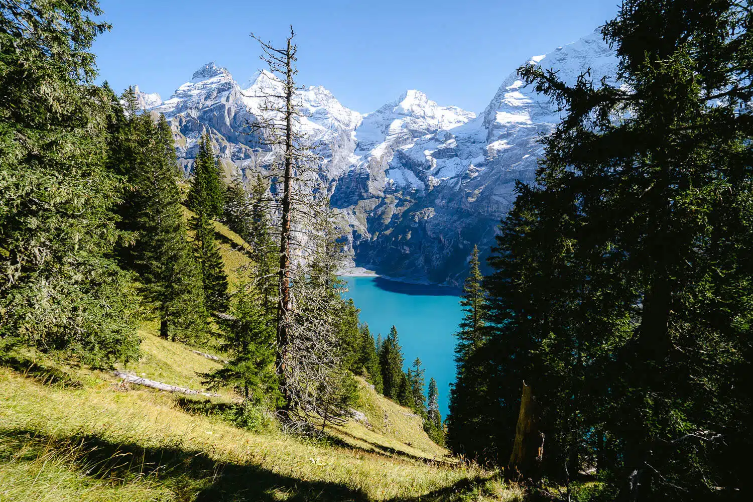
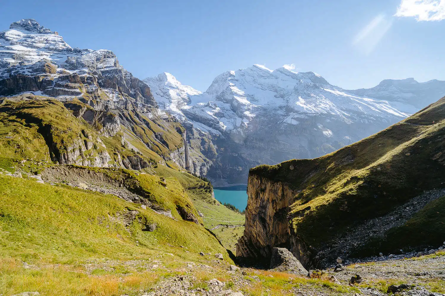
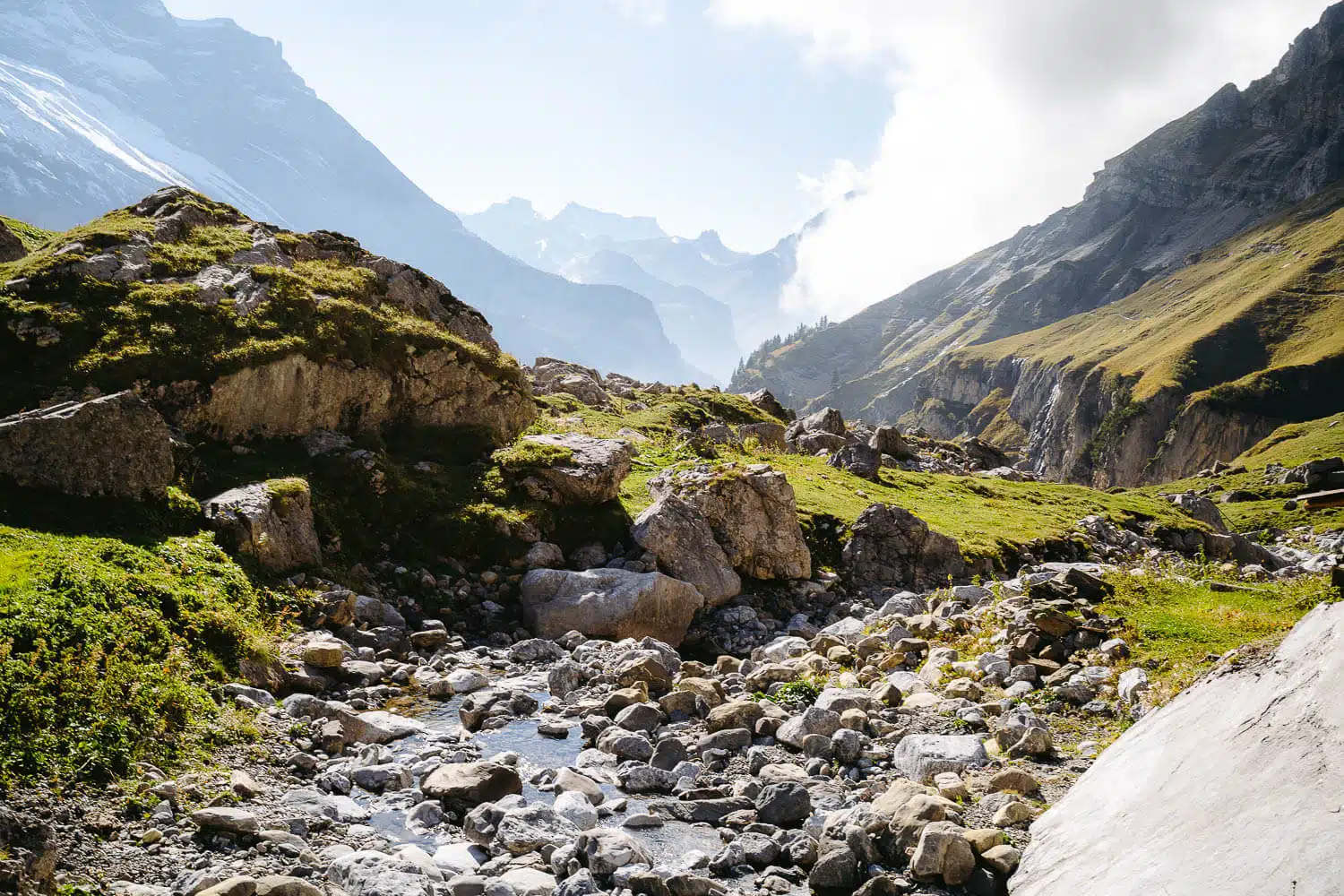
Formation: The lake was formed by several rockfalls from the flanks of the Fründenhorn and Doldenhorn mountains.

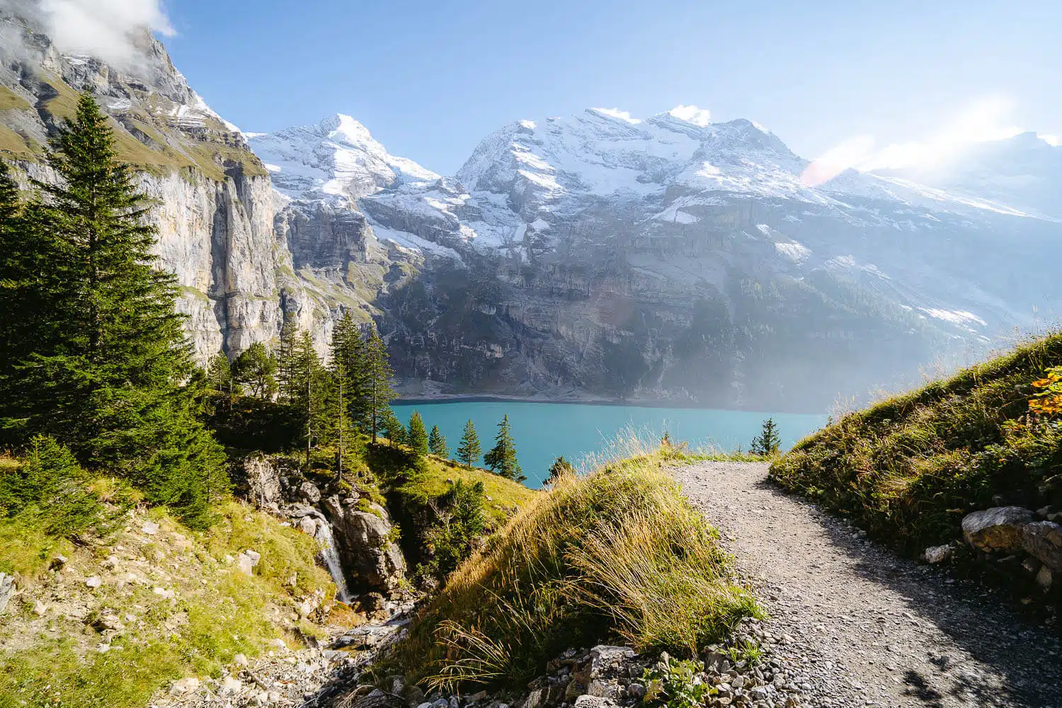
Height: The lake is located at an altitude of 1,578 meters above sea level.

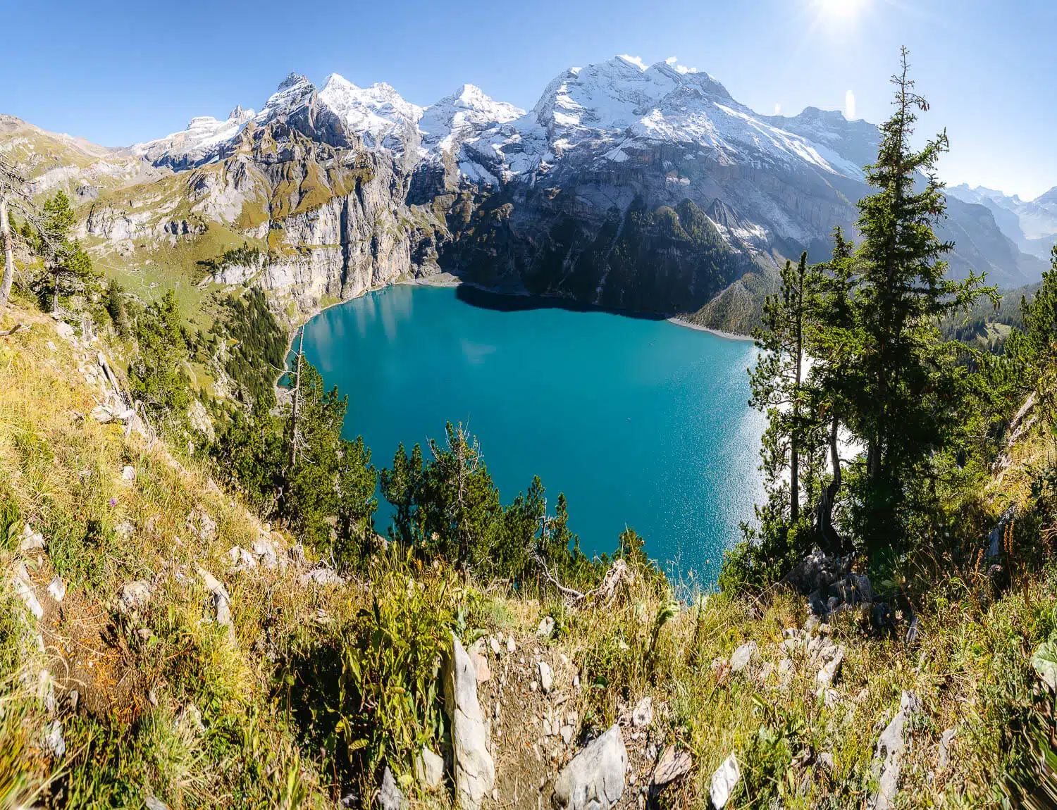
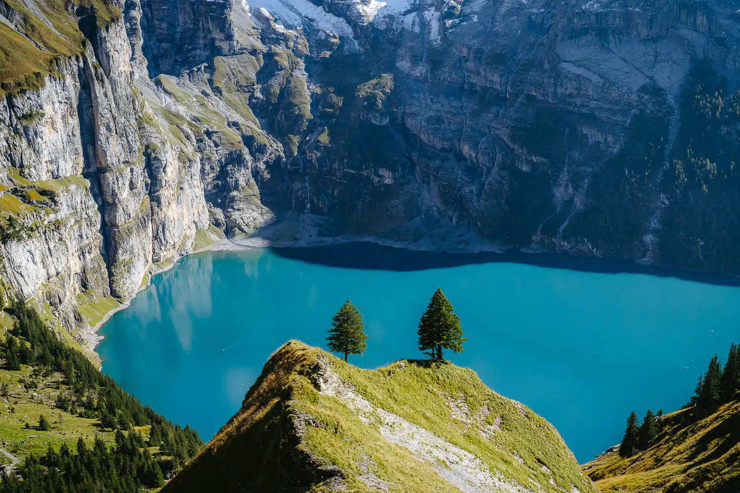
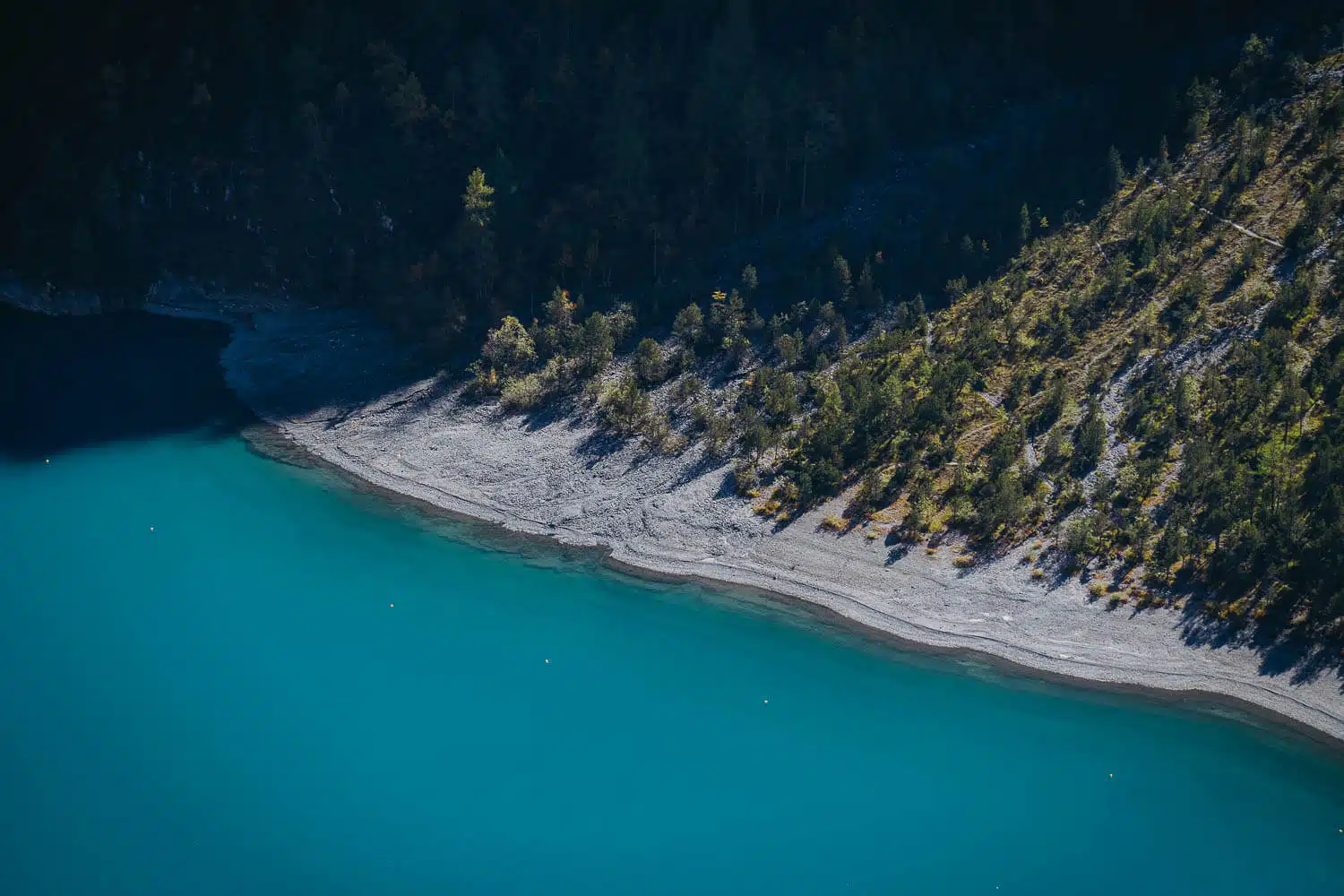
Size: Oeschinensee covers an area of 1.1 km², with a length of 1.6 km, a width of 1 km, and a circumference of 5.229 km.

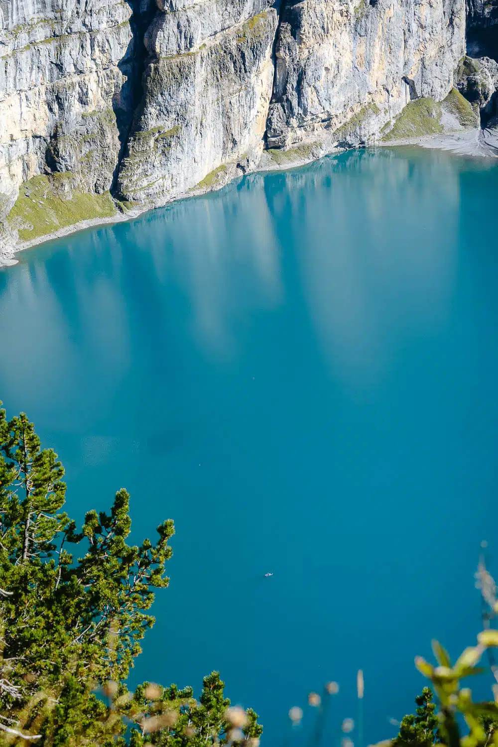
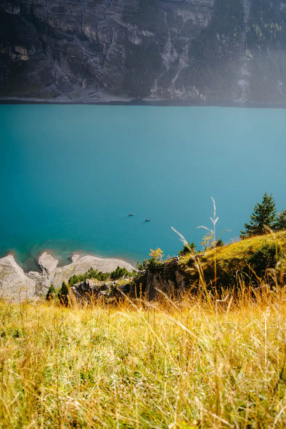
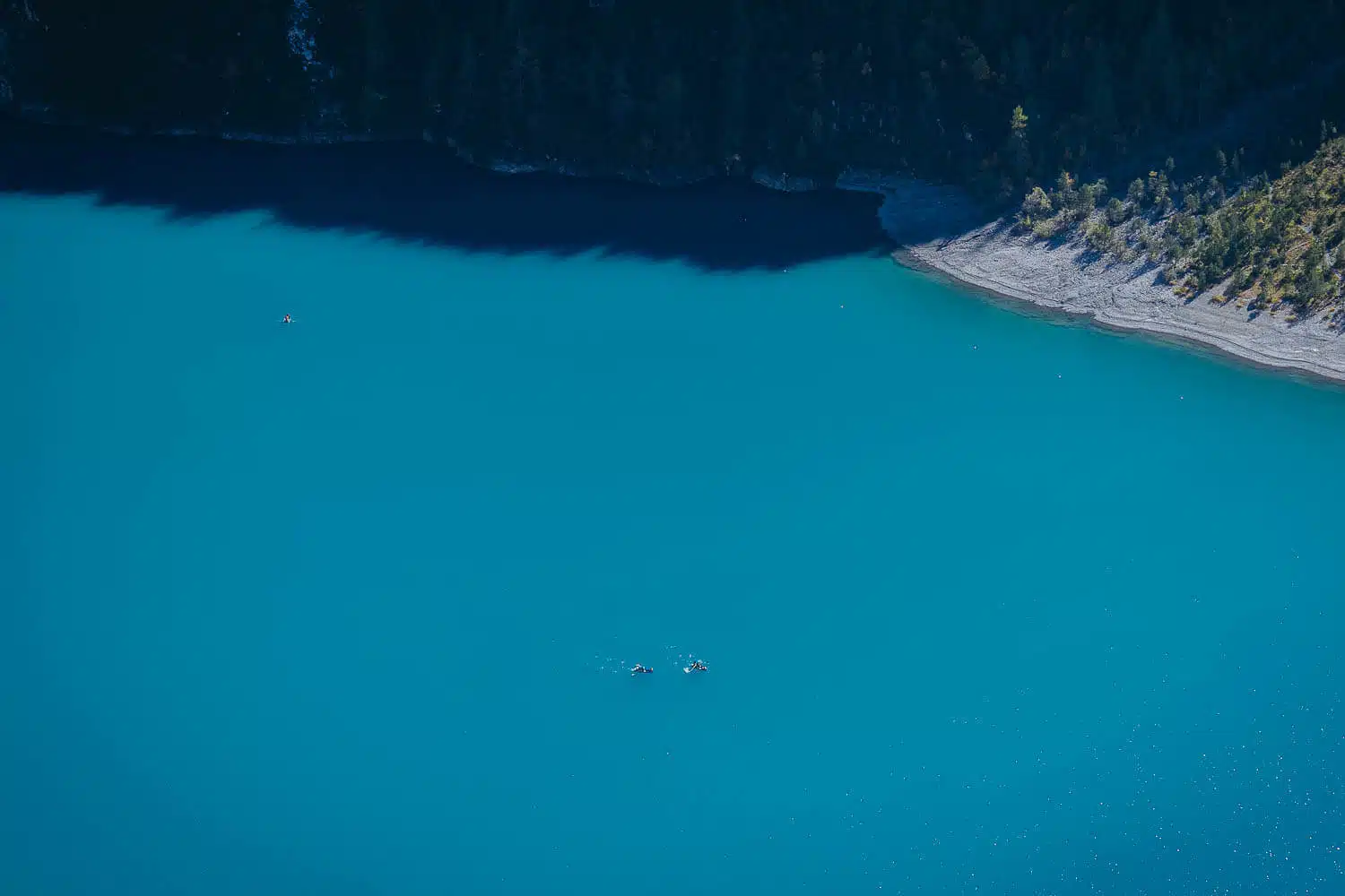
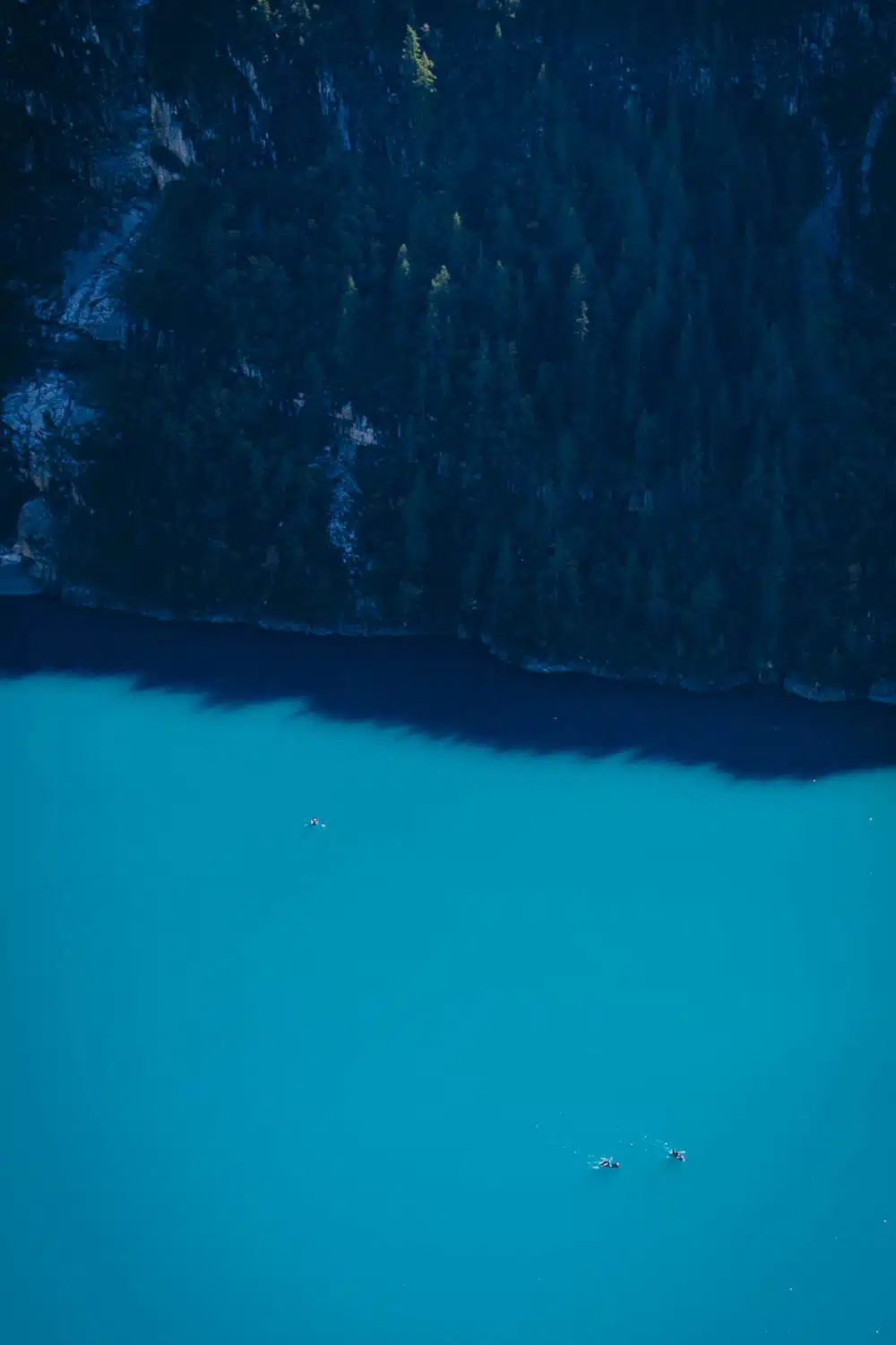
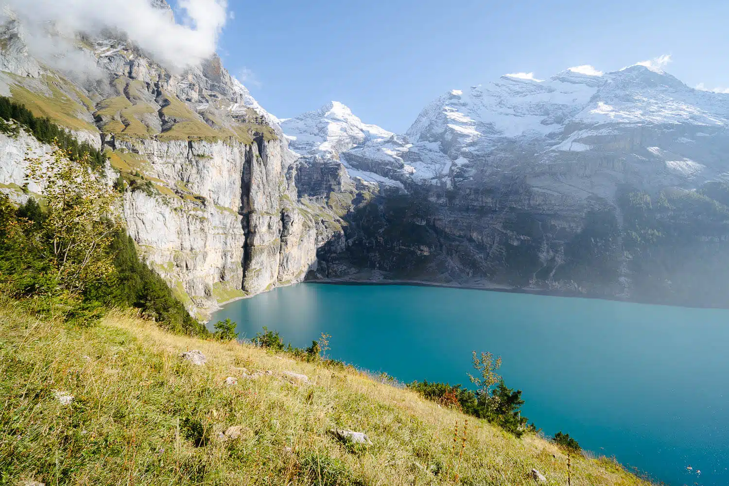
Depth: The lake has a maximum depth of 56 meters.

UNESCO World Heritage Site: Since 2007, Oeschinensee has been part of the “Swiss Alps Jungfrau-Aletsch” UNESCO World Heritage Site.

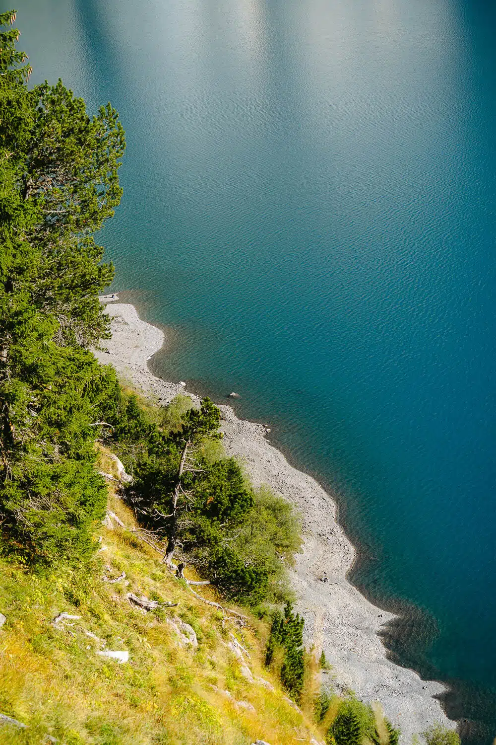
Water Sources: The lake is fed by several glacial streams and has an underground outflow via the Öschibach stream.

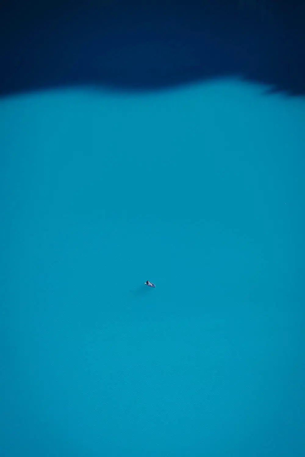
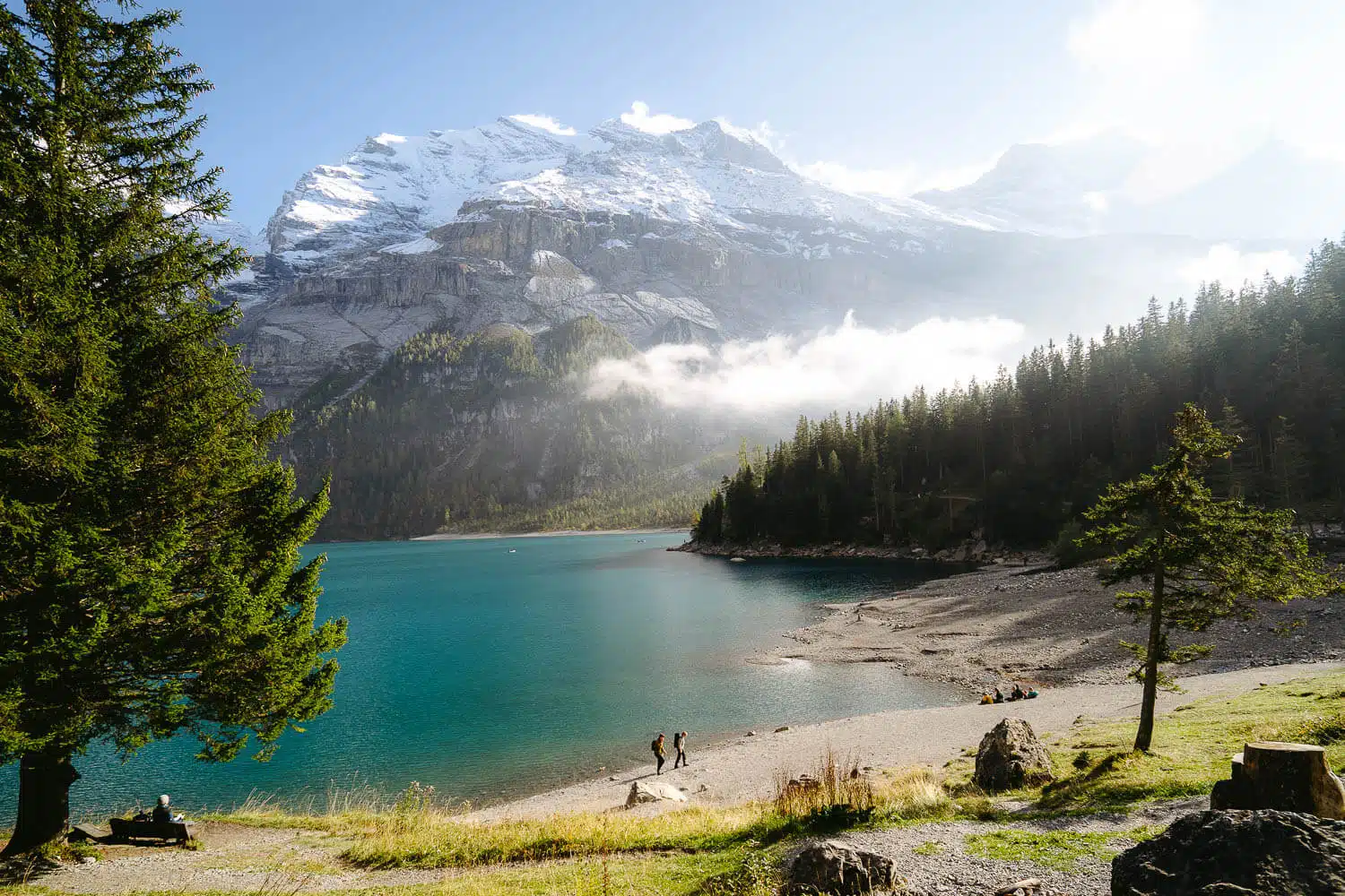
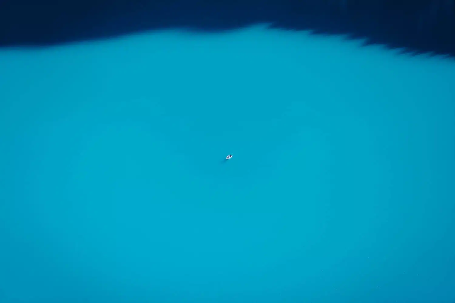
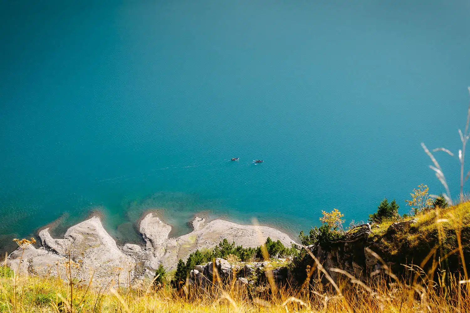
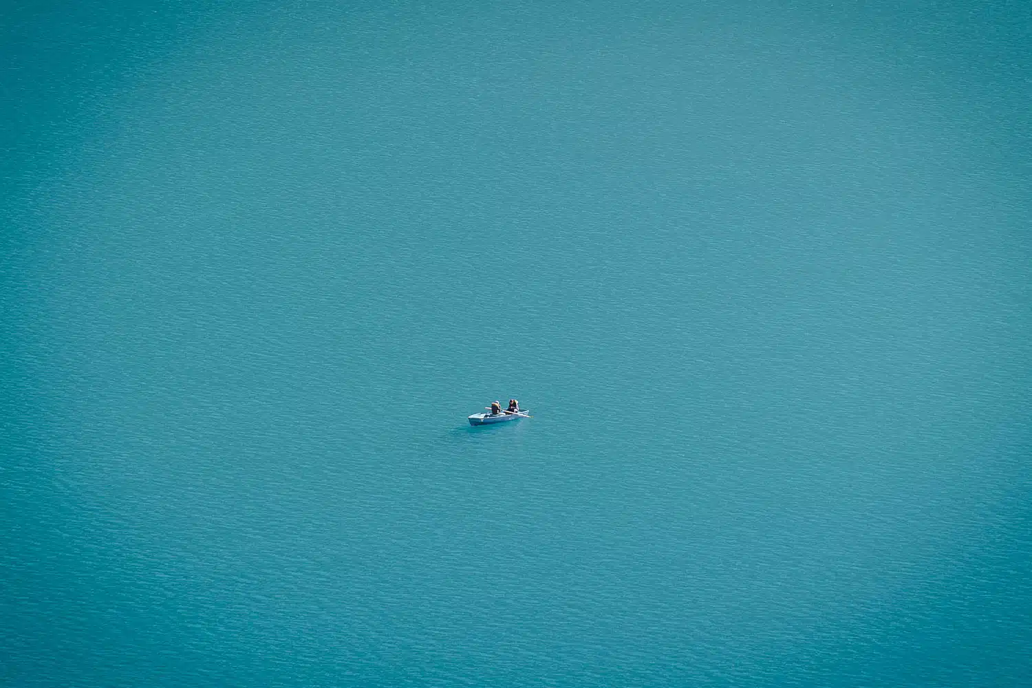
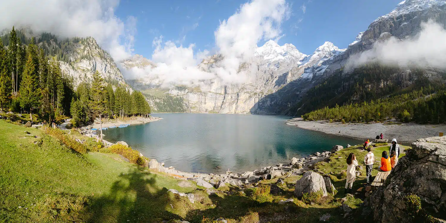
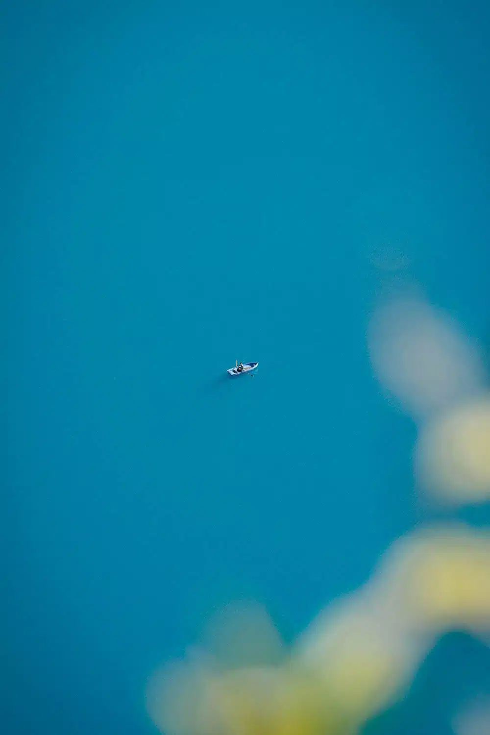
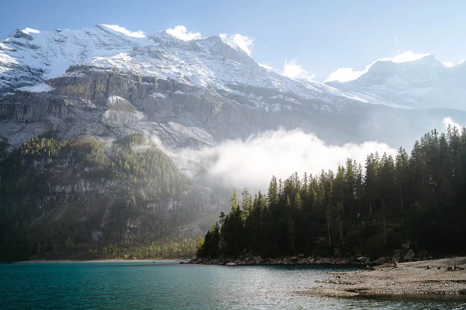
Things to do: Oeschinensee is a popular destination for summer activities like swimming, rowing, and hiking. Visitors can also enjoy tobogganing (mountain coaster) during the summer and sledging and ice skating in the winter.

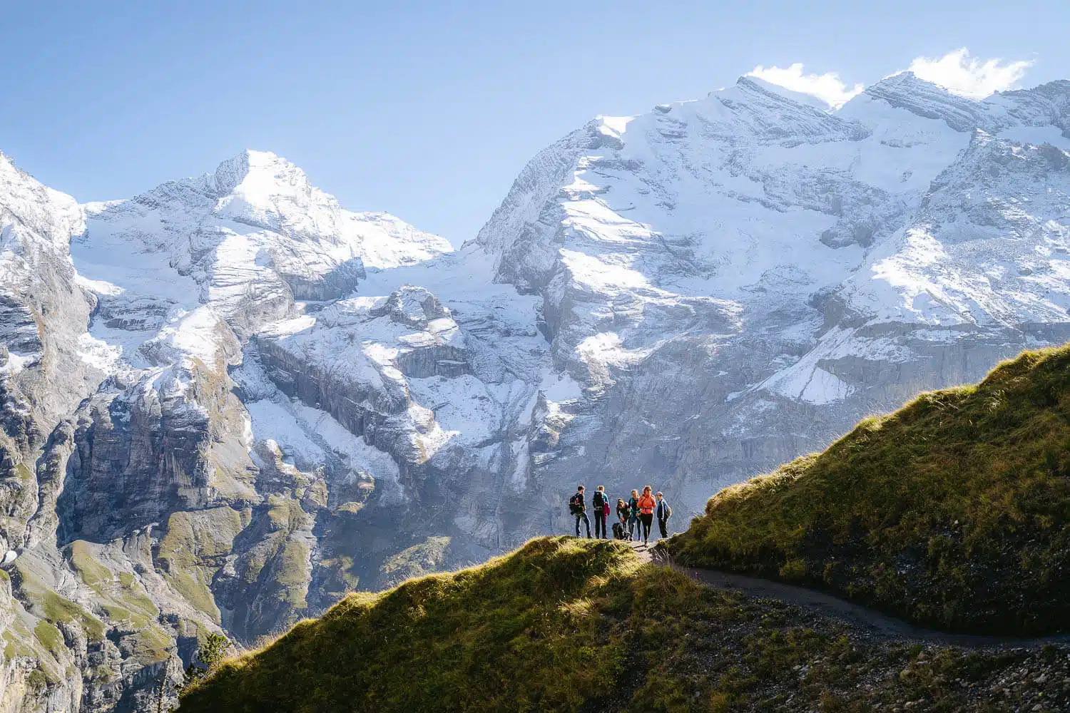
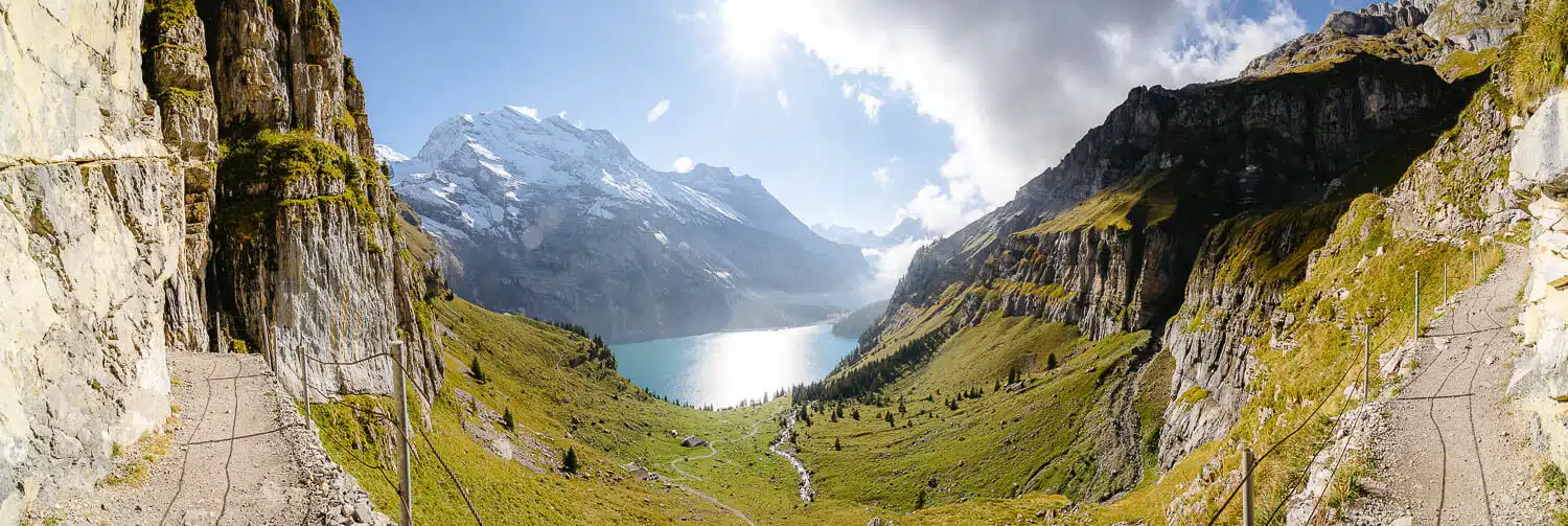
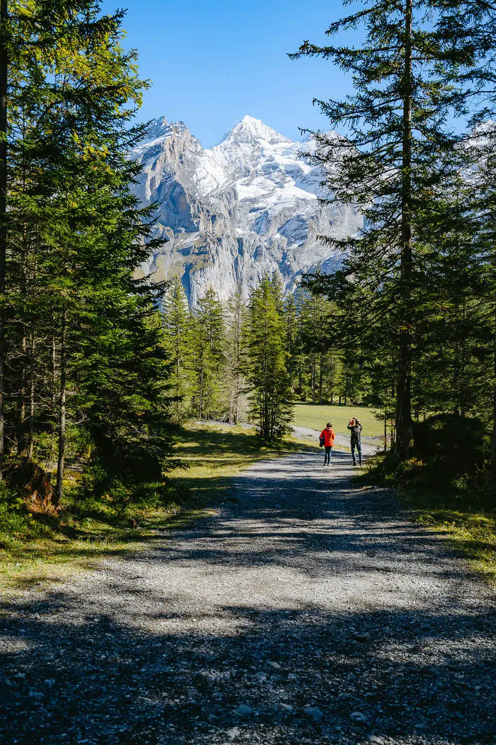
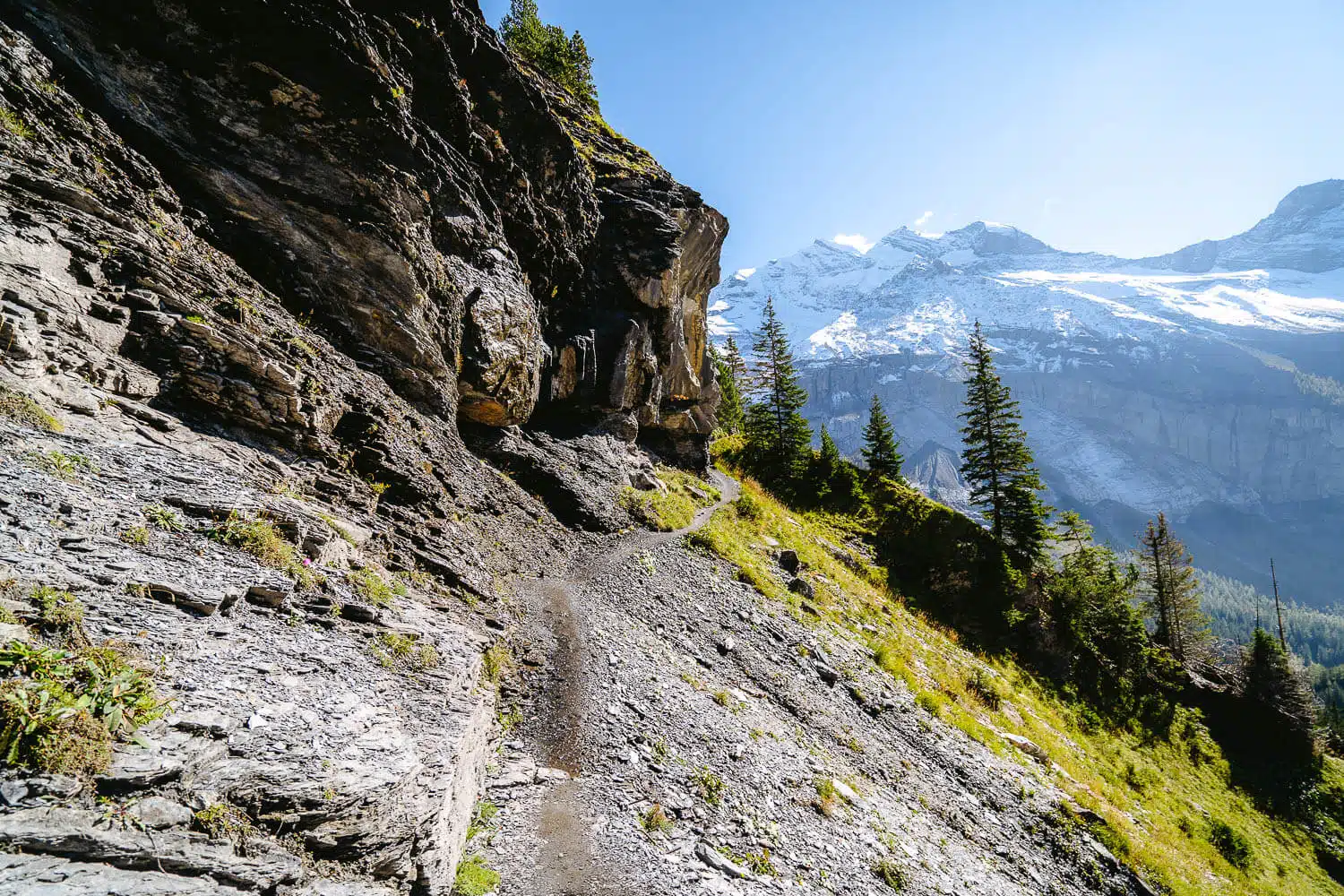
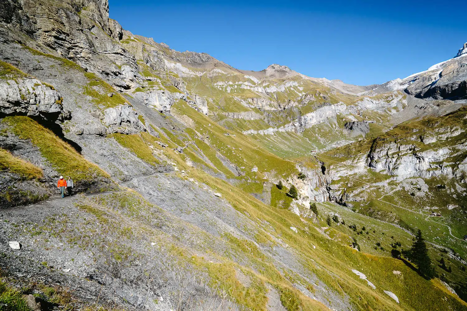
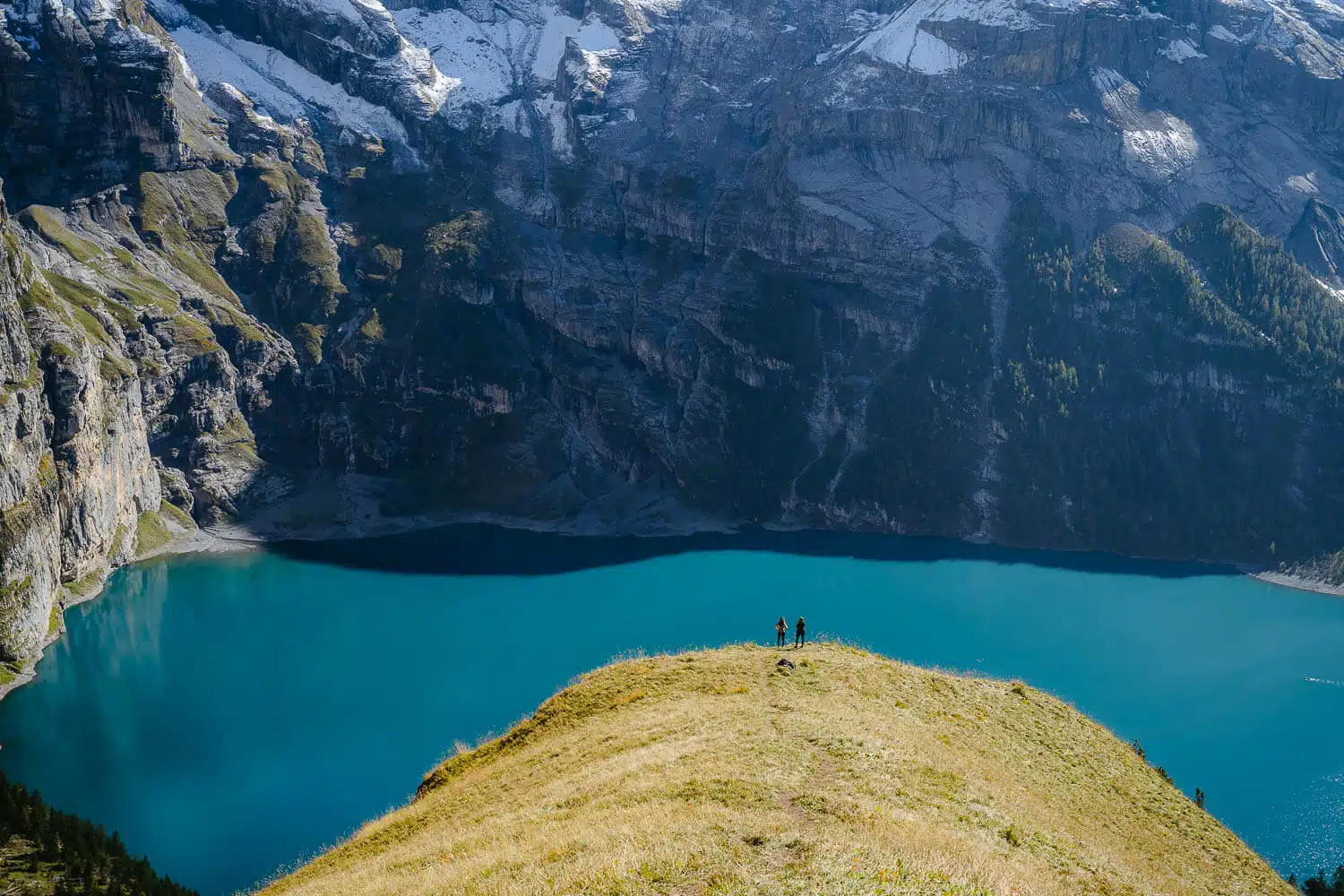
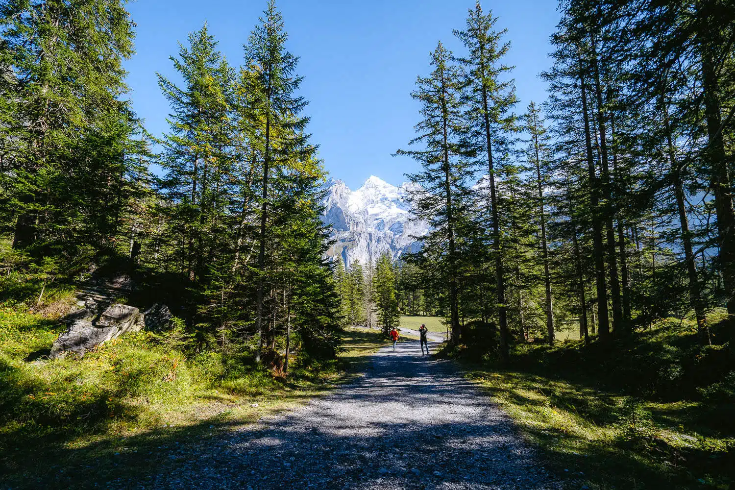
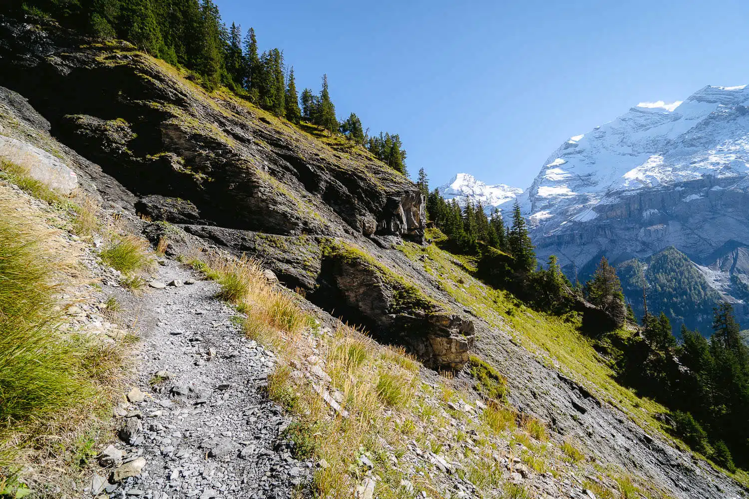
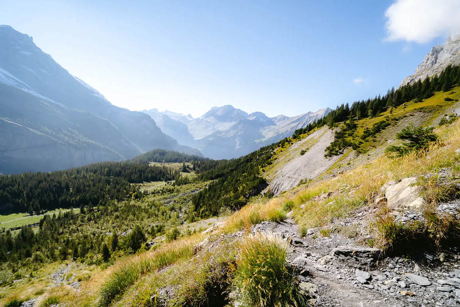
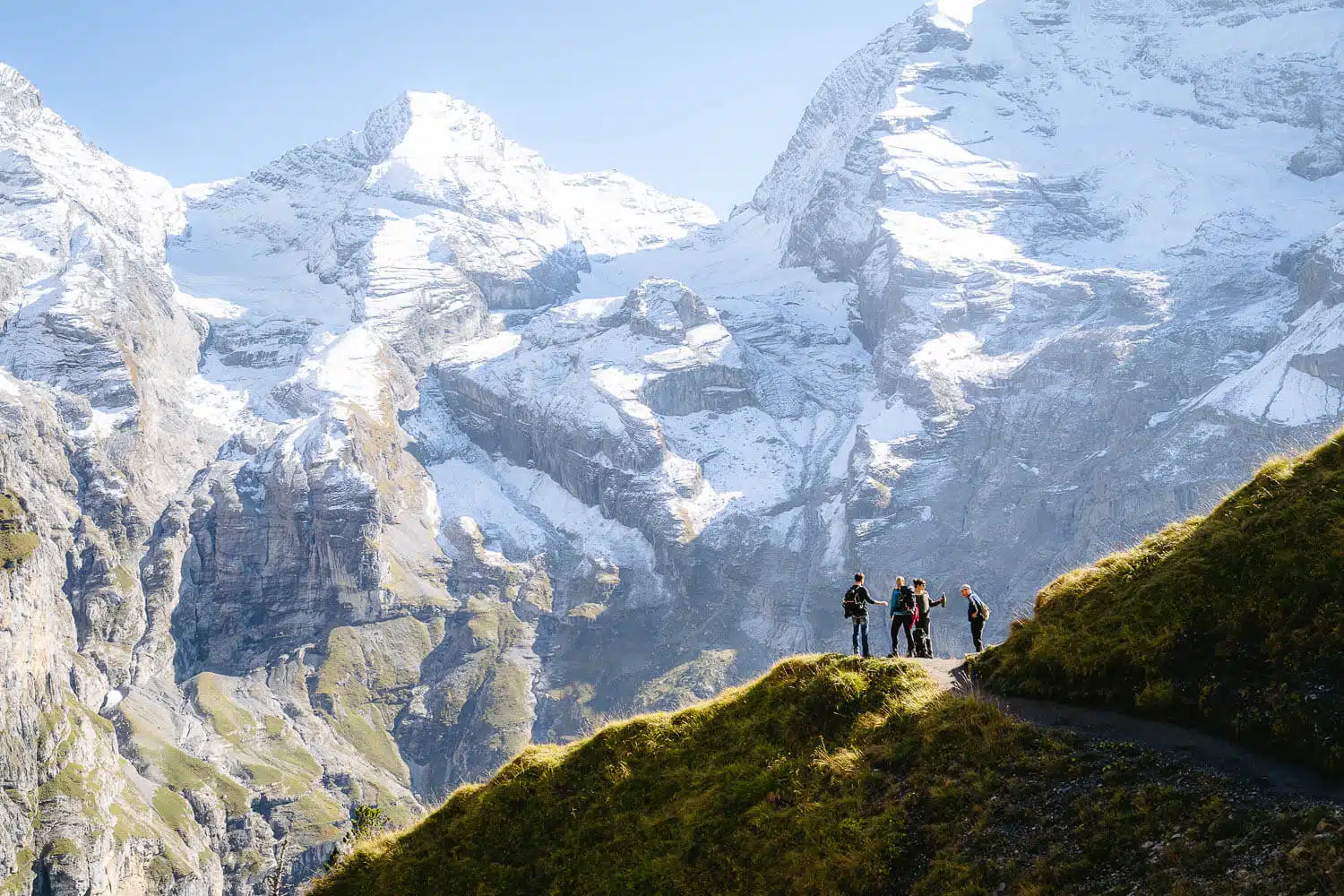
Accessibility: The lake is accessible from Kandersteg by gondola or several hiking trails. An electric cab service is available from the gondola station to the lake.

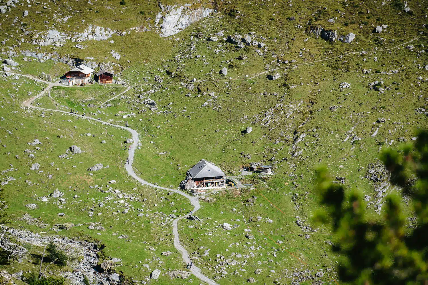
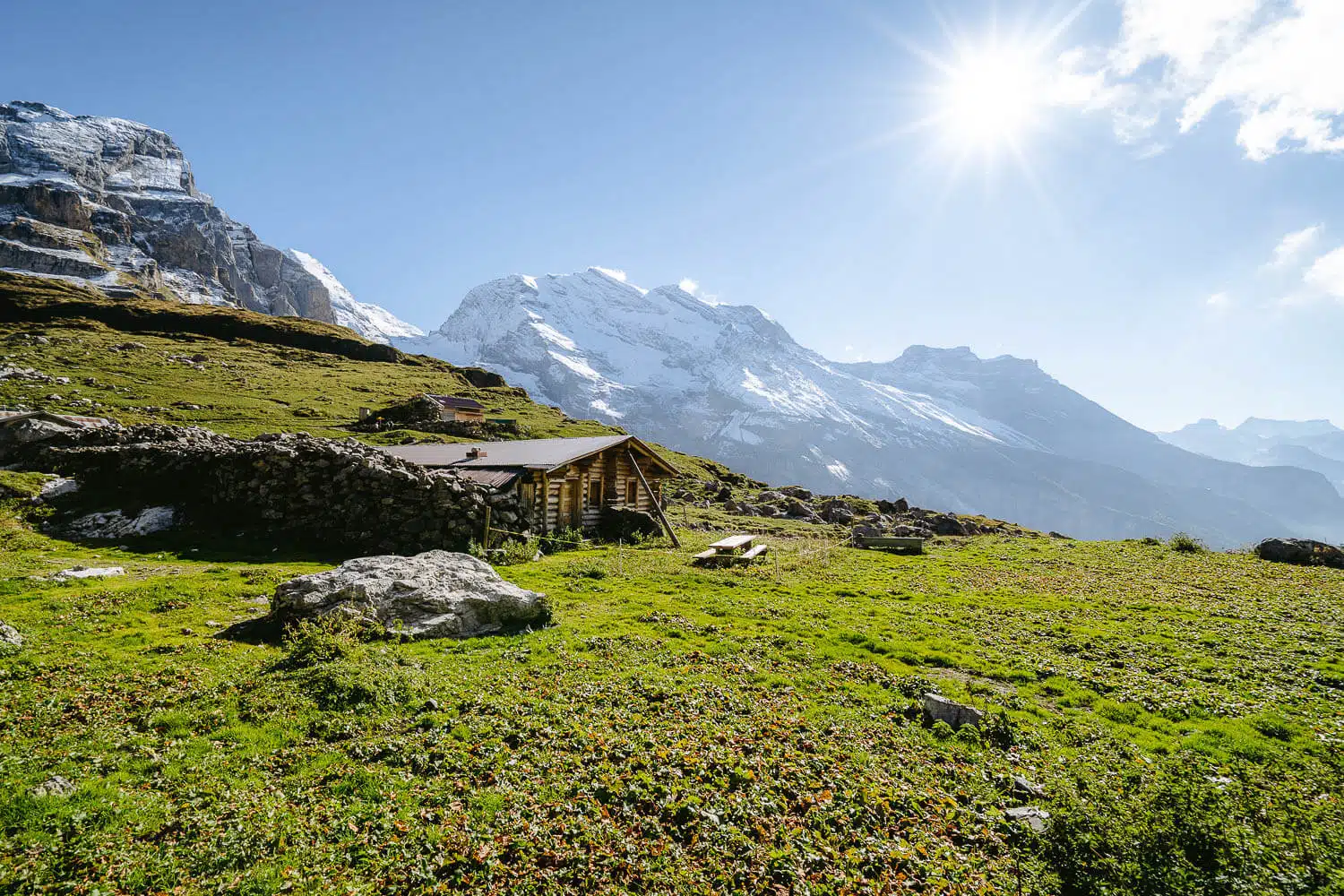
Surroundings: The lake is surrounded by the peaks of Blüemlisalp, Oeschinenhorn, Fründenhorn, and Doldenhorn, creating a picturesque alpine setting. Mountain huts in the surrounding peaks make it possible to do a big trek around the Alps with a pitstop at this beautiful lake.

A panorama of the Oeschinensee on the panorama trail

My Experience on the Oeschinensee Hike

This was one of my final hikes before departing Switzerland in 2021, and it unquestionably topped my list of the best hikes I wanted to do before leaving, alongside the Aletsch Glacier Trail and the Limmernsee Hike.

I asked many friends and coworkers if they wanted to join me, but it turned out that none of them could make it. Some were too busy, others were tight on cash, and a few just weren’t interested. So, I ended up deciding to go solo.

I did the Aletsch Glacier Trail on Saturday, slept at the mountain hut there, and made my way down to Fiesch. From there, I traveled to Kandersteg, where I took the cable car up to Oeschinensee, where my hike started.

In Kandersteg from the train station to the cable car station

From Kandersteg to Oeschinensee

I arrived in Kandersteg around 1-2 pm and walked from the train station to the cable car station. Once I got to the cable car station, I noticed it closed at 5 pm, which was a bit concerning because I needed to take the cable car down after completing the 3-hour loop trail. I hoped it would work out, otherwise, I’d have to hike all the way down instead.

The Blümlisalp on the background to the Kandersteg cable car station
The Blümlisalp mountain on the background to the Kandersteg cable car station
The hiking trail right after arriving at the Oeschinensee cable car station
The forest on the way to the Heuberg viewpoint
The gravel path after leaving the forest

From the Oeschinensee station to the Berghaus Unterbärgli

Once I arrived at the Oeschinensee cable car station, I followed the hiking signs to the Heuberg – Ober Bärgli viewpoint, as that is the route for the Panorama Trail. If you just want to go to the lake directly or do the loop circuit in reverse, then you must turn right and go 20 minutes down to the lake and start from there.

When you reach the Heuberg viewpoint, you continue straight until you reach the Berghaus Unterbärgli. It’s an open restaurant/bar where you can get some food and enjoy an awesome view of the lake.

As I was in a hurry, I didn’t stop here to eat or drink but did stop multiple times to change lenses to shoot this unbelievable lake in different ways.

The first view of the Oeschinensee Lake
The Oeschinensee surrounding mountains
The turquoise waters of the lake
The hiking path on the Panorama Trail
The Berghaus at the distance
The views on the way to the Berghaus
The scale of the Oeschinensee cliffs compared to a small boat in the water
The most picturesque trees on the entire hike
Too hikers casually posing with this amazing background
The mountain huts on the way to the Berghaus
The fog settling in the valley

From the Berghaus down to the Oeschinensee, and return home

This is one of the most famous hikes and lakes in Switzerland, so I expected to see many people on this trail. However, there were only around ten people during this three-hour hike.

After the Berghaus, you start heading down. Until the main lake area, there’s a descent of about 300 meters, but it’s relatively easy to hike. There’s a bit of gravel on the way, so it was nice to have hiking shoes and trekking poles.

You go through a beautiful forest and end up at the main lake area with the Berghotel restaurant. I stopped there for a while, but as the time drew to a close, I needed to run uphill back to the cable car station and return to Kandersteg. I managed to do it, but there was a huge queue for the last cable car.

And that’s about it. After coming down, I went to the train station, took the train back to Zurich, and the weekend was over. What a blast!

A waterfall on the way down to the lake
The boats and amazing photo opportunities on this hike is outstanding
A panorama of the lake on the way down
The boats down at the lake
Close-up shots of the boats on the Oeschinensee Lake
Some of the Oeschinensee beaches
A panorama of the beach in Oeschinensee
The view near the restaurants in Oeschinensee

Have you had the opportunity to hike the Oeschinensee Panorama Trail? If you have, I would love to hear about your experience. Please share your thoughts and opinions in the comments below.

Thanks for reading through, and I hope you have fun on this adventure. I will share more of my favorite shots below, enjoy!

Photo Gallery

From the Oeschinensee station to the Berghaus Unterbärgli

The forest on the way to the Heuberg viewpoint
The views at the beginning of the hike
The first view of the Oeschinensee
The boats and the beach of the Oeschinensee Lake
A boat at the Oeschinensee
Three boats on the lake
The beaches at Oeschinensee Lake
A group of hikers with the mountains on the background
The cliffs of Oeschinensee
A stream of water on its way to the lake

From the Berghaus down to Oeschinensee, and return home

The fog settling in the valley
A waterfall on the way down to the lake
The Oeschinensee Lake
The Oeschinen Lake
The fog over the lake