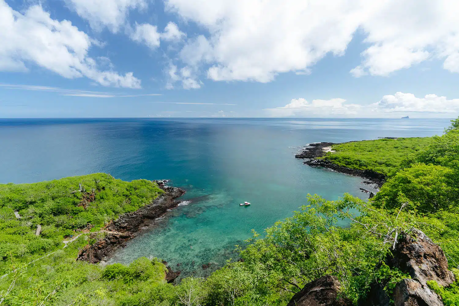
The Cerro Tijeretas and Playa Baquerizo hike on San Cristobal Island is a must-do if you wanna see pristine clear turquoise water and have a bit of a hiking feeling while on this island.
The attractions on this island are mainly reached by a tour a taxi or are on the water so this is it for hiking in San Cristobal Island in the Galapagos.
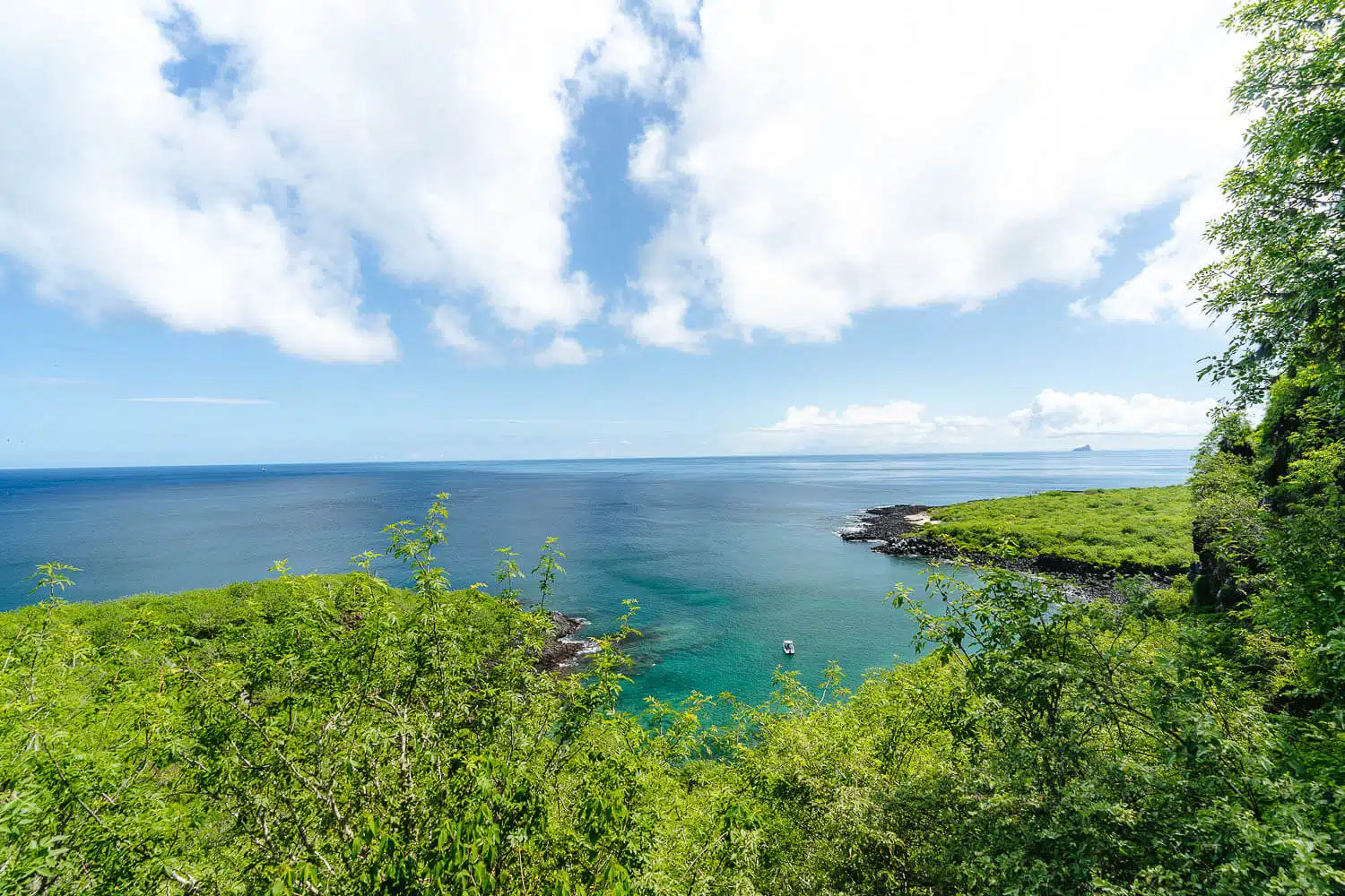
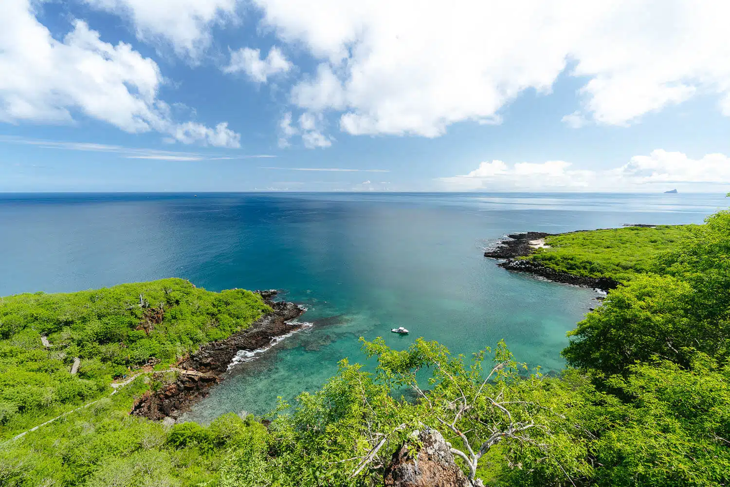
It’s a really beautiful hike, especially with a clear sky but some clouds are a must to protect you from the blazing sun.
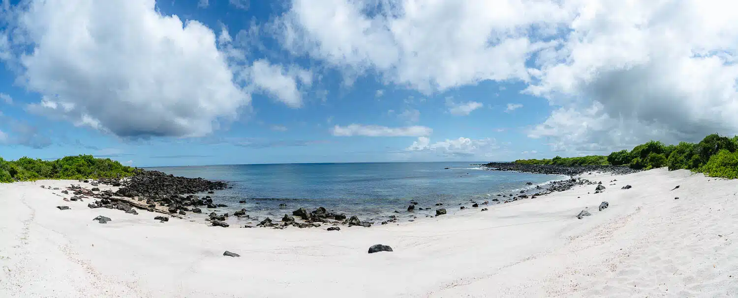
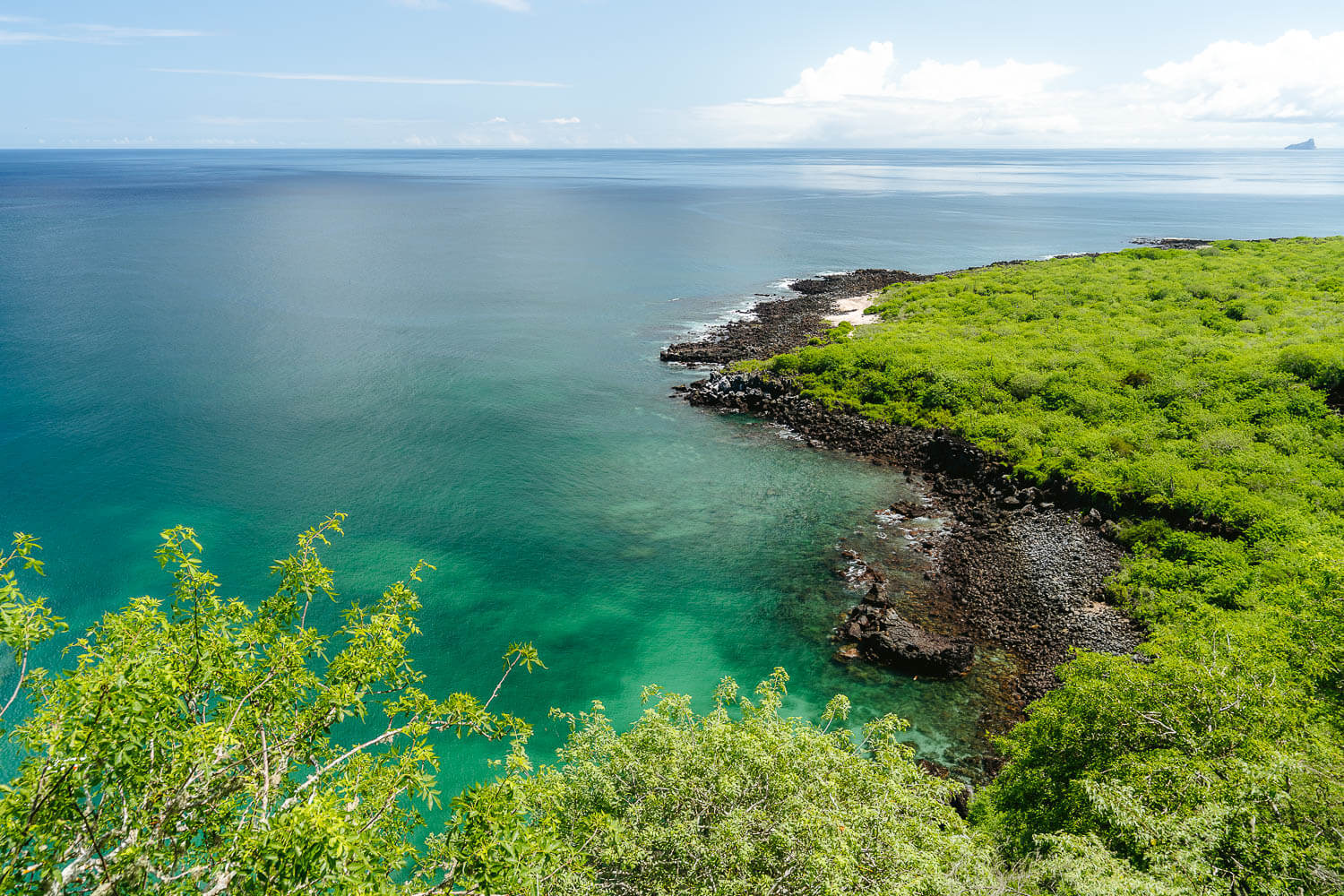
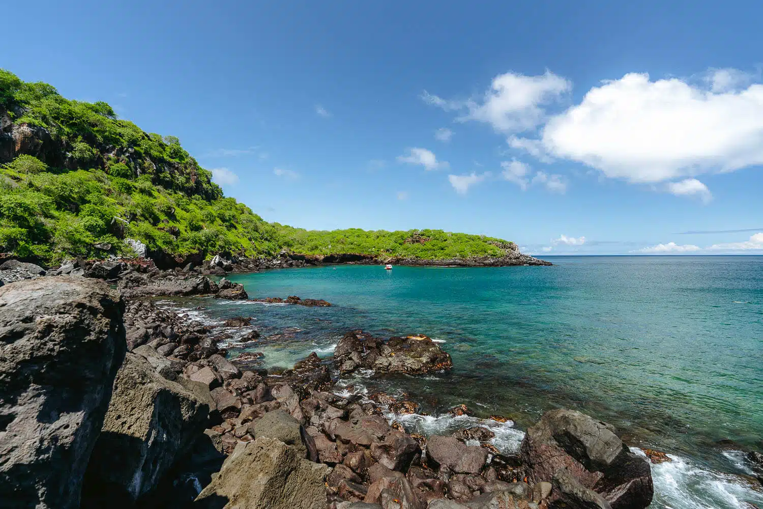
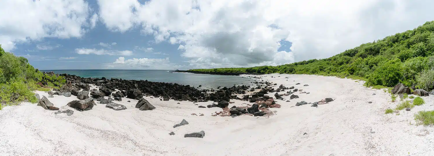
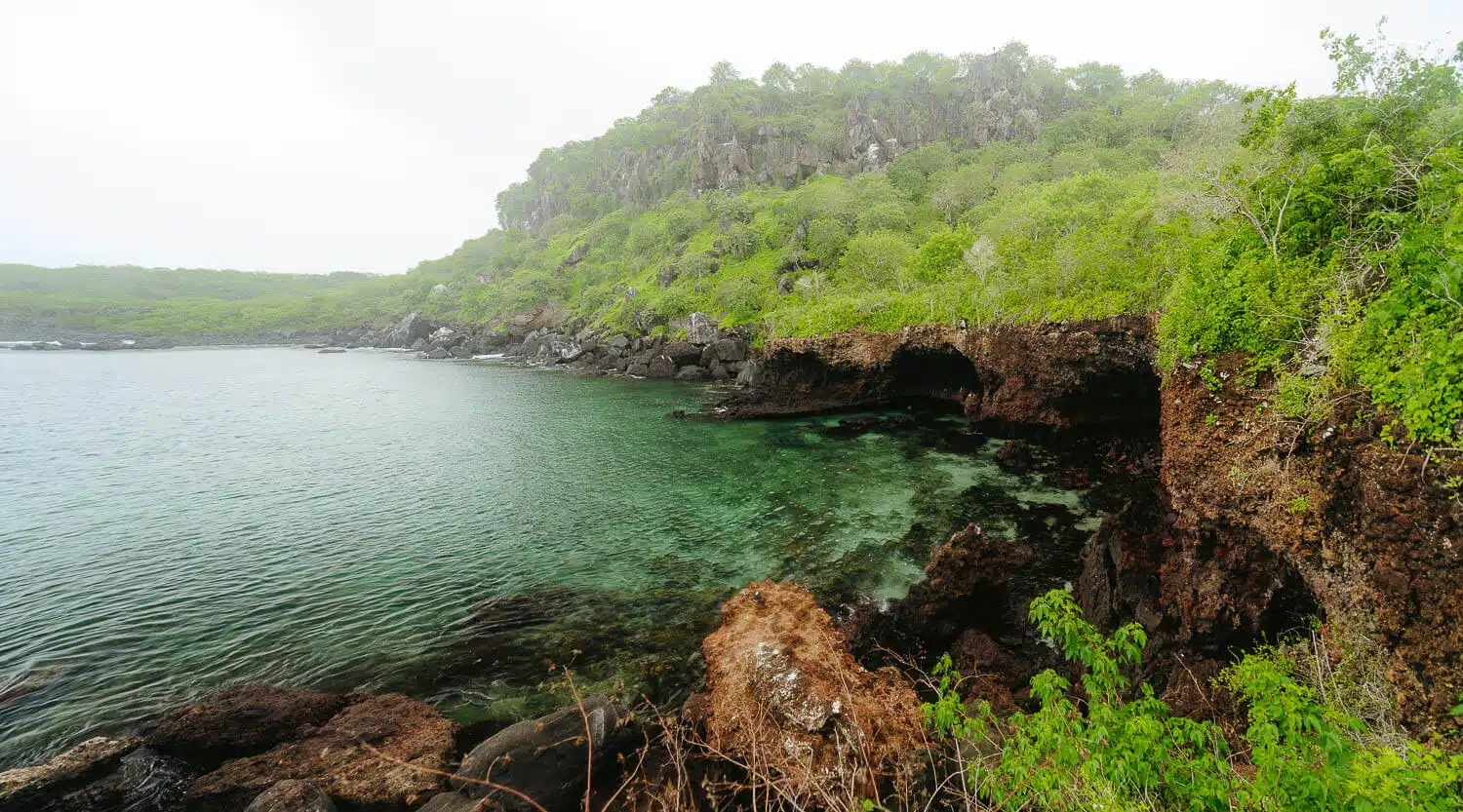
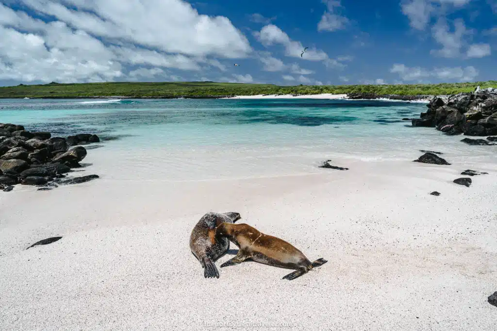
Playa Baquerizo in San Cristobal island, Galapagos
Plan Your Galapagos & South America Trip (Free Quote)
We’ve had many readers ask us for help planning a Galapagos & South America trip. While we don’t handle trip reservations or bookings ourselves, we partnered with Happy Gringo, a trusted local agency we 100% recommend. Share your travel details, and their team will help plan and book everything for you.
Cerro Tijeretas and Playa Baquerizo Hike: General Details
The Cerro Tijeretas and Playa Baquerizo Hike is an out-and-back trail to the beautiful Playa Baquerizo beach, starting at the Interpretation Center and passing through the viewpoint at the Cerro Tijeretas hill (on the photo above). You can on the way to Cerro Tijeretas visit the beautiful Punta Carola beach and Muelle Tijeretas (the port/beach on the left side of the first photo).
Hike Distance: 6kms.
Hike Duration: Around 2 hours of walking time. Counting with a lunch break or time to snorkel and take some photos, 3-4 hours.
Hike Difficulty: Moderate. The hardest thing about this hike is its terrain after Cerro Tijeretas and the hot weather. The path is mostly a very easy paved walking route until you reach the Cerro Tijeretas viewpoint. From then on to Playa Baquerizo beach the path has a lot of earth and gradually changes to pure sharp lava boulders. That’s why good shoes with a good grip are highly recommended, bring sunscreen, mosquito repellent (for the horse flies and mosquitos) a hat, and bring at least one liter of water with you (more if you plan to stay for a long time at the beach) and a snorkel kit.
Hike Incline: 50m of ascent and 40m of descent.
Hike Altitude: 0m (lowest point) at the Playa Baquerizo beach and 64m (highest point) at Cerro Tijeretas viewpoint.
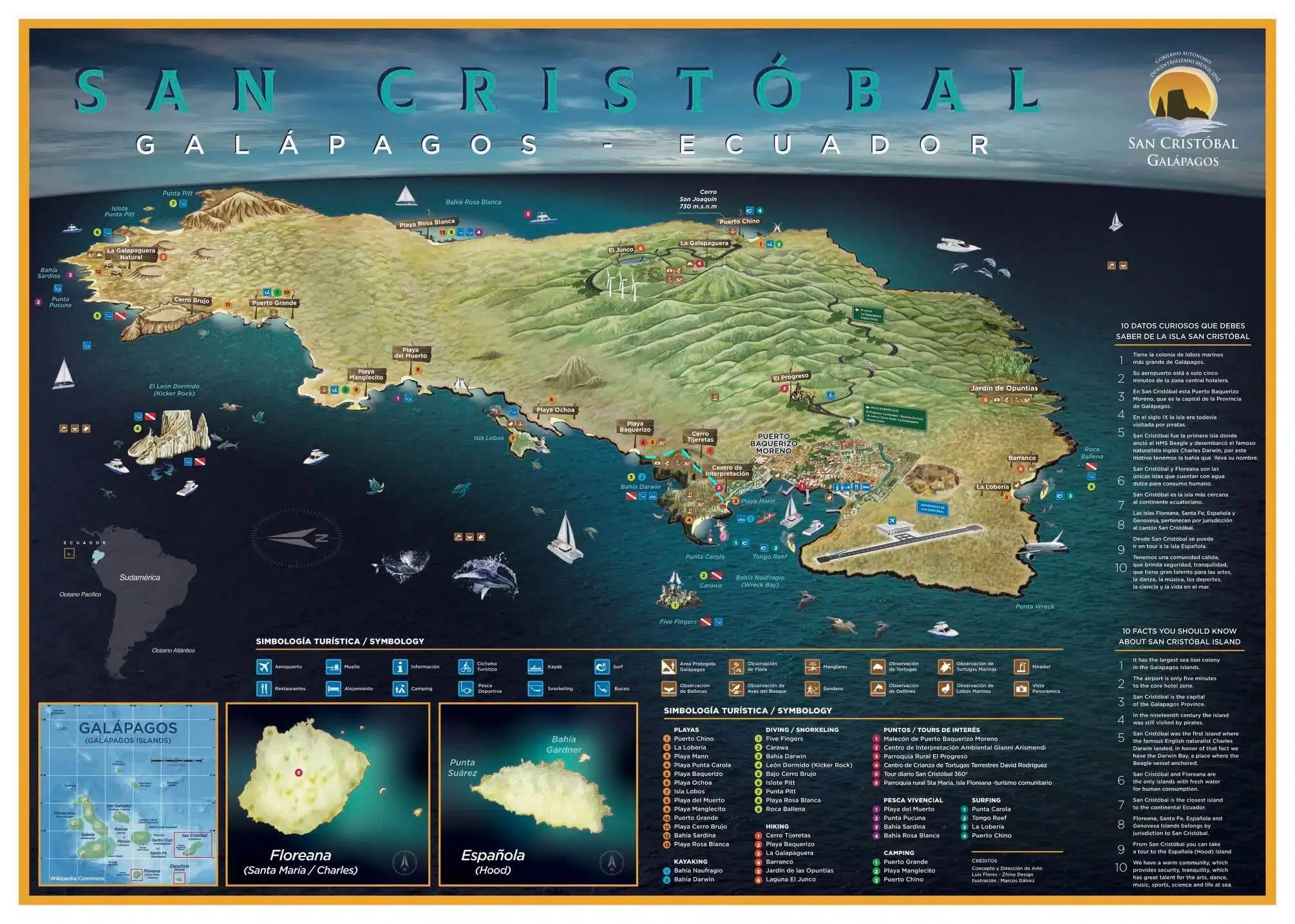
Cerro Tijeretas and Playa Baquerizo Hike map (light blue dashed line)
How To Get to Cerro Tijeretas and Playa Baquerizo?
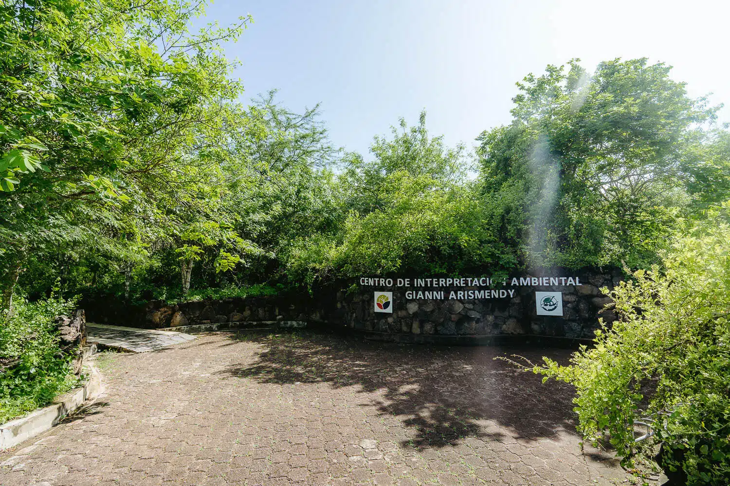
To get to Cerro Tijeretas and Playa Baquerizo you need to head first to the Interpretation Center (Centro de Interpretación Ambiental Gianni Arismendy), if you don’t want to walk there you can take a taxi from the village that costs you around 1$ USD.
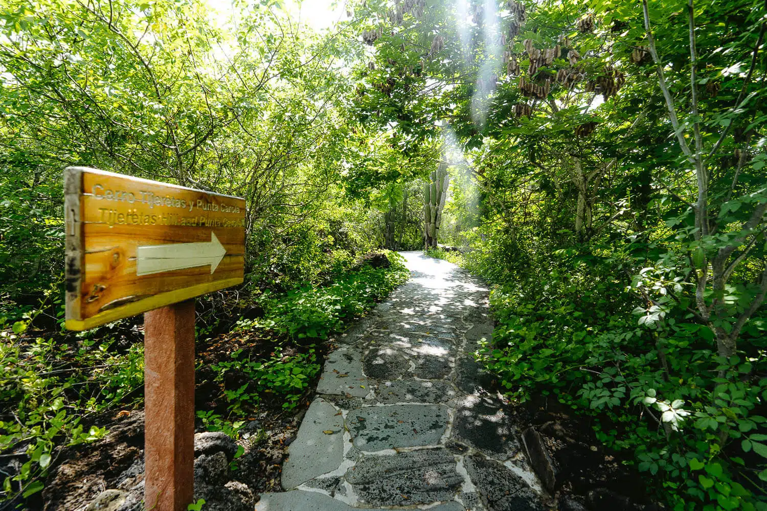
Once you finish the visit at the interpretation center you have signs showing you where the path starts.
You have the possibility to go left to Punta Carola beach or Muelle Tijeretas or to go right to Cerro Tijeretas and continue the hike to the Playa Baquerizo beach.
Hiking to Cerro Tijeretas
What to Bring on the Cerro Tijeretas and Playa Baquerizo Hike?
Mosquito Repellent: The beaches on the Galapagos islands, especially at sunset, have a lot of mosquitos and usually also horseflies or “Tabanos” as they are called in Spanish and they are silent and leave you with a huge unpleasant swollen bite.
Check out my complete guide on What’s in My Backpack – From photography gear, and clothing for Hiking, Mountaineering, Scuba Diving, Rainforest, and City-Street Photography.
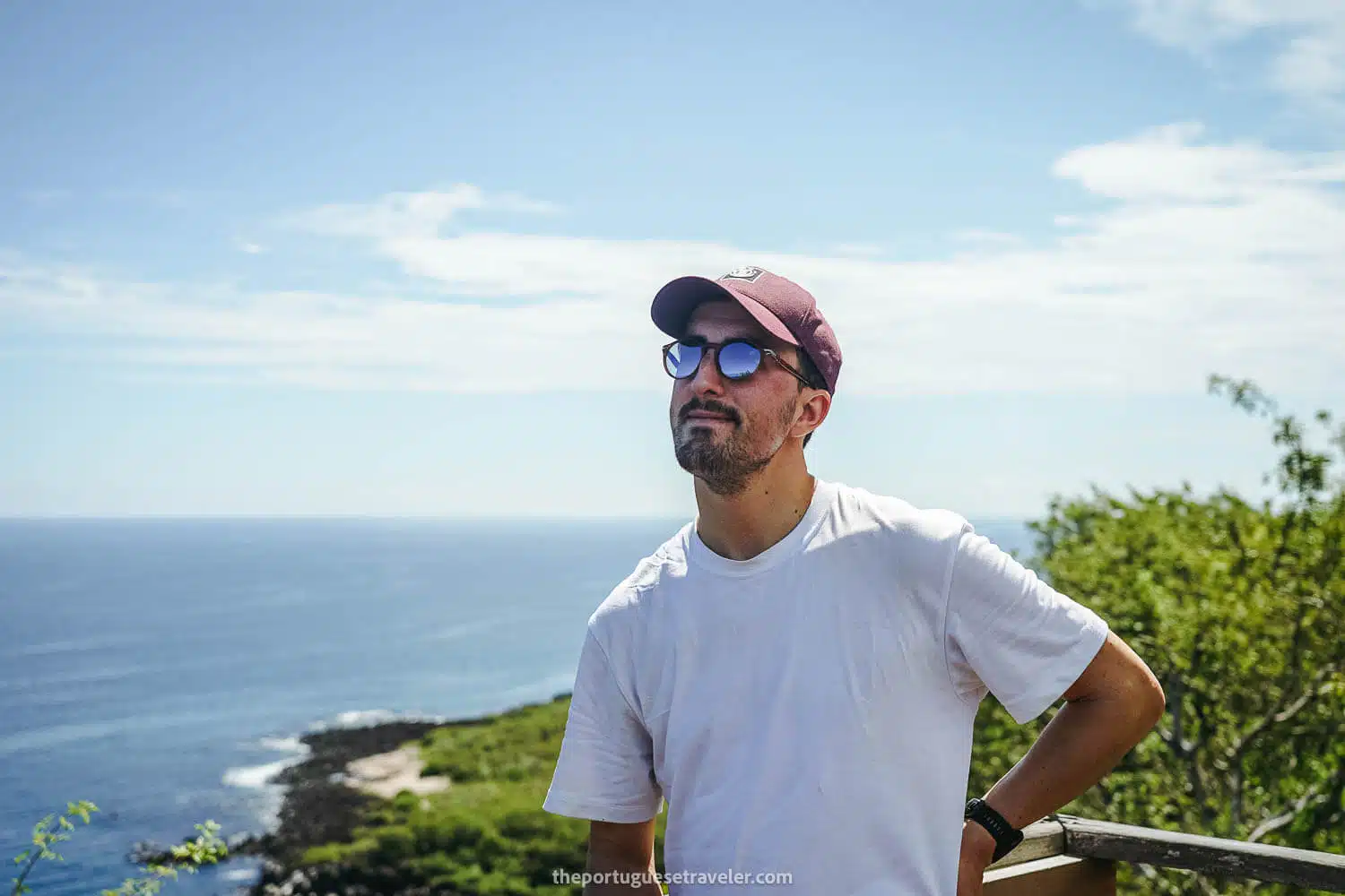
My Experience Hiking to Cerro Tijeretas and Playa Baquerizo
This was my second day on San Cristobal island and I decided to do my first hike on the island.
To start off I rented a taxi from my hotel to the interpretation center and then I started the hike. Not many people around, maybe one couple and a family possibly making their way to Muelle Tijeretas.
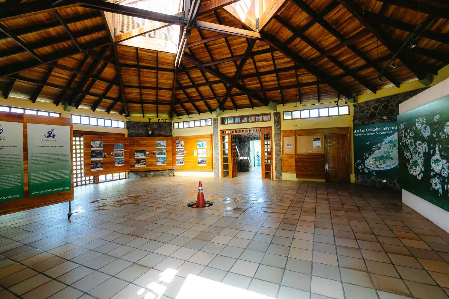
After visiting the Interpretation Center which takes around 30mins to one hour (depending on how much you pay attention to the information there), the hike starts.
If you’re interested in some information about the history and evolution of San Cristobal island and of the Galapagos Islands in general, their people, their struggles, and research studies this is the place to visit.
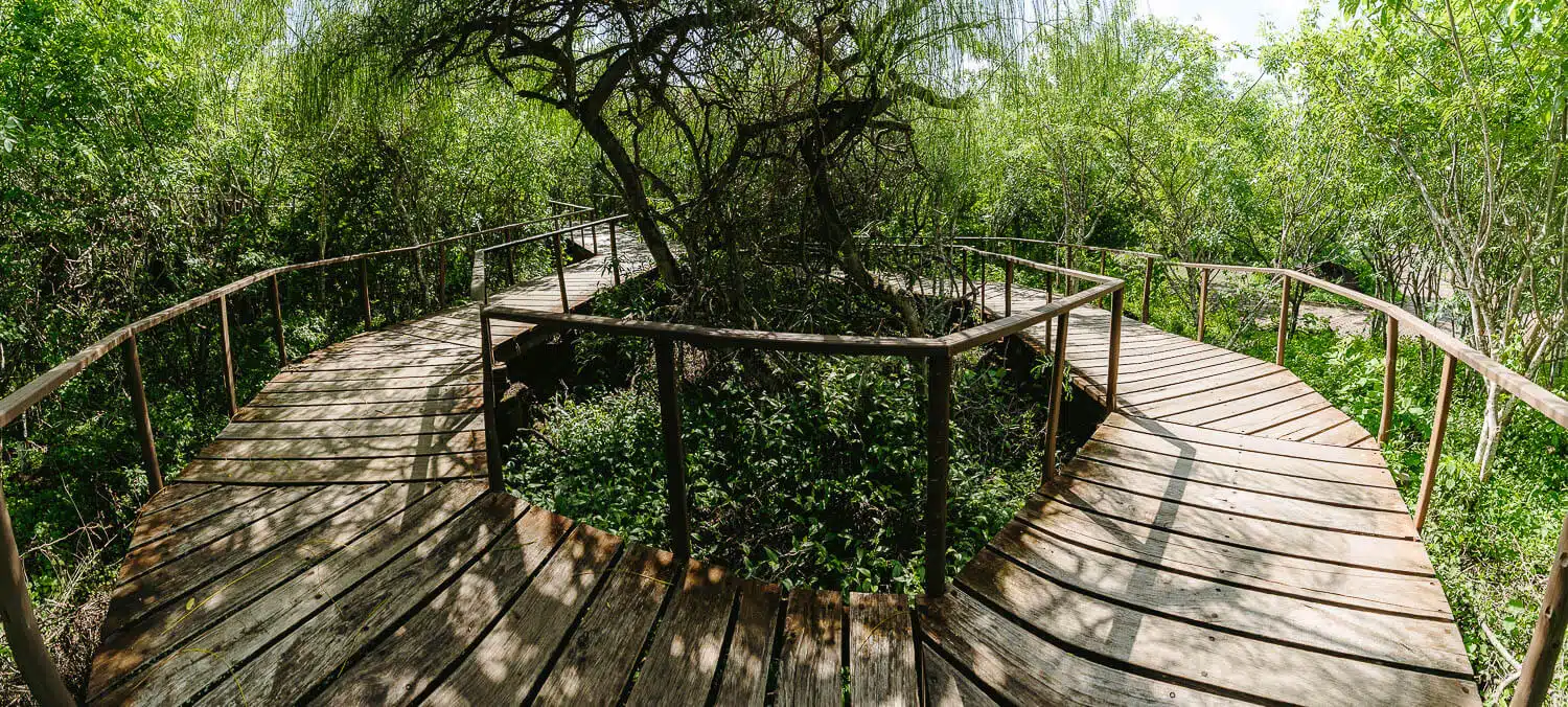
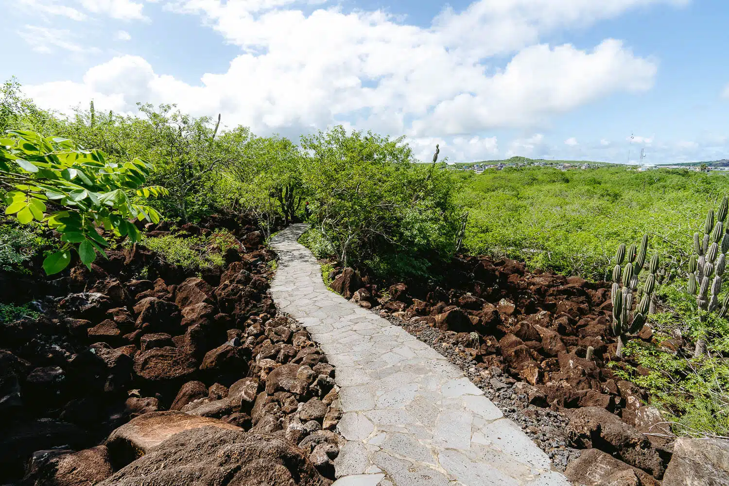
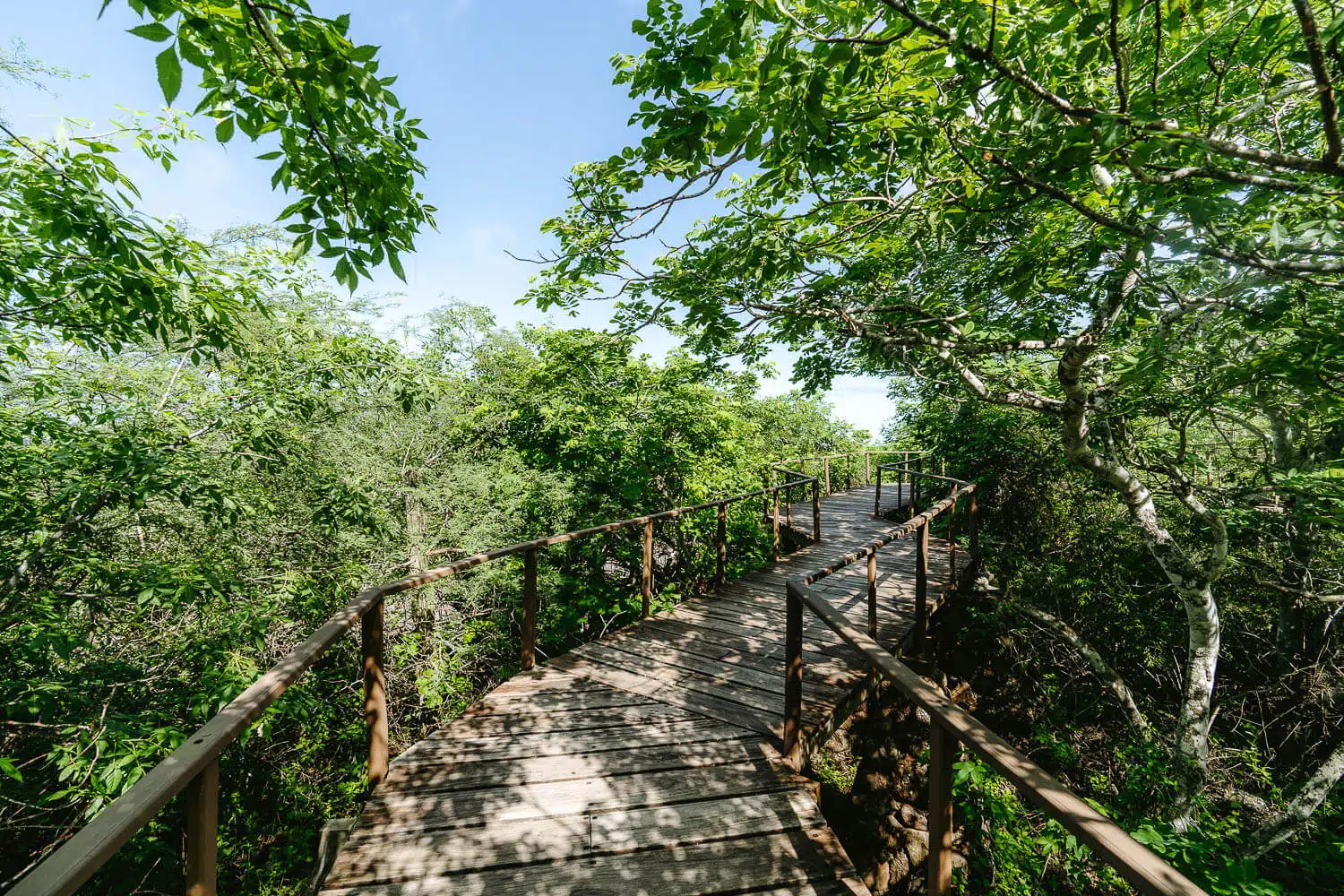
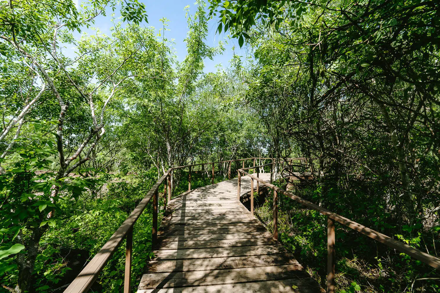
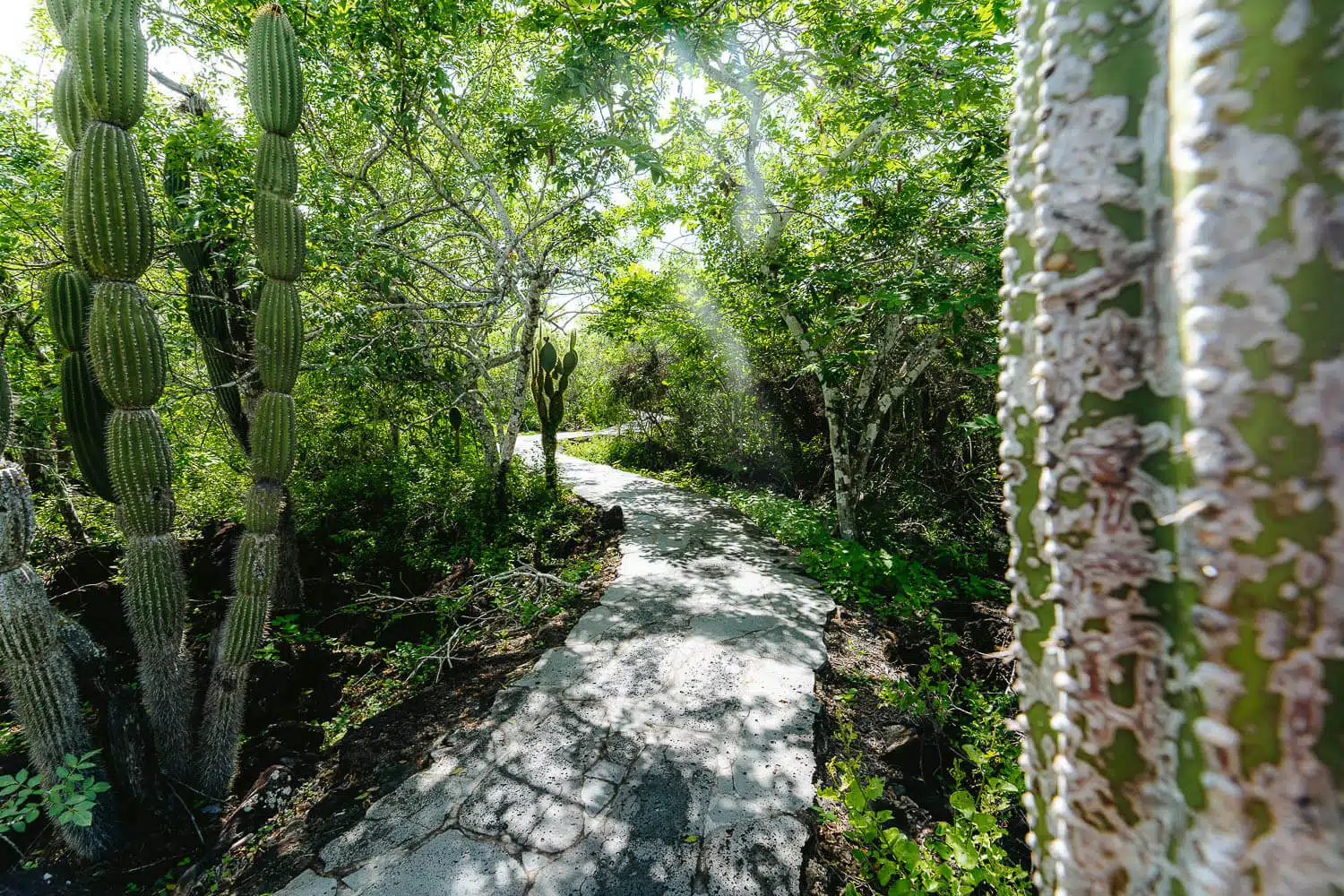
The wooden path to the Interpretation Center
From the Interpretation Center to Cerro Tijeretas
To reach the Interpretation Center you need to go to the far east side of the Puerto Baquerizo Moreno village, either walking or by taxi.
Once you finish your visit you can follow the marked signs pointing to Cerro Tijeretas – Tijeretas Hill and follow the paved lava stone path until you reach a part with stairs that lead you to the platform at the top where you have an amazing view over Muelle Tijeretas port and to the Playa Tijeretas on the right side.
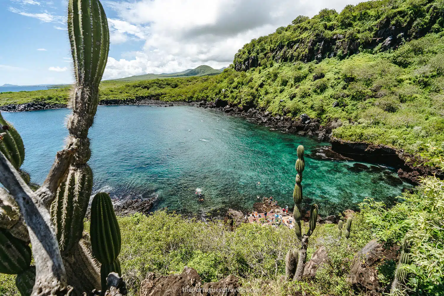
I’ve just returned from San Cristobal and went to Cerro Tijeretas and Muelle Tijeretas to take some photos with sun and what a different it makes to catch it on a sunny day. Turquoise water and dozens of sea lions (also dozens of tourists more). They added a new platform for you to change clothes next to the normal stone stairs (it’s nice but it burns your feet pretty quickly – suggestion, leave your things on the platform but change on the stone steps).
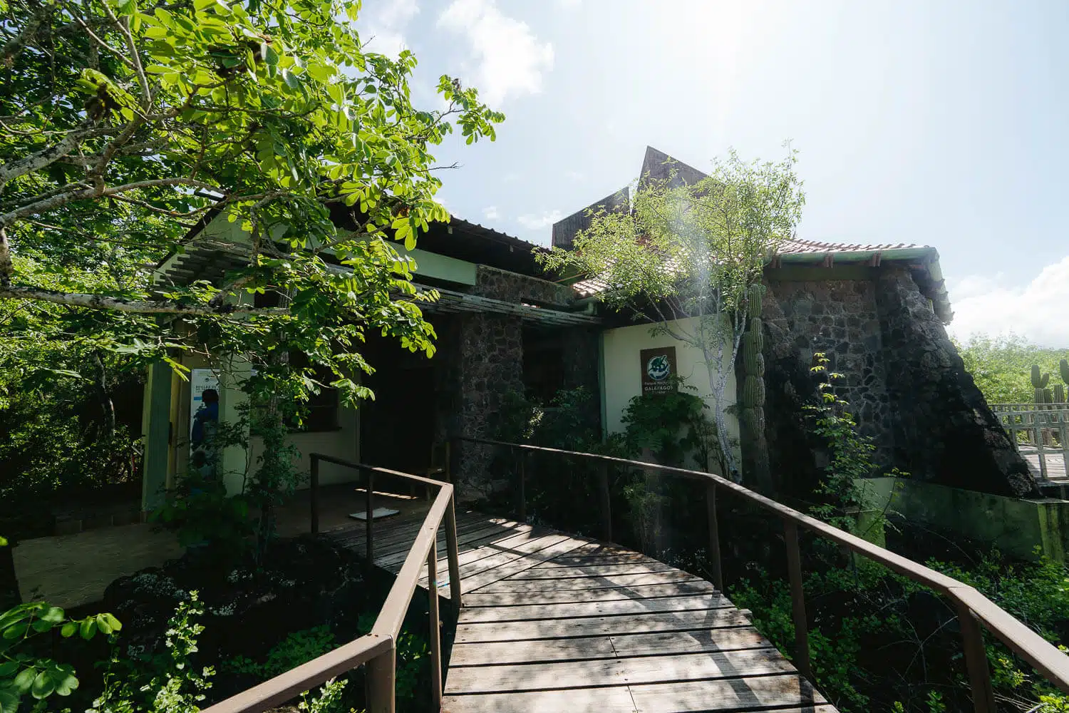
Interpretation Center of San Cristóbal Island
The entrance to the Interpretation Center
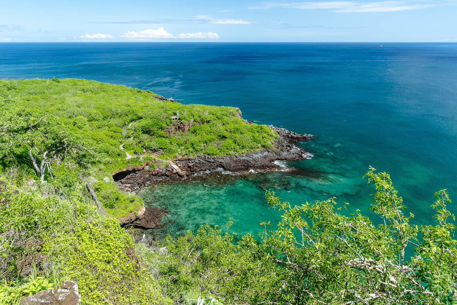
The view from Cerro Tijeretas (Leon Dormido on the horizon)
The interior of the Interpretation Centre of San Cristobal
The start of the hike to Cerro Tijeretas and Punta Carola beach
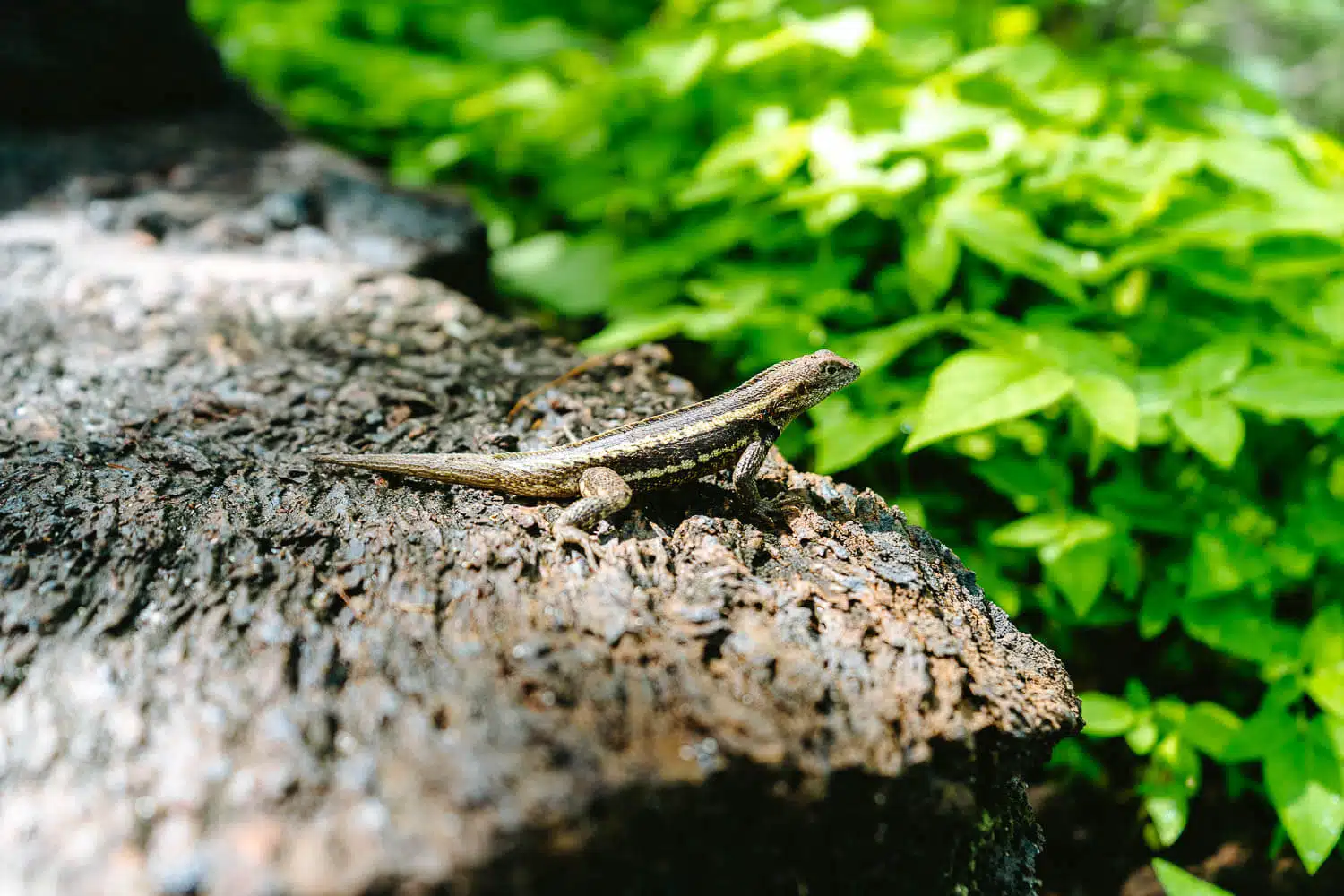
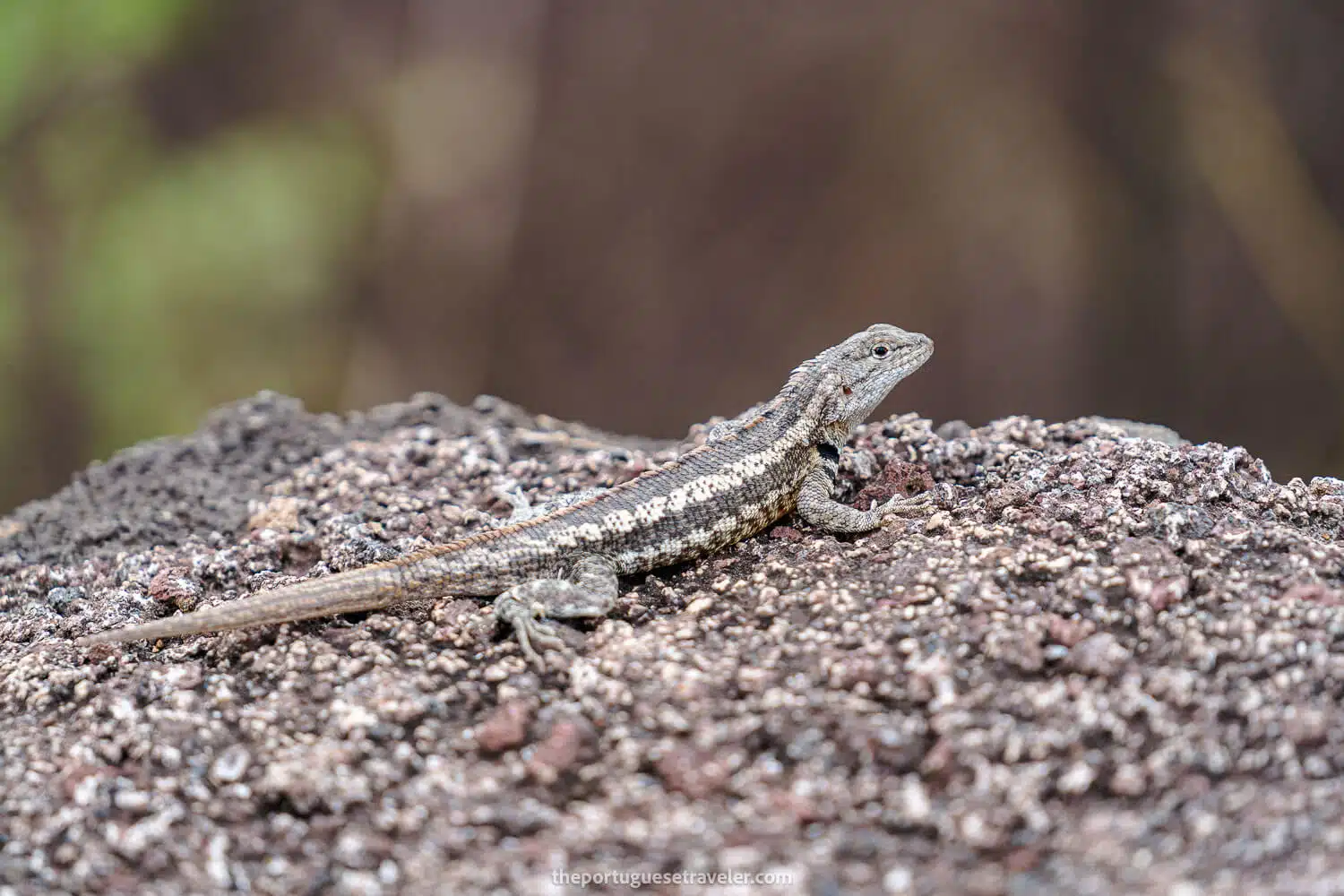
A lava lizard on the steps to Cerro Tijeretas
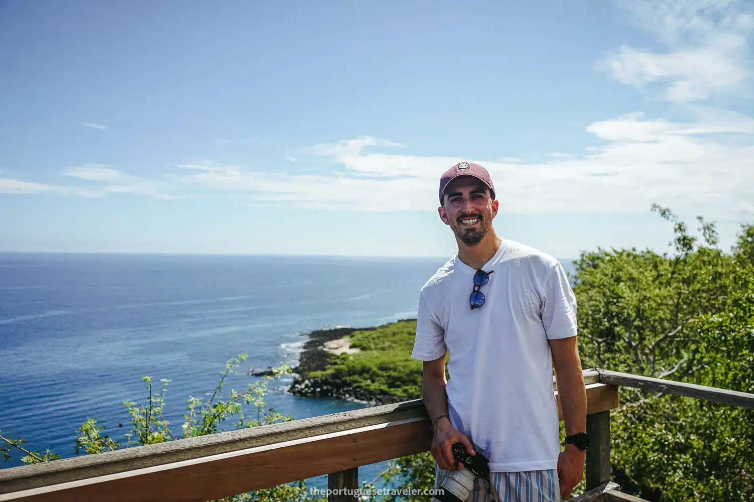
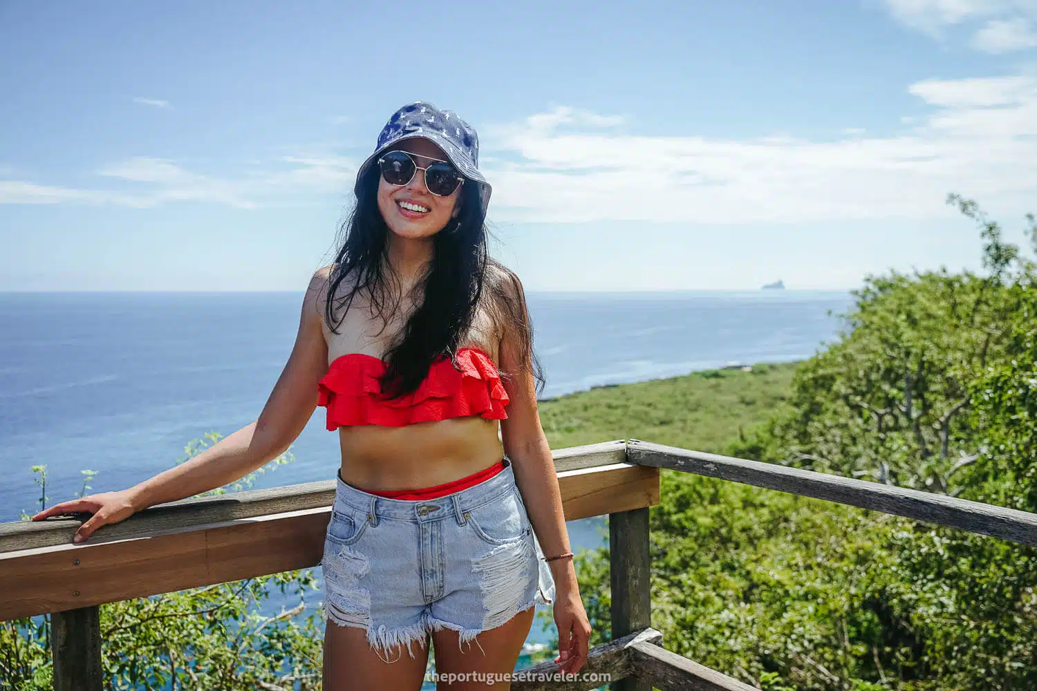
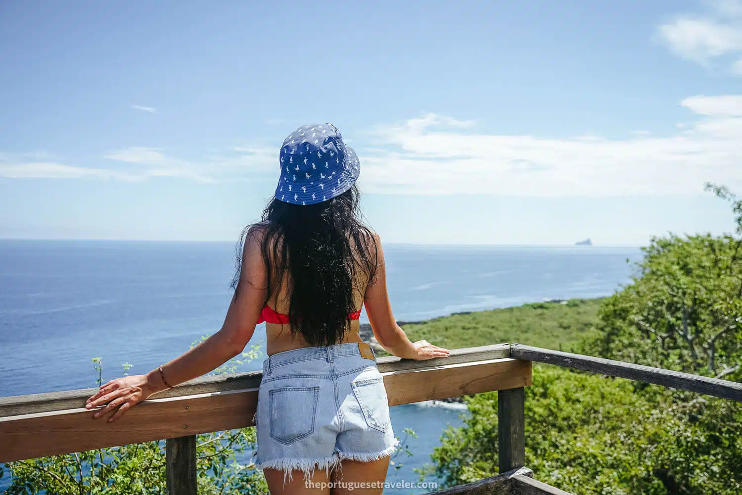
Me at Cerro Tijeretas taking some panoramas
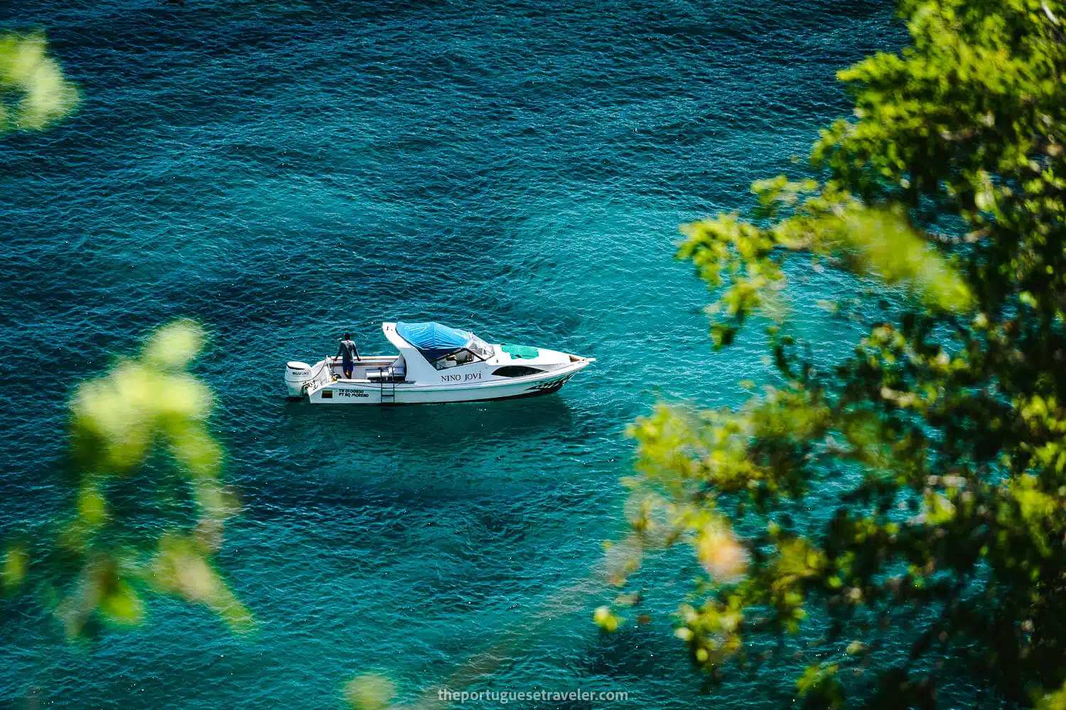
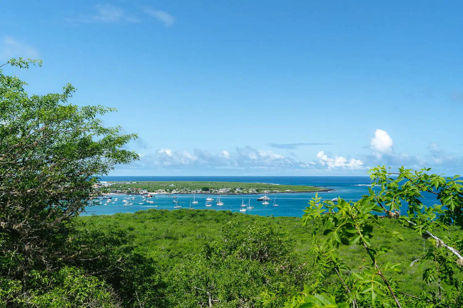
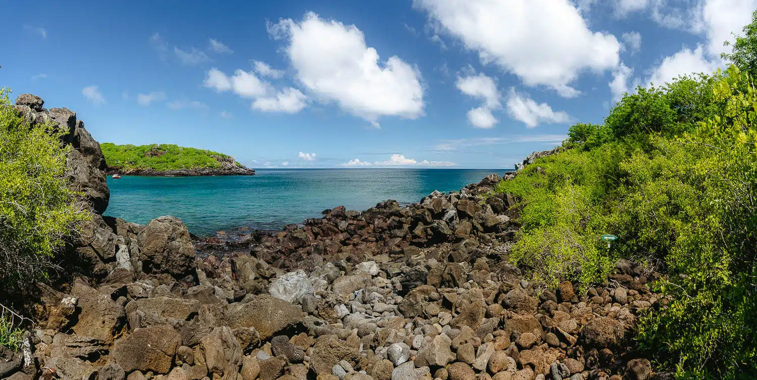
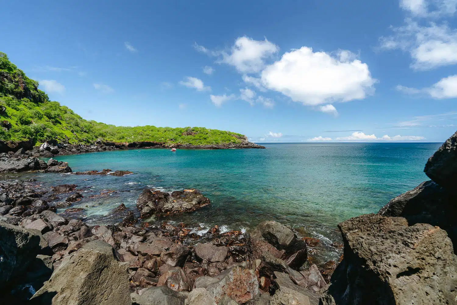
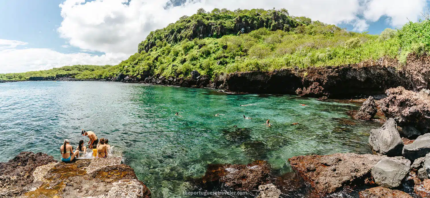
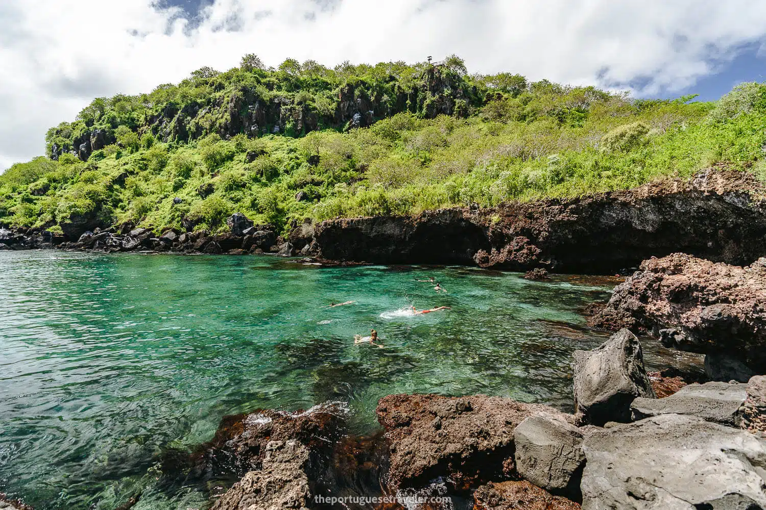
A yacht at Muelle Tijeretas
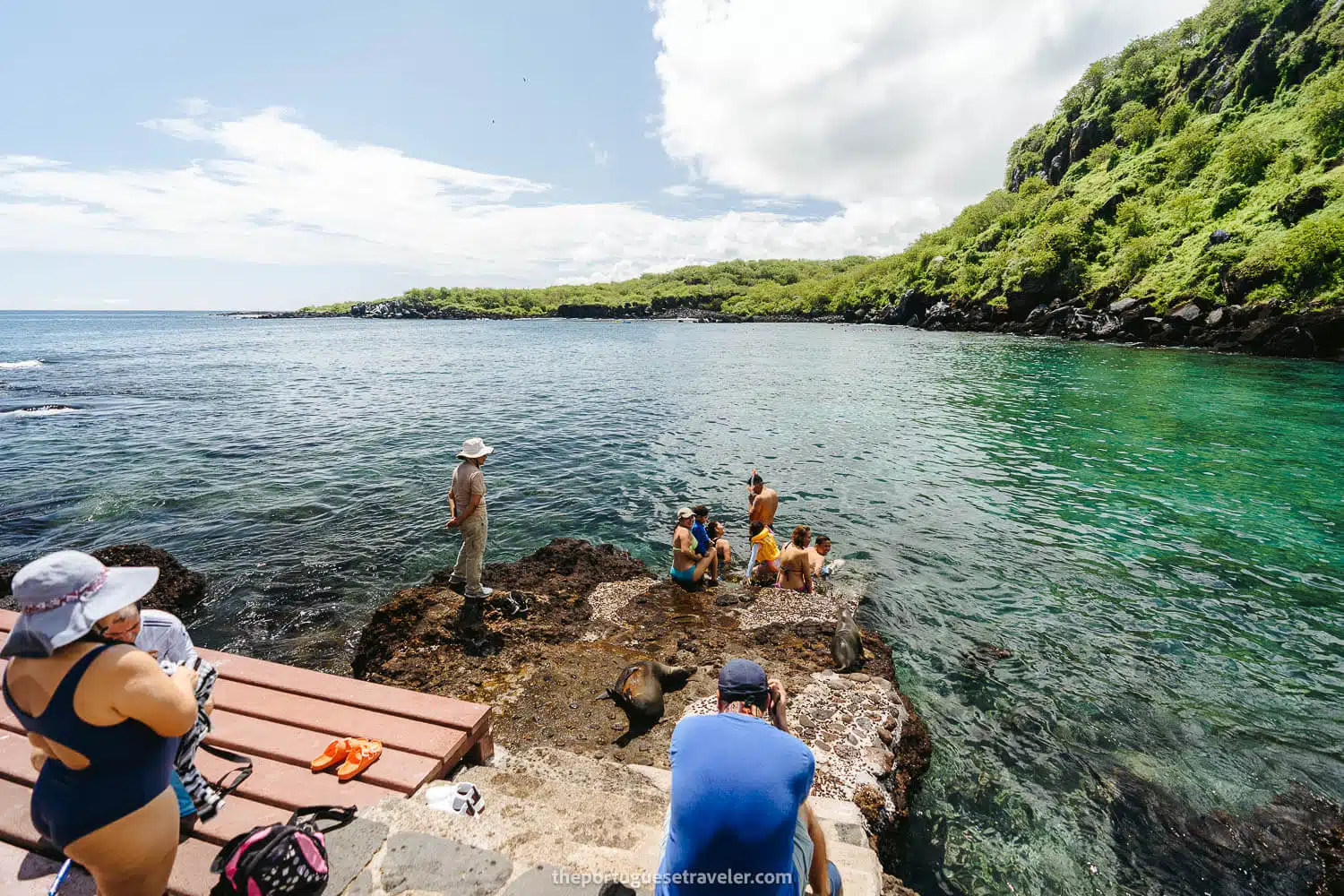
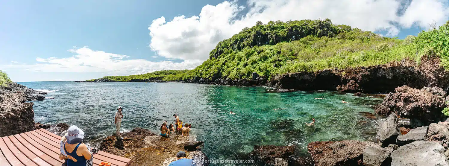
Muelle Tijeretas
Tijeretas with a new deck and people snorkeling
A model at Cerro Tijeretas
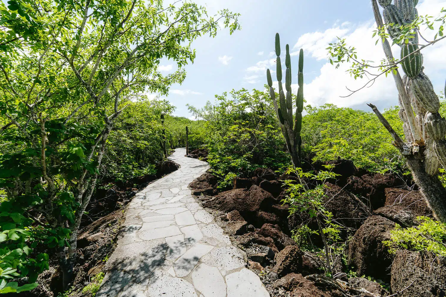
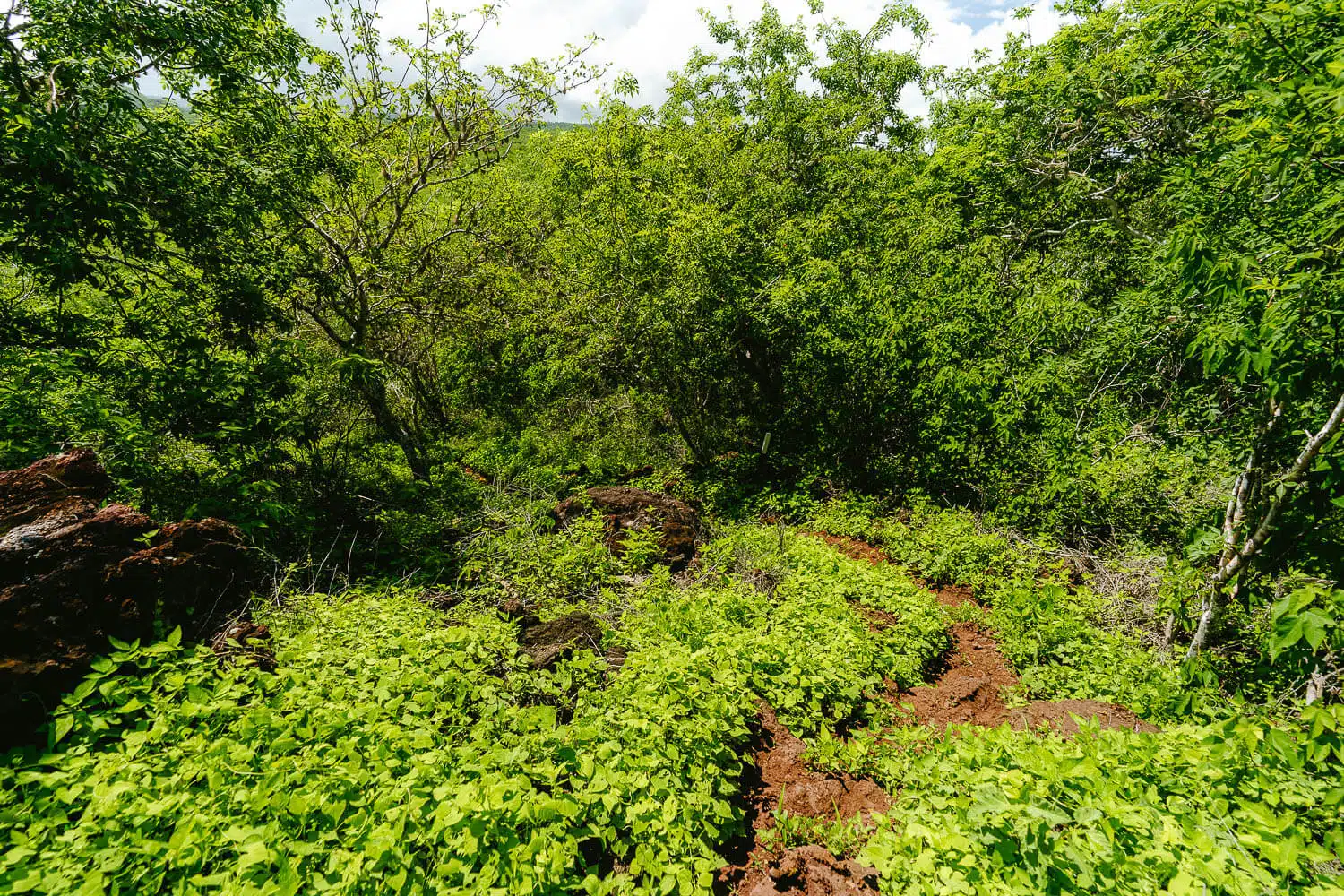
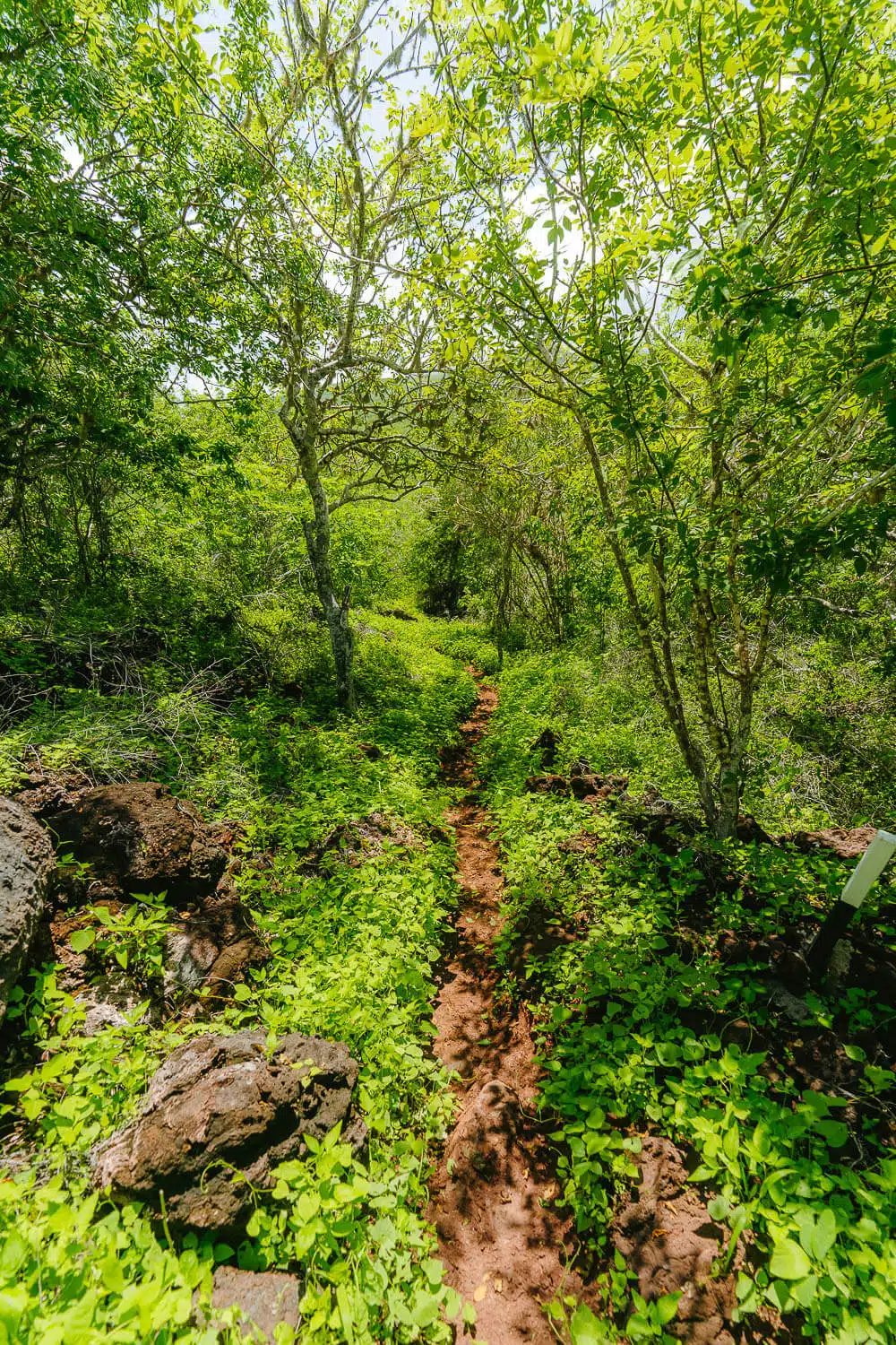
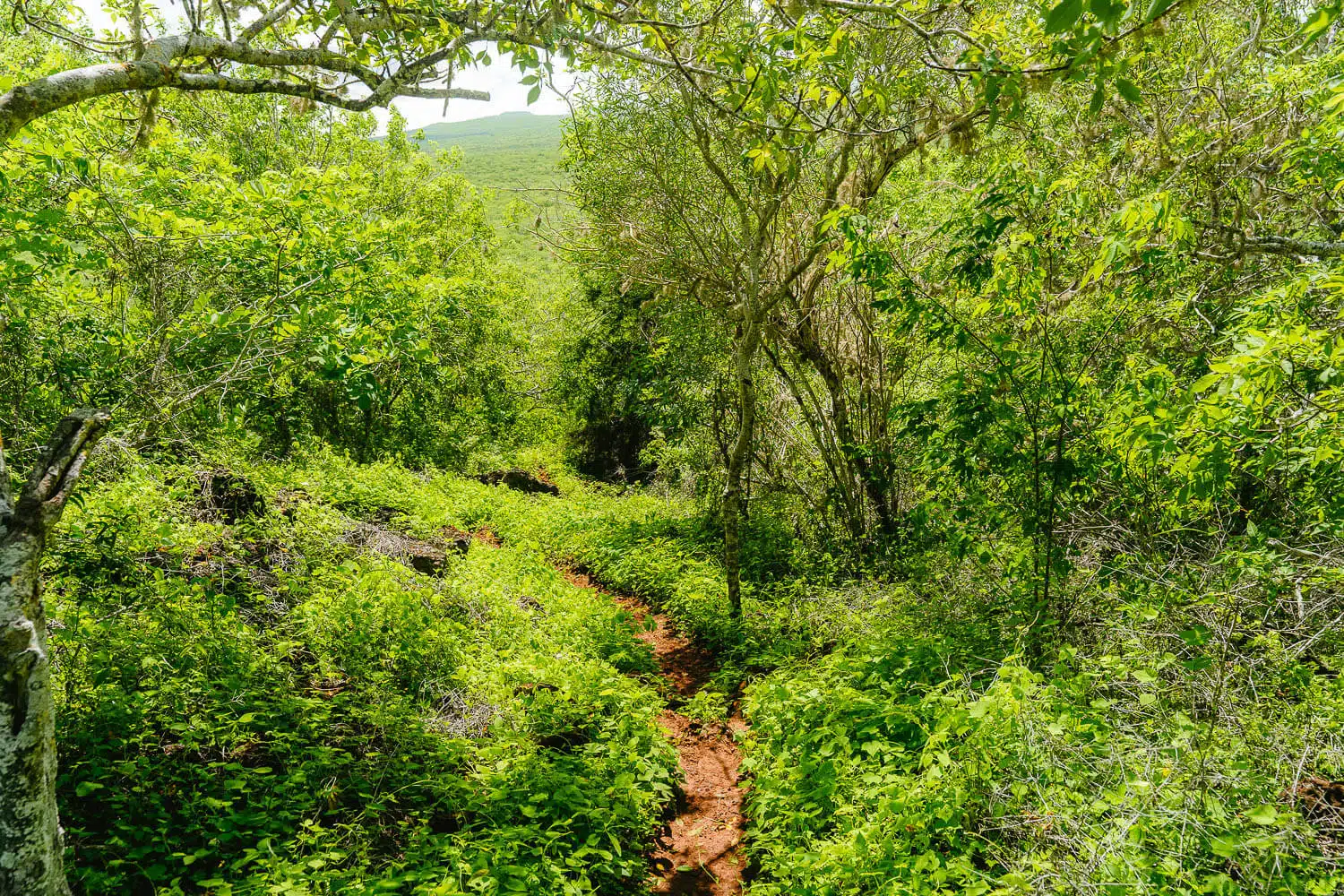
The muddy path right after Cerro Tijeretas
The muddy path right after Cerro Tijeretas
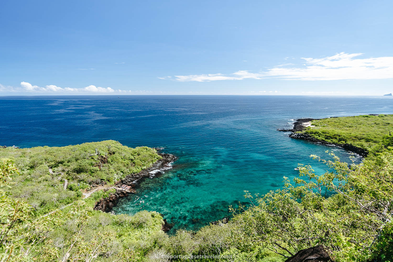
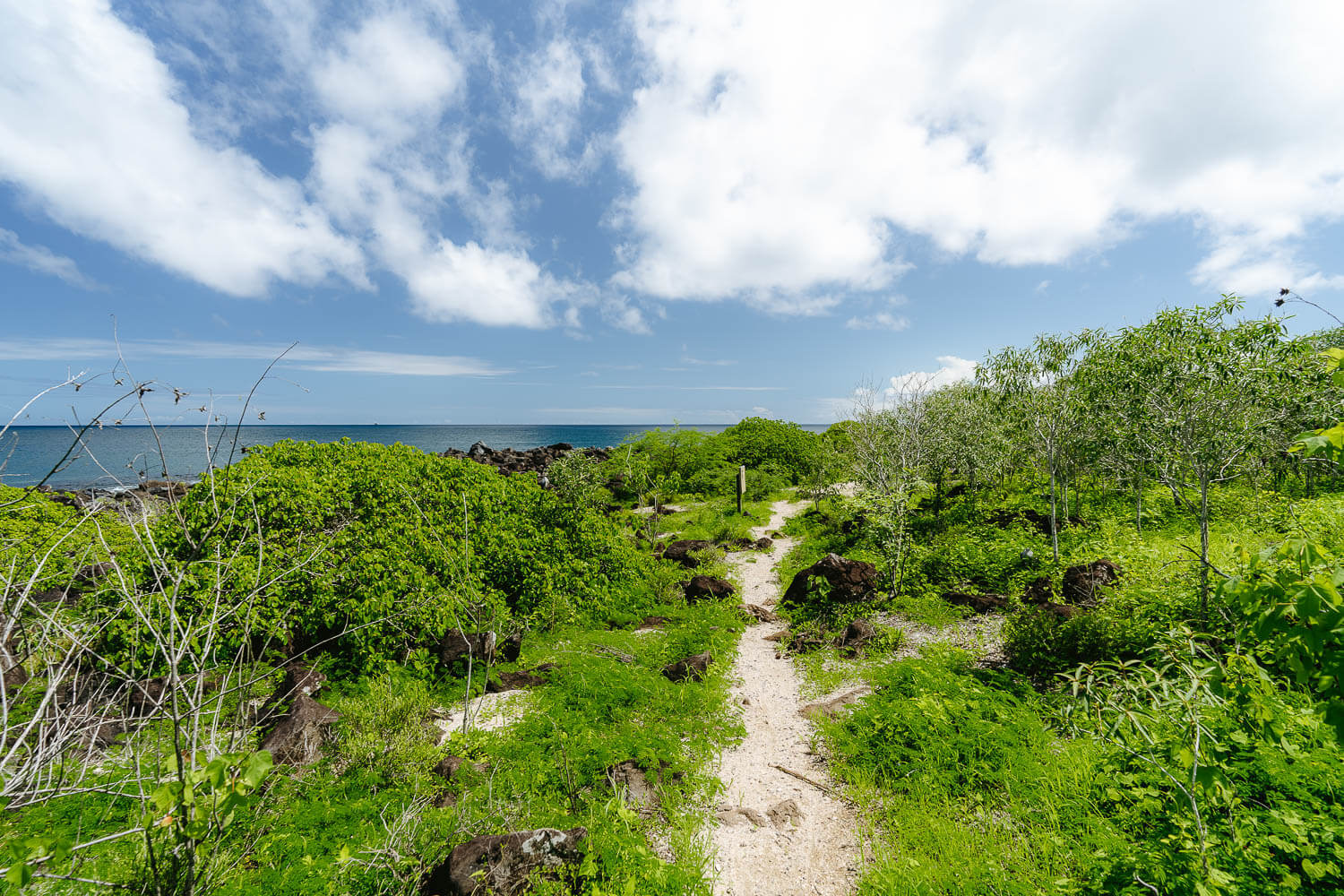
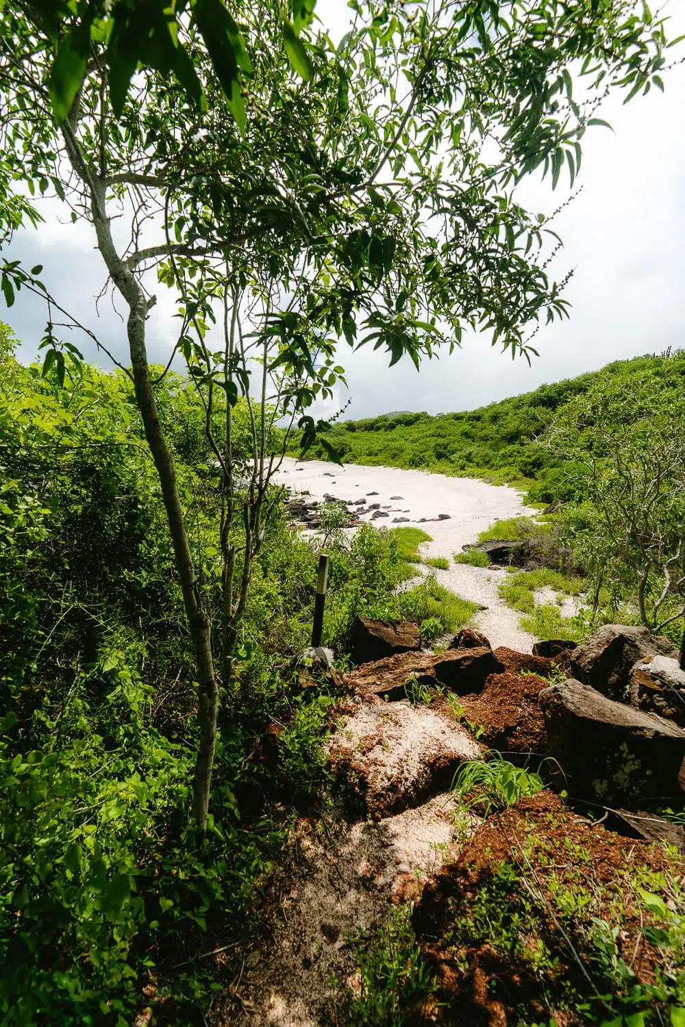
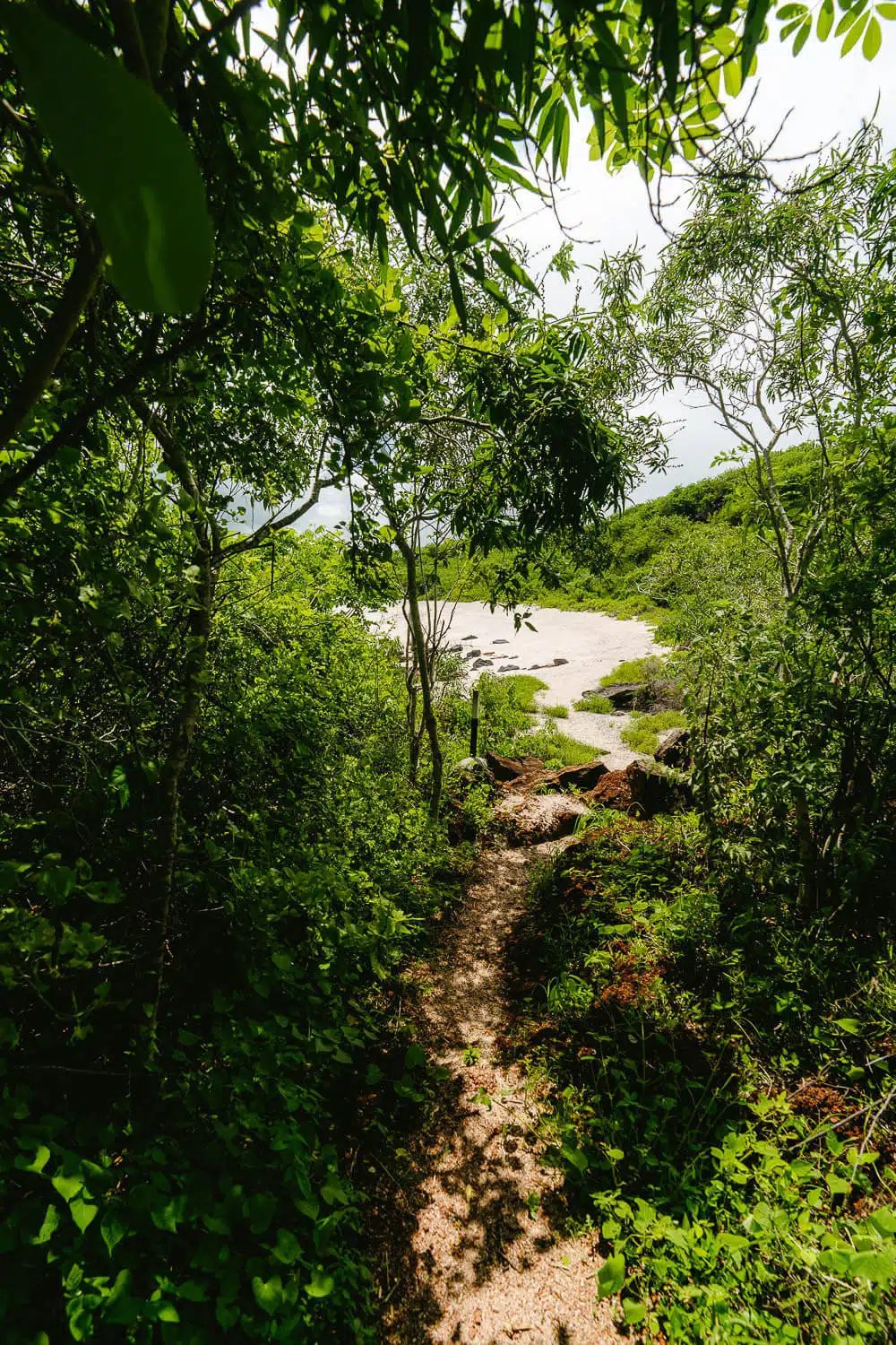
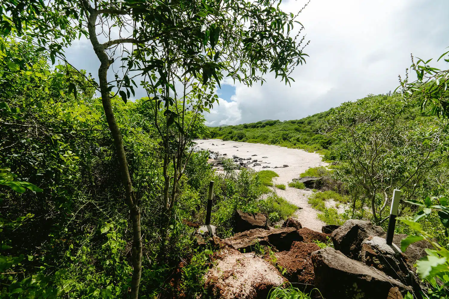
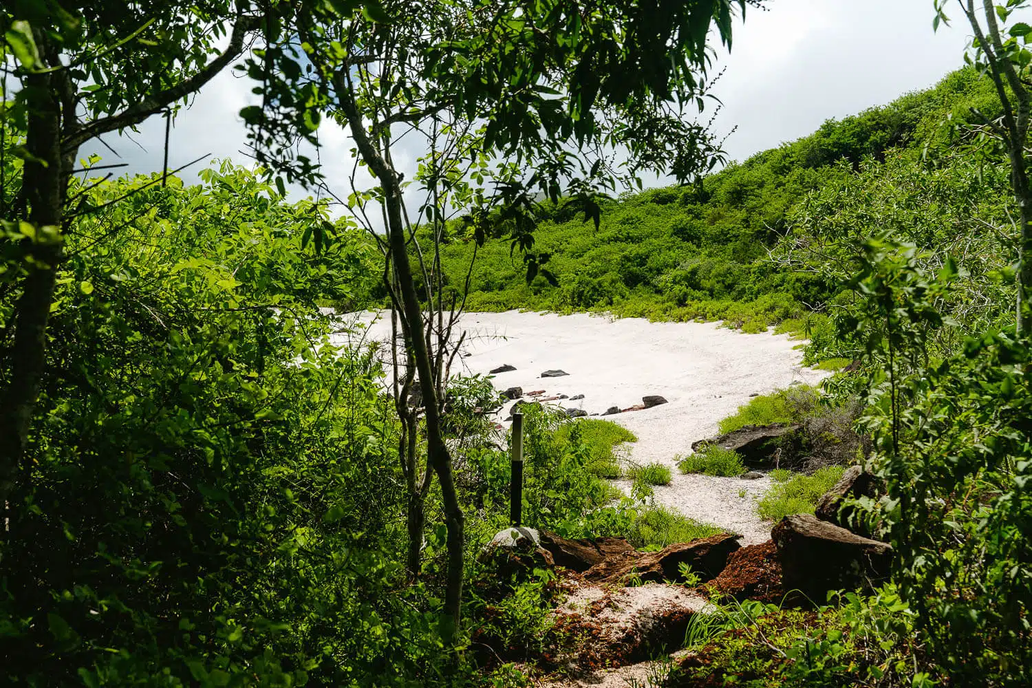
The hike to Playa Baquerizo opening up to the sea
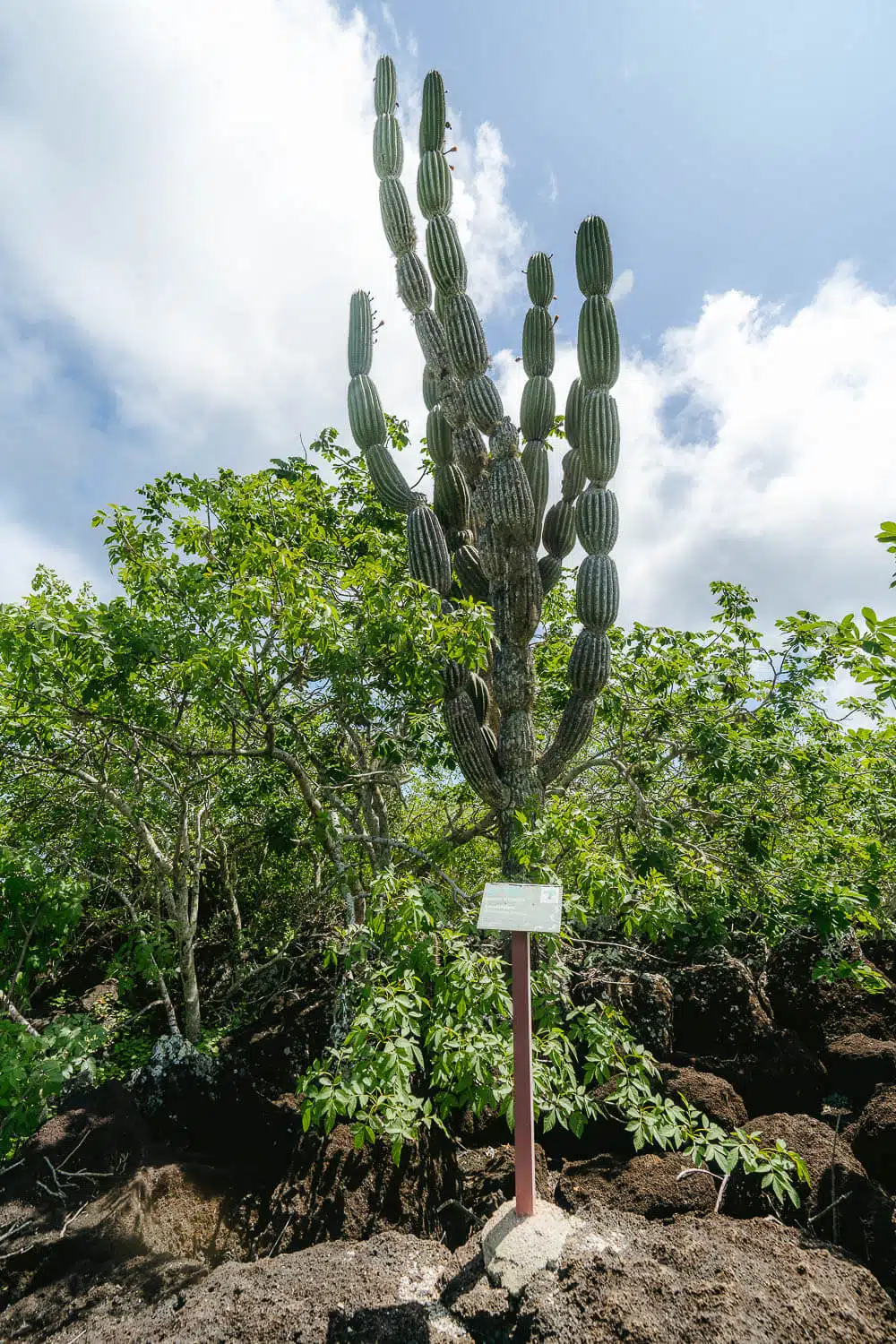
A Candelabra Cactus before Playa Tijeretas
From Cerro Tijeretas to Playa Baquerizo
Once you finish your break at the viewpoint you just have to follow the same path you came up but instead of turning left to the viewpoint continue straight.
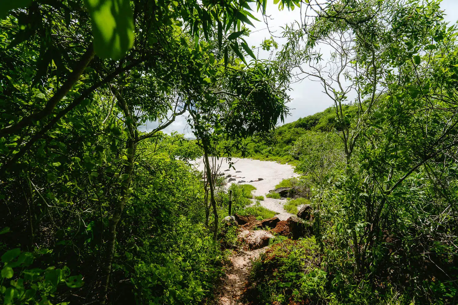
You will see the path is no longer a paved one and is mainly dirt and earth, so expect a lot of mud if it rained the previous days like in my case.
As I was one of the first people doing the hike after the massive rainfall of the previous day the ground was all muddy and in between the narrow sections of the path, hanging between cactus and trees there were big spider webs which hopefully you can avoid.
Once you climb down the Cerro Tijeretas hill you will have an open view of the sea and Muelle Tijeretas on your left and with luck spot some sea lions hanging on the rocks in front of you.
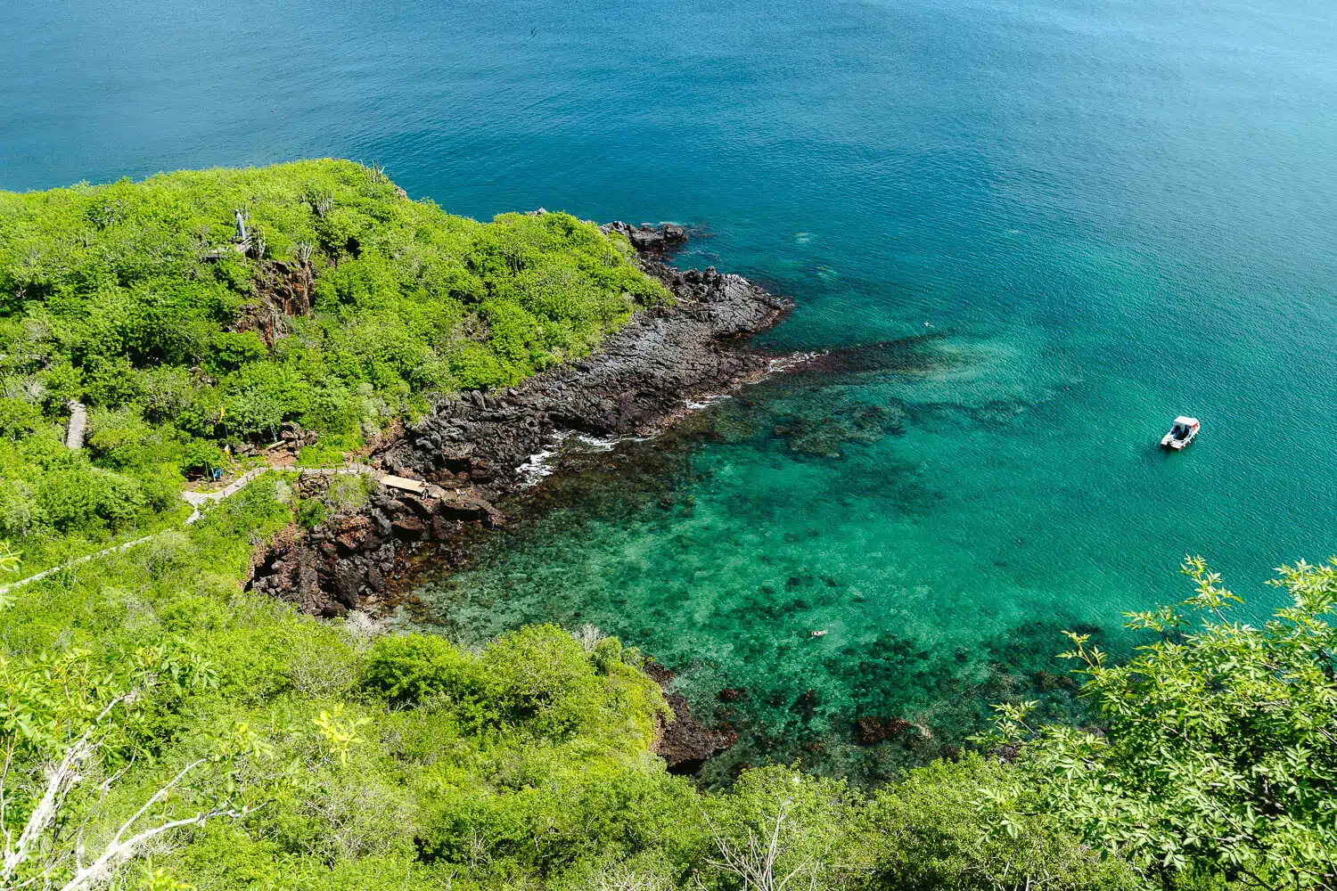
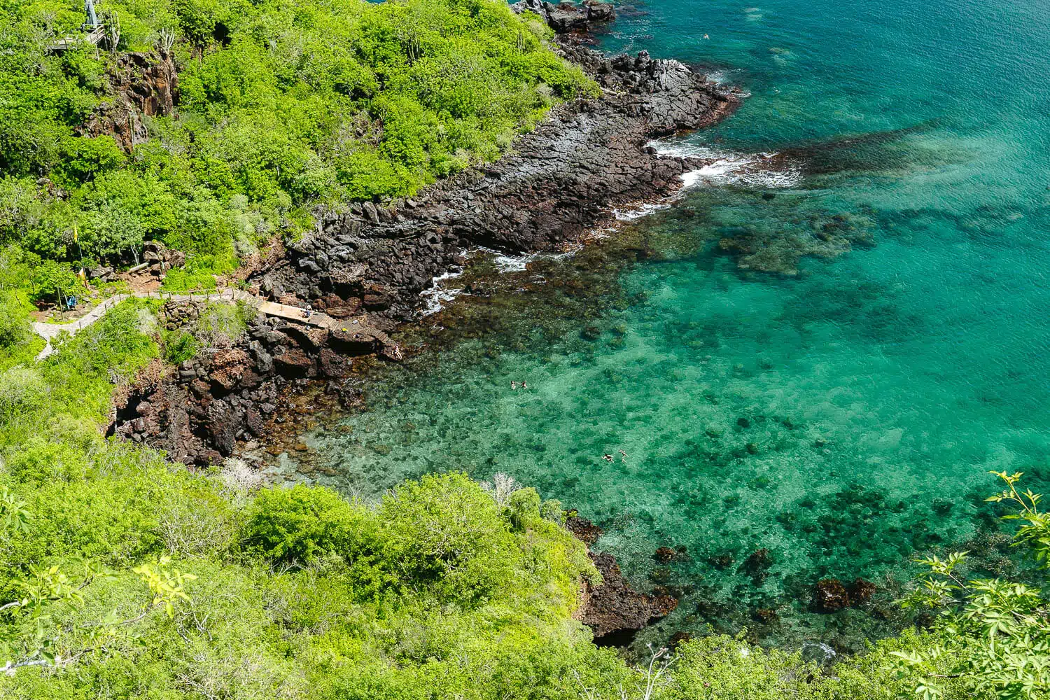
After this part, the floor is no longer muddy and it turns into a sand and gravel path with a view of the sea until you reach the Playa Tijeretas.
This is hardly a beach due to having more big rocks than sand near the water. I advise you to swim later at the proper beach Playa Baquerizo.
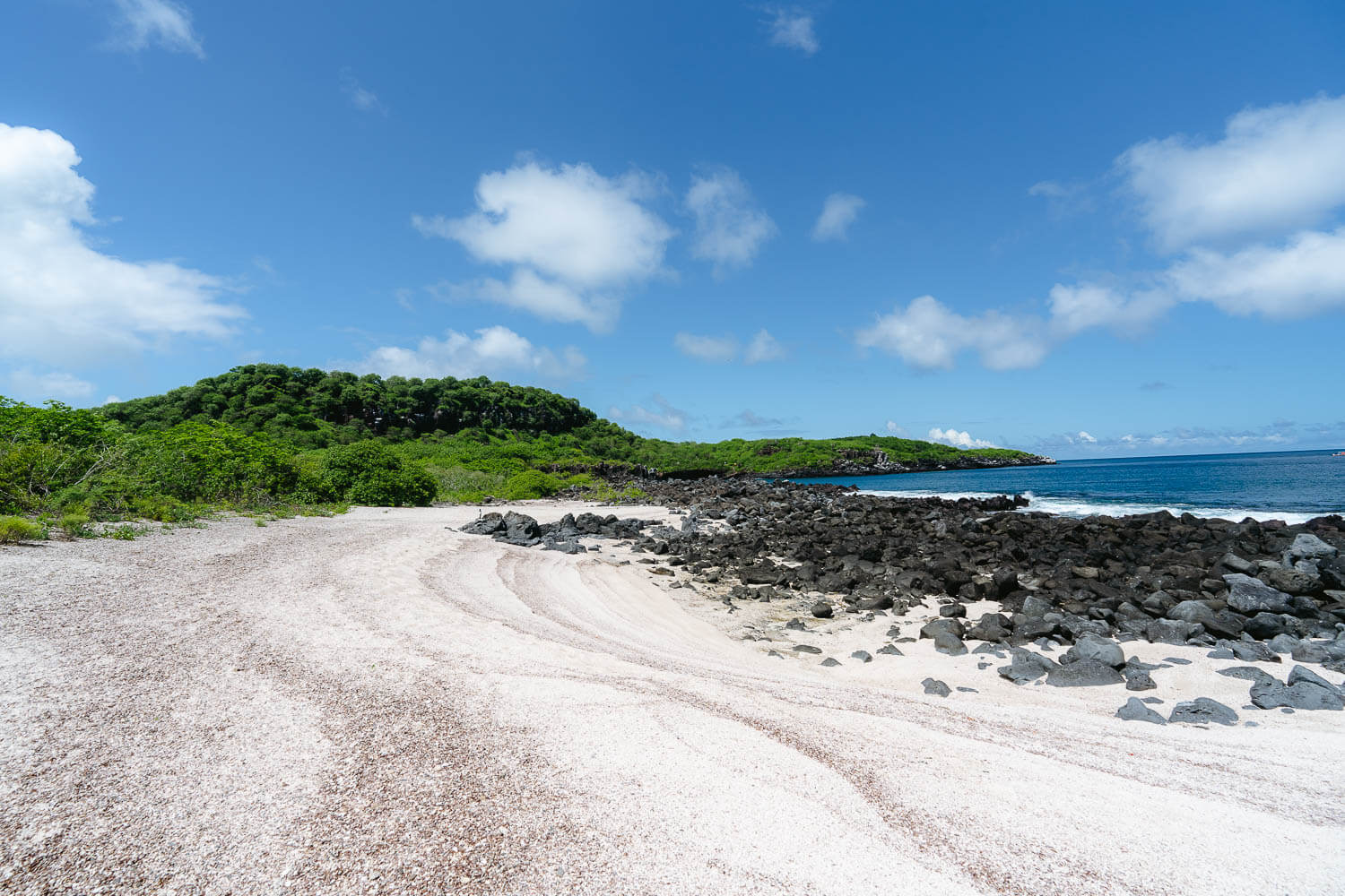
Once you pass Playa Tijeretas the floor changes from a sandy path to pure lava boulders until you reach Playa Baquerizo, which makes it hard to pass but it’s doable if you’re with hiking shoes or in worst case scenario sneakers.
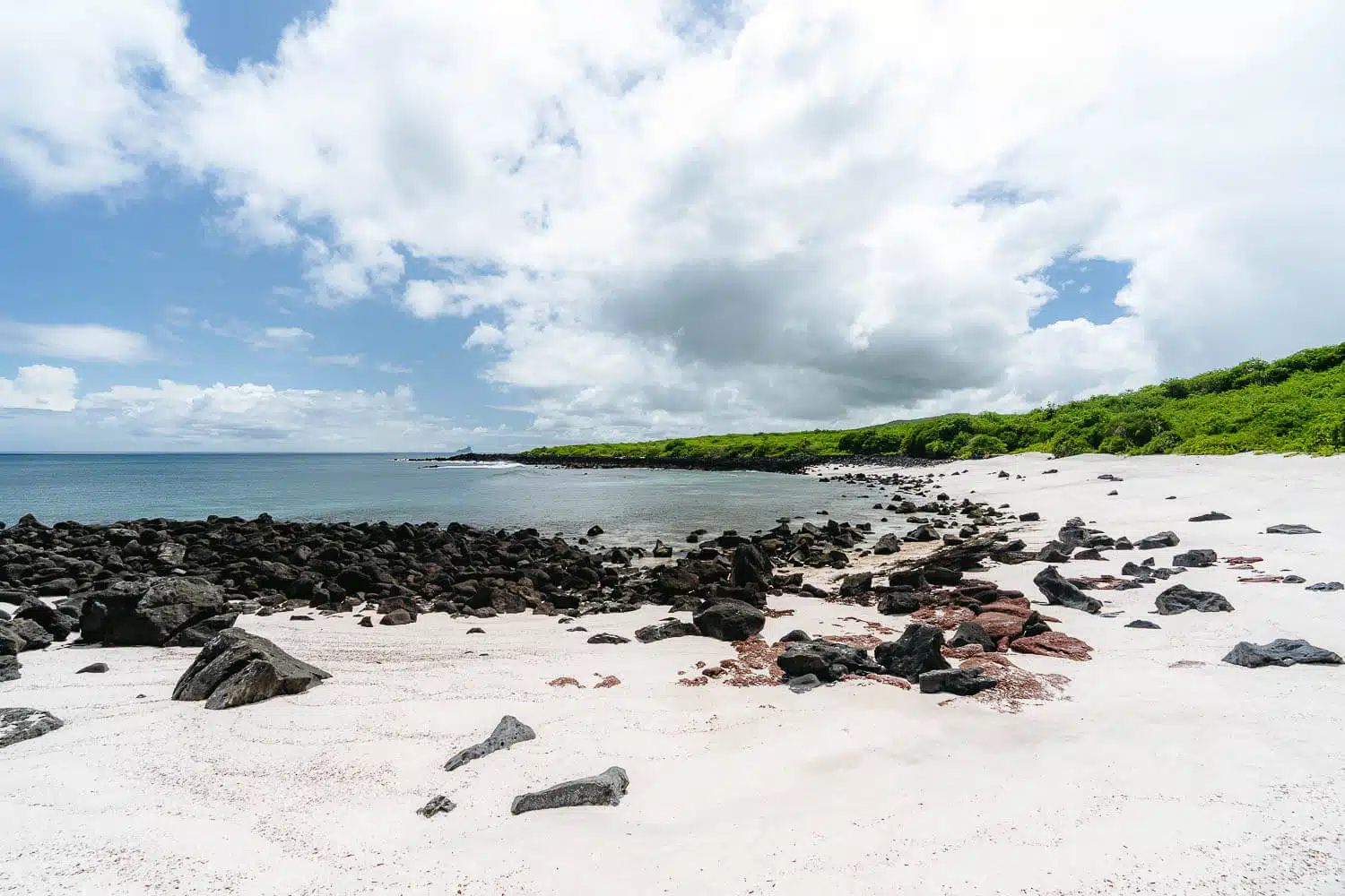
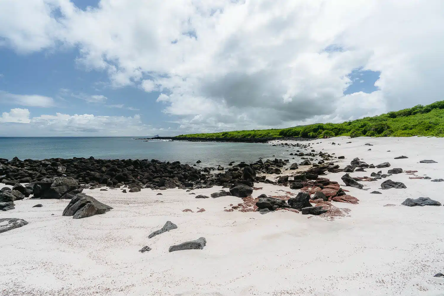
And finally, you reach the main goal after walking those 3kms under a blazing sun. It’s a beautiful beach with white sand and turquoise water.
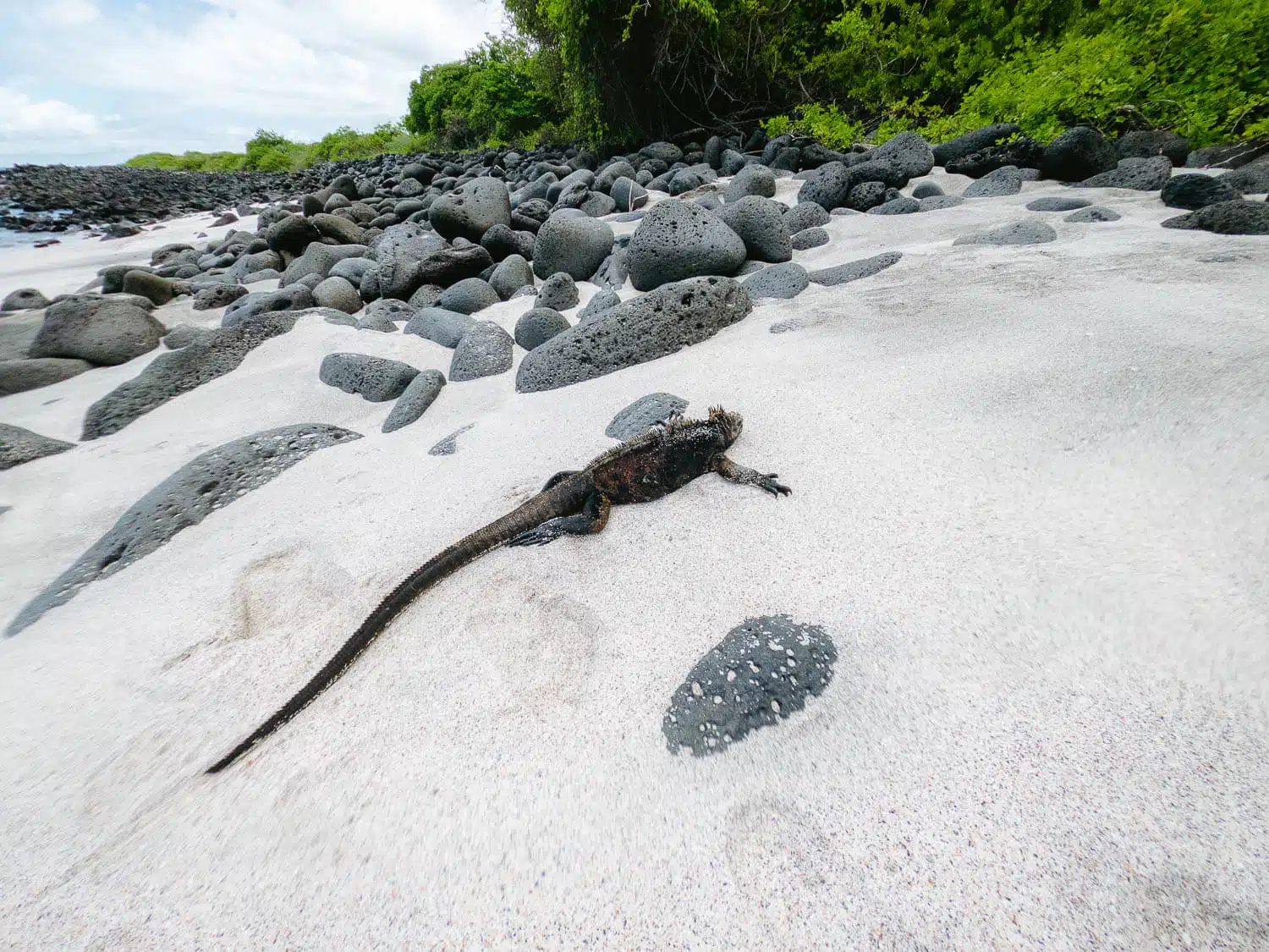
If you’re lucky you will find marine iguanas inside of the water or on the sand chilling under the shade of the trees at the end of the beach.
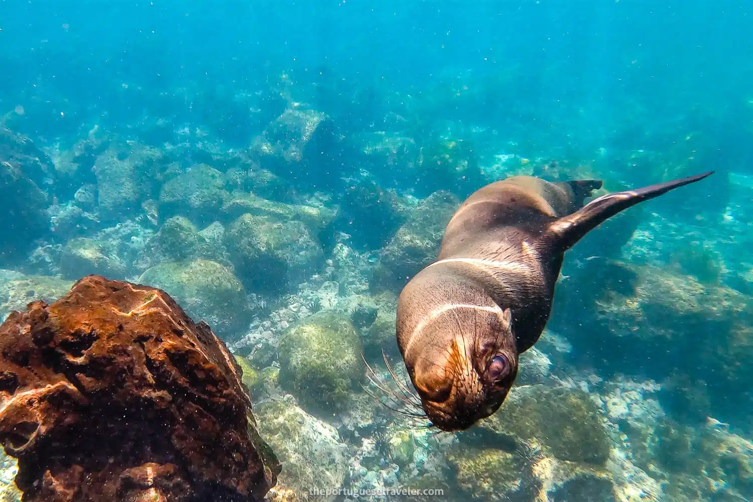
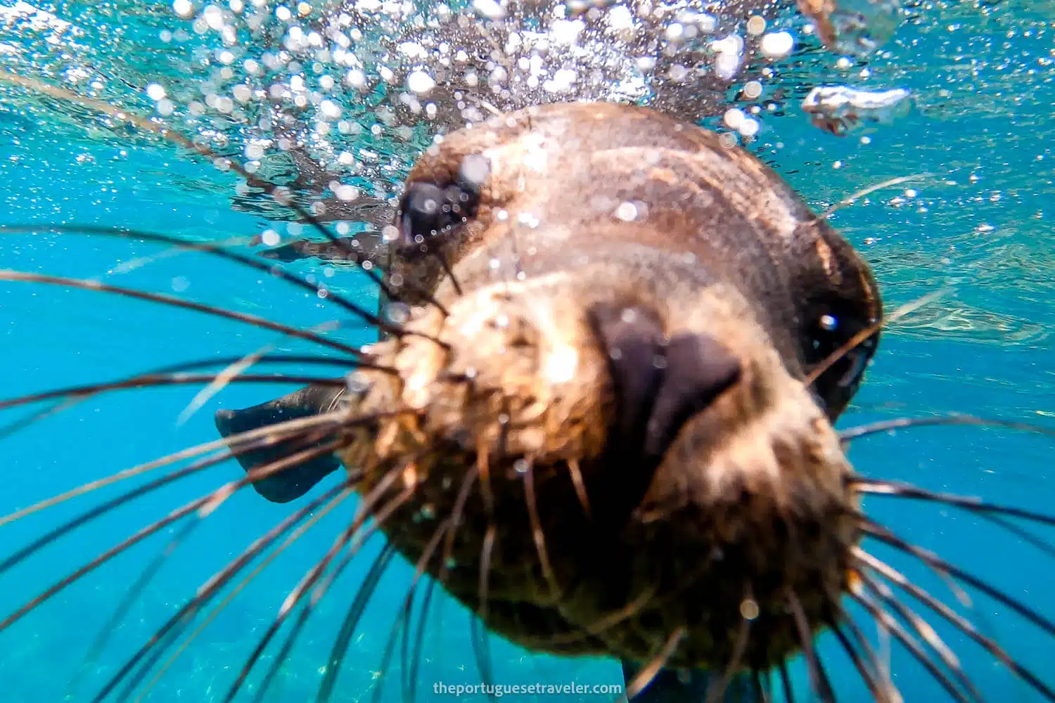
While snorkeling I saw many schools of fishes, a white tip reef shark, and a turtle but be careful with the rocks inside of the water and the waves pushing you into them.
The view to Muelle Tijeretas on the way to Playa Baquerizo beach
Playa Tijeretas (Cerro Tijeretas on the left)
The entrance to Playa Baquerizo beach
Playa Baquerizo in San Cristóbal island, Galápagos
An iguana at the Playa Baquerizo in San Cristóbal island, Galápagos
From Playa Baquerizo to Muelle Tijeretas and Back to the Interpretation Center
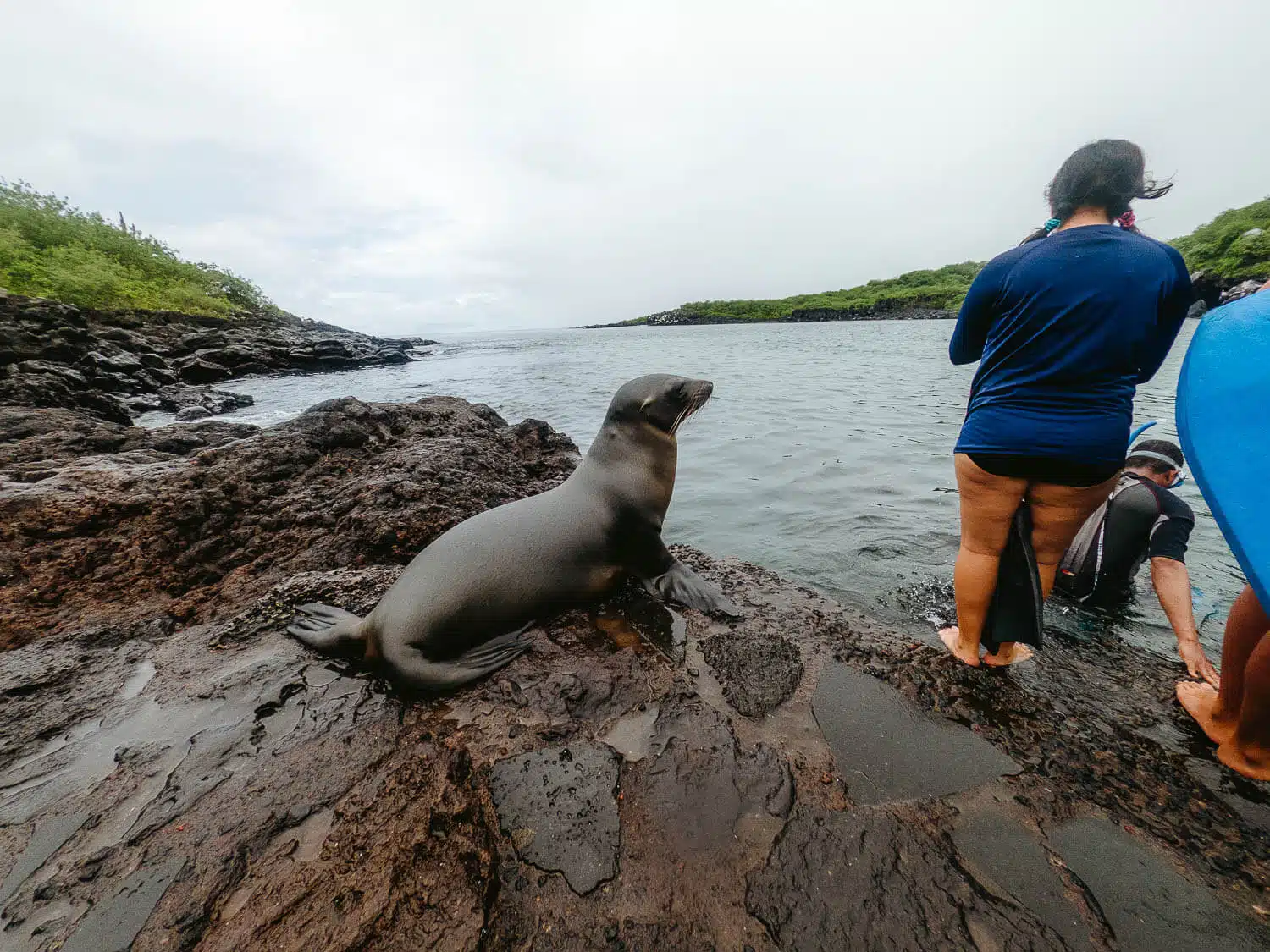
Once you’re done chilling at the beach you have to make your way back to Cerro Tijeretas hill and after you cross it you will see the path to Muelle Tijeretas on your right. It’s a small port and when I was there it was full of tourists, mainly Ecuatorian, and a sea lion.
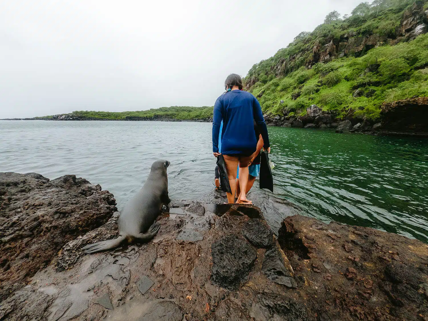
In my case, it started raining when I left Playa Baquerizo but even though cause the weather was so hot and humid it didn’t stop me to jump in the water and go check the caves on the right.
Inside the caves, I found around 4 sea lions and many many crabs hanging on the ceiling of the cave.
And that’s it after Muelle Tijeretas I went back to the Interpretation Center and took a taxi that was already waiting there.
What about you, have you already done the Cerro Tijeretas and Playa Baquerizo Hike? Leave me a comment down here if you did and after you did it with your impression.
Thanks for reading through and have fun hiking!
I’ll drop a couple of my other favorite photos from this hike down below, enjoy!
UPDATE:
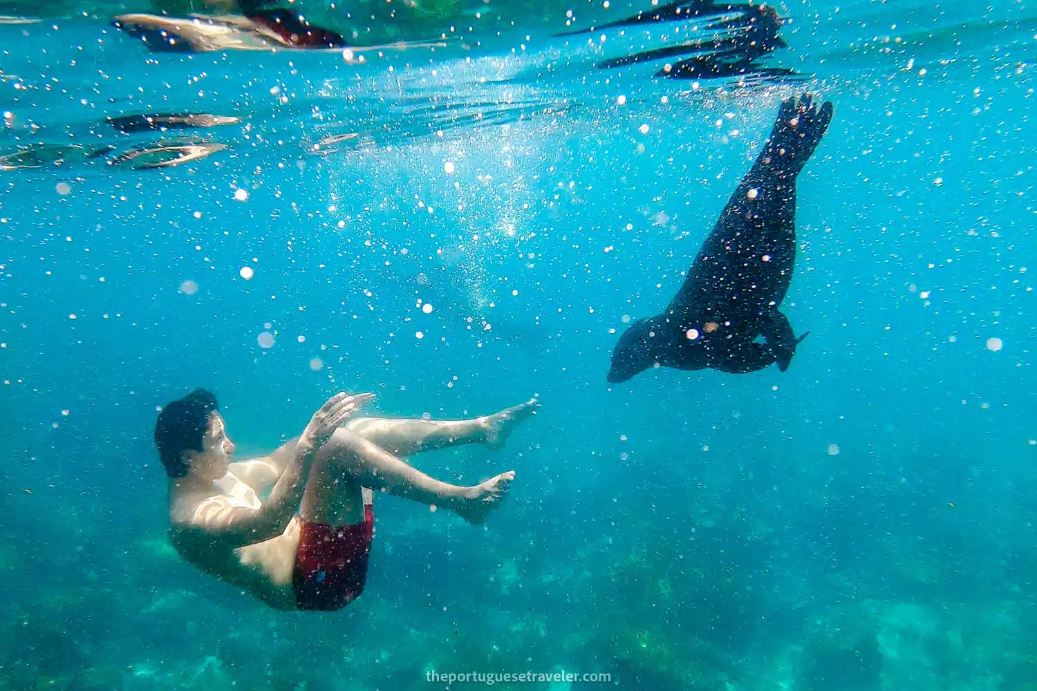
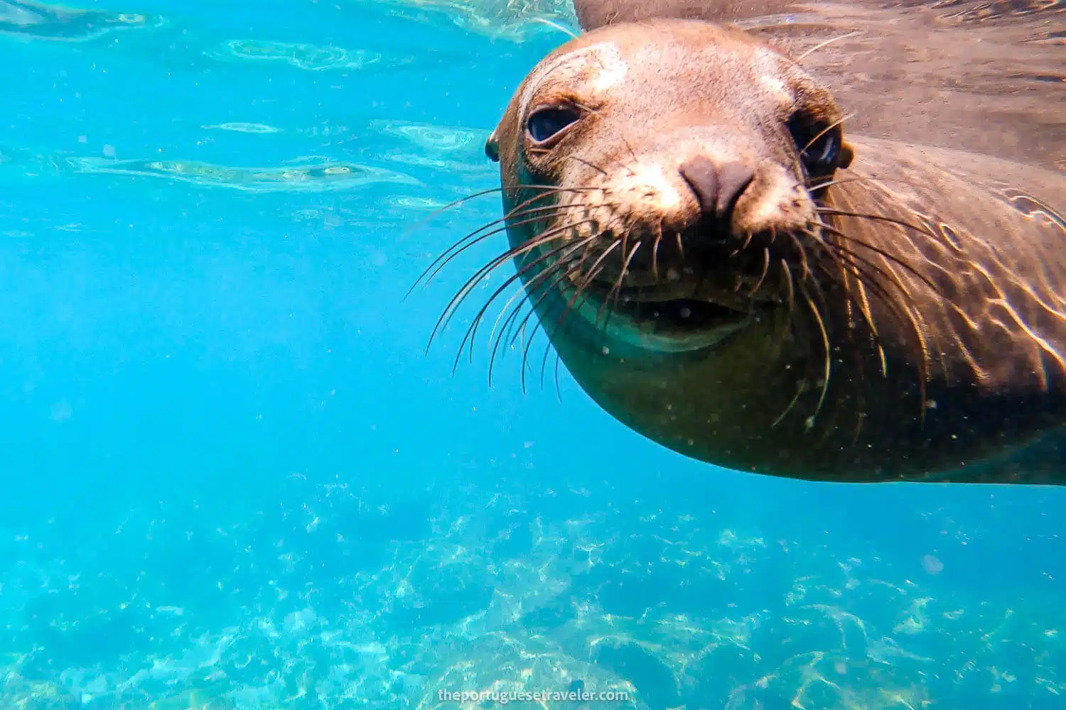
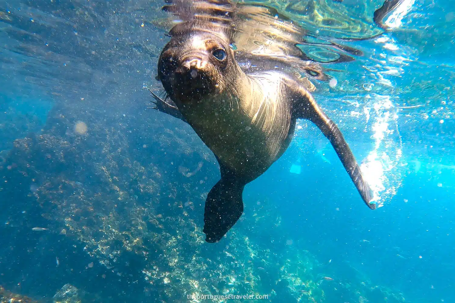
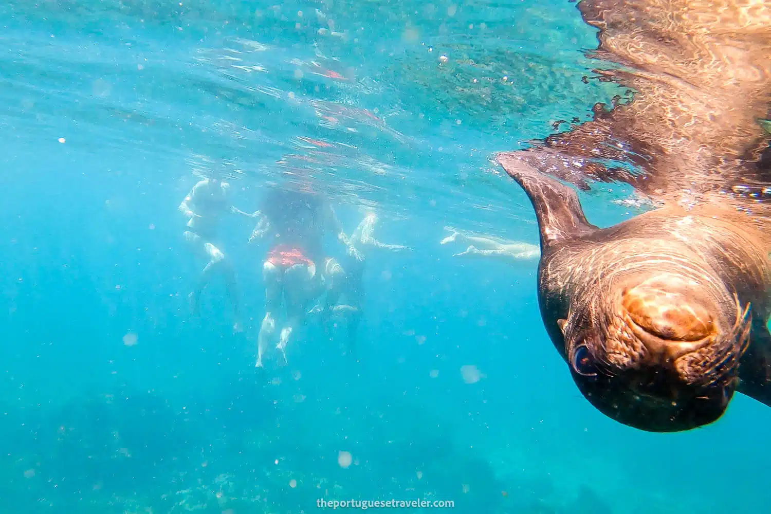
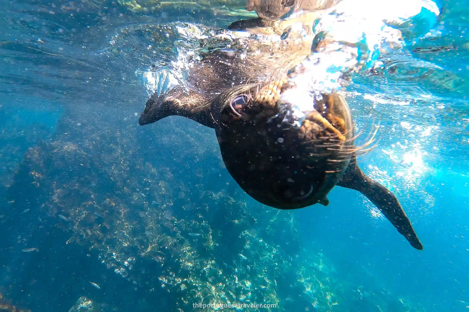
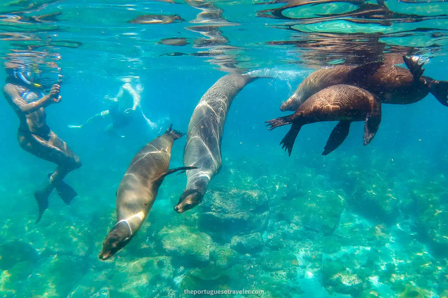
I’ve just returned from San Cristobal for the second time and this time I got really lucky with the weather so the sea lion photos you’re about to see are proof of that, I had a blast snorkeling with them. What a day!
The way back to Muelle Tijeretas
The paved path to Muelle Tijeretas
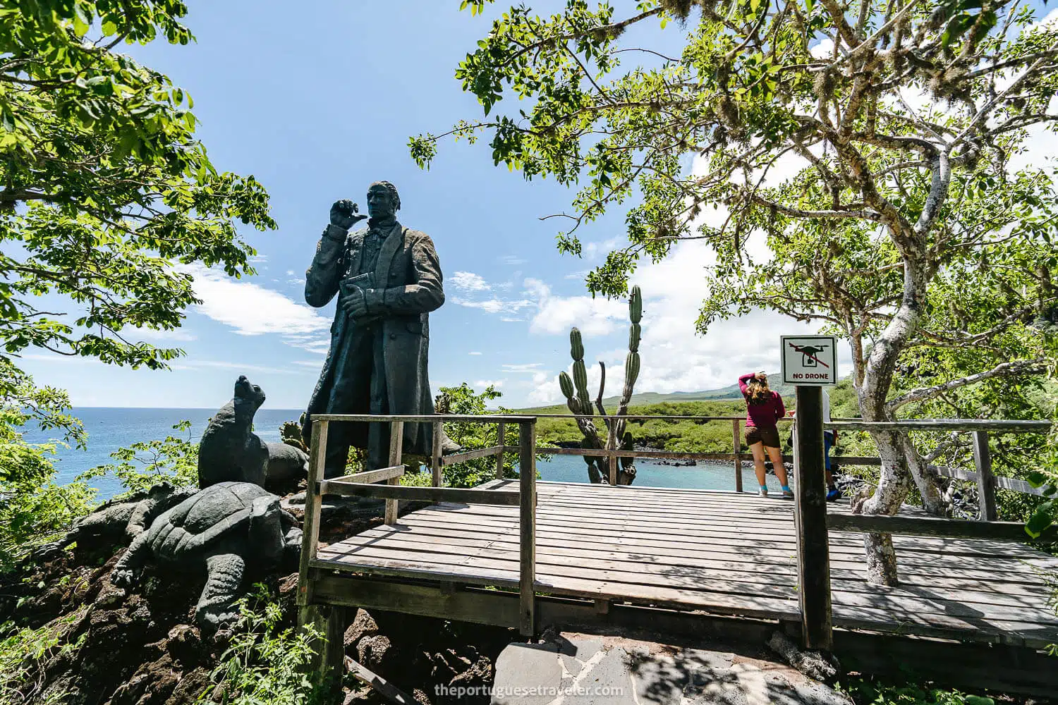
Muelle Tijeretas Viewpoint
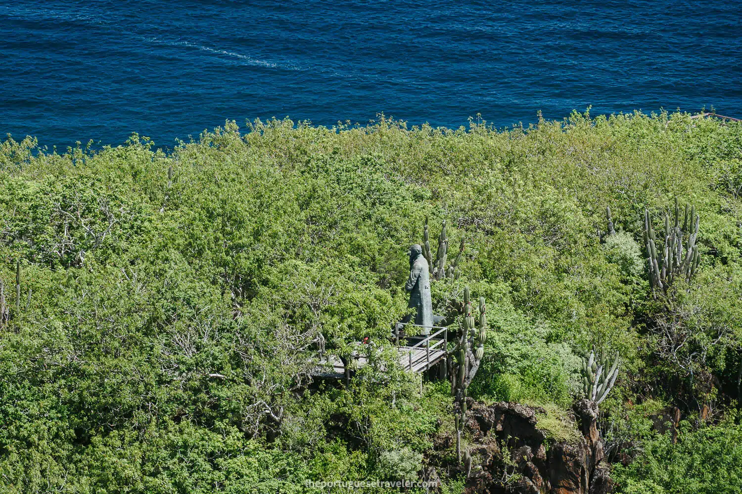
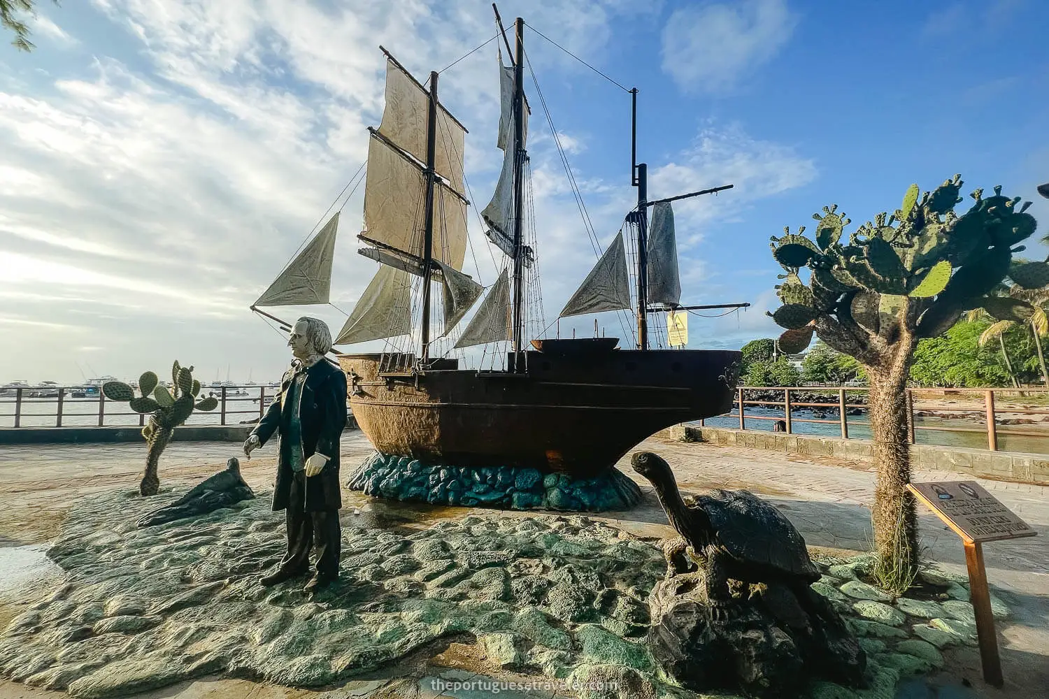
Darwin's Statue at Muelle Tijeretas Viewpoint
Muelle Tijeretas
Panorama of Darwin's Bay aka Tijeretas Bay
Snorkeling in Tijeretas
The Muelle Tijeretas (Cerro tijeretas on the right)
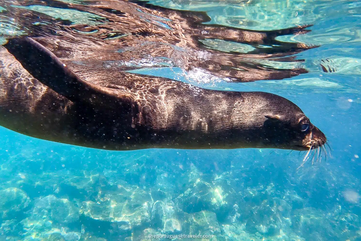
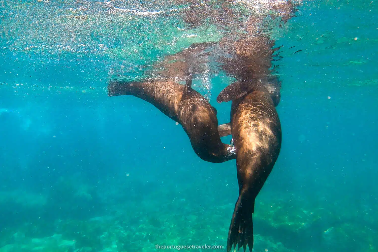
A sea lion and the locals at Muelle Tijeretas
Playful sea lions at Muelle Tijeretas
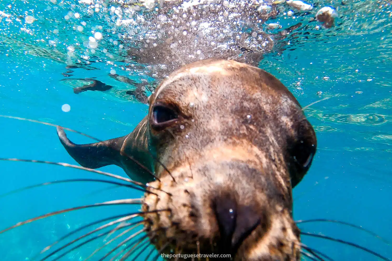
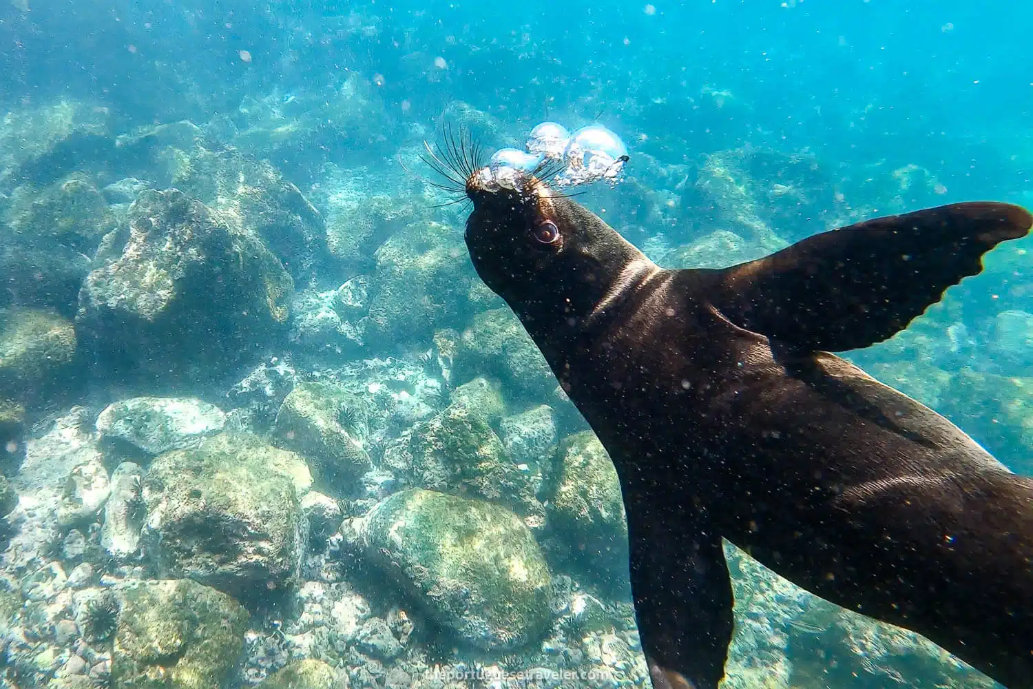
A curious sea lion in Tijeretas
A sea lion selfie
Photo Gallery
From the Interpretation Center to Cerro Tijeretas
From Cerro Tijeretas to Playa Baquerizo
From Playa Baquerizo to Muelle Tijeretas, and Back to the Interpretation Center
Plan your next adventure with us!
Here are the links we use and recommend to plan your trip easily and safely. You won’t pay more, and you’ll help keep the blog running!
Car Rental: Rent the perfect car for your trip with Discovercars.
Accommodation: Book your hotels with Booking.com or Expedia. For hotels in Asia, we usually reserve with Agoda.
Flights: We typically purchase our flight tickets through Trip.com or directly with the airlines for the best options and flexibility. If a flight is canceled or delayed, we use Airhelp for compensation.
Trains and Buses: In Europe, we typically use Omio, while in Asia, 12Go is our go-to choice for seamless transportation, and in Latin America, Busbud is what we always use.
Tours and Tickets: Book your tours and skip-the-line tickets with GetYourGuide, or Viator.
Internet: Get connected wherever you go with Holafly (5% discount) or Airalo.
Travel Insurance: For comprehensive global coverage, check out Heymondo (get 5% off with my link). If you’re a digital nomad, explore Safetywing for flexible insurance options.
I’m João Petersen, an explorer at heart, travel leader, and the creator of The Portuguese Traveler. Adventure tourism has always been my passion, and my goal is to turn my blog into a go-to resource for outdoor enthusiasts. Over the past few years, I’ve dedicated myself to exploring remote destinations, breathtaking landscapes, and fascinating cultures, sharing my experiences through a mix of storytelling and photography.
SUBSCRIBE
Don’t Miss Out! Be the first to know when I share new adventures—sign up for The Portuguese Traveler newsletter!